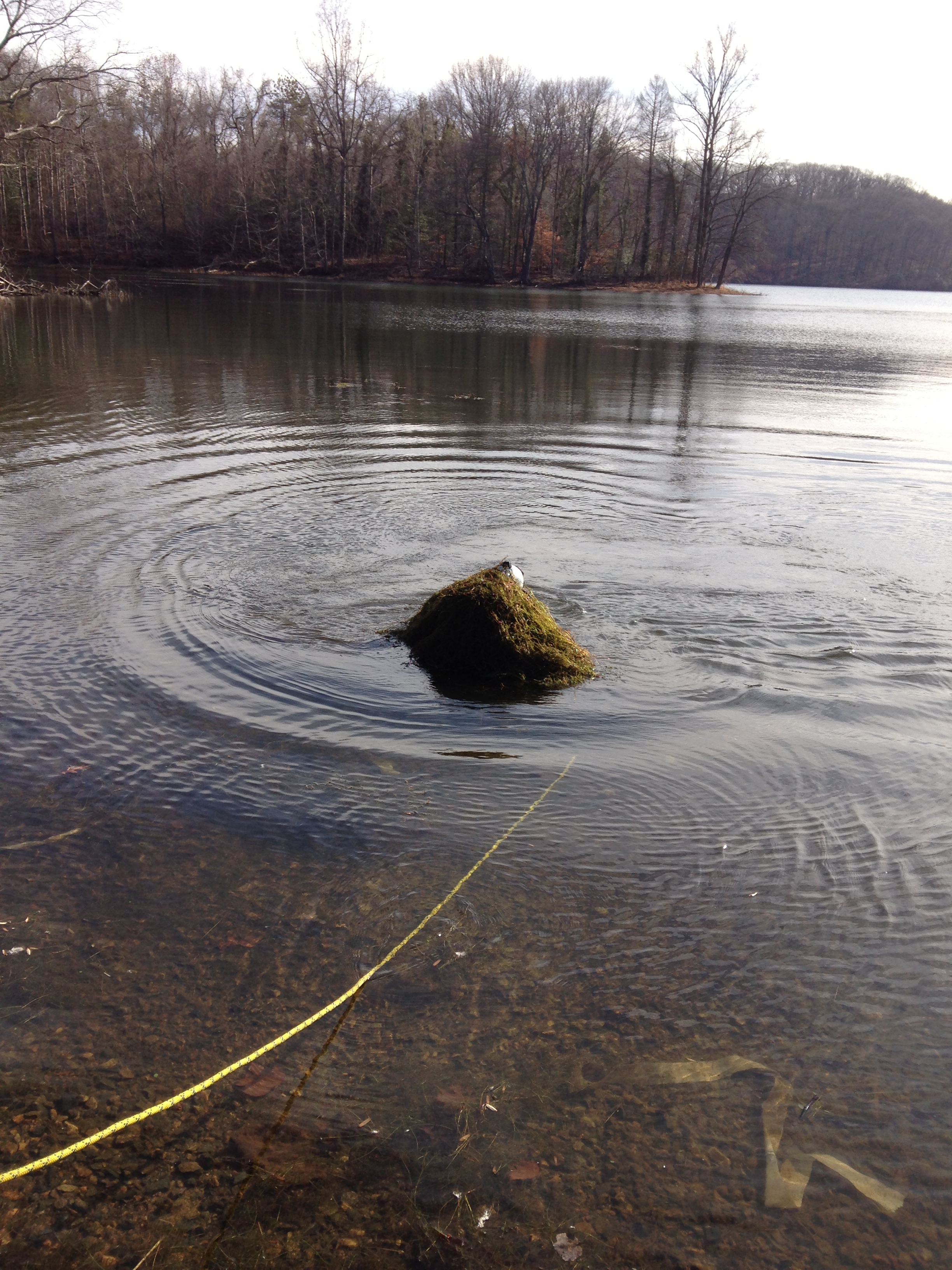
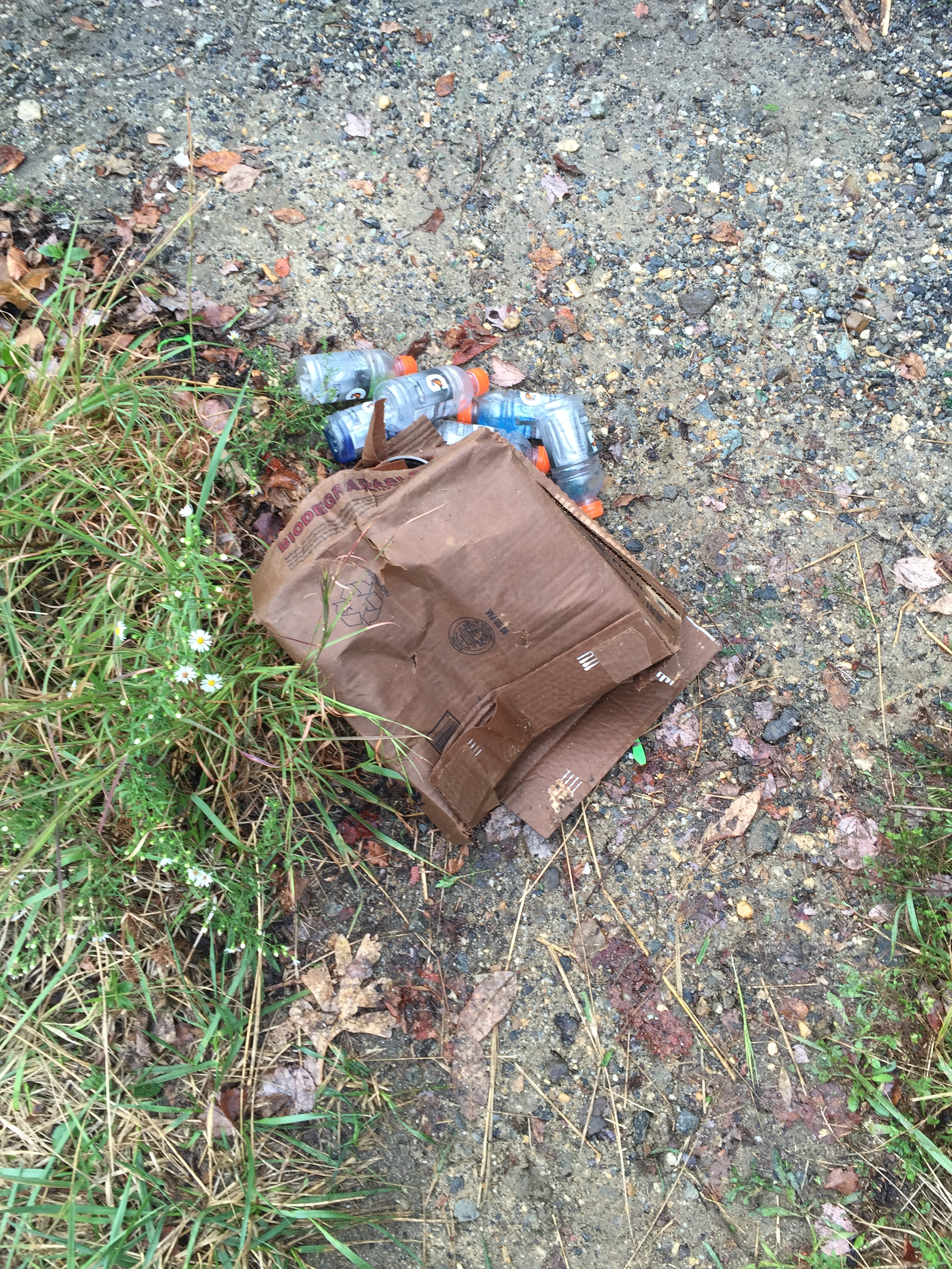
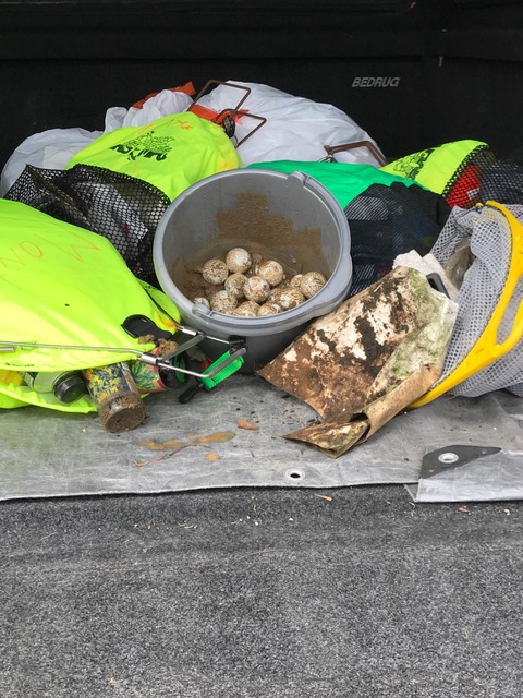
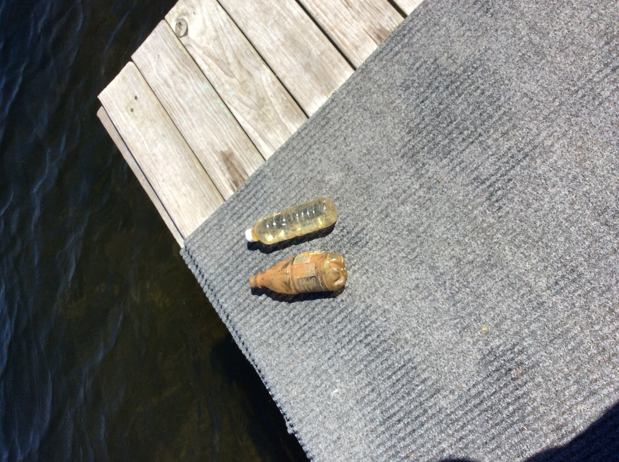
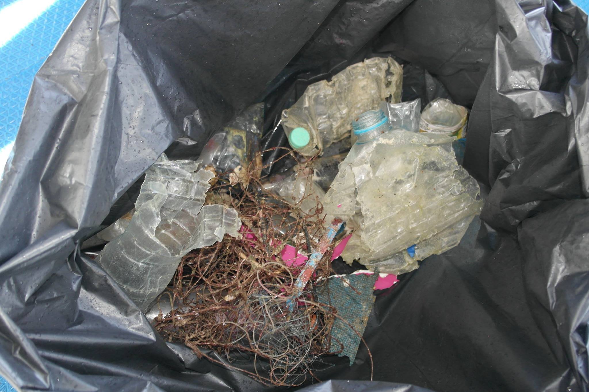
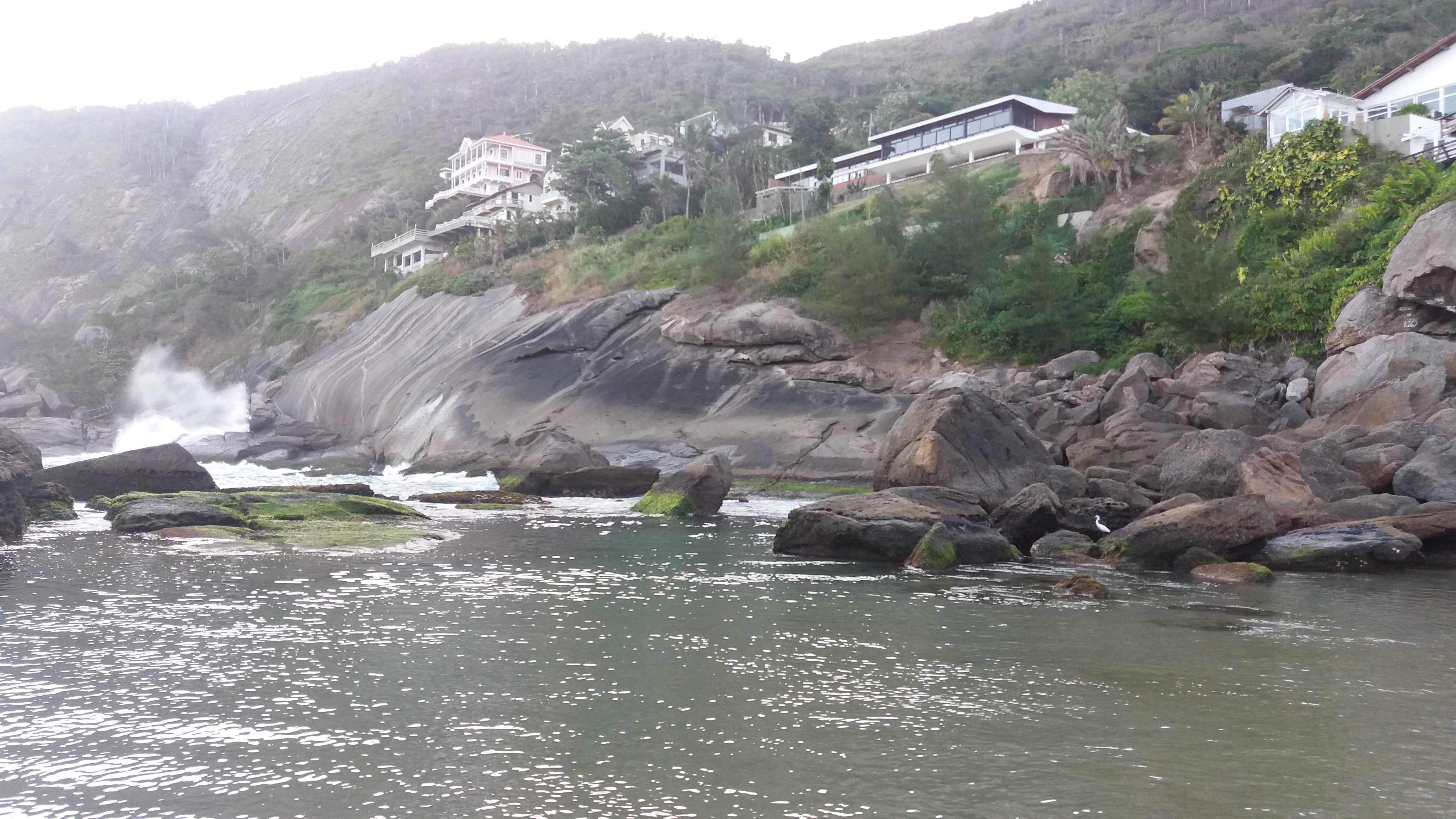
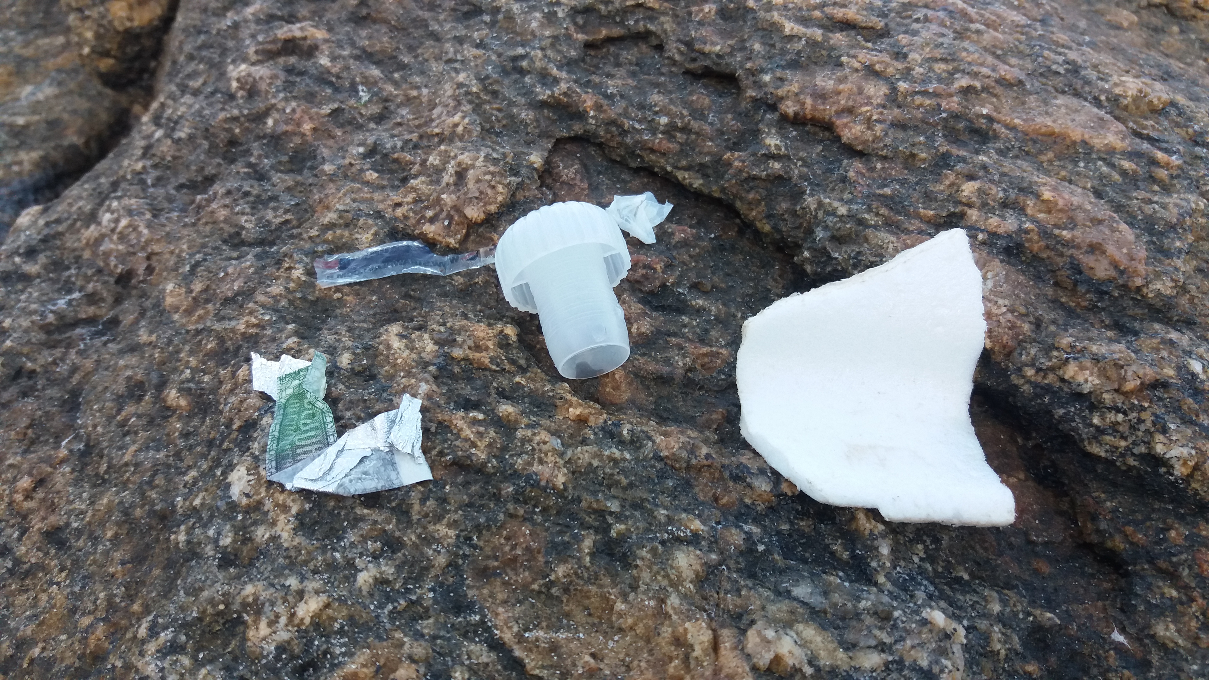
Photos shows the view of the site ADS271 - Ita Reef 2 and also some of the debris found on the dive day.
Good
Michelle Mayumi Tizuka
1
2
1
0.01
30
2.00
1.00
estimated
30.00
On
kilograms
I have debris data to report
Smooth (wavelets) for waves 0.1 - 0.5 meter high
0
m2
meters
rocky reef
1
Brazil
Map Help
Dive Location
If you know your survey site coordinates, enter them manually in decimal degrees using WGS84 Map Datum. Use the minus sign for latitudes south of the equator and longitudes west of the Prime Meridian to 180 degrees.
If you do not know your survey site coordinates, click the “Map Location” tab to use the map to zoom into your survey site and drop the pin on the map to fall within your survey dive site in the water (not on land or the beach). Ensure you zoom in as much as possible to ensure data accuracy.
Entangled Help
Use the vertical tabs below to record any entangled animals you found of each type.
The visibility in the reservoir was 10 feet which made it difficult to see the bottom. Some of the debris was picked up on the shore preventing it from making it into the reservoir.
No
This experience of collecting debris was an eye opener. Now whenever I dive I am aware of my surroundings and I will pick up debris in the immediate area and I encourage my students to do the same.
Golf Balls
Average high temperature was 77 degrees, low was 57 degrees
New Castle County Dive Team
Richard Miramontez
0
1
3
22
0
0
5
0
2
3
0
0
0
0
0
0
13
32
7
2
8
0
7
0
0
39
1
0
3
1
0
29
0
0
0
40.00
180
30.00
20.00
0
estimated
0
0
0
0
10000.00
1
0
0
0
0
Metal beverage containers emit toxins into the water as they slowly degrade poisoning the eco system.
Styrofoam cups are a concern because the marine life and other wild life cannot digest which can cause harm and even death.
Plastic food bags can form perfectly to marine life's stomachs. As the food is ingested it goes into the bag and the food is not absorbed by the body. The marine life can die from starvation.
0
On
pounds
0
I have debris data to report
18
3
0
Calm (glassy to rippled) for waves 0 – 0.1 meter high
2
0
1
0
5
0
0
ft2
0
3
feet
seagrass
16
0
2
0
0
5
0
8
0
3
0
0
0
9
0
0
0
11
0
0
0
0
11
0
3
0
0
1
0
Language
English
United States
State\Province
Delaware
City
New Castle
Map Help
Dive Location
If you know your survey site coordinates, enter them manually in decimal degrees using WGS84 Map Datum. Use the minus sign for latitudes south of the equator and longitudes west of the Prime Meridian to 180 degrees.
If you do not know your survey site coordinates, click the “Map Location” tab to use the map to zoom into your survey site and drop the pin on the map to fall within your survey dive site in the water (not on land or the beach). Ensure you zoom in as much as possible to ensure data accuracy.
Entangled Help
Use the vertical tabs below to record any entangled animals you found of each type.
High winds from the east, mild currents, some rain.
Aldora Divers
Liang Chen
1
4
3
1
0.50
93
11.00
7.00
estimated
52.00
On
pounds
I have debris data to report
Smooth (wavelets) for waves 0.1 - 0.5 meter high
m2
meters
rocky reef
Language
English
Mexico
State\Province
Quintana Roo
City
San Miguel, Cozumel
Map Help
Dive Location
If you know your survey site coordinates, enter them manually in decimal degrees using WGS84 Map Datum. Use the minus sign for latitudes south of the equator and longitudes west of the Prime Meridian to 180 degrees.
If you do not know your survey site coordinates, click the “Map Location” tab to use the map to zoom into your survey site and drop the pin on the map to fall within your survey dive site in the water (not on land or the beach). Ensure you zoom in as much as possible to ensure data accuracy.
Entangled Help
Use the vertical tabs below to record any entangled animals you found of each type.
Cloudy, no major storms, temperatures hovering 40-80 F
Charleston Scuba
Craig Nettles
2
2
1.00
52
19.00
3.00
estimated
5000.00
Plastic water bottles
On
pounds
I have debris data to report
Calm (glassy to rippled) for waves 0 – 0.1 meter high
ft2
feet
other
Language
English
United States
State\Province
South Carolina
City
Charleston
Map Help
Dive Location
If you know your survey site coordinates, enter them manually in decimal degrees using WGS84 Map Datum. Use the minus sign for latitudes south of the equator and longitudes west of the Prime Meridian to 180 degrees.
If you do not know your survey site coordinates, click the “Map Location” tab to use the map to zoom into your survey site and drop the pin on the map to fall within your survey dive site in the water (not on land or the beach). Ensure you zoom in as much as possible to ensure data accuracy.
Entangled Help
Use the vertical tabs below to record any entangled animals you found of each type.
Fishermen boats and diving boat being negligent and/or careless
Sunny and Clear
Kholousi Khayal
1
3
1
1
4
2
3
4.00
38
30.00
25.00
measured
10.00
On
kilograms
I have debris data to report
Smooth (wavelets) for waves 0.1 - 0.5 meter high
m2
meters
coral reef
Language
English
United Arab Emirates
State\Province
Fujairah
City
Dibba
Map Help
Dive Location
If you know your survey site coordinates, enter them manually in decimal degrees using WGS84 Map Datum. Use the minus sign for latitudes south of the equator and longitudes west of the Prime Meridian to 180 degrees.
If you do not know your survey site coordinates, click the “Map Location” tab to use the map to zoom into your survey site and drop the pin on the map to fall within your survey dive site in the water (not on land or the beach). Ensure you zoom in as much as possible to ensure data accuracy.
Entangled Help
Use the vertical tabs below to record any entangled animals you found of each type.
This dive site is used by the majority of Phuket dive centres and has approximately 200-600 divers visit daily - depending on the time of the year. It is currently high season (March) and Bay 1 has a large quantity of tourists and boats visiting. It is refreshing to see that dive companies and Instructors in the Phuket area are pro-active around this region at collecting marine debris when they dive, this is evident by the small quantity of debris collected. 42 divers of 14 teams covered a large area over an average of 43 mins of diving and retrieved very little. An awesome result not for the collection of debris but as a confirmation that Phuket divers are pro-active in the conservation of their dive sites.
Calm water, minimal waves, 20-25metre visibility, minimal current, between moons
Super Divers, Phuket
Jonathan Walsh
42
5
10.00
43
20.00
5.00
estimated
150.00
plastic bottles
fishing line
wood/boat debris
On
kilograms
I have debris data to report
Calm (glassy to rippled) for waves 0 – 0.1 meter high
23
m2
meters
coral reef
2
Language
English
Thailand
State\Province
Phuket
City
Patong
Map Help
Dive Location
If you know your survey site coordinates, enter them manually in decimal degrees using WGS84 Map Datum. Use the minus sign for latitudes south of the equator and longitudes west of the Prime Meridian to 180 degrees.
If you do not know your survey site coordinates, click the “Map Location” tab to use the map to zoom into your survey site and drop the pin on the map to fall within your survey dive site in the water (not on land or the beach). Ensure you zoom in as much as possible to ensure data accuracy.
Entangled Help
Use the vertical tabs below to record any entangled animals you found of each type.