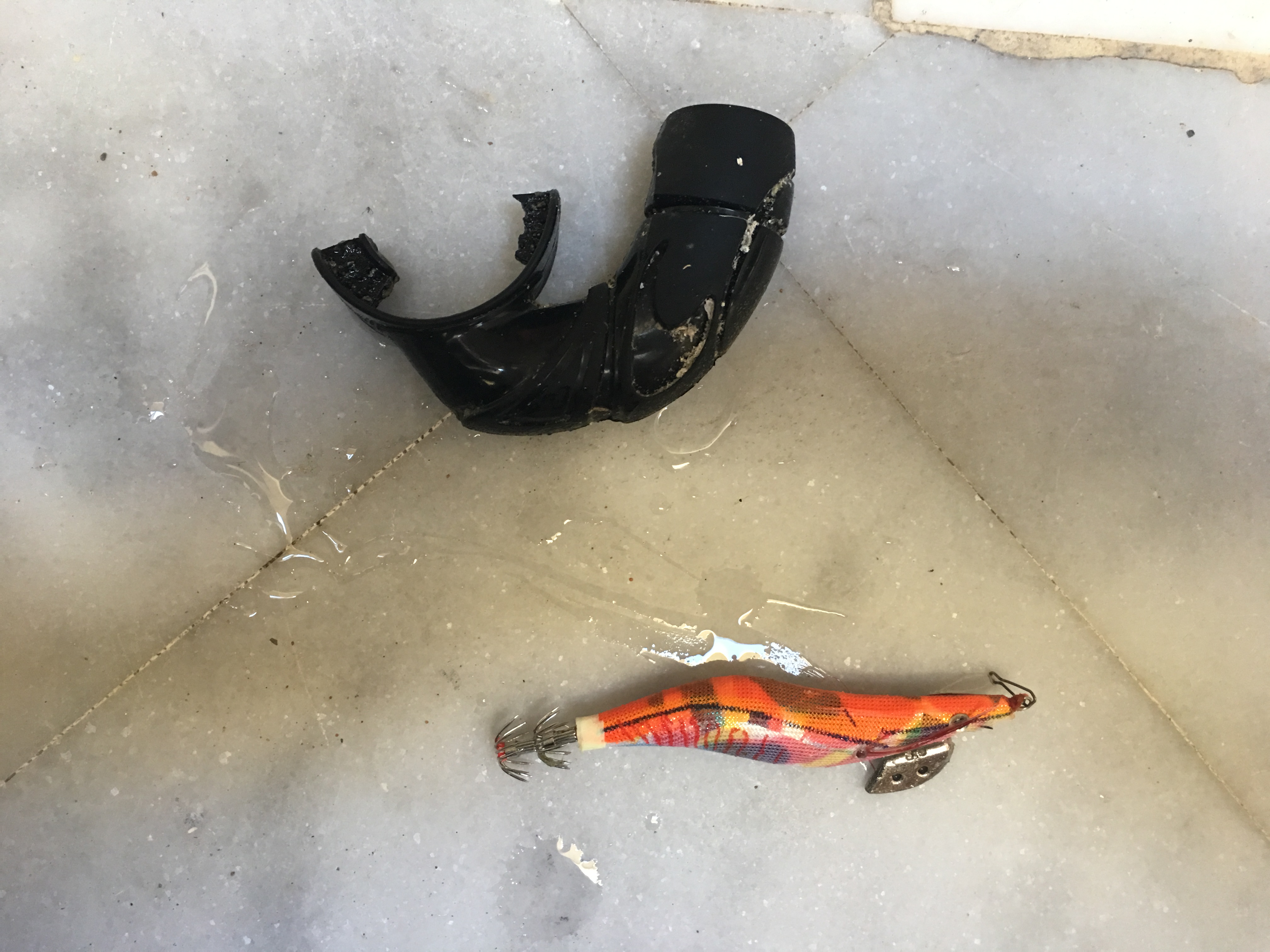
Loutraki Dive Club - Dive against Debris Loutraki Beach 4/3/2017
At this event we were 6 divers , 1 surface support and 5 land support !
very good 18°C
3
2
2
1
3
trash can ( metal)
Metal base support for sea umbrella ( type screw)
sea umbrella (big)
engine oil filter
sunbed
Loutraki Dive Club
Nikos_Ba
6
289.00
36
12.00
5.00
measured
929.00
5
On
kilograms
I have debris data to report
3
Calm (glassy to rippled) for waves 0 – 0.1 meter high
m2
4
tires
1 octopus and 3 starfish
Released Unharmed
meters
seagrass
7
1
Greece
State\Province
Corinthia
City
Loutraki
Map Help
Dive Location
If you know your survey site coordinates, enter them manually in decimal degrees using WGS84 Map Datum. Use the minus sign for latitudes south of the equator and longitudes west of the Prime Meridian to 180 degrees.
If you do not know your survey site coordinates, click the “Map Location” tab to use the map to zoom into your survey site and drop the pin on the map to fall within your survey dive site in the water (not on land or the beach). Ensure you zoom in as much as possible to ensure data accuracy.
Entangled Help
Use the vertical tabs below to record any entangled animals you found of each type.
Rain may have washed some debris into the quarry. Fishermen were staying over at the quarry on Saturday night.
Glass fragment
Rainy for most of the week
SCUBA.co.za
Gareth Austin
2
0.90
22
11.00
3.00
estimated
2
30.00
Fishing hook
Glass fragment
Fishing lure
On
kilograms
I have debris data to report
Slight for waves 0.5 -1.25 meter high
m2
meters
other
3
1
Language
English
South Africa
State\Province
Gauteng
City
Vereeniging
Map Help
Dive Location
If you know your survey site coordinates, enter them manually in decimal degrees using WGS84 Map Datum. Use the minus sign for latitudes south of the equator and longitudes west of the Prime Meridian to 180 degrees.
If you do not know your survey site coordinates, click the “Map Location” tab to use the map to zoom into your survey site and drop the pin on the map to fall within your survey dive site in the water (not on land or the beach). Ensure you zoom in as much as possible to ensure data accuracy.
Entangled Help
Use the vertical tabs below to record any entangled animals you found of each type.
Severe rain during the week could have washed some debris into the quarry
Plastic tape
Rain for most of the week
SCUBA.co.za
Gareth Austin
1
2
2
1.00
21
9.00
4.00
1
estimated
40.00
Small plastic fragments
Fishing lures
Tape fragments
On
kilograms
I have debris data to report
Smooth (wavelets) for waves 0.1 - 0.5 meter high
1
m2
meters
other
Language
English
South Africa
State\Province
Gauteng
City
Vereeniging
Map Help
Dive Location
If you know your survey site coordinates, enter them manually in decimal degrees using WGS84 Map Datum. Use the minus sign for latitudes south of the equator and longitudes west of the Prime Meridian to 180 degrees.
If you do not know your survey site coordinates, click the “Map Location” tab to use the map to zoom into your survey site and drop the pin on the map to fall within your survey dive site in the water (not on land or the beach). Ensure you zoom in as much as possible to ensure data accuracy.
Entangled Help
Use the vertical tabs below to record any entangled animals you found of each type.
Smooth (wavelets) for waves 0.1 - 0.5 meter high
m2
meters
other
Language
English
United Arab Emirates
City
Dubai
Map Help
Dive Location
If you know your survey site coordinates, enter them manually in decimal degrees using WGS84 Map Datum. Use the minus sign for latitudes south of the equator and longitudes west of the Prime Meridian to 180 degrees.
If you do not know your survey site coordinates, click the “Map Location” tab to use the map to zoom into your survey site and drop the pin on the map to fall within your survey dive site in the water (not on land or the beach). Ensure you zoom in as much as possible to ensure data accuracy.
Entangled Help
Use the vertical tabs below to record any entangled animals you found of each type.
Smooth (wavelets) for waves 0.1 - 0.5 meter high
m2
meters
other
Language
English
United Arab Emirates
State\Province
Dubai
City
Dubai
Map Help
Dive Location
If you know your survey site coordinates, enter them manually in decimal degrees using WGS84 Map Datum. Use the minus sign for latitudes south of the equator and longitudes west of the Prime Meridian to 180 degrees.
If you do not know your survey site coordinates, click the “Map Location” tab to use the map to zoom into your survey site and drop the pin on the map to fall within your survey dive site in the water (not on land or the beach). Ensure you zoom in as much as possible to ensure data accuracy.
Entangled Help
Use the vertical tabs below to record any entangled animals you found of each type.
There is no one specific event, however this is a very popular fishing spot and its obvious by our findings that the fishermen are the main contributors to the debris we found.
Finding the entangled bird had a huge impact on our divers and was obviously distressing.
On a more positive note, some the items we collected today will be reused!
Image included
Watch
Generaly good, few showers but overall calm and sunny.
Performance Diver
Laura HUtchings
1
2
2
13
2
4
3
44.00
45
7.60
5.00
1
measured
1
80
4832.05
Fishing Line.
Fishing sinkers, lures, hooks.
Beverage bottles (glass)
On
kilograms
I have debris data to report
29
Calm (glassy to rippled) for waves 0 – 0.1 meter high
2
1
Fishing hook and line
0
0
1
Shag
1
1
2
m2
3
1
Dead
meters
rocky reef
7
2
1
6
2
1
Language
English
New Zealand
City
Auckland
Map Help
Dive Location
If you know your survey site coordinates, enter them manually in decimal degrees using WGS84 Map Datum. Use the minus sign for latitudes south of the equator and longitudes west of the Prime Meridian to 180 degrees.
If you do not know your survey site coordinates, click the “Map Location” tab to use the map to zoom into your survey site and drop the pin on the map to fall within your survey dive site in the water (not on land or the beach). Ensure you zoom in as much as possible to ensure data accuracy.
Entangled Help
Use the vertical tabs below to record any entangled animals you found of each type.
Every month we collect from the beach and reef and every month we collect an abundance of discarded trash. We don't do this for us, it's for the better of everyone that lives on this earth! Do your best to protect what we are blessed to be a part of.
The biggest issue is general negligence and an "out of sight, out of mind" approach to living by the waters edge.
A T shirt promoting a local political party!! Purposefully planted or lost during celebrations???
Slight waves, a few rainy days
2
1
1
1
1
1
1
1
1
1
2
1
1
1
1
Spool (plastic)
Video tape (plastic)
Car Parts (plastic)
Toilet flush system (plastic)
Sun chair strapping (plastic)
Metal Sheet 1m² (metal)
"Brillo" mesh scrubbing pad (metal)
Telephone handset (externally -plastic)
Fibreglass boat hull (plastic)
CD (plastic)
Golf Balls (mixed - rubber and metal)
Bandage (cloth)
mophead (mixed- cloth and plastic)
Hammock (mixed - cloth and plastic)
Drain guttering (plastic)
Montserrat Island Dive Centre
Charley Bartlett
3
12
26
4
3
3
4
3
1
25
3
2
1
37.50
60
12.00
4.30
4
measured
650.00
2
Burlap Sacks - partially buried in the sand whilst strands break off and tangle around coral!
Plastic grocery bags - floting free as 'food', wrapped around coral, and breaking down as a further pollutant!
Single use items - plastic cutlery and bottles. With a life span of up to 1000years, do we really need to use something for 10minutes and throw it away?? If there's no alternative Reuse it again and again!
7
On
kilograms
I have debris data to report
5
Smooth (wavelets) for waves 0.1 - 0.5 meter high
1
6
25
7
m2
4
10
meters
coral reef
18
1
1
8
4
17
96
2
1
1
Language
English
Montserrat
Map Help
Dive Location
If you know your survey site coordinates, enter them manually in decimal degrees using WGS84 Map Datum. Use the minus sign for latitudes south of the equator and longitudes west of the Prime Meridian to 180 degrees.
If you do not know your survey site coordinates, click the “Map Location” tab to use the map to zoom into your survey site and drop the pin on the map to fall within your survey dive site in the water (not on land or the beach). Ensure you zoom in as much as possible to ensure data accuracy.
Entangled Help
Use the vertical tabs below to record any entangled animals you found of each type.
Calm (glassy to rippled) for waves 0 – 0.1 meter high
m2
meters
rocky reef
Language
English
Greece
State\Province
Alimos
City
Arhens
Map Help
Dive Location
If you know your survey site coordinates, enter them manually in decimal degrees using WGS84 Map Datum. Use the minus sign for latitudes south of the equator and longitudes west of the Prime Meridian to 180 degrees.
If you do not know your survey site coordinates, click the “Map Location” tab to use the map to zoom into your survey site and drop the pin on the map to fall within your survey dive site in the water (not on land or the beach). Ensure you zoom in as much as possible to ensure data accuracy.
Entangled Help
Use the vertical tabs below to record any entangled animals you found of each type.