Menu

Him wong bay/Green rock

22
coral
19
42

10.102277234044696, 99.84967164695263

Ban's Diving Resort participated in the annual Earth Day
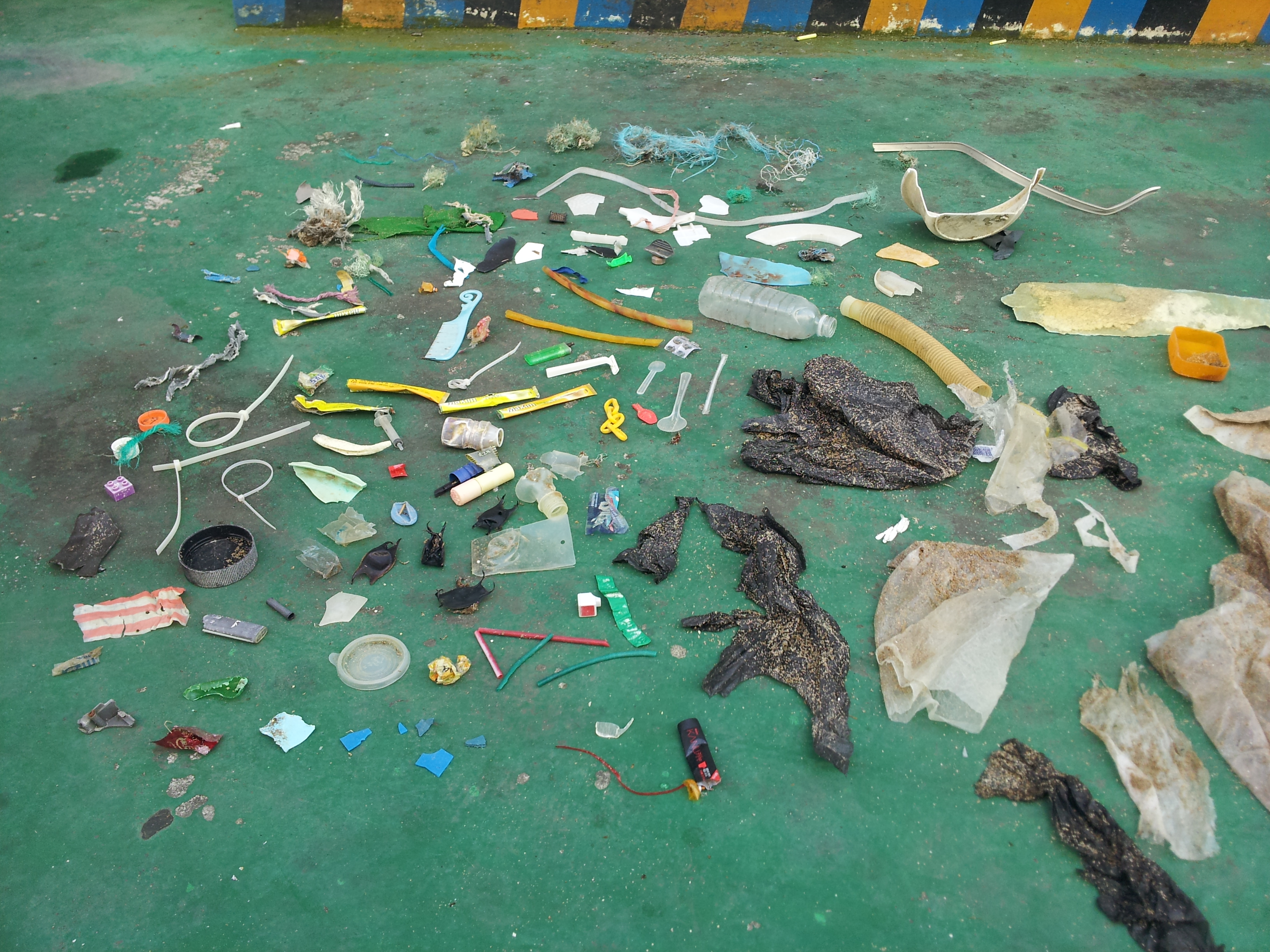
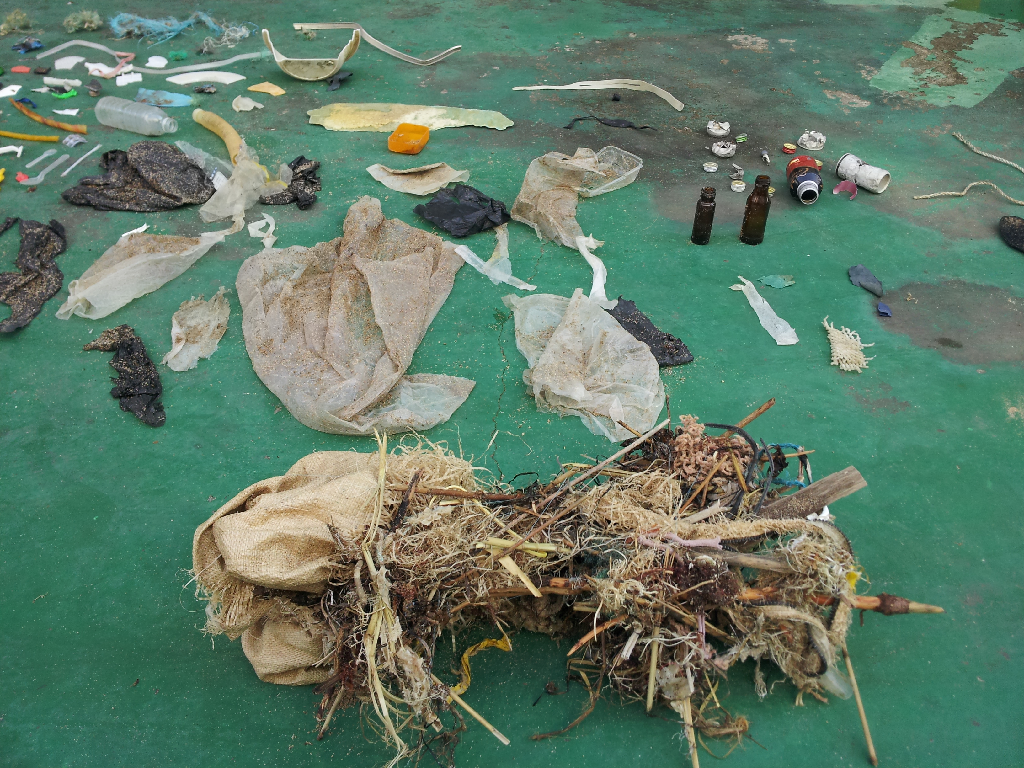
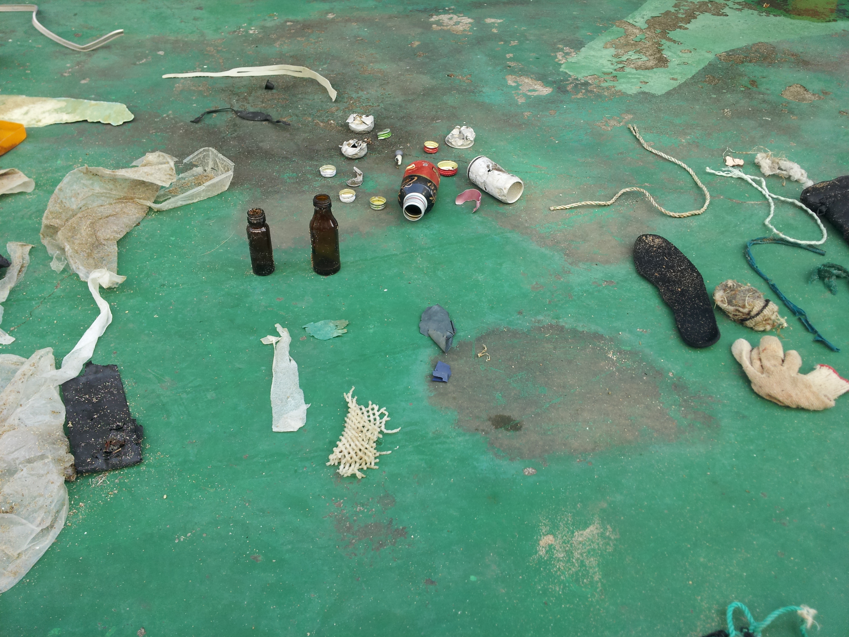
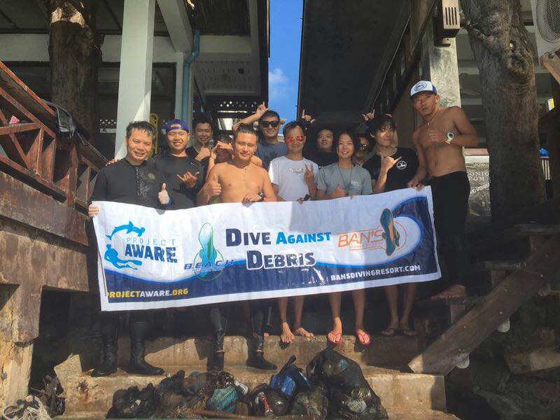
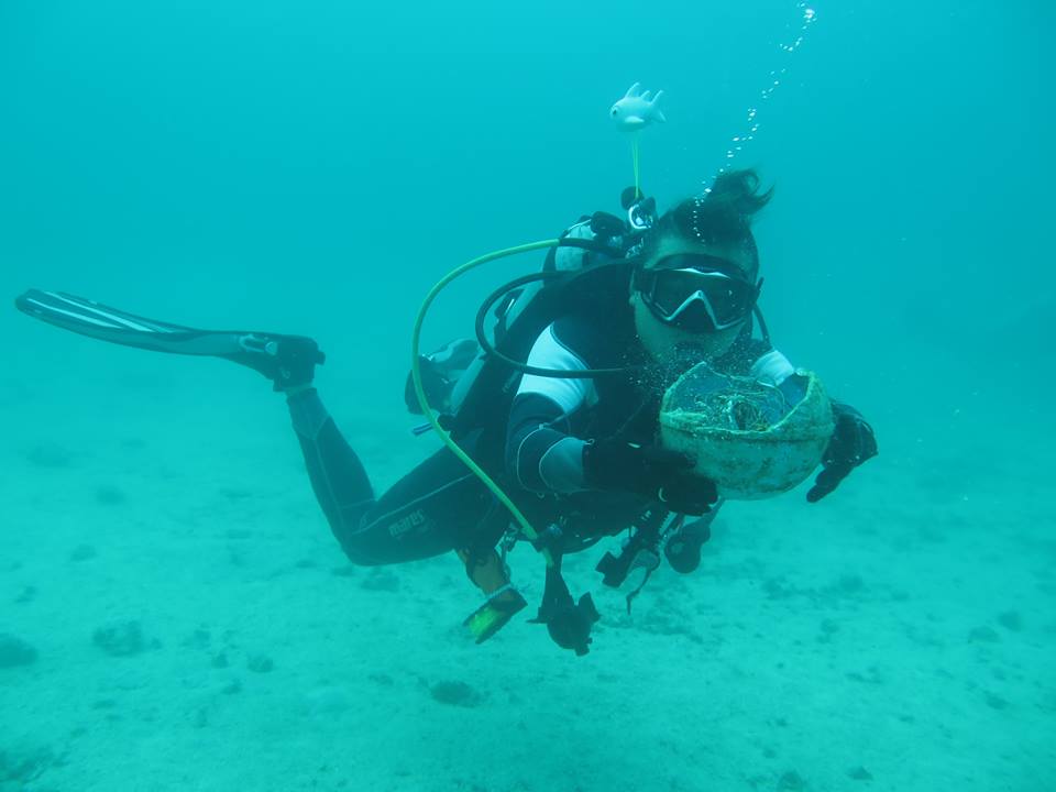
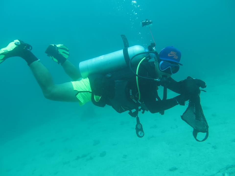
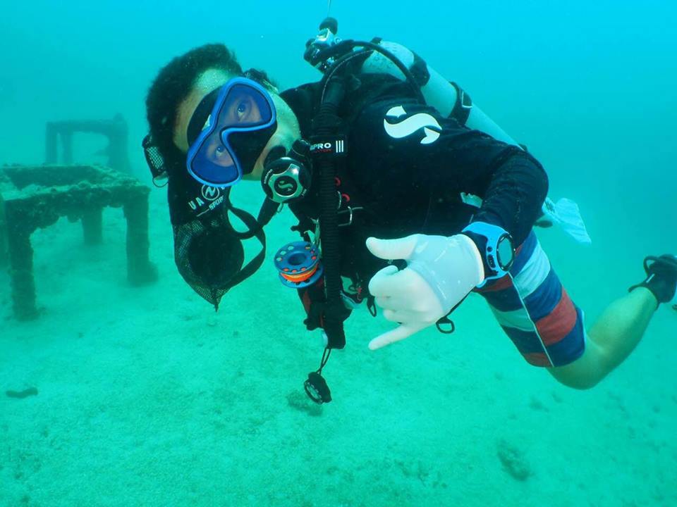
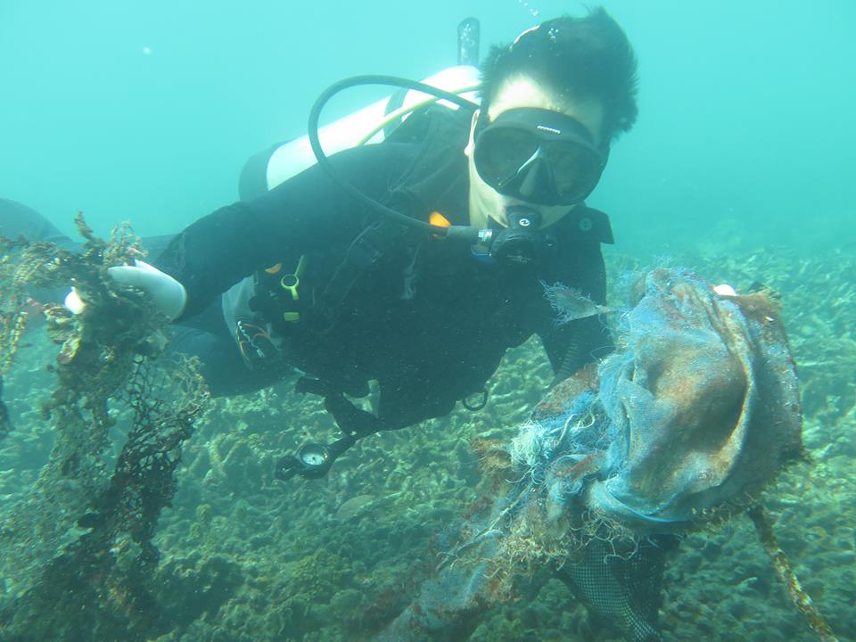
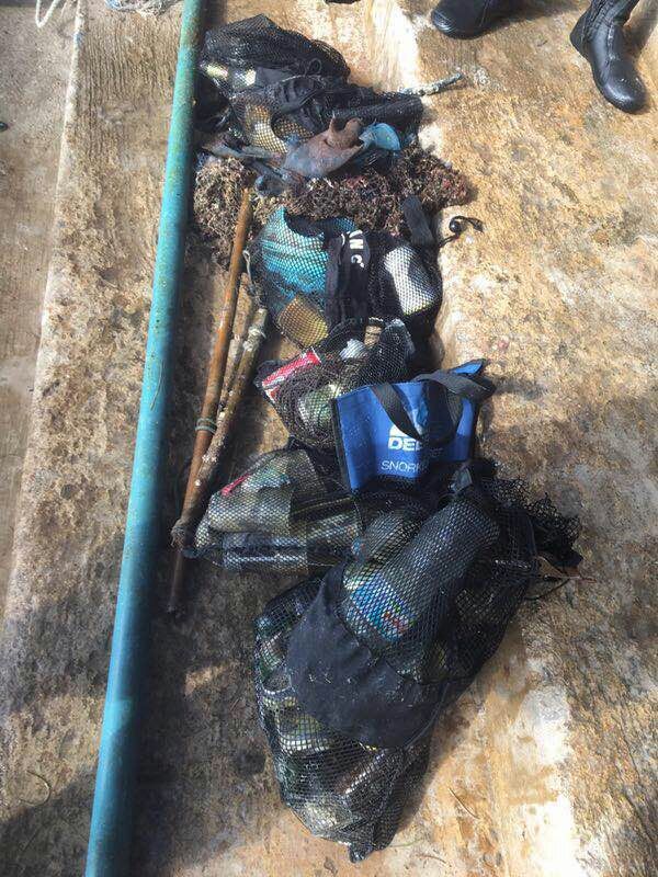
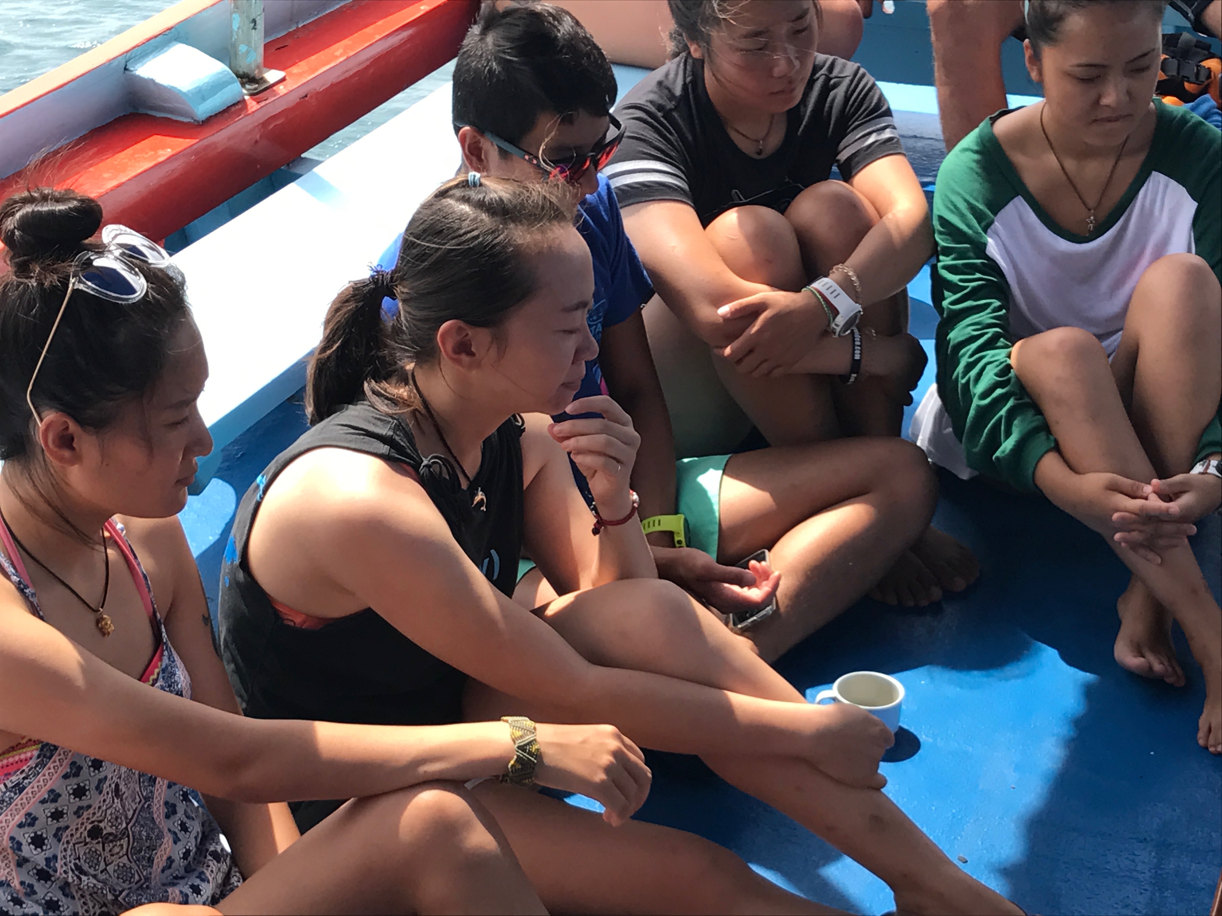
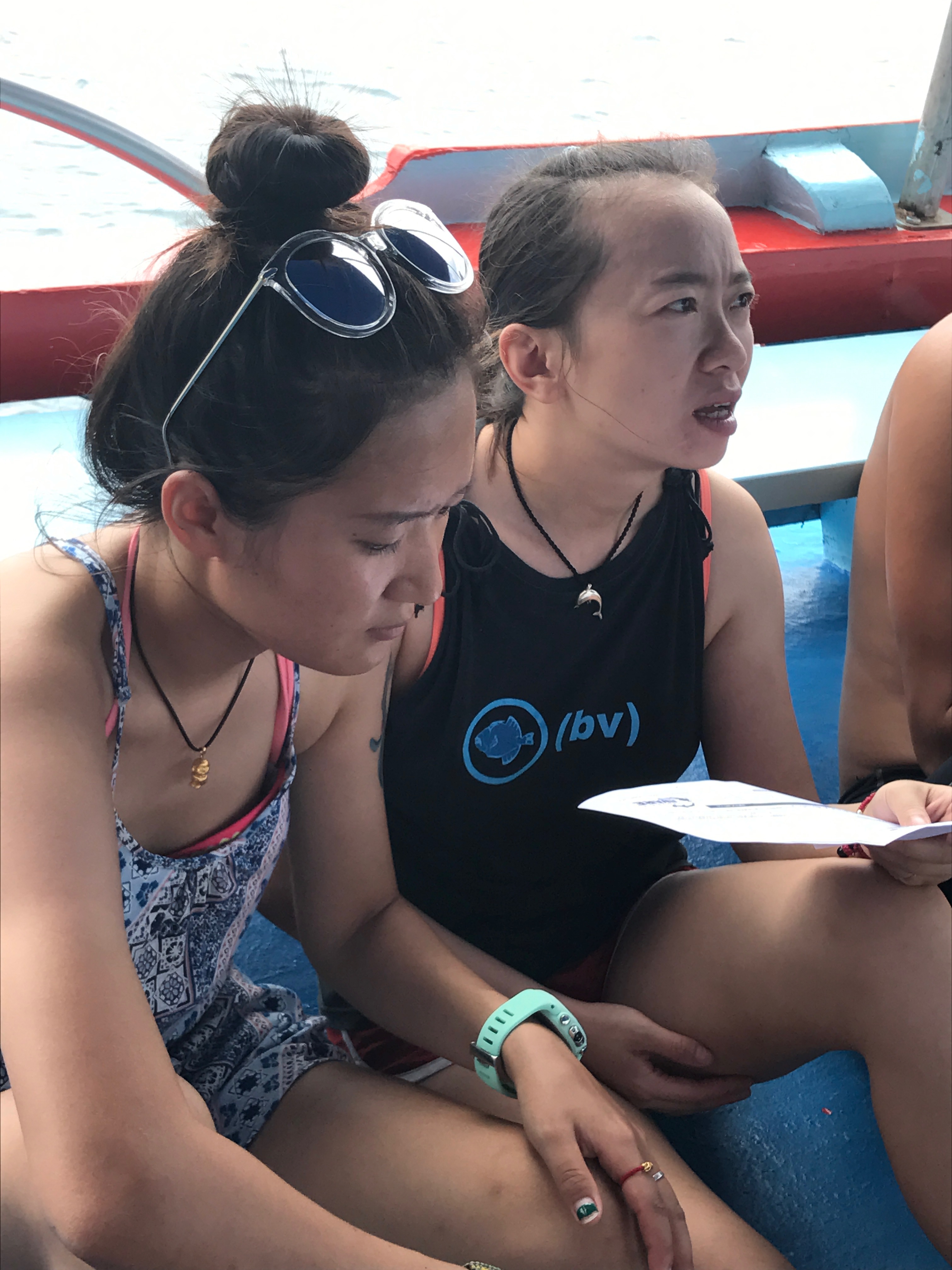
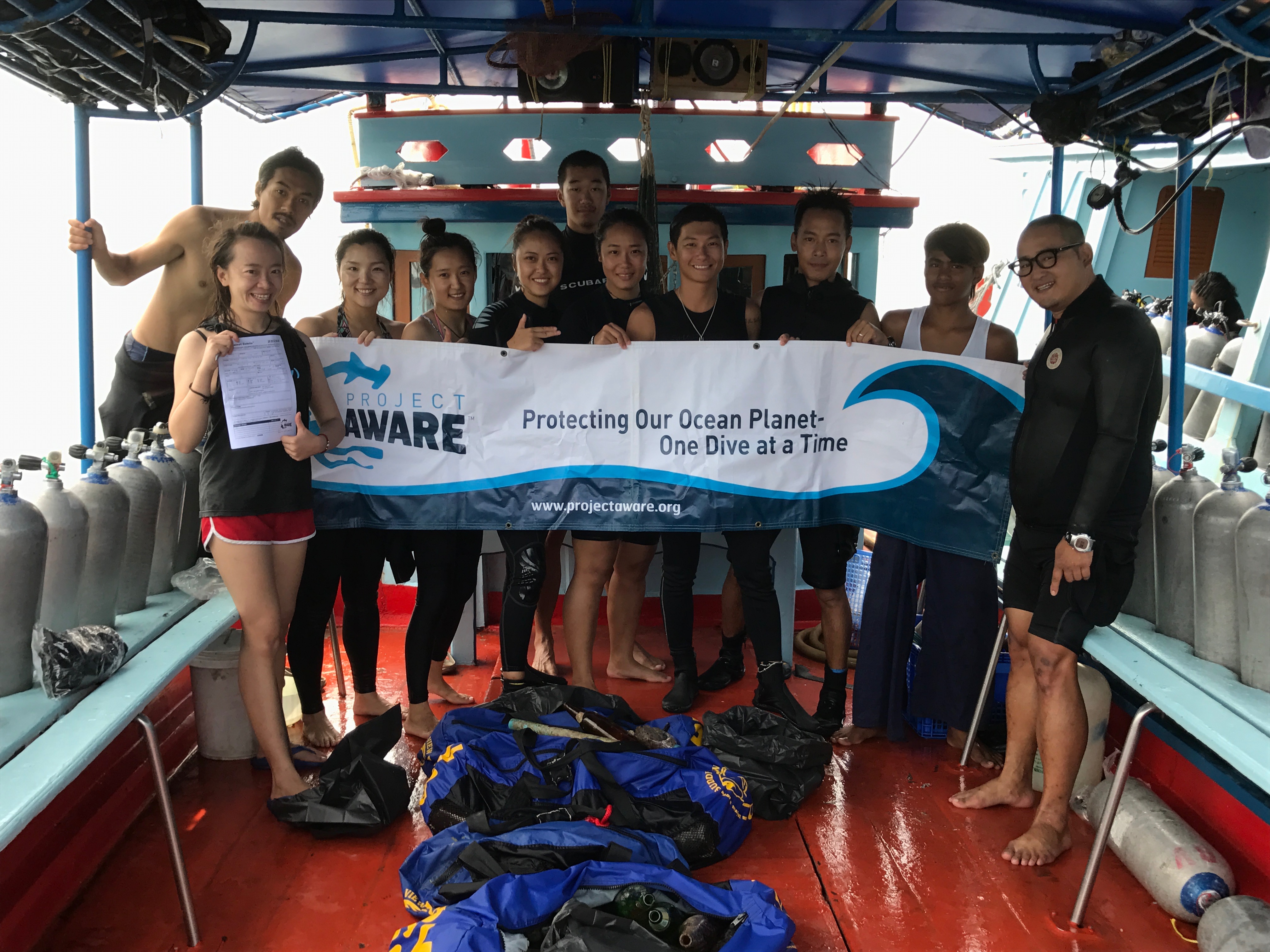
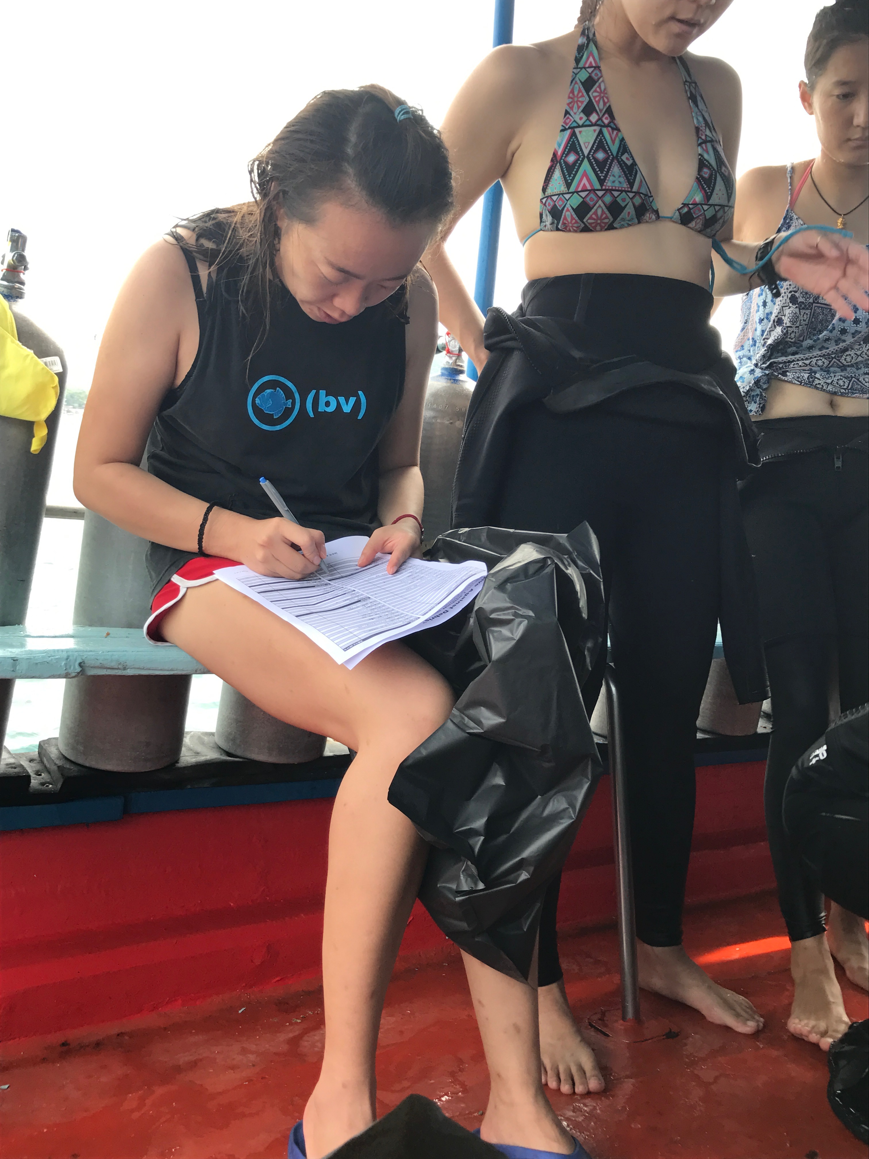
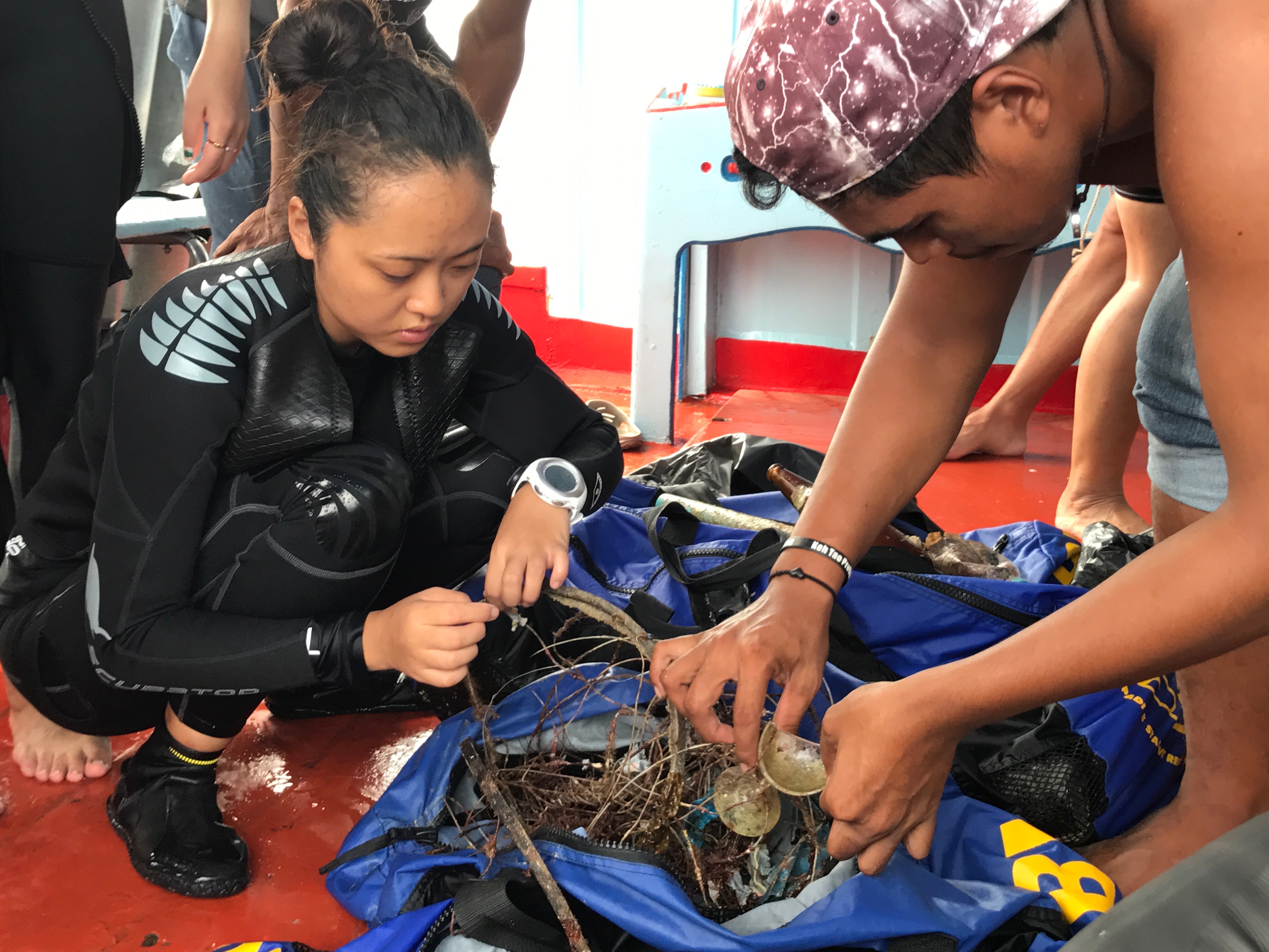
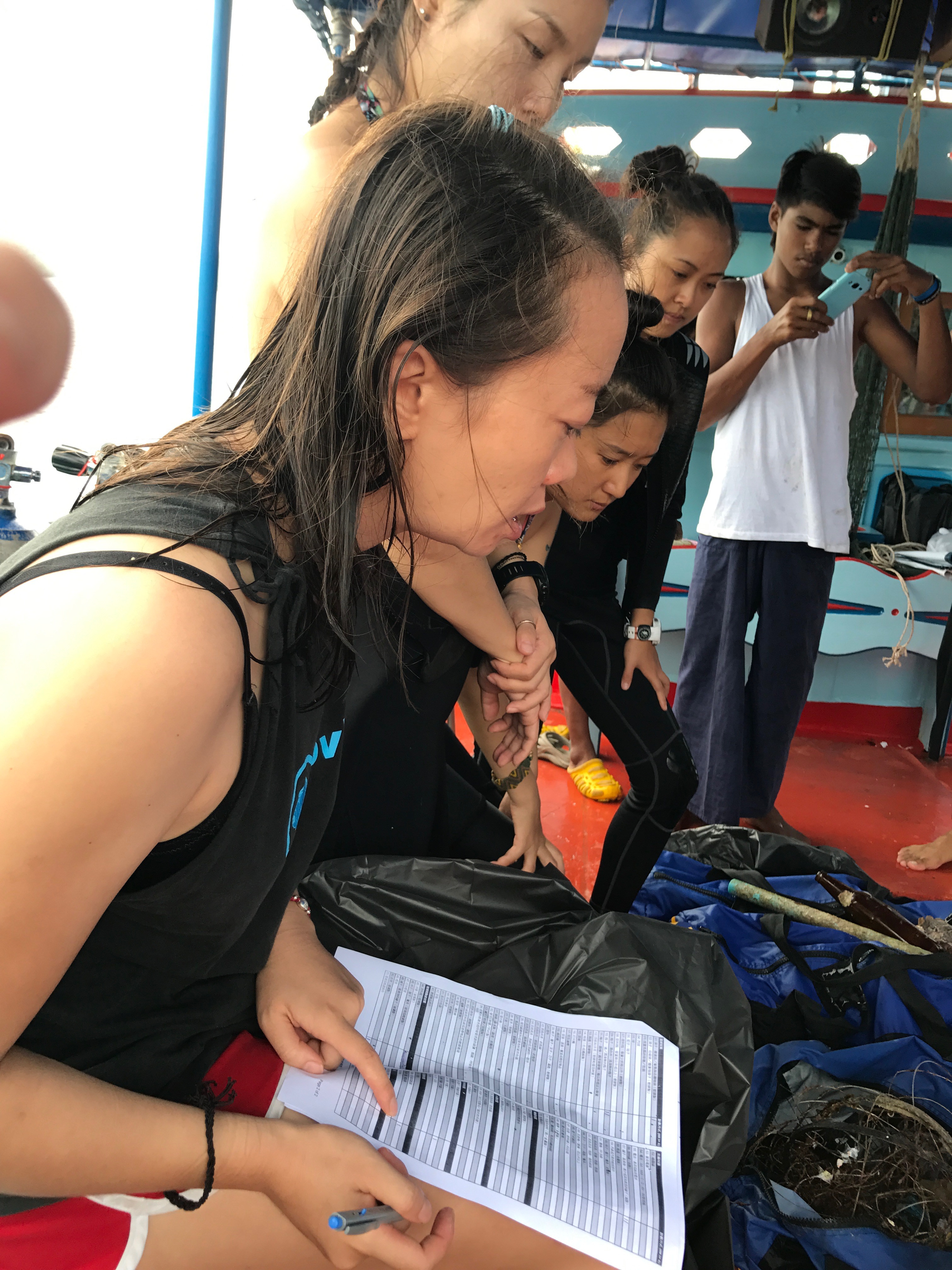
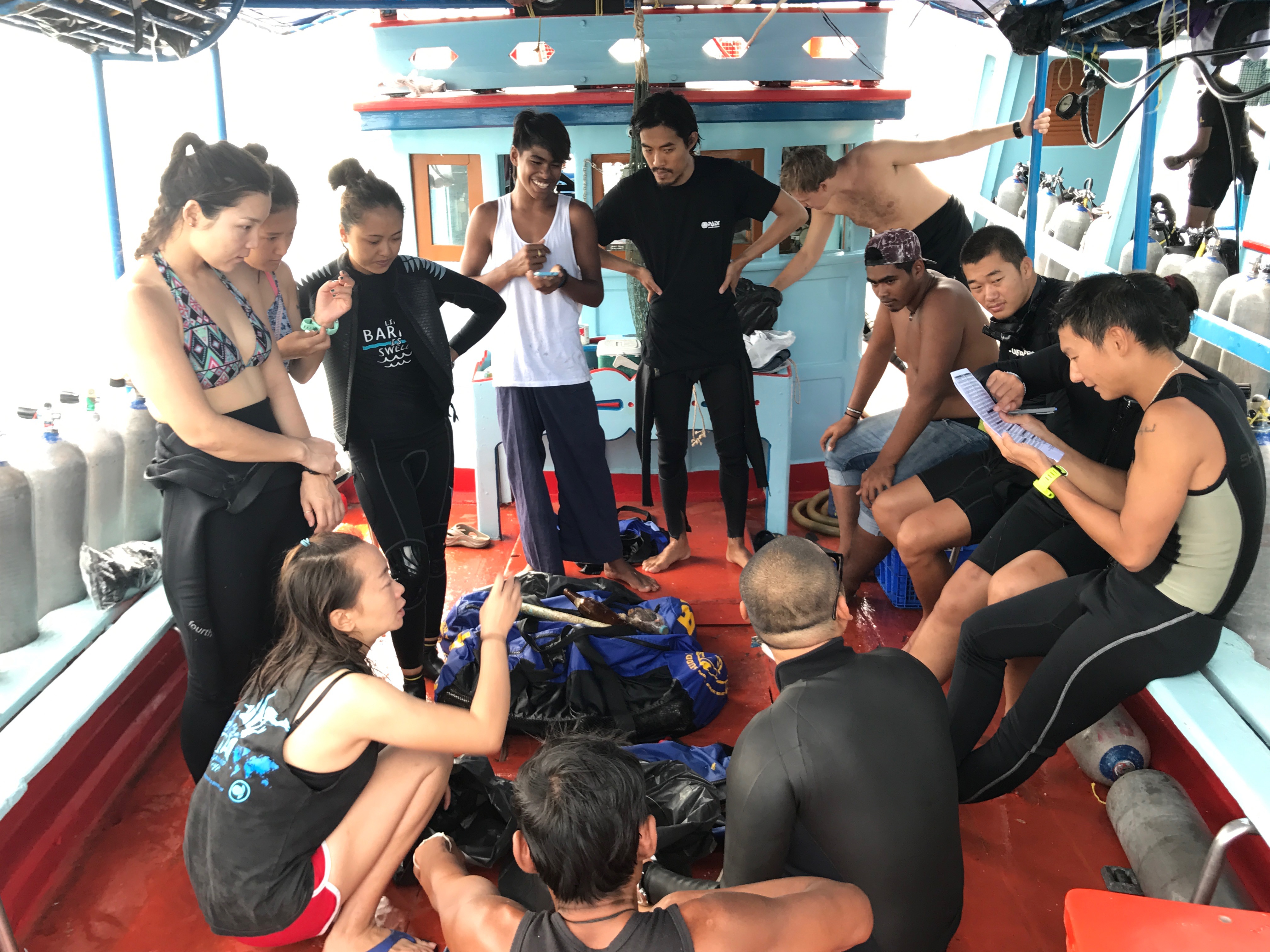
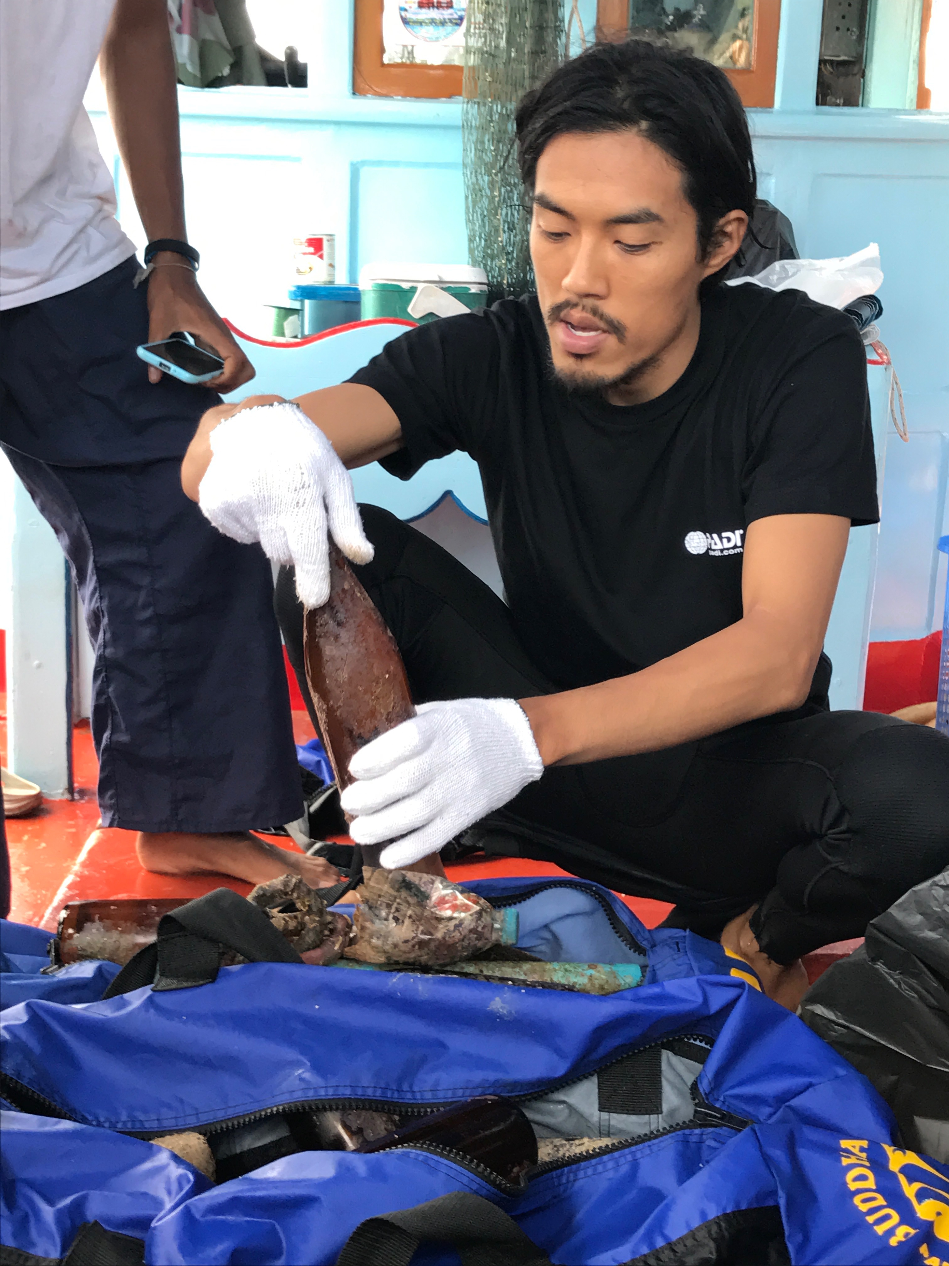
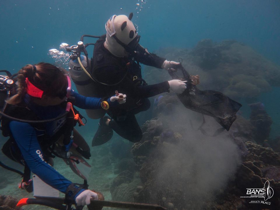
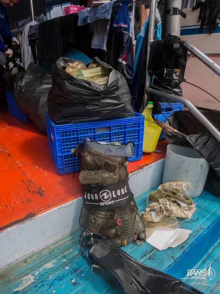
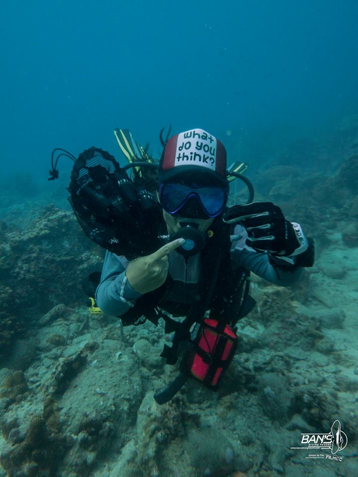
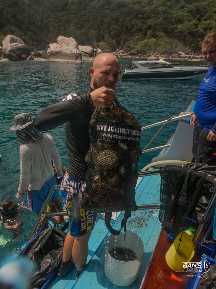
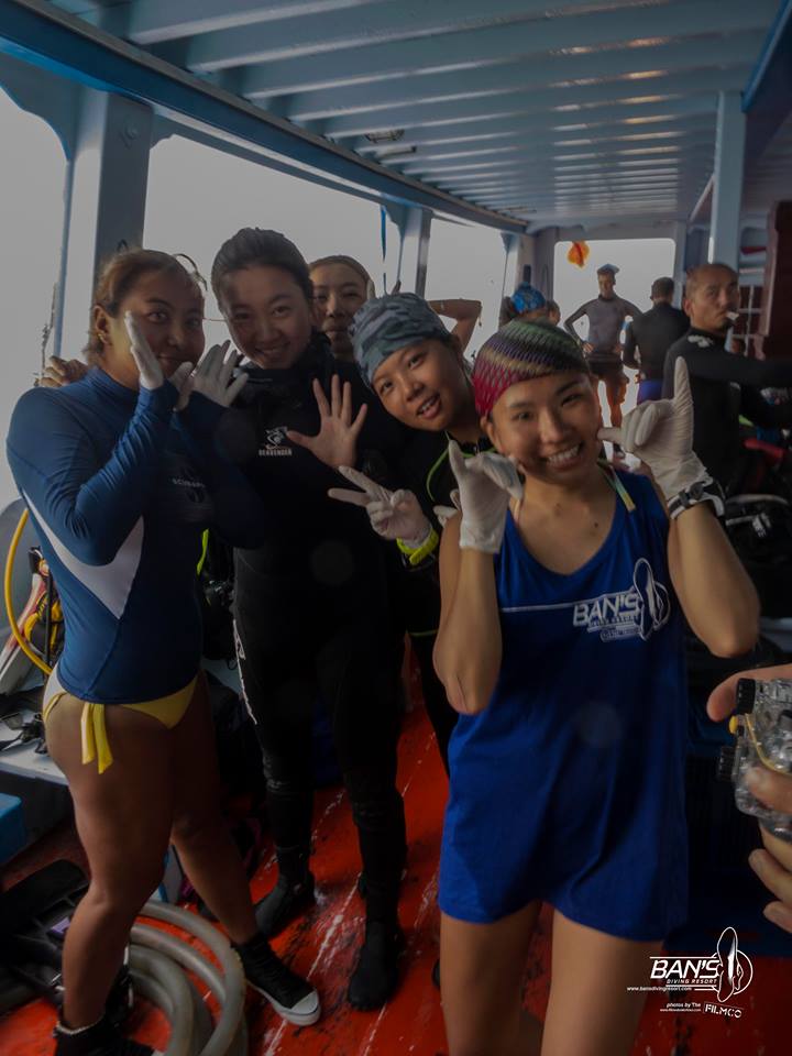
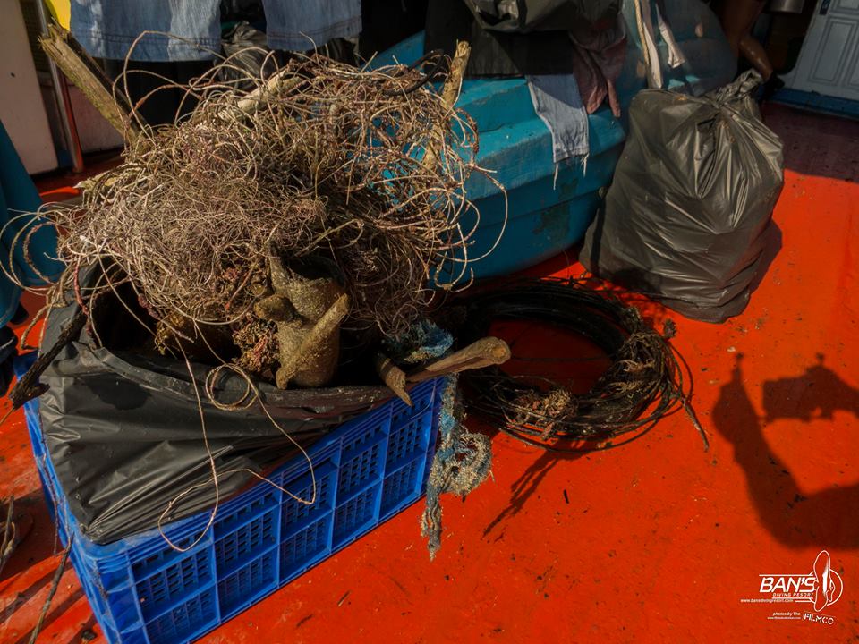
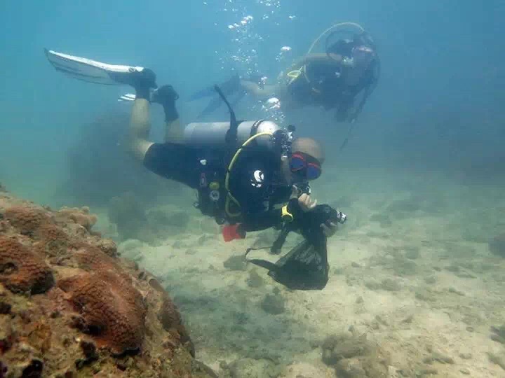
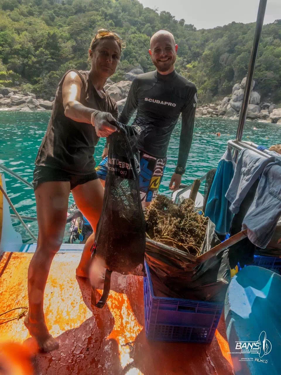
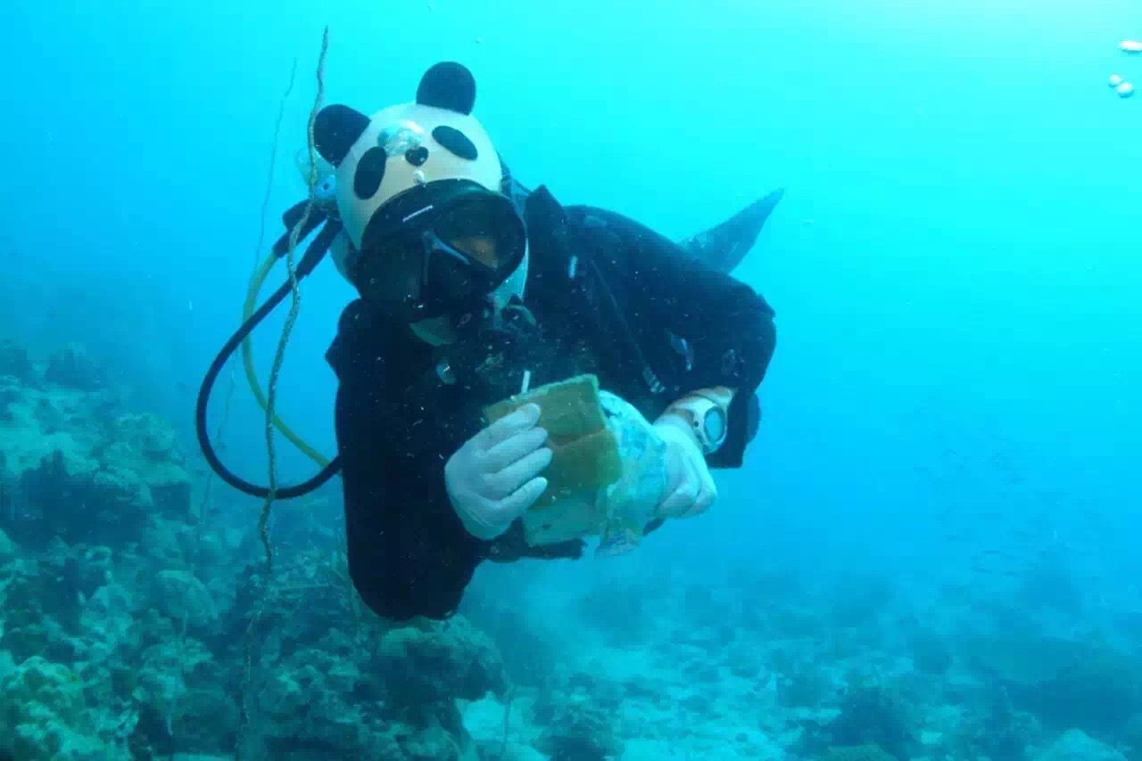
"Dive Against Debris" program today by offering free dives this afternoon to all participants willing to pick up debris and help clean up the ocean floor. We visited two different sites, Lighthouse and Green Rock. There were a total of 54 volunteers on board today, and at the end of the day, we had collected over 5 large trash bags full of trash & debris, and a large crate filled with fishing line, ropes, cables and metal strips.. Thanks to all who took time out of their day to come and help out Ban's to clean up our planet!!! (a practice we all should do daily).
sunny
BANS DIVING /SUNSHINE DIVING
LIZHOU (Joey) ,Natalie Hunt
21
54
10
136
47
4
5
72.00
50
14.00
1.00
estimated
3
2000.00
On
kilograms
I have debris data to report
12
Calm (glassy to rippled) for waves 0 – 0.1 meter high
2
m2
meters
coral reef
6
4
8
7
4
Thailand
State\Province
SURRATHANI
City
KOH TAO
Map Help


Dive Location

If you know your survey site coordinates, enter them manually in decimal degrees using WGS84 Map Datum. Use the minus sign for latitudes south of the equator and longitudes west of the Prime Meridian to 180 degrees.

If you do not know your survey site coordinates, click the “Map Location” tab to use the map to zoom into your survey site and drop the pin on the map to fall within your survey dive site in the water (not on land or the beach). Ensure you zoom in as much as possible to ensure data accuracy.

Entangled Help


Use the vertical tabs below to record any entangled animals you found of each type.

alona beach house reef

sand
14
1

9.549159275242173, 123.7788019166328

sierra madre dive center
sunle zhuang
2
2
22
2
7
3
5
1
17.00
70
12.00
1.50
estimated
1000.00
On
kilograms
I have debris data to report
Calm (glassy to rippled) for waves 0 – 0.1 meter high m2
meters
coral reef
Philippines
State\Province
bohol
City
panglao
Map Help


Dive Location

If you know your survey site coordinates, enter them manually in decimal degrees using WGS84 Map Datum. Use the minus sign for latitudes south of the equator and longitudes west of the Prime Meridian to 180 degrees.

If you do not know your survey site coordinates, click the “Map Location” tab to use the map to zoom into your survey site and drop the pin on the map to fall within your survey dive site in the water (not on land or the beach). Ensure you zoom in as much as possible to ensure data accuracy.

Entangled Help


Use the vertical tabs below to record any entangled animals you found of each type.

ADS142 - Sabang Bay Puerto Galera

7
2
1

13.521685, 120.975398

sand
1
20
A very nice video of the event was uploaded by Rob Jacobs / Calypso Multimedia:
https://www.facebook.com/Calypso-Multimedia-1720696354808939/?fref=ts&ref=br_tf#
None
Medicine Bottles
Supermoon and heavy rain previous 2 nights, daytime sunny conditions
3
2
3
Boat Engine Transmission Rubber Bands
Rubber Tubes
Medicine Glass Bottles
Asia Divers
Sabine Henkel
3
2
4
1
2
8
8
1
30.90
45
18.00
6.00
measured
2500.00
3
Fishing lines
Plastic
Boat replacement parts - like rubber transmission belts
On
kilograms
I have debris data to report
6
Smooth (wavelets) for waves 0.1 - 0.5 meter high
2
1
m2
2
4
meters
coral reef
3
2
3
1
1
Philippines
City
Puerto Galera
Map Help


Dive Location

If you know your survey site coordinates, enter them manually in decimal degrees using WGS84 Map Datum. Use the minus sign for latitudes south of the equator and longitudes west of the Prime Meridian to 180 degrees.

If you do not know your survey site coordinates, click the “Map Location” tab to use the map to zoom into your survey site and drop the pin on the map to fall within your survey dive site in the water (not on land or the beach). Ensure you zoom in as much as possible to ensure data accuracy.

Entangled Help


Use the vertical tabs below to record any entangled animals you found of each type.

ADS126 - Chilpo Beach Northern Rocky outcrop

10
91
1

36.136072, 129.398292

1
sand
18
2
10
This rocky outcrop sits between a long recreational beach open to the public to the south, and a private/restricted smaller beach used by the Korean military for training purposes to the north. Usually I don't venture to the northern end of the rocky outcrop, but on this dive I did. There was SOO much more debris in that area ( as it doesn't get washed up to a recreational beach that gets regular maintenance) That area also is suffering from the dumping of some fibrous plant/wood mess, but also more debris than I could have possibly collected alone.
Most of the debris was contained with a large swath of wood pulp/debris that seems to have been dumped weeks ago offshore. The lighter pieces of fiber/wood wereon the surface and eventually washed ashore. The "stems" and larger pieces sank to the bottom just off a sandbar approx. 1 meter deep and seems to have served as a trap or haven for all kinds of debris. See the video here~ https://www.facebook.com/robert.williams.503092/videos/1415864718431250/
Mostly clear. Ocean conditions remained fairly smooth.
Dive Against Debris Korea (Daegu)
William Henderson
3
1
1
5
5
5
1
1
1
1
12.00
41
6.00
0.50
7
estimated
4
47.00
4
plastic
On
kilograms
I have debris data to report
2
1
Slight for waves 0.5 -1.25 meter high
6
1
1
8
2
1
m2
12
meters
rocky reef
2
7
1
2
South Korea
State\Province
Gyeongsang-bukdo
City
Pohang
Map Help


Dive Location

If you know your survey site coordinates, enter them manually in decimal degrees using WGS84 Map Datum. Use the minus sign for latitudes south of the equator and longitudes west of the Prime Meridian to 180 degrees.

If you do not know your survey site coordinates, click the “Map Location” tab to use the map to zoom into your survey site and drop the pin on the map to fall within your survey dive site in the water (not on land or the beach). Ensure you zoom in as much as possible to ensure data accuracy.

Entangled Help


Use the vertical tabs below to record any entangled animals you found of each type.

sairee mid

3
coral
0
8

10.09348911530811, 99.82546739280224

Heavy rainny
BANS DIVING RESORT
LIZHOU(Joey)
1
7
3
14
15
0
5
8
0
0
1
14.00
65
8.90
1.00
measured
1000.00
On
kilograms
1
I have debris data to report
7
3
Calm (glassy to rippled) for waves 0 – 0.1 meter high
1
1
m2
meters
coral reef
0
Thailand
State\Province
SURRATHANI
City
KOH TAO
Map Help


Dive Location

If you know your survey site coordinates, enter them manually in decimal degrees using WGS84 Map Datum. Use the minus sign for latitudes south of the equator and longitudes west of the Prime Meridian to 180 degrees.

If you do not know your survey site coordinates, click the “Map Location” tab to use the map to zoom into your survey site and drop the pin on the map to fall within your survey dive site in the water (not on land or the beach). Ensure you zoom in as much as possible to ensure data accuracy.

Entangled Help


Use the vertical tabs below to record any entangled animals you found of each type.

ADS19 - Camp Cove South - around Green Point

31

-33.840301, 151.277745

1
sand
120
Fishing and recreational activity in the area
Managed to cut off the line but the fish swam away with the hook and lure dangling out of its mouth :(
Mostly dry with some high-swell days.
Underwater Research Group of NSW
Yanir Seroussi
3
1
3
6
2
3.00
60
8.00
1.00
estimated
39
10000.00
1
Fishing line and lures
On
kilograms
I have debris data to report
2
Smooth (wavelets) for waves 0.1 - 0.5 meter high
Injured
Cnidoglanis macrocephalus
1
Fishing hook, lure, and line
m2
1
meters
rocky reef
2
3
1
30
1
Australia
State\Province
New South Wales
City
Watsons Bay
Map Help


Dive Location

If you know your survey site coordinates, enter them manually in decimal degrees using WGS84 Map Datum. Use the minus sign for latitudes south of the equator and longitudes west of the Prime Meridian to 180 degrees.

If you do not know your survey site coordinates, click the “Map Location” tab to use the map to zoom into your survey site and drop the pin on the map to fall within your survey dive site in the water (not on land or the beach). Ensure you zoom in as much as possible to ensure data accuracy.

Entangled Help


Use the vertical tabs below to record any entangled animals you found of each type.

ADS175 - Blue Bay

3

35.031984, 34.042372

1
sand
3
1
windy
Taba Dive Centre
Manuel Vollmer
4
1
3
2
2
1.00
45
6.00
1.00
estimated
200.00
cigarette filters
On
kilograms
I have debris data to report
Slight for waves 0.5 -1.25 meter high m2
meters
rocky reef
Cyprus
City
Pernera
Map Help


Dive Location

If you know your survey site coordinates, enter them manually in decimal degrees using WGS84 Map Datum. Use the minus sign for latitudes south of the equator and longitudes west of the Prime Meridian to 180 degrees.

If you do not know your survey site coordinates, click the “Map Location” tab to use the map to zoom into your survey site and drop the pin on the map to fall within your survey dive site in the water (not on land or the beach). Ensure you zoom in as much as possible to ensure data accuracy.

Entangled Help


Use the vertical tabs below to record any entangled animals you found of each type.

ADS09 - Rompeolas/Mosquito Pier

seagrass
20

18.14854712191941, -65.51429646089673

Fishing for recreation
Black Beard Sports
Gabriel Espino
1
3.00
50
40.00
21.00
estimated
1600.00
On
pounds
I have debris data to report
5
Slight for waves 0.5 -1.25 meter high m2
feet
other
United States
State\Province
Puerto Rico
City
Vieques
Map Help


Dive Location

If you know your survey site coordinates, enter them manually in decimal degrees using WGS84 Map Datum. Use the minus sign for latitudes south of the equator and longitudes west of the Prime Meridian to 180 degrees.

If you do not know your survey site coordinates, click the “Map Location” tab to use the map to zoom into your survey site and drop the pin on the map to fall within your survey dive site in the water (not on land or the beach). Ensure you zoom in as much as possible to ensure data accuracy.

Entangled Help


Use the vertical tabs below to record any entangled animals you found of each type.

Ecosystem Other
Artificial Reef

SAIREE REEF KOHTAO THAILAND

3
1
sand
3
1

10.100267217320045, 99.82182793901302

I CAN GUSS ALL THIS FROM FISHING BOAT,DIVING BOAT
BEER BOTTLES
GOOD
BUDDHA VIEW DIVE RESORT
Chengyan Wu
6
1
1
1
2
1
3
38.00
38
10.00
5.00
measured
1
108.00
1
BEER BOTTLES
FISHING LINE
PLASTIC THING
On
kilograms
I have debris data to report
36
Smooth (wavelets) for waves 0.1 - 0.5 meter high
1
1
m2
1
1
meters
coral reef
1
2
1
2
1
17
Thailand
State\Province
SURATTANI
City
KOH TAO
Map Help


Dive Location

If you know your survey site coordinates, enter them manually in decimal degrees using WGS84 Map Datum. Use the minus sign for latitudes south of the equator and longitudes west of the Prime Meridian to 180 degrees.

If you do not know your survey site coordinates, click the “Map Location” tab to use the map to zoom into your survey site and drop the pin on the map to fall within your survey dive site in the water (not on land or the beach). Ensure you zoom in as much as possible to ensure data accuracy.

Entangled Help


Use the vertical tabs below to record any entangled animals you found of each type.

ADS127 - Muka Kampung Bunaken Island

7

1.598868, 124.774789

coral
1
two days before the DAD we saw a lot of debris on the surface around the island but on the adopted divesite was relative little debris.
wire wool
beginning on raining season. several days with 2-4 hours rain. which usually causes to wash debris off the islands or the mainland into the sea.
Two Fish Divers, Bunaken
Markus Reinhardt
10
5
7
3
4.00
50
20.00
2.00
measured
400.00
nappies
plastic bags
plastic bottles
On
kilograms
I have debris data to report
Smooth (wavelets) for waves 0.1 - 0.5 meter high
3
m2
meters
coral reef
1
Indonesia
State\Province
North Sulawesi
City
Bunaken Island
Map Help


Dive Location

If you know your survey site coordinates, enter them manually in decimal degrees using WGS84 Map Datum. Use the minus sign for latitudes south of the equator and longitudes west of the Prime Meridian to 180 degrees.

If you do not know your survey site coordinates, click the “Map Location” tab to use the map to zoom into your survey site and drop the pin on the map to fall within your survey dive site in the water (not on land or the beach). Ensure you zoom in as much as possible to ensure data accuracy.

Entangled Help


Use the vertical tabs below to record any entangled animals you found of each type.

Subscribe to