Lake in large park often frequented by youth and fishermen at night.
Park visitors at night
App does not want to upload pictures, sorry.
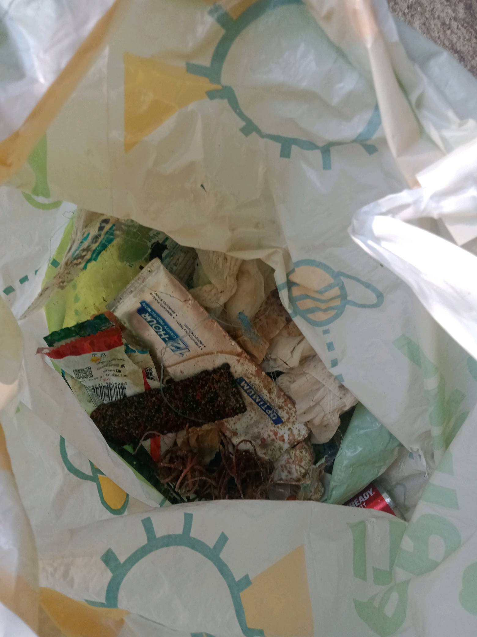
Serving tray + unopened beer bottle
Sun, calm
3
Pond liner
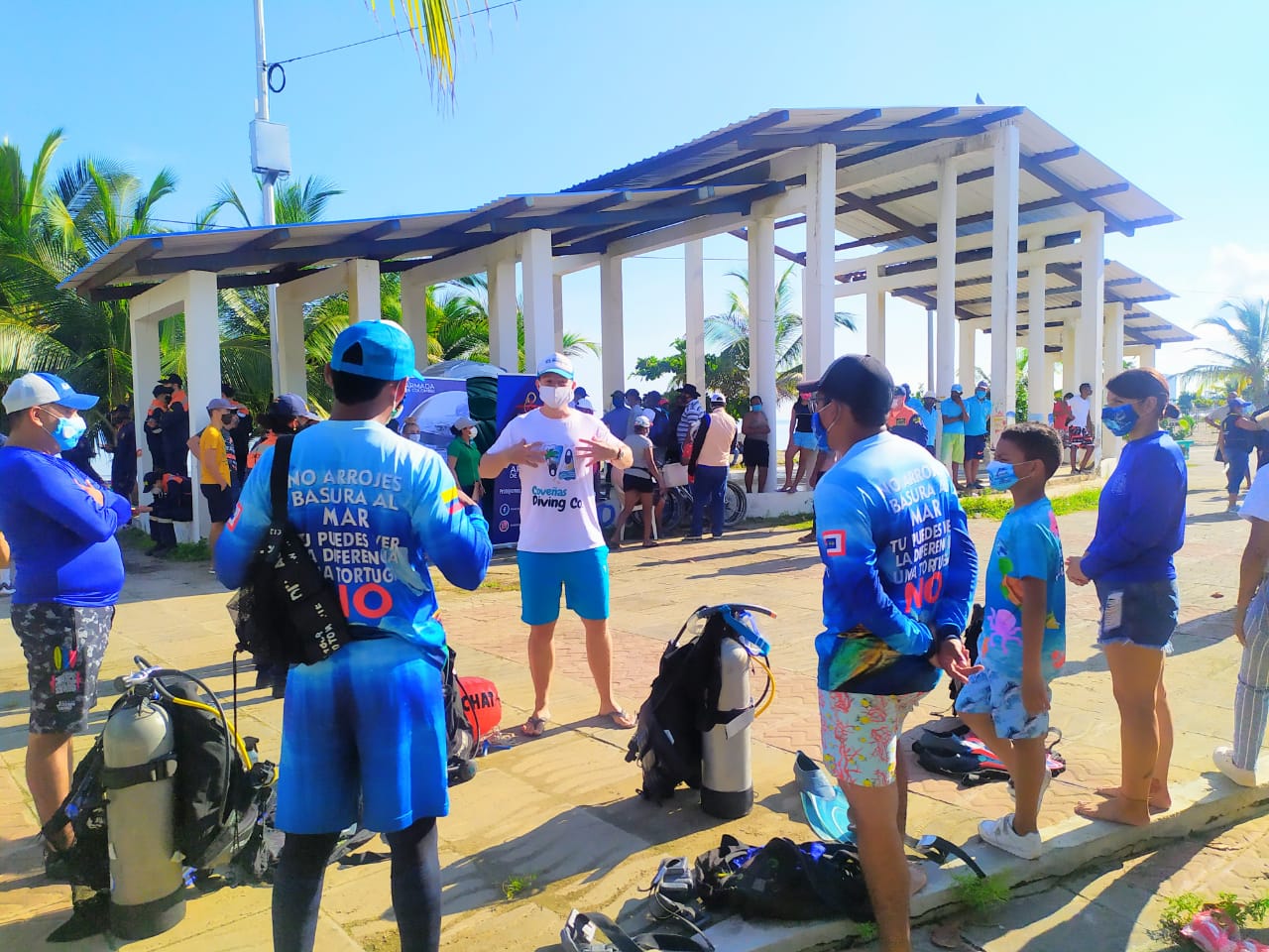
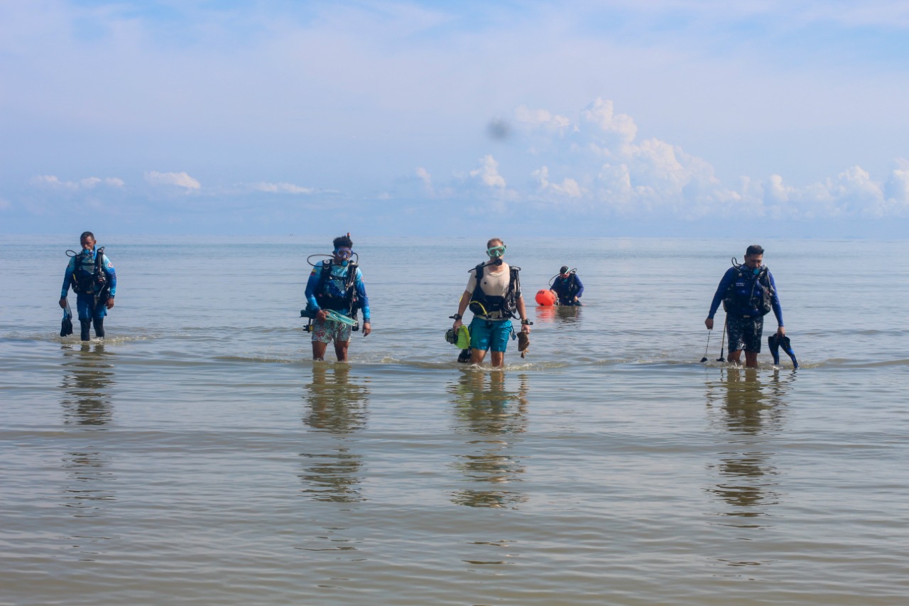
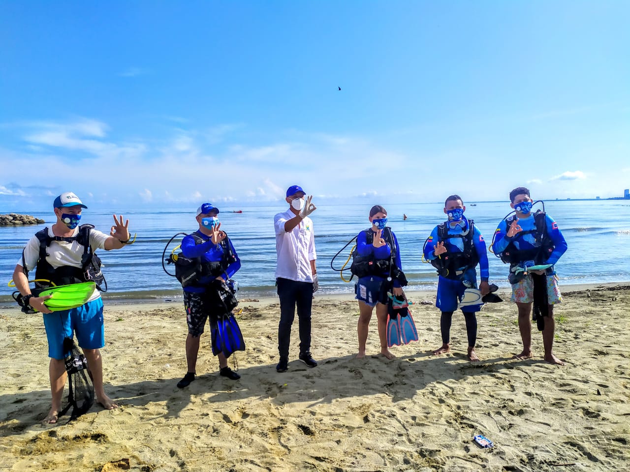
KevMic-Diving (S-23899)
Helmar de Ruiter (IDCS-953011)
0
0
0
6
0
0
0
0
0
0
0
0
0
0
0
0
0
0
0
14
0
0
0
0
0
0
10
0
0
0
0
0
0
0
0
0
33.00
55
7.00
1.00
0
measured
0
0
0
6
2751.95
1
1
0
3
0
Plastic items
Sharp metal cans
Fishing lines
0
On
kilograms
0
I have debris data to report
25
0
0
Calm (glassy to rippled) for waves 0 – 0.1 meter high
0
0
0
0
0
0
0
m2
0
3
meters
other
0
0
0
0
0
0
0
0
0
0
0
0
0
0
1
0
1
40
0
0
2
0
1
5
0
0
0
0
0
Netherlands
State\Province
Noord-Holland
City
Langedijk
Map Help
Dive Location
If you know your survey site coordinates, enter them manually in decimal degrees using WGS84 Map Datum. Use the minus sign for latitudes south of the equator and longitudes west of the Prime Meridian to 180 degrees.
If you do not know your survey site coordinates, click the “Map Location” tab to use the map to zoom into your survey site and drop the pin on the map to fall within your survey dive site in the water (not on land or the beach). Ensure you zoom in as much as possible to ensure data accuracy.
Entangled Help
Use the vertical tabs below to record any entangled animals you found of each type.
Calm (glassy to rippled) for waves 0 – 0.1 meter high
0
0
0
0
0
0
0
m2
0
0
meters
coral reef
0
0
0
0
0
0
0
0
0
0
0
0
0
0
0
0
0
0
0
0
0
0
2
0
0
0
0
0
0
Language
English
Philippines
State\Province
Cebu
City
Moalboal
Map Help
Dive Location
If you know your survey site coordinates, enter them manually in decimal degrees using WGS84 Map Datum. Use the minus sign for latitudes south of the equator and longitudes west of the Prime Meridian to 180 degrees.
If you do not know your survey site coordinates, click the “Map Location” tab to use the map to zoom into your survey site and drop the pin on the map to fall within your survey dive site in the water (not on land or the beach). Ensure you zoom in as much as possible to ensure data accuracy.
Entangled Help
Use the vertical tabs below to record any entangled animals you found of each type.
Calm (glassy to rippled) for waves 0 – 0.1 meter high
0
0
0
0
0
0
0
ft2
0
0
meters
other
0
0
0
0
0
0
0
0
0
0
0
0
0
0
0
0
0
0
0
0
0
0
0
0
0
0
0
0
Language
English
Canada
State\Province
Sk
City
Chamberlain
Map Help
Dive Location
If you know your survey site coordinates, enter them manually in decimal degrees using WGS84 Map Datum. Use the minus sign for latitudes south of the equator and longitudes west of the Prime Meridian to 180 degrees.
If you do not know your survey site coordinates, click the “Map Location” tab to use the map to zoom into your survey site and drop the pin on the map to fall within your survey dive site in the water (not on land or the beach). Ensure you zoom in as much as possible to ensure data accuracy.
Entangled Help
Use the vertical tabs below to record any entangled animals you found of each type.
Lots of fishing lines around corals- took a long time to detangle.
Extended Fishing
NA
Tank valve
Rainy
1
0
0
0
0
0
0
0
0
0
0
0
0
0
0
0
0
0
0
0
Thermostat
Asia Divers
Kris
0
0
0
0
0
0
0
0
0
0
0
0
0
15
0
0
0
0
7
4
0
1
0
1
2
0
0
0
0
0
0
0
0
0
4.00
66
16.40
2.00
9
measured
0
0
500.00
1
0
0
2
0
Fishing line
Plastic wrapping band
Nylon rope
1
On
kilograms
0
I have debris data to report
4
0
0
Calm (glassy to rippled) for waves 0 – 0.1 meter high
0
0
0
1
2
0
0
m2
0
1
meters
coral reef
4
0
0
0
0
0
0
0
0
0
0
0
0
0
0
1
3
0
0
0
0
0
0
0
0
0
0
0
Language
English
Philippines
City
Puerto Galera
Map Help
Dive Location
If you know your survey site coordinates, enter them manually in decimal degrees using WGS84 Map Datum. Use the minus sign for latitudes south of the equator and longitudes west of the Prime Meridian to 180 degrees.
If you do not know your survey site coordinates, click the “Map Location” tab to use the map to zoom into your survey site and drop the pin on the map to fall within your survey dive site in the water (not on land or the beach). Ensure you zoom in as much as possible to ensure data accuracy.
Entangled Help
Use the vertical tabs below to record any entangled animals you found of each type.
Calm (glassy to rippled) for waves 0 – 0.1 meter high
m2
meters
coral reef
Language
English
Netherlands Antilles
City
Willemstad
Map Help
Dive Location
If you know your survey site coordinates, enter them manually in decimal degrees using WGS84 Map Datum. Use the minus sign for latitudes south of the equator and longitudes west of the Prime Meridian to 180 degrees.
If you do not know your survey site coordinates, click the “Map Location” tab to use the map to zoom into your survey site and drop the pin on the map to fall within your survey dive site in the water (not on land or the beach). Ensure you zoom in as much as possible to ensure data accuracy.
Entangled Help
Use the vertical tabs below to record any entangled animals you found of each type.
Calm (glassy to rippled) for waves 0 – 0.1 meter high
m2
meters
coral reef
Language
English
Colombia
City
Coveñas
Map Help
Dive Location
If you know your survey site coordinates, enter them manually in decimal degrees using WGS84 Map Datum. Use the minus sign for latitudes south of the equator and longitudes west of the Prime Meridian to 180 degrees.
If you do not know your survey site coordinates, click the “Map Location” tab to use the map to zoom into your survey site and drop the pin on the map to fall within your survey dive site in the water (not on land or the beach). Ensure you zoom in as much as possible to ensure data accuracy.
Entangled Help
Use the vertical tabs below to record any entangled animals you found of each type.