Menu

ADS360 - Rif St. Marie

12.197922108759, -69.079177002249

coral
1

12.16957, -68.99002

Calm no wind. Very calm Sea no waves
Coral Divers Curacao
Koen van de Pol
3
4
0.10
55
29.00
5.00
estimated
3000.00
On
kilograms
I have debris data to report
1
Calm (glassy to rippled) for waves 0 – 0.1 meter high m2
meters
coral reef
Netherlands Antilles
City
Willemstad
Map Help


Dive Location

If you know your survey site coordinates, enter them manually in decimal degrees using WGS84 Map Datum. Use the minus sign for latitudes south of the equator and longitudes west of the Prime Meridian to 180 degrees.

If you do not know your survey site coordinates, click the “Map Location” tab to use the map to zoom into your survey site and drop the pin on the map to fall within your survey dive site in the water (not on land or the beach). Ensure you zoom in as much as possible to ensure data accuracy.

Entangled Help


Use the vertical tabs below to record any entangled animals you found of each type.

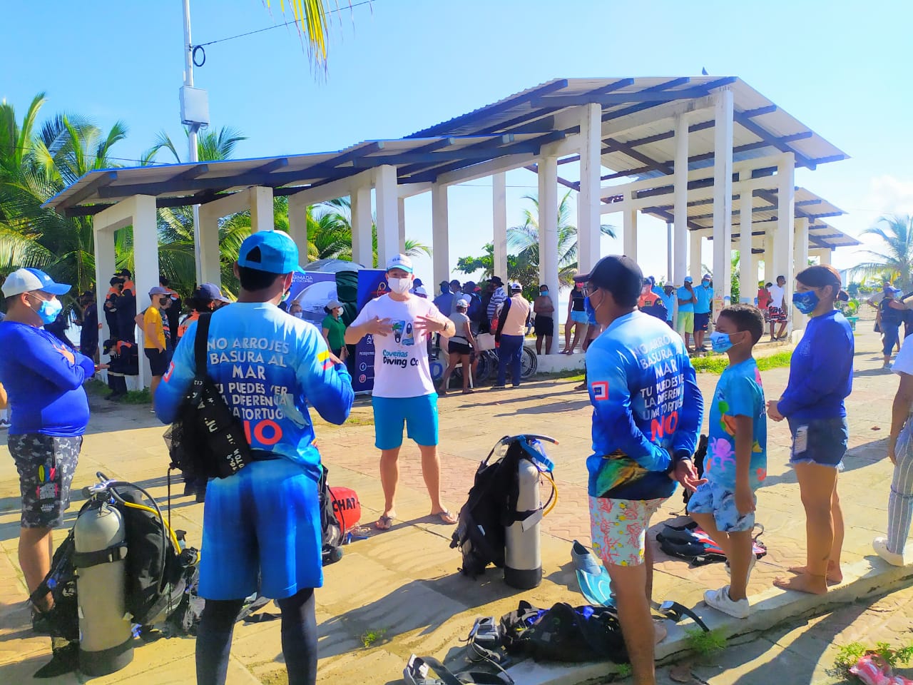
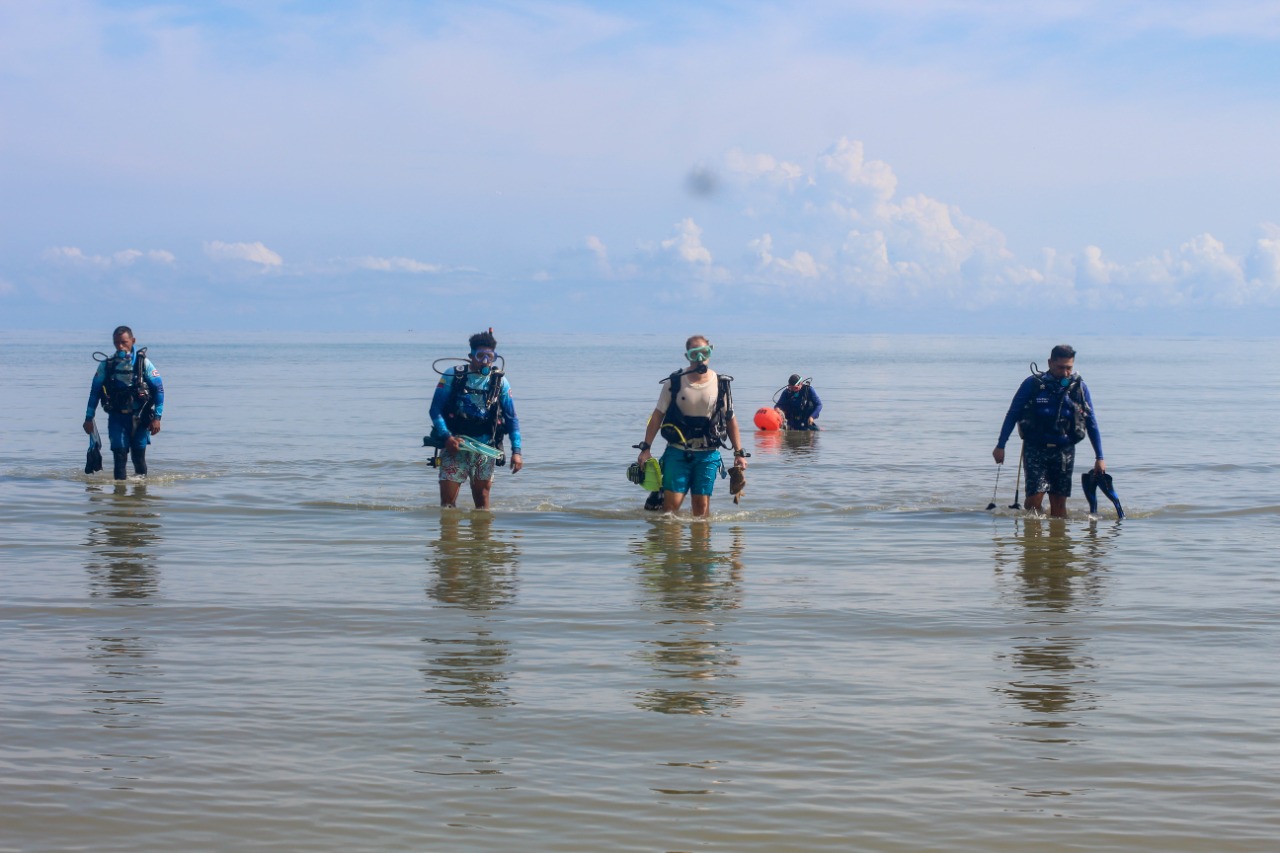
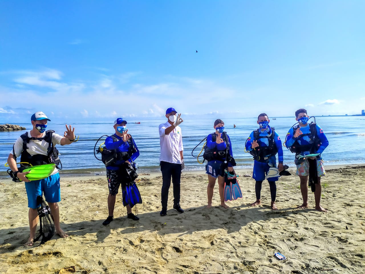
limpieza playas de Coveñas

coral

9.403618848204, -75.678571051203

sunny, some showers
covenas diving co
guillermo camara
150
300.00
180
5.00
2.00
estimated
100.00
On
kilograms
I have debris data to report
Calm (glassy to rippled) for waves 0 – 0.1 meter high m2
meters
coral reef
Colombia
City
Coveñas
Map Help


Dive Location

If you know your survey site coordinates, enter them manually in decimal degrees using WGS84 Map Datum. Use the minus sign for latitudes south of the equator and longitudes west of the Prime Meridian to 180 degrees.

If you do not know your survey site coordinates, click the “Map Location” tab to use the map to zoom into your survey site and drop the pin on the map to fall within your survey dive site in the water (not on land or the beach). Ensure you zoom in as much as possible to ensure data accuracy.

Entangled Help


Use the vertical tabs below to record any entangled animals you found of each type.

Pilares

0
9
0

20.265563873851, -87.385609716675

0
0
0
coral
0
1
0
1
0
No
Hair brush
Good
0
0
0
0
0
0
0
0
0
0
0
0
0
0
0
0
0
0
0
0
The GoPro family
The GoPro family
0
0
0
1
1
0
0
0
0
0
0
0
0
0
0
0
0
3
0
4
0
0
0
0
0
0
0
0
0
0
0
0
0
0
0.14
80
9.00
4.00
0
measured
0
0
352.87
0
0
0
0
0
Fishing wire
0
On
kilograms
0
I have debris data to report
0
0
0
Slight for waves 0.5 -1.25 meter high
0
0
0
0
0
0
0
m2
0
0
meters
coral reef
0
0
0
0
0
0
0
0
0
0
0
0
0
0
0
0
0
0
0
0
0
0
0
0
0
0
0
0
Mexico
State\Province
Quintana Roo
City
Tulum
Map Help


Dive Location

If you know your survey site coordinates, enter them manually in decimal degrees using WGS84 Map Datum. Use the minus sign for latitudes south of the equator and longitudes west of the Prime Meridian to 180 degrees.

If you do not know your survey site coordinates, click the “Map Location” tab to use the map to zoom into your survey site and drop the pin on the map to fall within your survey dive site in the water (not on land or the beach). Ensure you zoom in as much as possible to ensure data accuracy.
Entangled Help


Use the vertical tabs below to record any entangled animals you found of each type.

Electric Beach

0
0
0
0

21.353718, -158.13082

2
0
0
sand
0
6
0
16
0
No
Freezing spear
Calm
Aaron's Dive Shop
Keith
0
0
0
0
3
0
0
0
0
0
0
0
0
0
0
0
0
0
0
4
0
0
0
0
0
0
0
0
0
0
0
0
0
0
0
0
20.00
60
25.00
5.00
0
estimated
0
0
0
0
-1.00
0
0
0
0
0
Spear
Line
0
On
pounds
0
I have debris data to report
0
0
0
Slight for waves 0.5 -1.25 meter high
0
0
0
0
0
0
0
m2
0
0
feet
coral reef
0
0
0
0
0
0
0
0
0
0
0
0
0
0
0
0
0
0
0
0
0
0
0
0
0
0
0
0
0
United States
State\Province
Hawaii
Map Help


Dive Location

If you know your survey site coordinates, enter them manually in decimal degrees using WGS84 Map Datum. Use the minus sign for latitudes south of the equator and longitudes west of the Prime Meridian to 180 degrees.

If you do not know your survey site coordinates, click the “Map Location” tab to use the map to zoom into your survey site and drop the pin on the map to fall within your survey dive site in the water (not on land or the beach). Ensure you zoom in as much as possible to ensure data accuracy.
Entangled Help


Use the vertical tabs below to record any entangled animals you found of each type.

East Dam, Sai Kung

10
13
22

22.360451, 114.375915

1
rock
1

22.365100100739, 114.37262661352

Sunny intervals, occasional showers, light winds force 2
1
1
Surgical Mask
Glass fiber fragments
BLUE OCEAN CLUB HK
Eian KEE
2
2
16
1
1
7
39
4
53.70
60
10.00
2.00
1
measured
1
1500.00
On
kilograms
I have debris data to report
1
Calm (glassy to rippled) for waves 0 – 0.1 meter high
1
8
m2
meters
rocky reef
3
1
6
7
2
Hong Kong S.A.R., China
State\Province
No State
City
HONG KONG
Map Help


Dive Location

If you know your survey site coordinates, enter them manually in decimal degrees using WGS84 Map Datum. Use the minus sign for latitudes south of the equator and longitudes west of the Prime Meridian to 180 degrees.

If you do not know your survey site coordinates, click the “Map Location” tab to use the map to zoom into your survey site and drop the pin on the map to fall within your survey dive site in the water (not on land or the beach). Ensure you zoom in as much as possible to ensure data accuracy.

Entangled Help


Use the vertical tabs below to record any entangled animals you found of each type.

ADS307 - Portmellon

0
0
0

50.262178171276, -4.7835651694743

0
0
1
sand
0
0
0
0
0
West winds
Frizby
Calm and high east winds
2
2
0
0
0
0
0
0
0
0
0
0
0
0
0
0
0
0
0
0
Rubber sheet
Frizby
Viewpoint diving cornwall
Jade Getliff
0
0
0
0
0
0
0
0
0
0
0
0
0
0
0
0
0
0
0
2
0
0
0
0
0
0
0
0
0
0
1
0
0
0
2.00
60
10.00
3.00
0
estimated
0
0
12930.70
1
0
0
0
0
Frizby
0
On
kilograms
0
I have debris data to report
0
0
0
Slight for waves 0.5 -1.25 meter high
0
0
0
0
0
0
0
m2
0
0
meters
rocky reef
0
0
0
0
0
0
0
0
0
0
0
0
2
0
0
0
1
0
0
0
0
0
0
0
0
0
0
0
United Kingdom
State\Province
Cornwall
City
Portmellon
Map Help


Dive Location

If you know your survey site coordinates, enter them manually in decimal degrees using WGS84 Map Datum. Use the minus sign for latitudes south of the equator and longitudes west of the Prime Meridian to 180 degrees.

If you do not know your survey site coordinates, click the “Map Location” tab to use the map to zoom into your survey site and drop the pin on the map to fall within your survey dive site in the water (not on land or the beach). Ensure you zoom in as much as possible to ensure data accuracy.

Entangled Help


Use the vertical tabs below to record any entangled animals you found of each type.

Polyxrono-Hanioti

5
sand
11
3

40.008688411421, 23.564637364829

iSea
Elena Papadopoulou
17
11
11
2
15
2
5
2
100.00
60
2.50
2.00
8
estimated
3
100.00
3
On
kilograms
I have debris data to report
5
Smooth (wavelets) for waves 0.1 - 0.5 meter high
22
m2
meters
seagrass
10
7
2
Greece
State\Province
Chalkidiki
City
Hanioti
Map Help


Dive Location

If you know your survey site coordinates, enter them manually in decimal degrees using WGS84 Map Datum. Use the minus sign for latitudes south of the equator and longitudes west of the Prime Meridian to 180 degrees.

If you do not know your survey site coordinates, click the “Map Location” tab to use the map to zoom into your survey site and drop the pin on the map to fall within your survey dive site in the water (not on land or the beach). Ensure you zoom in as much as possible to ensure data accuracy.
Entangled Help


Use the vertical tabs below to record any entangled animals you found of each type.

Aigiali Amorgos

sand
40
7

36.897300554488, 25.963941832965

1 item
Aircondition
Amorgos Diving Center
Dimitris synodinos
4
20
33
40.00
60
20.00
2.00
estimated
1000.00
On
kilograms
I have debris data to report
15
Calm (glassy to rippled) for waves 0 – 0.1 meter high m2
meters
seagrass
Greece
City
Amorgos
Map Help


Dive Location

If you know your survey site coordinates, enter them manually in decimal degrees using WGS84 Map Datum. Use the minus sign for latitudes south of the equator and longitudes west of the Prime Meridian to 180 degrees.

If you do not know your survey site coordinates, click the “Map Location” tab to use the map to zoom into your survey site and drop the pin on the map to fall within your survey dive site in the water (not on land or the beach). Ensure you zoom in as much as possible to ensure data accuracy.

Entangled Help


Use the vertical tabs below to record any entangled animals you found of each type.

Nea Potidaia- Thermaic Gulf side

sand
6

40.180698803161, 23.302592179492

2metres
Gardening Rubber Plastic Water Pipe
Blue Diving Center
Charis Tsimperis
3
5
4
2.00
40
20.00
2.00
estimated
1000.00
On
kilograms
I have debris data to report
Calm (glassy to rippled) for waves 0 – 0.1 meter high m2
meters
seagrass
4
Greece
State\Province
Chalkidiki
City
Nea Potidaia
Map Help


Dive Location

If you know your survey site coordinates, enter them manually in decimal degrees using WGS84 Map Datum. Use the minus sign for latitudes south of the equator and longitudes west of the Prime Meridian to 180 degrees.

If you do not know your survey site coordinates, click the “Map Location” tab to use the map to zoom into your survey site and drop the pin on the map to fall within your survey dive site in the water (not on land or the beach). Ensure you zoom in as much as possible to ensure data accuracy.

Entangled Help


Use the vertical tabs below to record any entangled animals you found of each type.

ADS409 - St. George's Bay

0
0
0

35.926326, 14.489571

0
0
0
seagrass
0
0
0
0
1
No
No
No
Plastic wrapper
Choppy, bad visibility
1
0
0
0
0
0
0
0
0
0
0
0
0
0
0
0
0
0
0
0
Paint
Cresta Dive Centre
Bram Vermeulen
0
0
0
0
0
0
0
0
0
0
0
0
0
0
0
0
0
0
2
3
0
0
0
0
0
0
0
0
0
0
0
0
0
0
3.00
22
5.00
3.00
0
measured
0
0
2118.24
0
0
0
0
0
Bottles
Plastic
Metal
0
On
kilograms
0
I have debris data to report
4
0
0
Slight for waves 0.5 -1.25 meter high
0
0
0
0
0
0
0
m2
0
0
meters
seagrass
1
0
0
0
0
0
0
0
0
0
0
0
0
0
0
0
0
0
0
0
0
0
0
0
0
0
0
0
Malta
City
St. Julian's
Map Help


Dive Location

If you know your survey site coordinates, enter them manually in decimal degrees using WGS84 Map Datum. Use the minus sign for latitudes south of the equator and longitudes west of the Prime Meridian to 180 degrees.

If you do not know your survey site coordinates, click the “Map Location” tab to use the map to zoom into your survey site and drop the pin on the map to fall within your survey dive site in the water (not on land or the beach). Ensure you zoom in as much as possible to ensure data accuracy.

Entangled Help


Use the vertical tabs below to record any entangled animals you found of each type.

Subscribe to