Menu

Boat yard

12
16
0
0

13.092214052898, -59.613384207504

0
0
0
sand
0
2
0
0
0
Hurricane Beryl
Galvanized roof
Sunny
2
Galvanize steel roof
Sandals
Clayton
0
4
0
9
0
0
0
0
0
0
0
0
0
0
0
0
0
0
0
12
0
0
0
0
0
0
9
0
0
1
0
0
0
0
0
1
54.00
45
46.00
5.00
0
estimated
0
0
132772.00
0
0
0
0
0
Plastic fragments
Plastic food rappers
Plastic utensils
0
On
pounds
0
I have debris data to report
10
1
0
Calm (glassy to rippled) for waves 0 – 0.1 meter high
0
0
1
0
8
0
1
ft2
5
2
meters
rocky reef
0
0
0
0
0
0
0
0
0
0
0
0
0
0
0
0
1
0
0
0
0
0
0
1
0
0
0
0
0
Barbados
State\Province
St Michael
City
Bridgetown
Map Help


Dive Location

If you know your survey site coordinates, enter them manually in decimal degrees using WGS84 Map Datum. Use the minus sign for latitudes south of the equator and longitudes west of the Prime Meridian to 180 degrees.

If you do not know your survey site coordinates, click the “Map Location” tab to use the map to zoom into your survey site and drop the pin on the map to fall within your survey dive site in the water (not on land or the beach). Ensure you zoom in as much as possible to ensure data accuracy.

Entangled Help


Use the vertical tabs below to record any entangled animals you found of each type.

Sirens

30
274
8
2
sand

35.94938293884, 14.404740934776

Special thanks to Ben and Anna for assisting with the clean up
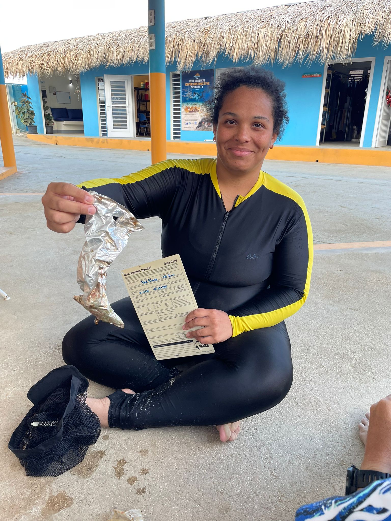
Condom wrapper
Calm
1
Sunglasses
NDS Malta
Susannah
27
1
1
3
16
6.00
50
7.50
5.00
estimated
3000.00
Plastic bottles
Tin cans
Food wrappers
On
kilograms
I have debris data to report
Calm (glassy to rippled) for waves 0 – 0.1 meter high
35
m2
6
meters
rocky reef
18
19
4
1
26
1
Malta
Map Help


Dive Location

If you know your survey site coordinates, enter them manually in decimal degrees using WGS84 Map Datum. Use the minus sign for latitudes south of the equator and longitudes west of the Prime Meridian to 180 degrees.

If you do not know your survey site coordinates, click the “Map Location” tab to use the map to zoom into your survey site and drop the pin on the map to fall within your survey dive site in the water (not on land or the beach). Ensure you zoom in as much as possible to ensure data accuracy.
Entangled Help


Use the vertical tabs below to record any entangled animals you found of each type.

Is Traias

27
19
8
0

39.116887706259, 9.5061379613635

0
0
0
sand
4
5
0
0
15
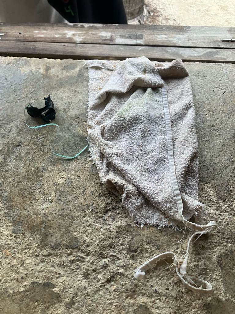
Pokemon Cards
Sunny
Three Scuba Eco Diving
0
0
0
12
53
13
0
0
1
3
0
2
3
0
0
1
0
11
13
5
0
0
0
0
7
5
3
0
0
0
0
0
0
0
0
0
35.00
120
5.00
1.00
25
estimated
0
0
2652.97
0
0
0
7
0
Plastics
Cigarettes
0
On
kilograms
0
I have debris data to report
0
0
0
Calm (glassy to rippled) for waves 0 – 0.1 meter high
5
0
0
0
18
0
0
m2
6
0
meters
seagrass
0
0
1
0
0
11
0
3
0
3
0
0
3
8
0
0
0
1
0
0
0
0
0
0
0
0
0
0
0
Italy
State\Province
SU
City
Villasimius
Map Help


Dive Location

If you know your survey site coordinates, enter them manually in decimal degrees using WGS84 Map Datum. Use the minus sign for latitudes south of the equator and longitudes west of the Prime Meridian to 180 degrees.

If you do not know your survey site coordinates, click the “Map Location” tab to use the map to zoom into your survey site and drop the pin on the map to fall within your survey dive site in the water (not on land or the beach). Ensure you zoom in as much as possible to ensure data accuracy.
Entangled Help


Use the vertical tabs below to record any entangled animals you found of each type.

Mani, Artsi #398130

0
0
0
0

36.596195, 22.384756

0
0
0
sand
0
0
0
0
0
Divingstore
Alexandros
0
0
0
0
0
0
0
0
0
0
0
0
0
0
0
0
0
0
0
1
0
0
0
0
0
0
3
0
0
0
0
0
0
0
0
0
0.20
20
9.00
5.00
0
estimated
0
0
0
0
1524.00
0
0
0
0
0
0
On
kilograms
0
I have debris data to report
0
0
0
Calm (glassy to rippled) for waves 0 – 0.1 meter high
0
0
0
0
0
0
0
m2
0
0
meters
rocky reef
0
0
0
0
0
0
0
0
0
0
0
0
0
0
0
0
0
1
0
0
0
0
0
0
0
0
0
0
0
Greece
City
Mani
Map Help


Dive Location

If you know your survey site coordinates, enter them manually in decimal degrees using WGS84 Map Datum. Use the minus sign for latitudes south of the equator and longitudes west of the Prime Meridian to 180 degrees.

If you do not know your survey site coordinates, click the “Map Location” tab to use the map to zoom into your survey site and drop the pin on the map to fall within your survey dive site in the water (not on land or the beach). Ensure you zoom in as much as possible to ensure data accuracy.
Entangled Help


Use the vertical tabs below to record any entangled animals you found of each type.

D’Lagoon Pulau Perhentian

1
130
0
26

5.9296711, 102.7215775

4
0
0
coral
0
5
0
6
11
Yes
Toothbrush
Sunny
Black Eye Scuba Team
Mohd Ariff Ismail
0
0
0
0
0
0
0
0
0
0
0
0
0
0
0
0
0
0
0
4
0
0
0
0
0
0
0
0
0
0
0
0
0
1
0
0
3.13
55
9.00
3.60
7
measured
0
0
286.32
0
0
0
0
0
Beverages bottles
Plastic fragments
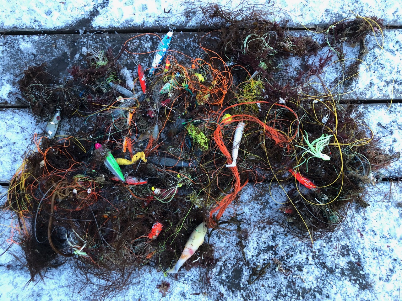
Fishing net & pieces of nets
0
On
kilograms
0
I have debris data to report
0
0
0
Calm (glassy to rippled) for waves 0 – 0.1 meter high
0
0
1
0
1
0
0
m2
0
0
meters
coral reef
0
0
0
0
0
0
0
0
0
0
0
0
0
0
0
0
0
1
0
0
0
0
1
0
0
0
0
0
0
Malaysia
State\Province
Terengganu
City
Perhentian Island Small,Besut
Map Help


Dive Location

If you know your survey site coordinates, enter them manually in decimal degrees using WGS84 Map Datum. Use the minus sign for latitudes south of the equator and longitudes west of the Prime Meridian to 180 degrees.

If you do not know your survey site coordinates, click the “Map Location” tab to use the map to zoom into your survey site and drop the pin on the map to fall within your survey dive site in the water (not on land or the beach). Ensure you zoom in as much as possible to ensure data accuracy.
Entangled Help


Use the vertical tabs below to record any entangled animals you found of each type.

hayama shibasaki beach

0
1
0
0

35.267507614178, 139.56720083378

4
0
0
rock
0
2
0
0
0
shonandive hayama tank service
kenta sugiki
0
0
0
1
0
0
0
0
0
0
0
0
0
0
0
0
0
0
0
2
0
0
0
0
0
1
0
0
0
0
1
0
0
0
0
0
0.70
45
6.00
3.00
0
estimated
0
0
45.00
0
0
0
0
0
0
On
kilograms
0
I have debris data to report
0
0
0
Calm (glassy to rippled) for waves 0 – 0.1 meter high
0
0
0
0
0
0
0
m2
1
0
meters
rocky reef
0
0
0
0
0
0
0
0
0
0
0
0
0
0
0
0
0
1
0
0
0
0
0
0
0
0
0
0
0
Japan
State\Province
kanagawa
City
hayama town
Map Help


Dive Location

If you know your survey site coordinates, enter them manually in decimal degrees using WGS84 Map Datum. Use the minus sign for latitudes south of the equator and longitudes west of the Prime Meridian to 180 degrees.

If you do not know your survey site coordinates, click the “Map Location” tab to use the map to zoom into your survey site and drop the pin on the map to fall within your survey dive site in the water (not on land or the beach). Ensure you zoom in as much as possible to ensure data accuracy.
Entangled Help


Use the vertical tabs below to record any entangled animals you found of each type.

Pieces Of 8

0
0
0
0

13.071691, -59.59502

0
0
0
sand
0
0
0
0
0
Storm surge
Barbados Blue
Kiera
0
0
0
0
0
0
0
0
0
0
0
0
0
0
0
0
0
0
0
6
0
0
0
0
0
0
0
0
0
0
0
0
0
0
0
0
0.00
45
16.00
8.00
0
estimated
0
0
0
0
8184.71
0
0
0
0
0
0
On
pounds
0
Our Survey Site was free of debris
0
0
0
Calm (glassy to rippled) for waves 0 – 0.1 meter high
0
0
0
0
0
0
0
m2
0
0
meters
coral reef
0
0
0
0
0
0
0
0
0
0
0
0
0
0
0
0
0
0
0
0
0
0
0
0
0
0
0
0
0
Barbados
City
St Michael
Map Help


Dive Location

If you know your survey site coordinates, enter them manually in decimal degrees using WGS84 Map Datum. Use the minus sign for latitudes south of the equator and longitudes west of the Prime Meridian to 180 degrees.

If you do not know your survey site coordinates, click the “Map Location” tab to use the map to zoom into your survey site and drop the pin on the map to fall within your survey dive site in the water (not on land or the beach). Ensure you zoom in as much as possible to ensure data accuracy.
Entangled Help


Use the vertical tabs below to record any entangled animals you found of each type.

Carlisle Bay s20882

0
2
0
0

13.085656000628, -59.611953875458

0
0
0
sand
0
0
0
0
0
No
No
No
Ceramic plate
Calm sunny
Barbados blue
Barbados Blue
0
0
0
1
0
0
0
0
0
0
0
0
0
0
0
0
0
0
0
8
0
0
0
0
0
0
0
0
0
0
0
0
0
0
0
0
3.00
45
14.00
5.00
0
estimated
0
0
1684.61
0
0
0
0
0
Plastic cup
Plastic fragment
0
On
pounds
0
I have debris data to report
1
0
0
Smooth (wavelets) for waves 0.1 - 0.5 meter high
0
0
0
0
0
0
0
m2
0
0
meters
coral reef
0
0
0
0
0
0
0
0
0
0
0
0
0
0
0
0
0
0
0
0
0
0
1
0
0
0
0
0
0
Barbados
State\Province
St Michael
City
Bridgetown
Map Help


Dive Location

If you know your survey site coordinates, enter them manually in decimal degrees using WGS84 Map Datum. Use the minus sign for latitudes south of the equator and longitudes west of the Prime Meridian to 180 degrees.

If you do not know your survey site coordinates, click the “Map Location” tab to use the map to zoom into your survey site and drop the pin on the map to fall within your survey dive site in the water (not on land or the beach). Ensure you zoom in as much as possible to ensure data accuracy.
Entangled Help


Use the vertical tabs below to record any entangled animals you found of each type.

Pieces Of 8

0
0
0
0

13.071691, -59.59502

0
0
0
coral
0
0
0
0
0
Reef has been damaged by last hurricane
None
Storm surge
Barbados Blue
Kiera
0
0
0
0
0
0
0
0
0
0
0
0
0
0
0
0
0
0
0
6
0
0
0
0
0
0
0
0
0
0
0
0
0
0
0
0
0.00
45
16.00
8.00
0
estimated
0
0
0
0
6222.38
0
0
0
0
0
Fishing line
Fishing pots
0
On
pounds
0
Our Survey Site was free of debris
0
0
0
Calm (glassy to rippled) for waves 0 – 0.1 meter high
0
0
0
0
0
0
0
m2
0
0
meters
coral reef
0
0
0
0
0
0
0
0
0
0
0
0
0
0
0
0
0
0
0
0
0
0
0
0
0
0
0
0
0
Barbados
City
St Michael
Map Help


Dive Location

If you know your survey site coordinates, enter them manually in decimal degrees using WGS84 Map Datum. Use the minus sign for latitudes south of the equator and longitudes west of the Prime Meridian to 180 degrees.

If you do not know your survey site coordinates, click the “Map Location” tab to use the map to zoom into your survey site and drop the pin on the map to fall within your survey dive site in the water (not on land or the beach). Ensure you zoom in as much as possible to ensure data accuracy.

Entangled Help


Use the vertical tabs below to record any entangled animals you found of each type.

Lighthouse / Bannerfish Bay

5
145

28.498747, 34.51991

sand
1
4
Other items:
Two small drink cartoons were collected - which category should these go under?
One small drink pouch was collected (see middle of the picture - brand = Best) - which category should this go under?
Both cartoons and pouch are grouped together in the 'other' category in this survey
Windy and hot
15
3
Chewing gum
Drink carton/pouch
Red Sea Tribe
Rachel Shelley
14
140
2
4
1
1
89
2
121
8
5
2.50
56
15.50
1.00
estimated
2720.00
Cigarette butts
Plastic fragments
Glass fragments
2
On
kilograms
I have debris data to report
Smooth (wavelets) for waves 0.1 - 0.5 meter high
5
Carpet fragment
Small crab, species unknown
Released Unharmed
1
m2
meters
coral reef
11
6
1
54
Egypt
State\Province
South Sinai
City
Dahab
Map Help


Dive Location

If you know your survey site coordinates, enter them manually in decimal degrees using WGS84 Map Datum. Use the minus sign for latitudes south of the equator and longitudes west of the Prime Meridian to 180 degrees.

If you do not know your survey site coordinates, click the “Map Location” tab to use the map to zoom into your survey site and drop the pin on the map to fall within your survey dive site in the water (not on land or the beach). Ensure you zoom in as much as possible to ensure data accuracy.

Entangled Help


Use the vertical tabs below to record any entangled animals you found of each type.

Subscribe to