Menu

Lighthouse / Bannerfish Bay

13
185
1
0

28.498747, 34.51991

0
0
0
sand
0
0
1
4
0
Eid holiday
Dry and windy
3
3
1
2
Shisha clips
Wet wipes
False nail
Fibreglass piece
Red Sea Tribe
Rachel Shelley
0
0
0
40
419
0
10
0
0
0
0
0
0
0
0
0
0
1
171
8
0
0
0
0
0
0
1
0
0
0
0
0
0
0
0
0
3.50
40
15.00
1.00
2
estimated
0
0
0
0
2712.24
0
0
0
7
0
Cigarette butts
Plastic pieces
Fabric fragments
2
On
kilograms
0
I have debris data to report
0
0
0
Smooth (wavelets) for waves 0.1 - 0.5 meter high
22
0
0
Unknown but probably fabric pieces
Unknown Shrimps
Released Unharmed
15
0
0
0
0
m2
1
0
meters
coral reef
3
0
0
0
0
26
0
22
0
163
0
0
0
59
0
0
1
0
0
0
0
0
53
0
0
0
0
0
0
Egypt
State\Province
South Sinai
City
Dahab
Map Help


Dive Location

If you know your survey site coordinates, enter them manually in decimal degrees using WGS84 Map Datum. Use the minus sign for latitudes south of the equator and longitudes west of the Prime Meridian to 180 degrees.

If you do not know your survey site coordinates, click the “Map Location” tab to use the map to zoom into your survey site and drop the pin on the map to fall within your survey dive site in the water (not on land or the beach). Ensure you zoom in as much as possible to ensure data accuracy.

Entangled Help


Use the vertical tabs below to record any entangled animals you found of each type.

Fisherman's Bay

1
rock

-32.789481911697, 152.09298893445

Sunny
Dan Byrnes
2
1
0.30
30
5.00
1.00
estimated
1000.00
On
kilograms
I have debris data to report
Slight for waves 0.5 -1.25 meter high m2
meters
kelp
Australia
Map Help


Dive Location

If you know your survey site coordinates, enter them manually in decimal degrees using WGS84 Map Datum. Use the minus sign for latitudes south of the equator and longitudes west of the Prime Meridian to 180 degrees.

If you do not know your survey site coordinates, click the “Map Location” tab to use the map to zoom into your survey site and drop the pin on the map to fall within your survey dive site in the water (not on land or the beach). Ensure you zoom in as much as possible to ensure data accuracy.
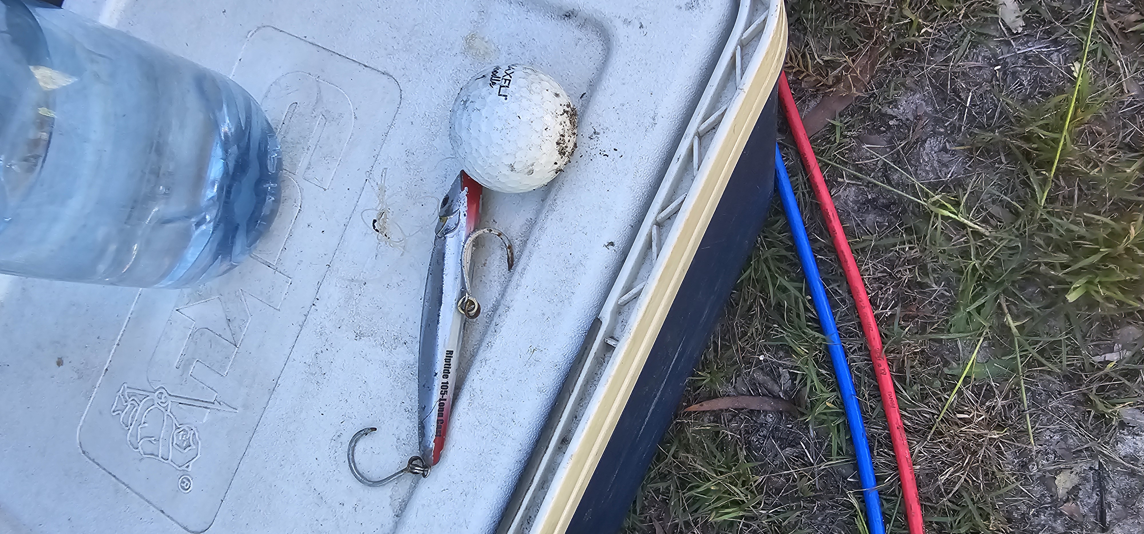
Entangled Help


Use the vertical tabs below to record any entangled animals you found of each type.

ADS525 - Padang Bai Jetty

11
30

-8.5083433077573, 115.51840559428

11
sand
Insulin Pens
Sunny
Cloudy
21
Insulin Pens
AquaMarine Diving - Bali
Mitra
5
2
2
3.98
37
15.40
12.00
measured
8
4
110.00
Plastic
Fishing line, net
On
kilograms
I have debris data to report
Calm (glassy to rippled) for waves 0 – 0.1 meter high
1
6
m2
meters
other
1
Indonesia
State\Province
Bali
City
Denpasar
Map Help


Dive Location

If you know your survey site coordinates, enter them manually in decimal degrees using WGS84 Map Datum. Use the minus sign for latitudes south of the equator and longitudes west of the Prime Meridian to 180 degrees.

If you do not know your survey site coordinates, click the “Map Location” tab to use the map to zoom into your survey site and drop the pin on the map to fall within your survey dive site in the water (not on land or the beach). Ensure you zoom in as much as possible to ensure data accuracy.

Entangled Help


Use the vertical tabs below to record any entangled animals you found of each type.

Ecosystem Other
Sandy

Maeda Point

0
29
0
0

26.443928318695, 127.7726823871

2
0
0
coral
0
0
0
1
0
No
Wind and rain
Tsunami Scuba
Patricia Shelton
0
0
0
0
0
0
0
0
0
0
0
0
0
0
0
0
0
1
0
8
0
0
0
0
0
0
1
0
6
0
0
0
0
0
0
0
14.10
45
45.00
15.00
0
measured
0
0
7248.27
0
0
0
0
0
Plastic
Glass
11
On
pounds
0
I have debris data to report
1
0
0
Smooth (wavelets) for waves 0.1 - 0.5 meter high
0
0
0
0
1
1
0
ft2
0
0
feet
coral reef
1
0
0
0
0
1
0
0
0
0
0
0
0
0
0
0
0
0
0
0
0
0
47
0
0
0
0
0
0
Japan
State\Province
AP
City
FPO
Map Help


Dive Location

If you know your survey site coordinates, enter them manually in decimal degrees using WGS84 Map Datum. Use the minus sign for latitudes south of the equator and longitudes west of the Prime Meridian to 180 degrees.

If you do not know your survey site coordinates, click the “Map Location” tab to use the map to zoom into your survey site and drop the pin on the map to fall within your survey dive site in the water (not on land or the beach). Ensure you zoom in as much as possible to ensure data accuracy.

Entangled Help


Use the vertical tabs below to record any entangled animals you found of each type.

Mōtītī islands

0
0
0
0

-37.643733242771, 176.40933632963

0
0
0
sand
0
0
0
0
0
Yes
Snorkel
Sunny but windy
Dive Zone Tauranga
Sophie
0
0
0
0
0
0
0
0
1
0
0
0
0
0
0
0
0
0
0
2
0
0
0
0
0
0
0
0
0
0
0
0
0
0
0
0
0.20
35
19.00
8.00
0
estimated
0
0
11166.00
0
0
0
0
0
Snorkel
0
On
kilograms
0
I have debris data to report
0
0
0
Slight for waves 0.5 -1.25 meter high
0
0
0
0
0
0
0
m2
0
0
meters
kelp
0
0
0
0
0
0
0
0
0
0
0
0
0
0
0
0
0
0
0
0
0
0
0
0
0
0
0
0
0
New Zealand
State\Province
Bay of plenty
City
Mount maunganui
Map Help


Dive Location

If you know your survey site coordinates, enter them manually in decimal degrees using WGS84 Map Datum. Use the minus sign for latitudes south of the equator and longitudes west of the Prime Meridian to 180 degrees.

If you do not know your survey site coordinates, click the “Map Location” tab to use the map to zoom into your survey site and drop the pin on the map to fall within your survey dive site in the water (not on land or the beach). Ensure you zoom in as much as possible to ensure data accuracy.

Entangled Help


Use the vertical tabs below to record any entangled animals you found of each type.

Bills happy place

0
27
0
0

16.298444381666, -86.597351251362

0
0
0
sand
0
0
0
3
0
No
Plastic bottle used to mix finer glass to repair boats
Calm clear
Sun Divers Roatan
Val Gilbert
0
0
0
2
0
0
0
0
0
0
0
0
0
0
0
0
0
0
5
2
0
0
0
0
0
0
0
0
0
0
0
0
0
0
0
0
1.00
58
39.00
15.00
0
estimated
0
0
95008.10
0
0
0
0
0
Plastic cups
Aluminum cans
0
On
pounds
0
I have debris data to report
0
0
0
Moderate to rough for waves greater than 1.25 meters
2
0
0
0
0
0
0
ft2
0
0
feet
coral reef
0
0
0
0
0
0
0
0
0
0
0
0
0
0
0
0
0
4
0
0
0
0
0
0
0
0
0
0
0
Honduras
State\Province
Islas de Bahia
City
Roatan
Map Help


Dive Location

If you know your survey site coordinates, enter them manually in decimal degrees using WGS84 Map Datum. Use the minus sign for latitudes south of the equator and longitudes west of the Prime Meridian to 180 degrees.

If you do not know your survey site coordinates, click the “Map Location” tab to use the map to zoom into your survey site and drop the pin on the map to fall within your survey dive site in the water (not on land or the beach). Ensure you zoom in as much as possible to ensure data accuracy.

Entangled Help


Use the vertical tabs below to record any entangled animals you found of each type.

Mononaftis

15
1
rock
3
1

35.416467957156, 25.018763244152

No
Calm
Stay Wet Diving Center
Yoan Gavira
9
1
4
3
2.00
30
-5.00
-2.00
estimated
500.00
plastic bags
platic fragments
0
On
kilograms
I have debris data to report
Calm (glassy to rippled) for waves 0 – 0.1 meter high m2
1
meters
rocky reef
3
1
4
Greece
State\Province
Crete
City
Agia Pelagia
Map Help


Dive Location

If you know your survey site coordinates, enter them manually in decimal degrees using WGS84 Map Datum. Use the minus sign for latitudes south of the equator and longitudes west of the Prime Meridian to 180 degrees.

If you do not know your survey site coordinates, click the “Map Location” tab to use the map to zoom into your survey site and drop the pin on the map to fall within your survey dive site in the water (not on land or the beach). Ensure you zoom in as much as possible to ensure data accuracy.

Entangled Help


Use the vertical tabs below to record any entangled animals you found of each type.

North Beach

0
1
0
0

21.456986155937, -157.74035507375

0
0
0
rock
0
0
0
3
0
No
Rain and sun
James Delecki
0
0
0
0
0
0
0
0
0
0
0
0
0
0
0
0
0
0
0
1
0
0
0
0
0
0
0
0
0
0
0
0
15
0
0
0
2.00
66
35.00
15.00
1
estimated
0
6
9473.77
0
0
0
1
0
Golf balls
Fishing gear
1
On
pounds
0
I have debris data to report
0
0
0
Smooth (wavelets) for waves 0.1 - 0.5 meter high
0
0
0
0
2
0
0
m2
0
0
feet
rocky reef
1
0
0
0
0
0
0
0
0
0
0
0
0
0
0
0
0
0
0
0
0
0
0
0
0
0
0
0
0
United States
State\Province
Hawaii
City
Kailua
Map Help


Dive Location

If you know your survey site coordinates, enter them manually in decimal degrees using WGS84 Map Datum. Use the minus sign for latitudes south of the equator and longitudes west of the Prime Meridian to 180 degrees.

If you do not know your survey site coordinates, click the “Map Location” tab to use the map to zoom into your survey site and drop the pin on the map to fall within your survey dive site in the water (not on land or the beach). Ensure you zoom in as much as possible to ensure data accuracy.
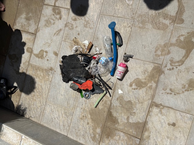
Entangled Help


Use the vertical tabs below to record any entangled animals you found of each type.

Caletita

16
seagrass

20.494653712428, -86.964802740733

Construction waste and fishing
Shoe sole
Fishing line around coral, entanglement.
Cozumel dive school
Jackie
1
16
4
5
2
3.50
94
6.70
2.00
estimated
24
200.00
Fishing line
Pull tabs and bottle caps
Construction waste
On
kilograms
I have debris data to report
Calm (glassy to rippled) for waves 0 – 0.1 meter high
1
1
4
m2
1
1
Fishing line
Coral
Injured
meters
coral reef
5
3
10
9
43
Mexico
State\Province
Quintana roo
City
Cozumel
Map Help


Dive Location

If you know your survey site coordinates, enter them manually in decimal degrees using WGS84 Map Datum. Use the minus sign for latitudes south of the equator and longitudes west of the Prime Meridian to 180 degrees.

If you do not know your survey site coordinates, click the “Map Location” tab to use the map to zoom into your survey site and drop the pin on the map to fall within your survey dive site in the water (not on land or the beach). Ensure you zoom in as much as possible to ensure data accuracy.

Entangled Help


Use the vertical tabs below to record any entangled animals you found of each type.

Miss Louise

sand
1

30.375495682483, -86.433147756717

Popular fishing site in destin.
Heavy lead weight.
Seas were approximately 2-3 ft. We had some rain a couple days prior which made visibility a little on the low side. Air temperature ranged from 55-75. Water temperature was 67 degrees.
Emerald Coast Scuba
Dylan Woodbridge
3
3.00
27
57.00
45.00
estimated
2
1999.00
On
pounds
Our Survey Site was free of debris
Smooth (wavelets) for waves 0.1 - 0.5 meter high ft2
feet
other
United States
State\Province
Florida
City
Destin
Map Help


Dive Location

If you know your survey site coordinates, enter them manually in decimal degrees using WGS84 Map Datum. Use the minus sign for latitudes south of the equator and longitudes west of the Prime Meridian to 180 degrees.

If you do not know your survey site coordinates, click the “Map Location” tab to use the map to zoom into your survey site and drop the pin on the map to fall within your survey dive site in the water (not on land or the beach). Ensure you zoom in as much as possible to ensure data accuracy.

Entangled Help


Use the vertical tabs below to record any entangled animals you found of each type.

Ecosystem Other
Wreck
Subscribe to