Nari Nari
1
28
3
coral
1
15
25.001905271646773, -77.53726073540747
This event was for training Dive Against Debris Instructors as part of their PADI Instructor Development Course with PADI Course Director Hayley-Jo Carr
Hurricane Matthew
Car Seats
Rough seas
1
3
1
1
1
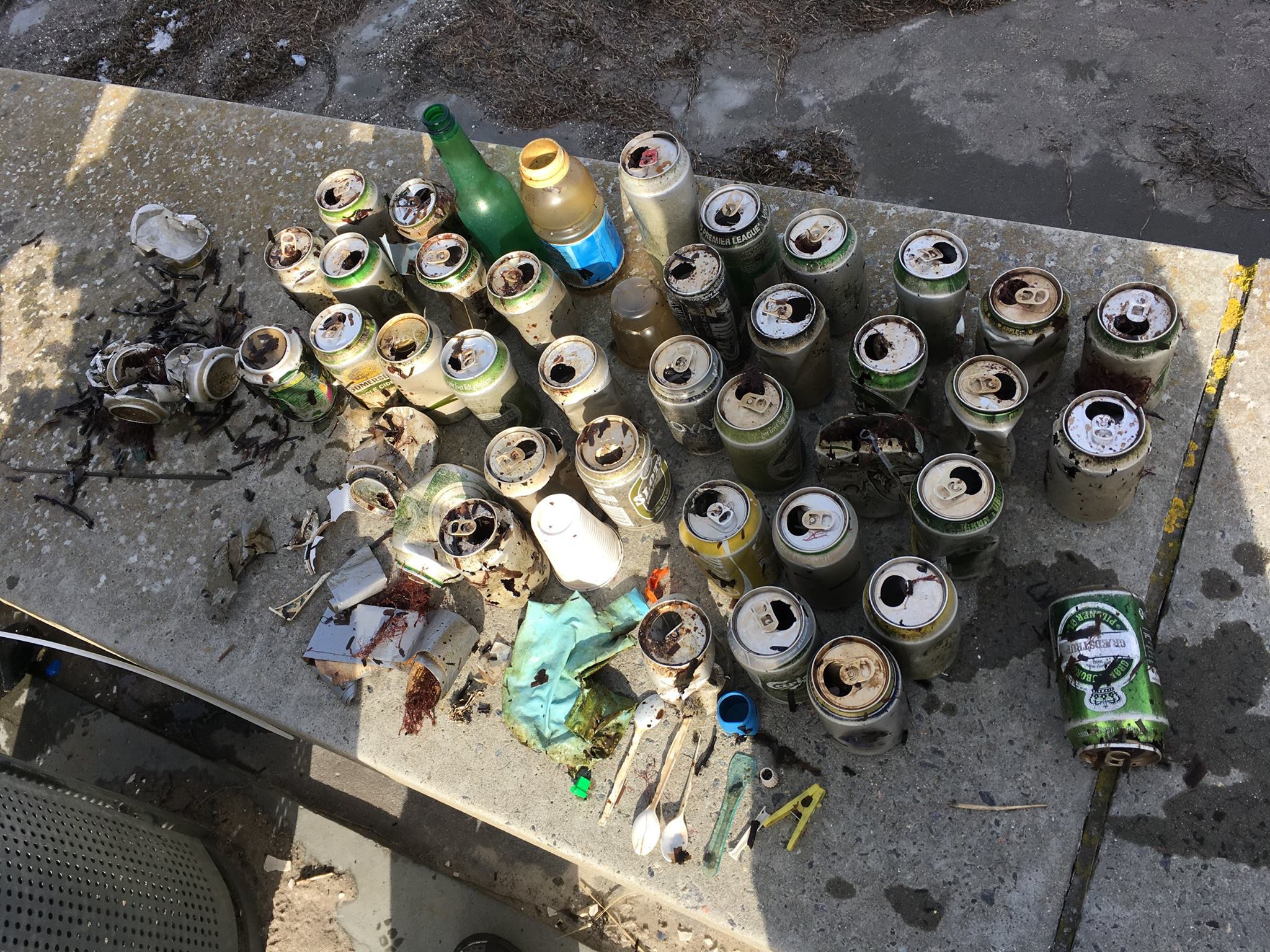
foam
Car seat
Rubber shoe sole
Nylon
Fan
Stuart Cove's Dive Bahamas
Hayley-Jo Carr
7
1
14
1
2
6
2
4
60.00
35
25.00
8.00
estimated
1
100.00
19
11
Rubber Sheets
Fishing Line
Cloth fragments
On
pounds
I have debris data to report
1
Slight for waves 0.5 -1.25 meter high
1
37
1
ft2

2
2
feet
coral reef
3
2
16
State\Province
New Providence
City
Nassau
Map Help
Dive Location
If you know your survey site coordinates, enter them manually in decimal degrees using WGS84 Map Datum. Use the minus sign for latitudes south of the equator and longitudes west of the Prime Meridian to 180 degrees.
If you do not know your survey site coordinates, click the “Map Location” tab to use the map to zoom into your survey site and drop the pin on the map to fall within your survey dive site in the water (not on land or the beach). Ensure you zoom in as much as possible to ensure data accuracy.
Entangled Help