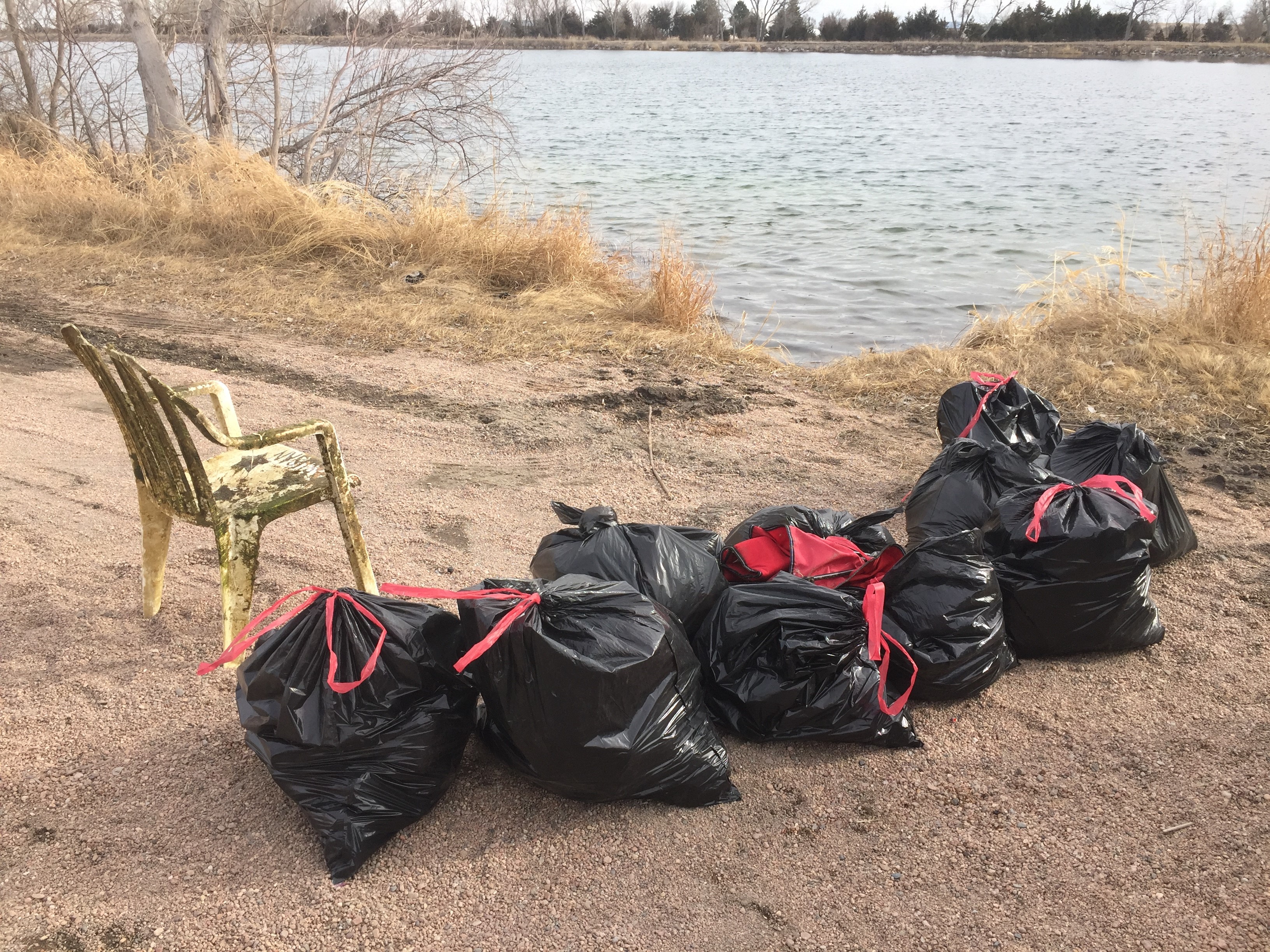
ADS137 - Vouliagmeni Lake Loutraki
10
3
rock
2
1
4
38.02658641532679, 22.892581522464752
ADS137 - Vouliagmeni Lake Loutraki 18/2/2017
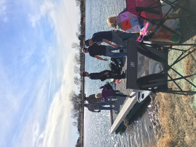
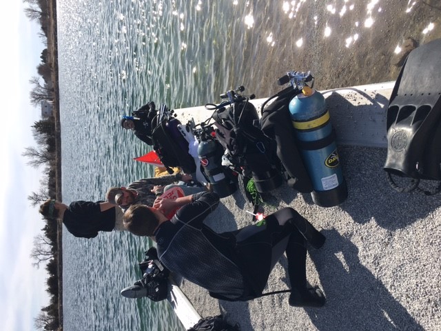
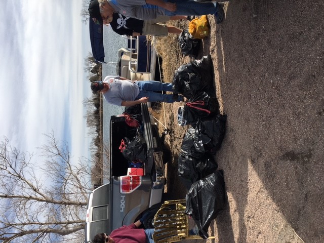
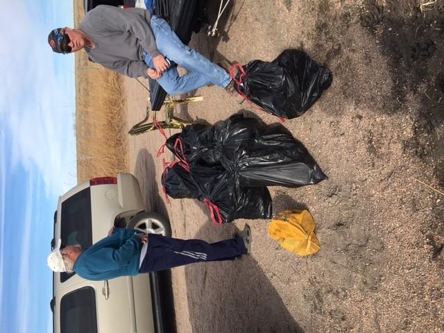
At these event we were seven divers and four land support
partly cloudy , good
1
1
1
1
1
1
1
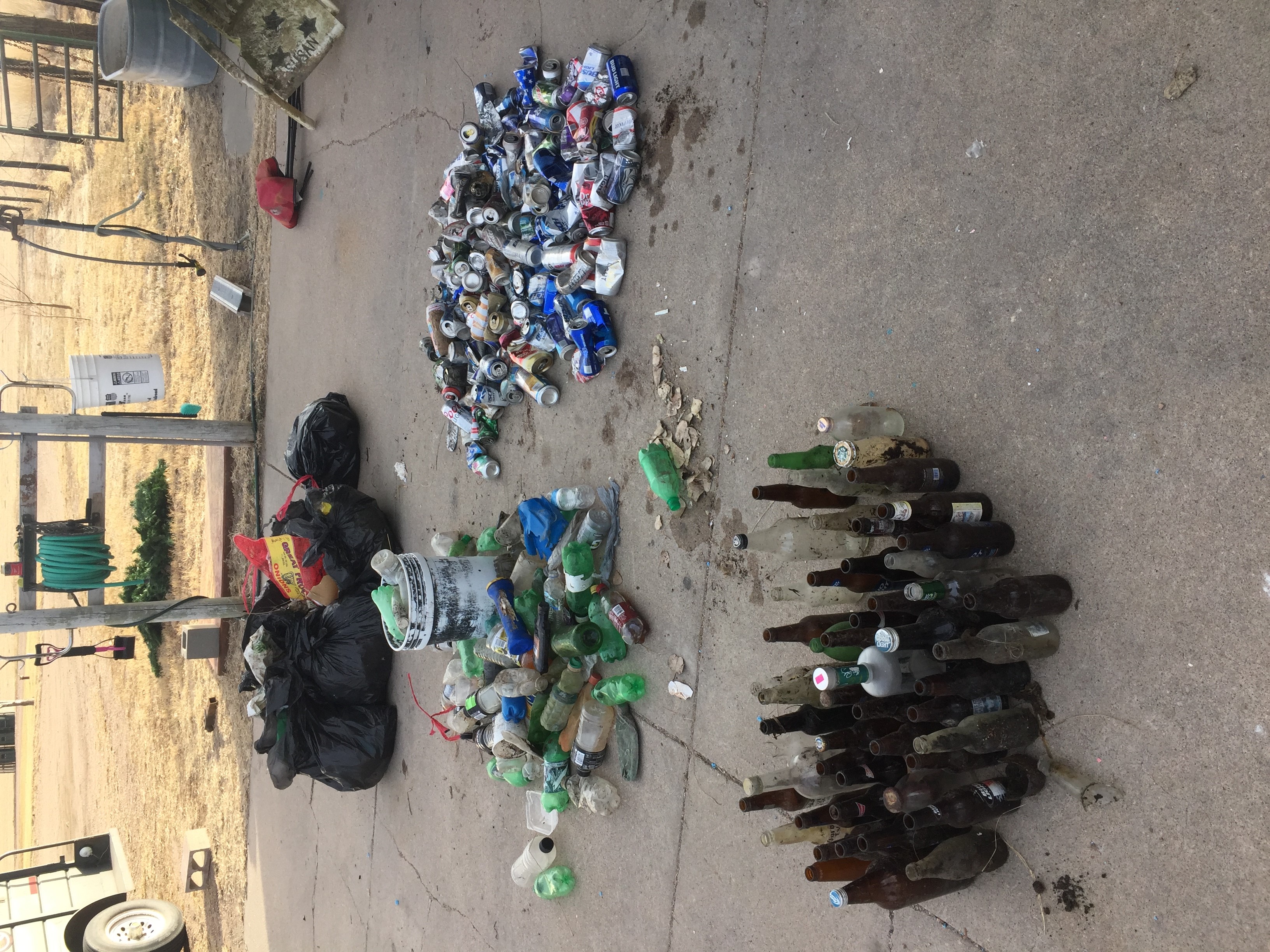
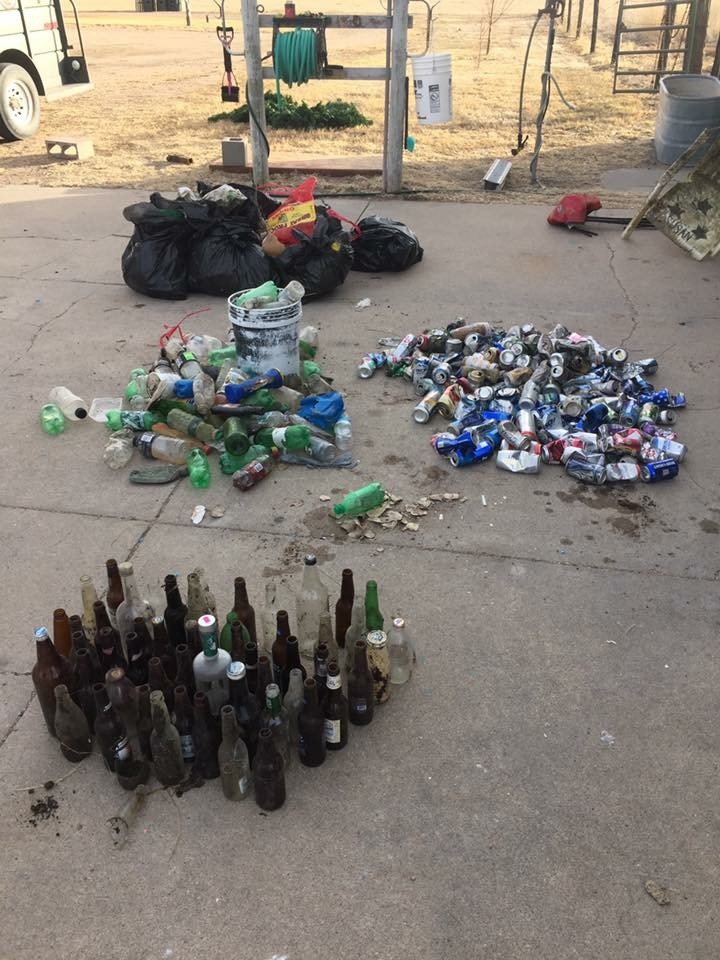
condom wrappers
pills tablet
sole
garden hose
pedalo
cassette
tetra pak container
Loutraki Dive Club
Nikos_Ba
1
1
7
4
246.00
49
8.00
1.00
estimated
4
571.00
1
5
On
kilograms
I have debris data to report
10
Calm (glassy to rippled) for waves 0 – 0.1 meter high
3
bottles & plastic containers
CRABs + crayfish
Released Unharmed
14
m2


meters
seagrass
2
1
1
12
1
State\Province
Corinthia
City
Loutraki
Map Help
Dive Location
If you know your survey site coordinates, enter them manually in decimal degrees using WGS84 Map Datum. Use the minus sign for latitudes south of the equator and longitudes west of the Prime Meridian to 180 degrees.
If you do not know your survey site coordinates, click the “Map Location” tab to use the map to zoom into your survey site and drop the pin on the map to fall within your survey dive site in the water (not on land or the beach). Ensure you zoom in as much as possible to ensure data accuracy.
Entangled Help