Menu

Hin Wong Bay

1
5
sand
4
3

10.104425796549, 99.847877466779

Coral Grand Divers
Elise
1
-43
7
8
5
-46
7
1
5
2
23.00
55
16.00
7.00
estimated
20.00
0
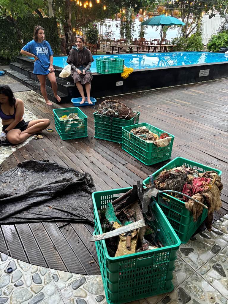
fishing nets
plastic bottle
glass bottle
On
kilograms
I have debris data to report
7
Calm (glassy to rippled) for waves 0 – 0.1 meter high
fishing net
Injured
damsel fish
shrimp
Released Unharmed
8
15
fishing nets
m2
meters
coral reef
1
Thailand
State\Province
surat Thani
City
KOH TAO
Map Help


Dive Location

If you know your survey site coordinates, enter them manually in decimal degrees using WGS84 Map Datum. Use the minus sign for latitudes south of the equator and longitudes west of the Prime Meridian to 180 degrees.

If you do not know your survey site coordinates, click the “Map Location” tab to use the map to zoom into your survey site and drop the pin on the map to fall within your survey dive site in the water (not on land or the beach). Ensure you zoom in as much as possible to ensure data accuracy.

Entangled Help


Use the vertical tabs below to record any entangled animals you found of each type.

Las Ninfas

87
1
seagrass
11
4

-12.479680923093, -76.800297947085

Calculadora
Cangrejos (4)
Pacific Divers Perú
Michael Epstein
11
1
6
2
76
1
50.00
46
7.00
3.00
estimated
3953.00
1
Botellas plásticas
Latas de cerveza
On
kilograms
I have debris data to report
1
1
Calm (glassy to rippled) for waves 0 – 0.1 meter high
4
4
Plásticos y vidrios
Gasterópodos
Released Unharmed
125
27
4
m2
2
23
Plásticos y vidrios
Chitones y cangrejos
Released Unharmed
meters
seagrass
14
1
23
1
33
1
10
10
Peru
State\Province
Lima
City
Lima
Map Help


Dive Location

If you know your survey site coordinates, enter them manually in decimal degrees using WGS84 Map Datum. Use the minus sign for latitudes south of the equator and longitudes west of the Prime Meridian to 180 degrees.

If you do not know your survey site coordinates, click the “Map Location” tab to use the map to zoom into your survey site and drop the pin on the map to fall within your survey dive site in the water (not on land or the beach). Ensure you zoom in as much as possible to ensure data accuracy.

Entangled Help


Use the vertical tabs below to record any entangled animals you found of each type.

Magic Island, Oahu

10
20
1
0

21.282912, -157.845613

8
0
5
rock
0
0
1
5
0
No
12 oz Yeti Cup
Dive Oahu
Angela Orlando
0
0
2
5
0
0
0
0
2
0
0
3
0
0
0
0
15
11
0
5
1
0
3
0
0
0
40
0
0
0
0
0
0
0
0
0
50.00
80
37.00
5.00
0
estimated
0
20
36268.40
0
0
0
1
0
Cloth wrapped around coral
Suitcase pieces
0
On
pounds
0
I have debris data to report
5
0
0
Smooth (wavelets) for waves 0.1 - 0.5 meter high
1
0
4
0
30
0
0
ft2
0
3
feet
coral reef
0
0
1
0
0
5
0
0
0
4
1
0
0
0
0
0
1
30
0
0
0
0
0
0
0
0
0
2
0
United States
State\Province
Hawaii
City
Honolulu
Map Help


Dive Location

If you know your survey site coordinates, enter them manually in decimal degrees using WGS84 Map Datum. Use the minus sign for latitudes south of the equator and longitudes west of the Prime Meridian to 180 degrees.

If you do not know your survey site coordinates, click the “Map Location” tab to use the map to zoom into your survey site and drop the pin on the map to fall within your survey dive site in the water (not on land or the beach). Ensure you zoom in as much as possible to ensure data accuracy.

Entangled Help


Use the vertical tabs below to record any entangled animals you found of each type.

Happy valley

0
0
0
0

12.093032206971, -61.760650397361

0
0
0
coral
0
0
0
0
0
Eco Dive
Ashley
0
0
0
0
0
0
0
0
0
0
0
0
0
0
0
0
0
0
0
6
0
0
0
0
0
0
0
0
0
0
0
0
0
0
0
0
0.00
45
18.00
5.00
0
measured
0
0
12515.60
0
0
0
0
0
0
On
kilograms
0
Our Survey Site was free of debris
0
0
0
Calm (glassy to rippled) for waves 0 – 0.1 meter high
0
0
0
0
0
0
0
m2
0
0
meters
coral reef
0
0
0
0
0
0
0
0
0
0
0
0
0
0
0
0
0
0
0
0
0
0
0
0
0
0
0
0
0
Grenada
City
St George's
Map Help


Dive Location

If you know your survey site coordinates, enter them manually in decimal degrees using WGS84 Map Datum. Use the minus sign for latitudes south of the equator and longitudes west of the Prime Meridian to 180 degrees.

If you do not know your survey site coordinates, click the “Map Location” tab to use the map to zoom into your survey site and drop the pin on the map to fall within your survey dive site in the water (not on land or the beach). Ensure you zoom in as much as possible to ensure data accuracy.

Entangled Help


Use the vertical tabs below to record any entangled animals you found of each type.

Grand Mal

0
0
0
0

12.082866622711, -61.762191292397

0
0
0
coral
0
0
0
0
0
We were on a mission for Lionfish
We plan to go back this week with cutting tools to remove long liner fishing line
Lycra suit
1
Clothing
Eco Dive
Ashley
0
0
0
0
0
0
0
0
0
0
0
0
0
0
0
0
0
0
0
6
0
0
0
0
0
0
0
0
0
0
0
0
0
0
0
0
2.00
50
18.00
5.00
0
measured
0
0
3193.03
0
0
0
0
0
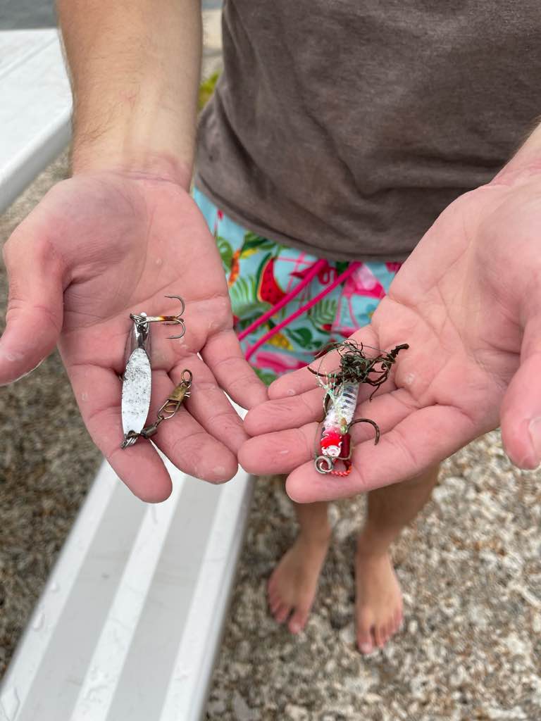
Fishing line
0
On
pounds
0
I have debris data to report
0
0
0
Calm (glassy to rippled) for waves 0 – 0.1 meter high
0
0
0
0
0
0
0
m2
0
0
meters
coral reef
0
0
0
0
0
0
0
0
0
0
0
0
0
0
0
0
0
0
0
0
0
0
0
0
0
0
0
0
0
Grenada
City
St George's
Map Help


Dive Location

If you know your survey site coordinates, enter them manually in decimal degrees using WGS84 Map Datum. Use the minus sign for latitudes south of the equator and longitudes west of the Prime Meridian to 180 degrees.

If you do not know your survey site coordinates, click the “Map Location” tab to use the map to zoom into your survey site and drop the pin on the map to fall within your survey dive site in the water (not on land or the beach). Ensure you zoom in as much as possible to ensure data accuracy.
Entangled Help


Use the vertical tabs below to record any entangled animals you found of each type.

Carlisle BAY

1
1
0
0

13.09202, -59.616279

0
0
0
sand
0
1
0
2
0
Barbados Blue
Nicole
0
0
0
4
0
0
0
0
1
0
0
0
0
0
0
0
0
1
0
4
0
0
0
0
0
0
1
0
0
0
0
0
0
0
0
0
8.00
50
18.00
8.00
1
estimated
0
0
0
0
2696.90
0
0
0
0
0
0
On
pounds
0
I have debris data to report
2
0
0
Calm (glassy to rippled) for waves 0 – 0.1 meter high
0
0
0
0
0
0
0
m2
0
0
meters
coral reef
2
0
0
0
0
0
0
0
0
0
0
0
0
0
0
0
1
1
0
0
0
0
0
0
0
0
0
0
0
Barbados
City
St Michael
Map Help


Dive Location

If you know your survey site coordinates, enter them manually in decimal degrees using WGS84 Map Datum. Use the minus sign for latitudes south of the equator and longitudes west of the Prime Meridian to 180 degrees.

If you do not know your survey site coordinates, click the “Map Location” tab to use the map to zoom into your survey site and drop the pin on the map to fall within your survey dive site in the water (not on land or the beach). Ensure you zoom in as much as possible to ensure data accuracy.

Entangled Help


Use the vertical tabs below to record any entangled animals you found of each type.

Turunc Pinari Wall

0
5
1
1

36.618289466984, 29.047587743495

0
0
0
rock
0
0
0
63
0
Dropped from yachts or lost by fishermen.
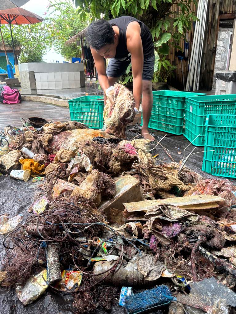
Shelf bracket
was windy and choppy for 2 days
1
Metal shelf bracket
Seahorse Dive Centre
Mark Taylor
0
1
0
0
0
0
0
0
0
0
0
0
0
3
0
0
1
0
0
6
0
0
0
0
0
0
2
0
2
0
0
0
0
0
0
0
7.80
63
18.90
5.00
4
measured
0
6
4092.71
0
0
0
2
0
Fishing lines
Glass
1
On
kilograms
0
I have debris data to report
4
0
0
Smooth (wavelets) for waves 0.1 - 0.5 meter high
0
0
0
0
0
0
0
m2
1
1
meters
rocky reef
5
0
0
0
2
0
0
2
0
1
0
0
0
0
0
2
0
1
0
0
8
0
5
0
0
0
0
0
0
Turkey
State\Province
Muğla
City
Fethiye
Map Help


Dive Location

If you know your survey site coordinates, enter them manually in decimal degrees using WGS84 Map Datum. Use the minus sign for latitudes south of the equator and longitudes west of the Prime Meridian to 180 degrees.

If you do not know your survey site coordinates, click the “Map Location” tab to use the map to zoom into your survey site and drop the pin on the map to fall within your survey dive site in the water (not on land or the beach). Ensure you zoom in as much as possible to ensure data accuracy.
Entangled Help


Use the vertical tabs below to record any entangled animals you found of each type.

Vobster

0
15
0
0

51.246011669154, -2.424768299952

0
0
0
silt
0
0
0
0
0

51.246011669154, -2.424768299952

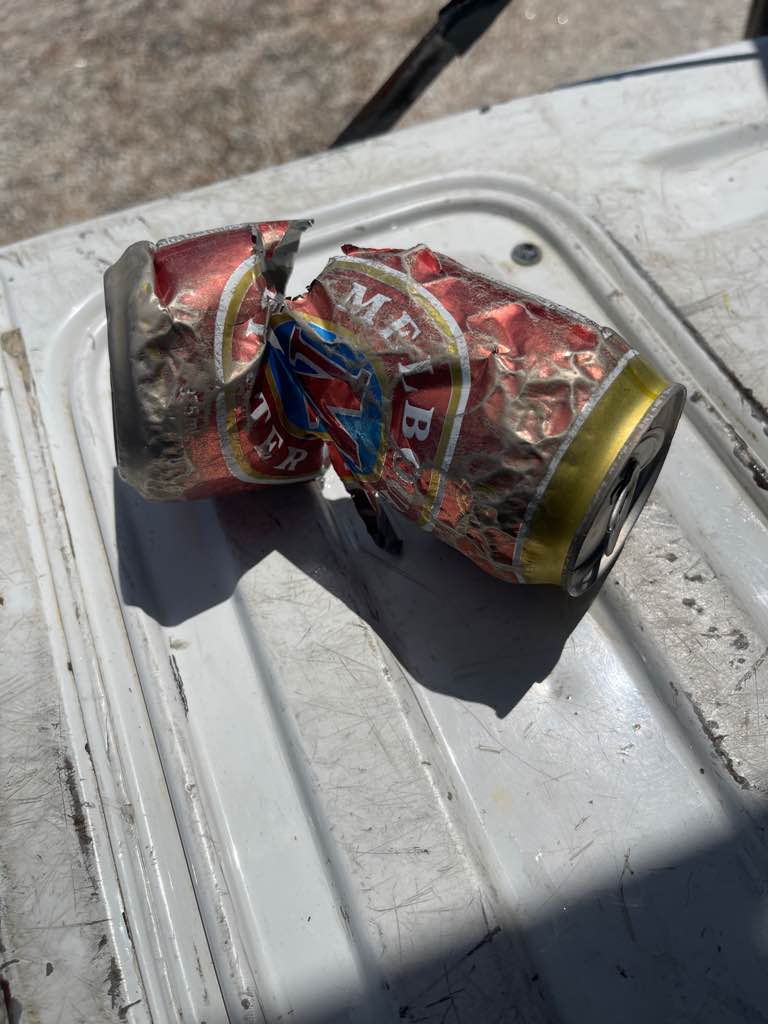
Corona can
Ocean turtle diving
Kerrie
0
0
0
0
0
0
0
0
0
0
0
0
0
0
0
0
0
0
0
1
0
0
0
0
0
0
0
0
0
0
0
0
0
0
0
0
0.50
30
12.00
7.00
0
estimated
0
0
1297.36
0
0
0
0
0
0
On
kilograms
0
I have debris data to report
0
0
0
Calm (glassy to rippled) for waves 0 – 0.1 meter high
1
0
0
0
0
0
0
m2
1
0
meters
other
0
0
0
0
0
0
0
0
0
0
0
0
0
1
0
0
1
0
0
0
0
0
3
0
0
0
0
0
0
United Kingdom
State\Province
Somerset
City
Drone
Map Help


Dive Location

If you know your survey site coordinates, enter them manually in decimal degrees using WGS84 Map Datum. Use the minus sign for latitudes south of the equator and longitudes west of the Prime Meridian to 180 degrees.

If you do not know your survey site coordinates, click the “Map Location” tab to use the map to zoom into your survey site and drop the pin on the map to fall within your survey dive site in the water (not on land or the beach). Ensure you zoom in as much as possible to ensure data accuracy.
Entangled Help


Use the vertical tabs below to record any entangled animals you found of each type.

Ecosystem Other
Other

AOW MAO

0
0
0
0

10.092903552013, 99.853717116045

0
0
0
sand
0
0
0
0
0
No
No
Fairly clean area
N/A
Cloudy Calm
Assava Dive Resort
Tim Hunt
0
0
0
0
0
0
0
0
0
0
0
0
0
0
0
0
0
0
0
2
0
0
0
0
0
0
2
0
0
0
0
0
0
0
0
0
2.00
30
16.00
12.00
0
estimated
0
0
2287.80
0
0
0
0
0
Plastic
Nets
0
On
pounds
0
I have debris data to report
0
0
0
Smooth (wavelets) for waves 0.1 - 0.5 meter high
0
0
0
0
0
0
0
m2
0
0
meters
coral reef
0
0
0
0
0
0
0
0
0
0
0
0
0
0
0
0
0
0
0
0
0
0
0
0
0
0
0
0
0
Thailand
State\Province
Surat Thani
City
Koh Tao
Map Help


Dive Location

If you know your survey site coordinates, enter them manually in decimal degrees using WGS84 Map Datum. Use the minus sign for latitudes south of the equator and longitudes west of the Prime Meridian to 180 degrees.

If you do not know your survey site coordinates, click the “Map Location” tab to use the map to zoom into your survey site and drop the pin on the map to fall within your survey dive site in the water (not on land or the beach). Ensure you zoom in as much as possible to ensure data accuracy.
Entangled Help


Use the vertical tabs below to record any entangled animals you found of each type.

東心淇

0
4
1
0

22.42538039374, 114.3536317201

2
0
0
sand
0
0
0
0
0
Crab
Plastic
Global Aqua
Anthony Lau
0
0
0
0
0
0
0
0
1
0
0
0
0
0
0
0
0
0
0
8
0
0
0
0
1
1
1
0
0
0
0
0
0
0
0
0
1.32
60
8.00
3.00
0
estimated
0
0
3763.48
0
0
0
0
0
0
On
kilograms
0
I have debris data to report
0
0
0
Calm (glassy to rippled) for waves 0 – 0.1 meter high
0
0
0
Crab
Crab
Dead
1
0
0
1
0
m2
0
0
meters
coral reef
0
0
0
0
0
0
0
0
0
0
0
0
0
0
0
0
2
0
0
0
0
0
0
0
0
0
0
0
0
Hong Kong S.A.R., China
City
hong kong
Map Help


Dive Location

If you know your survey site coordinates, enter them manually in decimal degrees using WGS84 Map Datum. Use the minus sign for latitudes south of the equator and longitudes west of the Prime Meridian to 180 degrees.

If you do not know your survey site coordinates, click the “Map Location” tab to use the map to zoom into your survey site and drop the pin on the map to fall within your survey dive site in the water (not on land or the beach). Ensure you zoom in as much as possible to ensure data accuracy.

Entangled Help


Use the vertical tabs below to record any entangled animals you found of each type.

Subscribe to