Menu

La Jolla cove

rock

32.850490236622, -117.27285494734

Gym shorts
Hot! 90s and sunny
Jamie
1
1
1.00
29
27.00
17.00
1
estimated
2604.00
Plastics
Fishing line
On
pounds
I have debris data to report
Smooth (wavelets) for waves 0.1 - 0.5 meter high ft2
feet
kelp
1
United States
State\Province
CA
City
La Jolla
Map Help


Dive Location

If you know your survey site coordinates, enter them manually in decimal degrees using WGS84 Map Datum. Use the minus sign for latitudes south of the equator and longitudes west of the Prime Meridian to 180 degrees.

If you do not know your survey site coordinates, click the “Map Location” tab to use the map to zoom into your survey site and drop the pin on the map to fall within your survey dive site in the water (not on land or the beach). Ensure you zoom in as much as possible to ensure data accuracy.

Entangled Help


Use the vertical tabs below to record any entangled animals you found of each type.

Karacaören Amphora Wall

0
2
0
2

36.5446383669, 29.056018376199

0
0
0
rock
0
0
0
25
0
Lost or dropped by fishermen
Windy and choppy seas
Seahorse diving centre
Mark Taylor
0
0
0
0
0
0
0
0
0
0
0
0
0
0
0
0
0
1
0
4
0
0
0
0
0
0
0
0
67
0
1
0
0
0
0
0
11.90
48
30.00
10.00
1
measured
0
79
5252.53
0
0
0
0
0
Fishing lines
0
On
kilograms
0
I have debris data to report
4
0
0
Smooth (wavelets) for waves 0.1 - 0.5 meter high
0
0
0
0
0
0
0
m2
0
0
meters
rocky reef
1
0
2
0
0
0
0
0
0
0
0
0
0
0
0
1
0
1
0
0
0
0
0
0
0
0
0
0
0
Turkey
State\Province
Muğla
City
Ölüdeniz
Map Help


Dive Location

If you know your survey site coordinates, enter them manually in decimal degrees using WGS84 Map Datum. Use the minus sign for latitudes south of the equator and longitudes west of the Prime Meridian to 180 degrees.

If you do not know your survey site coordinates, click the “Map Location” tab to use the map to zoom into your survey site and drop the pin on the map to fall within your survey dive site in the water (not on land or the beach). Ensure you zoom in as much as possible to ensure data accuracy.

Entangled Help


Use the vertical tabs below to record any entangled animals you found of each type.

Punta

0
0
0
0

43.289453, 17.017732

0
0
0
rock
0
0
0
0
0
Its cleaned ! Beautiful !
Boat traffic ,tourists,fishermans
100kg garbage , for PADI aware week.
Soldiers alumin. Bottle
Calm
More Sub d.o.o
Bojan Runtić
0
0
0
0
0
0
0
0
0
0
0
0
0
0
0
0
0
0
0
4
0
0
0
0
0
0
0
0
0
0
0
0
0
0
0
0
0.00
47
18.00
2.00
0
estimated
0
0
0
0
11210.00
0
0
0
0
0
84 glass bottles ,12 plastic Bottles ,8 alu. bottles
8 peaces clothes ,60m fishing line
Steel parts from boats deck,engine
0
On
pounds
0
Our Survey Site was free of debris
0
0
0
Calm (glassy to rippled) for waves 0 – 0.1 meter high
0
0
0
0
0
0
0
m2
0
0
meters
rocky reef
0
0
0
0
0
0
0
0
0
0
0
0
0
0
0
0
0
0
0
0
0
0
0
0
0
0
0
0
0
Croatia
State\Province
Croatia
City
Makarska
Map Help


Dive Location

If you know your survey site coordinates, enter them manually in decimal degrees using WGS84 Map Datum. Use the minus sign for latitudes south of the equator and longitudes west of the Prime Meridian to 180 degrees.

If you do not know your survey site coordinates, click the “Map Location” tab to use the map to zoom into your survey site and drop the pin on the map to fall within your survey dive site in the water (not on land or the beach). Ensure you zoom in as much as possible to ensure data accuracy.
Entangled Help


Use the vertical tabs below to record any entangled animals you found of each type.

Lighthouse / Bannerfish Bay

2
100
4
0

28.498747, 34.51991

0
0
0
sand
0
0
0
3
0
No
Windy and hot
17
1
Chewing gum
Snus packet
Red Sea Tribe
Rachel Shelley
0
0
0
8
307
0
0
0
0
0
0
0
0
3
0
0
0
0
64
11
0
0
0
0
0
0
0
0
0
0
0
0
0
0
0
0
62.00
52
12.50
1.00
0
estimated
0
0
1013.45
0
6
0
0
0
Cigarette butts
Plastic fragments
Glass fragments
0
On
kilograms
0
I have debris data to report
0
0
0
Smooth (wavelets) for waves 0.1 - 0.5 meter high
0
0
0
0
48
0
0
m2
0
0
meters
coral reef
3
0
0
0
0
7
0
7
0
0
0
0
0
14
0
0
0
0
0
0
0
0
24
0
0
0
0
0
0
Egypt
State\Province
South Sinai
City
Dahab
Map Help


Dive Location

If you know your survey site coordinates, enter them manually in decimal degrees using WGS84 Map Datum. Use the minus sign for latitudes south of the equator and longitudes west of the Prime Meridian to 180 degrees.

If you do not know your survey site coordinates, click the “Map Location” tab to use the map to zoom into your survey site and drop the pin on the map to fall within your survey dive site in the water (not on land or the beach). Ensure you zoom in as much as possible to ensure data accuracy.
Entangled Help


Use the vertical tabs below to record any entangled animals you found of each type.

Buda ROCK

0
3
0
0

10.062980638755, 99.828094610302

0
0
0
coral
0
0
0
5
0
No
Bad
Isla tortuga
Goofy
0
0
0
1
0
0
0
0
0
0
0
0
0
0
0
0
0
0
0
5
0
0
0
0
0
0
2
0
0
0
0
0
0
0
0
0
5.00
60
8.00
5.00
5
estimated
0
0
2813.61
0
0
0
0
0
0
On
kilograms
0
I have debris data to report
4
0
0
Slight for waves 0.5 -1.25 meter high
0
0
0
0
0
0
0
m2
0
0
meters
coral reef
0
0
0
0
0
0
0
0
0
0
0
0
0
0
0
0
0
0
0
0
0
0
0
0
0
0
0
0
0
Thailand
State\Province
Sura thani
City
Koh tao
Map Help


Dive Location

If you know your survey site coordinates, enter them manually in decimal degrees using WGS84 Map Datum. Use the minus sign for latitudes south of the equator and longitudes west of the Prime Meridian to 180 degrees.

If you do not know your survey site coordinates, click the “Map Location” tab to use the map to zoom into your survey site and drop the pin on the map to fall within your survey dive site in the water (not on land or the beach). Ensure you zoom in as much as possible to ensure data accuracy.
Entangled Help


Use the vertical tabs below to record any entangled animals you found of each type.

Mango bay

0
0
0
0

10.120973094492, 99.834960224764

0
0
0
sand
0
0
0
0
0
Isla tortuga
Matias
0
0
0
0
0
0
0
0
0
0
0
0
0
0
0
0
0
0
0
3
0
0
0
0
0
0
0
0
0
0
0
0
0
0
0
0
0.00
40
7.50
5.00
0
measured
0
0
6984.00
0
0
0
0
0
0
On
kilograms
0
Our Survey Site was free of debris
0
0
0
Calm (glassy to rippled) for waves 0 – 0.1 meter high
0
0
0
0
0
0
0
m2
0
0
meters
coral reef
0
0
0
0
0
0
0
0
0
0
0
0
0
0
0
0
0
0
0
0
0
0
0
0
0
0
0
0
0
Thailand
State\Province
Surathani
City
Koh tao
Map Help


Dive Location

If you know your survey site coordinates, enter them manually in decimal degrees using WGS84 Map Datum. Use the minus sign for latitudes south of the equator and longitudes west of the Prime Meridian to 180 degrees.

If you do not know your survey site coordinates, click the “Map Location” tab to use the map to zoom into your survey site and drop the pin on the map to fall within your survey dive site in the water (not on land or the beach). Ensure you zoom in as much as possible to ensure data accuracy.
Entangled Help


Use the vertical tabs below to record any entangled animals you found of each type.

Karacaoren Bay

0
0
0
0

36.540425074633, 29.053210186935

1
0
0
sand
0
0
0
0
0
Dropped from yachts and daily boats
Fishing rod
Windy and choppy
Seahorse dive centre
Mark Taylor
0
0
0
0
0
0
0
0
2
0
0
0
0
0
0
0
0
0
0
5
0
0
0
0
0
0
0
0
0
0
0
0
0
0
0
0
1.00
45
23.00
5.00
0
estimated
0
0
13187.40
0
0
0
0
0
Glass
0
On
kilograms
0
I have debris data to report
0
0
0
Slight for waves 0.5 -1.25 meter high
0
0
0
0
0
0
0
m2
0
0
meters
rocky reef
0
0
0
0
0
0
0
0
0
0
0
0
0
0
0
0
0
0
0
0
1
0
0
0
0
0
0
0
0
Turkey
State\Province
Muğla
City
Ölüdeniz
Map Help


Dive Location

If you know your survey site coordinates, enter them manually in decimal degrees using WGS84 Map Datum. Use the minus sign for latitudes south of the equator and longitudes west of the Prime Meridian to 180 degrees.

If you do not know your survey site coordinates, click the “Map Location” tab to use the map to zoom into your survey site and drop the pin on the map to fall within your survey dive site in the water (not on land or the beach). Ensure you zoom in as much as possible to ensure data accuracy.
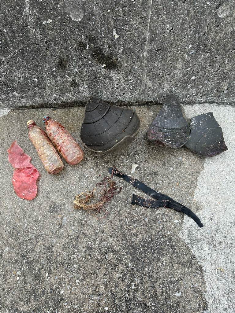
Entangled Help


Use the vertical tabs below to record any entangled animals you found of each type.

Longdong Bay-Northeast and Yilan Coast National Scenic Area Headquarters

rock
10

25.113806995926, 121.91244166526

Enjoyislands Dive Travel
9
8
99.00
148
12.00
3.00
measured
2.00
On
kilograms
I have debris data to report
Slight for waves 0.5 -1.25 meter high m2
meters
rocky reef
Taiwan
City
TAIPEI
Map Help


Dive Location

If you know your survey site coordinates, enter them manually in decimal degrees using WGS84 Map Datum. Use the minus sign for latitudes south of the equator and longitudes west of the Prime Meridian to 180 degrees.

If you do not know your survey site coordinates, click the “Map Location” tab to use the map to zoom into your survey site and drop the pin on the map to fall within your survey dive site in the water (not on land or the beach). Ensure you zoom in as much as possible to ensure data accuracy.

Entangled Help


Use the vertical tabs below to record any entangled animals you found of each type.

Port Island

5
0
2
2

22.501182425566, 114.35655366531

0
0
0
sand
0
4
1
0
8
More debris were found this year. It may because more divers joined in Dive Against Debris event this year.
Sunny
Froggy Diver
Po Lok Kwok
0
5
0
5
0
0
0
0
0
0
0
0
2
0
0
0
0
0
0
11
0
0
0
0
2
2
5
3
0
4
0
0
0
0
0
0
12.00
40
14.00
4.00
1
estimated
4
0
0
0
400.00
0
0
0
0
0
0
On
kilograms
0
I have debris data to report
2
0
0
Calm (glassy to rippled) for waves 0 – 0.1 meter high
0
0
0
0
0
0
0
m2
4
1
meters
other
0
6
0
0
0
0
0
0
0
1
0
0
0
0
0
4
3
0
0
0
0
0
0
0
0
0
2
0
0
Hong Kong S.A.R., China
City
Saikung
Map Help


Dive Location

If you know your survey site coordinates, enter them manually in decimal degrees using WGS84 Map Datum. Use the minus sign for latitudes south of the equator and longitudes west of the Prime Meridian to 180 degrees.

If you do not know your survey site coordinates, click the “Map Location” tab to use the map to zoom into your survey site and drop the pin on the map to fall within your survey dive site in the water (not on land or the beach). Ensure you zoom in as much as possible to ensure data accuracy.

Entangled Help


Use the vertical tabs below to record any entangled animals you found of each type.

Ecosystem Other
SAND

DeCosta Bay

0
25
0
0

35.009057185419, 34.062531231417

0
0
0
sand
0
0
0
0
0
1
2
3
Grappling hook
Hairband
Bandages
Taba Diving Centre
Manuel Vollmer
0
0
0
0
1
0
0
0
0
0
0
0
0
0
0
0
0
1
1
2
0
0
0
0
0
0
0
0
0
0
0
0
0
0
0
0
1.00
35
10.00
1.00
0
estimated
0
0
3696.01
0
0
0
0
0
0
On
kilograms
0
I have debris data to report
0
0
0
Smooth (wavelets) for waves 0.1 - 0.5 meter high
0
0
0
0
1
0
0
m2
0
0
meters
rocky reef
1
0
0
0
0
0
0
0
0
0
0
0
0
0
0
0
0
0
0
0
0
0
0
0
0
0
0
0
0
Cyprus
City
Protaras
Map Help


Dive Location

If you know your survey site coordinates, enter them manually in decimal degrees using WGS84 Map Datum. Use the minus sign for latitudes south of the equator and longitudes west of the Prime Meridian to 180 degrees.

If you do not know your survey site coordinates, click the “Map Location” tab to use the map to zoom into your survey site and drop the pin on the map to fall within your survey dive site in the water (not on land or the beach). Ensure you zoom in as much as possible to ensure data accuracy.

Entangled Help


Use the vertical tabs below to record any entangled animals you found of each type.

Subscribe to