Menu

MYOC - Romantic Reef S26664

1
0
0
1

5.9233907247156, 102.71596111257

0
0
0
coral
0
0
0
0
0
Monsoon
Sea Voice Divers
Rahmaan
0
0
0
0
0
0
0
0
0
0
0
0
0
0
0
0
0
0
0
4
0
0
0
0
0
0
0
0
0
0
0
0
0
0
0
0
0.01
50
12.00
5.00
0
estimated
0
0
1391.36
0
0
0
0
0
0
On
kilograms
0
I have debris data to report
0
0
0
Moderate to rough for waves greater than 1.25 meters
0
0
0
0
0
0
0
m2
0
0
meters
coral reef
1
0
0
0
0
0
0
0
0
0
0
0
0
0
0
0
0
0
0
0
0
0
0
0
0
0
0
0
0
Malaysia
State\Province
Terengganu
City
Perhentian Island
Map Help


Dive Location

If you know your survey site coordinates, enter them manually in decimal degrees using WGS84 Map Datum. Use the minus sign for latitudes south of the equator and longitudes west of the Prime Meridian to 180 degrees.

If you do not know your survey site coordinates, click the “Map Location” tab to use the map to zoom into your survey site and drop the pin on the map to fall within your survey dive site in the water (not on land or the beach). Ensure you zoom in as much as possible to ensure data accuracy.

Entangled Help


Use the vertical tabs below to record any entangled animals you found of each type.

Kewalo Pipe

0
0
0
0

21.279130462885, -157.88160603892

0
0
0
coral
0
0
0
0
0
Rainy and windy
Dive Oahu
Bradley Rudder
0
0
0
0
0
0
0
0
0
0
0
0
0
0
0
0
0
0
0
11
0
0
0
0
0
0
0
0
0
0
0
0
0
0
0
0
0.00
35
55.00
40.00
0
measured
0
0
5666.03
0
0
0
0
0
0
On
kilograms
0
Our Survey Site was free of debris
0
0
0
Smooth (wavelets) for waves 0.1 - 0.5 meter high
0
0
0
0
0
0
0
ft2
0
0
feet
coral reef
0
0
0
0
0
0
0
0
0
0
0
0
0
0
0
0
0
0
0
0
0
0
0
0
0
0
0
0
0
United States
State\Province
Hawaii
City
Honolulu
Map Help


Dive Location

If you know your survey site coordinates, enter them manually in decimal degrees using WGS84 Map Datum. Use the minus sign for latitudes south of the equator and longitudes west of the Prime Meridian to 180 degrees.

If you do not know your survey site coordinates, click the “Map Location” tab to use the map to zoom into your survey site and drop the pin on the map to fall within your survey dive site in the water (not on land or the beach). Ensure you zoom in as much as possible to ensure data accuracy.
Entangled Help


Use the vertical tabs below to record any entangled animals you found of each type.

Krabi #448533

0
0
0
1

7.9477223090705, 98.778204641494

0
0
0
sand
0
0
0
1
0
No
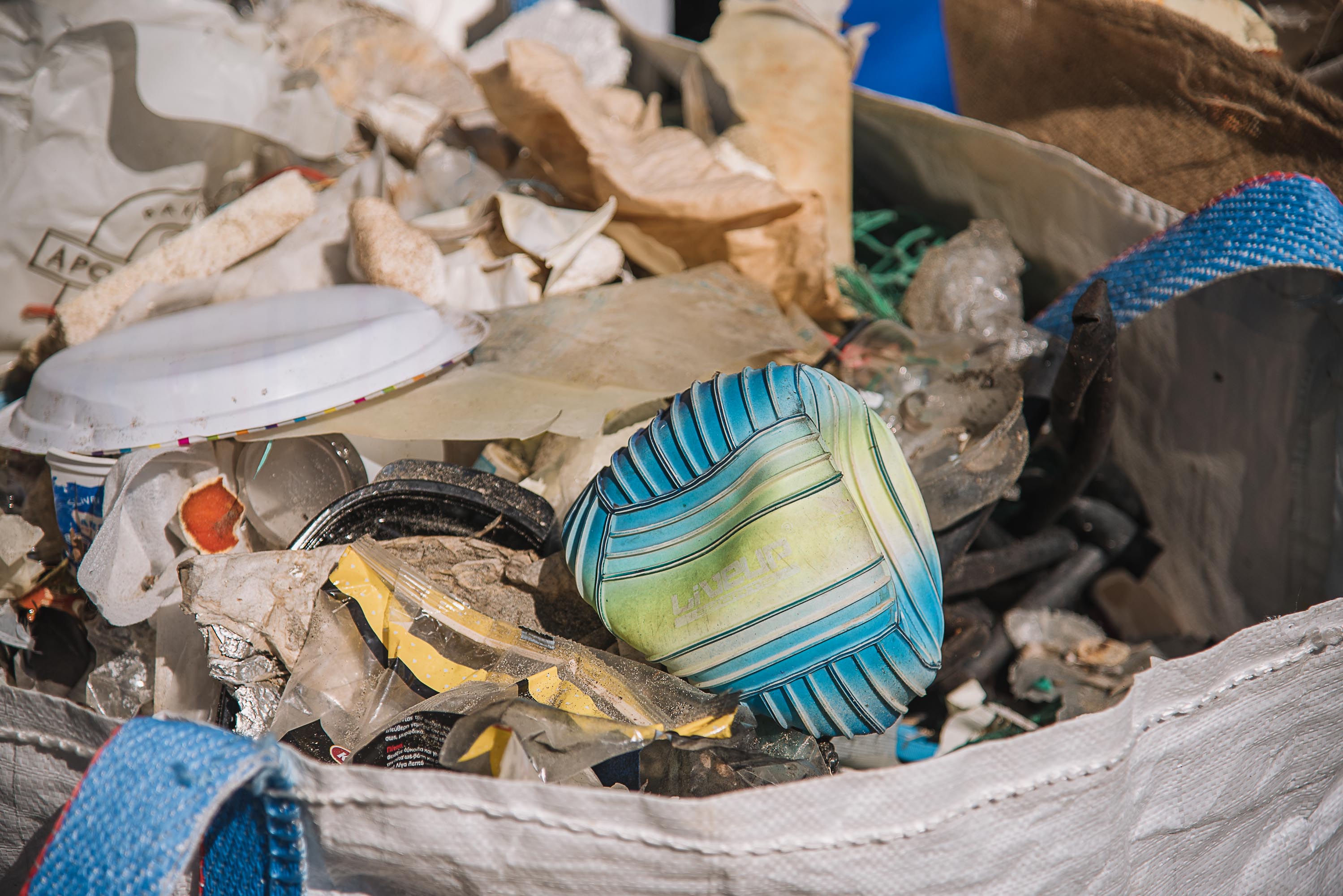
Platic, bottle, hook
Good
24932
Nico
0
0
0
0
0
0
0
0
0
0
0
0
0
0
0
0
0
0
0
1
0
0
0
0
0
0
0
0
0
0
0
0
0
0
0
0
1.00
60
15.00
2.00
0
estimated
0
4
3213.22
0
0
0
0
0
Fish hooks
Fish line
Fishnet
0
On
kilograms
0
I have debris data to report
0
0
0
Calm (glassy to rippled) for waves 0 – 0.1 meter high
0
0
0
0
0
0
0
m2
0
0
meters
coral reef
0
0
0
0
0
0
0
0
0
0
0
0
0
0
0
0
0
0
0
0
0
0
0
0
0
0
0
0
0
Thailand
State\Province
Mueang Krabi
City
Ao Nang
Map Help


Dive Location

If you know your survey site coordinates, enter them manually in decimal degrees using WGS84 Map Datum. Use the minus sign for latitudes south of the equator and longitudes west of the Prime Meridian to 180 degrees.

If you do not know your survey site coordinates, click the “Map Location” tab to use the map to zoom into your survey site and drop the pin on the map to fall within your survey dive site in the water (not on land or the beach). Ensure you zoom in as much as possible to ensure data accuracy.
Entangled Help


Use the vertical tabs below to record any entangled animals you found of each type.

370761 Point Panic

2
1
86
1
rock
86

21.290255223917, -157.86092561594

Lookin better in the harbor!
pacifier
Heavy Rain and wind
1
1
1
1
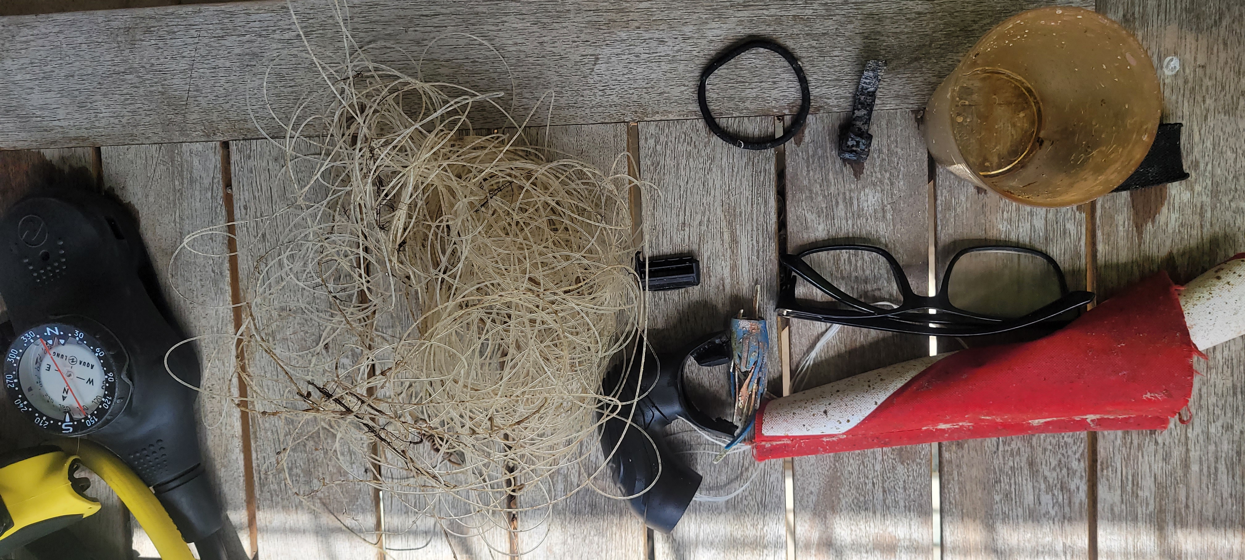
5 Gallon Water Jug
Glasses
Pacifier
Aluminum Flashing
Nudi Wear
Ryan Scalf
2
1
1
1
1
2
41
1
1
2
7
2
206.00
50
26.00
4.00
3
measured
123
300.00
2
3
On
pounds
I have debris data to report
40
Slight for waves 0.5 -1.25 meter high
2
1
1
ft2
feet
rocky reef
19
1
4
26
147
United States
State\Province
HI
City
Honolulu
Map Help


Dive Location

If you know your survey site coordinates, enter them manually in decimal degrees using WGS84 Map Datum. Use the minus sign for latitudes south of the equator and longitudes west of the Prime Meridian to 180 degrees.

If you do not know your survey site coordinates, click the “Map Location” tab to use the map to zoom into your survey site and drop the pin on the map to fall within your survey dive site in the water (not on land or the beach). Ensure you zoom in as much as possible to ensure data accuracy.

Entangled Help


Use the vertical tabs below to record any entangled animals you found of each type.

Punta Gaira S24277

0
5
3
1

11.219266, -74.240081

0
0
0
coral
0
74
0
0
0
Turismo
Bomper de bucero
Viento
Atlantida Centro De Buceo
Atlantida
0
1
0
59
0
0
0
0
8
0
0
0
0
0
1
0
0
0
0
7
0
0
0
0
0
0
52
0
0
23
2
0
0
0
0
0
40.00
55
9.00
3.00
0
measured
0
0
0
0
6442.71
0
0
0
0
0
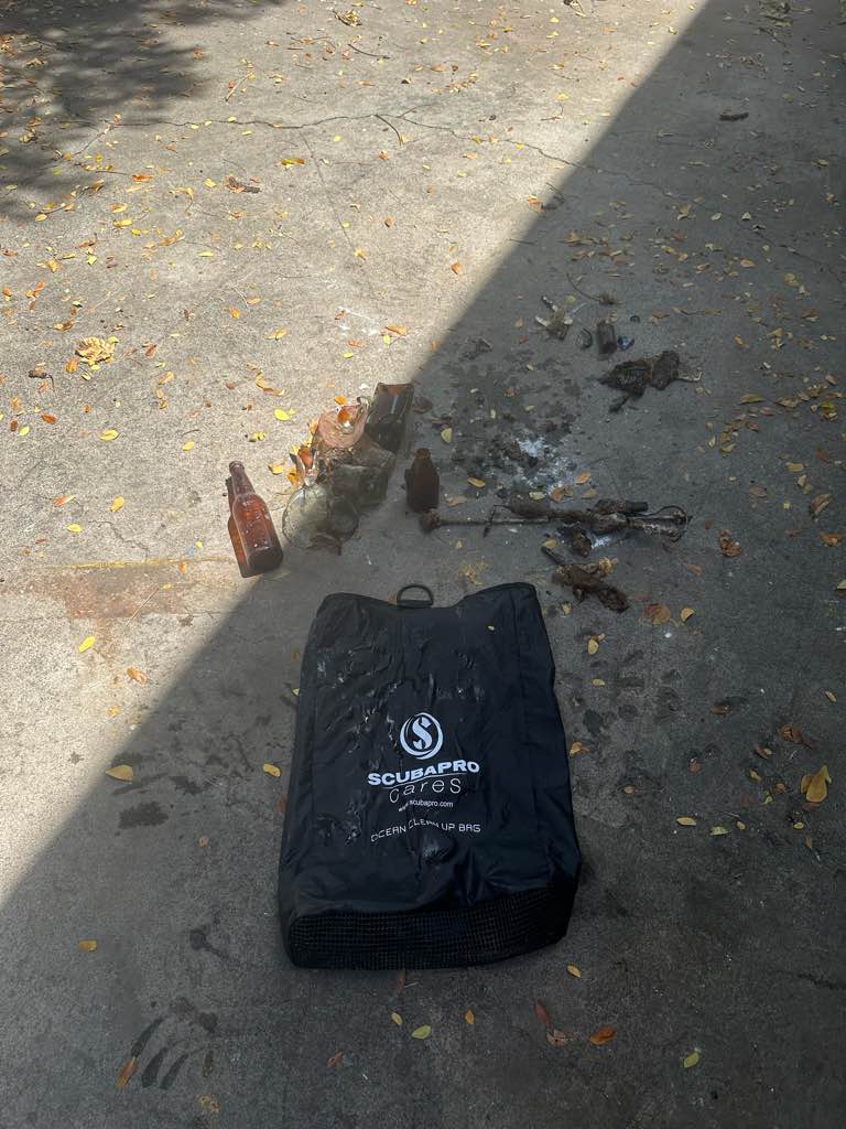
Contenedor de bebida lata (drink cans)
Desechables plásticos (plastic disposables)
Botella plástica (plastic bottles)
0
On
kilograms
0
I have debris data to report
3
0
0
Calm (glassy to rippled) for waves 0 – 0.1 meter high
0
0
1
6
8
0
0
m2
0
0
1
Lata
Erizo
Released Unharmed
meters
coral reef
0
0
0
0
0
0
0
0
0
12
0
0
0
0
0
0
0
109
0
0
0
0
0
0
0
0
0
0
0
Colombia
State\Province
Magdalena
City
Santa Marta
Map Help


Dive Location

If you know your survey site coordinates, enter them manually in decimal degrees using WGS84 Map Datum. Use the minus sign for latitudes south of the equator and longitudes west of the Prime Meridian to 180 degrees.

If you do not know your survey site coordinates, click the “Map Location” tab to use the map to zoom into your survey site and drop the pin on the map to fall within your survey dive site in the water (not on land or the beach). Ensure you zoom in as much as possible to ensure data accuracy.
Entangled Help


Use the vertical tabs below to record any entangled animals you found of each type.

Conch Wall

24.568506, -80.273239

coral
2/3 feet of waves, 30 feet of visibility, moderate current
Florida Keys Dive Center
Nathaniel Sterns
6
0.00
43
40.00
25.00
estimated
800.00
On
pounds
Our Survey Site was free of debris
Smooth (wavelets) for waves 0.1 - 0.5 meter high ft2
feet
coral reef
United States
State\Province
FL
City
Tavernier
Map Help


Dive Location

If you know your survey site coordinates, enter them manually in decimal degrees using WGS84 Map Datum. Use the minus sign for latitudes south of the equator and longitudes west of the Prime Meridian to 180 degrees.

If you do not know your survey site coordinates, click the “Map Location” tab to use the map to zoom into your survey site and drop the pin on the map to fall within your survey dive site in the water (not on land or the beach). Ensure you zoom in as much as possible to ensure data accuracy.

Entangled Help


Use the vertical tabs below to record any entangled animals you found of each type.

Conch wall

24.568506, -80.273239

1
sand
3
popular fishing spot
intact fishing rod with monofilament line still attached to reel
windy, 2/3 feet waves, 40 feet visibility
Florida Keys Dive Center
Nathaniel Sterns
5
7.00
36
36.00
30.00
estimated
300.00
fishing line, as it can entangle coral or other marine life if not recovered
listed above
listed above
On
pounds
I have debris data to report
Smooth (wavelets) for waves 0.1 - 0.5 meter high ft2
feet
rocky reef
United States
State\Province
FL
City
Key Largo
Map Help


Dive Location

If you know your survey site coordinates, enter them manually in decimal degrees using WGS84 Map Datum. Use the minus sign for latitudes south of the equator and longitudes west of the Prime Meridian to 180 degrees.

If you do not know your survey site coordinates, click the “Map Location” tab to use the map to zoom into your survey site and drop the pin on the map to fall within your survey dive site in the water (not on land or the beach). Ensure you zoom in as much as possible to ensure data accuracy.

Entangled Help


Use the vertical tabs below to record any entangled animals you found of each type.

Hammerhead

24.53143, -80.33038

coral
1
Plastic Crate
Islamorada Dive Center/FKNMS
Doug
5
1
1
5.00
30
40.00
19.00
estimated
1598.00
On
pounds
I have debris data to report
Slight for waves 0.5 -1.25 meter high ft2
feet
coral reef
2
1
United States
Map Help


Dive Location

If you know your survey site coordinates, enter them manually in decimal degrees using WGS84 Map Datum. Use the minus sign for latitudes south of the equator and longitudes west of the Prime Meridian to 180 degrees.

If you do not know your survey site coordinates, click the “Map Location” tab to use the map to zoom into your survey site and drop the pin on the map to fall within your survey dive site in the water (not on land or the beach). Ensure you zoom in as much as possible to ensure data accuracy.

Entangled Help


Use the vertical tabs below to record any entangled animals you found of each type.

Bio Rocks

43
4
1
sand
0
5

-8.3557377954573, 116.04303088874

Broom brush
3 days of rain. Some light wind. Otherwise sunny.
Blue Marlin Dive Gili Trawangan
Elizabeth "Blair" Lindsay
3
3
5
9
27
9
4
16.00
60
22.00
1.00
9
measured
200.00
1
Food Wrappers
Plastic Bags
Plastic Bottles
On
kilograms
I have debris data to report
6
Calm (glassy to rippled) for waves 0 – 0.1 meter high
Plastic Bag
Crab
Released Unharmed
1
0
m2
3
meters
coral reef
1
4
Indonesia
Map Help


Dive Location

If you know your survey site coordinates, enter them manually in decimal degrees using WGS84 Map Datum. Use the minus sign for latitudes south of the equator and longitudes west of the Prime Meridian to 180 degrees.

If you do not know your survey site coordinates, click the “Map Location” tab to use the map to zoom into your survey site and drop the pin on the map to fall within your survey dive site in the water (not on land or the beach). Ensure you zoom in as much as possible to ensure data accuracy.

Entangled Help


Use the vertical tabs below to record any entangled animals you found of each type.

Makiminato

2
14
1
3

26.2756333242, 127.71403866625

1
0
0
sand
0
0
9
0
0
good!
no
nice!
long rubber tube
nice
sunny
1
1
razor
mechanical pencil
Dr.blue
Manami
0
0
0
1
0
0
0
0
0
0
0
0
0
0
0
0
0
0
0
2
0
0
0
0
2
0
3
0
1
0
0
0
0
0
0
0
3.00
48
15.40
1.00
0
measured
0
2
6291.90
0
0
1
1
0
cap
cans
lighter
0
On
kilograms
0
I have debris data to report
0
0
0
Smooth (wavelets) for waves 0.1 - 0.5 meter high
0
0
0
0
0
0
0
m2
0
7
3
nets
coral
Released Unharmed
meters
coral reef
1
0
0
0
0
13
0
1
0
0
0
0
0
0
0
0
2
10
0
0
0
0
0
0
0
0
0
0
0
Japan
State\Province
Okinawa
City
Urasoe
Map Help


Dive Location

If you know your survey site coordinates, enter them manually in decimal degrees using WGS84 Map Datum. Use the minus sign for latitudes south of the equator and longitudes west of the Prime Meridian to 180 degrees.

If you do not know your survey site coordinates, click the “Map Location” tab to use the map to zoom into your survey site and drop the pin on the map to fall within your survey dive site in the water (not on land or the beach). Ensure you zoom in as much as possible to ensure data accuracy.

Entangled Help


Use the vertical tabs below to record any entangled animals you found of each type.

Subscribe to