Menu

Alligator Deep

1
1

24.84215, -80.619817

2
coral
1
10
1
2
1
1
Scissors
Anchor
Cell Phone & Case
License Plate Frame
Key Dives
Amanda Hudon
1
21
122.25
45
90.00
64.00
11
measured
5000.00
On
pounds
I have debris data to report
1
Smooth (wavelets) for waves 0.1 - 0.5 meter high ft2
feet
coral reef
1
United States
Map Help


Dive Location

If you know your survey site coordinates, enter them manually in decimal degrees using WGS84 Map Datum. Use the minus sign for latitudes south of the equator and longitudes west of the Prime Meridian to 180 degrees.

If you do not know your survey site coordinates, click the “Map Location” tab to use the map to zoom into your survey site and drop the pin on the map to fall within your survey dive site in the water (not on land or the beach). Ensure you zoom in as much as possible to ensure data accuracy.

Entangled Help


Use the vertical tabs below to record any entangled animals you found of each type.

ADS501 - The Maze

24.889633, -80.566477

coral
1
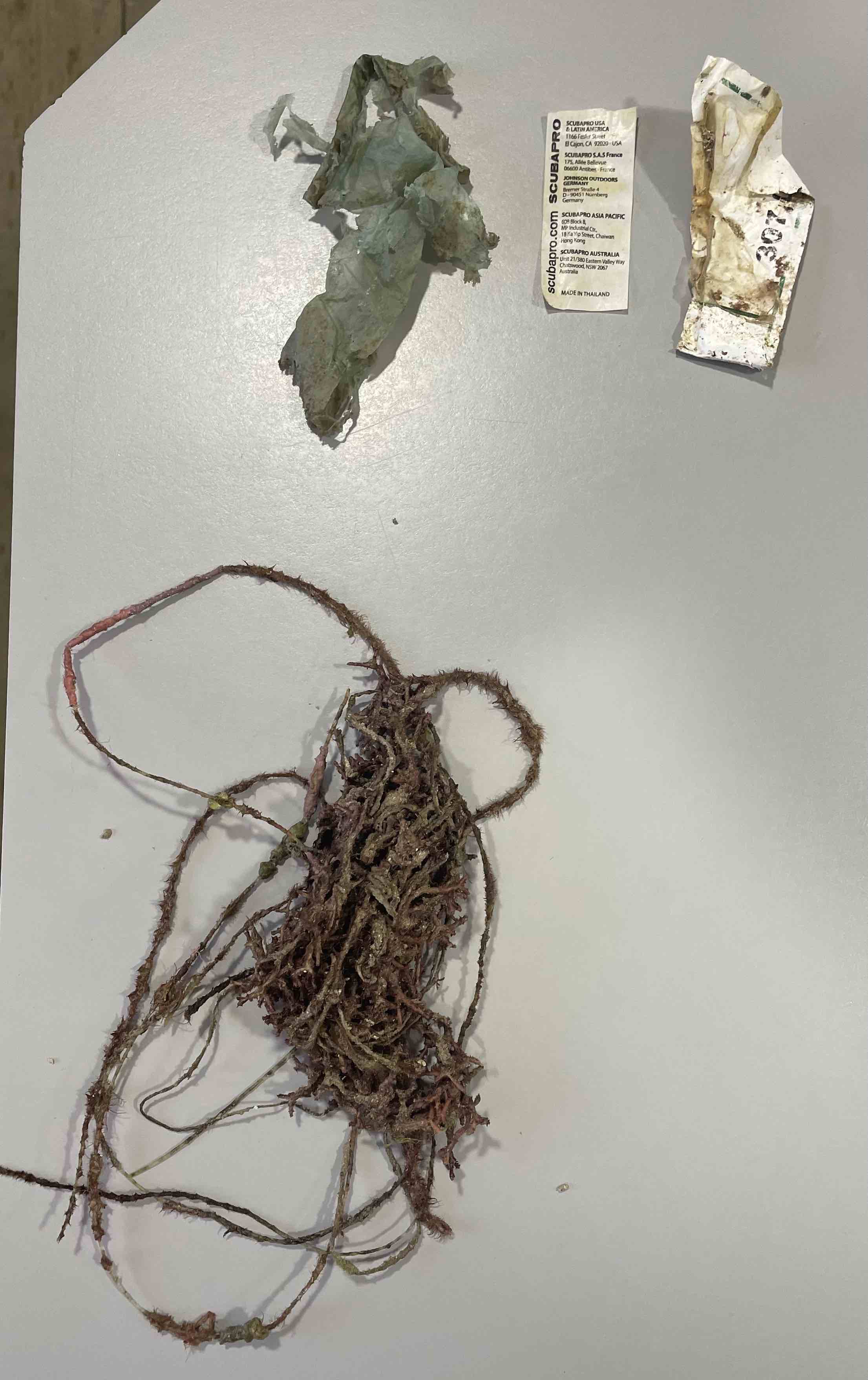
Glove
Key Dives
Amanda Hudon
1
52.00
45
30.00
18.00
measured
1
5000.00
On
pounds
I have debris data to report
Smooth (wavelets) for waves 0.1 - 0.5 meter high ft2
feet
coral reef
United States
Map Help


Dive Location

If you know your survey site coordinates, enter them manually in decimal degrees using WGS84 Map Datum. Use the minus sign for latitudes south of the equator and longitudes west of the Prime Meridian to 180 degrees.

If you do not know your survey site coordinates, click the “Map Location” tab to use the map to zoom into your survey site and drop the pin on the map to fall within your survey dive site in the water (not on land or the beach). Ensure you zoom in as much as possible to ensure data accuracy.
Entangled Help


Use the vertical tabs below to record any entangled animals you found of each type.

A Hole

24.828117, -80.64495

coral
10
Key Dives
Amanda Hudon
9
54.05
45
60.00
40.00
19
measured
5000.00
On
pounds
I have debris data to report
Smooth (wavelets) for waves 0.1 - 0.5 meter high ft2
feet
coral reef
United States
Map Help


Dive Location

If you know your survey site coordinates, enter them manually in decimal degrees using WGS84 Map Datum. Use the minus sign for latitudes south of the equator and longitudes west of the Prime Meridian to 180 degrees.

If you do not know your survey site coordinates, click the “Map Location” tab to use the map to zoom into your survey site and drop the pin on the map to fall within your survey dive site in the water (not on land or the beach). Ensure you zoom in as much as possible to ensure data accuracy.

Entangled Help


Use the vertical tabs below to record any entangled animals you found of each type.

Turtle Truk

1

24.812467, -80.66765

coral
1
10
1
5ft Anchor Chain
Key Dives
Amanda Hudon
9
94.70
45
75.00
40.00
5
measured
5000.00
On
pounds
I have debris data to report
4
Smooth (wavelets) for waves 0.1 - 0.5 meter high
5
ft2
feet
coral reef
2
5
United States
Map Help


Dive Location

If you know your survey site coordinates, enter them manually in decimal degrees using WGS84 Map Datum. Use the minus sign for latitudes south of the equator and longitudes west of the Prime Meridian to 180 degrees.

If you do not know your survey site coordinates, click the “Map Location” tab to use the map to zoom into your survey site and drop the pin on the map to fall within your survey dive site in the water (not on land or the beach). Ensure you zoom in as much as possible to ensure data accuracy.

Entangled Help


Use the vertical tabs below to record any entangled animals you found of each type.

Alligator Deep

1

24.84215, -80.619817

1
coral
3
10
1
1
Weight belt
Boat Diaper
Key Dives
Amanda Hudon
9
22.00
42
90.00
64.00
4
measured
8
5000.00
On
pounds
I have debris data to report
1
Smooth (wavelets) for waves 0.1 - 0.5 meter high ft2
feet
coral reef
2
2
United States
Map Help


Dive Location

If you know your survey site coordinates, enter them manually in decimal degrees using WGS84 Map Datum. Use the minus sign for latitudes south of the equator and longitudes west of the Prime Meridian to 180 degrees.

If you do not know your survey site coordinates, click the “Map Location” tab to use the map to zoom into your survey site and drop the pin on the map to fall within your survey dive site in the water (not on land or the beach). Ensure you zoom in as much as possible to ensure data accuracy.

Entangled Help


Use the vertical tabs below to record any entangled animals you found of each type.

Blue Heron Bridge

10
2
sand
1

26.784196859519, -80.044244320804

We found a crab living inside a glass bottle that he had grown too large to get out of. So we broke him out and collected the glass bottle pieces.
Calm, warm, perfect diving conditions.
EASE
Steven Smith
3
20
2
30
4
1
10.00
60
7.00
2.00
estimated
3020.00
On
pounds
I have debris data to report
3
Calm (glassy to rippled) for waves 0 – 0.1 meter high
6
Glass bottle
Crab
Released Unharmed
1
m2
meters
rocky reef
2
United States
State\Province
fl
City
west palm beach
Map Help


Dive Location

If you know your survey site coordinates, enter them manually in decimal degrees using WGS84 Map Datum. Use the minus sign for latitudes south of the equator and longitudes west of the Prime Meridian to 180 degrees.

If you do not know your survey site coordinates, click the “Map Location” tab to use the map to zoom into your survey site and drop the pin on the map to fall within your survey dive site in the water (not on land or the beach). Ensure you zoom in as much as possible to ensure data accuracy.

Entangled Help


Use the vertical tabs below to record any entangled animals you found of each type.

Black Turtle Reef

67
35
3
silt
4

10.085534545439, 99.824287747108

No specific event. Location close to the pier reknown hotspot for trash
Piggy Bank
Clear No wind
Black Turtle Dive
Lucas
1
2
1
1
2
1
1
4
3
1
1
30
1
2
2
1
29.00
40
3.00
1.00
4
measured
0
400.00
2
Plastic bottles
Food wrappers
Plastic fragments
1
On
kilograms
I have debris data to report
12
Calm (glassy to rippled) for waves 0 – 0.1 meter high
1
m2
meters
coral reef
2
1
11
1
Thailand
State\Province
Sura Thani
City
Koh Tao
Map Help


Dive Location

If you know your survey site coordinates, enter them manually in decimal degrees using WGS84 Map Datum. Use the minus sign for latitudes south of the equator and longitudes west of the Prime Meridian to 180 degrees.

If you do not know your survey site coordinates, click the “Map Location” tab to use the map to zoom into your survey site and drop the pin on the map to fall within your survey dive site in the water (not on land or the beach). Ensure you zoom in as much as possible to ensure data accuracy.

Entangled Help


Use the vertical tabs below to record any entangled animals you found of each type.

Junk Yard

1
3

10.086691686226, 99.823486914379

sand

10.0956102, 99.8403959

1
Metal Paint Roller Handle
The Coral Tribe
Jennifer Dowling
1
2
7
2
1.20
61
11.00
5.00
1
estimated
100.00
1
On
kilograms
I have debris data to report
Calm (glassy to rippled) for waves 0 – 0.1 meter high m2
meters
coral reef
1
2
2
Thailand
State\Province
Surat Thani
City
Koh Tao
Map Help


Dive Location

If you know your survey site coordinates, enter them manually in decimal degrees using WGS84 Map Datum. Use the minus sign for latitudes south of the equator and longitudes west of the Prime Meridian to 180 degrees.

If you do not know your survey site coordinates, click the “Map Location” tab to use the map to zoom into your survey site and drop the pin on the map to fall within your survey dive site in the water (not on land or the beach). Ensure you zoom in as much as possible to ensure data accuracy.

Entangled Help


Use the vertical tabs below to record any entangled animals you found of each type.

Aow Leuk

18
43
3
1
sand
3
5

10.072327468726, 99.83945464508

Scuba Mask.
5
2
P.P.E Mask
Deodorant Container
The Coral Tribe
Jennifer Dowling
23
2
5
1
12
9
57
12
2
10.20
50
11.00
5.00
1
measured
25.00
Plastic Bags
Net
Food Wrappers
3
On
kilograms
I have debris data to report
Slight for waves 0.5 -1.25 meter high
3
4
1
3
m2
4
meters
coral reef
2
3
Thailand
State\Province
Surat Thani
City
Koh Tao
Map Help


Dive Location

If you know your survey site coordinates, enter them manually in decimal degrees using WGS84 Map Datum. Use the minus sign for latitudes south of the equator and longitudes west of the Prime Meridian to 180 degrees.

If you do not know your survey site coordinates, click the “Map Location” tab to use the map to zoom into your survey site and drop the pin on the map to fall within your survey dive site in the water (not on land or the beach). Ensure you zoom in as much as possible to ensure data accuracy.

Entangled Help


Use the vertical tabs below to record any entangled animals you found of each type.

Christmas Tree Cave

25.03369, -80.349368

1
sand
2

25.1877642, -80.360297

Rainbow Reef
Chris Accinelli
0
9
1.00
44
33.00
18.00
estimated
3
4000.00
On
pounds
I have debris data to report
Calm (glassy to rippled) for waves 0 – 0.1 meter high ft2
feet
coral reef
1
United States
Map Help


Dive Location

If you know your survey site coordinates, enter them manually in decimal degrees using WGS84 Map Datum. Use the minus sign for latitudes south of the equator and longitudes west of the Prime Meridian to 180 degrees.

If you do not know your survey site coordinates, click the “Map Location” tab to use the map to zoom into your survey site and drop the pin on the map to fall within your survey dive site in the water (not on land or the beach). Ensure you zoom in as much as possible to ensure data accuracy.

Entangled Help


Use the vertical tabs below to record any entangled animals you found of each type.

Subscribe to