Menu

Mornington Pier

0
0
0
0

-38.212741, 145.033584

32
2
0
rock
0
0
0
0
0
Sunny
1
Anchor
6357 Aquatic Adventures
Chris Roulston
0
1
0
0
0
2
0
0
0
0
0
0
0
4
0
0
0
0
8
5
0
0
0
0
0
1
1
0
0
0
2
0
0
0
0
0
17.50
50
7.00
3.00
0
estimated
0
0
0
72
1997.39
0
0
0
0
0
0
On
kilograms
0
I have debris data to report
7
0
0
Calm (glassy to rippled) for waves 0 – 0.1 meter high
0
0
0
0
1
0
0
m2
0
0
meters
rocky reef
0
0
1
0
5
0
0
0
1
0
0
0
0
0
0
0
0
15
0
0
1
0
1
0
0
0
0
0
0
Australia
State\Province
Vic
City
Melbourne
Map Help


Dive Location

If you know your survey site coordinates, enter them manually in decimal degrees using WGS84 Map Datum. Use the minus sign for latitudes south of the equator and longitudes west of the Prime Meridian to 180 degrees.

If you do not know your survey site coordinates, click the “Map Location” tab to use the map to zoom into your survey site and drop the pin on the map to fall within your survey dive site in the water (not on land or the beach). Ensure you zoom in as much as possible to ensure data accuracy.

Entangled Help


Use the vertical tabs below to record any entangled animals you found of each type.

Kingman Wash

8
1
rock

36.018558996802, -114.72807635409

Humans
Hydraulic Piston
Sunny
1
Hydraulic Piston
Bluenote/ Mana Scuba
Ken and Noel
0
3
1
23.00
50
31.00
1.00
estimated
1076.51
On
kilograms
I have debris data to report
31
Calm (glassy to rippled) for waves 0 – 0.1 meter high
2
m2
meters
other
3
31
4
United States
State\Province
NV
City
Las Vegas
Map Help


Dive Location

If you know your survey site coordinates, enter them manually in decimal degrees using WGS84 Map Datum. Use the minus sign for latitudes south of the equator and longitudes west of the Prime Meridian to 180 degrees.

If you do not know your survey site coordinates, click the “Map Location” tab to use the map to zoom into your survey site and drop the pin on the map to fall within your survey dive site in the water (not on land or the beach). Ensure you zoom in as much as possible to ensure data accuracy.

Entangled Help


Use the vertical tabs below to record any entangled animals you found of each type.

Ecosystem Other
Rock wall

KIngman Wash

9
silt
46

36.037006044517, -114.71308196954

Humans
Sunny calm
1
anchor
Blue Note /Mana Scuba
Noel
1
5
12
10
2
22.00
89
21.33
2.00
estimated
100607.00
0
On
kilograms
I have debris data to report
12
Calm (glassy to rippled) for waves 0 – 0.1 meter high
0
m2
1
meters
other
0
1
114
1
United States
State\Province
NV
City
Las Vegas
Map Help


Dive Location

If you know your survey site coordinates, enter them manually in decimal degrees using WGS84 Map Datum. Use the minus sign for latitudes south of the equator and longitudes west of the Prime Meridian to 180 degrees.

If you do not know your survey site coordinates, click the “Map Location” tab to use the map to zoom into your survey site and drop the pin on the map to fall within your survey dive site in the water (not on land or the beach). Ensure you zoom in as much as possible to ensure data accuracy.

Entangled Help


Use the vertical tabs below to record any entangled animals you found of each type.

Ecosystem Other
Lake silt and rock

Tala Bay

8
40
0
0

29.444105, 34.967812

0
0
0
seagrass
0
21
6
1
0
Shift in wind from the south
Windy
4
4
1
Handiwipes
Paper cups with plastic lining
Piece of wood with screw
Deep Blue Dive Center
Catherine Hoelzer
0
0
0
17
0
0
0
0
0
1
1
0
0
0
0
0
0
0
0
2
0
0
0
0
0
0
0
0
0
0
0
0
0
0
0
0
3.00
60
15.00
5.00
0
estimated
0
5
100.00
0
0
0
0
0
0
On
kilograms
0
I have debris data to report
2
0
0
Calm (glassy to rippled) for waves 0 – 0.1 meter high
0
0
0
0
0
0
0
m2
0
0
meters
coral reef
0
0
0
0
0
0
0
0
0
0
0
0
0
0
0
0
0
0
0
0
0
0
0
0
0
0
0
0
0
Jordan
State\Province
Aqaba
City
Aqaba
Map Help


Dive Location

If you know your survey site coordinates, enter them manually in decimal degrees using WGS84 Map Datum. Use the minus sign for latitudes south of the equator and longitudes west of the Prime Meridian to 180 degrees.

If you do not know your survey site coordinates, click the “Map Location” tab to use the map to zoom into your survey site and drop the pin on the map to fall within your survey dive site in the water (not on land or the beach). Ensure you zoom in as much as possible to ensure data accuracy.

Entangled Help


Use the vertical tabs below to record any entangled animals you found of each type.

Manza in Leaf

2
sand
1

26.506884104848, 127.85653165399

Okinawa Diving Service Lgoon
Hiroaki YAMAMOTO
3
1
1
3.00
30
3.00
1.00
3
estimated
1
2100.00
On
kilograms
I have debris data to report
Smooth (wavelets) for waves 0.1 - 0.5 meter high m2
meters
coral reef
Japan
City
Onna
Map Help


Dive Location

If you know your survey site coordinates, enter them manually in decimal degrees using WGS84 Map Datum. Use the minus sign for latitudes south of the equator and longitudes west of the Prime Meridian to 180 degrees.

If you do not know your survey site coordinates, click the “Map Location” tab to use the map to zoom into your survey site and drop the pin on the map to fall within your survey dive site in the water (not on land or the beach). Ensure you zoom in as much as possible to ensure data accuracy.

Entangled Help


Use the vertical tabs below to record any entangled animals you found of each type.

Diamond Beach

1
sand
1

26.509154477684, 127.87451592126

1.Fishing Rot
2.Lure
3.Floating Trash
WIndy, Rainy, Bad weather
Okinawa Diving Service Lagoon
Hiroaki Yamamoto
3
1
1
1.00
33
3.60
1.00
1
measured
1
2320.00
Fishing Rot
On
kilograms
I have debris data to report
Smooth (wavelets) for waves 0.1 - 0.5 meter high m2
meters
coral reef
Japan
State\Province
Okinawa
City
Onna
Map Help


Dive Location

If you know your survey site coordinates, enter them manually in decimal degrees using WGS84 Map Datum. Use the minus sign for latitudes south of the equator and longitudes west of the Prime Meridian to 180 degrees.

If you do not know your survey site coordinates, click the “Map Location” tab to use the map to zoom into your survey site and drop the pin on the map to fall within your survey dive site in the water (not on land or the beach). Ensure you zoom in as much as possible to ensure data accuracy.

Entangled Help


Use the vertical tabs below to record any entangled animals you found of each type.

Camp Cove

2
5
1
1
sand
1

-33.839323635343, 151.2788791782

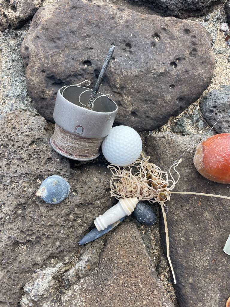
metal boat part
1
1
metal boat part
plastic boat part
Dive Centre Bondi
Alexander Blake
4
1
5
18
3
4
2
22
28.60
50
8.00
0.00
measured
2
200.00
broken glass
On
kilograms
I have debris data to report
22
Calm (glassy to rippled) for waves 0 – 0.1 meter high m2
2
meters
rocky reef
2
2
1
22
Australia
State\Province
NSW
City
Sydney
Map Help


Dive Location

If you know your survey site coordinates, enter them manually in decimal degrees using WGS84 Map Datum. Use the minus sign for latitudes south of the equator and longitudes west of the Prime Meridian to 180 degrees.

If you do not know your survey site coordinates, click the “Map Location” tab to use the map to zoom into your survey site and drop the pin on the map to fall within your survey dive site in the water (not on land or the beach). Ensure you zoom in as much as possible to ensure data accuracy.
Entangled Help


Use the vertical tabs below to record any entangled animals you found of each type.

Kawaihae Surfpark

14
18
7
2

20.0303176, -155.8303812

16
1
0
sand
0
0
2
150
5
Fall Break from School
Tea infuser
Large Swell and Rain
4
Spark Plugs
Kohala Divers LTD
Kay Cooper
0
2
0
5
0
0
0
0
9
0
1
0
2
9
0
0
0
4
0
21
0
1
0
0
0
3
2
0
2
0
0
0
11
0
0
0
36.00
60
16.00
8.00
4
estimated
0
32
73512.40
0
0
0
2
0
Fishing line
Lead weights
Plastic
0
On
pounds
0
I have debris data to report
16
0
0
Smooth (wavelets) for waves 0.1 - 0.5 meter high
2
0
0
2
3
0
0
ft2
3
1
feet
coral reef
6
0
0
0
0
4
4
10
0
0
0
0
1
0
0
0
2
54
0
0
0
0
6
0
1
0
0
0
0
United States
State\Province
Hawaii
City
Kawaihae
Map Help


Dive Location

If you know your survey site coordinates, enter them manually in decimal degrees using WGS84 Map Datum. Use the minus sign for latitudes south of the equator and longitudes west of the Prime Meridian to 180 degrees.

If you do not know your survey site coordinates, click the “Map Location” tab to use the map to zoom into your survey site and drop the pin on the map to fall within your survey dive site in the water (not on land or the beach). Ensure you zoom in as much as possible to ensure data accuracy.

Entangled Help


Use the vertical tabs below to record any entangled animals you found of each type.

Service Club Park

0
5
1
0

27.077821006039, -82.454378

1
0
0
sand
0
0
0
0
0
The recent storms seem to have pushed the trash in
Toy ring
Stormy and wavy for past two weeks
1
1
Sunglasses
Hair tie
Sarasota Ocean Preservers
Brooke Welch
0
0
0
0
0
0
0
0
1
0
0
0
0
0
0
0
0
0
0
1
0
0
1
0
0
0
1
0
0
0
0
0
0
0
0
0
2.00
49
19.00
15.00
0
estimated
0
0
680.98
0
0
0
0
0
Aluminum cans
Fishing lure
Plastic fragments
1
On
pounds
0
I have debris data to report
0
0
0
Calm (glassy to rippled) for waves 0 – 0.1 meter high
2
0
0
0
0
0
0
m2
0
0
feet
rocky reef
1
0
1
0
0
0
0
0
0
0
0
1
0
0
0
0
0
16
0
0
0
0
0
0
0
0
0
1
0
United States
State\Province
Florida
City
Venice
Map Help


Dive Location

If you know your survey site coordinates, enter them manually in decimal degrees using WGS84 Map Datum. Use the minus sign for latitudes south of the equator and longitudes west of the Prime Meridian to 180 degrees.

If you do not know your survey site coordinates, click the “Map Location” tab to use the map to zoom into your survey site and drop the pin on the map to fall within your survey dive site in the water (not on land or the beach). Ensure you zoom in as much as possible to ensure data accuracy.

Entangled Help


Use the vertical tabs below to record any entangled animals you found of each type.

Lake Phoenix S22073

0
16
0
0

36.952034, -77.766364

0
0
0
silt
0
0
0
0
0
Nope
No
No
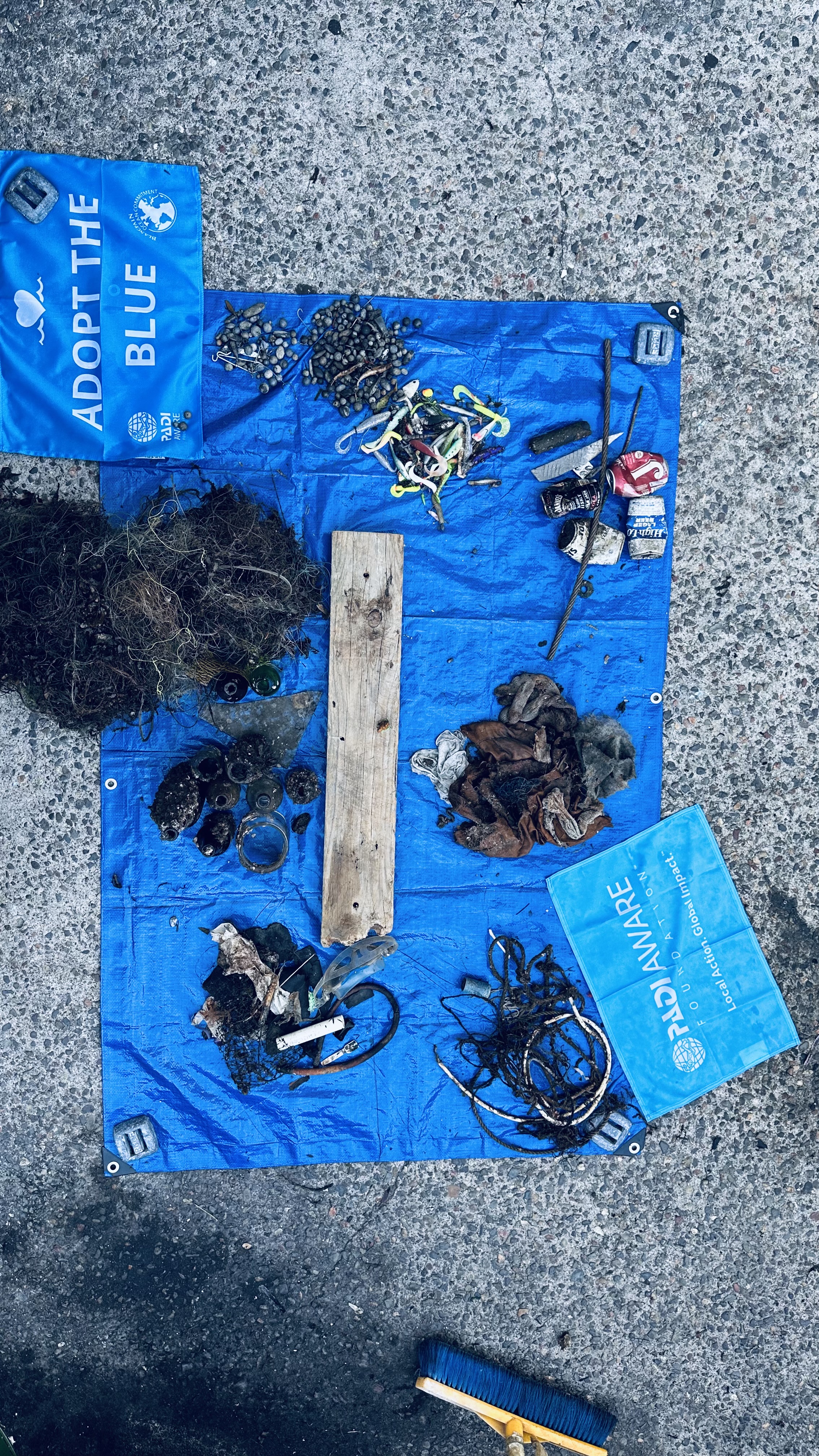
Plastic sheet
Sunny
Blue Planet Scuba
Michelle Swiger
0
0
0
0
0
0
0
0
0
1
0
0
0
4
0
0
0
0
0
4
0
0
0
0
0
0
0
0
0
0
0
0
1
0
0
0
0.30
38
25.00
10.00
0
estimated
0
0
0
0
6721.00
0
0
0
2
0
Plastic fragments
0
On
pounds
0
I have debris data to report
0
0
0
Calm (glassy to rippled) for waves 0 – 0.1 meter high
0
0
0
0
0
0
0
ft2
2
0
feet
other
4
0
0
0
0
0
0
0
0
0
0
0
0
0
0
0
0
0
0
0
0
0
6
0
0
0
0
0
0
United States
State\Province
Va
City
Rawlings
Map Help


Dive Location

If you know your survey site coordinates, enter them manually in decimal degrees using WGS84 Map Datum. Use the minus sign for latitudes south of the equator and longitudes west of the Prime Meridian to 180 degrees.

If you do not know your survey site coordinates, click the “Map Location” tab to use the map to zoom into your survey site and drop the pin on the map to fall within your survey dive site in the water (not on land or the beach). Ensure you zoom in as much as possible to ensure data accuracy.
Entangled Help


Use the vertical tabs below to record any entangled animals you found of each type.

Ecosystem Other
freshwater lake
Subscribe to