Menu

N EAST WRECK

0
0
0
0

8.73803, 167.73

0
0
0
sand
0
0
0
0
0
No
Windy
KWAJALEIN DIVE CENTER
Heath Christie
0
0
0
0
0
0
0
0
0
0
0
0
0
0
0
0
0
0
0
6
0
0
0
0
0
0
0
0
0
0
0
0
0
0
0
0
2.00
45
85.00
10.00
0
estimated
0
0
0
0
359.80
0
0
0
0
0
0
On
pounds
0
I have debris data to report
1
0
0
Smooth (wavelets) for waves 0.1 - 0.5 meter high
0
0
0
0
0
0
0
m2
0
0
feet
coral reef
0
0
0
0
0
0
0
0
0
0
0
0
0
0
0
0
0
1
0
0
0
0
0
0
0
0
0
0
0
Marshall Islands
State\Province
Kwajalein
City
Kwajalein
Map Help


Dive Location

If you know your survey site coordinates, enter them manually in decimal degrees using WGS84 Map Datum. Use the minus sign for latitudes south of the equator and longitudes west of the Prime Meridian to 180 degrees.

If you do not know your survey site coordinates, click the “Map Location” tab to use the map to zoom into your survey site and drop the pin on the map to fall within your survey dive site in the water (not on land or the beach). Ensure you zoom in as much as possible to ensure data accuracy.

Entangled Help


Use the vertical tabs below to record any entangled animals you found of each type.

Koh mae urai

coral
1
0
0

7.9556916617464, 98.792686004178

0
None
Net
Sunny warm, slight breeze.
Sea condition smooth.
Kon tiki dive centre
0
0
0
0
0
0
3
0
0
0
0
0
0
0
0
0
0.50
45
18.00
4.00
estimated
150.00
On
kilograms
I have debris data to report
Smooth (wavelets) for waves 0.1 - 0.5 meter high m2
meters
rocky reef
Thailand
State\Province
Surat thani
City
Ao nang
Map Help


Dive Location

If you know your survey site coordinates, enter them manually in decimal degrees using WGS84 Map Datum. Use the minus sign for latitudes south of the equator and longitudes west of the Prime Meridian to 180 degrees.

If you do not know your survey site coordinates, click the “Map Location” tab to use the map to zoom into your survey site and drop the pin on the map to fall within your survey dive site in the water (not on land or the beach). Ensure you zoom in as much as possible to ensure data accuracy.

Entangled Help


Use the vertical tabs below to record any entangled animals you found of each type.

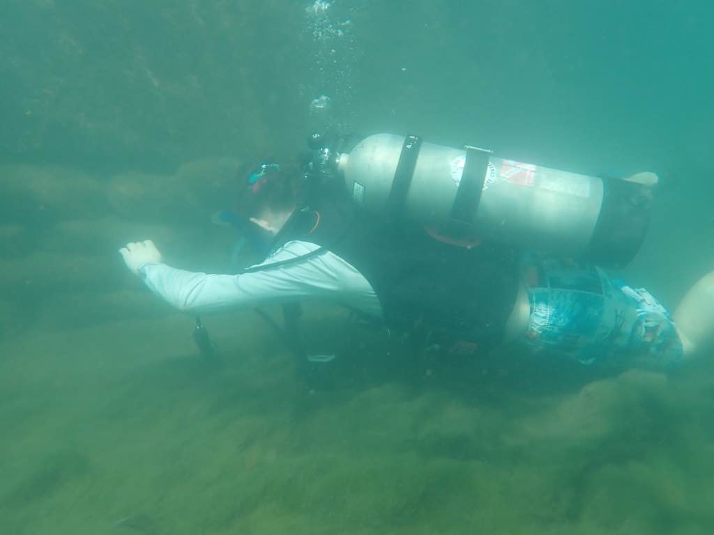
Lake pupuke (quarry)

1
0
0
0

-36.782945184007, 174.76057127916

0
0
1
silt
0
1
0
0
0
No
Site was pretty clear
Glove
Cloudy
Dive HQ
Alisha
0
0
0
0
0
0
0
0
0
0
0
0
0
0
0
0
0
0
0
3
0
0
0
0
0
0
0
0
0
0
0
0
0
0
0
0
0.10
15
11.10
5.00
0
estimated
0
0
618.60
0
0
0
0
0
Chip packet
Plastic bag
Glove
0
On
kilograms
0
I have debris data to report
0
0
0
Calm (glassy to rippled) for waves 0 – 0.1 meter high
0
0
0
0
0
0
0
m2
0
0
meters
other
0
0
0
0
0
0
0
0
0
0
0
0
0
0
0
0
0
0
0
0
0
0
0
0
0
0
0
0
0
New Zealand
State\Province
Auckland
City
Mt roskill
Map Help


Dive Location

If you know your survey site coordinates, enter them manually in decimal degrees using WGS84 Map Datum. Use the minus sign for latitudes south of the equator and longitudes west of the Prime Meridian to 180 degrees.

If you do not know your survey site coordinates, click the “Map Location” tab to use the map to zoom into your survey site and drop the pin on the map to fall within your survey dive site in the water (not on land or the beach). Ensure you zoom in as much as possible to ensure data accuracy.
Entangled Help


Use the vertical tabs below to record any entangled animals you found of each type.

Ecosystem Other
Lake

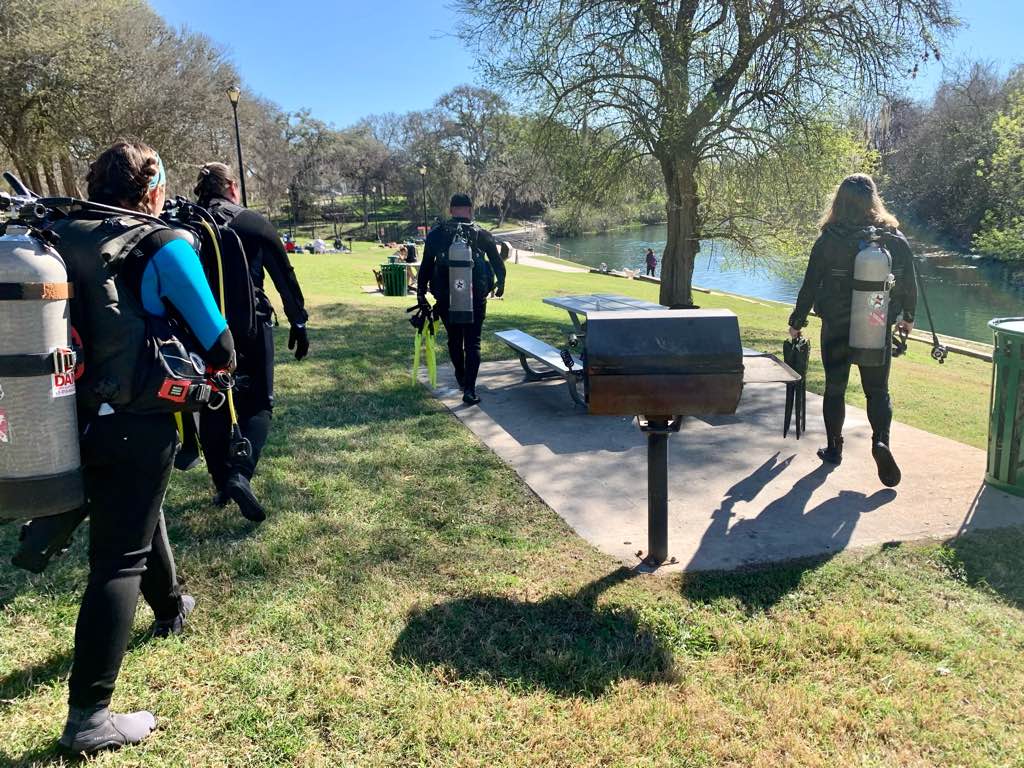
Comal River

0
0
0
0
0
0
0
sand
0
3
0
0
0

29.708040774793, -98.123838549669

Public park on River
Sunny
Texas Dive Center
Sean Cowher
0
0
0
14
0
0
0
0
1
0
0
0
0
0
0
0
0
0
0
6
2
0
0
0
0
0
17
0
0
0
0
0
0
0
0
0
10.00
30
12.00
6.00
2
estimated
0
0
114493.00
0
0
0
0
0
0
On
pounds
0
I have debris data to report
11
0
0
Calm (glassy to rippled) for waves 0 – 0.1 meter high
0
0
0
0
0
0
0
ft2
0
0
feet
other
0
0
0
0
0
0
0
0
0
6
0
0
0
0
0
0
8
0
0
0
0
0
0
0
0
0
0
0
0
United States
State\Province
Texas
City
New Braunfels
Map Help


Dive Location

If you know your survey site coordinates, enter them manually in decimal degrees using WGS84 Map Datum. Use the minus sign for latitudes south of the equator and longitudes west of the Prime Meridian to 180 degrees.

If you do not know your survey site coordinates, click the “Map Location” tab to use the map to zoom into your survey site and drop the pin on the map to fall within your survey dive site in the water (not on land or the beach). Ensure you zoom in as much as possible to ensure data accuracy.
Entangled Help


Use the vertical tabs below to record any entangled animals you found of each type.

Ecosystem Other
River

Sairee Reef

0
7
0
0
0
0
0
coral
0
1
0
0
0

10.096387111262, 99.827612643637

No
Pair of pants
Fifty Six
Isabella Preziosi
0
3
0
0
0
0
0
0
0
0
0
0
0
0
0
0
0
0
0
5
0
0
0
0
0
0
0
0
0
4
0
0
0
0
0
0
5.00
35
5.00
2.00
3
estimated
0
0
0
0
8330.66
0
0
0
0
0
Plastic bottles
Pipes
Rope
0
On
kilograms
0
I have debris data to report
0
0
0
Calm (glassy to rippled) for waves 0 – 0.1 meter high
0
0
0
0
3
0
0
m2
0
0
meters
coral reef
0
0
1
0
0
0
0
0
0
0
0
0
0
0
0
0
0
1
0
0
0
0
0
0
0
0
0
0
0
Thailand
State\Province
Suratthani
City
Koh Tao
Map Help


Dive Location

If you know your survey site coordinates, enter them manually in decimal degrees using WGS84 Map Datum. Use the minus sign for latitudes south of the equator and longitudes west of the Prime Meridian to 180 degrees.

If you do not know your survey site coordinates, click the “Map Location” tab to use the map to zoom into your survey site and drop the pin on the map to fall within your survey dive site in the water (not on land or the beach). Ensure you zoom in as much as possible to ensure data accuracy.
Entangled Help


Use the vertical tabs below to record any entangled animals you found of each type.

Blue Planet House Reef

1
coral

-5.6094071994038, 120.44897952334

No
Cloth
Sunny, partial cloud
Indo Ocean Project
Jess
3
0.15
58
16.20
5.00
1
measured
1000.00
On
kilograms
I have debris data to report
Calm (glassy to rippled) for waves 0 – 0.1 meter high
2
m2
meters
coral reef
Indonesia
State\Province
Bulukumba
City
Bira
Map Help


Dive Location

If you know your survey site coordinates, enter them manually in decimal degrees using WGS84 Map Datum. Use the minus sign for latitudes south of the equator and longitudes west of the Prime Meridian to 180 degrees.

If you do not know your survey site coordinates, click the “Map Location” tab to use the map to zoom into your survey site and drop the pin on the map to fall within your survey dive site in the water (not on land or the beach). Ensure you zoom in as much as possible to ensure data accuracy.

Entangled Help


Use the vertical tabs below to record any entangled animals you found of each type.

Lake Pupuke pump house

0
0
1
0

-36.784725761528, 174.76731680249

0
0
0
silt
0
0
0
0
0
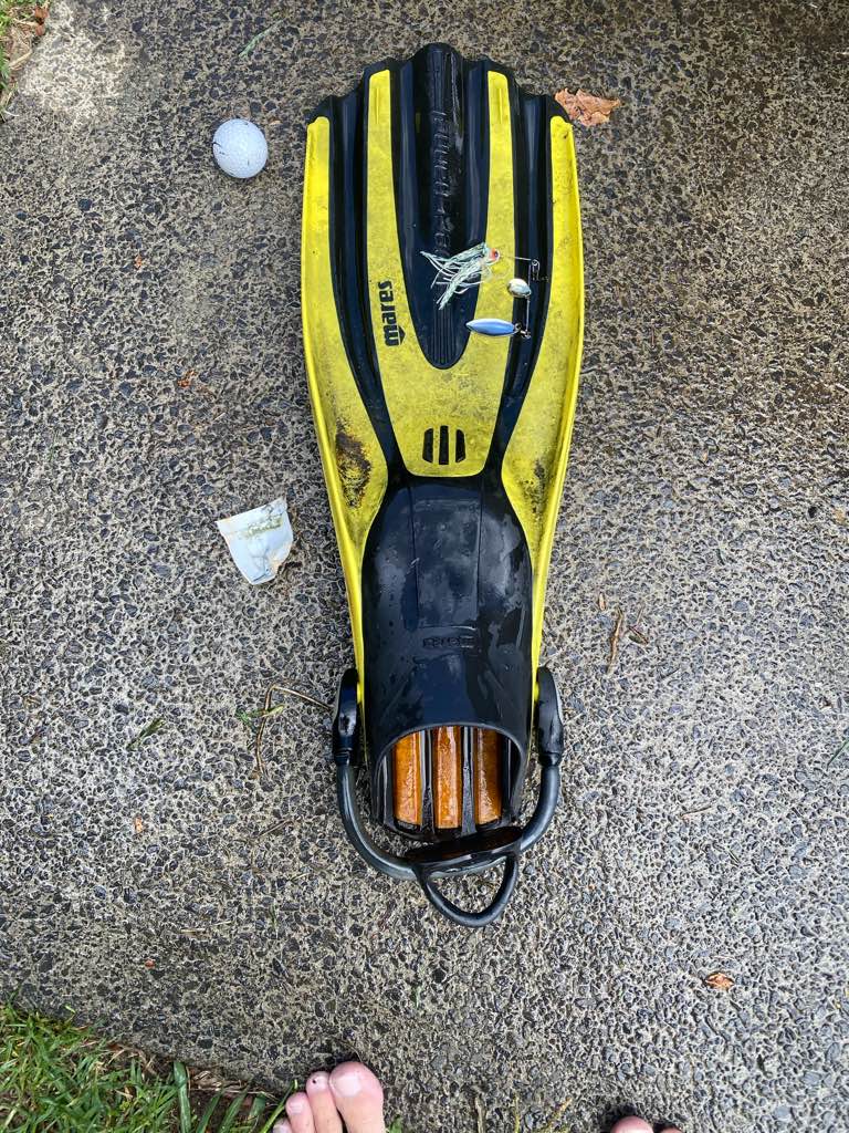
Someone losing their fin
Golf ball
Good
1
Golf Ball
Dive HQ Auckland
Charlie Hampton
0
0
0
0
0
0
0
0
0
0
0
0
0
0
0
0
0
0
0
4
0
0
0
0
0
0
0
0
0
0
0
0
0
0
0
0
0.50
50
10.00
4.00
0
estimated
0
1
40.00
0
0
0
1
0
0
On
kilograms
0
I have debris data to report
0
0
0
Calm (glassy to rippled) for waves 0 – 0.1 meter high
0
0
0
0
0
0
0
m2
0
0
meters
other
0
0
0
0
0
0
0
0
0
0
0
0
0
0
0
0
0
0
0
0
0
0
0
0
0
0
0
0
0
New Zealand
City
Auckland
Map Help


Dive Location

If you know your survey site coordinates, enter them manually in decimal degrees using WGS84 Map Datum. Use the minus sign for latitudes south of the equator and longitudes west of the Prime Meridian to 180 degrees.

If you do not know your survey site coordinates, click the “Map Location” tab to use the map to zoom into your survey site and drop the pin on the map to fall within your survey dive site in the water (not on land or the beach). Ensure you zoom in as much as possible to ensure data accuracy.

Entangled Help


Use the vertical tabs below to record any entangled animals you found of each type.

Ecosystem Other
Reeds

Bari Reef

4
sand

12.164643728772, -68.287256472602

Battery relay box
Dive friends
Sascha Heijnen
1
1
3
1
0.50
47
12.00
5.00
estimated
500.00
2
fishing line
rope
cable ties
On
kilograms
I have debris data to report
Calm (glassy to rippled) for waves 0 – 0.1 meter high m2
2
1
meters
coral reef
1
Netherlands Antilles
Map Help


Dive Location

If you know your survey site coordinates, enter them manually in decimal degrees using WGS84 Map Datum. Use the minus sign for latitudes south of the equator and longitudes west of the Prime Meridian to 180 degrees.

If you do not know your survey site coordinates, click the “Map Location” tab to use the map to zoom into your survey site and drop the pin on the map to fall within your survey dive site in the water (not on land or the beach). Ensure you zoom in as much as possible to ensure data accuracy.

Entangled Help


Use the vertical tabs below to record any entangled animals you found of each type.

Scuba Republic House Reef

1
3

0.44217, 130.75342

sand
Runoff from rain
broken plastic pipe
Occasional afternoon showers (torrential downpours)
1
Hygiene wrapper
Indo Ocean Project
Sabrina Tu
1
1
4
0.20
54
12.00
3.00
measured
10000.00
plastic fragments
plastic wrappers
On
kilograms
I have debris data to report
Calm (glassy to rippled) for waves 0 – 0.1 meter high
0
0
0
0
0
m2
0
meters
coral reef
0
1
Indonesia
State\Province
Raja Ampat
City
Waisai
Map Help


Dive Location

If you know your survey site coordinates, enter them manually in decimal degrees using WGS84 Map Datum. Use the minus sign for latitudes south of the equator and longitudes west of the Prime Meridian to 180 degrees.

If you do not know your survey site coordinates, click the “Map Location” tab to use the map to zoom into your survey site and drop the pin on the map to fall within your survey dive site in the water (not on land or the beach). Ensure you zoom in as much as possible to ensure data accuracy.

Entangled Help


Use the vertical tabs below to record any entangled animals you found of each type.

Crystal Bay

36

-8.715681, 115.457371

-2
sand
3
1
-Sunny with Rains and Clouds
Indo Ocean Project/ Reeflex Divers
Arya
6
3
1
6
2
2
4.00
57
8.90
4.00
2
estimated
700.00
2
1
On
kilograms
I have debris data to report
-1
Calm (glassy to rippled) for waves 0 – 0.1 meter high
2
6
m2
meters
coral reef
5
Indonesia
State\Province
Bali
City
Klungkung
Map Help


Dive Location

If you know your survey site coordinates, enter them manually in decimal degrees using WGS84 Map Datum. Use the minus sign for latitudes south of the equator and longitudes west of the Prime Meridian to 180 degrees.

If you do not know your survey site coordinates, click the “Map Location” tab to use the map to zoom into your survey site and drop the pin on the map to fall within your survey dive site in the water (not on land or the beach). Ensure you zoom in as much as possible to ensure data accuracy.

Entangled Help


Use the vertical tabs below to record any entangled animals you found of each type.

Subscribe to