Menu

Jubilee Jetty - Simons Town harbour

20
30

-34.192333333333, 18.432916666667

8
sand
10
10

-34.192476853446, 18.432918190956

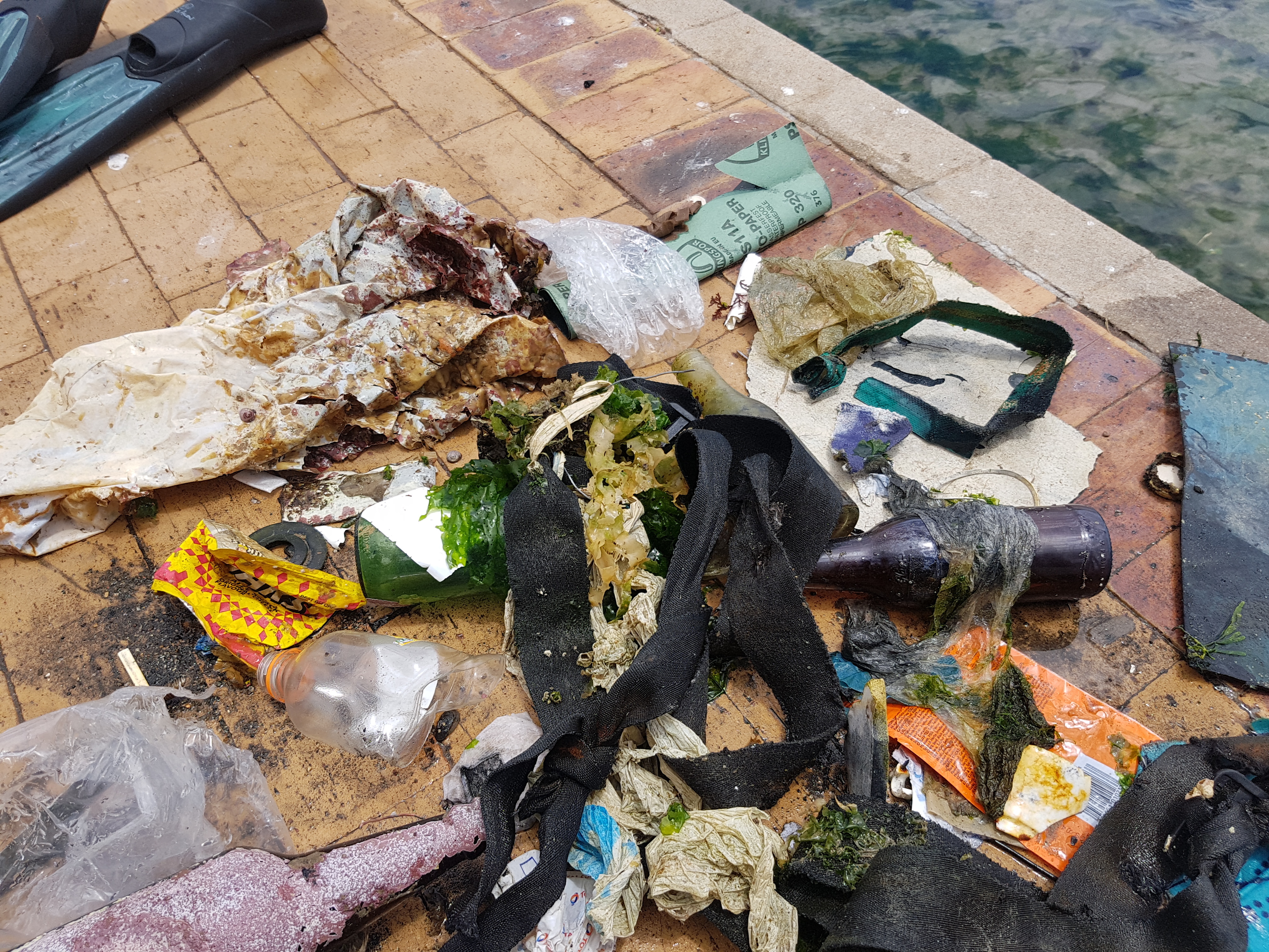
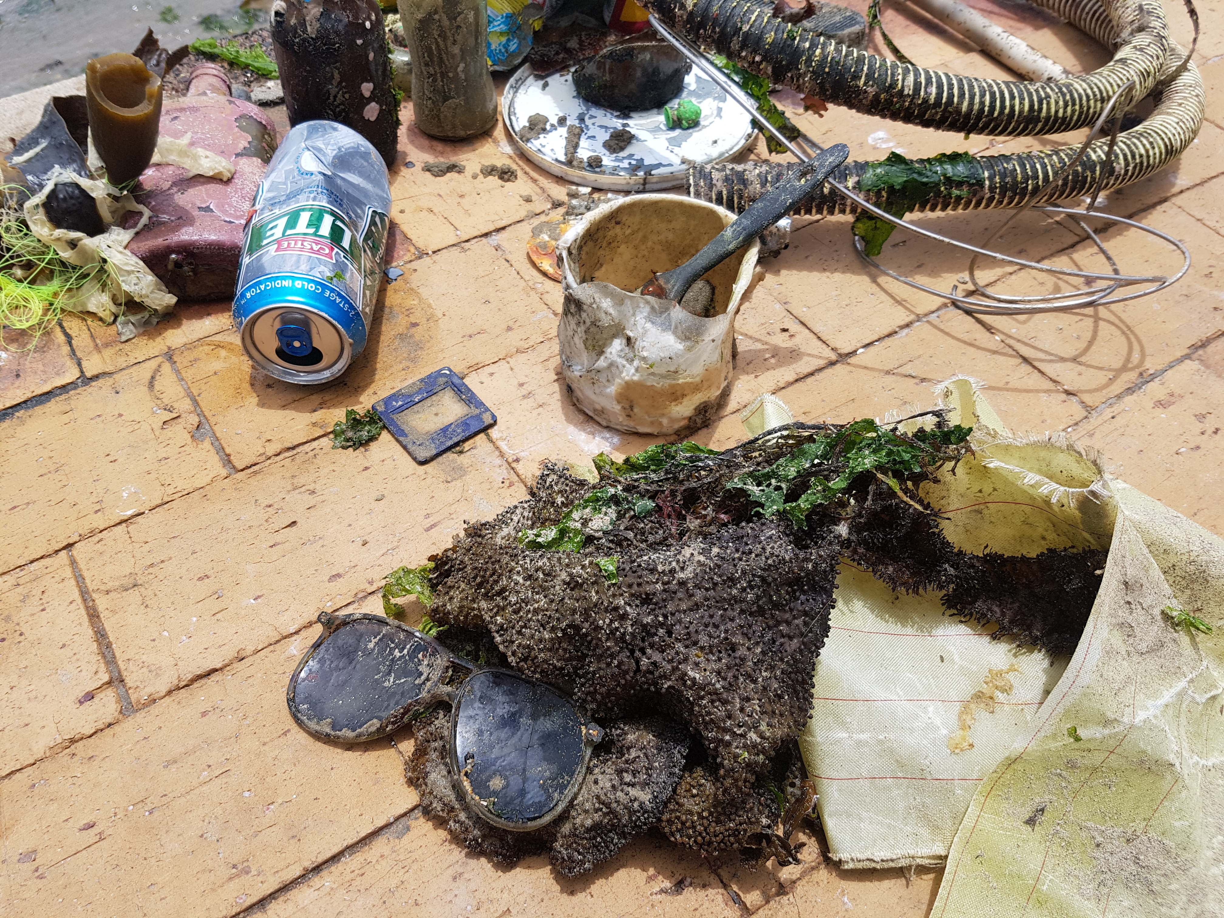
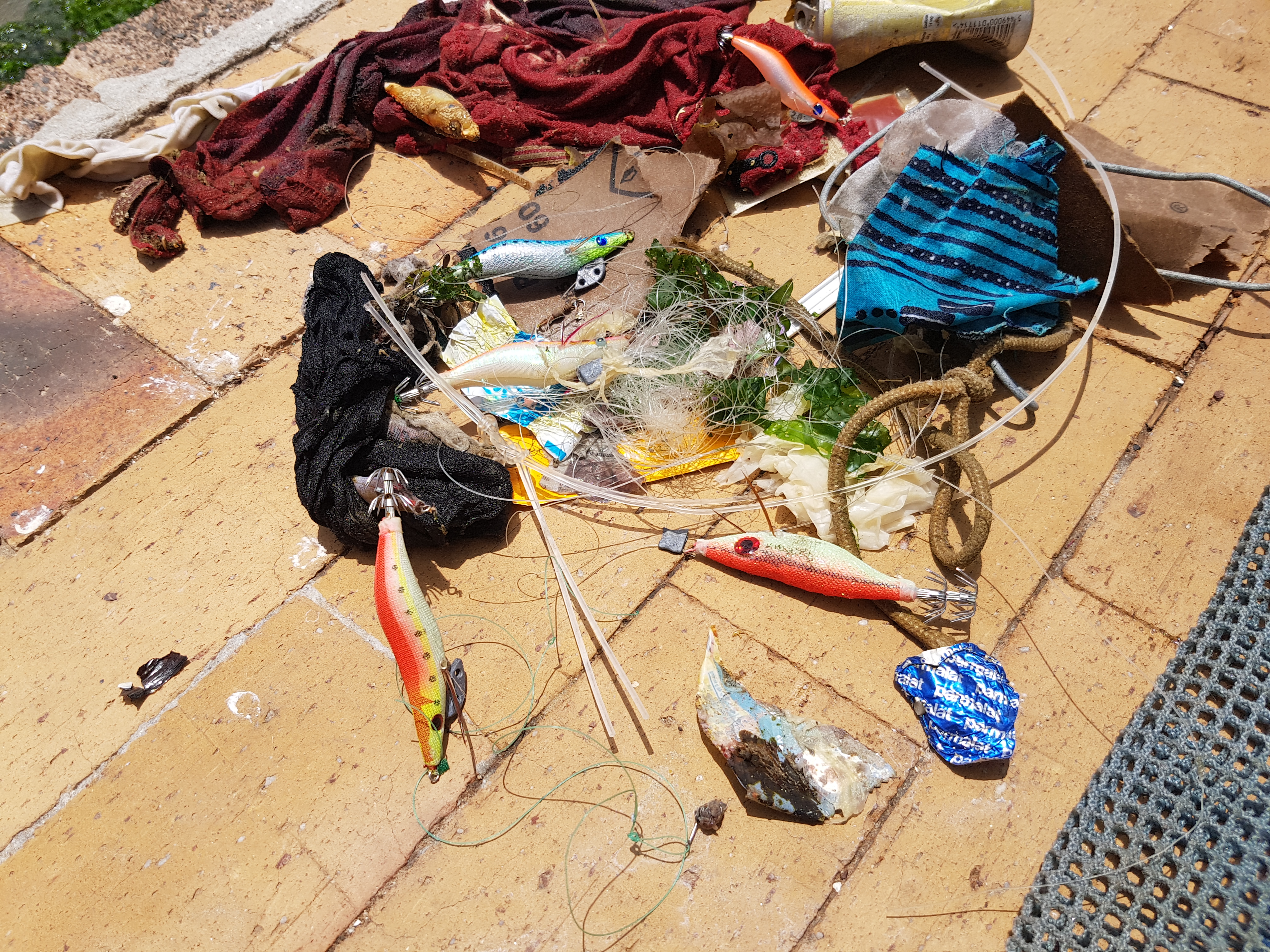
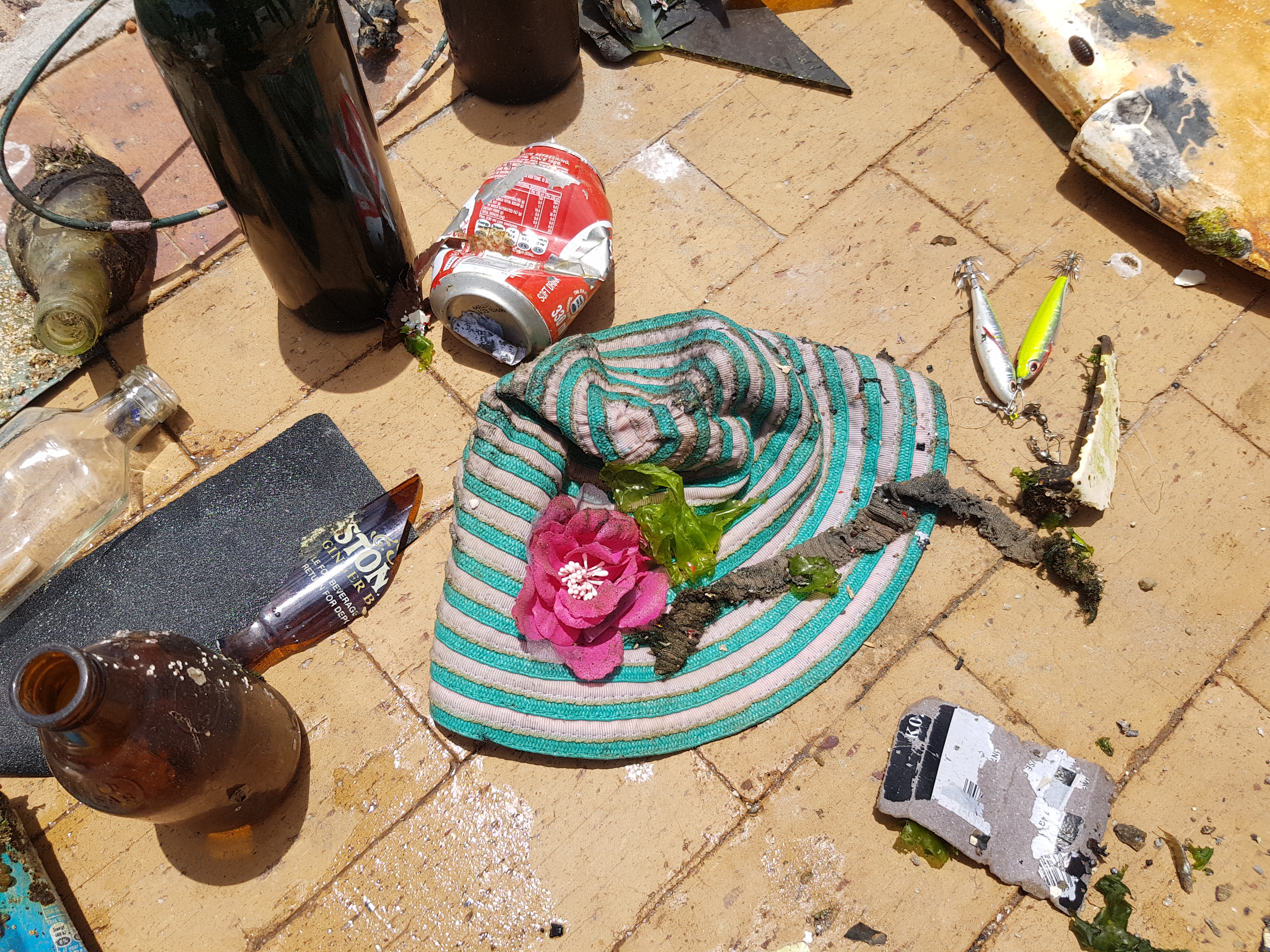
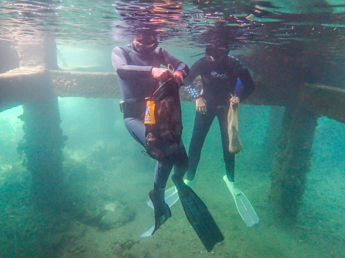
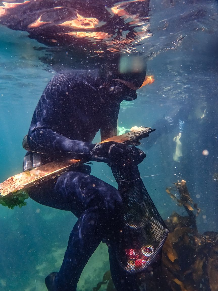
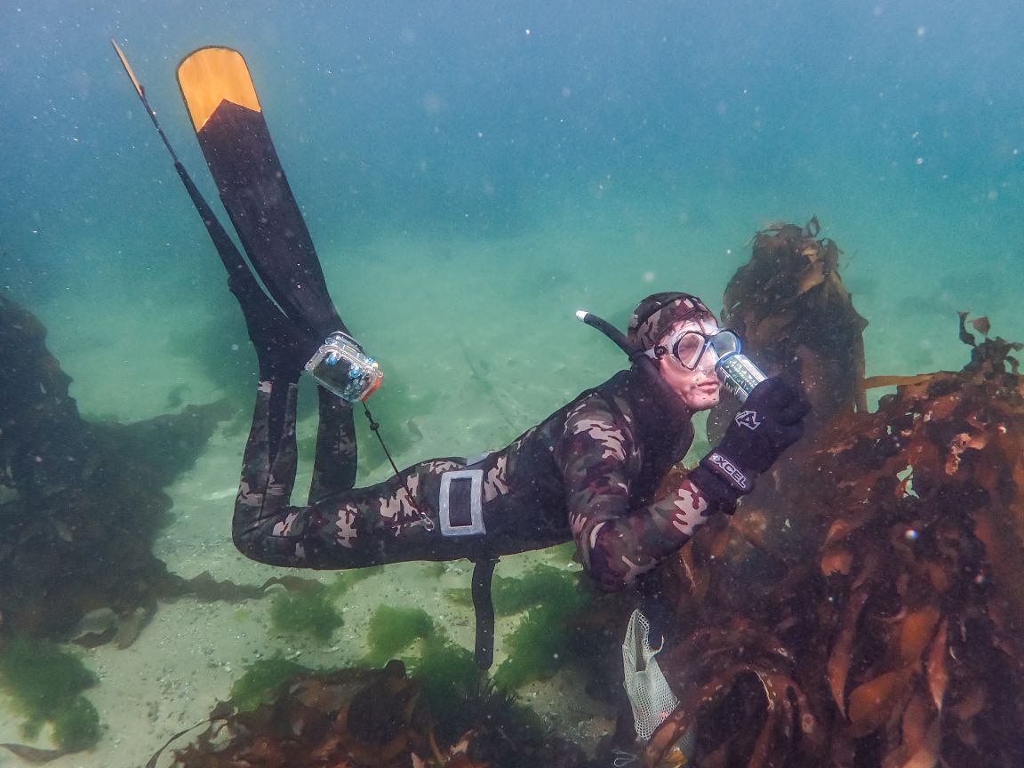
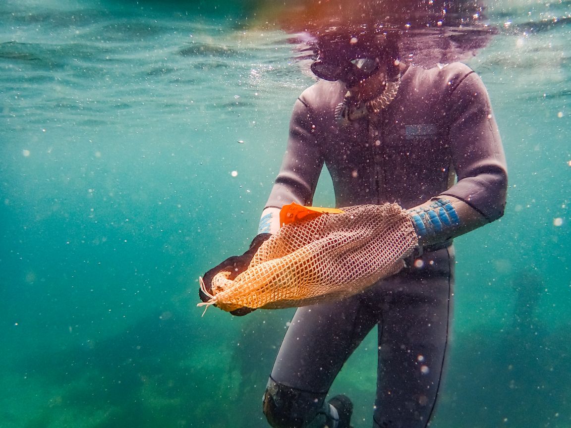
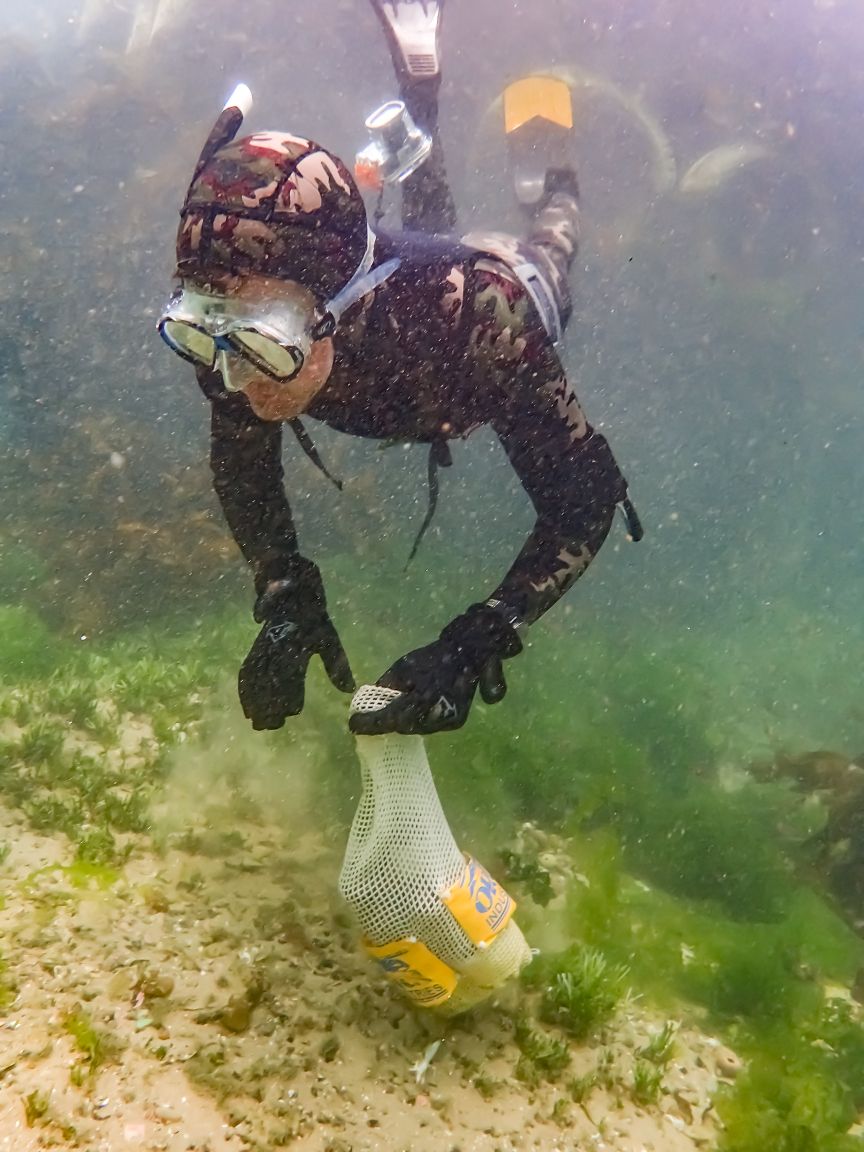
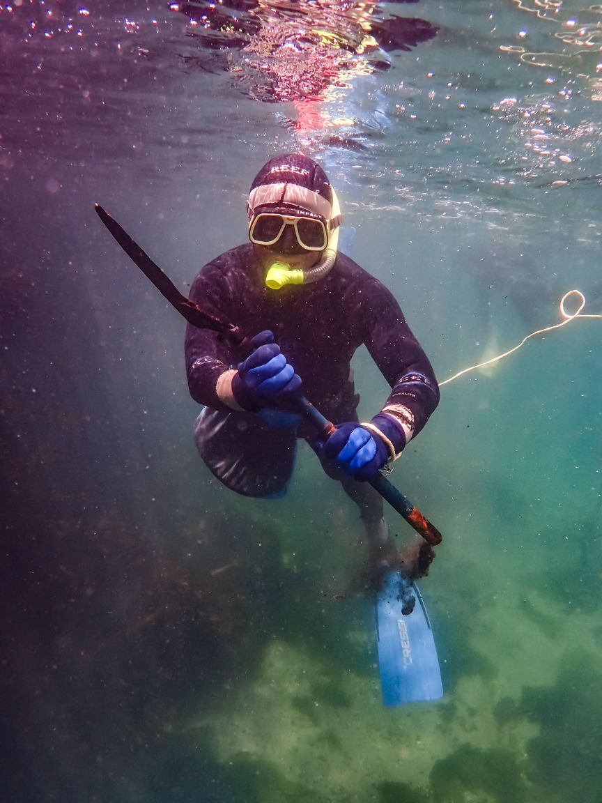
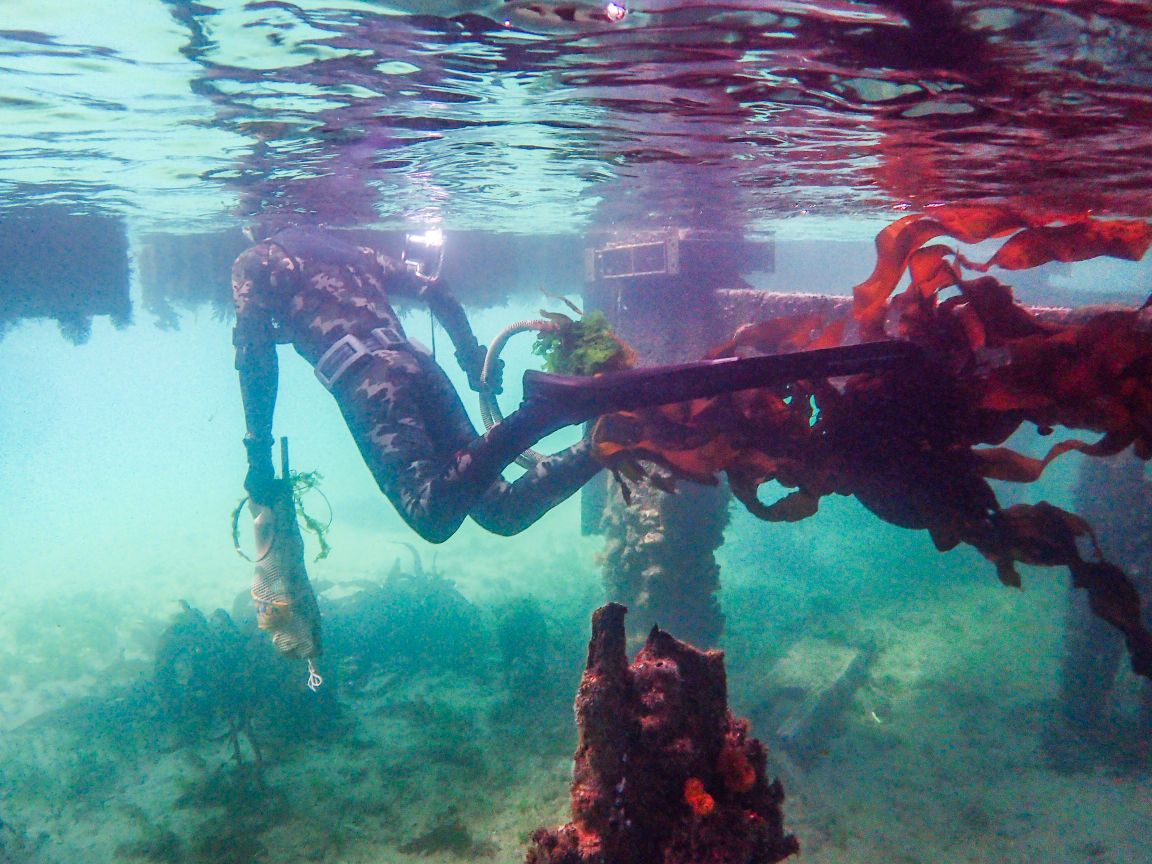
Photo credits:- Group: Johan Pool || Underwater: Collen Burrows & Lisa Beasley || Topside debris: Sharon Martin
No. general use of local yacht club and jetty activity.
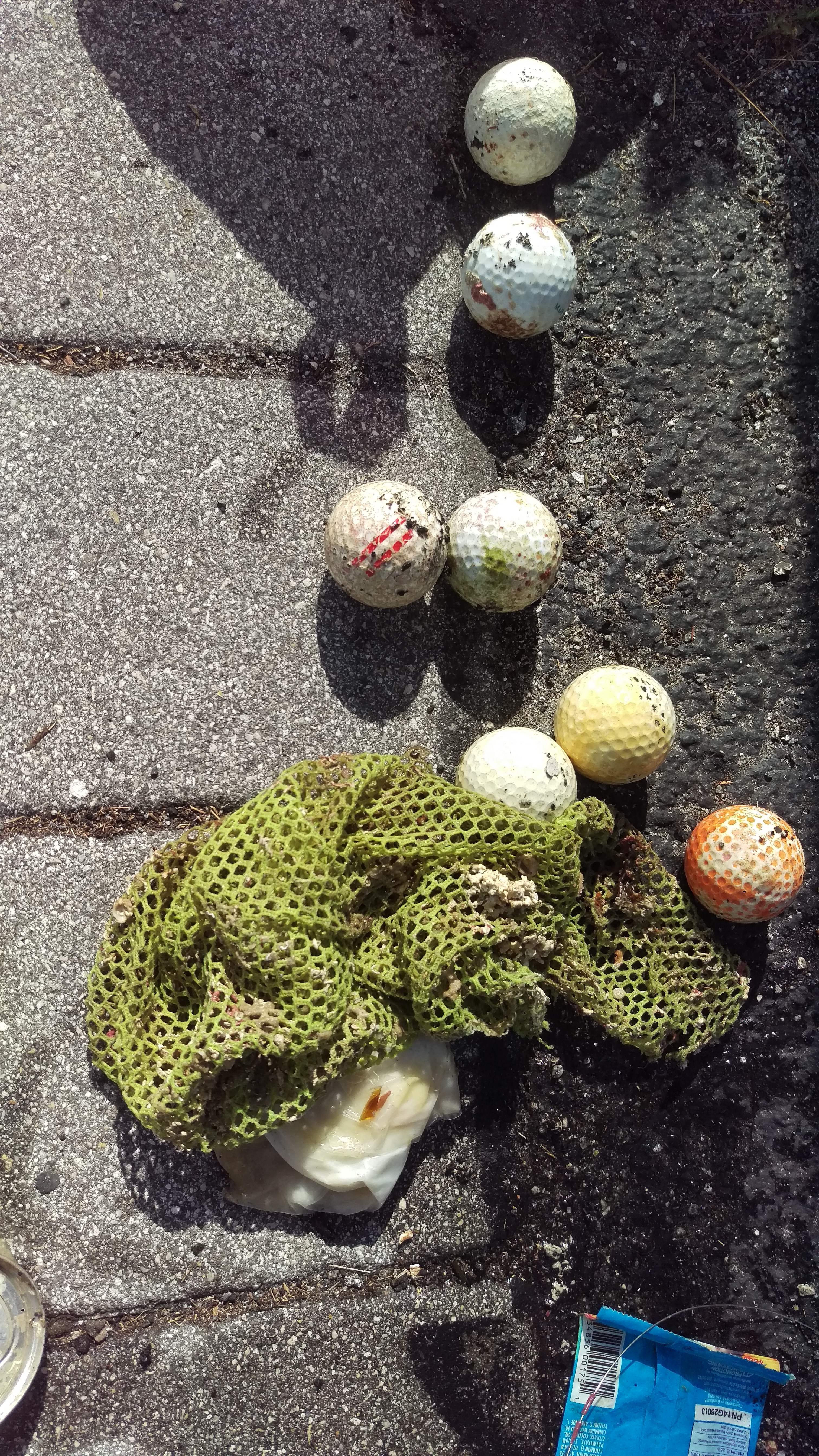
Note: As this was our first "dry-wet" run for Dive Against Debris - the weight and items list is estimated.
Our next dive will have an accurate record of the marine debris collected.

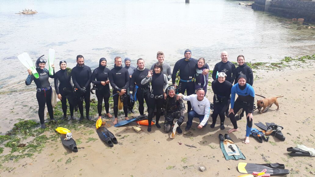
Background to our dive group:
I started our freediving group on Whatsapp approx. 2 years ago, so that new and experienced freedivers were able to find buddies to dive with.
Over time the group has grown to about 30 members, and we freedive most weekends, and sometimes during the week - conditions dependent.
The group also share marine conservation information, attend talks and films, and generally attempt to spread awareness about the oean and the incredible local marine protected areas and unique kelp forests along the Cape Peninsula.

Inspiration for the "Dive Against Debris" - Trailfreedivers "Trash Hunt":
Some of the group went to a local ocean film festival (arranged by Wavescape), where we saw inspiring films like Plastic Ocean and Blue. I had been planning an end-of-year "treasure hunt" dive for the group - but the films really struck a cord with all of us and I decided we should rather do a "TRASH HUNT".

The attendance was more than I expected, and each of the divers (and our shore based friends') dedication to the initiative was truly inspiring.
Yes we were saddened by the marine debris we saw, and removed, but we were also inspired to want to do more.. and I will be arranging another dive in January 2018.

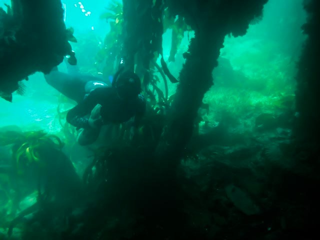
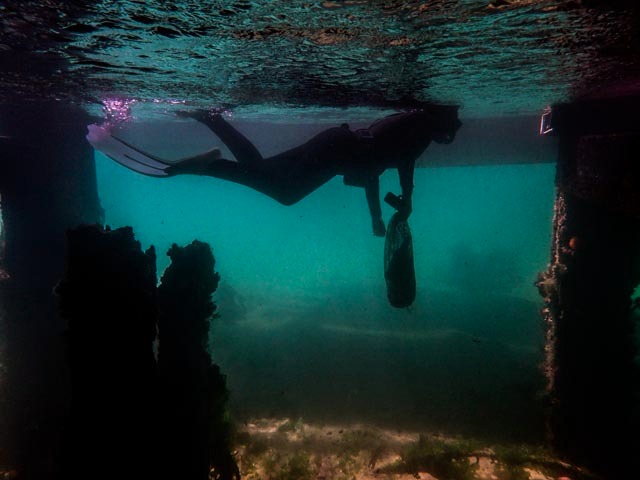
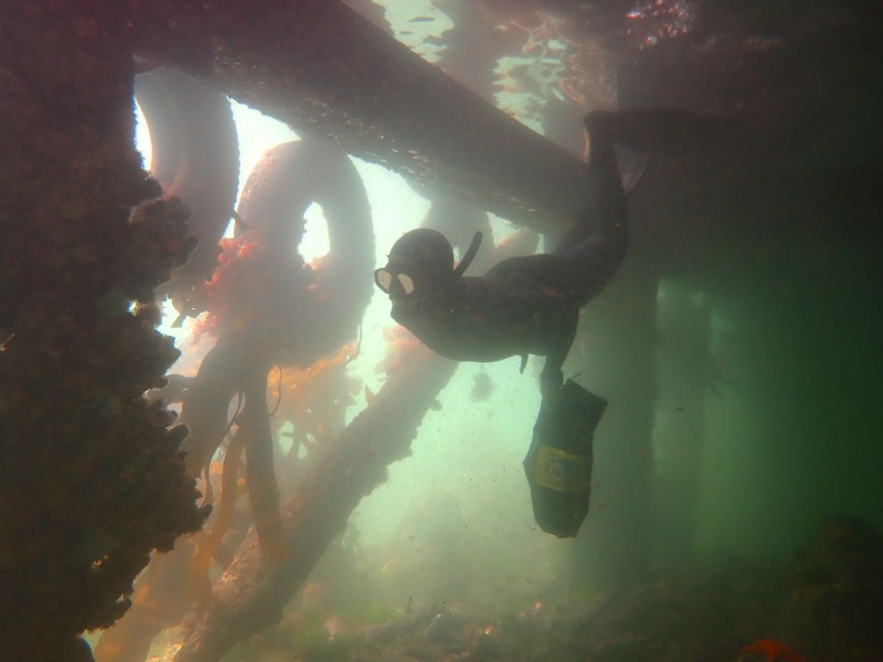
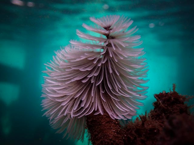
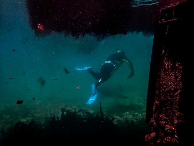
I chose a location (a municipal jetty near a yacht club, alongside the navy harbour) because I expected a great deal of trash there, and we did find a lot.. but we were also pleasantly suprised at how beautiful it was under and around the jetty. We encountered a lot of marine life- from shy sharks (endemic cat sharks), crabs, different fish species, octopus, fan worms and nudibranchs etc.
We feel that the conservation message has been well received both via sharing images on social media and even with onlookers on the day; where we, and our friends and family on the shore, explained to the public what we were doing.

Through this event, and sharing the images and stories, we know that we have raised awareness around the dire issues caused by marine pollution. All in attendance are looking forward to the next Dive Against Debris, and I do think we will have more divers next time!
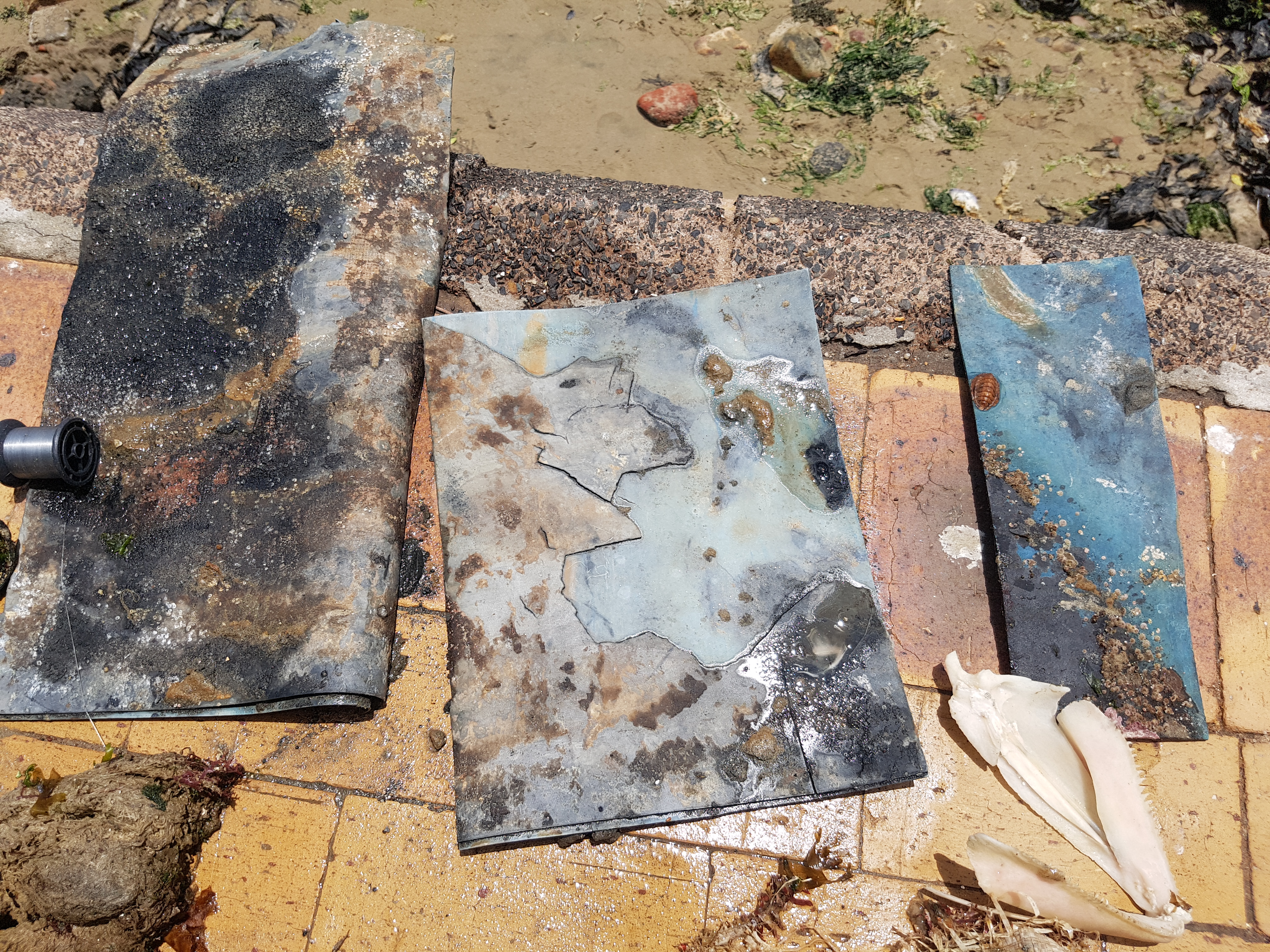
The very young shark had clearly tried to ingest some of the fibreglass and it was lodged in its mouth. The material was removed and the shark set free, however it was very weak, so we do not know if it survived.
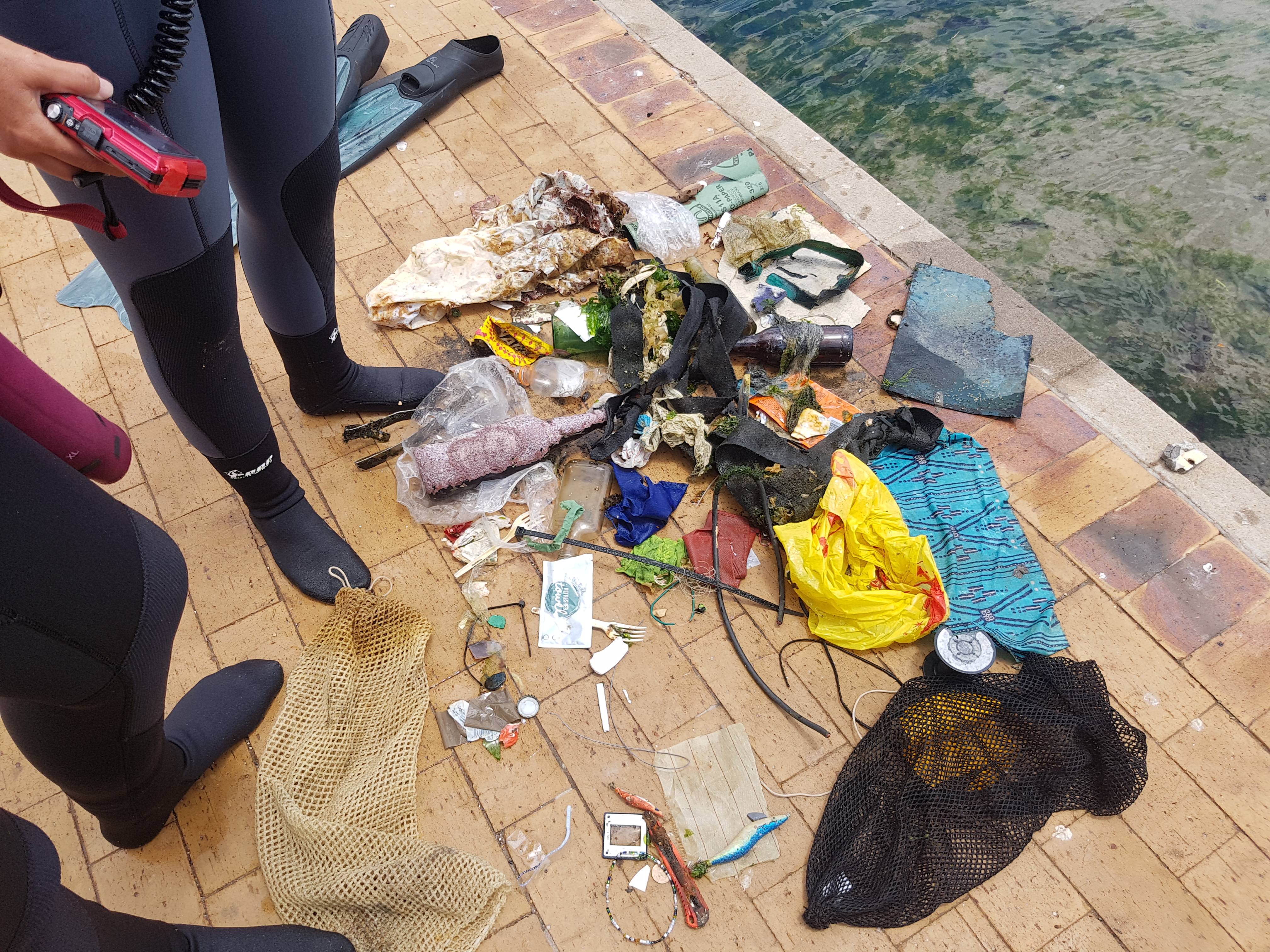
A metal tool about 1.5m long.
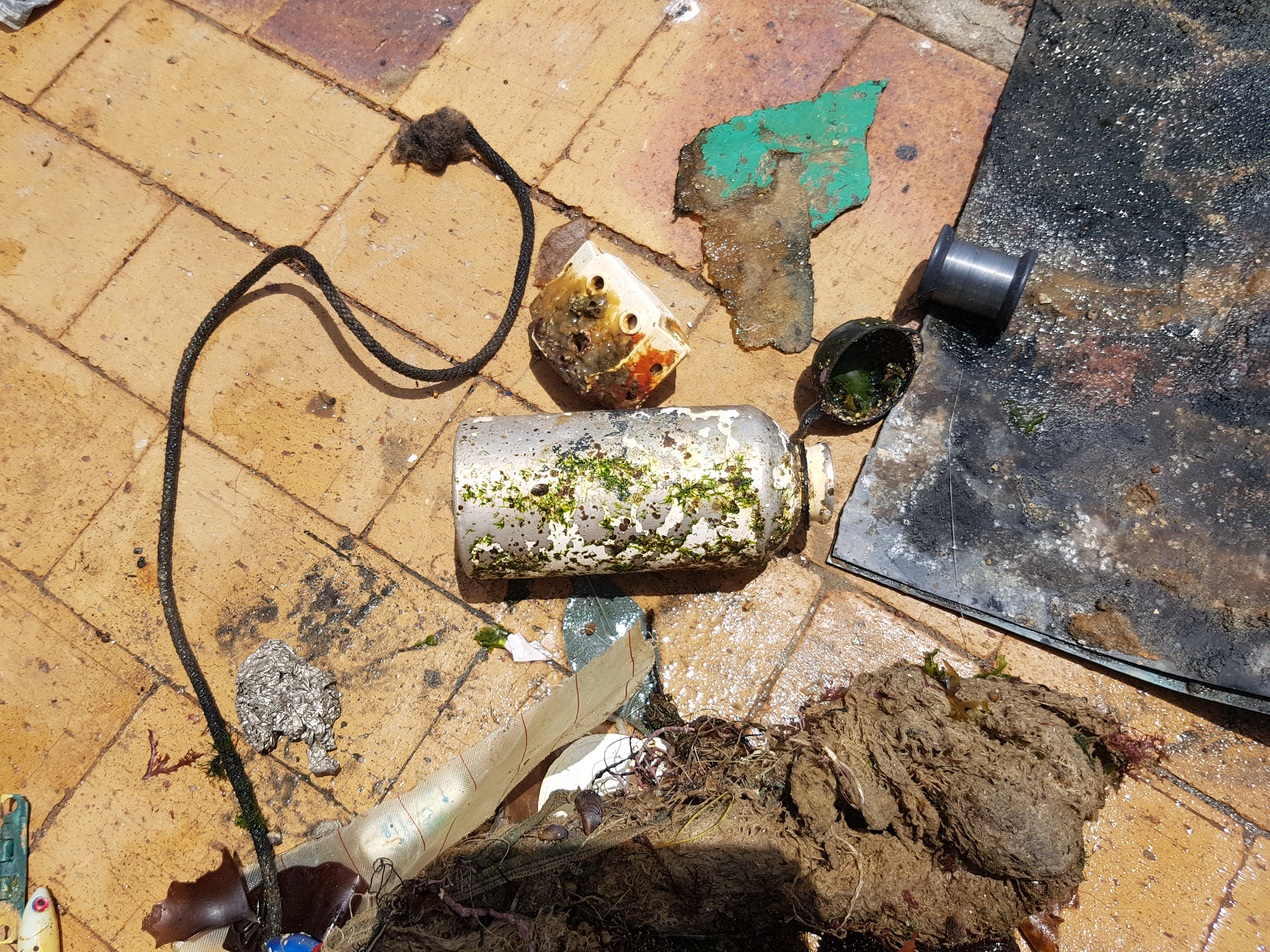
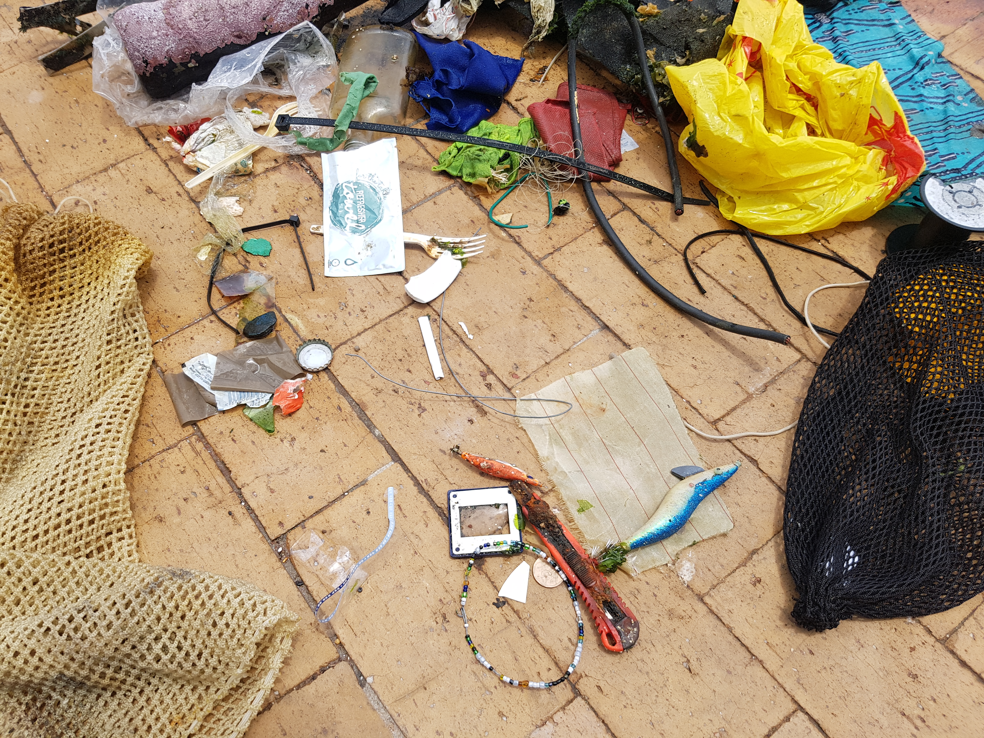
Debris was collected in protected harbour area.
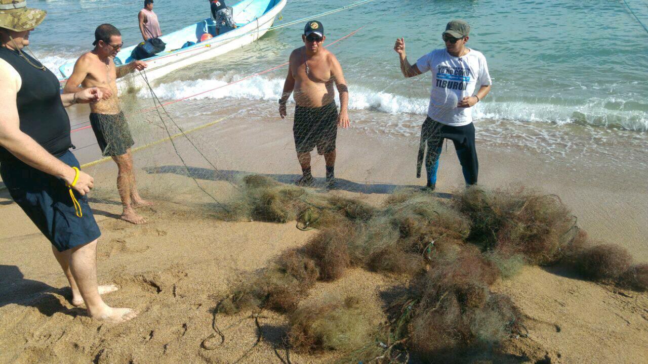
In the open water there was a strong south easterly wind and medium size swell.
Water temp 17C.
Trail Freedivers (informal dive group)
Sharon Lee Martin
1
5
1
5
1
5
16
10
25.00
60
5.00
0.20
5
estimated
15
6831.13
gut, hooks and lures (with multiple hooks) - still dangerous to marine life
plastic bags - always an issue for marine life
fibreglass sheeting - as per the notes above about the fibreglass stuck in shark's mouth
On
kilograms
I have debris data to report
15
Calm (glassy to rippled) for waves 0 – 0.1 meter high
1
1
fibreglass sheet
1
Released Unharmed
Puffadder Shy Shark (endemic small cat shark) - not mammal
5
m2
5
meters
kelp
2
1
10
3
1
15
5
1
1
South Africa
State\Province
Western Cape
City
Cape Town
Map Help


Dive Location

If you know your survey site coordinates, enter them manually in decimal degrees using WGS84 Map Datum. Use the minus sign for latitudes south of the equator and longitudes west of the Prime Meridian to 180 degrees.

If you do not know your survey site coordinates, click the “Map Location” tab to use the map to zoom into your survey site and drop the pin on the map to fall within your survey dive site in the water (not on land or the beach). Ensure you zoom in as much as possible to ensure data accuracy.

Entangled Help


Use the vertical tabs below to record any entangled animals you found of each type.

La Balsa Park

0
0
0
0

-26.685822, 153.134631

3
0
0
silt
1
0
0
15
0
River mouth.
No
Tyres seen but already well inhabited. Crab pot seen but unable to retrieve.
Fishing rods
Heavy rain/storms
1
Coin
Elliot Peters
0
0
0
0
0
0
0
0
0
0
0
0
0
0
0
0
0
0
0
1
0
0
0
0
0
0
0
0
0
0
0
0
1
0
0
0
3.00
60
6.00
2.00
0
estimated
0
0
0
10
505.61
0
0
0
0
0
Fishing line and hooks
0
On
kilograms
0
I have debris data to report
1
0
0
Calm (glassy to rippled) for waves 0 – 0.1 meter high
0
0
0
0
0
0
0
m2
0
0
meters
other
0
0
0
0
0
0
0
0
0
0
0
0
0
0
0
0
0
1
0
0
0
0
1
0
0
0
0
0
0
Australia
State\Province
Queensland
City
Buddina
Map Help


Dive Location

If you know your survey site coordinates, enter them manually in decimal degrees using WGS84 Map Datum. Use the minus sign for latitudes south of the equator and longitudes west of the Prime Meridian to 180 degrees.

If you do not know your survey site coordinates, click the “Map Location” tab to use the map to zoom into your survey site and drop the pin on the map to fall within your survey dive site in the water (not on land or the beach). Ensure you zoom in as much as possible to ensure data accuracy.

Entangled Help


Use the vertical tabs below to record any entangled animals you found of each type.

Ακτή Ξενία,Κουρσάρος,Κασσάνδρα,Χαλκιδική

1
seagrass

39.960292416563, 23.683353066444

Skopelos Dive Center
Kimon Papadimitriou
2
0.20
43
13.00
1.00
estimated
20041.30
On
kilograms
I have debris data to report
Smooth (wavelets) for waves 0.1 - 0.5 meter high m2
meters
rocky reef
Greece
City
Thessaloniki
Map Help


Dive Location

If you know your survey site coordinates, enter them manually in decimal degrees using WGS84 Map Datum. Use the minus sign for latitudes south of the equator and longitudes west of the Prime Meridian to 180 degrees.

If you do not know your survey site coordinates, click the “Map Location” tab to use the map to zoom into your survey site and drop the pin on the map to fall within your survey dive site in the water (not on land or the beach). Ensure you zoom in as much as possible to ensure data accuracy.

Entangled Help


Use the vertical tabs below to record any entangled animals you found of each type.

ADS127 - Muka Kampung Bunaken Island

1

1.593708, 124.777075

1
coral
3
All guests and staff were happy to help!
the currents and the divesite is in front of the village with a lot of boat traffice like ferries and fishermen
There was actually not much debris on the divesite but we found a big heave ropy of about 20kg.
in raining season now and it is raining a lot
Two Fish Divers, Bunaken
Markus Reinhardt
1
9
28.00
45
12.00
1.00
measured
300.00
1
robe
plastic bottles
diapers
On
kilograms
I have debris data to report
Slight for waves 0.5 -1.25 meter high
1
1
m2
3
meters
coral reef
1
2
Indonesia
State\Province
North Sulawesi
City
Bunaken Island
Map Help


Dive Location

If you know your survey site coordinates, enter them manually in decimal degrees using WGS84 Map Datum. Use the minus sign for latitudes south of the equator and longitudes west of the Prime Meridian to 180 degrees.

If you do not know your survey site coordinates, click the “Map Location” tab to use the map to zoom into your survey site and drop the pin on the map to fall within your survey dive site in the water (not on land or the beach). Ensure you zoom in as much as possible to ensure data accuracy.

Entangled Help


Use the vertical tabs below to record any entangled animals you found of each type.

ADS272 - Skår Gullmarn

0
0
0
1

58.297812, 11.531132

0
0
0
silt
0
0
0
1
0
Oxygene Diving Göteborg
Jonas Ekström
0
0
0
0
0
0
0
0
0
0
0
0
1
0
0
0
0
0
0
2
0
0
0
0
0
0
0
0
0
0
0
0
0
0
0
0
0.50
45
25.00
15.00
1
estimated
0
0
0
0
300.00
0
0
0
0
0
0
On
kilograms
0
I have debris data to report
0
0
0
Smooth (wavelets) for waves 0.1 - 0.5 meter high
0
0
0
0
0
0
0
m2
0
0
meters
other
0
0
0
0
0
0
0
0
0
0
0
0
0
0
0
0
0
0
0
0
0
0
0
0
0
0
0
0
0
Sweden
Map Help


Dive Location

If you know your survey site coordinates, enter them manually in decimal degrees using WGS84 Map Datum. Use the minus sign for latitudes south of the equator and longitudes west of the Prime Meridian to 180 degrees.

If you do not know your survey site coordinates, click the “Map Location” tab to use the map to zoom into your survey site and drop the pin on the map to fall within your survey dive site in the water (not on land or the beach). Ensure you zoom in as much as possible to ensure data accuracy.

Entangled Help


Use the vertical tabs below to record any entangled animals you found of each type.

ADS313 - Turtle Rock

rock

-19.990025878046, 57.57264001295

Hot and dry
Ocean Spirit
Bryan Haggerty
2
0.00
55
18.00
12.00
measured
400.00
On
kilograms
Our Survey Site was free of debris
Slight for waves 0.5 -1.25 meter high m2
meters
rocky reef
Mauritius
City
Pereybere
Map Help


Dive Location

If you know your survey site coordinates, enter them manually in decimal degrees using WGS84 Map Datum. Use the minus sign for latitudes south of the equator and longitudes west of the Prime Meridian to 180 degrees.

If you do not know your survey site coordinates, click the “Map Location” tab to use the map to zoom into your survey site and drop the pin on the map to fall within your survey dive site in the water (not on land or the beach). Ensure you zoom in as much as possible to ensure data accuracy.

Entangled Help


Use the vertical tabs below to record any entangled animals you found of each type.

Blue Grotto

2
silt

29.387941640347, -82.486580014229

EASE
Joe Laposta
2
0.10
30
30.00
15.00
estimated
500.00
On
pounds
I have debris data to report
Calm (glassy to rippled) for waves 0 – 0.1 meter high ft2
feet
other
United States
State\Province
FL
City
Williston
Map Help


Dive Location

If you know your survey site coordinates, enter them manually in decimal degrees using WGS84 Map Datum. Use the minus sign for latitudes south of the equator and longitudes west of the Prime Meridian to 180 degrees.

If you do not know your survey site coordinates, click the “Map Location” tab to use the map to zoom into your survey site and drop the pin on the map to fall within your survey dive site in the water (not on land or the beach). Ensure you zoom in as much as possible to ensure data accuracy.

Entangled Help


Use the vertical tabs below to record any entangled animals you found of each type.

Ecosystem Other
FW Spring

Baghram Dive Site, West Palm Beach Florida

26.719505, -80.024117

2
coral
10
No specific event tied to waste. Large amounts of fishing line, 1/2"-/1" rope, anchors, cloth, anchors, large metal food cans, large sections of wood and fiberglass fragments
Thank you for making the debris survey easy to fill out and submit!
Golf balls
Calm surface conditions, mild current
7
Golf Balls
Stephen Frederick
1
5
2
5.00
68
79.00
64.00
estimated
3
600.00
Fishing Line
Rope
Metal Cans
On
pounds
I have debris data to report
2
Calm (glassy to rippled) for waves 0 – 0.1 meter high
1
ft2
feet
rocky reef
5
United States
Map Help


Dive Location

If you know your survey site coordinates, enter them manually in decimal degrees using WGS84 Map Datum. Use the minus sign for latitudes south of the equator and longitudes west of the Prime Meridian to 180 degrees.

If you do not know your survey site coordinates, click the “Map Location” tab to use the map to zoom into your survey site and drop the pin on the map to fall within your survey dive site in the water (not on land or the beach). Ensure you zoom in as much as possible to ensure data accuracy.

Entangled Help


Use the vertical tabs below to record any entangled animals you found of each type.

Las 3 Cruces, Punta Remedios

0
0
0
58

13.530667, -89.847889

0
0
0
rock
0
0
0
0
0
Lost fishing net
330 feet of fishing net
Lead weight
Calm
SubAqua
Jose Baires
0
0
0
0
0
0
0
0
0
0
0
0
0
0
0
0
0
0
0
5
0
0
0
0
0
0
0
0
0
0
0
0
0
0
0
0
58.00
40
15.00
12.00
0
measured
0
0
0
0
400.00
0
0
0
0
0
Entangled net
0
On
pounds
0
I have debris data to report
0
0
0
Calm (glassy to rippled) for waves 0 – 0.1 meter high
0
0
0
Fishing net
Dead
Puffer Fish
Conch
Dead
1
3
Fishing net
0
0
0
0
m2
0
0
meters
rocky reef
0
0
0
0
0
0
0
0
0
0
0
0
0
0
0
0
0
0
0
0
0
0
0
0
0
0
0
0
0
El Salvador
State\Province
Sonsonate
City
Acajutla
Map Help


Dive Location

If you know your survey site coordinates, enter them manually in decimal degrees using WGS84 Map Datum. Use the minus sign for latitudes south of the equator and longitudes west of the Prime Meridian to 180 degrees.

If you do not know your survey site coordinates, click the “Map Location” tab to use the map to zoom into your survey site and drop the pin on the map to fall within your survey dive site in the water (not on land or the beach). Ensure you zoom in as much as possible to ensure data accuracy.

Entangled Help


Use the vertical tabs below to record any entangled animals you found of each type.

ADS334 - Mangel Halto

1
1

12.465054, -69.970241

sand
Children's birthdays and party boats/snorkeling tours
A bathroom tile
None to little wind, rainy, flat waters.
Happy Divers Aruba
Lisa de Jong
1
8
3
10
2.50
75
15.00
6.00
estimated
1801.60
Beerbottles
Plastic cups
Cans
1
On
kilograms
I have debris data to report
12
Calm (glassy to rippled) for waves 0 – 0.1 meter high m2
meters
mangroves
1
15
1
Aruba
State\Province
Noord
City
Noord
Map Help


Dive Location

If you know your survey site coordinates, enter them manually in decimal degrees using WGS84 Map Datum. Use the minus sign for latitudes south of the equator and longitudes west of the Prime Meridian to 180 degrees.

If you do not know your survey site coordinates, click the “Map Location” tab to use the map to zoom into your survey site and drop the pin on the map to fall within your survey dive site in the water (not on land or the beach). Ensure you zoom in as much as possible to ensure data accuracy.

Entangled Help


Use the vertical tabs below to record any entangled animals you found of each type.

Subscribe to