Menu

ADS534 - Shallow Plane

0
0
0
0

18.313369, -78.366275

0
0
0
coral
0
0
0
0
0
Beaches Negril
Glenroy Graham
0
0
0
0
0
0
0
0
0
0
0
0
0
0
0
0
0
0
0
5
0
0
0
0
0
0
0
0
0
0
0
0
0
0
0
0
1.00
45
40.00
30.00
0
estimated
0
0
0
0
248.85
0
0
0
0
0
0
On
pounds
0
I have debris data to report
1
0
0
Smooth (wavelets) for waves 0.1 - 0.5 meter high
0
0
0
0
0
0
0
m2
0
0
feet
coral reef
0
0
0
0
0
0
0
0
0
0
0
0
0
0
0
0
0
0
0
0
0
0
0
0
0
0
0
0
0
Jamaica
State\Province
Westmoreland
City
Negril
Map Help


Dive Location

If you know your survey site coordinates, enter them manually in decimal degrees using WGS84 Map Datum. Use the minus sign for latitudes south of the equator and longitudes west of the Prime Meridian to 180 degrees.

If you do not know your survey site coordinates, click the “Map Location” tab to use the map to zoom into your survey site and drop the pin on the map to fall within your survey dive site in the water (not on land or the beach). Ensure you zoom in as much as possible to ensure data accuracy.

Entangled Help


Use the vertical tabs below to record any entangled animals you found of each type.

Carib Sand

0
0
0
0

18.521693, -77.878171

0
0
0
coral
0
0
0
0
0
Sandals Royal Caribbean
Fabian Forbes
0
0
0
0
0
0
0
0
0
0
0
0
0
0
0
0
0
0
0
6
0
0
0
0
0
0
2
0
0
0
0
0
0
0
0
0
2.00
45
45.00
35.00
0
estimated
0
0
0
0
215.00
0
0
0
0
0
0
On
pounds
0
I have debris data to report
0
0
0
Calm (glassy to rippled) for waves 0 – 0.1 meter high
0
0
0
0
0
0
0
m2
0
0
feet
coral reef
0
0
0
0
0
0
0
0
0
0
0
0
0
0
0
0
0
0
0
0
0
0
2
0
0
0
0
0
0
Jamaica
State\Province
St James
City
Montego Bay
Map Help


Dive Location

If you know your survey site coordinates, enter them manually in decimal degrees using WGS84 Map Datum. Use the minus sign for latitudes south of the equator and longitudes west of the Prime Meridian to 180 degrees.

If you do not know your survey site coordinates, click the “Map Location” tab to use the map to zoom into your survey site and drop the pin on the map to fall within your survey dive site in the water (not on land or the beach). Ensure you zoom in as much as possible to ensure data accuracy.

Entangled Help


Use the vertical tabs below to record any entangled animals you found of each type.

Ok-A-Beh, Bighorn Canyon Natl Rec Monument, Montana, USA

10

45.304085, -107.97301

rock
3
5

45.3049987, -107.9736006

Spare tire and half a fish cleaning table
Cold, partly sunny to rainy conditions
Adventure Scuba
Nic Besel
1
2
2
3
2
2
64.00
46
110.00
3.00
measured
1024.00
1
Al cans
Can package
On
pounds
I have debris data to report
Smooth (wavelets) for waves 0.1 - 0.5 meter high
5
m2
1
feet
other
5
2
9
United States
State\Province
MT
City
Billings
Map Help


Dive Location

If you know your survey site coordinates, enter them manually in decimal degrees using WGS84 Map Datum. Use the minus sign for latitudes south of the equator and longitudes west of the Prime Meridian to 180 degrees.

If you do not know your survey site coordinates, click the “Map Location” tab to use the map to zoom into your survey site and drop the pin on the map to fall within your survey dive site in the water (not on land or the beach). Ensure you zoom in as much as possible to ensure data accuracy.

Entangled Help


Use the vertical tabs below to record any entangled animals you found of each type.

Ecosystem Other
Man-made reservoir

ADS531 - Billy's Grotto

0
0
0
0

17.089162752109, -61.931308186361

0
0
0
coral
0
0
0
0
0
Sandals Grande Antigua (store number 7109)
Maurice Watson
0
0
0
2
0
0
0
0
0
0
0
0
0
0
0
0
0
0
0
4
0
0
0
0
0
0
3
0
0
0
0
0
0
0
0
0
4.00
42
55.00
40.00
0
estimated
0
0
0
0
200.00
0
0
0
0
0
Glass bottles
Plastic
0
On
pounds
0
I have debris data to report
3
0
0
Slight for waves 0.5 -1.25 meter high
0
0
0
0
0
0
0
ft2
0
0
feet
coral reef
0
0
0
0
0
0
0
0
0
0
0
0
0
0
0
0
0
0
0
0
0
0
0
0
0
0
0
0
0
Antigua and Barbuda
City
St Johns
Map Help


Dive Location

If you know your survey site coordinates, enter them manually in decimal degrees using WGS84 Map Datum. Use the minus sign for latitudes south of the equator and longitudes west of the Prime Meridian to 180 degrees.

If you do not know your survey site coordinates, click the “Map Location” tab to use the map to zoom into your survey site and drop the pin on the map to fall within your survey dive site in the water (not on land or the beach). Ensure you zoom in as much as possible to ensure data accuracy.

Entangled Help


Use the vertical tabs below to record any entangled animals you found of each type.

ADS175 - Blue Bay

0
0
0

35.031984, 34.042372

0
0
0
sand
0
0
0
0
0
0
0
0
0
0
0
0
0
0
0
0
0
0
0
0
0
0
0
0
0
Taba Diving Centre
Manuel Vollmer
0
0
0
0
0
0
0
0
0
0
0
0
0
0
0
0
0
0
0
3
0
0
0
0
0
0
0
0
0
0
0
0
0
0
1.00
45
6.00
1.00
0
estimated
0
0
200.00
0
0
0
0
0
1
On
kilograms
0
I have debris data to report
1
0
0
Calm (glassy to rippled) for waves 0 – 0.1 meter high
0
0
2
0
0
0
0
m2
0
0
meters
rocky reef
0
0
0
0
0
0
0
0
0
0
0
0
0
0
0
0
0
0
0
0
0
0
0
0
0
0
0
0
Cyprus
City
Protaras
Map Help


Dive Location

If you know your survey site coordinates, enter them manually in decimal degrees using WGS84 Map Datum. Use the minus sign for latitudes south of the equator and longitudes west of the Prime Meridian to 180 degrees.

If you do not know your survey site coordinates, click the “Map Location” tab to use the map to zoom into your survey site and drop the pin on the map to fall within your survey dive site in the water (not on land or the beach). Ensure you zoom in as much as possible to ensure data accuracy.

Entangled Help


Use the vertical tabs below to record any entangled animals you found of each type.

ADS175 - Blue Bay

0
0
0

35.031984, 34.042372

0
0
0
sand
0
0
0
0
0
0
0
0
0
0
0
0
0
0
0
0
0
0
0
0
0
0
0
0
0
Taba Diving Centre
Manuel Vollmer
0
0
0
0
0
0
0
0
0
0
0
0
0
0
0
0
0
0
0
4
0
0
2
0
0
0
0
0
0
0
0
0
0
0
3.00
45
6.00
1.00
0
estimated
0
0
200.00
0
0
0
0
0
0
On
kilograms
0
I have debris data to report
0
0
0
Calm (glassy to rippled) for waves 0 – 0.1 meter high
0
0
1
0
0
0
0
m2
3
1
meters
rocky reef
0
0
0
0
0
0
0
0
0
0
0
0
0
0
0
0
5
0
0
0
0
0
0
0
0
0
0
0
Cyprus
City
Protaras
Map Help


Dive Location

If you know your survey site coordinates, enter them manually in decimal degrees using WGS84 Map Datum. Use the minus sign for latitudes south of the equator and longitudes west of the Prime Meridian to 180 degrees.

If you do not know your survey site coordinates, click the “Map Location” tab to use the map to zoom into your survey site and drop the pin on the map to fall within your survey dive site in the water (not on land or the beach). Ensure you zoom in as much as possible to ensure data accuracy.
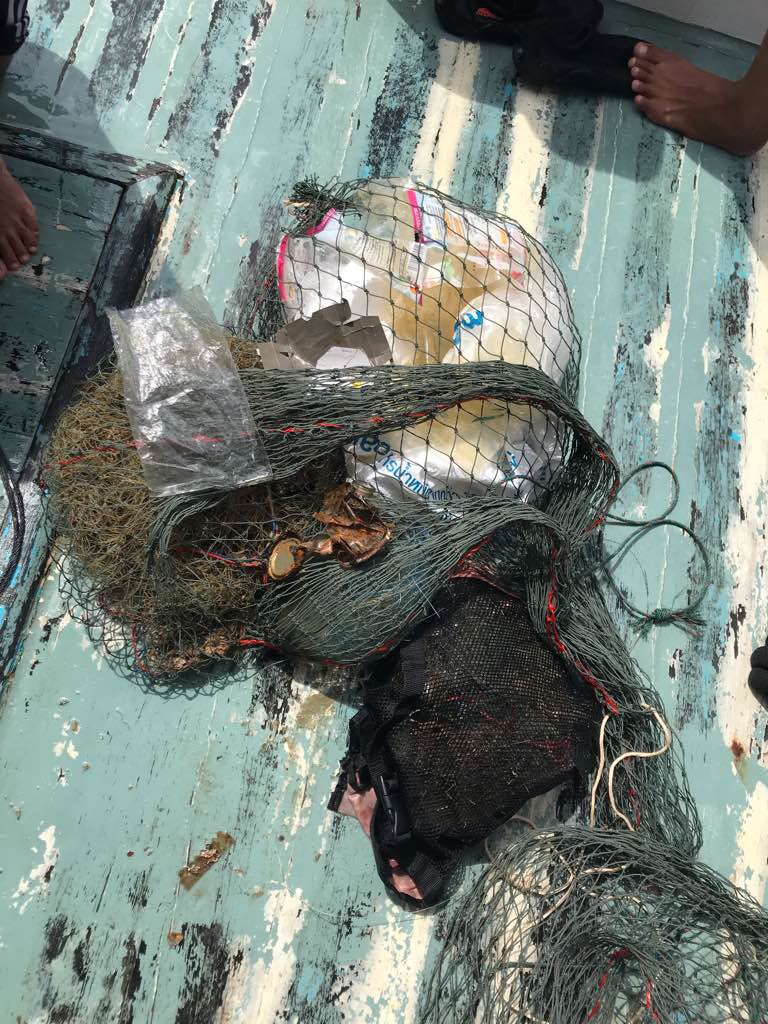
Entangled Help


Use the vertical tabs below to record any entangled animals you found of each type.

ADS92 - Grand Anse Beach

100
0
0

12.02443310548, -61.761974394321

0
0
0
sand
0
48
2
9
0
General Public Beach Use
Wooden Fence Fragment
Surf Winds, mild current
1
0
0
0
0
0
0
0
0
0
0
0
0
0
0
0
0
0
0
0
Box Cutter
Eco Dive
Christine Finney
0
12
0
56
0
0
0
0
5
0
10
0
0
0
0
0
0
9
7
11
0
0
4
0
0
0
0
0
0
0
0
1
0
0
20.00
60
6.00
1.00
0
estimated
0
0
100.00
0
0
0
6
0
Plastic bags
Food Wrappers
2
On
kilograms
0
I have debris data to report
1
1
0
Smooth (wavelets) for waves 0.1 - 0.5 meter high
0
1
5
0
0
0
0
m2
1
0
meters
seagrass
2
0
0
0
0
5
0
0
0
15
0
0
0
0
0
25
0
0
0
0
0
0
0
0
0
0
0
0
Grenada
State\Province
Saint George’s
City
Saint George’s
Map Help


Dive Location

If you know your survey site coordinates, enter them manually in decimal degrees using WGS84 Map Datum. Use the minus sign for latitudes south of the equator and longitudes west of the Prime Meridian to 180 degrees.

If you do not know your survey site coordinates, click the “Map Location” tab to use the map to zoom into your survey site and drop the pin on the map to fall within your survey dive site in the water (not on land or the beach). Ensure you zoom in as much as possible to ensure data accuracy.
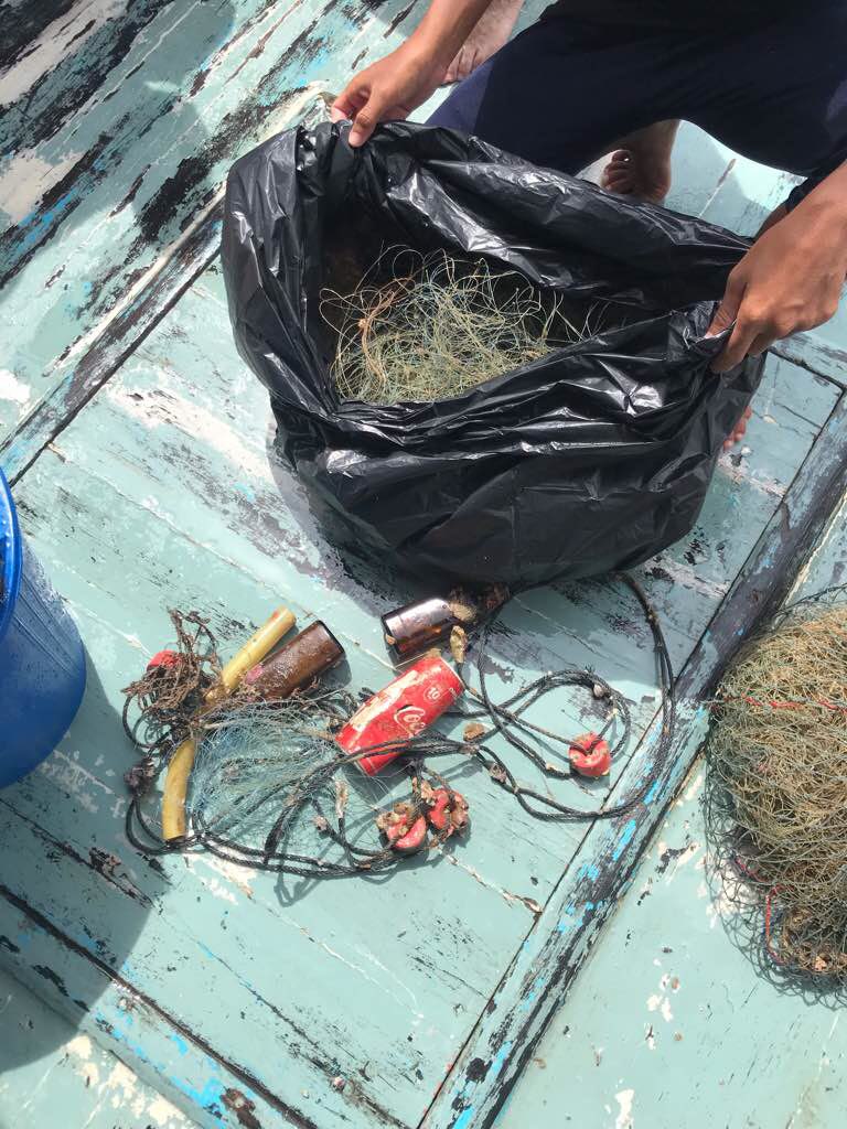
Entangled Help


Use the vertical tabs below to record any entangled animals you found of each type.

Koh Haa

4
2
6

7.9306853635442, 98.806146219373

0
0
0
sand
0
0
0
2
0
No
Good
0
0
0
0
0
0
0
0
0
0
0
0
0
0
0
0
0
0
0
0
The dive Ao nang
Nick Quinlan Norburn
0
0
1
1
0
0
0
0
1
0
0
0
0
0
0
0
0
0
0
10
1
0
0
0
10
0
4
0
0
0
0
0
0
0
8.00
60
18.00
5.00
2
estimated
0
0
75.00
0
0
0
0
0
Nets
0
On
kilograms
0
I have debris data to report
6
0
0
Smooth (wavelets) for waves 0.1 - 0.5 meter high
0
0
0
0
0
0
0
m2
0
0
meters
coral reef
0
0
0
0
0
0
0
0
0
0
0
0
0
0
0
2
0
0
0
0
0
0
0
0
0
0
0
0
Thailand
State\Province
Krabi
City
Ao nang
Map Help


Dive Location

If you know your survey site coordinates, enter them manually in decimal degrees using WGS84 Map Datum. Use the minus sign for latitudes south of the equator and longitudes west of the Prime Meridian to 180 degrees.

If you do not know your survey site coordinates, click the “Map Location” tab to use the map to zoom into your survey site and drop the pin on the map to fall within your survey dive site in the water (not on land or the beach). Ensure you zoom in as much as possible to ensure data accuracy.

Entangled Help


Use the vertical tabs below to record any entangled animals you found of each type.

Hin Musan Noi

0
0
10

7.9149419253156, 98.637292541859

10
0
0
sand
0
0
0
5
0
Good
0
0
0
0
0
0
0
0
0
0
0
0
0
0
0
0
0
0
0
0
The diver Ao nang
Lertlid Trozop
0
0
0
0
0
0
0
0
1
0
0
0
0
0
0
0
0
0
1
11
1
0
0
0
2
0
0
0
0
0
0
0
0
3
15.00
60
21.00
10.00
0
estimated
0
0
100.00
0
0
0
0
0
Nets
Fishing cage
0
On
kilograms
0
I have debris data to report
32
0
0
Smooth (wavelets) for waves 0.1 - 0.5 meter high
0
0
0
Released Unharmed
Frog Fish
1
Fishing net
0
0
0
0
m2
5
0
meters
coral reef
1
0
0
0
0
0
0
0
0
0
0
0
0
1
0
0
2
0
0
0
0
0
0
0
0
0
0
0
Thailand
State\Province
Krabi
City
Ao nang
Map Help


Dive Location

If you know your survey site coordinates, enter them manually in decimal degrees using WGS84 Map Datum. Use the minus sign for latitudes south of the equator and longitudes west of the Prime Meridian to 180 degrees.

If you do not know your survey site coordinates, click the “Map Location” tab to use the map to zoom into your survey site and drop the pin on the map to fall within your survey dive site in the water (not on land or the beach). Ensure you zoom in as much as possible to ensure data accuracy.

Entangled Help


Use the vertical tabs below to record any entangled animals you found of each type.

Crescent Cove

2
0
0

33.545965977189, -117.80082997313

0
0
0
sand
0
0
0
0
0
No
N/a
Rainy
0
0
0
0
0
0
0
0
0
0
0
0
0
0
0
0
0
0
0
0
Project AWARE
Danna
0
0
0
0
0
0
0
0
0
0
0
0
0
0
0
0
0
0
0
6
0
0
0
0
0
0
0
0
0
0
0
0
0
0
0.10
45
30.00
20.00
0
estimated
0
0
12797.20
0
0
0
0
0
Plastic
0
On
pounds
0
I have debris data to report
0
0
0
Moderate to rough for waves greater than 1.25 meters
0
0
0
0
0
0
0
ft2
0
0
feet
rocky reef
0
0
0
0
0
0
0
0
0
0
0
0
0
0
0
0
0
0
0
0
0
0
0
0
0
0
0
0
United States
State\Province
California
City
Laguna Beach
Map Help


Dive Location

If you know your survey site coordinates, enter them manually in decimal degrees using WGS84 Map Datum. Use the minus sign for latitudes south of the equator and longitudes west of the Prime Meridian to 180 degrees.

If you do not know your survey site coordinates, click the “Map Location” tab to use the map to zoom into your survey site and drop the pin on the map to fall within your survey dive site in the water (not on land or the beach). Ensure you zoom in as much as possible to ensure data accuracy.

Entangled Help


Use the vertical tabs below to record any entangled animals you found of each type.

Subscribe to