Menu

ADS561 - Shark Point

3

-8.34229, 116.028148

coral

-8.3429851480732, 116.02912442794

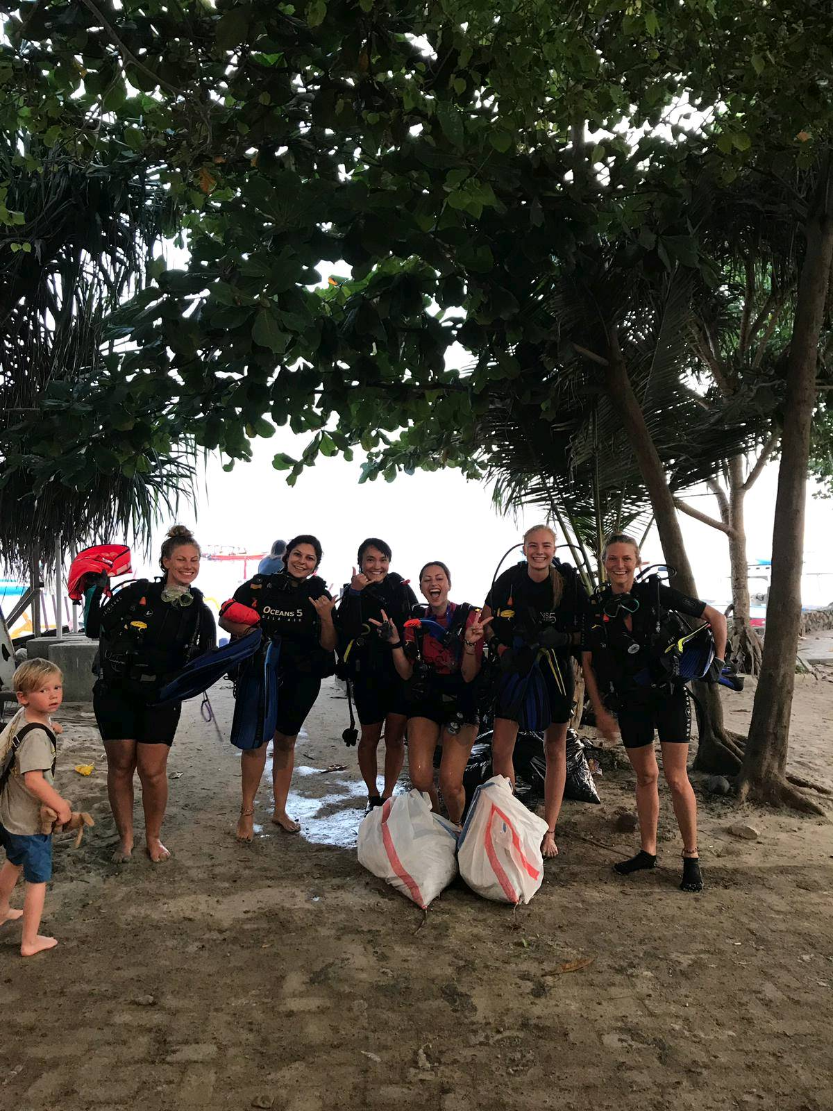
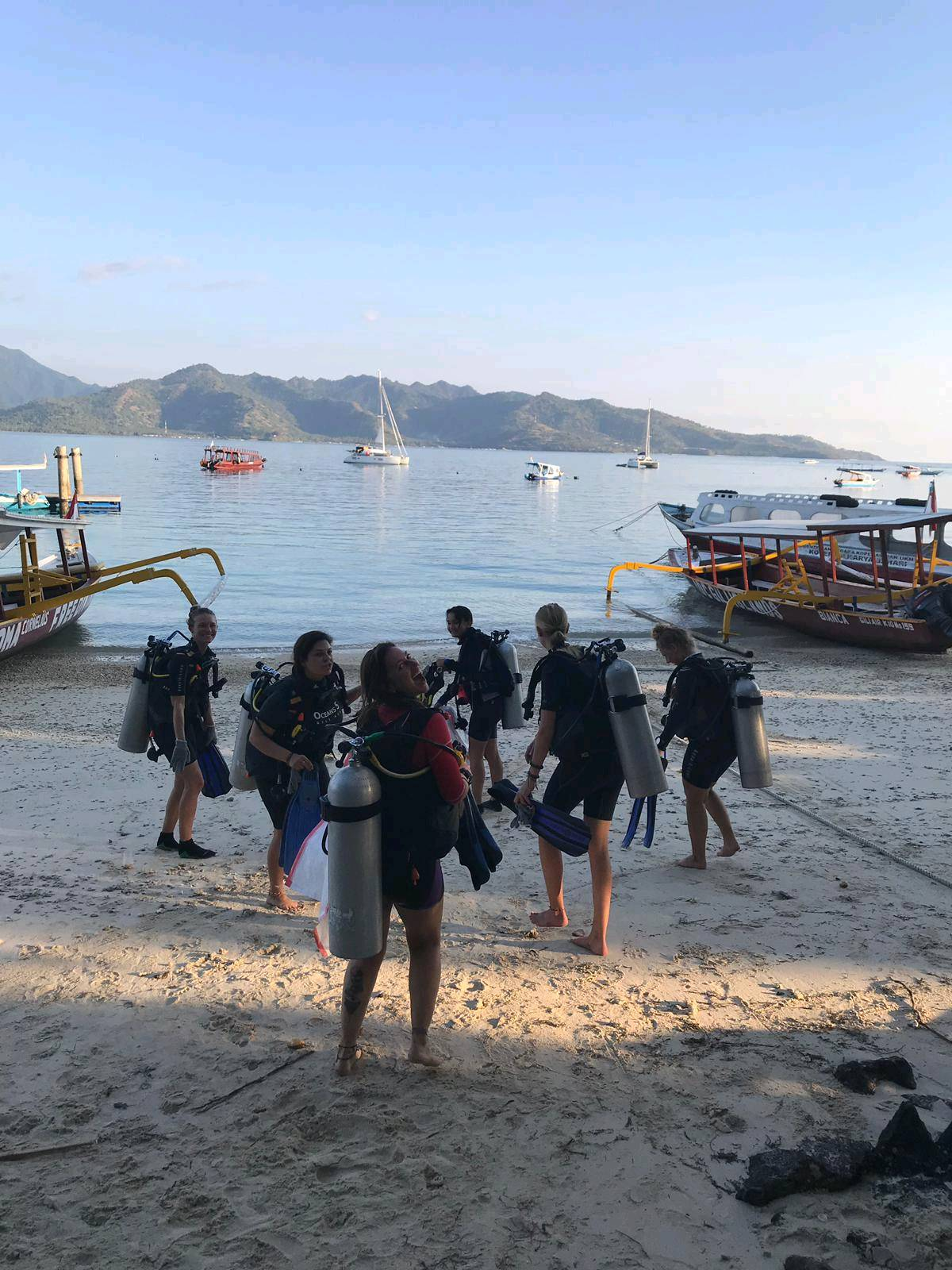
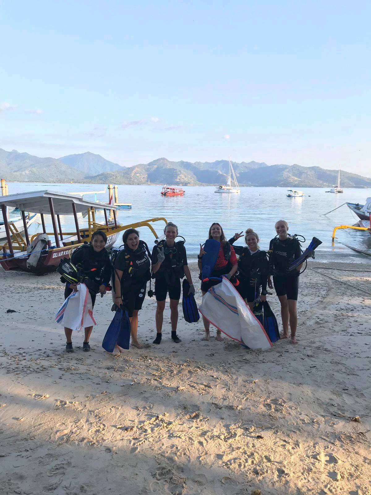
Beach clean-up and underwater clean-up
big wind coming from South, strong currents
Trawangan Dive Center
Laura Kazimierska
4
0.25
40
18.00
7.00
1
estimated
400.00
food wrappers
fishing lines
On
kilograms
I have debris data to report
Smooth (wavelets) for waves 0.1 - 0.5 meter high m2
meters
coral reef
Indonesia
City
Gili Trawanagan
Map Help


Dive Location

If you know your survey site coordinates, enter them manually in decimal degrees using WGS84 Map Datum. Use the minus sign for latitudes south of the equator and longitudes west of the Prime Meridian to 180 degrees.

If you do not know your survey site coordinates, click the “Map Location” tab to use the map to zoom into your survey site and drop the pin on the map to fall within your survey dive site in the water (not on land or the beach). Ensure you zoom in as much as possible to ensure data accuracy.

Entangled Help


Use the vertical tabs below to record any entangled animals you found of each type.

ADS562 - Put van Ekeren

0
0
0
0

51.283495, 4.392182

0
0
0
sand
0
0
0
0
0
buddiesnbubbles
Kurt Kesteloot
0
0
0
1
0
0
0
0
0
1
0
0
0
0
0
0
0
0
0
3
0
0
0
0
0
1
0
0
0
0
0
0
0
0
0
0
0.10
60
10.00
3.00
0
estimated
0
0
0
0
44264.50
0
0
0
0
0
0
On
kilograms
0
I have debris data to report
0
0
0
Calm (glassy to rippled) for waves 0 – 0.1 meter high
0
0
0
0
0
0
0
m2
0
0
meters
other
0
0
0
0
0
0
0
0
0
0
0
0
0
0
0
0
0
0
0
0
0
0
0
0
0
0
0
0
0
Belgium
Map Help


Dive Location

If you know your survey site coordinates, enter them manually in decimal degrees using WGS84 Map Datum. Use the minus sign for latitudes south of the equator and longitudes west of the Prime Meridian to 180 degrees.

If you do not know your survey site coordinates, click the “Map Location” tab to use the map to zoom into your survey site and drop the pin on the map to fall within your survey dive site in the water (not on land or the beach). Ensure you zoom in as much as possible to ensure data accuracy.

Entangled Help


Use the vertical tabs below to record any entangled animals you found of each type.

ADS505 - Los Alamitos Bay Bayshore and Division

1
1
0

33.756240266934, -118.13108746781

1
0
0
silt
0
1
0
0
0
Many kids toys
Calm
0
0
0
0
0
0
0
0
0
0
0
0
0
0
0
0
0
0
0
0
Plastic sand toy buckets
Jade Scuba Adventures
Ashley Arnold
1
0
7
6
0
0
0
0
3
0
1
0
0
0
0
0
0
0
0
2
0
0
13
0
0
0
0
0
0
0
0
0
0
0
10.00
41
9.00
4.00
0
estimated
0
0
2002.61
0
0
0
0
0
Plastic cups
Plastic bottles
0
On
pounds
0
I have debris data to report
0
0
0
Calm (glassy to rippled) for waves 0 – 0.1 meter high
0
0
0
0
0
0
0
ft2
0
0
feet
seagrass
0
0
0
0
0
0
0
0
0
1
0
0
3
0
0
0
2
0
0
0
0
0
0
0
0
0
0
0
United States
State\Province
CA
City
Long Beach
Map Help


Dive Location

If you know your survey site coordinates, enter them manually in decimal degrees using WGS84 Map Datum. Use the minus sign for latitudes south of the equator and longitudes west of the Prime Meridian to 180 degrees.

If you do not know your survey site coordinates, click the “Map Location” tab to use the map to zoom into your survey site and drop the pin on the map to fall within your survey dive site in the water (not on land or the beach). Ensure you zoom in as much as possible to ensure data accuracy.

Entangled Help


Use the vertical tabs below to record any entangled animals you found of each type.

Sea Aquarium Beach

10
40
0

12.085794818352, -68.89943494075

0
0
0
sand
0
5
7
0
0
Float fest - Party
Calm waters
0
0
0
0
0
0
0
0
0
0
0
0
0
0
0
0
0
0
0
0
Ocean Encounters
Jeremiah Peek
0
0
0
150
0
0
0
0
0
0
80
0
0
25
0
0
0
0
0
9
0
0
0
0
0
0
0
0
0
17
9
0
0
0
120.00
65
4.00
1.00
3
estimated
0
0
2741.02
0
0
0
0
0
Cans
Plastic
0
On
kilograms
0
I have debris data to report
50
0
0
Calm (glassy to rippled) for waves 0 – 0.1 meter high
0
0
0
0
0
0
0
m2
0
0
meters
seagrass
0
0
0
0
0
10
0
0
0
0
0
0
0
0
0
0
150
0
0
0
0
0
0
0
0
0
0
0
Netherlands Antilles
City
Willemstad
Map Help


Dive Location

If you know your survey site coordinates, enter them manually in decimal degrees using WGS84 Map Datum. Use the minus sign for latitudes south of the equator and longitudes west of the Prime Meridian to 180 degrees.

If you do not know your survey site coordinates, click the “Map Location” tab to use the map to zoom into your survey site and drop the pin on the map to fall within your survey dive site in the water (not on land or the beach). Ensure you zoom in as much as possible to ensure data accuracy.

Entangled Help


Use the vertical tabs below to record any entangled animals you found of each type.

Gili Air Harbour

20
0
0
0
0
0
0
silt
0
12
0
0
3

-8.3638692578131, 116.08281415134

Harbour, SMB needed as boats go in and out.
Near the harbour so the the boats dump a lot of trash straight in to the water.
Oceans 5 weekly reef cleanup.
Diaper
Sunny
Oceans5
Yardena
0
0
0
5
0
0
0
0
0
0
4
0
3
0
0
0
0
0
5
6
0
0
0
0
5
0
3
0
0
5
0
0
0
1
0
0
15.00
30
12.00
5.00
0
estimated
0
0
0
0
12.00
0
0
0
0
0
Many plastic food wrappers
Plastic tooth brush
0
On
kilograms
0
I have debris data to report
3
0
0
Smooth (wavelets) for waves 0.1 - 0.5 meter high
0
0
0
0
7
2
3
m2
0
5
meters
other
7
0
0
0
0
0
0
0
0
0
0
0
0
0
0
0
0
0
0
0
0
0
3
0
0
0
0
0
0
Indonesia
State\Province
Lombok
City
Gili Air
Map Help


Dive Location

If you know your survey site coordinates, enter them manually in decimal degrees using WGS84 Map Datum. Use the minus sign for latitudes south of the equator and longitudes west of the Prime Meridian to 180 degrees.

If you do not know your survey site coordinates, click the “Map Location” tab to use the map to zoom into your survey site and drop the pin on the map to fall within your survey dive site in the water (not on land or the beach). Ensure you zoom in as much as possible to ensure data accuracy.

Entangled Help


Use the vertical tabs below to record any entangled animals you found of each type.

ADS127 - Muka Kampung Bunaken Island

28
11
2
2
5
coral
6
40

1.5960267113989, 124.78340255096

Next to jetty where many locals/tourists disembark from boats
Thanks to the all the people who helped with the clean-up
Shoes
Sunny, Sometimes cloudy. A few rain showers. Light current in water calm surface.
2
1
Sunglasses
plastic shaver 1
Two Fish Divers Bunaken
Nicholas Hogle
1
3
52
9
9
1
11
1
40.00
40
18.00
4.00
estimated
5
564.26
3
Plastic sheeting
beverage bottles glass
beverage bottles Plastic
On
kilograms
I have debris data to report
9
Smooth (wavelets) for waves 0.1 - 0.5 meter high
7
glass
shrimp and boxing crab
Released Unharmed
2
22
8
1
m2
9
109
6
clothing
brittle star
Released Unharmed
meters
coral reef
7
2
2
2
2
1
Indonesia
State\Province
North Sulawesi
City
Manado
Map Help


Dive Location

If you know your survey site coordinates, enter them manually in decimal degrees using WGS84 Map Datum. Use the minus sign for latitudes south of the equator and longitudes west of the Prime Meridian to 180 degrees.

If you do not know your survey site coordinates, click the “Map Location” tab to use the map to zoom into your survey site and drop the pin on the map to fall within your survey dive site in the water (not on land or the beach). Ensure you zoom in as much as possible to ensure data accuracy.

Entangled Help


Use the vertical tabs below to record any entangled animals you found of each type.

Deerfield Beach Fishing Pier

22
34
5
sand
5236

26.3164522, -80.074169

One by one by one... A world record is broken. (WORLD RECORD DIVE AGAINST DEBRIS EVENT)

633 divers. 2700lbs of fishing gear. Over 9,000 pieces of marine debris reported to Project AWARE. To say today's collaboration of The World Record Clean Up Event hosted by Dixie Divers was a success is an understatement.

Hundreds of Divers under the support of PADI, Project AWARE, many other dive centers, community members, and more, all came together to make Deerfield Beach a better place for all who live there, above and below the waves.

What an amazing day for Conservation and an amazing day for the dive community.
This was part of the successful World Record Clean Up Event in Deerfield Beach Florida
Metal Gym Weights (45lbs)
Calm, few waves in late afternoon, early morning very calm
2
6
1
12
Boat Hook
Metal Pliers
Metal Gym Weights and equipment
fishing rod METAL
Dixie Divers
Pavan Arilton
2
633
2
3
2572.20
55
20.00
2.00
measured
3
2
5126
115728.00
Fishing Sinkers
Fishing Monofilament line
Fishing Traps
On
pounds
I have debris data to report
12
Calm (glassy to rippled) for waves 0 – 0.1 meter high ft2
12
feet
rocky reef
24
13
2
13
United States
State\Province
Florida
City
Deerfield Beach
Map Help


Dive Location

If you know your survey site coordinates, enter them manually in decimal degrees using WGS84 Map Datum. Use the minus sign for latitudes south of the equator and longitudes west of the Prime Meridian to 180 degrees.

If you do not know your survey site coordinates, click the “Map Location” tab to use the map to zoom into your survey site and drop the pin on the map to fall within your survey dive site in the water (not on land or the beach). Ensure you zoom in as much as possible to ensure data accuracy.

Entangled Help


Use the vertical tabs below to record any entangled animals you found of each type.

ADS426 - House Reef Outrigger Konotta Maldives

0.46258801100945, 73.156623343355

rock
2
2
The strong winds and stormy weather could have lead to transplantation of debris from deeper ocean away from the reef. Also we are having some villa refurbishments near the location so some building material could have infiltrated into the reef environment more easily.
Some stormy weather, strong winds, white caps, slight waves.
Best Dives Maldives
Amelia Cody
2
3
3
15.00
45
20.00
5.00
estimated
250.00
Metal rods/pipes
On
kilograms
I have debris data to report
2
Slight for waves 0.5 -1.25 meter high
2
4
2
m2
3
meters
coral reef
2
1
3
4
1
1
2
2
1
Maldives
Map Help


Dive Location

If you know your survey site coordinates, enter them manually in decimal degrees using WGS84 Map Datum. Use the minus sign for latitudes south of the equator and longitudes west of the Prime Meridian to 180 degrees.

If you do not know your survey site coordinates, click the “Map Location” tab to use the map to zoom into your survey site and drop the pin on the map to fall within your survey dive site in the water (not on land or the beach). Ensure you zoom in as much as possible to ensure data accuracy.

Entangled Help


Use the vertical tabs below to record any entangled animals you found of each type.

ADS54 - Mosquito Pier

2

18.148768, -65.514533

1
sand
83
headlamp
varied: some rain, high heat, moderate winds
1
2
1
1
1
5
bullet casing
knife
sunglasses
headlamp
electric cable
spark plug
Isla Nena Scuba
Tania Puell
1
1
2
12
15.20
61
40.00
5.00
measured
279
153399.00
8
fishng line
fishing hooks
fishing sinkers
On
pounds
I have debris data to report
4
Smooth (wavelets) for waves 0.1 - 0.5 meter high
3
ft2
feet
other
5
1
1
2
United States
State\Province
PR
City
Vieques
Map Help


Dive Location

If you know your survey site coordinates, enter them manually in decimal degrees using WGS84 Map Datum. Use the minus sign for latitudes south of the equator and longitudes west of the Prime Meridian to 180 degrees.

If you do not know your survey site coordinates, click the “Map Location” tab to use the map to zoom into your survey site and drop the pin on the map to fall within your survey dive site in the water (not on land or the beach). Ensure you zoom in as much as possible to ensure data accuracy.

Entangled Help


Use the vertical tabs below to record any entangled animals you found of each type.

Ecosystem Other
man made environment: pier

ACE Wreck

2
3
24
sand
2
120
2

33.398241644125, -117.66425271646

This is an actual wreck that sunk 10 years ago. We have started the process of removing the items that were originally on the boat. But, it is apparent that the area is being fished quite a bit.
We pulled up two boat anchors from a different boat.
Fish caught on a lure and unable to release. We were able to catch him and remove the hook.
Clear with overcast. Light rains
Beach Cities Scuba
D.J. Mansfield
2
1
12
1
2
186.00
40
121.00
80.00
70
measured
3
1800.00
Fishing Line
Boat Lines
Plastic debris from fishermen
On
pounds
I have debris data to report
1
Calm (glassy to rippled) for waves 0 – 0.1 meter high
Released Unharmed
Sand Bass
1
Fishing Line
ft2
feet
other
1
2
United States
State\Province
CA
City
Dana Point
Map Help


Dive Location

If you know your survey site coordinates, enter them manually in decimal degrees using WGS84 Map Datum. Use the minus sign for latitudes south of the equator and longitudes west of the Prime Meridian to 180 degrees.

If you do not know your survey site coordinates, click the “Map Location” tab to use the map to zoom into your survey site and drop the pin on the map to fall within your survey dive site in the water (not on land or the beach). Ensure you zoom in as much as possible to ensure data accuracy.

Entangled Help


Use the vertical tabs below to record any entangled animals you found of each type.

Ecosystem Other
Wreck
Subscribe to