ADS541 - Middle Reef
26
7
-8.1420095827232, 114.65578438045
17
2
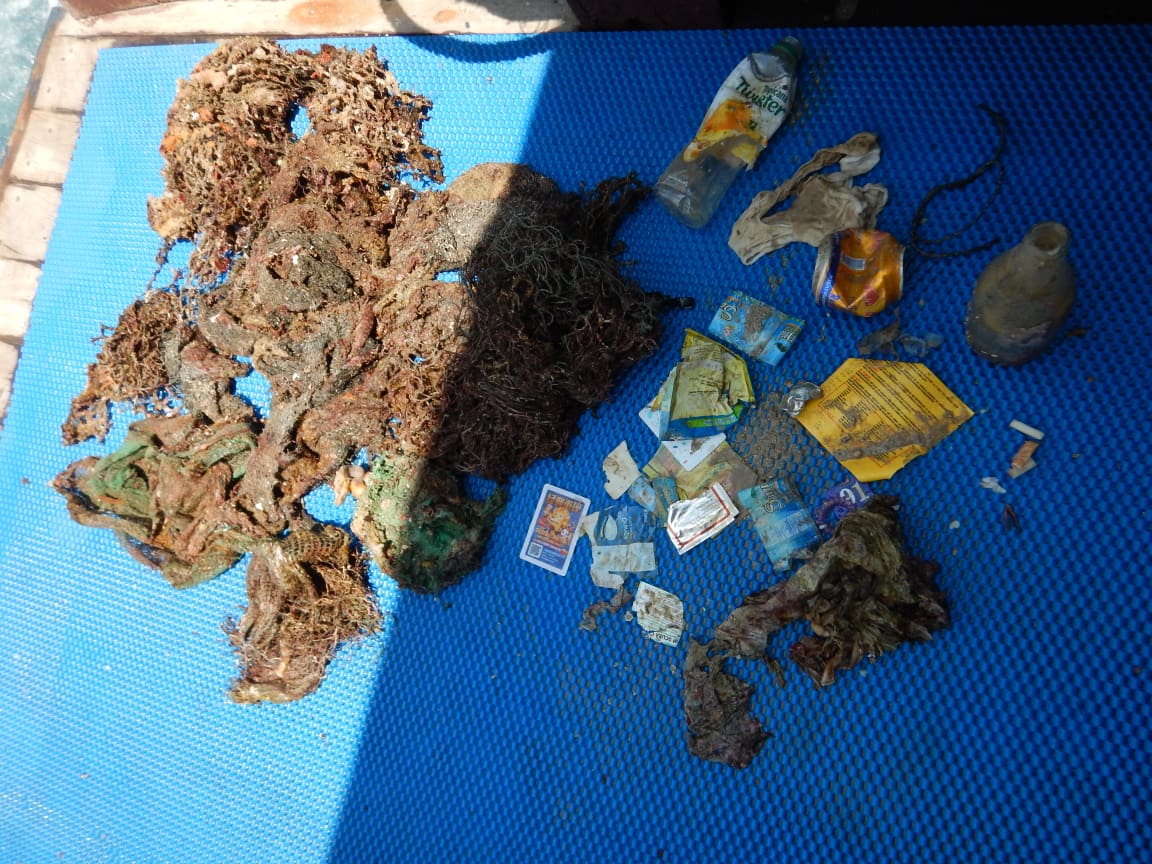
SIM card slate
One day of rain, otherwise mostly sunny, windy. Waves in the afternoon are getting higher.
1
1
SIM card slate
Sanitary pad
Easy Divers Bali
Ana Mestek
4
2
0.50
77
20.00
3.00
6
measured
1280.00
food wrappings
plastic bags
diapers
On
kilograms
I have debris data to report
Slight for waves 0.5 -1.25 meter high
m2
meters
other
State\Province
Bali
City
Pemuteran
Map Help
Dive Location
If you know your survey site coordinates, enter them manually in decimal degrees using WGS84 Map Datum. Use the minus sign for latitudes south of the equator and longitudes west of the Prime Meridian to 180 degrees.
If you do not know your survey site coordinates, click the “Map Location” tab to use the map to zoom into your survey site and drop the pin on the map to fall within your survey dive site in the water (not on land or the beach). Ensure you zoom in as much as possible to ensure data accuracy.
Entangled Help
Use the vertical tabs below to record any entangled animals you found of each type.
Ecosystem Other
sand, sea grass, coral reef