Menu

Mainit

2
0
0
5

9.1855532127072, 123.26442405646

0
0
0
sand
0
2
0
4
0
Sunny
IDP new instructors with Liquid Dumaguete
Julianne Chin
0
0
0
0
0
0
0
0
0
0
0
0
0
0
0
0
0
0
0
4
0
0
0
0
0
0
0
0
0
0
0
0
0
0
0
0
0.70
50
21.00
5.00
0
estimated
0
0
237.83
0
0
0
0
0
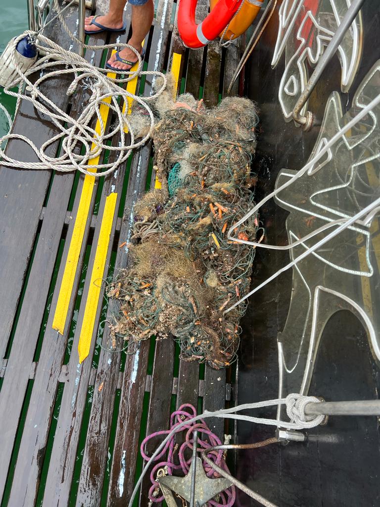
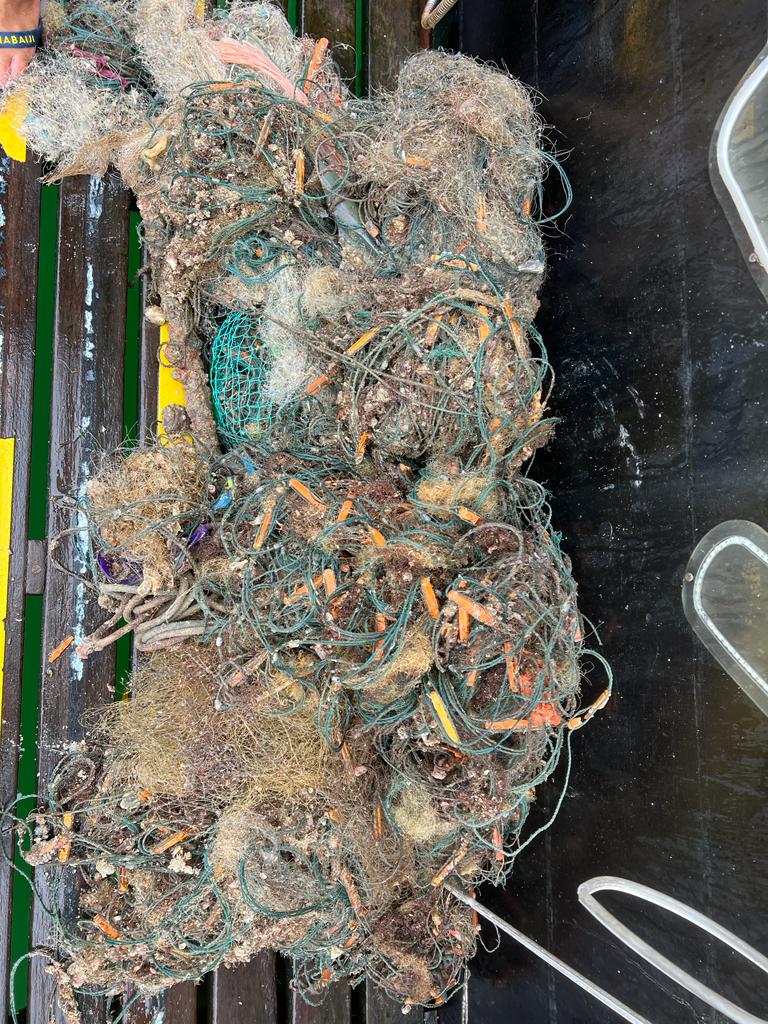
Fishing nets
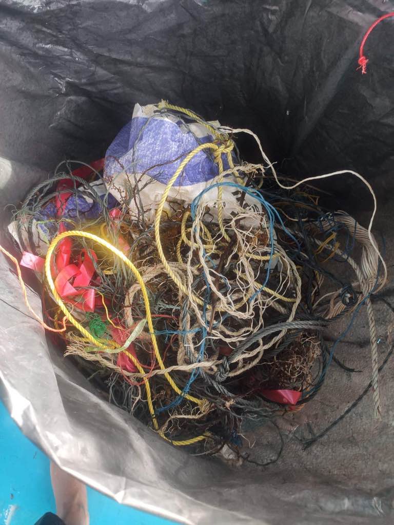
Fishing lines
Food packages
0
On
kilograms
0
I have debris data to report
0
0
0
Smooth (wavelets) for waves 0.1 - 0.5 meter high
0
0
0
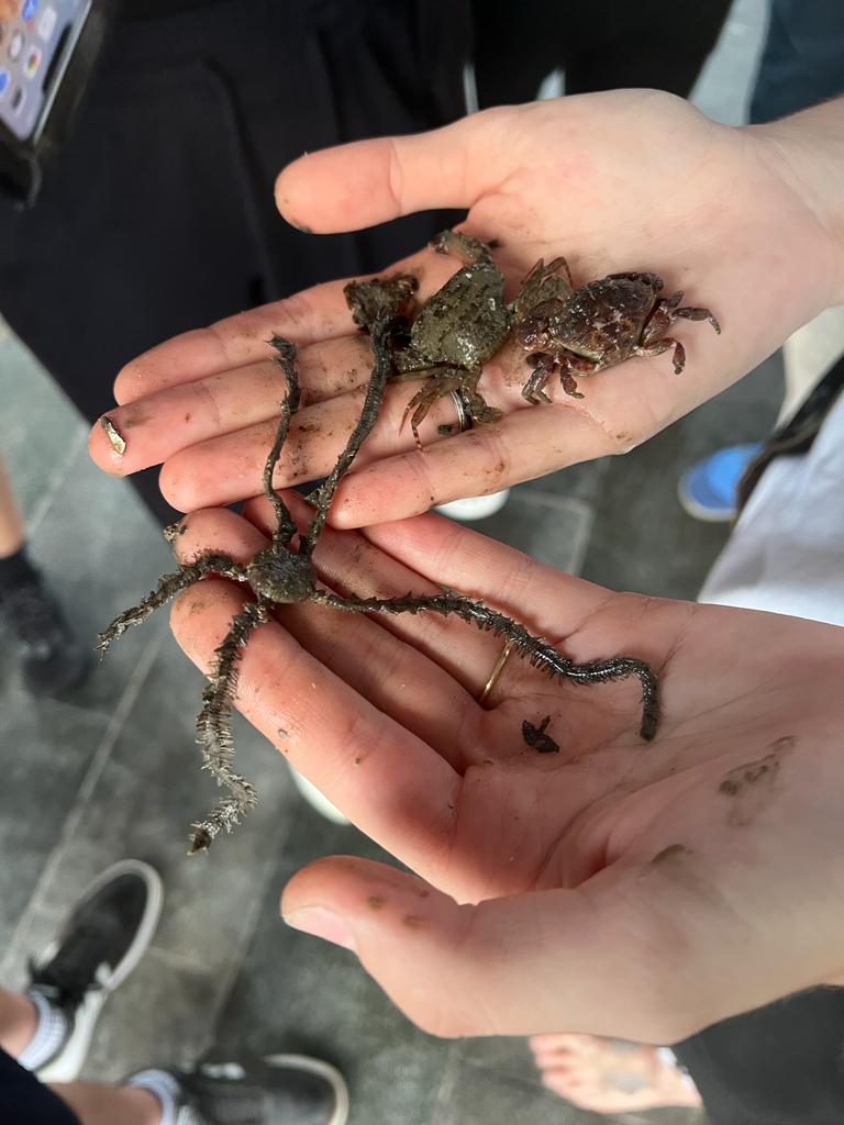
Released Unharmed
Box fish
1
Fish net
0
0
0
0
m2
0
0
meters
coral reef
0
0
0
0
0
0
0
0
0
0
0
0
0
0
0
0
0
0
0
0
0
0
0
0
0
0
0
0
0
Philippines
State\Province
Dauin
City
Dumaguete
Map Help


Dive Location

If you know your survey site coordinates, enter them manually in decimal degrees using WGS84 Map Datum. Use the minus sign for latitudes south of the equator and longitudes west of the Prime Meridian to 180 degrees.

If you do not know your survey site coordinates, click the “Map Location” tab to use the map to zoom into your survey site and drop the pin on the map to fall within your survey dive site in the water (not on land or the beach). Ensure you zoom in as much as possible to ensure data accuracy.

Entangled Help


Use the vertical tabs below to record any entangled animals you found of each type.

Isola Gallinara #16105322

0
0
0
0

44.045515797907, 8.2272913722833

0
0
0
rock
0
1
0
0
0
Good
MolaMola diving center
Orante
0
0
0
0
0
0
0
0
0
0
0
0
0
0
0
0
0
0
0
2
0
0
0
0
1
0
1
0
0
0
0
0
0
0
0
0
1.00
45
25.00
15.00
0
estimated
0
0
500.00
0
0
0
0
0
0
On
kilograms
0
I have debris data to report
0
0
0
Calm (glassy to rippled) for waves 0 – 0.1 meter high
0
0
0
0
0
0
0
m2
0
0
meters
rocky reef
0
0
0
0
0
0
0
0
0
0
0
0
0
0
0
0
0
0
0
0
0
0
0
0
0
0
0
0
0
Italy
City
Alassio
Map Help


Dive Location

If you know your survey site coordinates, enter them manually in decimal degrees using WGS84 Map Datum. Use the minus sign for latitudes south of the equator and longitudes west of the Prime Meridian to 180 degrees.

If you do not know your survey site coordinates, click the “Map Location” tab to use the map to zoom into your survey site and drop the pin on the map to fall within your survey dive site in the water (not on land or the beach). Ensure you zoom in as much as possible to ensure data accuracy.
Entangled Help


Use the vertical tabs below to record any entangled animals you found of each type.

Gallinara

0
0
0
0

44.048478154959, 8.2282405332379

0
0
0
rock
0
0
0
0
0
No
Good
MolaMola diving center
Orante
0
0
0
0
0
0
0
0
0
0
0
0
0
0
0
0
0
0
0
2
0
0
0
0
0
0
0
0
0
0
0
0
0
0
0
0
0.00
45
25.00
15.00
0
measured
0
0
500.00
0
0
0
0
0
0
On
kilograms
0
Our Survey Site was free of debris
0
0
0
Calm (glassy to rippled) for waves 0 – 0.1 meter high
0
0
0
0
0
0
0
m2
0
0
meters
rocky reef
0
0
0
0
0
0
0
0
0
0
0
0
0
0
0
0
0
0
0
0
0
0
0
0
0
0
0
0
0
Italy
City
Alassio
Map Help


Dive Location

If you know your survey site coordinates, enter them manually in decimal degrees using WGS84 Map Datum. Use the minus sign for latitudes south of the equator and longitudes west of the Prime Meridian to 180 degrees.

If you do not know your survey site coordinates, click the “Map Location” tab to use the map to zoom into your survey site and drop the pin on the map to fall within your survey dive site in the water (not on land or the beach). Ensure you zoom in as much as possible to ensure data accuracy.
Entangled Help


Use the vertical tabs below to record any entangled animals you found of each type.

DROC - park reef

18.68287, -68.39314

rock
3
5
No
No
Good
Sea pro divers
Maximiliano José García
2
2
4.00
40
14.00
10.00
2
estimated
101.00
On
pounds
I have debris data to report
Smooth (wavelets) for waves 0.1 - 0.5 meter high m2
meters
coral reef
Dominican Republic
State\Province
La Altagracia
City
Bávaro
Map Help


Dive Location

If you know your survey site coordinates, enter them manually in decimal degrees using WGS84 Map Datum. Use the minus sign for latitudes south of the equator and longitudes west of the Prime Meridian to 180 degrees.

If you do not know your survey site coordinates, click the “Map Location” tab to use the map to zoom into your survey site and drop the pin on the map to fall within your survey dive site in the water (not on land or the beach). Ensure you zoom in as much as possible to ensure data accuracy.
Entangled Help


Use the vertical tabs below to record any entangled animals you found of each type.

Martha’s Quarry

0
0
0
0

36.221985298945, -86.438156520724

0
0
0
silt
0
0
0
0
0
Finding bottles and cans seems to be the most common, from divers…
Yes
Old beer can
Light rain
Ohana Dive Company
Ryan Hiler
0
0
0
0
0
0
0
0
0
0
0
0
0
0
0
0
0
0
0
3
0
0
0
0
0
0
3
0
0
0
0
0
0
0
0
0
3.00
26
26.00
8.00
0
estimated
0
0
7514.65
0
0
0
0
0
Cans
0
On
pounds
0
I have debris data to report
0
0
0
Calm (glassy to rippled) for waves 0 – 0.1 meter high
0
0
0
0
0
0
0
ft2
0
0
feet
other
0
0
0
0
0
0
0
0
0
0
0
0
0
0
0
0
0
8
0
0
0
0
0
0
0
0
0
0
0
United States
State\Province
TN
City
My Juliet
Map Help


Dive Location

If you know your survey site coordinates, enter them manually in decimal degrees using WGS84 Map Datum. Use the minus sign for latitudes south of the equator and longitudes west of the Prime Meridian to 180 degrees.

If you do not know your survey site coordinates, click the “Map Location” tab to use the map to zoom into your survey site and drop the pin on the map to fall within your survey dive site in the water (not on land or the beach). Ensure you zoom in as much as possible to ensure data accuracy.
Entangled Help


Use the vertical tabs below to record any entangled animals you found of each type.

Ecosystem Other
Rock quarry

Cindy's Corner

24.835267, -80.635667

coral
2
Recreational fishing & boating
calm
Key Dives
Amanda Hudon
2
3.00
45
75.00
45.00
3
measured
3000.00
line
fishing
On
pounds
I have debris data to report
Slight for waves 0.5 -1.25 meter high ft2
feet
coral reef
United States
Map Help


Dive Location

If you know your survey site coordinates, enter them manually in decimal degrees using WGS84 Map Datum. Use the minus sign for latitudes south of the equator and longitudes west of the Prime Meridian to 180 degrees.

If you do not know your survey site coordinates, click the “Map Location” tab to use the map to zoom into your survey site and drop the pin on the map to fall within your survey dive site in the water (not on land or the beach). Ensure you zoom in as much as possible to ensure data accuracy.
Entangled Help


Use the vertical tabs below to record any entangled animals you found of each type.

Mushroom

24.841333, -80.62855

coral
Recreational boating
Calm
1
Anchor & Chain
Key Dives
Amanda Hudon
2
15.10
45
45.00
35.00
1
measured
3000.00
chain
line
On
pounds
I have debris data to report
Slight for waves 0.5 -1.25 meter high ft2
feet
coral reef
United States
Map Help


Dive Location

If you know your survey site coordinates, enter them manually in decimal degrees using WGS84 Map Datum. Use the minus sign for latitudes south of the equator and longitudes west of the Prime Meridian to 180 degrees.

If you do not know your survey site coordinates, click the “Map Location” tab to use the map to zoom into your survey site and drop the pin on the map to fall within your survey dive site in the water (not on land or the beach). Ensure you zoom in as much as possible to ensure data accuracy.

Entangled Help


Use the vertical tabs below to record any entangled animals you found of each type.

Dante's Ledge

1

24.8466, -80.614117

coral
1
1
Anchor & chain
Key Dives
Michael Ryan
4
1
12.50
45
90.00
45.00
1
measured
3000.00
On
pounds
I have debris data to report
Slight for waves 0.5 -1.25 meter high ft2
feet
coral reef
United States
Map Help


Dive Location

If you know your survey site coordinates, enter them manually in decimal degrees using WGS84 Map Datum. Use the minus sign for latitudes south of the equator and longitudes west of the Prime Meridian to 180 degrees.

If you do not know your survey site coordinates, click the “Map Location” tab to use the map to zoom into your survey site and drop the pin on the map to fall within your survey dive site in the water (not on land or the beach). Ensure you zoom in as much as possible to ensure data accuracy.

Entangled Help


Use the vertical tabs below to record any entangled animals you found of each type.

Newfound Harbor

2
1
1

24.63287930388, -81.35624550283

2
rock
1
9
This was mostly fishing and trapping related.
MAGA hat
Sunny and hot with morning showers
3
1
1
1
concrete from construction
eye glasses
metal from maybe a roof
MAGA hat
DiveN2Life
Kama Cannon
1
1
2
1
1
12
3
1
1
1
4
1
650.00
40
30.00
8.00
4
measured
1
0
4
5000.00
1
rope
concrete or bricks from traps
glass bottles
On
pounds
I have debris data to report
10
2
Smooth (wavelets) for waves 0.1 - 0.5 meter high
7
1
1
1
m2
8
feet
coral reef
1
1
1
12
3
1
1
United States
State\Province
Florida
City
Summerland Key
Map Help


Dive Location

If you know your survey site coordinates, enter them manually in decimal degrees using WGS84 Map Datum. Use the minus sign for latitudes south of the equator and longitudes west of the Prime Meridian to 180 degrees.

If you do not know your survey site coordinates, click the “Map Location” tab to use the map to zoom into your survey site and drop the pin on the map to fall within your survey dive site in the water (not on land or the beach). Ensure you zoom in as much as possible to ensure data accuracy.
Entangled Help


Use the vertical tabs below to record any entangled animals you found of each type.

Mülheimer Hafenbecken

silt

51.427810461584, 6.8770831136917

E-Scooter
2
1
1
1
Skateboard
E-Scooter
Bike
Water traffic plate
Frank's Dive Center
Andreas Brauwers
17
15
1
15
4
2
1
1
105.00
120
4.00
3.00
measured
1
400.00
E-Scooter
On
kilograms
I have debris data to report
40
1
Calm (glassy to rippled) for waves 0 – 0.1 meter high
3
m2
meters
other
4
1
2
1
5
Germany
State\Province
NRW
City
Mülheim a. d. Ruhr
Map Help


Dive Location

If you know your survey site coordinates, enter them manually in decimal degrees using WGS84 Map Datum. Use the minus sign for latitudes south of the equator and longitudes west of the Prime Meridian to 180 degrees.

If you do not know your survey site coordinates, click the “Map Location” tab to use the map to zoom into your survey site and drop the pin on the map to fall within your survey dive site in the water (not on land or the beach). Ensure you zoom in as much as possible to ensure data accuracy.

Entangled Help


Use the vertical tabs below to record any entangled animals you found of each type.

Ecosystem Other
Harbour
Subscribe to