Menu

Coral Beach

209
209
2
coral

-8.7307075996851, 115.90987147843

Good
46
3
2
Detergent Plastic
Pack Cigarettes
Medicine package
SORCE
Raja Aditya
20
25
5
8
2
7
13.67
58
18.00
5.00
3
measured
1
1878.66
Food Container Plastic
Plastic Fragment
Nappies
On
kilograms
I have debris data to report
Calm (glassy to rippled) for waves 0 – 0.1 meter high
14
5
m2
meters
coral reef
1
Indonesia
State\Province
Nusa Tenggara Barat
City
Lombok
Map Help


Dive Location

If you know your survey site coordinates, enter them manually in decimal degrees using WGS84 Map Datum. Use the minus sign for latitudes south of the equator and longitudes west of the Prime Meridian to 180 degrees.

If you do not know your survey site coordinates, click the “Map Location” tab to use the map to zoom into your survey site and drop the pin on the map to fall within your survey dive site in the water (not on land or the beach). Ensure you zoom in as much as possible to ensure data accuracy.

Entangled Help


Use the vertical tabs below to record any entangled animals you found of each type.

Coral Beach/Gili Layar

205
58
coral
8

-8.7302657179245, 115.91052474552

Good
14
8
2
Detergent Plastic
Styrofoam
School Bag
SORCE
Raja Aditya
12
2
7
4
7.81
58
18.00
5.00
measured
3113.20
Plastic
Food Container Plastic
On
kilograms
I have debris data to report
2
Calm (glassy to rippled) for waves 0 – 0.1 meter high
6
1
1
2
m2
meters
coral reef
Indonesia
State\Province
Nusa Tenggara Barat
City
Lombok
Map Help


Dive Location

If you know your survey site coordinates, enter them manually in decimal degrees using WGS84 Map Datum. Use the minus sign for latitudes south of the equator and longitudes west of the Prime Meridian to 180 degrees.

If you do not know your survey site coordinates, click the “Map Location” tab to use the map to zoom into your survey site and drop the pin on the map to fall within your survey dive site in the water (not on land or the beach). Ensure you zoom in as much as possible to ensure data accuracy.

Entangled Help


Use the vertical tabs below to record any entangled animals you found of each type.

Coral Beach/Gili Layar

99
59
coral

-8.7304486682421, 115.91040243178

Good
3
1
Detergent Plastic
toothpaste
SORCE
Raja Aditya
4
24
4
4
9.93
57
18.00
5.00
5
measured
3113.20
Plastic
Food container plastic
Nappies
On
kilograms
I have debris data to report
Calm (glassy to rippled) for waves 0 – 0.1 meter high
1
1
m2
meters
coral reef
Indonesia
State\Province
Nusa Tenggara Barat
City
Lombok
Map Help


Dive Location

If you know your survey site coordinates, enter them manually in decimal degrees using WGS84 Map Datum. Use the minus sign for latitudes south of the equator and longitudes west of the Prime Meridian to 180 degrees.

If you do not know your survey site coordinates, click the “Map Location” tab to use the map to zoom into your survey site and drop the pin on the map to fall within your survey dive site in the water (not on land or the beach). Ensure you zoom in as much as possible to ensure data accuracy.
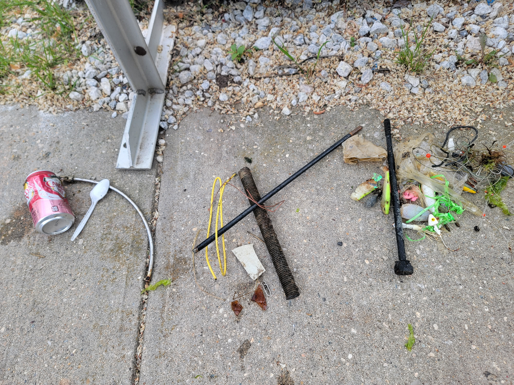
Entangled Help


Use the vertical tabs below to record any entangled animals you found of each type.

Coral Beach/Gili Layar

158
119
coral

-8.7299571257533, 115.91086870636

Good
15
1
1
6
Detergent Plastic
Cosmetic glass
Medicine package
Styrofoam
SORCE
Raja Aditya
3
24
4
12
13.54
58
18.00
5.00
3
measured
2975.75
Plastic
Food container plastic
Diapers/nappies
On
kilograms
I have debris data to report
Calm (glassy to rippled) for waves 0 – 0.1 meter high
3
5
m2
meters
coral reef
Indonesia
State\Province
Nusa Tenggara Barat
City
Lombok
Map Help


Dive Location

If you know your survey site coordinates, enter them manually in decimal degrees using WGS84 Map Datum. Use the minus sign for latitudes south of the equator and longitudes west of the Prime Meridian to 180 degrees.

If you do not know your survey site coordinates, click the “Map Location” tab to use the map to zoom into your survey site and drop the pin on the map to fall within your survey dive site in the water (not on land or the beach). Ensure you zoom in as much as possible to ensure data accuracy.
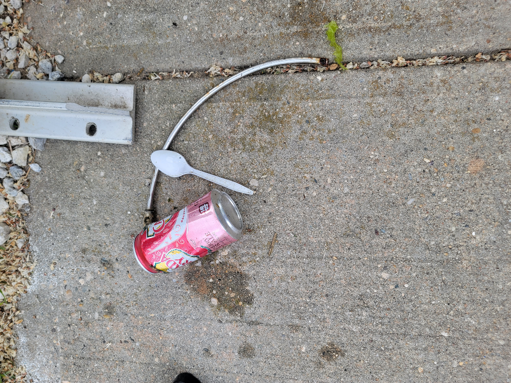
Entangled Help


Use the vertical tabs below to record any entangled animals you found of each type.

Crummunda Park

0
0
0
0
0
0
0
sand
0
2
0
0
0

-26.765305570192, 153.12249960921

Sunny
Debbie Ives
0
0
0
0
0
0
0
0
0
0
0
0
0
0
0
0
0
0
0
3
0
0
0
0
0
1
0
0
0
0
0
0
1
0
0
0
0.50
20
3.00
1.00
0
estimated
0
0
965.78
0
0
0
0
0
0
On
kilograms
0
I have debris data to report
0
0
0
Calm (glassy to rippled) for waves 0 – 0.1 meter high
0
0
0
0
0
0
0
m2
0
0
meters
other
0
0
0
0
0
0
0
0
0
0
0
0
0
1
0
0
0
0
0
0
0
0
1
0
0
0
0
0
0
Australia
State\Province
Qld
City
Currumundi
Map Help


Dive Location

If you know your survey site coordinates, enter them manually in decimal degrees using WGS84 Map Datum. Use the minus sign for latitudes south of the equator and longitudes west of the Prime Meridian to 180 degrees.

If you do not know your survey site coordinates, click the “Map Location” tab to use the map to zoom into your survey site and drop the pin on the map to fall within your survey dive site in the water (not on land or the beach). Ensure you zoom in as much as possible to ensure data accuracy.
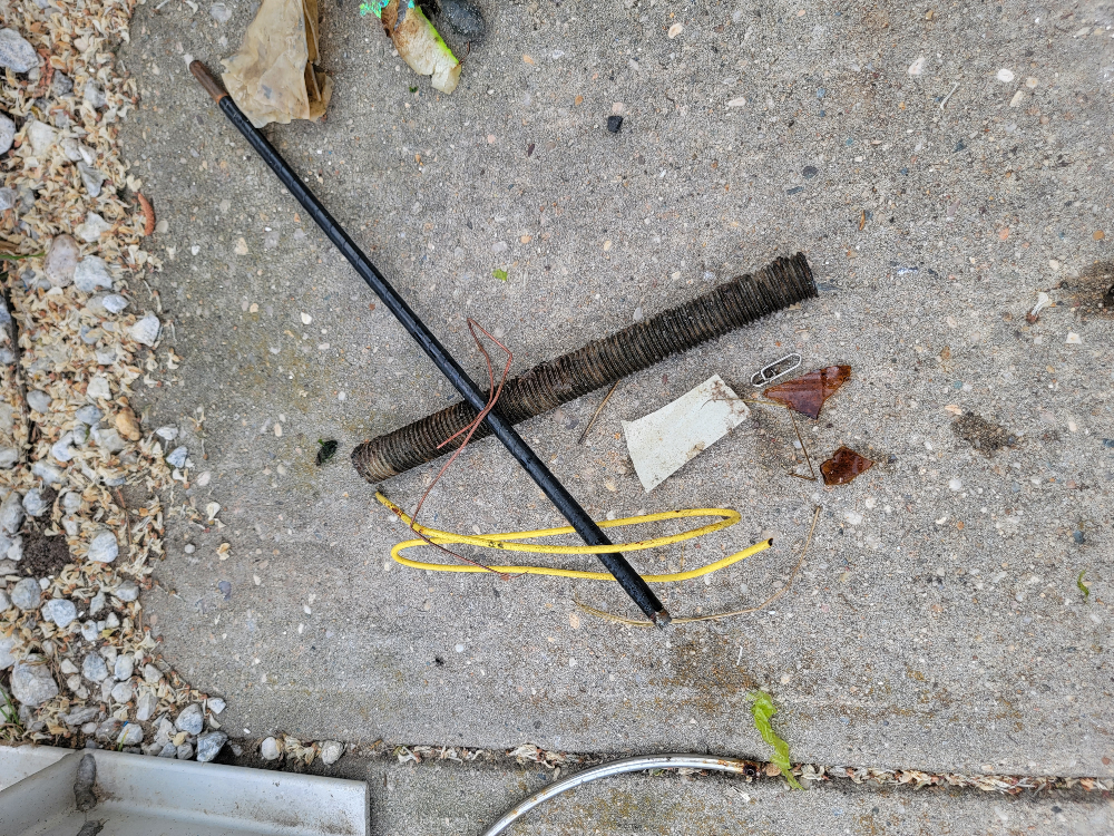
Entangled Help


Use the vertical tabs below to record any entangled animals you found of each type.

Ecosystem Other
Other

willow beach

sand

35.889920659416, -114.68495030026

cook pot
18 mph with gusts up to 31
1
1
4
10 gallon pot
umbrella
sunglasses
Blue Note Scuba/ Mana Scuba
Ken Wige
1
1
2
1
1
30.00
48
35.00
20.00
estimated
300.00
1
umbrella
On
pounds
I have debris data to report
2
Moderate to rough for waves greater than 1.25 meters ft2
1
1
feet
other
2
2
1
United States
State\Province
AZ
City
willow beach
Map Help


Dive Location

If you know your survey site coordinates, enter them manually in decimal degrees using WGS84 Map Datum. Use the minus sign for latitudes south of the equator and longitudes west of the Prime Meridian to 180 degrees.

If you do not know your survey site coordinates, click the “Map Location” tab to use the map to zoom into your survey site and drop the pin on the map to fall within your survey dive site in the water (not on land or the beach). Ensure you zoom in as much as possible to ensure data accuracy.
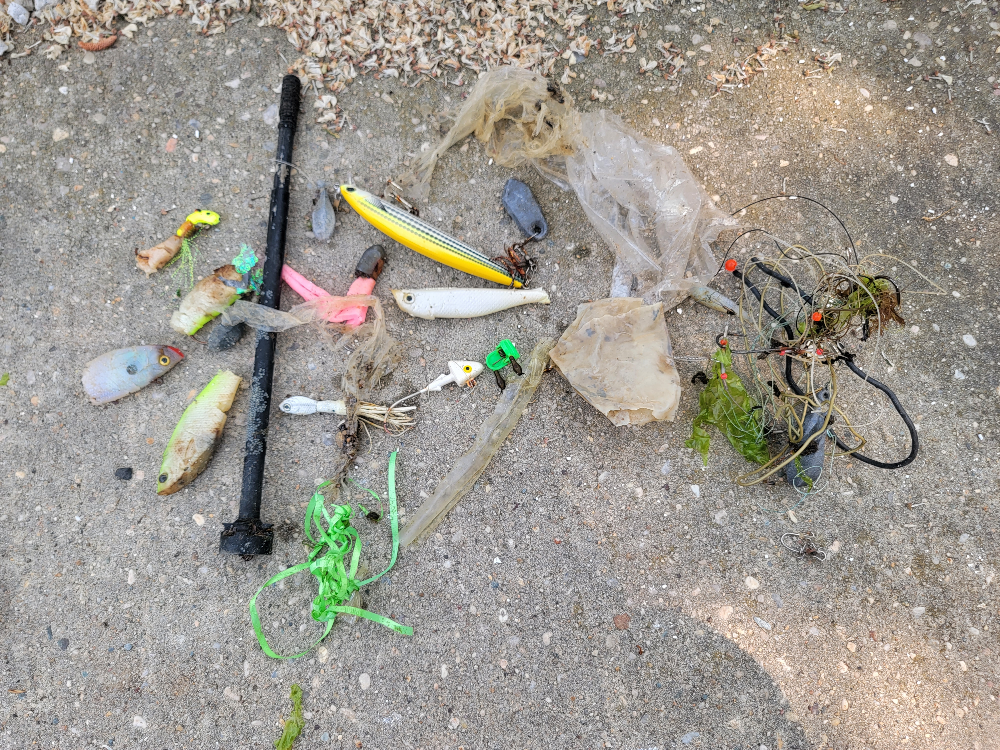
Entangled Help


Use the vertical tabs below to record any entangled animals you found of each type.

Ecosystem Other
River

Padang Bai - Blue Lagoon

5
18
sand
4

-8.5297670055419, 115.51414523134

Yes, AquaMarine's Monthly Dive Against Debris.
Cloudy,
Shiny
AquaMarine Diving - Bali
Aramita Livia Ardis
2
1
6
1
1.72
43
12.50
5.00
3
measured
9
1000.00
Fishing Nets. lures, sinkers
Plastic Packages
On
kilograms
I have debris data to report
Calm (glassy to rippled) for waves 0 – 0.1 meter high
2
3
m2
meters
coral reef
Indonesia
State\Province
Bali
City
Badung
Map Help


Dive Location

If you know your survey site coordinates, enter them manually in decimal degrees using WGS84 Map Datum. Use the minus sign for latitudes south of the equator and longitudes west of the Prime Meridian to 180 degrees.

If you do not know your survey site coordinates, click the “Map Location” tab to use the map to zoom into your survey site and drop the pin on the map to fall within your survey dive site in the water (not on land or the beach). Ensure you zoom in as much as possible to ensure data accuracy.

Entangled Help


Use the vertical tabs below to record any entangled animals you found of each type.

Tejon

1
1
1
rock

15.762692155227, -96.111866604487

No
Condom wrapper
Nothing unusual, strong surge.
Huatulco Dive Center
David-Alexandre Gassin
1
1
3
1
0.15
50
12.00
5.00
estimated
250.00
On
kilograms
I have debris data to report
Slight for waves 0.5 -1.25 meter high m2
meters
rocky reef
Mexico
State\Province
Oaxaca
City
Huatulco
Map Help


Dive Location

If you know your survey site coordinates, enter them manually in decimal degrees using WGS84 Map Datum. Use the minus sign for latitudes south of the equator and longitudes west of the Prime Meridian to 180 degrees.

If you do not know your survey site coordinates, click the “Map Location” tab to use the map to zoom into your survey site and drop the pin on the map to fall within your survey dive site in the water (not on land or the beach). Ensure you zoom in as much as possible to ensure data accuracy.

Entangled Help


Use the vertical tabs below to record any entangled animals you found of each type.

Kalamaki, Agioi Theodoroi

97
sand
26
1

37.922563324994, 23.019554674422

The cleanup was conducted in collaboration with Hellenic Cables company
steering wheel
All For Blue
Katerina Topouzoglou
2
3
10
5
35
4
3
38
5
53
3
1
22
72.00
90
5.00
1.00
3
measured
1
106.65
1
On
kilograms
I have debris data to report
11
Smooth (wavelets) for waves 0.1 - 0.5 meter high
3
1
m2
5
cardboard-plastic package
sea urchins
Released Unharmed
meters
seagrass
1
19
1
1
Greece
State\Province
Attika
City
Athens
Map Help


Dive Location

If you know your survey site coordinates, enter them manually in decimal degrees using WGS84 Map Datum. Use the minus sign for latitudes south of the equator and longitudes west of the Prime Meridian to 180 degrees.

If you do not know your survey site coordinates, click the “Map Location” tab to use the map to zoom into your survey site and drop the pin on the map to fall within your survey dive site in the water (not on land or the beach). Ensure you zoom in as much as possible to ensure data accuracy.

Entangled Help


Use the vertical tabs below to record any entangled animals you found of each type.

Aow Luek

2
7
2
6
sand
2

10.071582014866, 99.839976391611

Tropical Storm
1
bracelet
The Coral Tribe
Jennifer Dowling
1
1
2
2
0.80
58
9.70
5.00
8
measured
49.00
plastic bag
net
rope
2
On
kilograms
I have debris data to report
Smooth (wavelets) for waves 0.1 - 0.5 meter high
n/a
Released Unharmed
shrimp
crabs
Released Unharmed
1
1
N/A
1
1
m2
2
meters
coral reef
2
1
1
Thailand
State\Province
Surat Thani
City
Koh Tao
Map Help


Dive Location

If you know your survey site coordinates, enter them manually in decimal degrees using WGS84 Map Datum. Use the minus sign for latitudes south of the equator and longitudes west of the Prime Meridian to 180 degrees.

If you do not know your survey site coordinates, click the “Map Location” tab to use the map to zoom into your survey site and drop the pin on the map to fall within your survey dive site in the water (not on land or the beach). Ensure you zoom in as much as possible to ensure data accuracy.

Entangled Help


Use the vertical tabs below to record any entangled animals you found of each type.

Subscribe to