Menu

Aow Luek

2
7
2
6
sand
2

10.071582014866, 99.839976391611

Tropical Storm
1
bracelet
The Coral Tribe
Jennifer Dowling
1
1
2
2
0.80
58
9.70
5.00
8
measured
49.00
plastic bag
net
rope
2
On
kilograms
I have debris data to report
Smooth (wavelets) for waves 0.1 - 0.5 meter high
n/a
Released Unharmed
shrimp
crabs
Released Unharmed
1
1
N/A
1
1
m2
2
meters
coral reef
2
1
1
Thailand
State\Province
Surat Thani
City
Koh Tao
Map Help


Dive Location

If you know your survey site coordinates, enter them manually in decimal degrees using WGS84 Map Datum. Use the minus sign for latitudes south of the equator and longitudes west of the Prime Meridian to 180 degrees.

If you do not know your survey site coordinates, click the “Map Location” tab to use the map to zoom into your survey site and drop the pin on the map to fall within your survey dive site in the water (not on land or the beach). Ensure you zoom in as much as possible to ensure data accuracy.

Entangled Help


Use the vertical tabs below to record any entangled animals you found of each type.

Aow Luek

5
22
sand
4
3

10.072162750719, 99.840065176464

Tropical Storm
2
1
1
1
PPE
Tooth Paste
Scarf
Pencil
The Coral Tribe
Jennifer Dowling
3
1
1
1
1
1.40
64
11.80
7.20
7
measured
100.00
fishing net
nylon ropes
plastic cups
On
kilograms
I have debris data to report
Smooth (wavelets) for waves 0.1 - 0.5 meter high
n/a
crabs
Released Unharmed
10
m2
1
meters
coral reef
2
Thailand
State\Province
Surat Thani
City
Koh Tao
Map Help


Dive Location

If you know your survey site coordinates, enter them manually in decimal degrees using WGS84 Map Datum. Use the minus sign for latitudes south of the equator and longitudes west of the Prime Meridian to 180 degrees.

If you do not know your survey site coordinates, click the “Map Location” tab to use the map to zoom into your survey site and drop the pin on the map to fall within your survey dive site in the water (not on land or the beach). Ensure you zoom in as much as possible to ensure data accuracy.
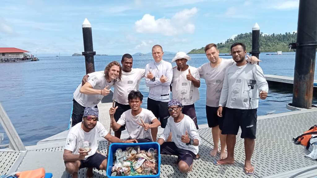
Entangled Help


Use the vertical tabs below to record any entangled animals you found of each type.

Blue Planet House Reef

4
coral
3

-5.609206361168, 120.4487295799

T-shirt
Indo Ocean Project
Sigrid
1
2
1
1.30
50
20.00
4.00
measured
2000.00
Fishing Line
1
On
kilograms
I have debris data to report
Calm (glassy to rippled) for waves 0 – 0.1 meter high m2
meters
coral reef
3
1
Indonesia
State\Province
South Sulawesi
City
Bulukumba
Map Help


Dive Location

If you know your survey site coordinates, enter them manually in decimal degrees using WGS84 Map Datum. Use the minus sign for latitudes south of the equator and longitudes west of the Prime Meridian to 180 degrees.

If you do not know your survey site coordinates, click the “Map Location” tab to use the map to zoom into your survey site and drop the pin on the map to fall within your survey dive site in the water (not on land or the beach). Ensure you zoom in as much as possible to ensure data accuracy.
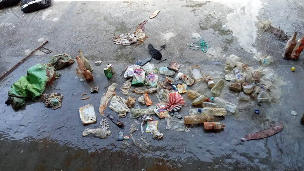
Entangled Help


Use the vertical tabs below to record any entangled animals you found of each type.

AOW MAO

25
19
10
sand
4
4

10.093384159335, 99.852983397884

NO
Rolling Pin
tropical storms
3
10
4
1
2
1
1
Plastic Pen
Plastic Burlaps
PPE
Covid Test
Cushions
Rolling Pin
Dog Lead
The Coral Tribe
Jenifer Dowling
2
4
8
14
0
138
1
22.50
51
12.00
7.00
measured
2
100.00
Plastic Bottle
Fishing net
Burlaps sack
On
kilograms
I have debris data to report
Smooth (wavelets) for waves 0.1 - 0.5 meter high
6
N/A
Released Unharmed
Shrimp
crab
Released Unharmed
3
2
N/A
13
m2
7
1
N/A
Brittle Star
Released Unharmed
meters
coral reef
2
13
1
8
1
Thailand
State\Province
Surat Thani
City
Koh Tao
Map Help


Dive Location

If you know your survey site coordinates, enter them manually in decimal degrees using WGS84 Map Datum. Use the minus sign for latitudes south of the equator and longitudes west of the Prime Meridian to 180 degrees.

If you do not know your survey site coordinates, click the “Map Location” tab to use the map to zoom into your survey site and drop the pin on the map to fall within your survey dive site in the water (not on land or the beach). Ensure you zoom in as much as possible to ensure data accuracy.
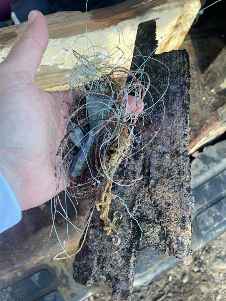
Entangled Help


Use the vertical tabs below to record any entangled animals you found of each type.

Zamami

0
0
0
0

26.25928610196, 127.29178839618

0
0
0
coral
0
0
0
0
0
Cloudy
Dive Terry’s
Toru
0
0
0
0
0
0
0
0
0
0
0
0
0
0
0
0
0
0
0
2
0
0
0
0
0
0
0
0
1
0
0
0
0
0
0
0
2.00
40
16.00
6.00
1
estimated
0
0
645767.00
0
0
0
0
0
0
On
kilograms
0
I have debris data to report
0
0
0
Smooth (wavelets) for waves 0.1 - 0.5 meter high
0
0
0
0
0
0
0
m2
0
0
meters
coral reef
0
0
0
0
0
0
0
0
0
0
0
0
0
0
0
0
0
0
0
0
0
0
0
0
0
0
0
0
0
Japan
State\Province
Okinawa
City
Zamami
Map Help


Dive Location

If you know your survey site coordinates, enter them manually in decimal degrees using WGS84 Map Datum. Use the minus sign for latitudes south of the equator and longitudes west of the Prime Meridian to 180 degrees.

If you do not know your survey site coordinates, click the “Map Location” tab to use the map to zoom into your survey site and drop the pin on the map to fall within your survey dive site in the water (not on land or the beach). Ensure you zoom in as much as possible to ensure data accuracy.

Entangled Help


Use the vertical tabs below to record any entangled animals you found of each type.

Kalatita

5

20.4948742, -86.9645072

3
seagrass
60

20.5046173, -105.3819935

Plastic Sandbag under rocks, could not remove.
Storm with Strong Winds
Cozumel Dive School
Elizabeth Macleod
1
3
1.10
67
6.00
2.00
measured
57
50.00
2
Fishing Hooks
Fishing Line
On
kilograms
I have debris data to report
Calm (glassy to rippled) for waves 0 – 0.1 meter high
4
m2
meters
rocky reef
7
21
11
Mexico
State\Province
Quintaroo
City
Cozumel
Map Help


Dive Location

If you know your survey site coordinates, enter them manually in decimal degrees using WGS84 Map Datum. Use the minus sign for latitudes south of the equator and longitudes west of the Prime Meridian to 180 degrees.

If you do not know your survey site coordinates, click the “Map Location” tab to use the map to zoom into your survey site and drop the pin on the map to fall within your survey dive site in the water (not on land or the beach). Ensure you zoom in as much as possible to ensure data accuracy.

Entangled Help


Use the vertical tabs below to record any entangled animals you found of each type.

Churchill Barrier 3 S27568

0
2
0
15

58.871928, -2.916393

2
0
0
sand
0
0
0
4
0
Calmish
Kraken Diving
Margot Watson
0
0
0
0
0
0
0
0
0
0
0
0
0
0
0
0
0
0
0
3
0
0
0
0
0
0
0
0
0
0
0
0
0
0
0
0
5.00
45
8.50
2.00
5
estimated
0
0
0
1
1769.57
0
0
0
0
0
Fishing line
Fishing rope
Lobster pots
0
On
kilograms
0
I have debris data to report
0
0
0
Smooth (wavelets) for waves 0.1 - 0.5 meter high
0
0
0
0
0
0
0
m2
0
0
meters
kelp
1
0
0
0
0
0
0
0
0
0
0
0
0
0
0
0
0
0
0
0
0
0
0
0
0
0
0
0
0
United Kingdom
State\Province
Orkney
City
St Mary's
Map Help


Dive Location

If you know your survey site coordinates, enter them manually in decimal degrees using WGS84 Map Datum. Use the minus sign for latitudes south of the equator and longitudes west of the Prime Meridian to 180 degrees.

If you do not know your survey site coordinates, click the “Map Location” tab to use the map to zoom into your survey site and drop the pin on the map to fall within your survey dive site in the water (not on land or the beach). Ensure you zoom in as much as possible to ensure data accuracy.

Entangled Help


Use the vertical tabs below to record any entangled animals you found of each type.

Big Harcar

0
0
0
0

55.638892, -1.61947

0
0
0
rock
0
0
0
0
0
Fairly rough seas
The Fifth Point Diving Centre
Matt Stephenson
0
0
0
0
0
0
0
0
0
0
0
0
0
0
0
0
0
0
0
9
0
0
0
0
0
0
0
0
0
0
0
0
0
0
0
0
0.00
36
15.20
5.00
0
estimated
0
0
0
0
3850.14
0
0
0
0
0
0
On
pounds
0
Our Survey Site was free of debris
0
0
0
Slight for waves 0.5 -1.25 meter high
0
0
0
0
0
0
0
m2
0
0
meters
rocky reef
0
0
0
0
0
0
0
0
0
0
0
0
0
0
0
0
0
0
0
0
0
0
0
0
0
0
0
0
0
United Kingdom
State\Province
Northumberland
City
Seahouses
Map Help


Dive Location

If you know your survey site coordinates, enter them manually in decimal degrees using WGS84 Map Datum. Use the minus sign for latitudes south of the equator and longitudes west of the Prime Meridian to 180 degrees.

If you do not know your survey site coordinates, click the “Map Location” tab to use the map to zoom into your survey site and drop the pin on the map to fall within your survey dive site in the water (not on land or the beach). Ensure you zoom in as much as possible to ensure data accuracy.

Entangled Help


Use the vertical tabs below to record any entangled animals you found of each type.

BLUE CAPS

0
0
0
0

55.639821, -1.610818

0
0
0
rock
0
0
0
0
0
Fairly rough seas
The Fifth Point
Matt Stephenson
0
0
0
0
0
0
0
0
0
0
0
0
0
0
0
0
0
0
0
12
0
0
0
0
0
0
0
0
0
0
0
0
0
0
0
0
0.00
34
25.00
5.00
0
estimated
0
0
0
0
9323.29
0
0
0
0
0
0
On
pounds
0
Our Survey Site was free of debris
0
0
0
Smooth (wavelets) for waves 0.1 - 0.5 meter high
0
0
0
0
0
0
0
m2
0
0
meters
rocky reef
0
0
0
0
0
0
0
0
0
0
0
0
0
0
0
0
0
0
0
0
0
0
0
0
0
0
0
0
0
United Kingdom
State\Province
Northumberland
City
Seahouses
Map Help


Dive Location

If you know your survey site coordinates, enter them manually in decimal degrees using WGS84 Map Datum. Use the minus sign for latitudes south of the equator and longitudes west of the Prime Meridian to 180 degrees.

If you do not know your survey site coordinates, click the “Map Location” tab to use the map to zoom into your survey site and drop the pin on the map to fall within your survey dive site in the water (not on land or the beach). Ensure you zoom in as much as possible to ensure data accuracy.

Entangled Help


Use the vertical tabs below to record any entangled animals you found of each type.

Logans Run

sand

25.012878509511, -80.372706626327

strong current
none
Windy, waves
Rainbow Reef Dive Center
Chad Jackson
7
0.00
36
33.00
20.00
estimated
25000.00
On
pounds
Our Survey Site was free of debris
Smooth (wavelets) for waves 0.1 - 0.5 meter high ft2
feet
coral reef
United States
State\Province
FL
City
Key Largo
Map Help


Dive Location

If you know your survey site coordinates, enter them manually in decimal degrees using WGS84 Map Datum. Use the minus sign for latitudes south of the equator and longitudes west of the Prime Meridian to 180 degrees.

If you do not know your survey site coordinates, click the “Map Location” tab to use the map to zoom into your survey site and drop the pin on the map to fall within your survey dive site in the water (not on land or the beach). Ensure you zoom in as much as possible to ensure data accuracy.

Entangled Help


Use the vertical tabs below to record any entangled animals you found of each type.

Subscribe to