Menu

osezak S5607

0
0
0
0

35.039538600629, 138.78622800298

0
0
0
sand
0
2
0
0
0
fine
Dive Terry's
Toru
0
0
0
0
0
0
0
0
0
0
0
0
0
0
0
0
0
1
0
12
0
0
0
0
1
0
0
0
0
0
0
0
0
0
0
0
2.00
35
16.00
6.00
0
estimated
0
0
34310.20
0
0
0
0
0
0
On
kilograms
0
I have debris data to report
0
0
0
Calm (glassy to rippled) for waves 0 – 0.1 meter high
0
0
0
0
0
0
0
m2
0
0
meters
other
0
0
0
0
0
0
0
0
0
0
0
0
0
0
0
0
0
0
0
0
0
0
0
0
0
0
0
0
0
Japan
State\Province
Shizuoka
City
Numadu
Map Help


Dive Location

If you know your survey site coordinates, enter them manually in decimal degrees using WGS84 Map Datum. Use the minus sign for latitudes south of the equator and longitudes west of the Prime Meridian to 180 degrees.

If you do not know your survey site coordinates, click the “Map Location” tab to use the map to zoom into your survey site and drop the pin on the map to fall within your survey dive site in the water (not on land or the beach). Ensure you zoom in as much as possible to ensure data accuracy.

Entangled Help


Use the vertical tabs below to record any entangled animals you found of each type.

Ecosystem Other
sand

Manta point

0
0
0
0

-8.791971959457, 115.52366036621

0
0
0
coral
0
0
0
0
0
Sunny
Purple dive penida
Yvonne
0
0
0
0
0
0
0
0
0
0
0
0
0
0
0
0
0
0
0
2
0
0
0
0
0
0
0
0
0
0
0
0
0
0
0
0
0.00
42
11.20
5.00
0
measured
0
0
1980.50
0
0
0
0
0
0
On
kilograms
0
Our Survey Site was free of debris
0
0
0
Smooth (wavelets) for waves 0.1 - 0.5 meter high
0
0
0
0
0
0
0
m2
0
0
meters
coral reef
0
0
0
0
0
0
0
0
0
0
0
0
0
0
0
0
0
0
0
0
0
0
0
0
0
0
0
0
0
Indonesia
State\Province
Klungkung
City
Nusa Penida
Map Help


Dive Location

If you know your survey site coordinates, enter them manually in decimal degrees using WGS84 Map Datum. Use the minus sign for latitudes south of the equator and longitudes west of the Prime Meridian to 180 degrees.

If you do not know your survey site coordinates, click the “Map Location” tab to use the map to zoom into your survey site and drop the pin on the map to fall within your survey dive site in the water (not on land or the beach). Ensure you zoom in as much as possible to ensure data accuracy.

Entangled Help


Use the vertical tabs below to record any entangled animals you found of each type.

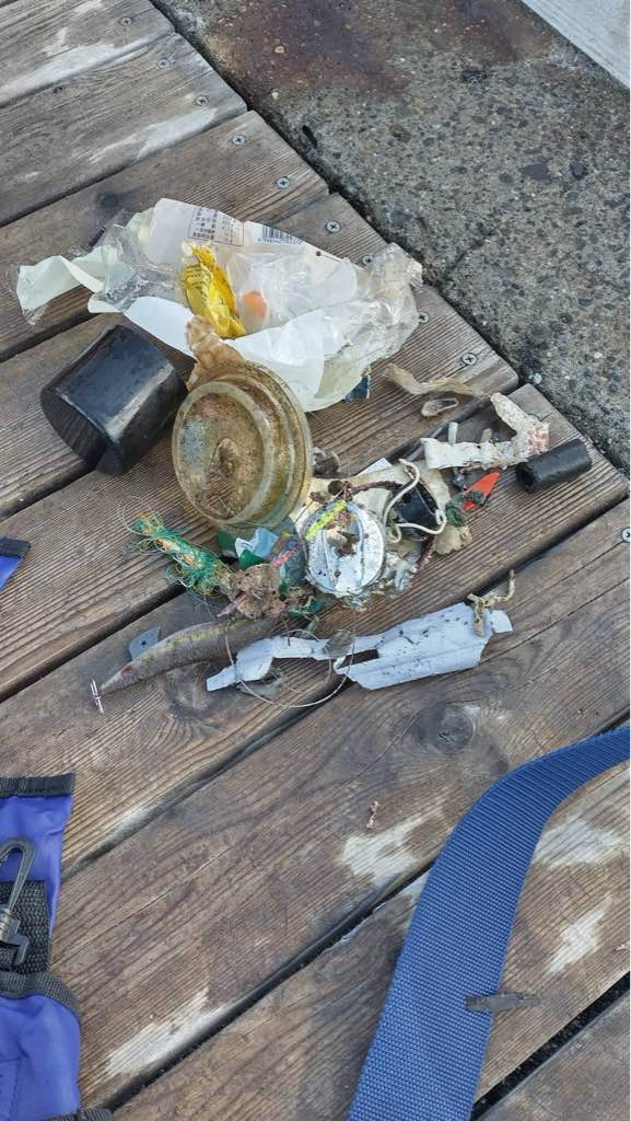
Lake Phoenix S22073

0
9
0
0

36.95207784772, -77.765283716239

0
0
0
silt
0
0
0
0
0
None
Binder clip metal
Rainy
Blue Planet Scuba
Michelle Swiger
0
0
0
0
0
0
0
0
0
0
0
0
0
9
0
0
0
0
0
3
0
0
0
0
0
0
0
0
0
0
0
0
0
0
0
0
0.40
34
25.00
10.00
0
measured
0
0
0
0
6721.00
0
0
0
7
0
Plastic
Metal wire pieces
0
On
pounds
0
I have debris data to report
0
0
0
Calm (glassy to rippled) for waves 0 – 0.1 meter high
0
0
0
0
0
0
1
ft2
0
0
feet
other
3
0
0
0
0
0
0
0
0
0
0
0
0
0
0
22
0
0
0
0
0
0
0
0
0
0
0
0
0
United States
State\Province
Va
City
Rawlings
Map Help


Dive Location

If you know your survey site coordinates, enter them manually in decimal degrees using WGS84 Map Datum. Use the minus sign for latitudes south of the equator and longitudes west of the Prime Meridian to 180 degrees.

If you do not know your survey site coordinates, click the “Map Location” tab to use the map to zoom into your survey site and drop the pin on the map to fall within your survey dive site in the water (not on land or the beach). Ensure you zoom in as much as possible to ensure data accuracy.
Entangled Help


Use the vertical tabs below to record any entangled animals you found of each type.

Ecosystem Other
freshwater lake

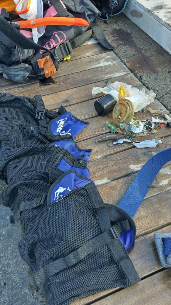
Dubai. La Mer Beach

0
0
0
0

25.219287700911, 55.250934072809

0
0
0
seagrass
0
0
0
0
0
Beach activities
Plastic
Calm
1
Diving Weight belt
Dive Fantasy
Saeed S Majed
0
0
0
0
0
0
0
0
0
0
0
0
0
0
0
0
0
0
0
3
0
0
0
0
0
0
0
0
0
0
0
0
0
0
0
0
20.00
45
7.00
1.00
0
estimated
0
0
4582.40
0
0
0
0
0
Plastic bags
Drink tin cans
0
On
kilograms
0
I have debris data to report
0
0
0
Calm (glassy to rippled) for waves 0 – 0.1 meter high
0
0
0
Plastic
Crap
Released Unharmed
4
0
0
0
0
m2
0
0
meters
seagrass
0
0
0
0
0
0
0
0
0
0
0
0
0
0
0
0
0
0
0
0
0
0
0
0
0
0
3
0
0
United Arab Emirates
State\Province
Dubai
City
Dubai
Map Help


Dive Location

If you know your survey site coordinates, enter them manually in decimal degrees using WGS84 Map Datum. Use the minus sign for latitudes south of the equator and longitudes west of the Prime Meridian to 180 degrees.

If you do not know your survey site coordinates, click the “Map Location” tab to use the map to zoom into your survey site and drop the pin on the map to fall within your survey dive site in the water (not on land or the beach). Ensure you zoom in as much as possible to ensure data accuracy.
Entangled Help


Use the vertical tabs below to record any entangled animals you found of each type.

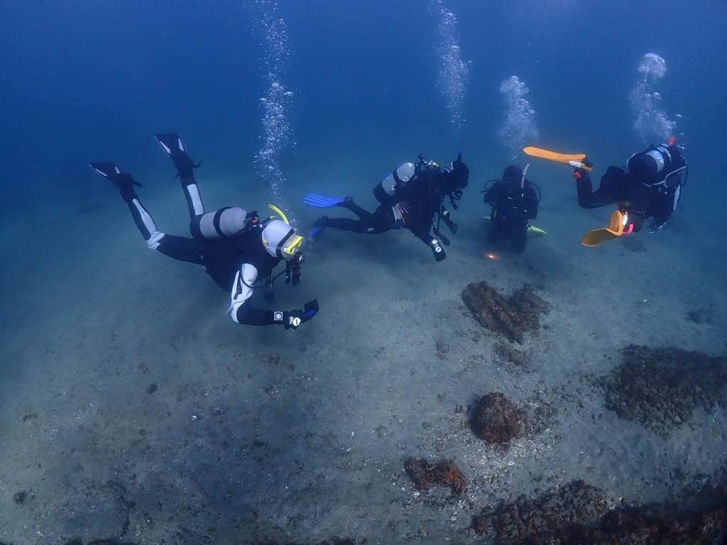
Tala Bay

1
1
0
0

29.43426, 34.972391

0
0
0
seagrass
0
0
0
0
0
Windy
2
Plastic boxes
Deep Blue Dive Center
Catherine Hoelzer
0
0
0
1
0
0
0
0
0
0
1
0
0
0
0
0
0
0
3
2
0
0
0
0
0
0
0
0
0
0
0
0
0
0
0
0
0.25
50
20.00
5.00
0
estimated
0
0
920.24
0
0
0
0
0
0
On
kilograms
0
I have debris data to report
0
0
0
Calm (glassy to rippled) for waves 0 – 0.1 meter high
0
0
0
0
0
0
0
m2
0
0
meters
coral reef
0
0
0
0
0
0
0
0
0
0
0
0
0
0
0
0
0
1
0
0
0
0
0
0
0
0
0
0
0
Jordan
State\Province
Aqaba
City
Aqaba
Map Help


Dive Location

If you know your survey site coordinates, enter them manually in decimal degrees using WGS84 Map Datum. Use the minus sign for latitudes south of the equator and longitudes west of the Prime Meridian to 180 degrees.

If you do not know your survey site coordinates, click the “Map Location” tab to use the map to zoom into your survey site and drop the pin on the map to fall within your survey dive site in the water (not on land or the beach). Ensure you zoom in as much as possible to ensure data accuracy.
Entangled Help


Use the vertical tabs below to record any entangled animals you found of each type.

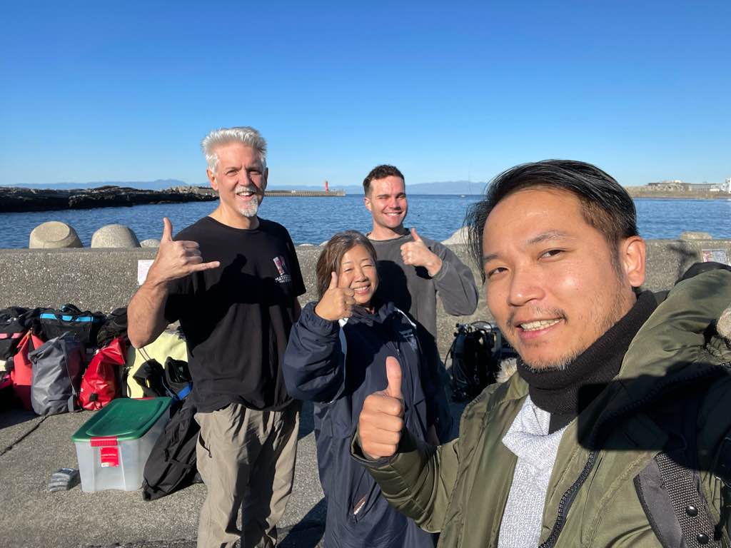
Bounty Wreck

7
2
0
0

-8.3554916375585, 116.04251705201

0
0
0
coral
0
0
0
0
1
No
Diaper
Good
1
Snorkel
Blue Marlin Gili T
Matt Keeley
0
0
0
1
1
0
0
0
0
1
0
0
0
0
1
0
0
0
2
10
1
0
0
0
4
0
0
0
0
0
0
0
0
0
0
0
1.00
45
23.00
10.00
0
estimated
0
0
312.83
0
0
0
2
0
Plastic food wrappers
0
On
kilograms
0
I have debris data to report
0
0
0
Calm (glassy to rippled) for waves 0 – 0.1 meter high
0
0
0
0
0
0
0
m2
0
0
meters
coral reef
0
0
0
0
0
0
0
0
0
0
0
0
0
0
0
0
1
0
0
0
0
0
0
0
0
0
0
0
0
Indonesia
City
Gili T
Map Help


Dive Location

If you know your survey site coordinates, enter them manually in decimal degrees using WGS84 Map Datum. Use the minus sign for latitudes south of the equator and longitudes west of the Prime Meridian to 180 degrees.

If you do not know your survey site coordinates, click the “Map Location” tab to use the map to zoom into your survey site and drop the pin on the map to fall within your survey dive site in the water (not on land or the beach). Ensure you zoom in as much as possible to ensure data accuracy.
Entangled Help


Use the vertical tabs below to record any entangled animals you found of each type.

Edmonds Underwater Park #444074

0
1
0
0

47.81435, -122.381549

0
0
0
sand
0
0
0
0
0
Boater trash
There was a huge group of people who came to ask about the trash and take photos of it so I completely failed to take a photo of the spread!
Fancy bottle
Sunny
Tro Ota
0
0
0
0
0
0
0
0
0
0
0
0
0
0
0
0
0
0
0
2
0
0
0
0
0
0
0
0
0
0
0
0
7
0
0
0
27.00
45
50.00
36.00
0
measured
0
0
0
0
217.38
0
0
1
0
0
Glass bottles
Golf balls
Cans
0
On
pounds
0
I have debris data to report
3
0
0
Slight for waves 0.5 -1.25 meter high
0
0
0
0
0
0
0
m2
0
0
feet
rocky reef
2
0
0
0
0
0
0
0
0
0
0
0
0
0
0
0
0
0
0
0
0
0
17
0
0
0
0
4
0
United States
State\Province
Washington
City
Edmonds
Map Help


Dive Location

If you know your survey site coordinates, enter them manually in decimal degrees using WGS84 Map Datum. Use the minus sign for latitudes south of the equator and longitudes west of the Prime Meridian to 180 degrees.

If you do not know your survey site coordinates, click the “Map Location” tab to use the map to zoom into your survey site and drop the pin on the map to fall within your survey dive site in the water (not on land or the beach). Ensure you zoom in as much as possible to ensure data accuracy.

Entangled Help


Use the vertical tabs below to record any entangled animals you found of each type.

Edmonds Underwater Park #444074

1
0
0
0

47.81435, -122.381549

0
0
0
sand
0
0
0
0
0
Candy wrapper
Sunny
Tro Ota
0
0
0
0
0
0
0
0
0
0
0
0
0
0
0
0
0
0
0
2
0
0
0
0
0
0
0
0
0
0
0
0
0
0
0
0
0.10
41
17.00
10.00
0
measured
0
0
0
0
661.90
0
0
0
0
0
Cans
Bottles
Golf balls
0
On
pounds
0
I have debris data to report
0
0
0
Smooth (wavelets) for waves 0.1 - 0.5 meter high
0
0
0
0
0
0
0
m2
0
0
feet
rocky reef
2
0
0
0
0
0
0
0
0
0
0
0
0
0
0
0
0
0
0
0
0
0
0
0
0
0
0
0
0
United States
State\Province
Washington
City
Edmonds
Map Help


Dive Location

If you know your survey site coordinates, enter them manually in decimal degrees using WGS84 Map Datum. Use the minus sign for latitudes south of the equator and longitudes west of the Prime Meridian to 180 degrees.

If you do not know your survey site coordinates, click the “Map Location” tab to use the map to zoom into your survey site and drop the pin on the map to fall within your survey dive site in the water (not on land or the beach). Ensure you zoom in as much as possible to ensure data accuracy.

Entangled Help


Use the vertical tabs below to record any entangled animals you found of each type.

Scuba Republic House Reef

1
5

-0.442641, 130.753435

rock
1
2
No unusal event that we are aware of.
Large piece of Machined Wood.
Sunny with Minimal rain and wind.
Indo Ocean Project
Michael van Zyl
6
0.71
50
19.00
5.00
measured
25.00
Plastic Food Wrapping
Plastic Bags
Fishing Line
On
kilograms
I have debris data to report
1
Calm (glassy to rippled) for waves 0 – 0.1 meter high m2
meters
coral reef
Indonesia
City
Waigeo
Map Help


Dive Location

If you know your survey site coordinates, enter them manually in decimal degrees using WGS84 Map Datum. Use the minus sign for latitudes south of the equator and longitudes west of the Prime Meridian to 180 degrees.

If you do not know your survey site coordinates, click the “Map Location” tab to use the map to zoom into your survey site and drop the pin on the map to fall within your survey dive site in the water (not on land or the beach). Ensure you zoom in as much as possible to ensure data accuracy.

Entangled Help


Use the vertical tabs below to record any entangled animals you found of each type.

South Pier

3
166
3
5
10
coral
8
1
458
-1

12.146716843504, -68.277365813675

cruise boats, freight ships
LED light construction site
2
2kg
Vapes
Mixed
Dive Friends Bonaire
Ilse de Loyer
3
74
3
2
27
80
28
1
350.00
60
18.00
4.00
estimated
1317.00
8
4
15
plastic fragments
plastic cups
fishing line
9
On
kilograms
I have debris data to report
62
Calm (glassy to rippled) for waves 0 – 0.1 meter high
15
13
1
52
m2
78
meters
coral reef
32
3
11
1
20
3
2
6
16
22
5
Netherlands Antilles
City
Kralendijk
Map Help


Dive Location

If you know your survey site coordinates, enter them manually in decimal degrees using WGS84 Map Datum. Use the minus sign for latitudes south of the equator and longitudes west of the Prime Meridian to 180 degrees.

If you do not know your survey site coordinates, click the “Map Location” tab to use the map to zoom into your survey site and drop the pin on the map to fall within your survey dive site in the water (not on land or the beach). Ensure you zoom in as much as possible to ensure data accuracy.

Entangled Help


Use the vertical tabs below to record any entangled animals you found of each type.

Subscribe to