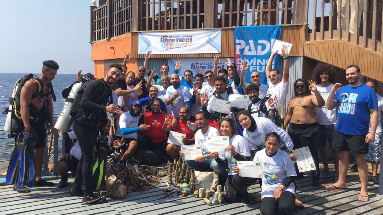
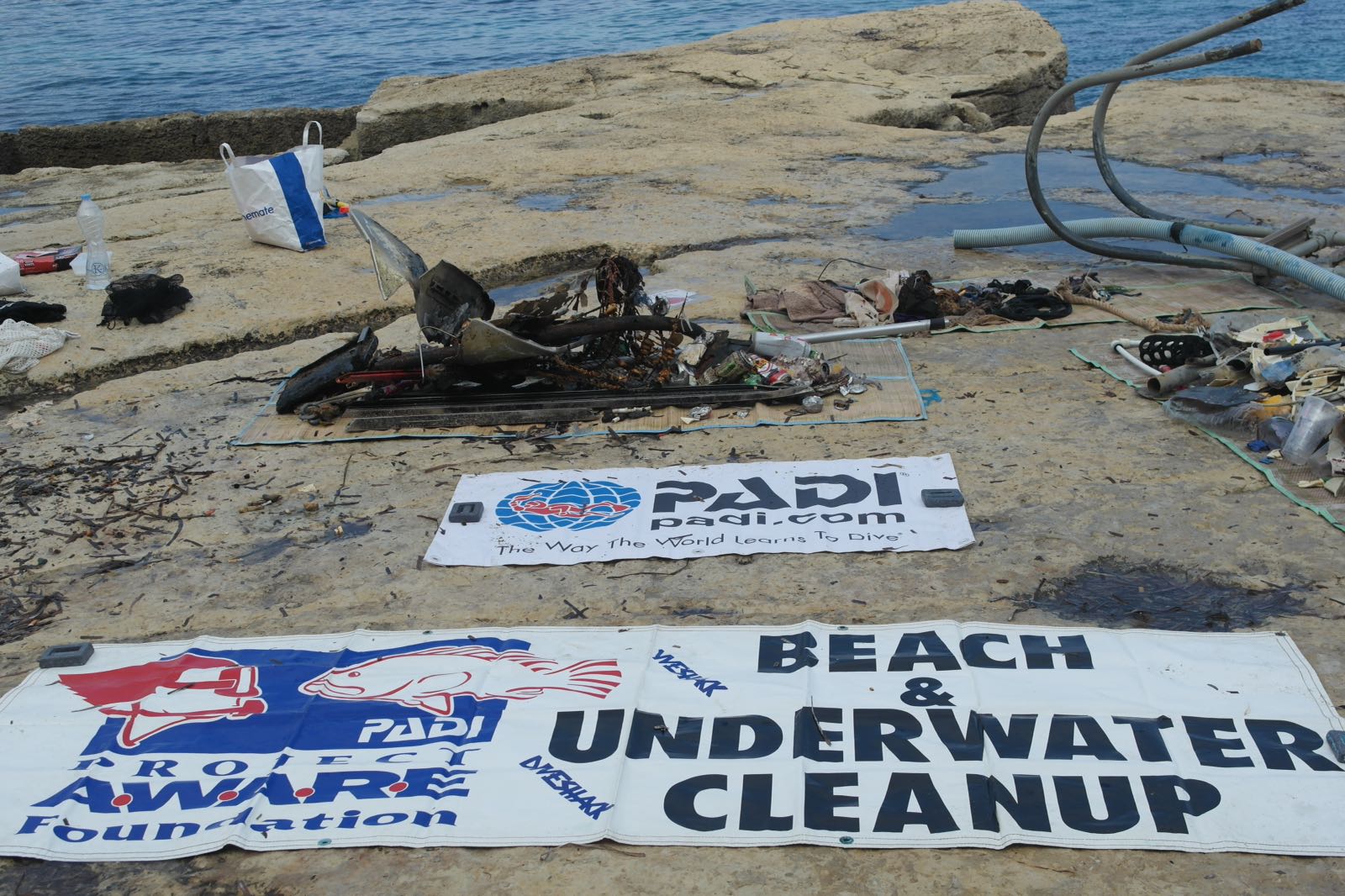
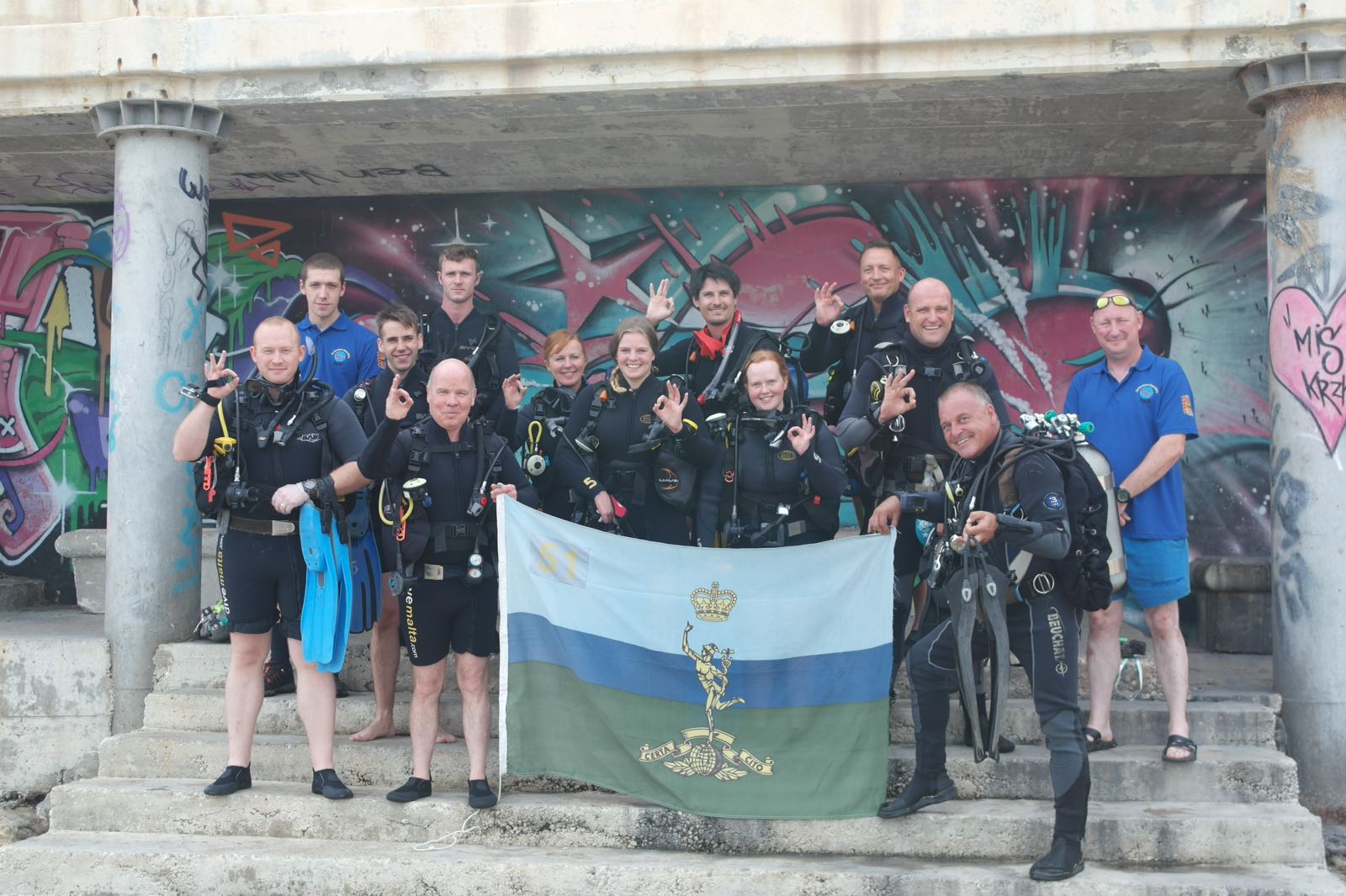
In cooperation with Nemo Classic Diving these events have been done 4 times a year since 2010, However this is the first time we atempt to register the data.
Nice weather and unresponsible boaters. There is a large boat club/ marina near by. Tidal currents often send debris in to the diving area.
Due to a flooded camera there are no pictures avalible from this event.
OSTC 2n Dive Computer. Working on returning to owner
Mostley suny, some clouds, between 0 and 3ms wind from the south. declining temperature hittig around 0c at nitght and day temp around 9c
Nemo Classic Diving #5080
Rene Petterson
0
2
2
0
0
0
0
0
2
0
0
0
0
0
0
0
0
0
6
0
12
18
0
0
0
0
0
0
0
45.00
50
18.00
5.00
2
estimated
10
1
0
2793.00
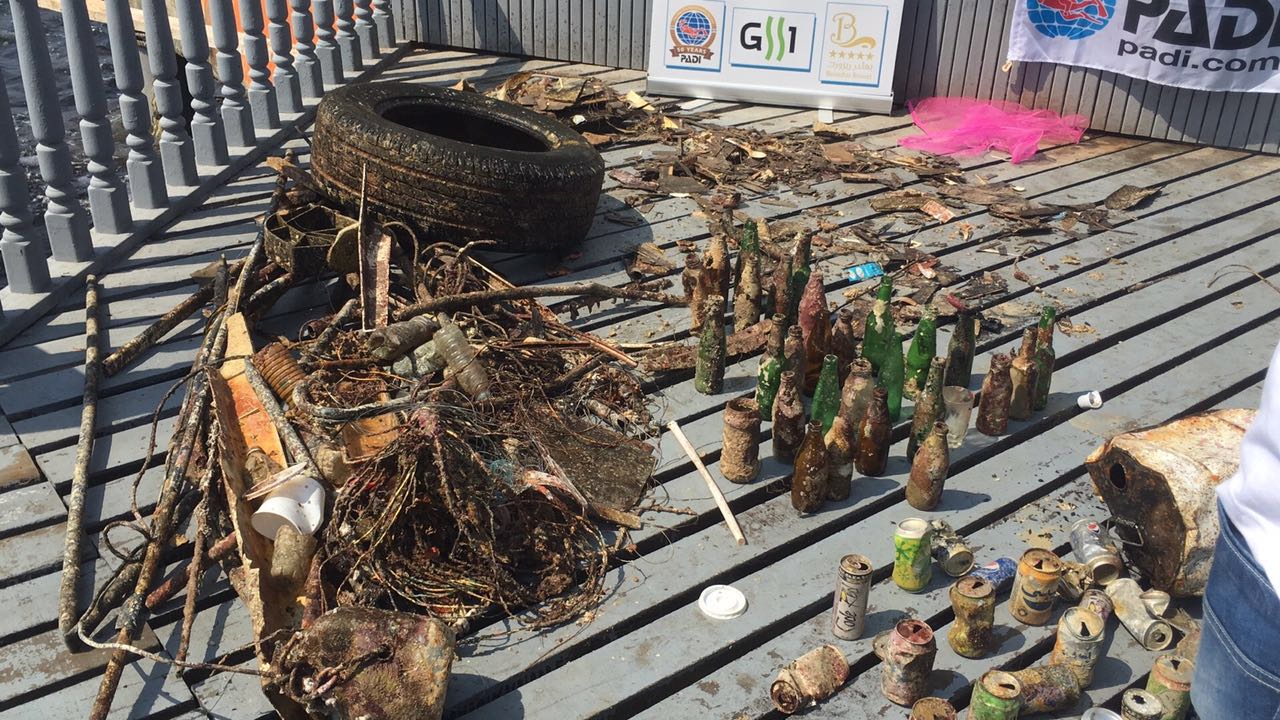
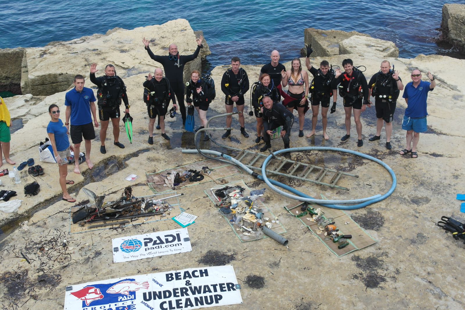
Pots for crabs and fish.
On
kilograms
I have debris data to report
Calm (glassy to rippled) for waves 0 – 0.1 meter high
2
m2
meters
kelp
Norway
State\Province
Hordaland
City
Bergen
Map Help
Dive Location
If you know your survey site coordinates, enter them manually in decimal degrees using WGS84 Map Datum. Use the minus sign for latitudes south of the equator and longitudes west of the Prime Meridian to 180 degrees.
If you do not know your survey site coordinates, click the “Map Location” tab to use the map to zoom into your survey site and drop the pin on the map to fall within your survey dive site in the water (not on land or the beach). Ensure you zoom in as much as possible to ensure data accuracy.
Entangled Help
Use the vertical tabs below to record any entangled animals you found of each type.
Calm (glassy to rippled) for waves 0 – 0.1 meter high
m2
meters
coral reef
0
0
0
0
0
0
0
0
0
0
0
0
20
0
2
2
1
4
0
0
0
3
5
0
0
Language
English
Saudi Arabia
State\Province
makkah
City
jeddah
Map Help
Dive Location
If you know your survey site coordinates, enter them manually in decimal degrees using WGS84 Map Datum. Use the minus sign for latitudes south of the equator and longitudes west of the Prime Meridian to 180 degrees.
If you do not know your survey site coordinates, click the “Map Location” tab to use the map to zoom into your survey site and drop the pin on the map to fall within your survey dive site in the water (not on land or the beach). Ensure you zoom in as much as possible to ensure data accuracy.
Entangled Help
Use the vertical tabs below to record any entangled animals you found of each type.
Calm (glassy to rippled) for waves 0 – 0.1 meter high
1
1
m2
2
meters
rocky reef
1
1
Language
English
Brazil
State\Province
RJ
City
Rio de Janeiro
Map Help
Dive Location
If you know your survey site coordinates, enter them manually in decimal degrees using WGS84 Map Datum. Use the minus sign for latitudes south of the equator and longitudes west of the Prime Meridian to 180 degrees.
If you do not know your survey site coordinates, click the “Map Location” tab to use the map to zoom into your survey site and drop the pin on the map to fall within your survey dive site in the water (not on land or the beach). Ensure you zoom in as much as possible to ensure data accuracy.
Entangled Help
Use the vertical tabs below to record any entangled animals you found of each type.
All ghost nets from the site have now been removed apart from one very small net which will be hopefully be bagged up and removed on the next dive
no
golf ball
Has been reasonable weather, winds have been variable but not too strong. Pretty sunny most of the week.
1
piece of fibreglass
Emma Christison
2
20
1
75.00
48
6.00
2.00
11
estimated
1
800.00
monfilament net
On
kilograms
I have debris data to report
Smooth (wavelets) for waves 0.1 - 0.5 meter high
m2
meters
rocky reef
Language
English
United Kingdom
State\Province
Dorset
City
Poole
Map Help
Dive Location
If you know your survey site coordinates, enter them manually in decimal degrees using WGS84 Map Datum. Use the minus sign for latitudes south of the equator and longitudes west of the Prime Meridian to 180 degrees.
If you do not know your survey site coordinates, click the “Map Location” tab to use the map to zoom into your survey site and drop the pin on the map to fall within your survey dive site in the water (not on land or the beach). Ensure you zoom in as much as possible to ensure data accuracy.
Entangled Help
Use the vertical tabs below to record any entangled animals you found of each type.
Calm (glassy to rippled) for waves 0 – 0.1 meter high
m2
meters
kelp
Language
English
Norway
City
Saltstraumen
Map Help
Dive Location
If you know your survey site coordinates, enter them manually in decimal degrees using WGS84 Map Datum. Use the minus sign for latitudes south of the equator and longitudes west of the Prime Meridian to 180 degrees.
If you do not know your survey site coordinates, click the “Map Location” tab to use the map to zoom into your survey site and drop the pin on the map to fall within your survey dive site in the water (not on land or the beach). Ensure you zoom in as much as possible to ensure data accuracy.
Entangled Help
Use the vertical tabs below to record any entangled animals you found of each type.
Calm (glassy to rippled) for waves 0 – 0.1 meter high
7
m2
4
meters
other
3
4
6
4
6
Language
English
Australia
State\Province
Queensland
City
Brisbane
Map Help
Dive Location
If you know your survey site coordinates, enter them manually in decimal degrees using WGS84 Map Datum. Use the minus sign for latitudes south of the equator and longitudes west of the Prime Meridian to 180 degrees.
If you do not know your survey site coordinates, click the “Map Location” tab to use the map to zoom into your survey site and drop the pin on the map to fall within your survey dive site in the water (not on land or the beach). Ensure you zoom in as much as possible to ensure data accuracy.
Entangled Help
Use the vertical tabs below to record any entangled animals you found of each type.
Ecosystem Other
Man made seaway entrance, rock wall with sand bottom
Majority of the dive spent on a rock shelf at approximately minimum depth 1m Max depth 3m. The water eddys here and waste tends to collect. A very surgy area of the Seaway.
Shotgun Shells
Good
2
1
1
Shotgun Shells
Surfboard Fin
Boot Sole
Environmental Divers
Kelly Fletcher
11
39
1
5
1
3
4
1
59.00
145
8.00
1.00
22
measured
1115
100.00
1
Fishing Line
Lead
Hooks
On
kilograms
I have debris data to report
3
Smooth (wavelets) for waves 0.1 - 0.5 meter high
20
m2
meters
other
2
3
2
18
7
7
Language
English
Australia
State\Province
Queensland
City
Brisbane
Map Help
Dive Location
If you know your survey site coordinates, enter them manually in decimal degrees using WGS84 Map Datum. Use the minus sign for latitudes south of the equator and longitudes west of the Prime Meridian to 180 degrees.
If you do not know your survey site coordinates, click the “Map Location” tab to use the map to zoom into your survey site and drop the pin on the map to fall within your survey dive site in the water (not on land or the beach). Ensure you zoom in as much as possible to ensure data accuracy.
Entangled Help
Use the vertical tabs below to record any entangled animals you found of each type.
Ecosystem Other
Man made seaway entrance, rock wall with sand bottom