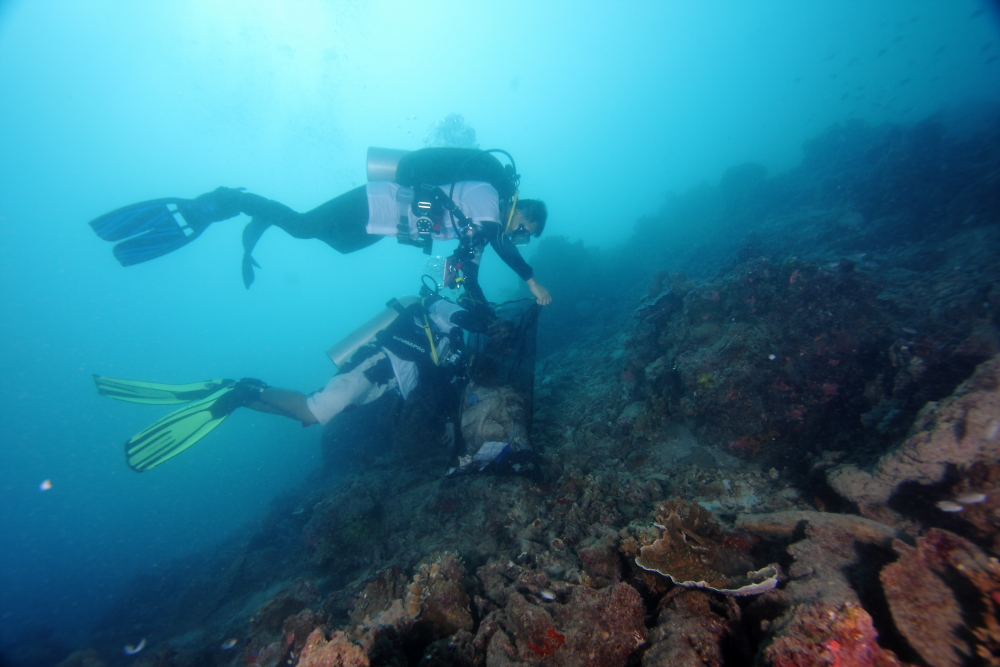
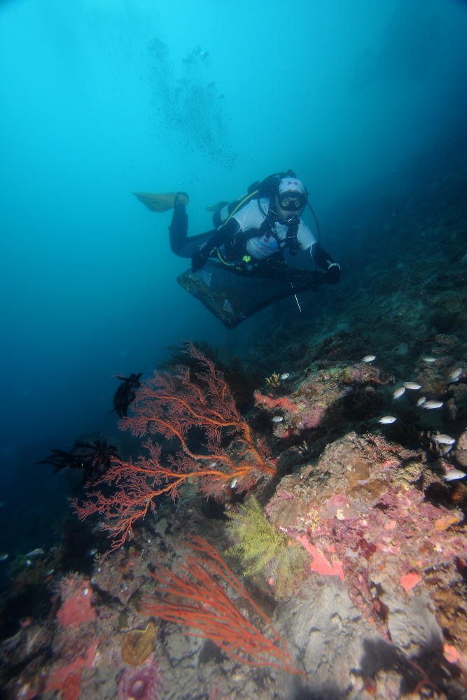
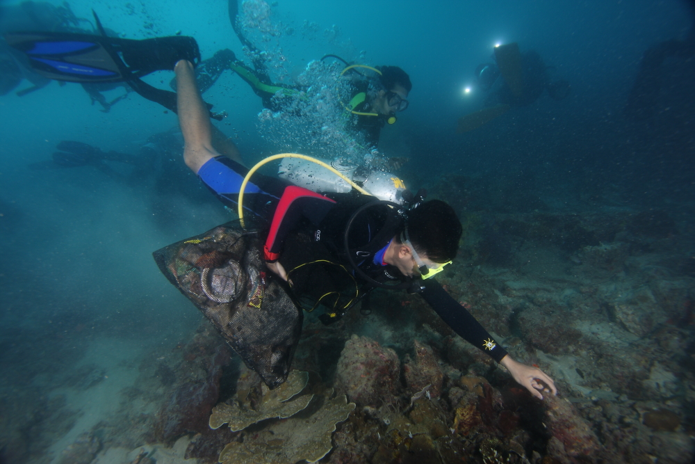
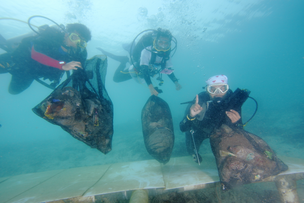
Calm (glassy to rippled) for waves 0 – 0.1 meter high
m2
meters
coral reef
2
27
Indonesia
State\Province
NORTH JAKARTA
City
JAKARTA
Map Help
Dive Location
If you know your survey site coordinates, enter them manually in decimal degrees using WGS84 Map Datum. Use the minus sign for latitudes south of the equator and longitudes west of the Prime Meridian to 180 degrees.
If you do not know your survey site coordinates, click the “Map Location” tab to use the map to zoom into your survey site and drop the pin on the map to fall within your survey dive site in the water (not on land or the beach). Ensure you zoom in as much as possible to ensure data accuracy.
Entangled Help
Use the vertical tabs below to record any entangled animals you found of each type.
The spotted moray was caught by a fish hook and the line was wrapped around fire coral, I used my scissors to cut the line so he could swim away
Normal, Prevailing winds from the east
Fantasy Island Dive Center
Chris Willey
3
0.01
55
20.00
6.00
estimated
600.00
On
kilograms
I have debris data to report
Smooth (wavelets) for waves 0.1 - 0.5 meter high
m2
1
fish hook that was attached to line
Spotted Moray Eel
Released Unharmed
meters
coral reef
Language
English
Honduras
State\Province
Bay Islands
City
French Harbor , Roatan
Map Help
Dive Location
If you know your survey site coordinates, enter them manually in decimal degrees using WGS84 Map Datum. Use the minus sign for latitudes south of the equator and longitudes west of the Prime Meridian to 180 degrees.
If you do not know your survey site coordinates, click the “Map Location” tab to use the map to zoom into your survey site and drop the pin on the map to fall within your survey dive site in the water (not on land or the beach). Ensure you zoom in as much as possible to ensure data accuracy.
Entangled Help
Use the vertical tabs below to record any entangled animals you found of each type.
If you know your survey site coordinates, enter them manually in decimal degrees using WGS84 Map Datum. Use the minus sign for latitudes south of the equator and longitudes west of the Prime Meridian to 180 degrees.
If you do not know your survey site coordinates, click the “Map Location” tab to use the map to zoom into your survey site and drop the pin on the map to fall within your survey dive site in the water (not on land or the beach). Ensure you zoom in as much as possible to ensure data accuracy.
Entangled Help
Use the vertical tabs below to record any entangled animals you found of each type.
Calm (glassy to rippled) for waves 0 – 0.1 meter high
4
2
1
m2
meters
coral reef
1
1
1
1
1
Language
English
Thailand
State\Province
Surat Thani
City
Koh Tao
Map Help
Dive Location
If you know your survey site coordinates, enter them manually in decimal degrees using WGS84 Map Datum. Use the minus sign for latitudes south of the equator and longitudes west of the Prime Meridian to 180 degrees.
If you do not know your survey site coordinates, click the “Map Location” tab to use the map to zoom into your survey site and drop the pin on the map to fall within your survey dive site in the water (not on land or the beach). Ensure you zoom in as much as possible to ensure data accuracy.
Entangled Help
Use the vertical tabs below to record any entangled animals you found of each type.
That was out last Debris dive in 2016 at Nilaveli Diving Centre with our adopted Divesite Sithanane Pare.
As soon we moved to Unawatuna we will do the first Debris Dive over there.
8 kg anchor
Excellent. No waves. Visibility up to 20 m
Nilaveli Diving Centre # S-23912
Andreas Conrad-Wagenfeld
0
0
0
0
0
0
0
0
0
0
0
0
0
0
0
0
0
0
0
15
0
0
0
0
0
0
0
0
0
0
0
0
0
0
0
0
70.00
70
12.00
7.00
1
estimated
0
0
0
0
400.00
0
0
0
0
0
Fishernet
Ropes
Metal Anchor
0
On
kilograms
0
I have debris data to report
0
0
0
Calm (glassy to rippled) for waves 0 – 0.1 meter high
0
0
0
0
0
0
0
m2
0
0
meters
rocky reef
7
0
0
0
0
0
0
0
0
0
0
0
0
0
0
0
0
0
0
0
0
0
0
0
0
0
0
0
0
Language
English
Sri Lanka
State\Province
East Province
City
Nilaveli
Map Help
Dive Location
If you know your survey site coordinates, enter them manually in decimal degrees using WGS84 Map Datum. Use the minus sign for latitudes south of the equator and longitudes west of the Prime Meridian to 180 degrees.
If you do not know your survey site coordinates, click the “Map Location” tab to use the map to zoom into your survey site and drop the pin on the map to fall within your survey dive site in the water (not on land or the beach). Ensure you zoom in as much as possible to ensure data accuracy.
Entangled Help
Use the vertical tabs below to record any entangled animals you found of each type.
Due to the lake being close to interstate and lots of business. Trash tends to either blow in or get thrown into lake. There is also a larger amount of dog toys due to people playing fetch with their dogs in the summertime.
The weather condition were very nice. it has been about 65/75 degrees all week and sunny.
Coral Key Scuba and Travel
Britney Cox
2
7
5
6
1
1
1
3
18.00
45
20.00
10.00
measured
1296.00
Metal Cans
Plastic bottles/cups
Plastic food wrappers
On
pounds
I have debris data to report
Calm (glassy to rippled) for waves 0 – 0.1 meter high
6
ft2
feet
other
4
Language
English
United States
State\Province
Co
City
Arvada
Map Help
Dive Location
If you know your survey site coordinates, enter them manually in decimal degrees using WGS84 Map Datum. Use the minus sign for latitudes south of the equator and longitudes west of the Prime Meridian to 180 degrees.
If you do not know your survey site coordinates, click the “Map Location” tab to use the map to zoom into your survey site and drop the pin on the map to fall within your survey dive site in the water (not on land or the beach). Ensure you zoom in as much as possible to ensure data accuracy.
Entangled Help
Use the vertical tabs below to record any entangled animals you found of each type.
We normally focus on the opposite side of the reef, this side seemed to have debris that has sat for a long time. We could visit this deeper side as we had more experienced divers available, so we don't believe this will interrupt our usual findings from our monthly scheduled Dive Against Debris.
Traffic cone
High winds and rain storms60
1
1
1
1
1
Fishing rod (metal)
Traffic cone (plastic)
Ships bilge bung (mixed - rubber and metal)
Bracelet (plastic)
Serving tray (Plastic)
Montserrat Island Dive Centre
Charley Bartlett
1
6
2
3
1
15
35.00
60
17.70
10.20
1
estimated
1
2
455.00
Fishing nets - nylon
Paint bucket and roller - metal and mixed
Fishing line - plastic
On
kilograms
I have debris data to report
2
1
Calm (glassy to rippled) for waves 0 – 0.1 meter high
1
1
m2
3
meters
coral reef
46
1
2
4
1
1
35
Language
English
Montserrat
Map Help
Dive Location
If you know your survey site coordinates, enter them manually in decimal degrees using WGS84 Map Datum. Use the minus sign for latitudes south of the equator and longitudes west of the Prime Meridian to 180 degrees.
If you do not know your survey site coordinates, click the “Map Location” tab to use the map to zoom into your survey site and drop the pin on the map to fall within your survey dive site in the water (not on land or the beach). Ensure you zoom in as much as possible to ensure data accuracy.
Entangled Help
Use the vertical tabs below to record any entangled animals you found of each type.
Every time we dive, at least one of the team has a mesh bag to collect debris, just in case
Speaker
Still and calm seas
1
Portable speaker
Montserrat Island Dive Centre
Charley Bartlett
8
2
7
7.00
32
6.00
3.00
estimated
132.00
Glass bottles left on the beach or thrown from boats absent mindedly
Packaging
On
kilograms
I have debris data to report
7
Calm (glassy to rippled) for waves 0 – 0.1 meter high
m2
meters
rocky reef
3
1
2
1
Language
English
Montserrat
Map Help
Dive Location
If you know your survey site coordinates, enter them manually in decimal degrees using WGS84 Map Datum. Use the minus sign for latitudes south of the equator and longitudes west of the Prime Meridian to 180 degrees.
If you do not know your survey site coordinates, click the “Map Location” tab to use the map to zoom into your survey site and drop the pin on the map to fall within your survey dive site in the water (not on land or the beach). Ensure you zoom in as much as possible to ensure data accuracy.
Entangled Help
Use the vertical tabs below to record any entangled animals you found of each type.
Glass bottles left on the beach or thrown from boats absent mindedly
On
kilograms
I have debris data to report
3
Smooth (wavelets) for waves 0.1 - 0.5 meter high
m2
meters
coral reef
Language
English
Montserrat
Map Help
Dive Location
If you know your survey site coordinates, enter them manually in decimal degrees using WGS84 Map Datum. Use the minus sign for latitudes south of the equator and longitudes west of the Prime Meridian to 180 degrees.
If you do not know your survey site coordinates, click the “Map Location” tab to use the map to zoom into your survey site and drop the pin on the map to fall within your survey dive site in the water (not on land or the beach). Ensure you zoom in as much as possible to ensure data accuracy.
Entangled Help
Use the vertical tabs below to record any entangled animals you found of each type.