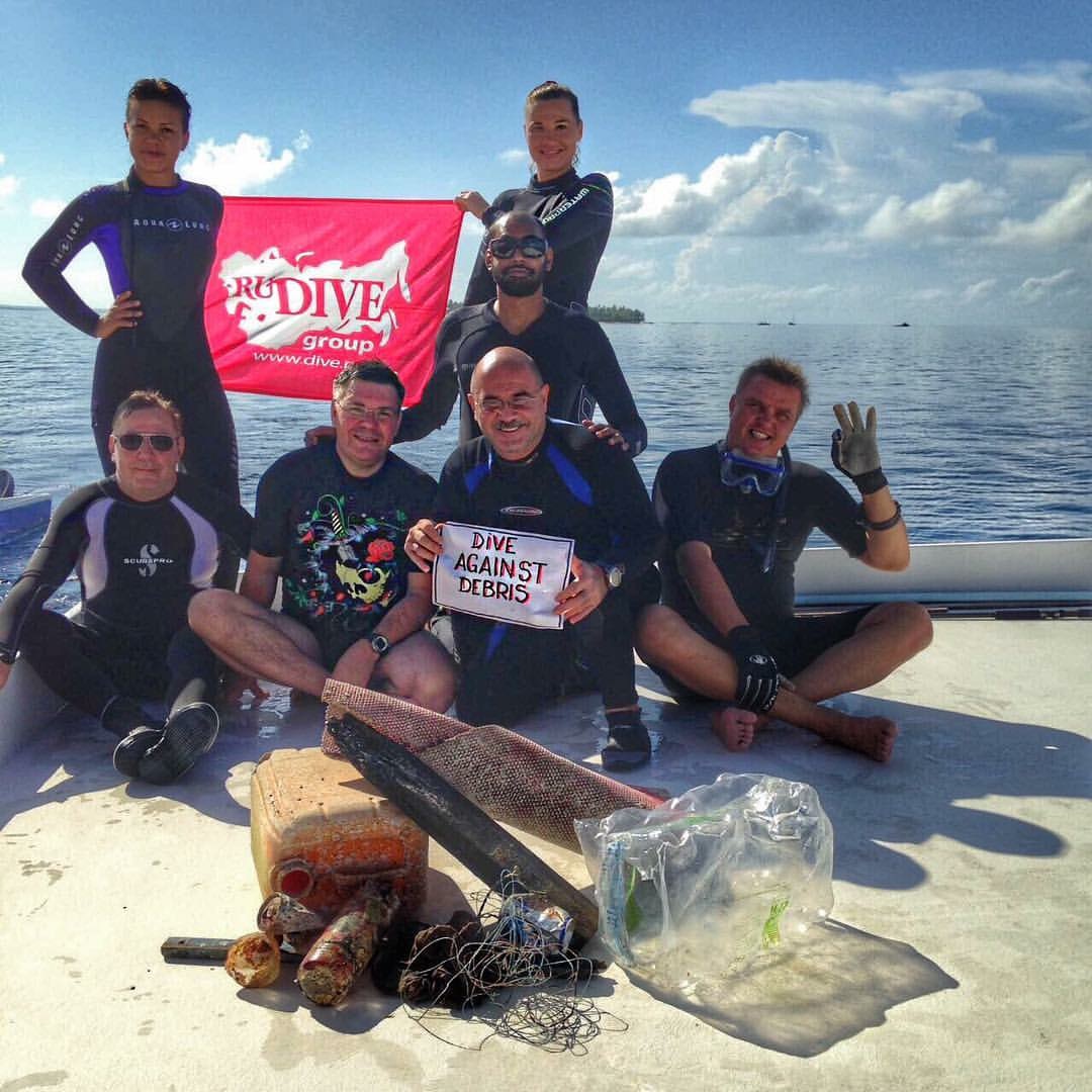
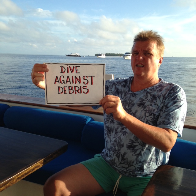
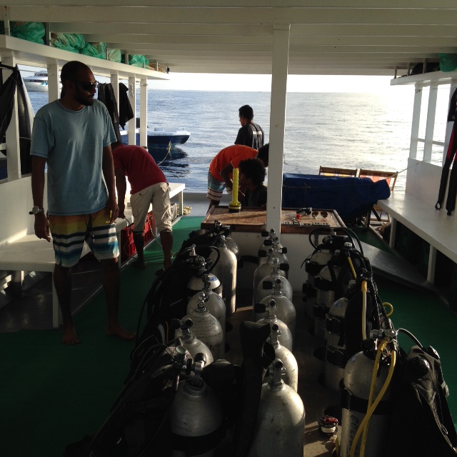
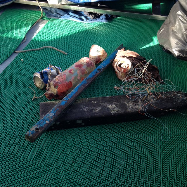
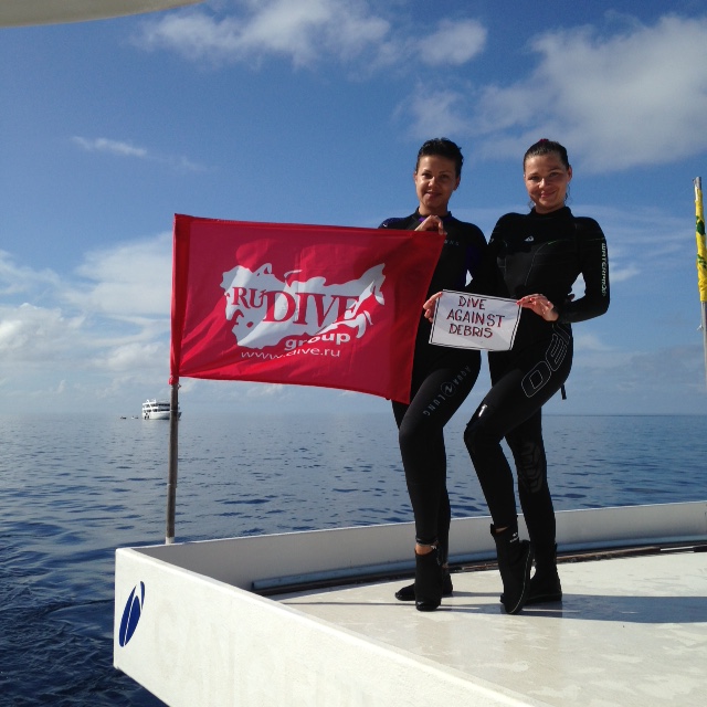
Initially went to recover broken mooring ball made the dive into a dive against debris after finding a few other items.
Left forelimb was tangled in fishing line, restricting movement, would not let us approach to help.
Choppy surface conditions caused by high winds from the south/south east
Aaron's Dive Shop
Shaun Schuster
3
1
6
1
8.00
60
35.00
29.00
1
measured
1735.00
fishing line from so many shore fishermen in the area
plastic bags are being seen less and less due to new laws but are still being found
glass bottles from people drinking on boats
On
pounds
I have debris data to report
3
Slight for waves 0.5 -1.25 meter high
ft2
feet
rocky reef
1
Fishing line
Injured
Green Sea Turtle
United States
State\Province
Hawaii
City
Honolulu
Map Help
Dive Location
If you know your survey site coordinates, enter them manually in decimal degrees using WGS84 Map Datum. Use the minus sign for latitudes south of the equator and longitudes west of the Prime Meridian to 180 degrees.
If you do not know your survey site coordinates, click the “Map Location” tab to use the map to zoom into your survey site and drop the pin on the map to fall within your survey dive site in the water (not on land or the beach). Ensure you zoom in as much as possible to ensure data accuracy.
Entangled Help
Use the vertical tabs below to record any entangled animals you found of each type.
Temperature around 0-5 centigrades and 0-10 m/s wind from NE-SE.
1
5
Chemical hot pack
Golf balls
Oxygene Göteborg
Anna Viker
2
10.00
30
5.00
1.00
measured
400.00
Chemical hot pack - chemicals in the ocean
Metal pipes & fragments - Sharp object may harm swimmers & divers
On
kilograms
I have debris data to report
Smooth (wavelets) for waves 0.1 - 0.5 meter high
0
m2
meters
seagrass
3
2
Language
English
Sweden
City
Göteborg
Map Help
Dive Location
If you know your survey site coordinates, enter them manually in decimal degrees using WGS84 Map Datum. Use the minus sign for latitudes south of the equator and longitudes west of the Prime Meridian to 180 degrees.
If you do not know your survey site coordinates, click the “Map Location” tab to use the map to zoom into your survey site and drop the pin on the map to fall within your survey dive site in the water (not on land or the beach). Ensure you zoom in as much as possible to ensure data accuracy.
Entangled Help
Use the vertical tabs below to record any entangled animals you found of each type.
Calm (glassy to rippled) for waves 0 – 0.1 meter high
m2
20
fishing nets and rope
Coral
Injured
meters
rocky reef
Language
English
Cambodia
Map Help
Dive Location
If you know your survey site coordinates, enter them manually in decimal degrees using WGS84 Map Datum. Use the minus sign for latitudes south of the equator and longitudes west of the Prime Meridian to 180 degrees.
If you do not know your survey site coordinates, click the “Map Location” tab to use the map to zoom into your survey site and drop the pin on the map to fall within your survey dive site in the water (not on land or the beach). Ensure you zoom in as much as possible to ensure data accuracy.
Entangled Help
Use the vertical tabs below to record any entangled animals you found of each type.
Thank you to all those who didn't get into SCUBA but still helped out on the beach. We had 2 free divers, 2 beach helpers and our wonderful helper, Arthur, who carries the garbage to the dumpsite! You really don't have to be a diver to help out on these clean up events!
After the heavy rain storms the past week, we found most of the debris was concealed between numerous leaves, making it a challenging (although fun) search! the team swam very carefully so as not to disturb the leaf litter, but still the majority of the dive was spent on a 20m^2 area slowly searching, waiting for the leaves to settle and researching. A conscious effort completed by all!
An unidentified something… electrical car part? a lamp? None of our team seemed to be able to work it out! See the photo, if you know what it may be drop us a message a our Facebook page Montserrat Island Dive Centre
Rain storms
1
1
2
1
1
1
1
1
1
1
1
whistle (plastic)
tape reel (plastic)
condom wrappers (foil)
Potting tray (plastic)
silicon from caulk gun (plastic)
vinyl carpet (plastic)
car mats (rubber)
baby bottle teat (rubber)
chair leg (plastic)
Handle (plastic)
car parts (rubber)
Montserrat Island Dive Centre
Charley Bartlett
1
68
3
3
3
1
46
1
2
14
37.00
65
10.40
6.00
measured
230.00
2
2
Beverage cans - single use and easily washed to the sea. Thankfully most fill with water and sand and sink, so we can find them to save the reef!
Plastic cutlery - used once and discarded. If we have to eat out we carry our own washable tools!
Plastic fragments - pieces of all sizes of indistinguishable origin. Broken down in the water to provide a toxic meal for an unsuspecting fish!
On
pounds
I have debris data to report
Smooth (wavelets) for waves 0.1 - 0.5 meter high
1
15
m2
7
9
meters
coral reef
17
5
136
Language
English
Montserrat
Map Help
Dive Location
If you know your survey site coordinates, enter them manually in decimal degrees using WGS84 Map Datum. Use the minus sign for latitudes south of the equator and longitudes west of the Prime Meridian to 180 degrees.
If you do not know your survey site coordinates, click the “Map Location” tab to use the map to zoom into your survey site and drop the pin on the map to fall within your survey dive site in the water (not on land or the beach). Ensure you zoom in as much as possible to ensure data accuracy.
Entangled Help
Use the vertical tabs below to record any entangled animals you found of each type.
A BIG METAL RUBBISH BIN FULL OF RUBBISH OVER 120KG
A BIG WOODEN CABLE REEL 0VER 50 KG
AEGEAN SEALS DIVING CENTER
STRATOS SYNODIS
5
3
30
12
5
23
1
45
6
1
51
21
22
34
6
13
4
4
400.00
85
5.00
2.00
6
estimated
3
6000.00
6
12
15
On
kilograms
2
I have debris data to report
16
Calm (glassy to rippled) for waves 0 – 0.1 meter high
7
CUTTLEFISH
1
Released Unharmed
CUTTLEFISH
m2
2
meters
seagrass
9
1
50
20
3
20
12
2
Language
English
Greece
State\Province
EVIA
City
NEA ARTAKI
Map Help
Dive Location
If you know your survey site coordinates, enter them manually in decimal degrees using WGS84 Map Datum. Use the minus sign for latitudes south of the equator and longitudes west of the Prime Meridian to 180 degrees.
If you do not know your survey site coordinates, click the “Map Location” tab to use the map to zoom into your survey site and drop the pin on the map to fall within your survey dive site in the water (not on land or the beach). Ensure you zoom in as much as possible to ensure data accuracy.
Entangled Help
Use the vertical tabs below to record any entangled animals you found of each type.
Calm (glassy to rippled) for waves 0 – 0.1 meter high
m2
meters
rocky reef
0
22
Language
English
South Korea
City
seogwipo
Map Help
Dive Location
If you know your survey site coordinates, enter them manually in decimal degrees using WGS84 Map Datum. Use the minus sign for latitudes south of the equator and longitudes west of the Prime Meridian to 180 degrees.
If you do not know your survey site coordinates, click the “Map Location” tab to use the map to zoom into your survey site and drop the pin on the map to fall within your survey dive site in the water (not on land or the beach). Ensure you zoom in as much as possible to ensure data accuracy.
Entangled Help
Use the vertical tabs below to record any entangled animals you found of each type.
Calm (glassy to rippled) for waves 0 – 0.1 meter high
17
4
14
m2
3
1
meters
seagrass
1
2
42
11
12
26
31
Language
English
Greece
State\Province
EVIA
City
ERETRIA
Map Help
Dive Location
If you know your survey site coordinates, enter them manually in decimal degrees using WGS84 Map Datum. Use the minus sign for latitudes south of the equator and longitudes west of the Prime Meridian to 180 degrees.
If you do not know your survey site coordinates, click the “Map Location” tab to use the map to zoom into your survey site and drop the pin on the map to fall within your survey dive site in the water (not on land or the beach). Ensure you zoom in as much as possible to ensure data accuracy.
Entangled Help
Use the vertical tabs below to record any entangled animals you found of each type.
Thanks to all the Honors Legacy & Dodi staff, who helped !
Sunny, party cloudy, rainy
1
Nylon rope
RuDIVE
Alexey Sergeev
1
1
7
1
2
10.00
46
25.00
5.00
estimated
200.00
2
Plastic bottles
Aluminium cans
Fishing line
On
kilograms
I have debris data to report
2
Smooth (wavelets) for waves 0.1 - 0.5 meter high
5
1
1
m2
meters
coral reef
3
1
1
Language
English
Maldives
State\Province
Vaavu Atoll
Map Help
Dive Location
If you know your survey site coordinates, enter them manually in decimal degrees using WGS84 Map Datum. Use the minus sign for latitudes south of the equator and longitudes west of the Prime Meridian to 180 degrees.
If you do not know your survey site coordinates, click the “Map Location” tab to use the map to zoom into your survey site and drop the pin on the map to fall within your survey dive site in the water (not on land or the beach). Ensure you zoom in as much as possible to ensure data accuracy.
Entangled Help
Use the vertical tabs below to record any entangled animals you found of each type.
Many (hundreds, even thousands) of the plastic bottles found on the seabed have been used to attract fish to snorkelling areas for tourists. The bottles have a hole in the bottom, which is a clear indication the debris is created deliberate and direct consequence of human behaviour.
Around the Hurghada region, much of the litter gets dropped into the ocean and it is taken by the current to Magawish Island where it collects in huge quantities.
It stays here and builds up very quickly. The overall amount of trash collected on this date was 9 Tons by a joint effort between 10 Dive Centres and HEPCA.
Very warm. Sea conditions calm with good visibility.
Euro-Divers and PADI EMEA Ltd
Su-Li Wong & Jana Tenner
300
50
14
300
100
200.00
300
15.00
1.00
estimated
150.00
Plastic Bottles
Plastic Bags and packaging
On
kilograms
I have debris data to report
Calm (glassy to rippled) for waves 0 – 0.1 meter high
m2
meters
coral reef
Language
English
Egypt
City
Hurghada
Map Help
Dive Location
If you know your survey site coordinates, enter them manually in decimal degrees using WGS84 Map Datum. Use the minus sign for latitudes south of the equator and longitudes west of the Prime Meridian to 180 degrees.
If you do not know your survey site coordinates, click the “Map Location” tab to use the map to zoom into your survey site and drop the pin on the map to fall within your survey dive site in the water (not on land or the beach). Ensure you zoom in as much as possible to ensure data accuracy.
Entangled Help
Use the vertical tabs below to record any entangled animals you found of each type.