Menu

Озеро Сенеж. Тимоново (Senege Lake. Timonovo)

sand
15
12

56.213222022886, 37.022573780268

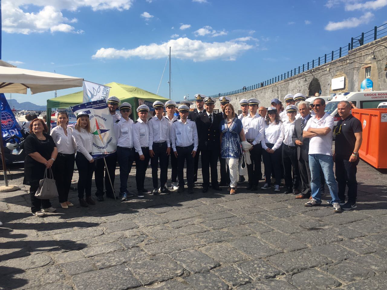
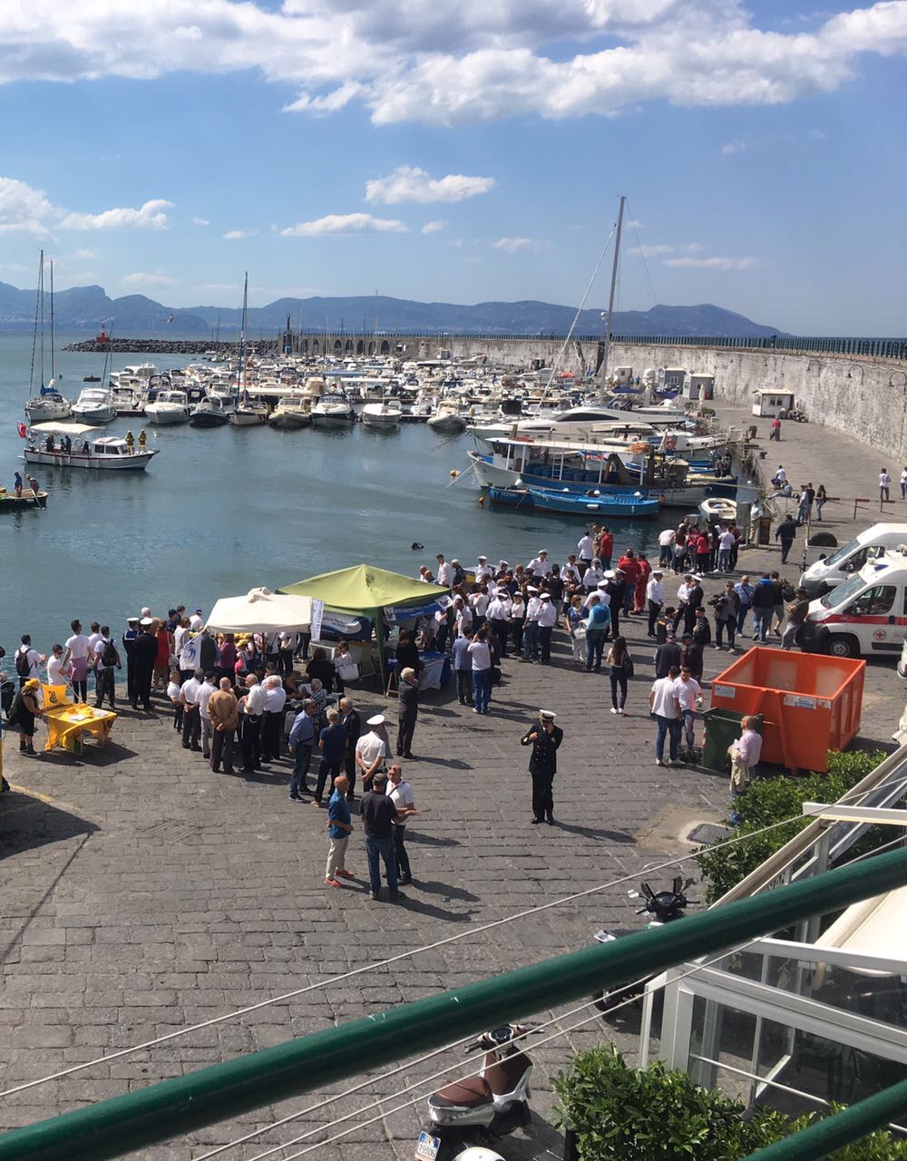
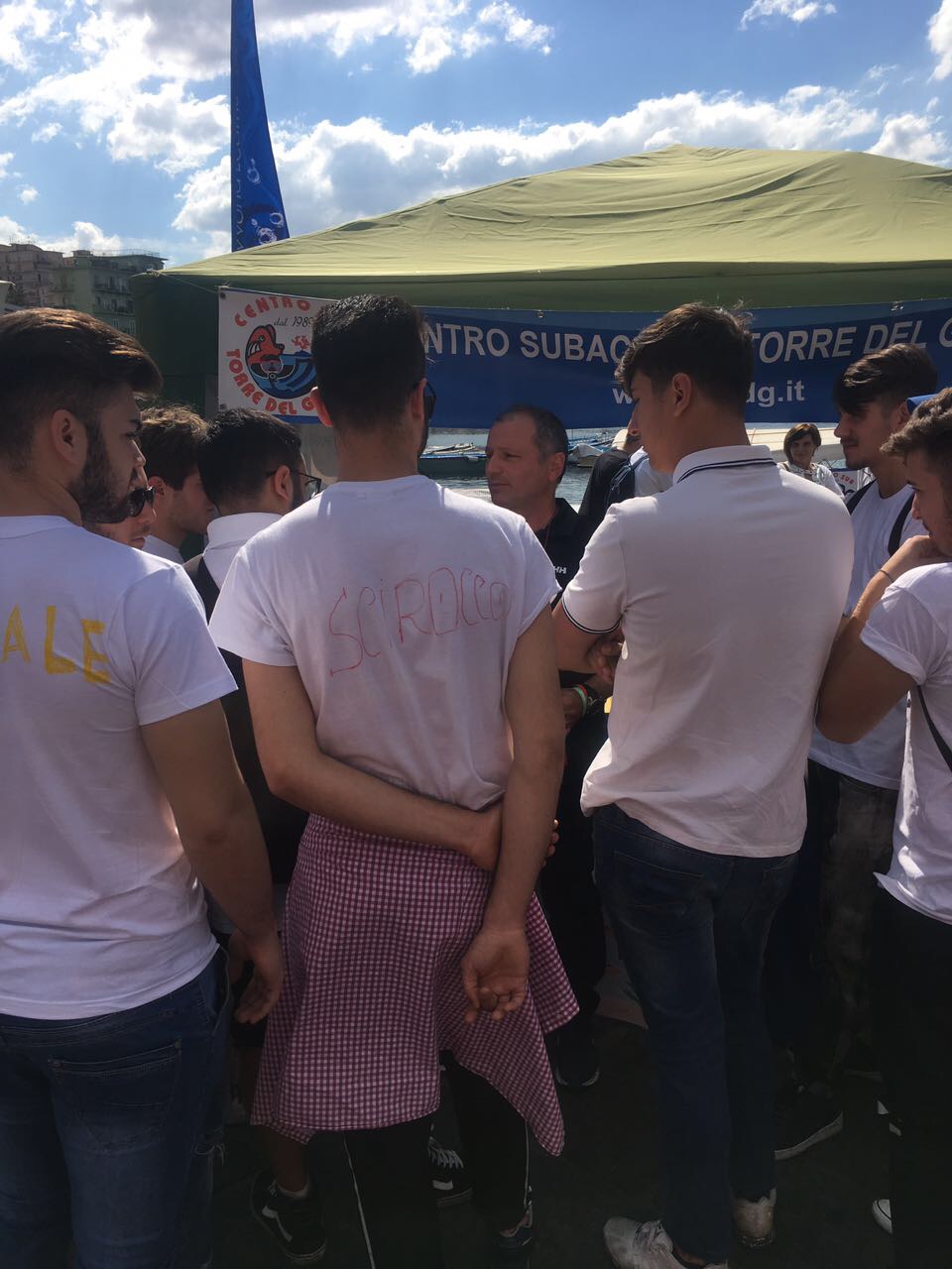
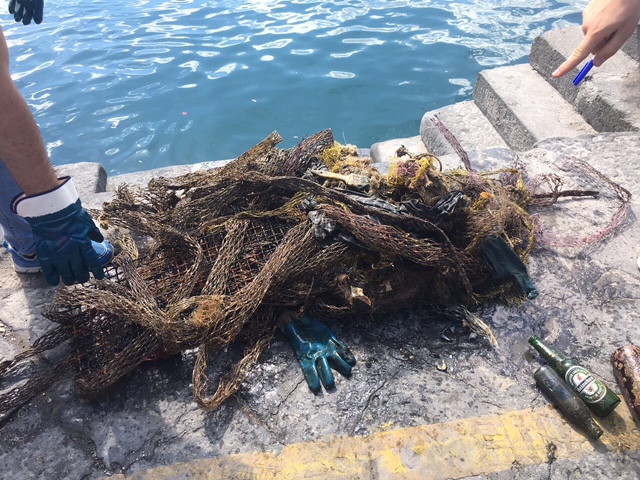
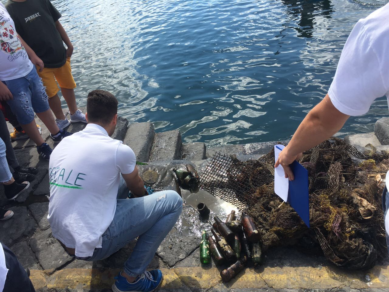
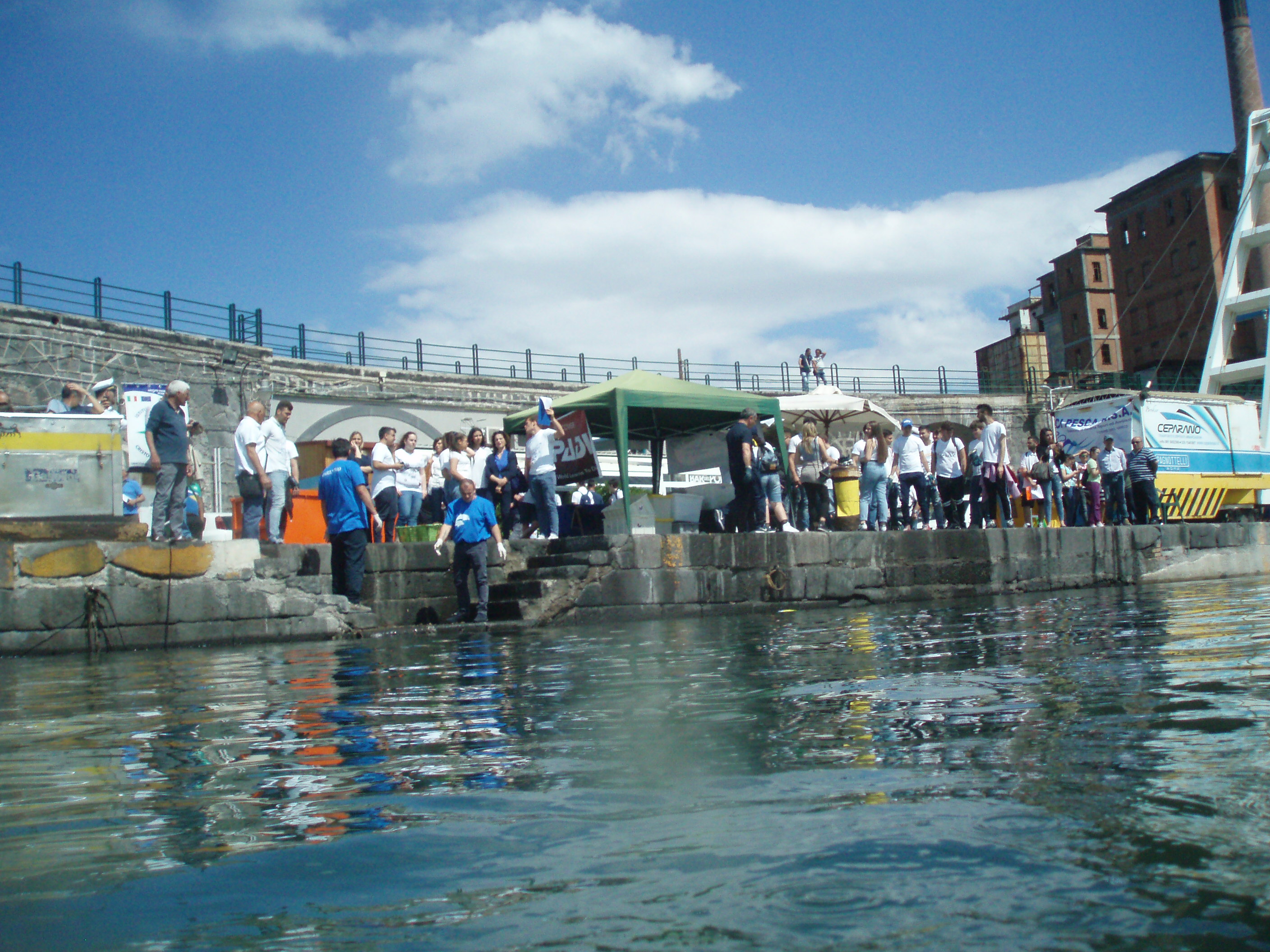
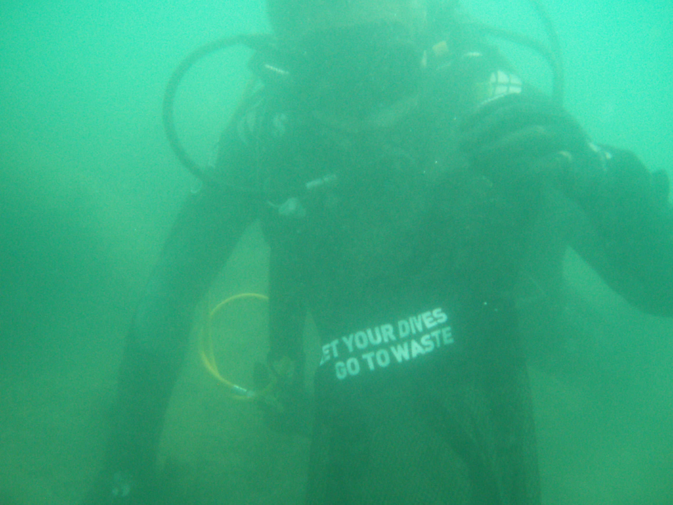
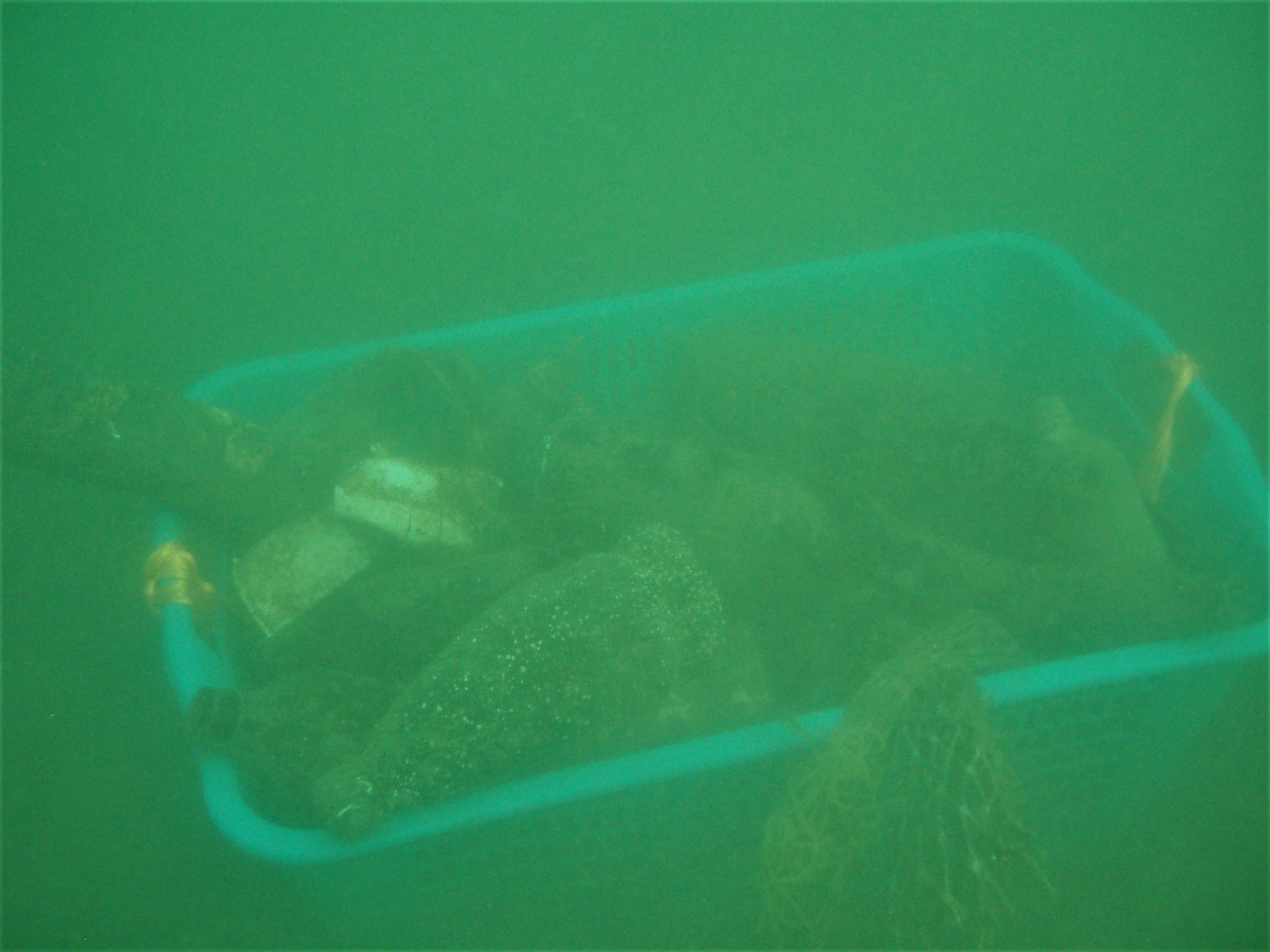
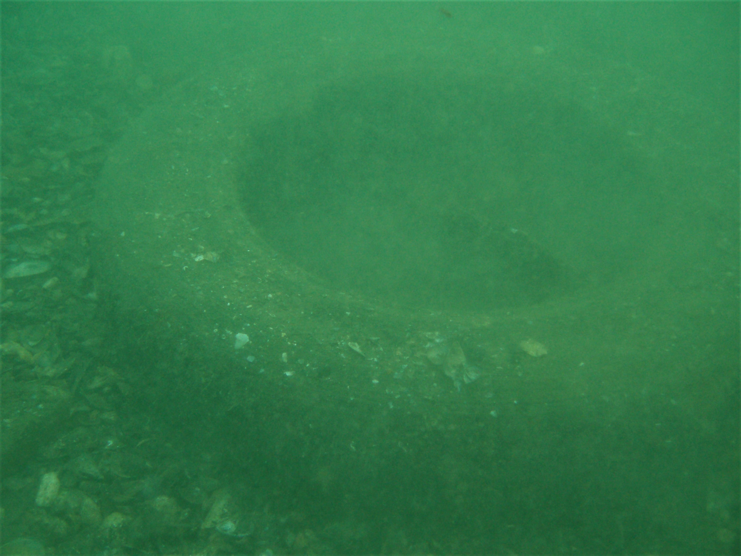
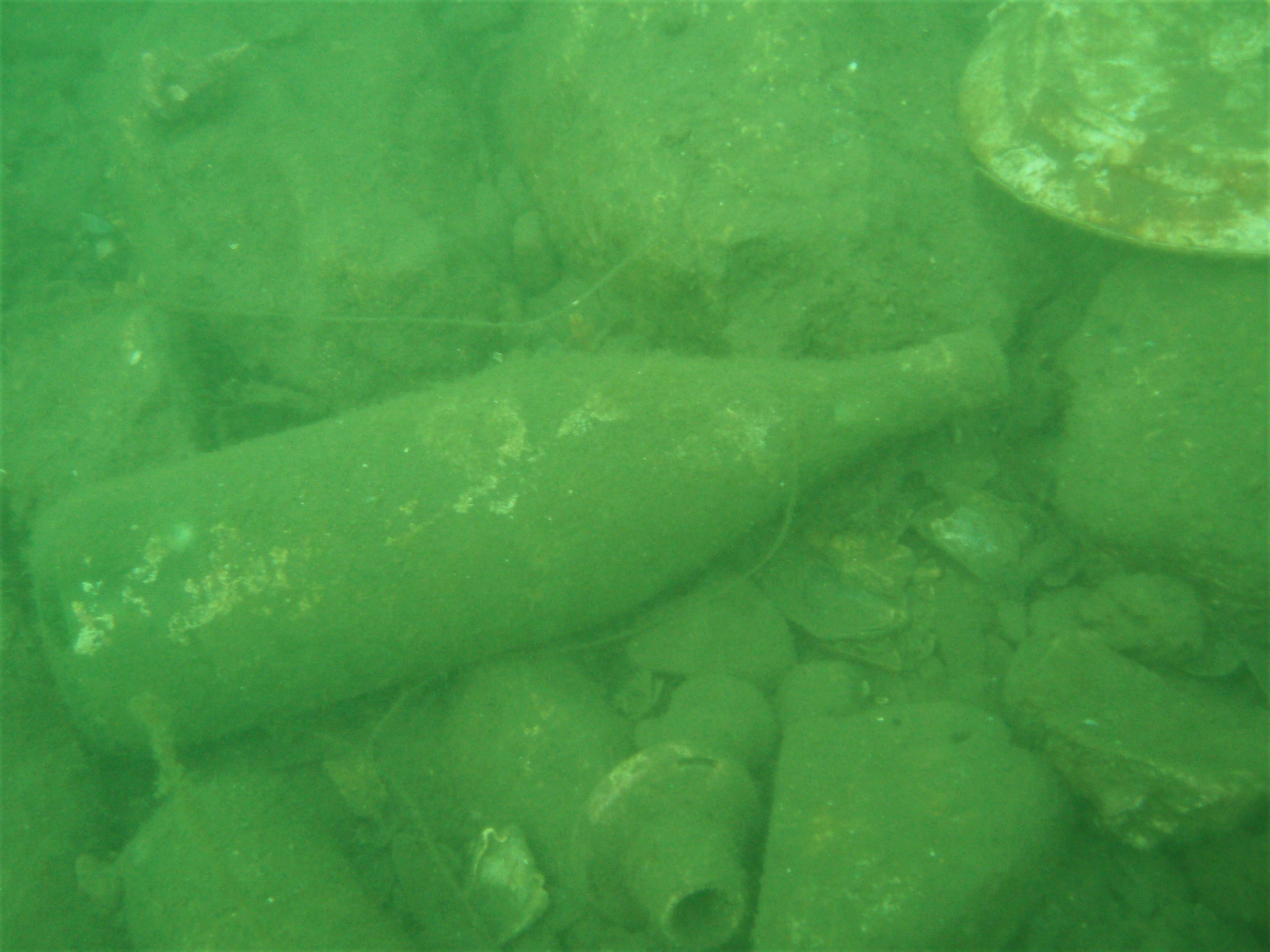
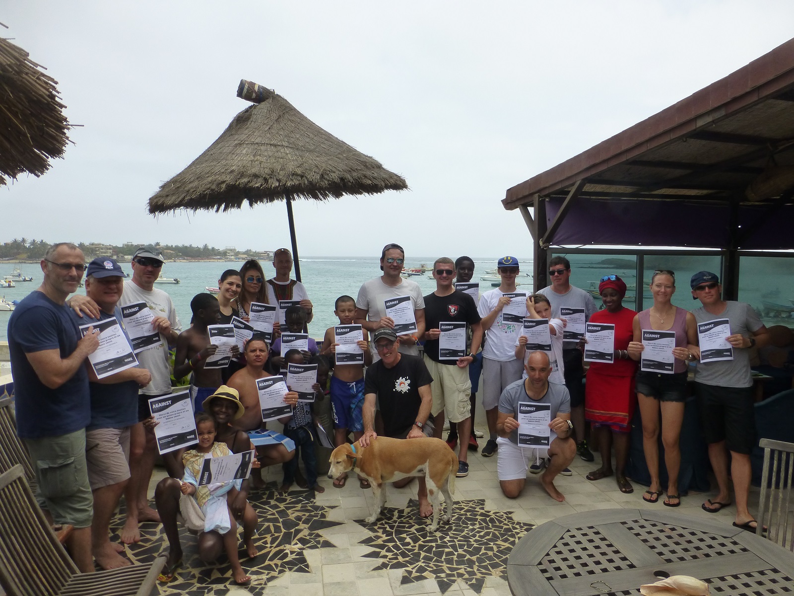
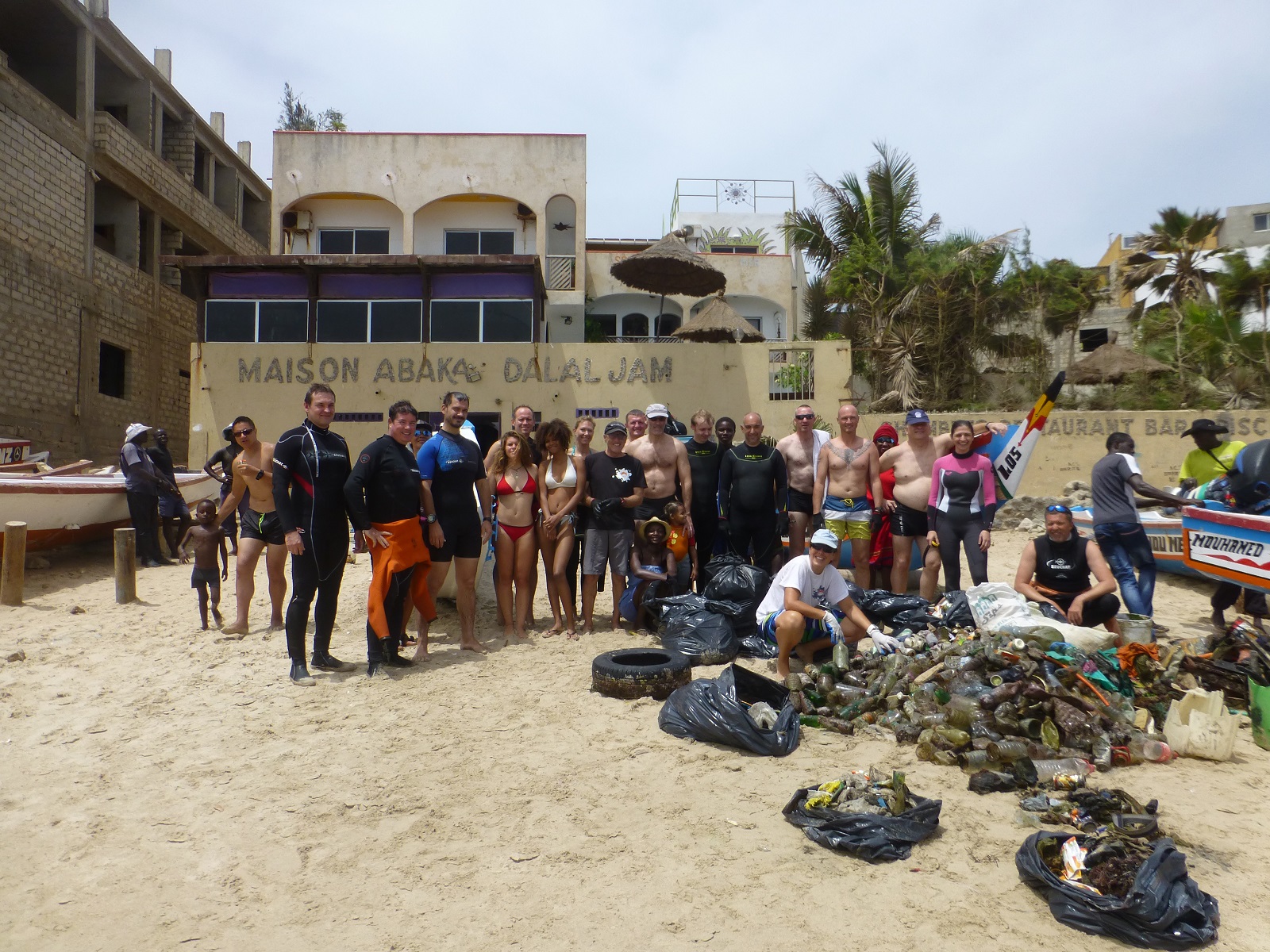
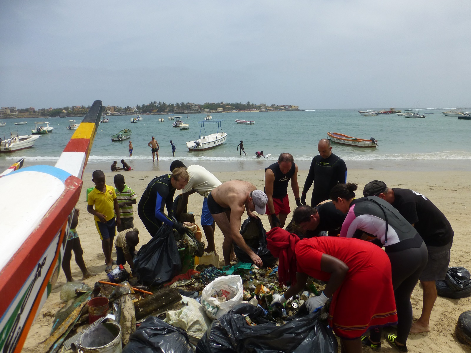
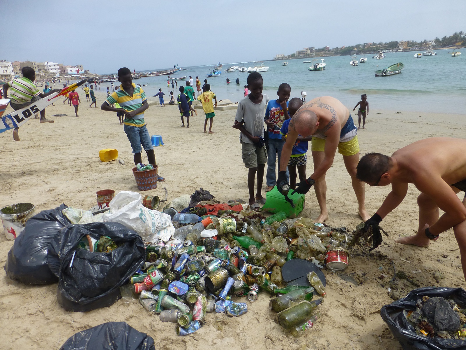
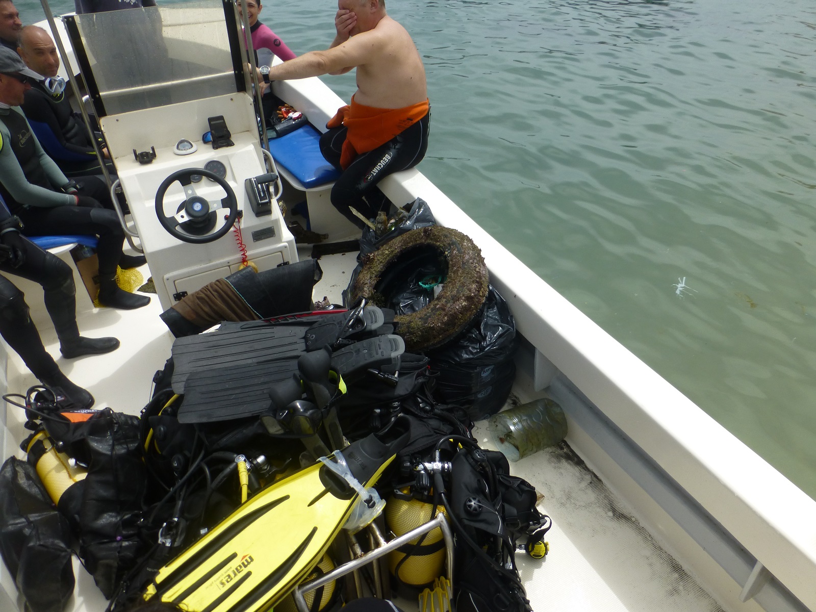
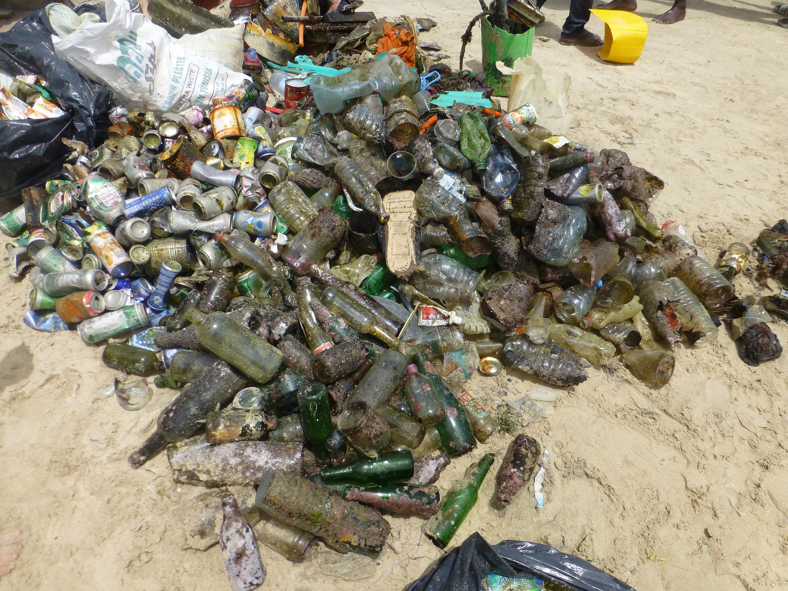
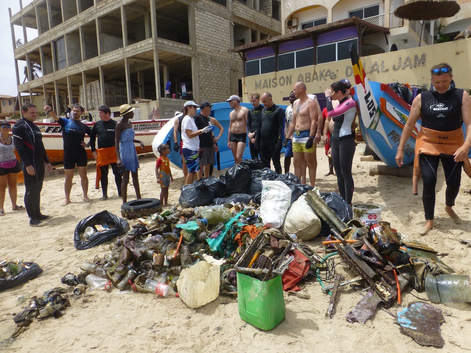
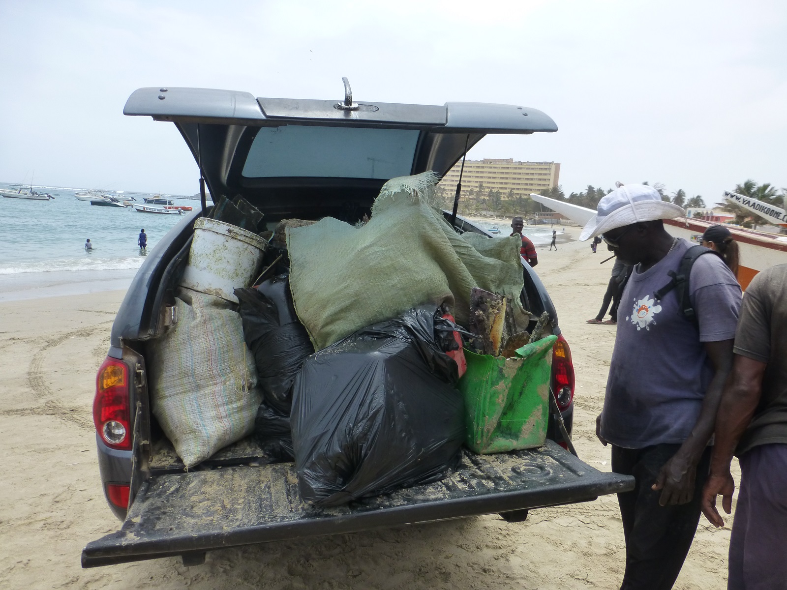
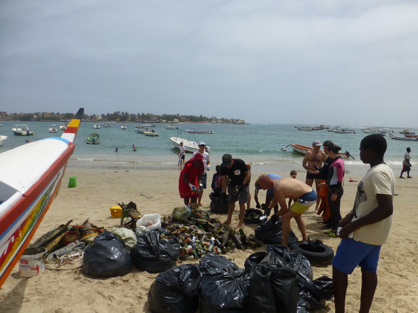
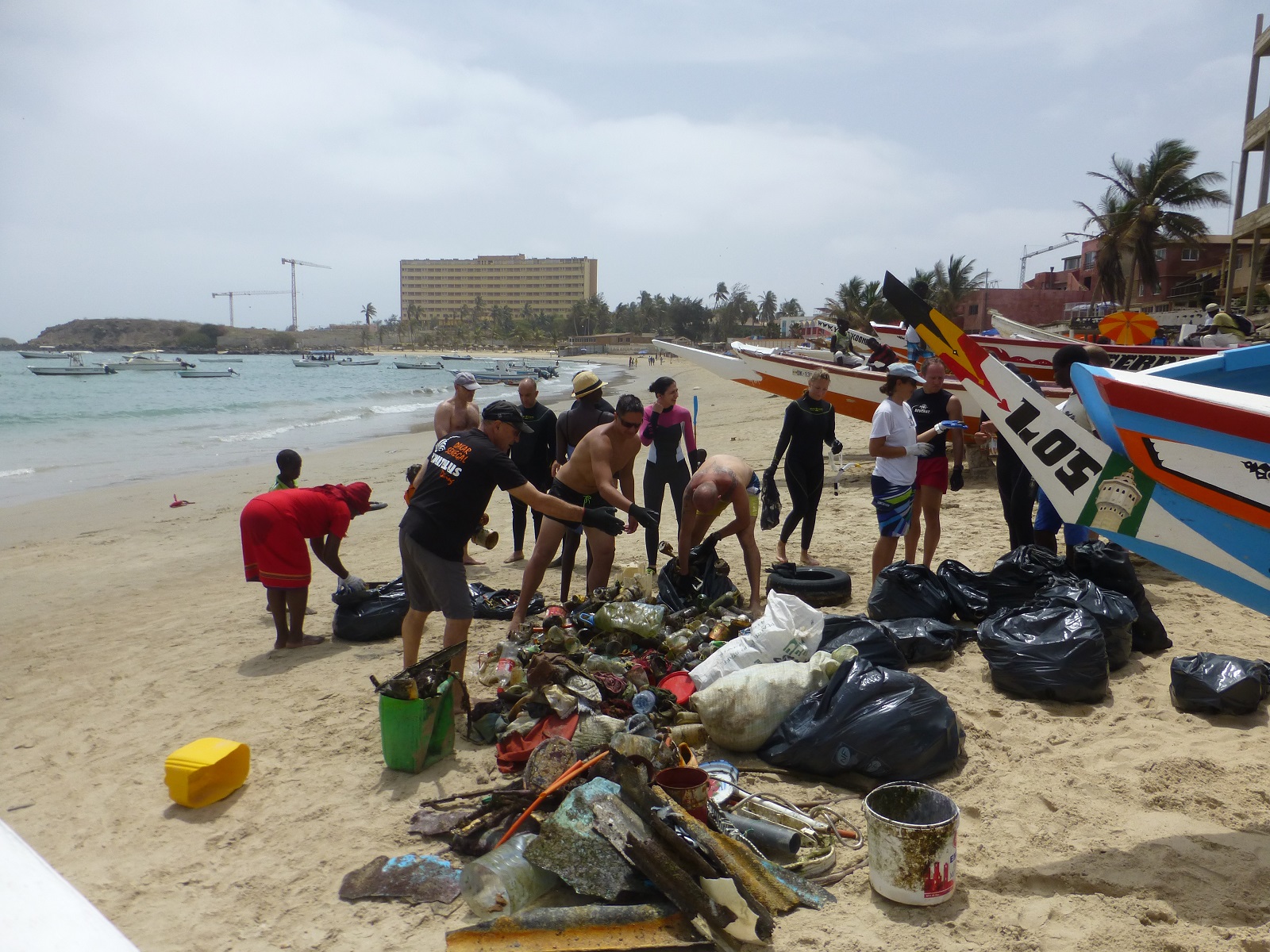
Первое воскресенье июня клуб Акванавт традиционно отметил Международным днём очистки водоёмов. На берегу озера Сенеж собралась отличная компания во главе с главой администрации Солнечногорска. Было шумно, многолюдно и весело. Всевозможные детские конкурсы и викторины под музыку, которую ставил местный диджей, великолепное материально-техническое обеспечение праздника - начиная с навеса и лодок, и заканчивая свежеотремонтированными лавочками и лестницами, а также бригадой рабочих с трактором и бензопилами. Все участники мероприятия были награждены памятными дипломами и шоколадками Алёнка. В конце всех накормили вкусным пловом. Руководство российского отделения PADI в лице Ирины Бересневой и Елены Меркуловой поблагодарило клуб Акванавт за отличную организацию праздника и также вручило памятный диплом. Курс-директор PADI Герман Гурский провёл курс Dive Against Debris (ДайверыПротив Мусора). Поздравляем новых дайверов-экологов: Дениса Давыдова, Евгения Александрова и Руслана Исламгазина! Огромное спасибо всем, кто откликнулся на наше приглашение и приехал ранним воскресным утром в Солнечногорск! Мусора на берегу и под водой мы собрали больше двух тонн!!! Сделаем нашу планету чище!
Rainy
CDC Akvanavt
German G Gurskiy
14
80
20
15
2000.00
45
5.00
0.50
estimated
20
1500.00
20
On
kilograms
I have debris data to report
120
20
Calm (glassy to rippled) for waves 0 – 0.1 meter high
50
m2
meters
seagrass
100
20
100
20
Russia
City
Moscow
Map Help


Dive Location

If you know your survey site coordinates, enter them manually in decimal degrees using WGS84 Map Datum. Use the minus sign for latitudes south of the equator and longitudes west of the Prime Meridian to 180 degrees.

If you do not know your survey site coordinates, click the “Map Location” tab to use the map to zoom into your survey site and drop the pin on the map to fall within your survey dive site in the water (not on land or the beach). Ensure you zoom in as much as possible to ensure data accuracy.

Entangled Help


Use the vertical tabs below to record any entangled animals you found of each type.

ADS318 - USAT Liberty Wreck

20

-8.274206, 115.593038

rock
25
This was our first Dive Against Debris and it went better than expected. We had a group of 10 divers (every level from open water to master instructor) and several people doing fun dives at the site collected debris as well and deposited it with our shore crew. We collected a fairly good amount of debris, rubbish, and fishing line and weights. We identified a lot of the debris comes from the dive site up current and we're thinking to adopt that site too. Looking forward to the next Dive Against Debris!
sanitary pad
Mostly sunny; hot and humid; windy.
Overnight rainstorm before debris data survey dive.
Max
3
1
2
1
1
14
6
5.00
71
30.00
1.00
2
estimated
948.30
fishing line
plastic food wrappers
terracotta tiling
On
kilograms
I have debris data to report
Slight for waves 0.5 -1.25 meter high m2
meters
coral reef
5
6
Indonesia
Map Help


Dive Location

If you know your survey site coordinates, enter them manually in decimal degrees using WGS84 Map Datum. Use the minus sign for latitudes south of the equator and longitudes west of the Prime Meridian to 180 degrees.

If you do not know your survey site coordinates, click the “Map Location” tab to use the map to zoom into your survey site and drop the pin on the map to fall within your survey dive site in the water (not on land or the beach). Ensure you zoom in as much as possible to ensure data accuracy.

Entangled Help


Use the vertical tabs below to record any entangled animals you found of each type.

ADS257 - North Point

1

8.682083, 97.642917

rock
Daren Yang
1
3
1
3
3
4
5.00
45
23.00
5.00
3
estimated
40.00
On
kilograms
I have debris data to report
Calm (glassy to rippled) for waves 0 – 0.1 meter high m2
meters
rocky reef
2
4
2
Thailand
Map Help


Dive Location

If you know your survey site coordinates, enter them manually in decimal degrees using WGS84 Map Datum. Use the minus sign for latitudes south of the equator and longitudes west of the Prime Meridian to 180 degrees.

If you do not know your survey site coordinates, click the “Map Location” tab to use the map to zoom into your survey site and drop the pin on the map to fall within your survey dive site in the water (not on land or the beach). Ensure you zoom in as much as possible to ensure data accuracy.

Entangled Help


Use the vertical tabs below to record any entangled animals you found of each type.

The Next Wave Submission 1496903656

User Name
Isabelle
User Email
User Country
IT
Top Issue
leadership
Ocean Lover Type
none of the above

Los Bamboos

53
9
rock
19

11.34542024237, 124.10818219185

Local fishing village or current from mainland.
Calm
Evolution dive resort
Mette Hallum
2
4
6
29
4
18
12
20
26
11
14
5
22.00
60
15.00
1.00
29
measured
2
1723.00
19
19
Shashes
Ice bags
On
kilograms
22
I have debris data to report
12
Calm (glassy to rippled) for waves 0 – 0.1 meter high
10
2
26
19
m2
19
meters
rocky reef
49
3
10
14
3
12
3
2
Philippines
State\Province
Cebu
City
Malapascua
Map Help


Dive Location

If you know your survey site coordinates, enter them manually in decimal degrees using WGS84 Map Datum. Use the minus sign for latitudes south of the equator and longitudes west of the Prime Meridian to 180 degrees.

If you do not know your survey site coordinates, click the “Map Location” tab to use the map to zoom into your survey site and drop the pin on the map to fall within your survey dive site in the water (not on land or the beach). Ensure you zoom in as much as possible to ensure data accuracy.

Entangled Help


Use the vertical tabs below to record any entangled animals you found of each type.

ADS304 - Renggis

2.809785, 104.134624

coral
sunny
Eric
1
1
0.30
40
9.00
5.00
estimated
321.63
On
kilograms
I have debris data to report
Calm (glassy to rippled) for waves 0 – 0.1 meter high m2
meters
coral reef
Malaysia
Map Help


Dive Location

If you know your survey site coordinates, enter them manually in decimal degrees using WGS84 Map Datum. Use the minus sign for latitudes south of the equator and longitudes west of the Prime Meridian to 180 degrees.

If you do not know your survey site coordinates, click the “Map Location” tab to use the map to zoom into your survey site and drop the pin on the map to fall within your survey dive site in the water (not on land or the beach). Ensure you zoom in as much as possible to ensure data accuracy.

Entangled Help


Use the vertical tabs below to record any entangled animals you found of each type.

XIX Giornata Nazionale della Sicurezza in Mare e fondali Puliti

5
sand
2
8

40.787378827164, 14.360516756806

A strange way to enjoy yourself.
Have you ever swum in a sea full of rubbish ?
It certainly doesn’t sound much fun, but this was the reality on 26th May 2017 at the Torre del Greco Harbour, near Naples, Italy.
On May 26th during the 19th National Day of Safety at Sea and Cleaned Seabed ( Project Aware) , the “C. Colombo”Maritime High School students met at the harbour to clean up the rubbish in the sea, supported by national aaritime Associations, harbour authorities and the Municipality.
A relevant role has been played by “Project Aware” which put together divers, students and authorities to attend the cleaning of Torre del Greco Harbour ’s seabed from debris.
Among the volunteers were Divers from the local diving association. The largest part of the clean up was done beneath the waves with the help from teams of students alongside the divers.
The overall outcome of the day was 400 Kgs of rubbish being collected. We found aluminum tins, many glass bottles, plastic bags, tires and a large number of unknown objects as well.
At the end of the day the Municipality and all the Authorities appreciated the collaboration of all the students and the other associations for cleaning up the seabed and for increasing the awareness of a cleaner sea.
In conclusion, we have learnt to consider the sea as a resource that should have been protected and will continue to be protected from this day forward.
tires/tyres and batteries car or boat
calm
Lega Navale Italiana sez. TDG, Guardia Costiera di TDG, Comune di TDG, Istituto C. Colombo, Lega Ambiente Campania, Marevivo, Centro Subacqueo TDG, Arci Pesca FISA, Croce Rossa Italiana sez. Ercolano
Francesco Palomba
12
2
5
10
1
3
4
2
10
1
12
1
2
7
1
6
400.00
66
5.00
1.50
3
estimated
5
3
7
600.00
6
25
11
Release toxic substances
1
On
kilograms
I have debris data to report
461
4
Calm (glassy to rippled) for waves 0 – 0.1 meter high
4
11
fishing: sinkers, lures, hooks
Released Unharmed
bavosa
granchio comune
Released Unharmed
12
7
beverage bottles (glass)
3
4
m2
10
meters
other
13
5
58
2
2
2
1
2
7
9
1
Italy
State\Province
Napoli
City
Torre del Greco
Map Help


Dive Location

If you know your survey site coordinates, enter them manually in decimal degrees using WGS84 Map Datum. Use the minus sign for latitudes south of the equator and longitudes west of the Prime Meridian to 180 degrees.

If you do not know your survey site coordinates, click the “Map Location” tab to use the map to zoom into your survey site and drop the pin on the map to fall within your survey dive site in the water (not on land or the beach). Ensure you zoom in as much as possible to ensure data accuracy.

Entangled Help


Use the vertical tabs below to record any entangled animals you found of each type.

Ecosystem Other
Benthos

Ngor Bay cleanup

12
rock

14.750350289437, -17.512346673757

We posted some pictures on our facebook page : Nautilus Diving Dakar
It was our first action and we were 30 people : 20 divers + 10 on the beach
We hope to do a new one quite soon.
Piece of car hard top for pickup
Sun
Sea calm
Water 24°
Nautilus Diving Dakar
Hilda Hausard
3
73
1
2
13
12
37
20
2
65
50
10
250.00
65
4.50
1.50
estimated
3000.00
1
3
plastic bottle : too many all over !!
can bottle : people drink it and through it directly in the sea
metal pieces : dangerous underwater
On
kilograms
I have debris data to report
28
2
Smooth (wavelets) for waves 0.1 - 0.5 meter high
8
7
15
m2
3
meters
rocky reef
3
8
2
6
18
95
Senegal
City
Dakar
Map Help


Dive Location

If you know your survey site coordinates, enter them manually in decimal degrees using WGS84 Map Datum. Use the minus sign for latitudes south of the equator and longitudes west of the Prime Meridian to 180 degrees.

If you do not know your survey site coordinates, click the “Map Location” tab to use the map to zoom into your survey site and drop the pin on the map to fall within your survey dive site in the water (not on land or the beach). Ensure you zoom in as much as possible to ensure data accuracy.

Entangled Help


Use the vertical tabs below to record any entangled animals you found of each type.

The Next Wave Submission 1496866163

User Name
Kamil Aziz Khan
User Email
User Country
PK
Top Issue
climatechange
Ocean Lover Type
all of the above

The Next Wave Submission 1496861280

User Name
Marielle Castro
User Email
User Country
UM
Top Issue
cleanocean
Ocean Lover Type
diver
Subscribe to