Menu

SORCE House Reef

102
18
0
0

-8.75189, 115.893751

0
0
0
coral
0
27
0
1
0
22
detergent wrapper
SORCE
Sudar
0
0
0
15
3
0
0
0
0
0
3
0
0
0
3
0
0
0
0
5
0
0
0
0
0
0
0
0
0
0
0
0
0
0
0
0
5.00
60
18.00
5.00
0
measured
0
0
0
3
14454.00
0
0
0
0
0
0
On
kilograms
0
I have debris data to report
0
0
0
Smooth (wavelets) for waves 0.1 - 0.5 meter high
0
0
1
0
0
0
0
m2
0
0
meters
coral reef
1
0
0
0
0
0
0
0
0
0
0
0
0
0
0
0
0
0
0
0
0
0
0
0
0
0
0
0
0
Indonesia
State\Province
Nusa Tenggara Barat
City
Lombok
Map Help


Dive Location

If you know your survey site coordinates, enter them manually in decimal degrees using WGS84 Map Datum. Use the minus sign for latitudes south of the equator and longitudes west of the Prime Meridian to 180 degrees.

If you do not know your survey site coordinates, click the “Map Location” tab to use the map to zoom into your survey site and drop the pin on the map to fall within your survey dive site in the water (not on land or the beach). Ensure you zoom in as much as possible to ensure data accuracy.

Entangled Help


Use the vertical tabs below to record any entangled animals you found of each type.

Coral Beach

149
117
0
0

-8.72995, 115.910633

0
0
0
coral
0
81
0
0
0
5
2
17
shampoo
medicine
detergent wrapper
SORCE
Sudar
0
0
0
40
0
0
0
0
0
0
14
0
0
0
5
0
0
0
0
5
0
0
1
0
0
0
0
0
0
0
0
0
0
0
0
0
10.94
60
18.00
5.00
2
measured
0
0
0
0
4593.00
0
0
0
0
0
0
On
kilograms
0
I have debris data to report
0
3
0
Smooth (wavelets) for waves 0.1 - 0.5 meter high
0
0
3
0
0
0
0
m2
0
0
meters
coral reef
0
0
0
0
0
1
0
0
0
0
0
0
0
0
0
0
0
0
0
0
0
0
0
0
0
0
0
0
0
Indonesia
City
Sekotong
Map Help


Dive Location

If you know your survey site coordinates, enter them manually in decimal degrees using WGS84 Map Datum. Use the minus sign for latitudes south of the equator and longitudes west of the Prime Meridian to 180 degrees.

If you do not know your survey site coordinates, click the “Map Location” tab to use the map to zoom into your survey site and drop the pin on the map to fall within your survey dive site in the water (not on land or the beach). Ensure you zoom in as much as possible to ensure data accuracy.
Entangled Help


Use the vertical tabs below to record any entangled animals you found of each type.

Gili Goleng

82
1
0
0

-8.750243, 115.891478

0
0
0
sand
0
94
0
0
0
16
detergent wrapper
SORCE
Sudar
0
0
0
8
0
0
0
0
0
0
7
0
0
0
0
0
0
0
0
5
0
0
0
0
0
0
0
0
0
0
0
0
0
0
0
0
3.70
45
18.00
5.00
1
measured
0
0
0
0
2669.00
0
0
0
0
0
0
On
kilograms
0
I have debris data to report
0
0
0
Smooth (wavelets) for waves 0.1 - 0.5 meter high
1
0
0
0
0
0
0
m2
0
0
meters
coral reef
0
0
0
0
0
0
0
0
0
0
0
0
0
0
0
0
0
0
0
0
0
0
2
0
0
0
0
0
0
Indonesia
City
Sekotong
Map Help


Dive Location

If you know your survey site coordinates, enter them manually in decimal degrees using WGS84 Map Datum. Use the minus sign for latitudes south of the equator and longitudes west of the Prime Meridian to 180 degrees.

If you do not know your survey site coordinates, click the “Map Location” tab to use the map to zoom into your survey site and drop the pin on the map to fall within your survey dive site in the water (not on land or the beach). Ensure you zoom in as much as possible to ensure data accuracy.
Entangled Help


Use the vertical tabs below to record any entangled animals you found of each type.

The Sands

62
7
0
0

-8.730504, 115.908975

0
0
0
sand
0
73
0
0
0
2
19
cosmetics product
detergent wrapper
SORCE
Sudar
0
0
0
22
0
0
0
0
0
0
6
0
0
0
3
0
0
0
0
5
0
0
0
0
0
0
0
0
0
0
0
0
0
0
0
0
5.16
60
18.00
5.00
1
measured
0
0
0
0
3106.00
0
0
0
1
0
0
On
kilograms
0
I have debris data to report
1
1
0
Smooth (wavelets) for waves 0.1 - 0.5 meter high
1
0
0
0
3
0
0
m2
0
0
meters
coral reef
0
0
0
0
0
0
0
0
0
0
0
0
0
0
0
0
0
0
0
0
0
0
0
0
0
0
0
0
0
Indonesia
City
Sekotong
Map Help


Dive Location

If you know your survey site coordinates, enter them manually in decimal degrees using WGS84 Map Datum. Use the minus sign for latitudes south of the equator and longitudes west of the Prime Meridian to 180 degrees.

If you do not know your survey site coordinates, click the “Map Location” tab to use the map to zoom into your survey site and drop the pin on the map to fall within your survey dive site in the water (not on land or the beach). Ensure you zoom in as much as possible to ensure data accuracy.

Entangled Help


Use the vertical tabs below to record any entangled animals you found of each type.

Pontoon

1

-8.676095, 115.439308

sand

-8.6761908220771, 115.43929338455

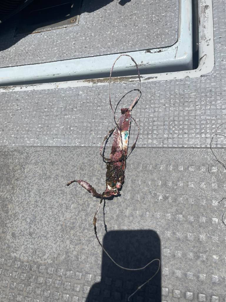
I was able to remove him alive and unharmed before adding the fishing line to our mesh bag
Scuba Center Asia
Yasmine
5
13
8.00
52
9.10
5.00
estimated
2
100.00
2
On
kilograms
I have debris data to report
Smooth (wavelets) for waves 0.1 - 0.5 meter high
6
Fishing line
Shrimp
Released Unharmed
1
m2
6
meters
coral reef
1
1
Indonesia
State\Province
Bali
City
Lembongan
Map Help


Dive Location

If you know your survey site coordinates, enter them manually in decimal degrees using WGS84 Map Datum. Use the minus sign for latitudes south of the equator and longitudes west of the Prime Meridian to 180 degrees.

If you do not know your survey site coordinates, click the “Map Location” tab to use the map to zoom into your survey site and drop the pin on the map to fall within your survey dive site in the water (not on land or the beach). Ensure you zoom in as much as possible to ensure data accuracy.

Entangled Help


Use the vertical tabs below to record any entangled animals you found of each type.

Rainbow Reef- 100 Yards of Hope

25.690083, -80.097233

coral
5
Fishing activities
Windy
Deco Divers
Maddie Kaufman
3
4.00
40
30.00
15.00
1
measured
5
10000.00
On
pounds
I have debris data to report
Smooth (wavelets) for waves 0.1 - 0.5 meter high ft2
2
Fishing rope
Acropora cervicornis/Staghorn coral
Injured
feet
coral reef
1
United States
State\Province
FL
City
Miami
Map Help


Dive Location

If you know your survey site coordinates, enter them manually in decimal degrees using WGS84 Map Datum. Use the minus sign for latitudes south of the equator and longitudes west of the Prime Meridian to 180 degrees.

If you do not know your survey site coordinates, click the “Map Location” tab to use the map to zoom into your survey site and drop the pin on the map to fall within your survey dive site in the water (not on land or the beach). Ensure you zoom in as much as possible to ensure data accuracy.
Entangled Help


Use the vertical tabs below to record any entangled animals you found of each type.

Nea Makri Beach

sand

38.089296, 23.983172

SPIROS KARTELIAS DIVE CENTER
Michail Kassidiaris
6
1
20.00
60
6.00
1.50
estimated
477.00
18
On
kilograms
I have debris data to report
1
Slight for waves 0.5 -1.25 meter high m2
meters
other
Greece
State\Province
Attica
City
Athens
Map Help


Dive Location

If you know your survey site coordinates, enter them manually in decimal degrees using WGS84 Map Datum. Use the minus sign for latitudes south of the equator and longitudes west of the Prime Meridian to 180 degrees.

If you do not know your survey site coordinates, click the “Map Location” tab to use the map to zoom into your survey site and drop the pin on the map to fall within your survey dive site in the water (not on land or the beach). Ensure you zoom in as much as possible to ensure data accuracy.
Entangled Help


Use the vertical tabs below to record any entangled animals you found of each type.

Ecosystem Other
sand

Roda Reef Dive against Debris

7
23
4
7
sand
50

-8.5572806350984, 125.50430344528

This was a collective clean up involving 4 different dive centres and guests in Timor Leste. The 4 dive centres were Dive Timor Lorosae, Aquatica, Dreamers Dive Academy and Compass.
A local fisherman lost his net which smothered the reef
Pen
Calm
1
pen
Dive Timor Lorosae
Marianne Woodward
1
1
15
18
20.00
60
27.00
2.00
10
estimated
50.00
Fishing Net entangled on the reef
Fishing line entangled on the reef
On
kilograms
I have debris data to report
1
Smooth (wavelets) for waves 0.1 - 0.5 meter high
Nets
2
Released Unharmed
Damsel fish
m2
1
meters
other
2
Timor-Leste
State\Province
Dili
City
Dili
Map Help


Dive Location

If you know your survey site coordinates, enter them manually in decimal degrees using WGS84 Map Datum. Use the minus sign for latitudes south of the equator and longitudes west of the Prime Meridian to 180 degrees.

If you do not know your survey site coordinates, click the “Map Location” tab to use the map to zoom into your survey site and drop the pin on the map to fall within your survey dive site in the water (not on land or the beach). Ensure you zoom in as much as possible to ensure data accuracy.

Entangled Help


Use the vertical tabs below to record any entangled animals you found of each type.

Ecosystem Other
Artificial Reef on sand

Vourkadi Port, Porto Rafti

0
0
0
0

37.868351, 24.034132

0
0
0
sand
0
0
2
9
2
No
Load of car tires
Sunny, low winds
Blue Yard Hub
Luc Lakeman
0
0
0
0
13
0
0
0
0
0
0
0
0
0
0
0
1
0
0
9
0
0
0
0
19
0
0
0
0
0
0
0
0
0
0
0
200.00
90
2.00
1.00
0
estimated
0
0
0
0
1958.98
0
22
0
0
0
Car tires
Rope
Plastic bags brought in by the current
0
On
kilograms
0
I have debris data to report
0
0
0
Calm (glassy to rippled) for waves 0 – 0.1 meter high
0
0
0
0
0
0
0
m2
15
5
meters
other
0
0
4
0
0
0
0
0
0
0
0
0
0
0
0
0
0
17
0
0
0
0
0
0
0
0
0
0
0
Greece
State\Province
Attica
City
Porto Rafti
Map Help


Dive Location

If you know your survey site coordinates, enter them manually in decimal degrees using WGS84 Map Datum. Use the minus sign for latitudes south of the equator and longitudes west of the Prime Meridian to 180 degrees.

If you do not know your survey site coordinates, click the “Map Location” tab to use the map to zoom into your survey site and drop the pin on the map to fall within your survey dive site in the water (not on land or the beach). Ensure you zoom in as much as possible to ensure data accuracy.

Entangled Help


Use the vertical tabs below to record any entangled animals you found of each type.

Lighthouse

31
170
coral
14

10.121255614925, 99.842644565319

the storm passing through likely dragged extra debris into the bay
sand bag with strange morphology
a storm had recently passed through the island. other than that conditions had been stable.
1
sand bag
Master Divers
Joseph Dent
2
39
24
70
3
1
30
7.50
52
12.00
5.00
51
estimated
1800.00
2
ropes entangled on branching corals
2
On
kilograms
I have debris data to report
1
Smooth (wavelets) for waves 0.1 - 0.5 meter high
4
2
6
1
m2
15
meters
coral reef
1
2
2
2
2
4
3
Thailand
State\Province
surat thani
City
koh tao
Map Help


Dive Location

If you know your survey site coordinates, enter them manually in decimal degrees using WGS84 Map Datum. Use the minus sign for latitudes south of the equator and longitudes west of the Prime Meridian to 180 degrees.

If you do not know your survey site coordinates, click the “Map Location” tab to use the map to zoom into your survey site and drop the pin on the map to fall within your survey dive site in the water (not on land or the beach). Ensure you zoom in as much as possible to ensure data accuracy.

Entangled Help


Use the vertical tabs below to record any entangled animals you found of each type.

Subscribe to