
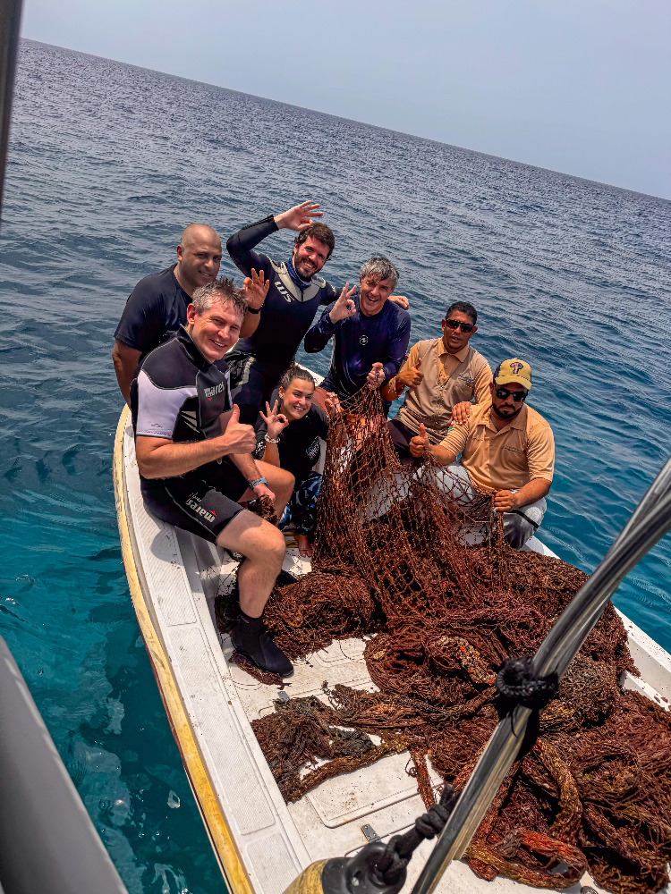
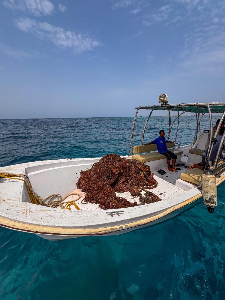
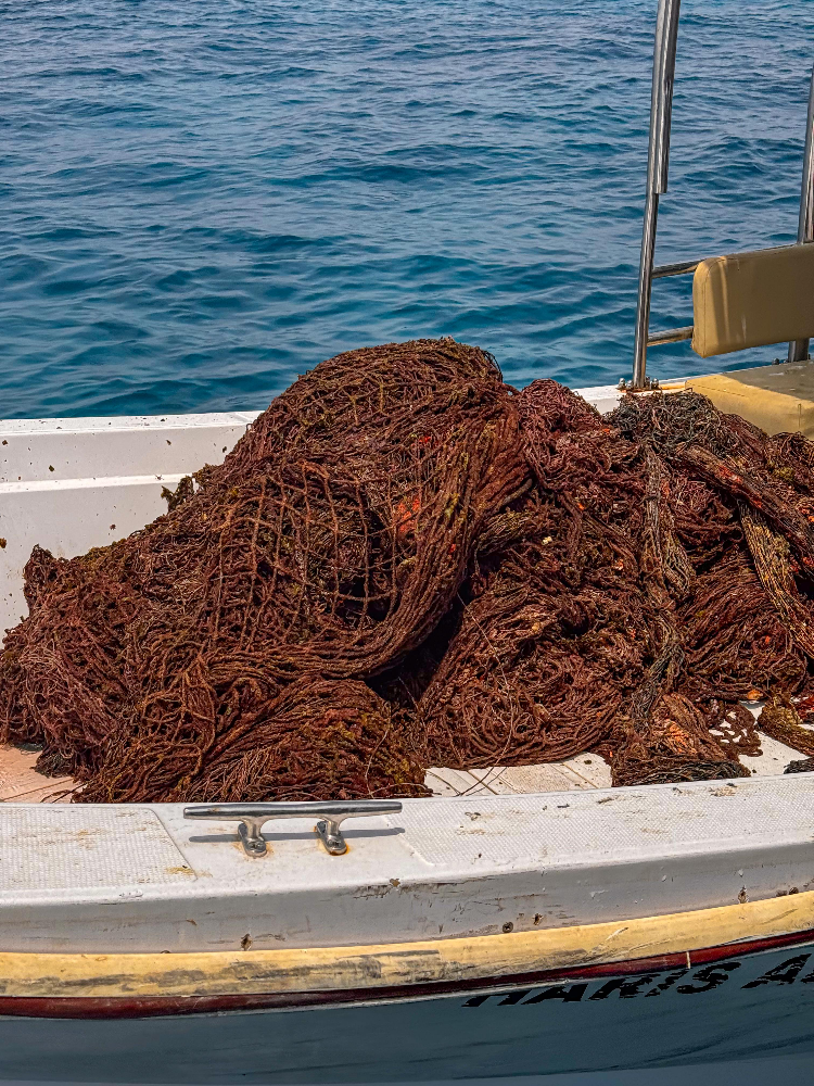
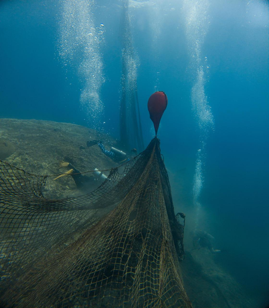
Dive Against Debris Data Submission
Daymaniyat
1 July, 2024
- Team Leader
- Behnaz Banirad
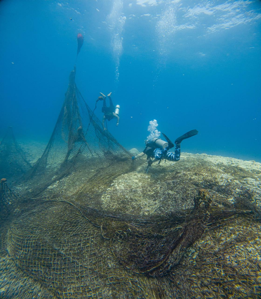
- Number of Participants
- 7
- Total Debris Collected
- 600 kgs (measured)
23.854511, 58.0917
Survey Information
- Location Name
- Daymaniyat
- Organization/Dive Centre
- Omanta
- City
- Muscat
- Country
- Oman
- Date
- 1 July, 2024
- Survey Duration
- 120 Minutes
- GPS Coordinates
- Latitude: 23.854511
Longitude: 58.0917
- Weather Conditions
-
Wavy
- Survey Depth Range
- 10–15 meters
- Area Surveyed
- 11574 m2
- Dominant Substrate
- coral
- Ecosystem
- coral reef
- Wave Conditions
- Slight for waves 0.5 -1.25 meter high
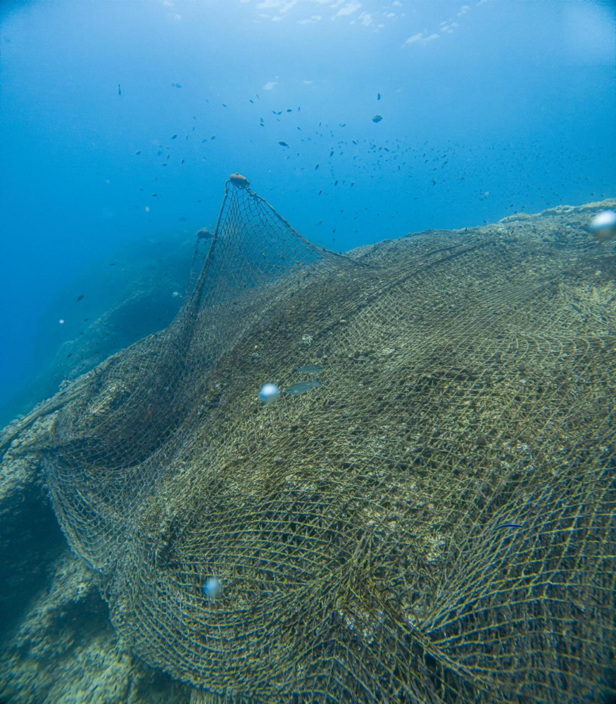
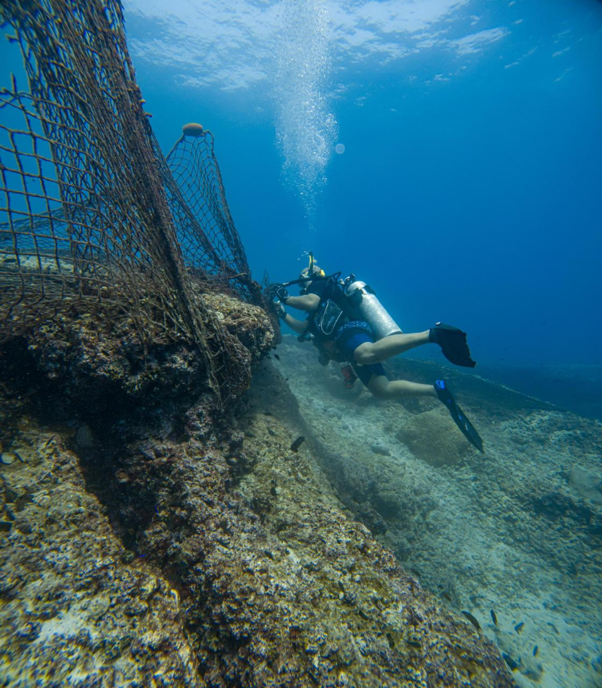
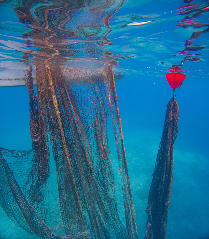
Survey Photos

Debris Items Collected
| plastic materials collected | |
|---|---|
| Buoys & Floats (plastic & Foamed) | 20 |
| Fishing: Line | 2 |
| Fishing: Lures, Rods/poles | 3 |
| Fishing: Nets & Pieces Of Nets | 4 |
| Rope (plastic/nylon) | 5 |
| cloth materials collected | |
|---|---|
| Rope And String (cloth) | 5 |
| Towels/rags | 2 |
| Cloth Fragments | 3 |
Additional Information
Yes
Fishing net


