Menu

Skår

1
sand

58.297805208793, 11.531352829188

A bit rainy, a few days windy.
Tim Uddh
2
1
1.50
63
28.00
3.00
measured
8000.00
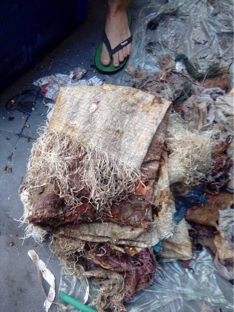
Rope, risk of entanglement.
On
kilograms
I have debris data to report
Smooth (wavelets) for waves 0.1 - 0.5 meter high m2
1
meters
rocky reef
Sweden
State\Province
Västra Götala
City
Lysekil
Map Help


Dive Location

If you know your survey site coordinates, enter them manually in decimal degrees using WGS84 Map Datum. Use the minus sign for latitudes south of the equator and longitudes west of the Prime Meridian to 180 degrees.

If you do not know your survey site coordinates, click the “Map Location” tab to use the map to zoom into your survey site and drop the pin on the map to fall within your survey dive site in the water (not on land or the beach). Ensure you zoom in as much as possible to ensure data accuracy.

Entangled Help


Use the vertical tabs below to record any entangled animals you found of each type.

Kullaviks Småbåtshamn

2
sand

57.549489675827, 11.920594498515

A not broken drinking glass.
Some rain, mild winds.
Tim Uddh
2
1
0.50
52
9.00
3.00
measured
4000.00
Plastics
Broken glass, people could get hurt.
Kitchenware, people could get hurt.
On
kilograms
I have debris data to report
Calm (glassy to rippled) for waves 0 – 0.1 meter high m2
meters
seagrass
1
4
Sweden
State\Province
Västra Götaland
City
Kullavik
Map Help


Dive Location

If you know your survey site coordinates, enter them manually in decimal degrees using WGS84 Map Datum. Use the minus sign for latitudes south of the equator and longitudes west of the Prime Meridian to 180 degrees.

If you do not know your survey site coordinates, click the “Map Location” tab to use the map to zoom into your survey site and drop the pin on the map to fall within your survey dive site in the water (not on land or the beach). Ensure you zoom in as much as possible to ensure data accuracy.
Entangled Help


Use the vertical tabs below to record any entangled animals you found of each type.

ADS256 - Churchill Barrier 3

58.872289, -2.915842

1
silt
1
Old Car Seat!
Wet and windy with some sunny spells.
Scapa Scuba
Jon MacLeod
2
30.00
32
6.80
4.00
estimated
120.00
1
Plastics
fishing lines
On
kilograms
I have debris data to report
Slight for waves 0.5 -1.25 meter high m2
meters
rocky reef
United Kingdom
State\Province
Orkney
City
Stromness
Map Help


Dive Location

If you know your survey site coordinates, enter them manually in decimal degrees using WGS84 Map Datum. Use the minus sign for latitudes south of the equator and longitudes west of the Prime Meridian to 180 degrees.

If you do not know your survey site coordinates, click the “Map Location” tab to use the map to zoom into your survey site and drop the pin on the map to fall within your survey dive site in the water (not on land or the beach). Ensure you zoom in as much as possible to ensure data accuracy.
Entangled Help


Use the vertical tabs below to record any entangled animals you found of each type.

The Next Wave Submission 1501160475

User Name
Ben Arthur
User Email
User Country
US
Top Issue
leadership
Ocean Lover Type
all of the above

ADS333 - Corsaire

4
1

-4.616933, 55.40745

coral
2
No events recorded
Pillow
Rainy weather
1
Pillow
GVI Cap Ternay
Andy Ezeta
1
1
1
10
3
10.00
35
9.00
5.50
estimated
3750.00
Glass bottels
On
kilograms
I have debris data to report
10
Calm (glassy to rippled) for waves 0 – 0.1 meter high
1
m2
meters
coral reef
3
1
Seychelles
State\Province
Mahe
City
Victoria
Map Help


Dive Location

If you know your survey site coordinates, enter them manually in decimal degrees using WGS84 Map Datum. Use the minus sign for latitudes south of the equator and longitudes west of the Prime Meridian to 180 degrees.

If you do not know your survey site coordinates, click the “Map Location” tab to use the map to zoom into your survey site and drop the pin on the map to fall within your survey dive site in the water (not on land or the beach). Ensure you zoom in as much as possible to ensure data accuracy.
Entangled Help


Use the vertical tabs below to record any entangled animals you found of each type.

Xatt L'ahmar

seagrass

36.01802791193, 14.28636440638

Bubbles Dive Centre, Gozo
Jack O'Kane
3
0.00
50
18.00
10.00
estimated
200.00
On
kilograms
I have debris data to report
Slight for waves 0.5 -1.25 meter high m2
meters
rocky reef
1
Malta
State\Province
Gozo
City
Marsalforn
Map Help


Dive Location

If you know your survey site coordinates, enter them manually in decimal degrees using WGS84 Map Datum. Use the minus sign for latitudes south of the equator and longitudes west of the Prime Meridian to 180 degrees.

If you do not know your survey site coordinates, click the “Map Location” tab to use the map to zoom into your survey site and drop the pin on the map to fall within your survey dive site in the water (not on land or the beach). Ensure you zoom in as much as possible to ensure data accuracy.
Entangled Help


Use the vertical tabs below to record any entangled animals you found of each type.

Xatt L'ahmar

seagrass

36.018185992906, 14.286046028137

Bubbles Dive Centre, Gozo
Jack O'Kane
3
0.00
50
18.00
1.00
estimated
200.00
On
kilograms
I have debris data to report
Slight for waves 0.5 -1.25 meter high m2
meters
rocky reef
1
Malta
State\Province
Gozo
City
Marsalforn
Map Help


Dive Location

If you know your survey site coordinates, enter them manually in decimal degrees using WGS84 Map Datum. Use the minus sign for latitudes south of the equator and longitudes west of the Prime Meridian to 180 degrees.

If you do not know your survey site coordinates, click the “Map Location” tab to use the map to zoom into your survey site and drop the pin on the map to fall within your survey dive site in the water (not on land or the beach). Ensure you zoom in as much as possible to ensure data accuracy.
Entangled Help


Use the vertical tabs below to record any entangled animals you found of each type.

The Next Wave Submission 1501091384

User Name
JULIANA CRISTINA BALBO
User Email
User Country
BR
Top Issue
cleanocean
Ocean Lover Type
diver

The Next Wave Submission 1501071248

User Name
Angelika Musiol
User Email
User Country
GB
Top Issue
sharksrays
Ocean Lover Type
all of the above

ADS168 - Abu Sauatir

26.205403139253, 34.219644136246

1
coral
8
no
n/a
clear skies , calm wind +40 degrees
Pharaoh Dive Club
Elliot Greatrix
3
0.12
56
19.90
15.00
measured
3267.00
fishing line as we have alot of local fisherman using lines to catch reef fish which gets caught in the coral and they cut it free leaving most of it including hooks tangled in the reef
fishing hook that stay in the fish as they escape
cut fishing nets
On
kilograms
I have debris data to report
Slight for waves 0.5 -1.25 meter high m2
meters
coral reef
Egypt
State\Province
Red Sea
City
el quseir
Map Help


Dive Location

If you know your survey site coordinates, enter them manually in decimal degrees using WGS84 Map Datum. Use the minus sign for latitudes south of the equator and longitudes west of the Prime Meridian to 180 degrees.

If you do not know your survey site coordinates, click the “Map Location” tab to use the map to zoom into your survey site and drop the pin on the map to fall within your survey dive site in the water (not on land or the beach). Ensure you zoom in as much as possible to ensure data accuracy.
Entangled Help


Use the vertical tabs below to record any entangled animals you found of each type.

Subscribe to