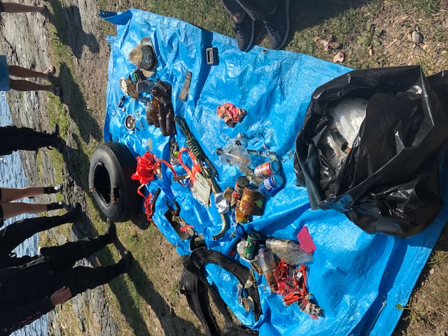
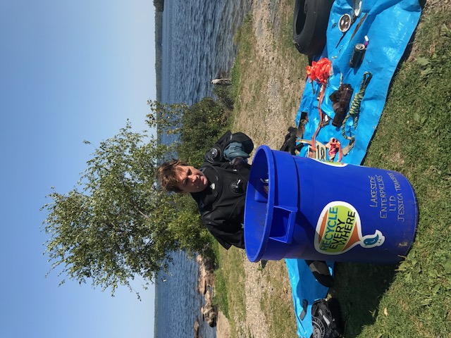
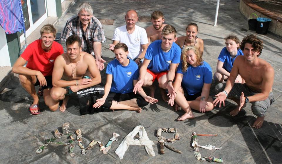
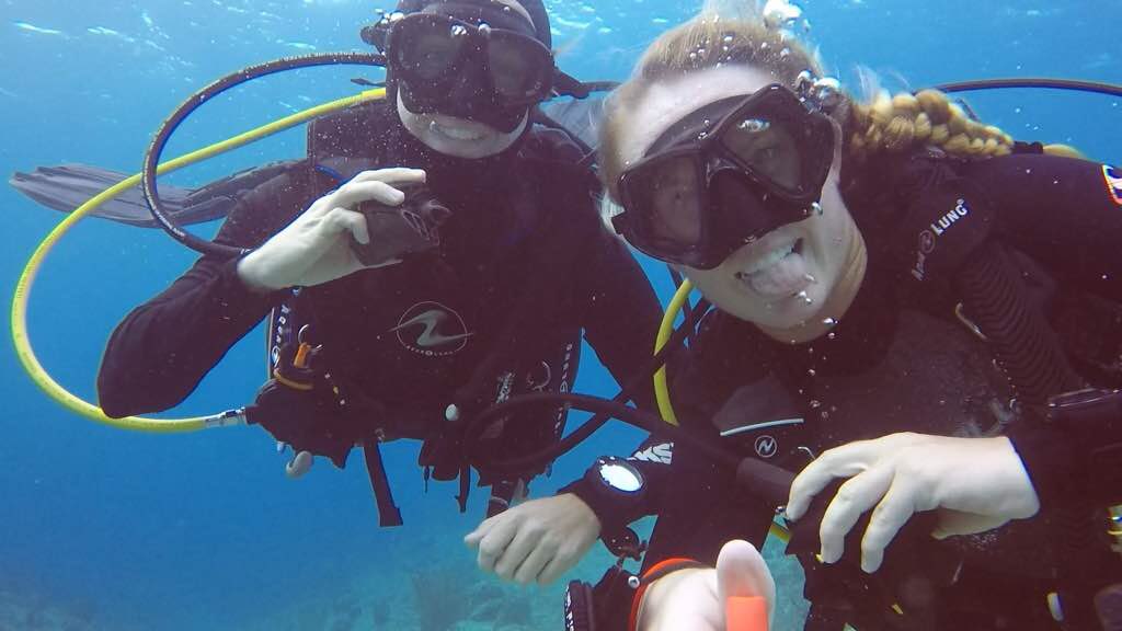
This was our first Dive Against Debris Dive in a long time for Underworld Scuba. There are also other dive groups doing clean up dives and the debris is getting less and less.
No
Antique Coke Bottles.
Wind, rain, sunny periods - a mix of weather.
Underworld Scuba
Tim Ness
1
3
20
1
4
1
35.00
37
40.00
0.00
2
estimated
3
1
5000.00
2
Beverage Cans
Grocery Bags
Plastics
On
pounds
I have debris data to report
8
Calm (glassy to rippled) for waves 0 – 0.1 meter high
1
1
ft2
feet
other
6
1
5
1
10
1
Canada
State\Province
Manitoba
City
Winnipeg
Map Help
Dive Location
If you know your survey site coordinates, enter them manually in decimal degrees using WGS84 Map Datum. Use the minus sign for latitudes south of the equator and longitudes west of the Prime Meridian to 180 degrees.
If you do not know your survey site coordinates, click the “Map Location” tab to use the map to zoom into your survey site and drop the pin on the map to fall within your survey dive site in the water (not on land or the beach). Ensure you zoom in as much as possible to ensure data accuracy.
Entangled Help
Use the vertical tabs below to record any entangled animals you found of each type.
Divesite is close to a newly constructed resort. There is also construction trash close buly, but will report more in detail after next dive there
No
First time i report debris and hope i do it correctly...
Tealight holder
Sunny, Calm
Sun Dive Center
Sabine
0
0
0
0
0
0
0
0
0
0
0
0
0
0
0
0
0
1
0
3
0
0
0
0
0
0
0
0
0
0
0
0
0
0
0
0
1.00
60
20.00
5.00
0
estimated
0
0
0
0
1089.22
0
0
0
0
0
Cloth napkins
Plastic spoon
Plasitc bag
0
On
kilograms
0
I have debris data to report
0
0
0
Calm (glassy to rippled) for waves 0 – 0.1 meter high
0
0
0
0
0
0
0
m2
0
6
meters
coral reef
0
0
0
0
1
0
0
0
0
0
0
0
0
0
0
0
0
0
0
0
1
0
0
0
0
0
0
1
0
Maldives
State\Province
Lhaviyani Atoll
City
Kanuhura
Map Help
Dive Location
If you know your survey site coordinates, enter them manually in decimal degrees using WGS84 Map Datum. Use the minus sign for latitudes south of the equator and longitudes west of the Prime Meridian to 180 degrees.
If you do not know your survey site coordinates, click the “Map Location” tab to use the map to zoom into your survey site and drop the pin on the map to fall within your survey dive site in the water (not on land or the beach). Ensure you zoom in as much as possible to ensure data accuracy.
Entangled Help
Use the vertical tabs below to record any entangled animals you found of each type.
Calm (glassy to rippled) for waves 0 – 0.1 meter high
0
0
0
0
2
0
0
m2
0
0
meters
coral reef
0
0
0
0
0
0
0
0
0
1
0
0
0
0
0
0
1
0
0
0
0
0
0
0
0
0
0
0
0
Netherlands Antilles
State\Province
Curacao
City
Willemstad
Map Help
Dive Location
If you know your survey site coordinates, enter them manually in decimal degrees using WGS84 Map Datum. Use the minus sign for latitudes south of the equator and longitudes west of the Prime Meridian to 180 degrees.
If you do not know your survey site coordinates, click the “Map Location” tab to use the map to zoom into your survey site and drop the pin on the map to fall within your survey dive site in the water (not on land or the beach). Ensure you zoom in as much as possible to ensure data accuracy.
Entangled Help
Use the vertical tabs below to record any entangled animals you found of each type.
Very windy, lots of debris being blown into the ocean!
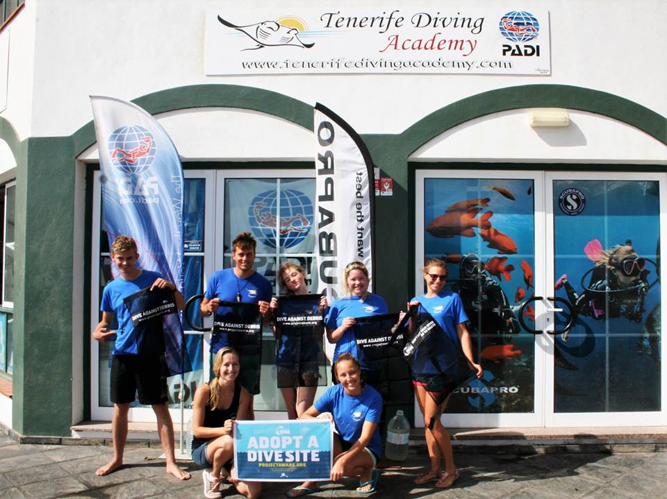
Tenerife Diving Academy
Kim Timmers
12
8.03
45
7.00
2.00
measured
31
500.00
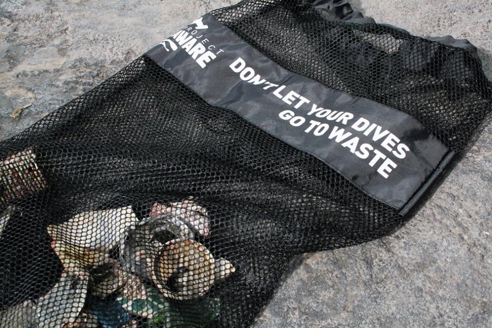
Fishing gear
Glass
Cans
On
kilograms
I have debris data to report
1
Slight for waves 0.5 -1.25 meter high
1
1
m2
3
meters
rocky reef
10
2
40
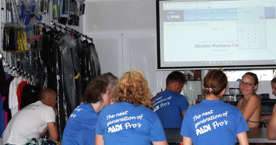
Spain
State\Province
Tenerife
City
Abades
Map Help
Dive Location
If you know your survey site coordinates, enter them manually in decimal degrees using WGS84 Map Datum. Use the minus sign for latitudes south of the equator and longitudes west of the Prime Meridian to 180 degrees.
If you do not know your survey site coordinates, click the “Map Location” tab to use the map to zoom into your survey site and drop the pin on the map to fall within your survey dive site in the water (not on land or the beach). Ensure you zoom in as much as possible to ensure data accuracy.
Entangled Help
Use the vertical tabs below to record any entangled animals you found of each type.
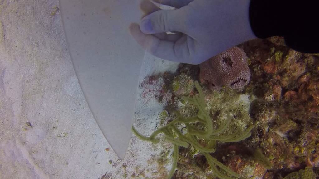
This was a ghostnet recovery dive. We found one big floating net and lots of old net pieces.
The visibility was very low 0.5-1 m.
Gameboy, sunglasses, lots of shoes
Sunny and windy
1
1
3
4
2
2
5
1
1
1
Slap on bracelet
Gameboy
Pen
Tube of hygiene products
Metal wire with rubber tubing
Bubble wrap
Sunglasses
Plastic toy fragment, looks like a propeller
Cleaning brush with plastic handle
Swimming googles
Mandarin divers
Tusiopsdiver
4
1
17
2
2
3
7
8
1
12
15
1
8
74
16
1
100.00
34
7.70
1.70
13
estimated
725.84
3
Plastic
Abandoned fishing gears
4
On
kilograms
I have debris data to report
Smooth (wavelets) for waves 0.1 - 0.5 meter high
6
15
10
11
m2
2
1
meters
rocky reef
2
5
1
1
16
1
2
Hong Kong S.A.R., China
City
Lamma Island
Map Help
Dive Location
If you know your survey site coordinates, enter them manually in decimal degrees using WGS84 Map Datum. Use the minus sign for latitudes south of the equator and longitudes west of the Prime Meridian to 180 degrees.
If you do not know your survey site coordinates, click the “Map Location” tab to use the map to zoom into your survey site and drop the pin on the map to fall within your survey dive site in the water (not on land or the beach). Ensure you zoom in as much as possible to ensure data accuracy.
Entangled Help
Use the vertical tabs below to record any entangled animals you found of each type.
It was our second dive of the day, we found a lot more trash on the other side of the bay. The visibility was low, 0.5-1 m, thus our survey was quite restricted.
Light bulb and shoes
Sunny and windy
2
Bubble wrap
Mandarin divers
Tursiopsdiver
1
3
4
5.00
51
7.70
1.80
5
estimated
716.69
Plastic
Abandoned fishing gear
On
kilograms
I have debris data to report
Smooth (wavelets) for waves 0.1 - 0.5 meter high
1
3
m2
meters
rocky reef
1
1
2
1
1
2
Hong Kong S.A.R., China
City
Lamma Island
Map Help
Dive Location
If you know your survey site coordinates, enter them manually in decimal degrees using WGS84 Map Datum. Use the minus sign for latitudes south of the equator and longitudes west of the Prime Meridian to 180 degrees.
If you do not know your survey site coordinates, click the “Map Location” tab to use the map to zoom into your survey site and drop the pin on the map to fall within your survey dive site in the water (not on land or the beach). Ensure you zoom in as much as possible to ensure data accuracy.
Entangled Help
Use the vertical tabs below to record any entangled animals you found of each type.
Calm (glassy to rippled) for waves 0 – 0.1 meter high
0
0
2
0
5
0
0
m2
0
0
meters
rocky reef
0
0
0
0
0
0
0
0
0
0
0
0
0
0
0
0
0
7
0
0
0
0
0
0
0
0
0
0
0
Colombia
State\Province
Nariño
City
Tumaco
Map Help
Dive Location
If you know your survey site coordinates, enter them manually in decimal degrees using WGS84 Map Datum. Use the minus sign for latitudes south of the equator and longitudes west of the Prime Meridian to 180 degrees.
If you do not know your survey site coordinates, click the “Map Location” tab to use the map to zoom into your survey site and drop the pin on the map to fall within your survey dive site in the water (not on land or the beach). Ensure you zoom in as much as possible to ensure data accuracy.
Entangled Help
Use the vertical tabs below to record any entangled animals you found of each type.
Typhoon that came in from the east the week earlier
This is the first time that we'd done mango drop off in a long time. We were taken back by the amount of plastic bottles that we came across seeing that on previous clean up dives, we'd not found a great deal. This was a first time in a long time that I only took one clean up bag with me as ...sods law!!
Sun cap
Windy
1
Sun Cap
Eco Koh Tao - Crystal Dive
Jennifer Dowling
2
1
3
10
2
88
1
7.30
55
17.00
6.00
measured
200.00
1
plastic bottles
plastic fragments
On
kilograms
I have debris data to report
Slight for waves 0.5 -1.25 meter high
0
0
2
m2
meters
coral reef
3
1
5
5
Thailand
State\Province
Surat Thani
City
Koh Tao
Map Help
Dive Location
If you know your survey site coordinates, enter them manually in decimal degrees using WGS84 Map Datum. Use the minus sign for latitudes south of the equator and longitudes west of the Prime Meridian to 180 degrees.
If you do not know your survey site coordinates, click the “Map Location” tab to use the map to zoom into your survey site and drop the pin on the map to fall within your survey dive site in the water (not on land or the beach). Ensure you zoom in as much as possible to ensure data accuracy.
Entangled Help
Use the vertical tabs below to record any entangled animals you found of each type.