Menu

ADS142 - Sabang Bay Puerto Galera

2
1

13.521685, 120.975398

sand
This was the first of the Dive Against Debris Dives by our Project Aware CAS Project group. We used part of the money we raised from our school campaign back in December to fund this as well as future dives. Through this, we aim to actively partake in protecting and maintaining the health of our oceans.
2 large plastic pipes
New Moon
Asia Divers
Brad Bynum
2
1
5
1
4.00
44
18.00
5.00
estimated
1200.00
Plastic
Glass bottles
Metal
On
kilograms
I have debris data to report
4
Smooth (wavelets) for waves 0.1 - 0.5 meter high m2
meters
coral reef
1
Philippines
City
Puerto Galera
Map Help


Dive Location

If you know your survey site coordinates, enter them manually in decimal degrees using WGS84 Map Datum. Use the minus sign for latitudes south of the equator and longitudes west of the Prime Meridian to 180 degrees.

If you do not know your survey site coordinates, click the “Map Location” tab to use the map to zoom into your survey site and drop the pin on the map to fall within your survey dive site in the water (not on land or the beach). Ensure you zoom in as much as possible to ensure data accuracy.

Entangled Help


Use the vertical tabs below to record any entangled animals you found of each type.

ADS464 - Quarry Ramada

56.777108157115, 60.718125617132

seagrass

56.777108157115, 60.718125617132

Ural-ALPHA-Diving
Vladimir Akimov
3
5.00
55
10.00
5.00
estimated
270.00
On
kilograms
I have debris data to report
Calm (glassy to rippled) for waves 0 – 0.1 meter high
fishing nets
crustacean shells
5
2
m2
2
meters
seagrass
Russia
State\Province
Sverdlovsk region
City
Yekaterinburg
Map Help


Dive Location

If you know your survey site coordinates, enter them manually in decimal degrees using WGS84 Map Datum. Use the minus sign for latitudes south of the equator and longitudes west of the Prime Meridian to 180 degrees.

If you do not know your survey site coordinates, click the “Map Location” tab to use the map to zoom into your survey site and drop the pin on the map to fall within your survey dive site in the water (not on land or the beach). Ensure you zoom in as much as possible to ensure data accuracy.
Entangled Help


Use the vertical tabs below to record any entangled animals you found of each type.

ADS352 - Meno Slope

0
0
0
0

-8.349828, 116.050467

0
0
0
gravel
0
0
0
0
0
No
Windy and cloudy
Gili Shark Conservation
Ady
0
0
0
0
0
0
0
0
0
0
0
0
0
0
0
0
0
0
0
1
0
0
0
0
0
0
0
0
0
0
0
0
0
0
0
0
0.00
45
18.00
8.00
0
estimated
0
0
0
0
13550.90
0
0
0
0
0
0
On
kilograms
0
Our Survey Site was free of debris
0
0
0
Slight for waves 0.5 -1.25 meter high
0
0
0
0
0
0
0
m2
0
0
meters
coral reef
0
0
0
0
0
0
0
0
0
0
0
0
0
0
0
0
0
0
0
0
0
0
0
0
0
0
0
0
0
Indonesia
State\Province
West Nusa Tenggarai
City
Gili Air
Map Help


Dive Location

If you know your survey site coordinates, enter them manually in decimal degrees using WGS84 Map Datum. Use the minus sign for latitudes south of the equator and longitudes west of the Prime Meridian to 180 degrees.

If you do not know your survey site coordinates, click the “Map Location” tab to use the map to zoom into your survey site and drop the pin on the map to fall within your survey dive site in the water (not on land or the beach). Ensure you zoom in as much as possible to ensure data accuracy.
Entangled Help


Use the vertical tabs below to record any entangled animals you found of each type.

Harbour reef

sand

-8.3635, 116.082946

Calm
Oceans 5 Dive
Cedric cabrieres
12
175.00
60
16.00
5.00
estimated
100.00
Plastic
On
kilograms
I have debris data to report
Calm (glassy to rippled) for waves 0 – 0.1 meter high m2
meters
seagrass
Indonesia
State\Province
Lombok
City
Gili air
Map Help


Dive Location

If you know your survey site coordinates, enter them manually in decimal degrees using WGS84 Map Datum. Use the minus sign for latitudes south of the equator and longitudes west of the Prime Meridian to 180 degrees.

If you do not know your survey site coordinates, click the “Map Location” tab to use the map to zoom into your survey site and drop the pin on the map to fall within your survey dive site in the water (not on land or the beach). Ensure you zoom in as much as possible to ensure data accuracy.
Entangled Help


Use the vertical tabs below to record any entangled animals you found of each type.

ADS464 - Quarry Ramada

0
2
5

56.777086236321, 60.718006981076

4
0
0
sand
0
7
1
0
0
Organized and hosted the event to clean the bottom
Warm + 18
0
0
0
0
0
0
0
0
0
0
0
0
0
0
0
0
0
0
0
0
Ural Alpha Diving s -24473
Vladimir Akimov
2
0
0
12
0
0
0
0
0
0
0
0
0
0
0
0
0
0
0
4
0
0
0
0
11
3
1
3
0
0
0
0
0
0
100.00
45
9.00
5.00
2
estimated
0
0
243.19
0
2
0
0
0
0
On
kilograms
0
I have debris data to report
2
0
0
Calm (glassy to rippled) for waves 0 – 0.1 meter high
2
0
0
Plastic pocket
Bream, Shell of Cancer
Shell of cancer
Dead
1
1
Fishing net
0
0
0
0
m2
0
0
meters
seagrass
0
0
0
0
0
3
0
3
0
0
0
0
6
0
0
0
0
0
0
0
0
0
0
0
0
0
0
0
Russia
State\Province
Sverdlovsk
City
Ekaterinburg
Map Help


Dive Location

If you know your survey site coordinates, enter them manually in decimal degrees using WGS84 Map Datum. Use the minus sign for latitudes south of the equator and longitudes west of the Prime Meridian to 180 degrees.

If you do not know your survey site coordinates, click the “Map Location” tab to use the map to zoom into your survey site and drop the pin on the map to fall within your survey dive site in the water (not on land or the beach). Ensure you zoom in as much as possible to ensure data accuracy.

Entangled Help


Use the vertical tabs below to record any entangled animals you found of each type.

ADS184 - Gold Coast Seaway

3
1

-27.93664, 153.426301

rock
1
Snorkeling and Freediving the shelf is well worth it! Especially if you have an Eagle Eyed Child as your Buddy.

The Sprogs aka next generation took the in water pics and had a complete and utter blast.

We can not wait to get these Merkids in the making back in the water.
Highly used area.
A truly amazing day. Teaching the next generation to Snorkel and feel comfortable in the water while discussing why the marine environment is so special and why it needs our protection along with all the help we can give it. That along with the pure joy and excitement these guys showed every time they saw a fish was literally enough to make anyone's day.
Artificial Christmas Tree Limb
Fair
1
Artificial Christmas Tree Limb
Environmental Divers
Kelly Fletcher
1
4
1
3.20
60
6.00
1.00
2
measured
100.00
Fishing Line
Lead Sinkers
Hooks
On
kilograms
I have debris data to report
1
Moderate to rough for waves greater than 1.25 meters
1
m2
meters
other
2
1
1
Australia
State\Province
Queensland
City
Gold Coast
Map Help


Dive Location

If you know your survey site coordinates, enter them manually in decimal degrees using WGS84 Map Datum. Use the minus sign for latitudes south of the equator and longitudes west of the Prime Meridian to 180 degrees.

If you do not know your survey site coordinates, click the “Map Location” tab to use the map to zoom into your survey site and drop the pin on the map to fall within your survey dive site in the water (not on land or the beach). Ensure you zoom in as much as possible to ensure data accuracy.

Entangled Help


Use the vertical tabs below to record any entangled animals you found of each type.

Ecosystem Other
Man made seaway entrance, rock wall with sand bottom

Sairee Reef Koh Tao

12
sand
12

10.094191539874, 99.821562232682

windy
1
1
Mop Head
Metal Cake stand / Fruit bowl
Eco Koh Tao - Crystal Dive
jennifer dowling
2
3
6
1
3.00
50
13.00
5.00
estimated
4
50.00
fishing line
plastic fragments
rope, string
3
On
kilograms
I have debris data to report
Calm (glassy to rippled) for waves 0 – 0.1 meter high
0
0
4
m2
9
meters
coral reef
5
2
4
1
Thailand
State\Province
Surat Thani
City
Koh Tao
Map Help


Dive Location

If you know your survey site coordinates, enter them manually in decimal degrees using WGS84 Map Datum. Use the minus sign for latitudes south of the equator and longitudes west of the Prime Meridian to 180 degrees.

If you do not know your survey site coordinates, click the “Map Location” tab to use the map to zoom into your survey site and drop the pin on the map to fall within your survey dive site in the water (not on land or the beach). Ensure you zoom in as much as possible to ensure data accuracy.

Entangled Help


Use the vertical tabs below to record any entangled animals you found of each type.

ADS88 - Dive Bus House Reef

25

12.088975, -68.905175

coral
1
10
New Years
Computer parts
Partly cloudy, windy
The Dive Bus
Bor
1
23
14
9
4
19.00
60
25.00
1.00
measured
9
100.00
Fireworks
On
kilograms
I have debris data to report
14
Smooth (wavelets) for waves 0.1 - 0.5 meter high
1
7
m2
5
meters
coral reef
6
150
1
22
6
Netherlands Antilles
State\Province
Curacao
City
Willemstad
Map Help


Dive Location

If you know your survey site coordinates, enter them manually in decimal degrees using WGS84 Map Datum. Use the minus sign for latitudes south of the equator and longitudes west of the Prime Meridian to 180 degrees.

If you do not know your survey site coordinates, click the “Map Location” tab to use the map to zoom into your survey site and drop the pin on the map to fall within your survey dive site in the water (not on land or the beach). Ensure you zoom in as much as possible to ensure data accuracy.

Entangled Help


Use the vertical tabs below to record any entangled animals you found of each type.

ADS370 - Blue Bay The Wall & The Garden

3

12.134471, -68.984976

coral
7
6
Blue Bay Dive & Watersports
Mick Bosman
1
8
4
6
2
4
4.00
45
16.00
1.00
estimated
1500.00
plastic items
On
kilograms
I have debris data to report
Calm (glassy to rippled) for waves 0 – 0.1 meter high m2
meters
coral reef
1
1
10
Netherlands Antilles
City
Willemstad
Map Help


Dive Location

If you know your survey site coordinates, enter them manually in decimal degrees using WGS84 Map Datum. Use the minus sign for latitudes south of the equator and longitudes west of the Prime Meridian to 180 degrees.

If you do not know your survey site coordinates, click the “Map Location” tab to use the map to zoom into your survey site and drop the pin on the map to fall within your survey dive site in the water (not on land or the beach). Ensure you zoom in as much as possible to ensure data accuracy.

Entangled Help


Use the vertical tabs below to record any entangled animals you found of each type.

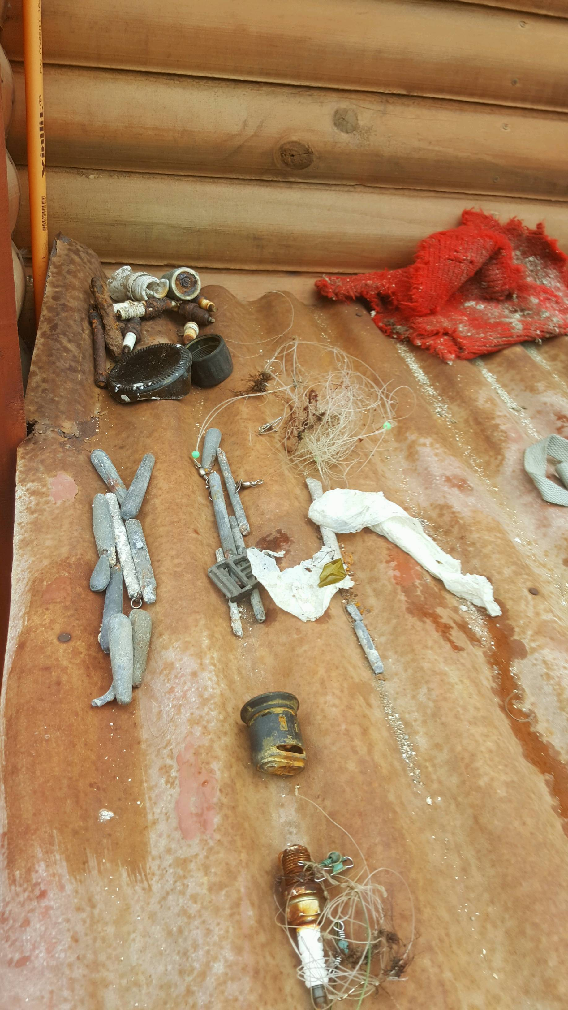
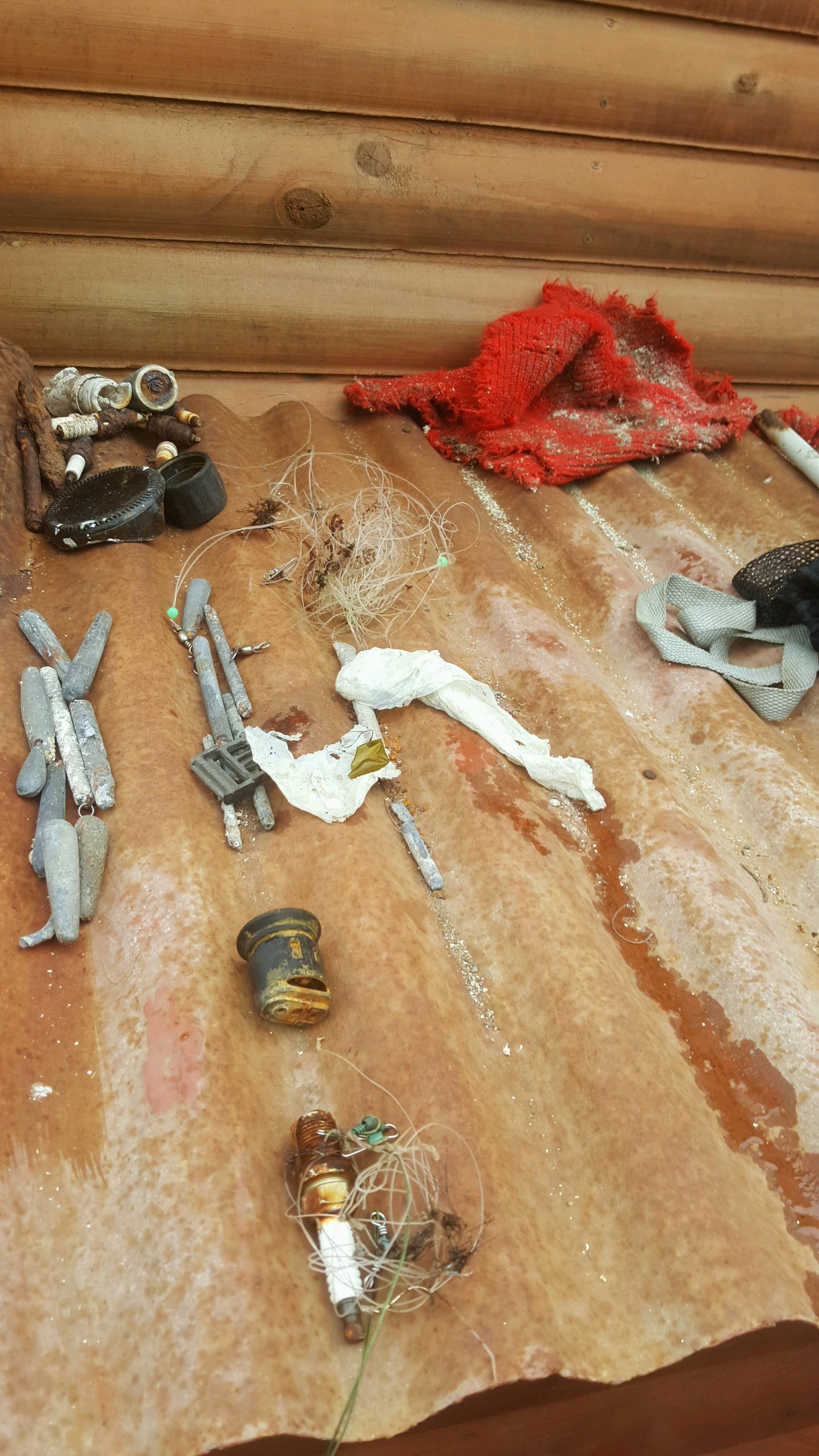
ADS184 - Gold Coast Seaway

5
11
2
1

-27.93664, 153.426301

rock
1
315
Fishing Debris Breakdown -
Hard Lures - 3
Soft Lures - 6
Hooks - 186
Swivels - 176
Sinkers - 125
Wire Trace - 7
Highly used area
Had both snorkelers and Divers in the water for our first public event aka Monthly Maintenance Dive of 2018.
Many thanks to Charmaine from the ABC Gold Coast for coming and speaking with our divers and the amazing piece she did on Environmental Divers regarding our continuous efforts in the Gold Coast Seaway.
Dead, strangulated by line.
Sunglasses, Knife, Plastic Glove
Fair - King Tides
1
1
1
Sunglasses
Plastic Glove
Knife
Environmental Divers
Kelly Fletcher
1
3
1
12
2
2
19.80
60
15.00
1.00
1
measured
1
9
503
90.00
Fishing Line
Lead Sinkers
Hooks
On
kilograms
I have debris data to report
2
Moderate to rough for waves greater than 1.25 meters
Hook and line entangled
1
Dead
Banded Moray Eel
4
m2
meters
other
2
3
1
10
2
Australia
State\Province
Queensland
City
Gold Coast
Map Help


Dive Location

If you know your survey site coordinates, enter them manually in decimal degrees using WGS84 Map Datum. Use the minus sign for latitudes south of the equator and longitudes west of the Prime Meridian to 180 degrees.

If you do not know your survey site coordinates, click the “Map Location” tab to use the map to zoom into your survey site and drop the pin on the map to fall within your survey dive site in the water (not on land or the beach). Ensure you zoom in as much as possible to ensure data accuracy.

Entangled Help


Use the vertical tabs below to record any entangled animals you found of each type.

Ecosystem Other
Man made seaway entrance, rock wall with sand bottom
Subscribe to