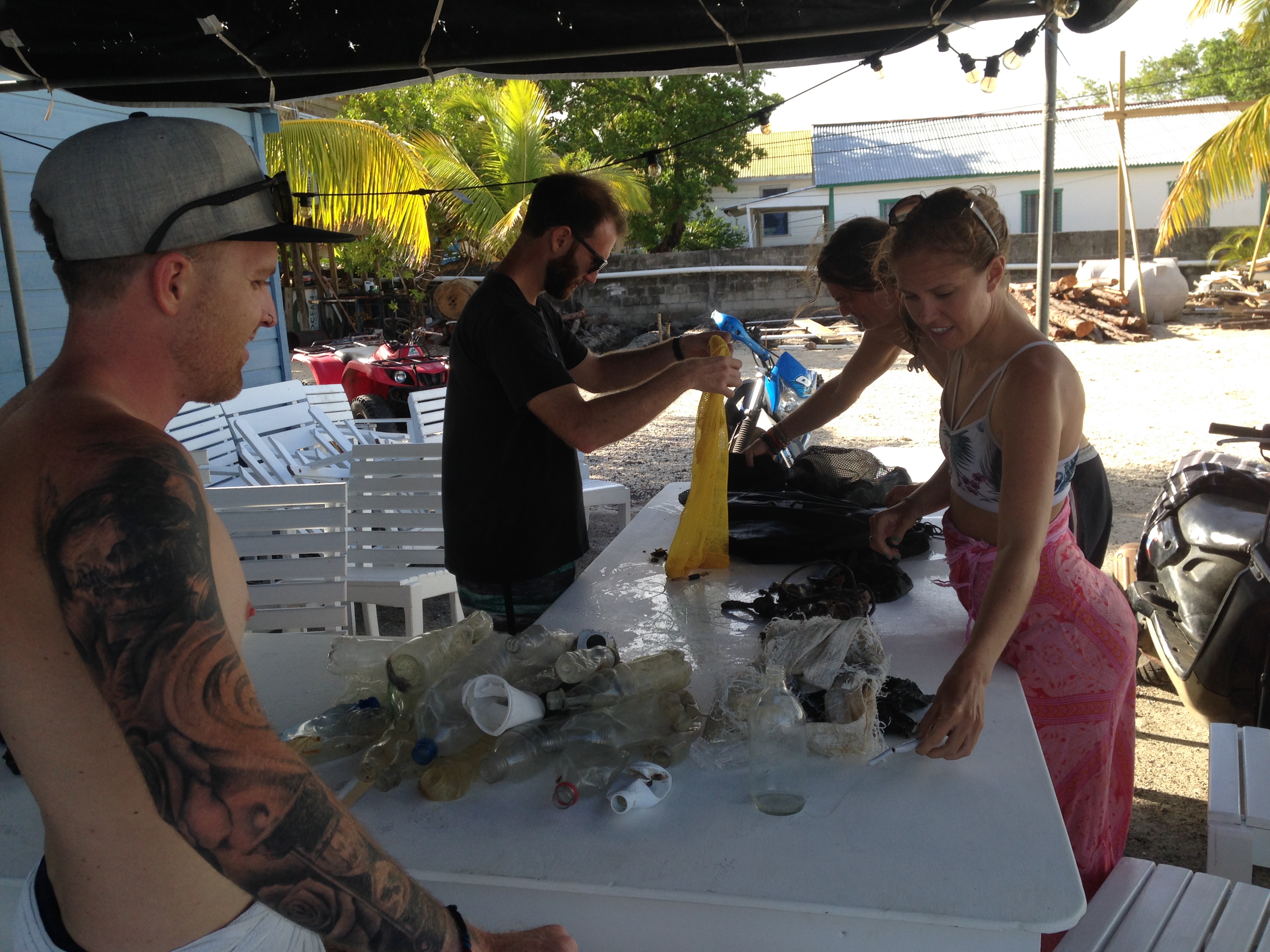
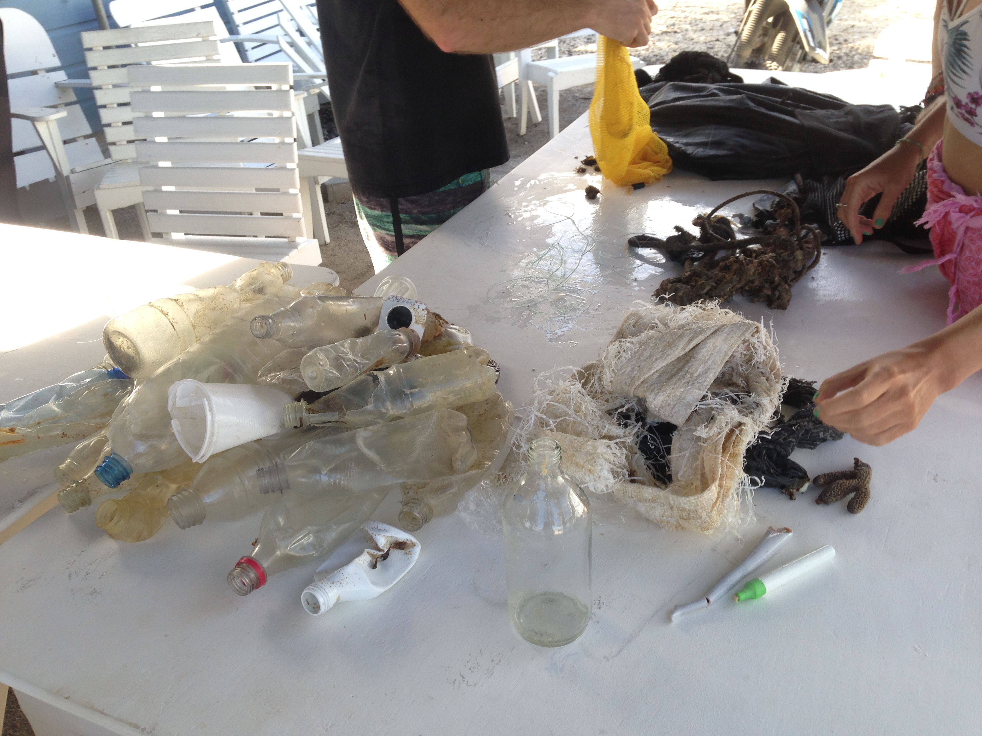
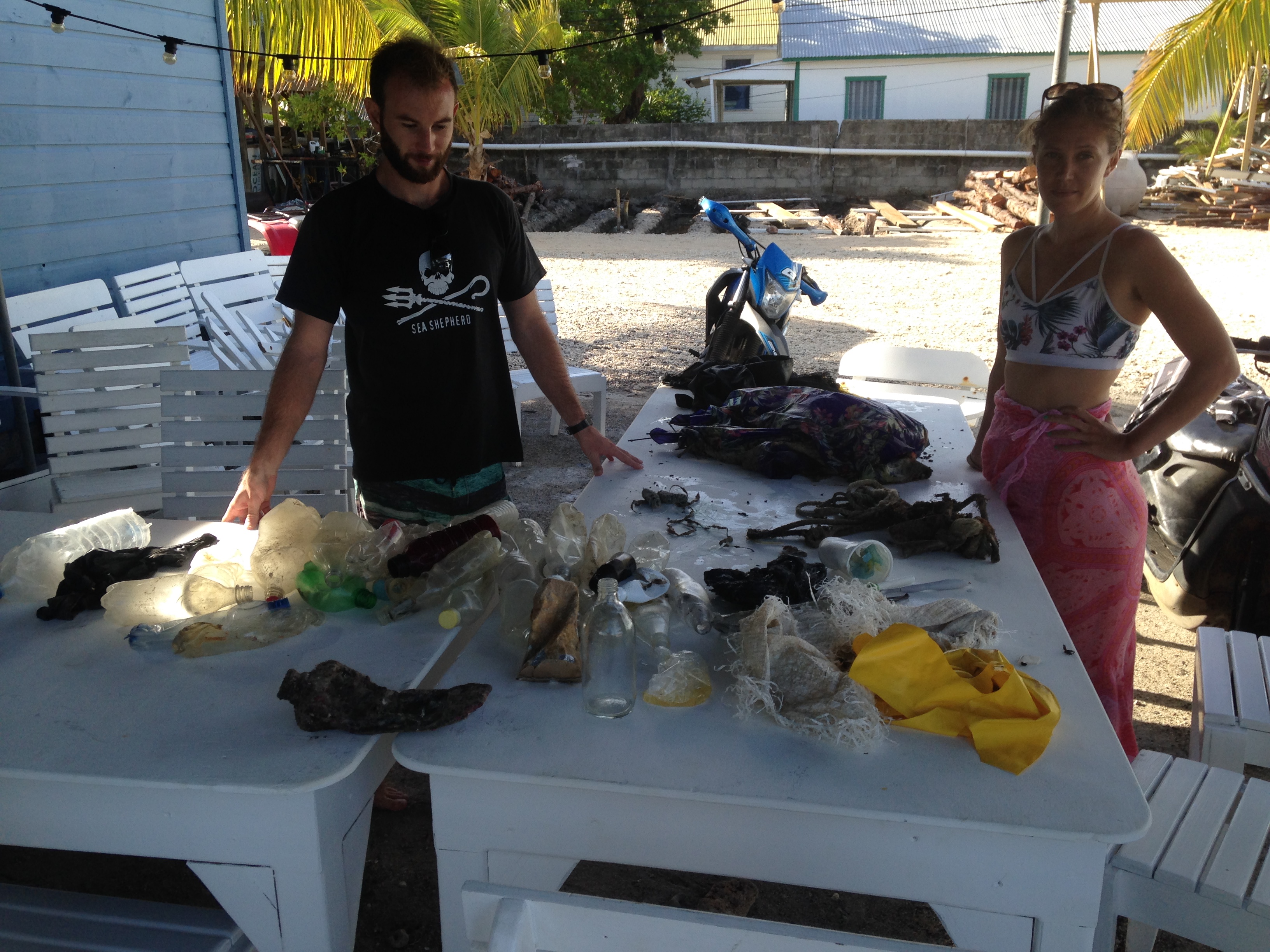
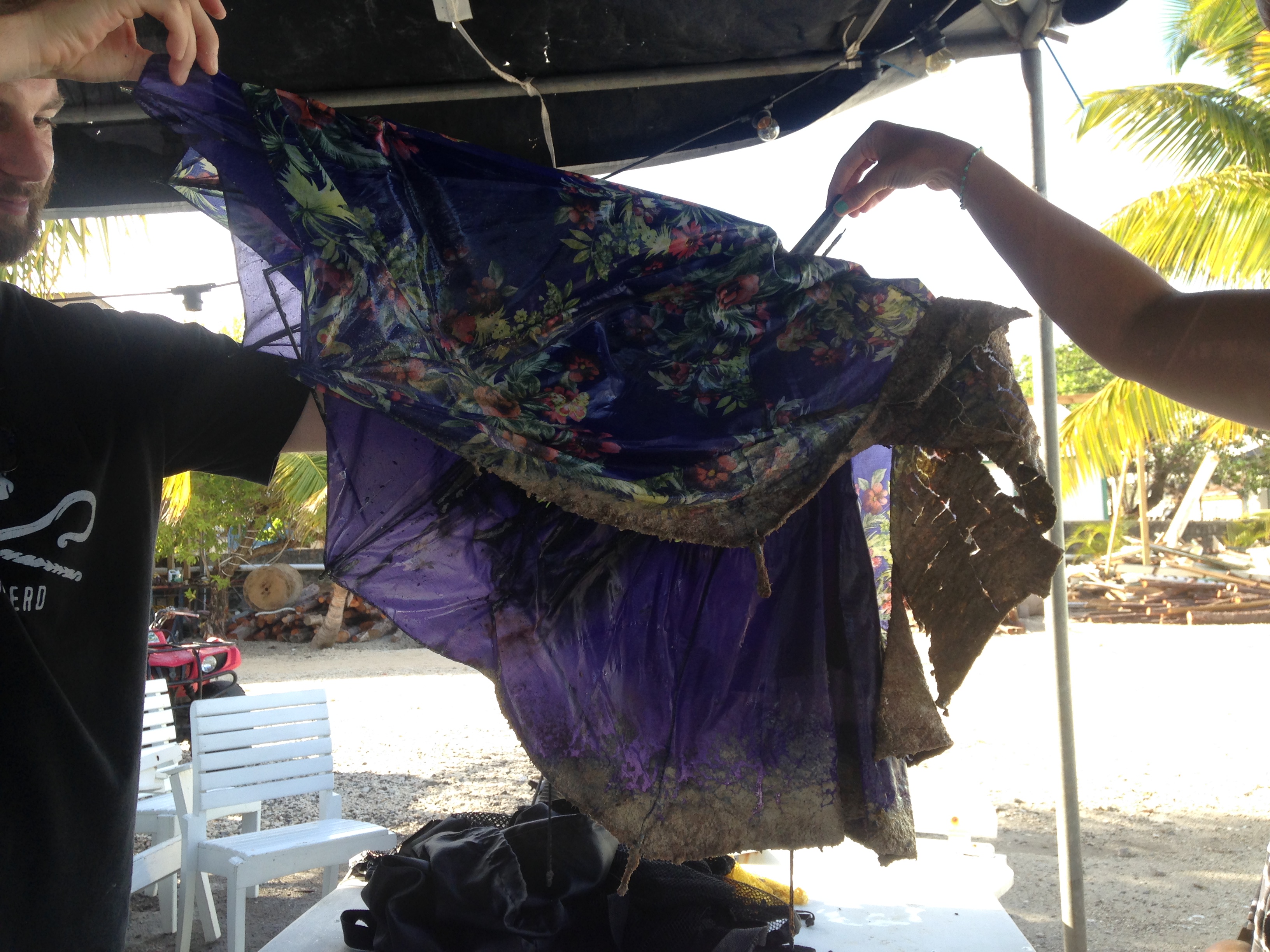
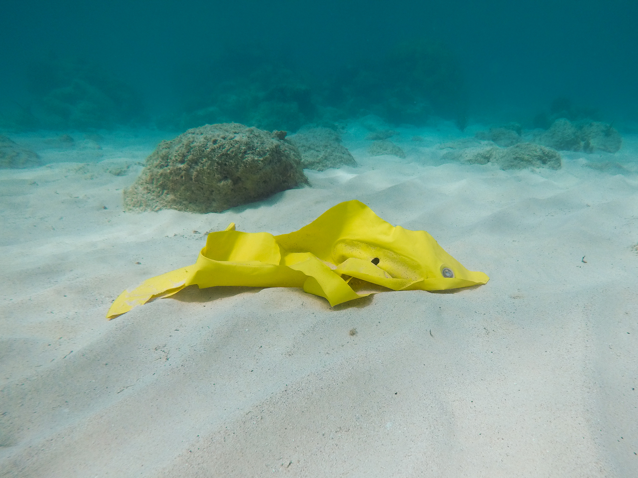
We removed about a km of longline fishing gear, with hooks and floats that drifted to our island. This kind of gear is illegal in Curaçao, so most likely it comes from Venezuela
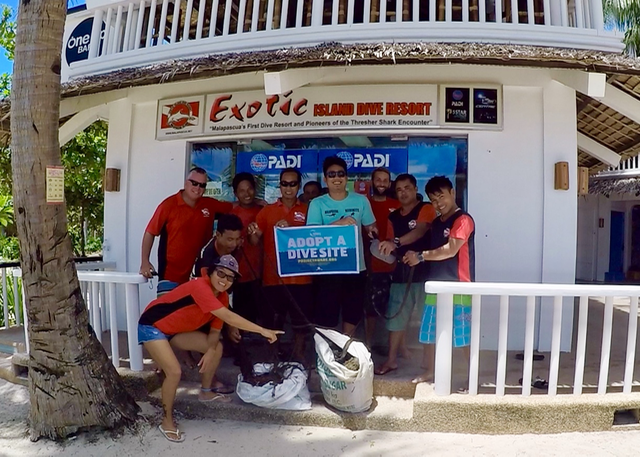
Community was involved, different dive shops, local coast guard...
Longline fishing gear
Windy
0
0
0
0
0
0
0
0
0
0
0
0
0
0
0
0
0
0
0
0
Ocean Encounters
Pol Bosch
0
0
1
0
0
0
0
0
0
0
0
0
0
0
0
0
0
0
0
6
0
0
0
0
0
0
10
0
0
0
0
0
0
0
40.00
75
23.00
2.00
80
estimated
0
150
637926.00
0
0
0
0
0
Rope
Fishing line
0
On
kilograms
0
I have debris data to report
0
0
0
Slight for waves 0.5 -1.25 meter high
0
0
0
0
0
0
0
m2
0
0
meters
coral reef
0
0
0
0
0
0
0
0
0
0
0
0
0
0
0
0
0
0
0
0
0
0
0
0
0
0
0
0
Netherlands Antilles
City
Willemstad
Map Help
Dive Location
If you know your survey site coordinates, enter them manually in decimal degrees using WGS84 Map Datum. Use the minus sign for latitudes south of the equator and longitudes west of the Prime Meridian to 180 degrees.
If you do not know your survey site coordinates, click the “Map Location” tab to use the map to zoom into your survey site and drop the pin on the map to fall within your survey dive site in the water (not on land or the beach). Ensure you zoom in as much as possible to ensure data accuracy.
Entangled Help
Use the vertical tabs below to record any entangled animals you found of each type.
The chemical barrels have been reported to the Department of Enviromental Quality, Water Division.
no
We still have lots more to remove from the area, other Clean Up Dive for Debris planned for next year.
55 gal chemical barrel (2-4-5-T) Weed Killer
clear, sunny, warm
Blue Mountain Divers
Lisa Anderson
4
2
380.00
180
34.00
12.00
3
measured
7
1000.00
19
6
aluminum cans
tires
chemical barrel
6
On
pounds
I have debris data to report
68
Smooth (wavelets) for waves 0.1 - 0.5 meter high
ft2
2
feet
other
1
1
2
1
39
5
8
Language
English
United States
State\Province
Washington
City
Walla Walla
Map Help
Dive Location
If you know your survey site coordinates, enter them manually in decimal degrees using WGS84 Map Datum. Use the minus sign for latitudes south of the equator and longitudes west of the Prime Meridian to 180 degrees.
If you do not know your survey site coordinates, click the “Map Location” tab to use the map to zoom into your survey site and drop the pin on the map to fall within your survey dive site in the water (not on land or the beach). Ensure you zoom in as much as possible to ensure data accuracy.
Entangled Help
Use the vertical tabs below to record any entangled animals you found of each type.
The fishing net has been underwater for a long time based on the condition of it.
One huge fishing net
Windy and wavy due to typhoon influence
Malapascua Exotic Island Dive REsort
Troy Murray
8
48.40
44
24.00
11.00
measured
84.00
Plastic food wrapper
Plastic bottle
Glass bottle
On
kilograms
I have debris data to report
Calm (glassy to rippled) for waves 0 – 0.1 meter high
Dead
Parrot fish
1
Fishing net
m2
meters
coral reef
Language
English
Philippines
State\Province
Cebu
City
Daanbantayan
Map Help
Dive Location
If you know your survey site coordinates, enter them manually in decimal degrees using WGS84 Map Datum. Use the minus sign for latitudes south of the equator and longitudes west of the Prime Meridian to 180 degrees.
If you do not know your survey site coordinates, click the “Map Location” tab to use the map to zoom into your survey site and drop the pin on the map to fall within your survey dive site in the water (not on land or the beach). Ensure you zoom in as much as possible to ensure data accuracy.
Entangled Help
Use the vertical tabs below to record any entangled animals you found of each type.
That we only found half of plastic bottle. We normally find more.
Passing clouds, occasional rains, sunny
Four Seasons Landaa Giraavaru
Angela
1
8
3
1
5.00
52
16.60
4.00
measured
1790.00
Fishing line
On
kilograms
I have debris data to report
Smooth (wavelets) for waves 0.1 - 0.5 meter high
1
m2
meters
coral reef
1
1
Language
English
Maldives
State\Province
Baa Atoll
City
Landaa Giraavaru
Map Help
Dive Location
If you know your survey site coordinates, enter them manually in decimal degrees using WGS84 Map Datum. Use the minus sign for latitudes south of the equator and longitudes west of the Prime Meridian to 180 degrees.
If you do not know your survey site coordinates, click the “Map Location” tab to use the map to zoom into your survey site and drop the pin on the map to fall within your survey dive site in the water (not on land or the beach). Ensure you zoom in as much as possible to ensure data accuracy.
Entangled Help
Use the vertical tabs below to record any entangled animals you found of each type.
Calm (glassy to rippled) for waves 0 – 0.1 meter high
0
0
0
0
0
0
0
ft2
0
0
feet
rocky reef
0
0
0
0
1
0
0
0
0
0
0
0
0
0
0
0
0
0
0
0
0
0
0
1
0
0
1
0
Language
English
United States
State\Province
Ca
City
Catalina
Map Help
Dive Location
If you know your survey site coordinates, enter them manually in decimal degrees using WGS84 Map Datum. Use the minus sign for latitudes south of the equator and longitudes west of the Prime Meridian to 180 degrees.
If you do not know your survey site coordinates, click the “Map Location” tab to use the map to zoom into your survey site and drop the pin on the map to fall within your survey dive site in the water (not on land or the beach). Ensure you zoom in as much as possible to ensure data accuracy.
Entangled Help
Use the vertical tabs below to record any entangled animals you found of each type.
Moderate to rough for waves greater than 1.25 meters
0
0
0
0
0
0
0
ft2
0
0
feet
rocky reef
0
0
0
0
0
0
0
0
0
0
0
0
0
0
0
0
0
0
0
0
0
0
0
0
0
0
0
0
Language
English
United States
State\Province
CA
City
Laguna Beach
Map Help
Dive Location
If you know your survey site coordinates, enter them manually in decimal degrees using WGS84 Map Datum. Use the minus sign for latitudes south of the equator and longitudes west of the Prime Meridian to 180 degrees.
If you do not know your survey site coordinates, click the “Map Location” tab to use the map to zoom into your survey site and drop the pin on the map to fall within your survey dive site in the water (not on land or the beach). Ensure you zoom in as much as possible to ensure data accuracy.
Entangled Help
Use the vertical tabs below to record any entangled animals you found of each type.
Would like to have a category for plastic pens/markers/stationary items as those are quite common debris items we've found.
umbrella
mild wind with occasional squall
1
1
Plastic marker pen
Umbrella (nylon cloth & metal)
Utila Water Sports
Caitlin Chock
1
2
1
1
8
1
1
32
1
2
12.60
63
11.30
1.00
1
measured
1
3000.00
plastic beverage bottles
fishing line
plastic bags
On
pounds
I have debris data to report
1
Smooth (wavelets) for waves 0.1 - 0.5 meter high
2
1
m2
2
meters
coral reef
Language
English
Honduras
State\Province
Bay Islands
City
Utila
Map Help
Dive Location
If you know your survey site coordinates, enter them manually in decimal degrees using WGS84 Map Datum. Use the minus sign for latitudes south of the equator and longitudes west of the Prime Meridian to 180 degrees.
If you do not know your survey site coordinates, click the “Map Location” tab to use the map to zoom into your survey site and drop the pin on the map to fall within your survey dive site in the water (not on land or the beach). Ensure you zoom in as much as possible to ensure data accuracy.
Entangled Help
Use the vertical tabs below to record any entangled animals you found of each type.