Menu

ADS480 - Pompano Beach 1st Reef

20

26.2227, -80.0866

sand
30
No, as far as I know there was no event. It was just spontaneous.
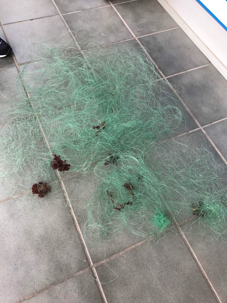
Big wad of 1/4" mesh rope.
East wind blowing from 10 to 20.
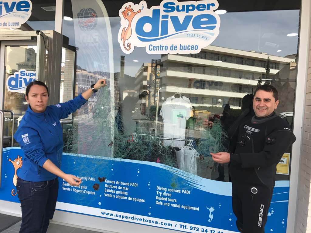
Don Burde
2
5
1
1
20.00
30
20.00
1.00
1
estimated
10000.00
1 gallon wine bottle, very heavy.
On
pounds
I have debris data to report
1
Slight for waves 0.5 -1.25 meter high ft2
feet
rocky reef
1
United States
State\Province
FL
City
Tamarac
Map Help


Dive Location

If you know your survey site coordinates, enter them manually in decimal degrees using WGS84 Map Datum. Use the minus sign for latitudes south of the equator and longitudes west of the Prime Meridian to 180 degrees.

If you do not know your survey site coordinates, click the “Map Location” tab to use the map to zoom into your survey site and drop the pin on the map to fall within your survey dive site in the water (not on land or the beach). Ensure you zoom in as much as possible to ensure data accuracy.

Entangled Help


Use the vertical tabs below to record any entangled animals you found of each type.

Bonaire Harbourfront: Karel's Beach- Fisherman's Pier

38
209
3
2
7
4
coral
5
2
382

12.154952261779, -68.279038562434

Number of glass bottles due to proximity to beach bar
Dive Friends Bonaire
Caitlin Hale
19
35
3
6
33
101
3
9
7
510.00
68
30.00
1.00
9
estimated
3
19
60.00
28
glass bottle
fishing line
plastic fragments
6
On
kilograms
I have debris data to report
403
Calm (glassy to rippled) for waves 0 – 0.1 meter high
13
3
29
1
m2
32
meters
coral reef
41
8
1
35
38
74
12
86
42
Netherlands Antilles
City
Kralendijk
Map Help


Dive Location

If you know your survey site coordinates, enter them manually in decimal degrees using WGS84 Map Datum. Use the minus sign for latitudes south of the equator and longitudes west of the Prime Meridian to 180 degrees.

If you do not know your survey site coordinates, click the “Map Location” tab to use the map to zoom into your survey site and drop the pin on the map to fall within your survey dive site in the water (not on land or the beach). Ensure you zoom in as much as possible to ensure data accuracy.

Entangled Help


Use the vertical tabs below to record any entangled animals you found of each type.

ADS452 - Negre del Falaguer

50
1
rock
3

42.067174548597, 3.2111593075138

Bad weather. Rain. Sea storm. Rough sea.
1
watering plastic can
El Rei del Mar
El Rei del Mar
1
2
15
2
1
1
3
3.00
42
20.00
1.00
estimated
300.00
On
kilograms
I have debris data to report
Slight for waves 0.5 -1.25 meter high m2
meters
rocky reef
Spain
State\Province
Girona
City
L'Estartit
Map Help


Dive Location

If you know your survey site coordinates, enter them manually in decimal degrees using WGS84 Map Datum. Use the minus sign for latitudes south of the equator and longitudes west of the Prime Meridian to 180 degrees.

If you do not know your survey site coordinates, click the “Map Location” tab to use the map to zoom into your survey site and drop the pin on the map to fall within your survey dive site in the water (not on land or the beach). Ensure you zoom in as much as possible to ensure data accuracy.

Entangled Help


Use the vertical tabs below to record any entangled animals you found of each type.

Selce

0
0
0
0

45.0909, 14.431

0
0
0
rock
0
0
0
0
0
Sunny
Diving center Mihurić
0
0
0
0
0
0
0
0
0
0
0
0
0
0
0
0
0
0
0
32
0
0
0
0
0
0
0
0
0
0
0
0
0
0
0
0
500.00
45
12.00
3.00
0
estimated
0
0
0
0
548464.00
0
0
0
0
0
0
On
kilograms
0
I have debris data to report
0
0
0
Smooth (wavelets) for waves 0.1 - 0.5 meter high
0
0
0
0
0
0
0
m2
0
0
meters
rocky reef
0
0
0
0
0
0
0
0
0
0
0
0
0
0
0
0
0
0
0
0
0
0
0
0
0
0
0
0
0
Croatia
City
Selce
Map Help


Dive Location

If you know your survey site coordinates, enter them manually in decimal degrees using WGS84 Map Datum. Use the minus sign for latitudes south of the equator and longitudes west of the Prime Meridian to 180 degrees.

If you do not know your survey site coordinates, click the “Map Location” tab to use the map to zoom into your survey site and drop the pin on the map to fall within your survey dive site in the water (not on land or the beach). Ensure you zoom in as much as possible to ensure data accuracy.

Entangled Help


Use the vertical tabs below to record any entangled animals you found of each type.

ADS375 - Mar Menuda

0
0
1

41.72020161, 2.93185686

0
0
0
rock
0
0
0
0
0
Bad
0
0
0
0
0
0
0
0
0
0
0
0
0
0
0
0
0
0
0
0
SuperDive Tossa de Mar
Chiqui Bustos
0
0
0
0
0
0
0
0
0
0
0
0
0
0
0
0
0
0
0
3
0
0
0
0
0
0
0
0
0
0
0
0
0
0
1.00
55
18.00
6.00
0
estimated
0
0
477436.00
0
0
0
0
0
0
On
kilograms
0
I have debris data to report
0
0
0
Smooth (wavelets) for waves 0.1 - 0.5 meter high
0
0
0
0
0
0
0
m2
0
0
meters
other
0
0
0
0
0
0
0
0
0
0
0
0
0
0
0
0
0
0
0
0
0
0
0
0
0
0
0
0
Spain
State\Province
Girona
City
Tossa de Mar
Map Help


Dive Location

If you know your survey site coordinates, enter them manually in decimal degrees using WGS84 Map Datum. Use the minus sign for latitudes south of the equator and longitudes west of the Prime Meridian to 180 degrees.

If you do not know your survey site coordinates, click the “Map Location” tab to use the map to zoom into your survey site and drop the pin on the map to fall within your survey dive site in the water (not on land or the beach). Ensure you zoom in as much as possible to ensure data accuracy.

Entangled Help


Use the vertical tabs below to record any entangled animals you found of each type.

ADS375 - Mar Menuda

0
0
1

41.721823209708, 2.9388595392716

0
0
0
rock
0
0
0
0
0
Ok
0
0
0
0
0
0
0
0
0
0
0
0
0
0
0
0
0
0
0
0
SuperDive Tossa de Mar
Chiqui Bustos
0
0
0
0
0
0
0
0
0
0
0
0
0
0
0
0
0
0
0
3
0
0
0
0
0
0
0
0
0
0
0
0
0
0
0.00
58
18.00
6.00
0
estimated
0
0
12.00
0
0
0
0
0
0
On
kilograms
0
I have debris data to report
0
0
0
Slight for waves 0.5 -1.25 meter high
0
0
0
0
0
0
0
m2
0
0
meters
other
0
0
0
0
0
0
0
0
0
0
0
0
0
0
0
0
0
0
0
0
0
0
0
0
0
0
0
0
Spain
State\Province
Girona
City
Tossa de Mar
Map Help


Dive Location

If you know your survey site coordinates, enter them manually in decimal degrees using WGS84 Map Datum. Use the minus sign for latitudes south of the equator and longitudes west of the Prime Meridian to 180 degrees.

If you do not know your survey site coordinates, click the “Map Location” tab to use the map to zoom into your survey site and drop the pin on the map to fall within your survey dive site in the water (not on land or the beach). Ensure you zoom in as much as possible to ensure data accuracy.

Entangled Help


Use the vertical tabs below to record any entangled animals you found of each type.

ADS296 - St. Petersburg Bay Reef

27.7887, 82.590633

silt
4
Fishermen and boaters catch anchors and leave them behind.
3
1
Anchor
Anchor Chain
Tikkun HaYam
Shayna Cohen
3
30.00
50
35.00
15.00
estimated
60.00
On
pounds
I have debris data to report
1
Calm (glassy to rippled) for waves 0 – 0.1 meter high ft2
6
feet
other
United States
State\Province
Florida
City
St. Petersburg
Map Help


Dive Location

If you know your survey site coordinates, enter them manually in decimal degrees using WGS84 Map Datum. Use the minus sign for latitudes south of the equator and longitudes west of the Prime Meridian to 180 degrees.

If you do not know your survey site coordinates, click the “Map Location” tab to use the map to zoom into your survey site and drop the pin on the map to fall within your survey dive site in the water (not on land or the beach). Ensure you zoom in as much as possible to ensure data accuracy.

Entangled Help


Use the vertical tabs below to record any entangled animals you found of each type.

Ecosystem Other
Artificial Reef

ADS296 - St. Petersburg Bay Reef

26.7887, -82.590633

silt
8
1
1
Anchor Chain
Anchor
Tikkun HaYam
Shayna Cohen
5
36.00
45
35.00
15.00
1
estimated
50.00
On
pounds
I have debris data to report
1
Calm (glassy to rippled) for waves 0 – 0.1 meter high ft2
3
feet
other
United States
State\Province
Florida
City
St. Petersburg
Map Help


Dive Location

If you know your survey site coordinates, enter them manually in decimal degrees using WGS84 Map Datum. Use the minus sign for latitudes south of the equator and longitudes west of the Prime Meridian to 180 degrees.

If you do not know your survey site coordinates, click the “Map Location” tab to use the map to zoom into your survey site and drop the pin on the map to fall within your survey dive site in the water (not on land or the beach). Ensure you zoom in as much as possible to ensure data accuracy.

Entangled Help


Use the vertical tabs below to record any entangled animals you found of each type.

Ecosystem Other
Artificial Reef

Treardurr Bay, Haunted House - Anglesey

sand

53.280532924702, -4.6291302459905

This dive was going to be cancelled due to the bad weather the week, and the strong winds - but we decided to head to the coast with our dive gear on the off chance the surf wasn't too strong. We visited a few coves along the south of Holyhead and found one that was sheltered so wasn't suffering from strong surf. Although the water was flat and the sky cloud free, the vis was very poor. We could see our computers but that was about it.
As the vis was so bad, finding debris was nearly impossible, so the results of our survey will not reflect the debris in the area. However, we managed not to leave empty handed and during the dive found 4 large boards made from fiberglass which although awkward to carry, these were removed from the site.
An enjoyable dive, and additional depth can be gained going further out from the shore. I would recommend this site for a pleasure dive, an easy entry and exit with parking on the roadside.
Ben was very excited with our haul from the sea.
4 pieces of fiberglass, possibly from the same boat (three white pieces, one blue piece). Roughly 50cmx30cm
Heavy rain and storm Callum had caused very high winds the week before. The weather really badly affected the vis, which was down to 20cm max, this really impacted our ability to find debris as we often couldn't see the bottom of the dive site.
Fibreglass boards - Boat Debris
Scuba Leeds
Susannah Noble
2
8.31
38
4.30
1.00
measured
1153.00
On
kilograms
I have debris data to report
Smooth (wavelets) for waves 0.1 - 0.5 meter high m2
meters
kelp
United Kingdom
Map Help


Dive Location

If you know your survey site coordinates, enter them manually in decimal degrees using WGS84 Map Datum. Use the minus sign for latitudes south of the equator and longitudes west of the Prime Meridian to 180 degrees.

If you do not know your survey site coordinates, click the “Map Location” tab to use the map to zoom into your survey site and drop the pin on the map to fall within your survey dive site in the water (not on land or the beach). Ensure you zoom in as much as possible to ensure data accuracy.

Entangled Help


Use the vertical tabs below to record any entangled animals you found of each type.

ADS456 - East Garden

11
11

11.344375443107, 124.11941963064

coral
3
Fine
1
marker pen
Exotic Island Dive Resort
Troy Murray
5
6
-1
5.04
60
11.00
6.00
measured
500.00
1
diapers
plastic food wrappers
plastic fragments
On
kilograms
I have debris data to report
2
Calm (glassy to rippled) for waves 0 – 0.1 meter high
1
2
6
m2
meters
coral reef
2
Philippines
State\Province
Cebu
City
Malapascua
Map Help


Dive Location

If you know your survey site coordinates, enter them manually in decimal degrees using WGS84 Map Datum. Use the minus sign for latitudes south of the equator and longitudes west of the Prime Meridian to 180 degrees.

If you do not know your survey site coordinates, click the “Map Location” tab to use the map to zoom into your survey site and drop the pin on the map to fall within your survey dive site in the water (not on land or the beach). Ensure you zoom in as much as possible to ensure data accuracy.

Entangled Help


Use the vertical tabs below to record any entangled animals you found of each type.

Subscribe to