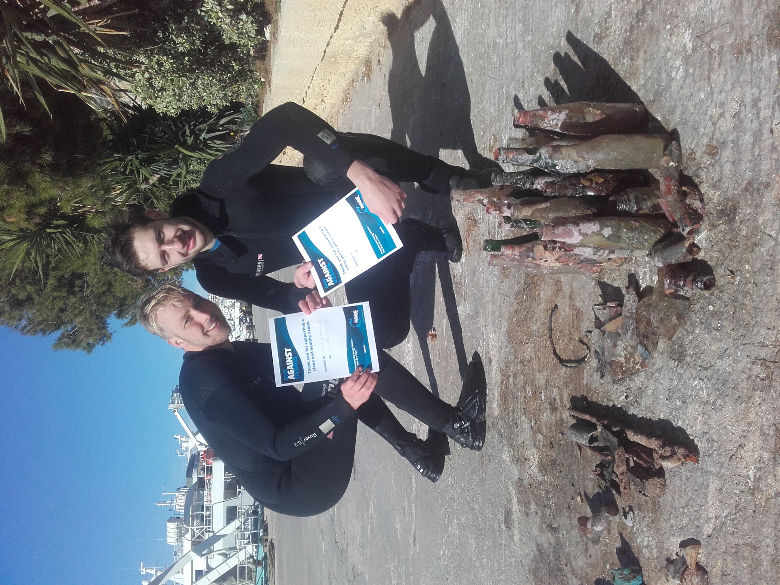
The origin of the marine litter pollution was identified as local, and the main sources were from tourism/recreation activities associated to the local commerce.
4
21
1
2
4
1
2
fiberglass
wooden skewers
plastic hose
painting brush
wooden icecream sticks
Sunglass lens
perfume flask (religious offering to the sea godess)
Gerson Fernandino
1
2
1
7
2
2
3
9.90
60
5.00
3.00
measured
200.00
1
wooden skewers
beverage cans
plastic fragments
On
kilograms
I have debris data to report
1
Smooth (wavelets) for waves 0.1 - 0.5 meter high
1
4
m2
meters
rocky reef
7
1
1
2
2
1
1
15
1
Brazil
State\Province
Bahia
City
Salvador
Map Help
Dive Location
If you know your survey site coordinates, enter them manually in decimal degrees using WGS84 Map Datum. Use the minus sign for latitudes south of the equator and longitudes west of the Prime Meridian to 180 degrees.
If you do not know your survey site coordinates, click the “Map Location” tab to use the map to zoom into your survey site and drop the pin on the map to fall within your survey dive site in the water (not on land or the beach). Ensure you zoom in as much as possible to ensure data accuracy.
Entangled Help
Use the vertical tabs below to record any entangled animals you found of each type.
Calm (glassy to rippled) for waves 0 – 0.1 meter high
9
5
7
m2
10
meters
coral reef
4
48
8
36
56
6
15
4
Language
English
Thailand
City
Koh Tao
Map Help
Dive Location
If you know your survey site coordinates, enter them manually in decimal degrees using WGS84 Map Datum. Use the minus sign for latitudes south of the equator and longitudes west of the Prime Meridian to 180 degrees.
If you do not know your survey site coordinates, click the “Map Location” tab to use the map to zoom into your survey site and drop the pin on the map to fall within your survey dive site in the water (not on land or the beach). Ensure you zoom in as much as possible to ensure data accuracy.
Entangled Help
Use the vertical tabs below to record any entangled animals you found of each type.
Calm (glassy to rippled) for waves 0 – 0.1 meter high
0
0
0
0
0
0
0
m2
0
1
meters
coral reef
0
0
0
0
0
0
0
0
0
0
0
0
0
0
0
0
0
0
0
0
0
0
0
0
0
0
0
0
0
Language
English
Indonesia
State\Province
Karangasem, Bali
City
Amed
Map Help
Dive Location
If you know your survey site coordinates, enter them manually in decimal degrees using WGS84 Map Datum. Use the minus sign for latitudes south of the equator and longitudes west of the Prime Meridian to 180 degrees.
If you do not know your survey site coordinates, click the “Map Location” tab to use the map to zoom into your survey site and drop the pin on the map to fall within your survey dive site in the water (not on land or the beach). Ensure you zoom in as much as possible to ensure data accuracy.
Entangled Help
Use the vertical tabs below to record any entangled animals you found of each type.
The area is a private marina, workers throw many of their waste directly into the sea.
Wind: N 2-5 Bft
Orange Shark Diving Centres
Alessio Tenenti
3
15.00
45
20.00
2.00
estimated
4972.00
2
metal, glass and ceramic fragments
On
kilograms
I have debris data to report
19
Calm (glassy to rippled) for waves 0 – 0.1 meter high
2
m2
meters
rocky reef
6
1
20
1
Language
English
Malta
Map Help
Dive Location
If you know your survey site coordinates, enter them manually in decimal degrees using WGS84 Map Datum. Use the minus sign for latitudes south of the equator and longitudes west of the Prime Meridian to 180 degrees.
If you do not know your survey site coordinates, click the “Map Location” tab to use the map to zoom into your survey site and drop the pin on the map to fall within your survey dive site in the water (not on land or the beach). Ensure you zoom in as much as possible to ensure data accuracy.
Entangled Help
Use the vertical tabs below to record any entangled animals you found of each type.
Calm (glassy to rippled) for waves 0 – 0.1 meter high
1
m2
meters
coral reef
Language
English
Singapore
State\Province
SINGAPORE
City
SINGAPORE
Map Help
Dive Location
If you know your survey site coordinates, enter them manually in decimal degrees using WGS84 Map Datum. Use the minus sign for latitudes south of the equator and longitudes west of the Prime Meridian to 180 degrees.
If you do not know your survey site coordinates, click the “Map Location” tab to use the map to zoom into your survey site and drop the pin on the map to fall within your survey dive site in the water (not on land or the beach). Ensure you zoom in as much as possible to ensure data accuracy.
Entangled Help
Use the vertical tabs below to record any entangled animals you found of each type.
Fishing line, doesn’t decompose and can cause a problem for aquatic life.
On
pounds
I have debris data to report
1
Smooth (wavelets) for waves 0.1 - 0.5 meter high
ft2
3
feet
coral reef
2
2
1
Language
English
United States
State\Province
HI
City
Honolulu
Map Help
Dive Location
If you know your survey site coordinates, enter them manually in decimal degrees using WGS84 Map Datum. Use the minus sign for latitudes south of the equator and longitudes west of the Prime Meridian to 180 degrees.
If you do not know your survey site coordinates, click the “Map Location” tab to use the map to zoom into your survey site and drop the pin on the map to fall within your survey dive site in the water (not on land or the beach). Ensure you zoom in as much as possible to ensure data accuracy.
Entangled Help
Use the vertical tabs below to record any entangled animals you found of each type.
sunny and windy (from south-east) at the beginning of this and the previous week
Lanzarote Non Stop Divers
Emilia Fulgido
1
2
3
2
1
2
3.00
40
7.00
2.00
estimated
2600.56
plastic bottles
cans
On
kilograms
1
I have debris data to report
Calm (glassy to rippled) for waves 0 – 0.1 meter high
1
1
1
m2
2
meters
rocky reef
1
4
Language
English
Spain
City
Playa Blanca
Map Help
Dive Location
If you know your survey site coordinates, enter them manually in decimal degrees using WGS84 Map Datum. Use the minus sign for latitudes south of the equator and longitudes west of the Prime Meridian to 180 degrees.
If you do not know your survey site coordinates, click the “Map Location” tab to use the map to zoom into your survey site and drop the pin on the map to fall within your survey dive site in the water (not on land or the beach). Ensure you zoom in as much as possible to ensure data accuracy.
Entangled Help
Use the vertical tabs below to record any entangled animals you found of each type.
The dive site is an area close to a busy beach. It is enclosed by wavebreakers, which make it a place without current. Because of this all the rubbish stay "trapped" there between the rocks and the silt bottom.
Plastic, bottles, cans.
Sunny, no wind
Lanzarote Non Stop Divers
Carlos Campaña
1
18
3
9
2
17
18.00
40
10.00
1.50
estimated
4058.00
Plastic
bottles
cans
On
kilograms
I have debris data to report
1
Calm (glassy to rippled) for waves 0 – 0.1 meter high
15
m2
meters
rocky reef
8
23
Language
English
Spain
City
Playa Blanca
Map Help
Dive Location
If you know your survey site coordinates, enter them manually in decimal degrees using WGS84 Map Datum. Use the minus sign for latitudes south of the equator and longitudes west of the Prime Meridian to 180 degrees.
If you do not know your survey site coordinates, click the “Map Location” tab to use the map to zoom into your survey site and drop the pin on the map to fall within your survey dive site in the water (not on land or the beach). Ensure you zoom in as much as possible to ensure data accuracy.
Entangled Help
Use the vertical tabs below to record any entangled animals you found of each type.