Menu

Sandy Cove

0
1
0

44.461852686955, -63.708235079944

0
0
0
sand
0
0
0
0
0
0
0
0
0
0
0
0
0
0
0
0
0
0
0
0
0
0
0
0
0
CD
0
0
1
0
0
0
0
0
0
0
0
0
0
0
0
0
0
0
0
3
0
0
0
0
0
0
0
0
0
0
0
0
0
0
2.00
50
12.00
4.00
0
estimated
0
0
1785.92
0
0
0
0
0
0
On
pounds
0
I have debris data to report
0
0
0
Calm (glassy to rippled) for waves 0 – 0.1 meter high
0
0
0
0
0
0
0
m2
0
0
feet
rocky reef
0
0
0
0
0
0
0
0
0
0
0
0
0
0
0
0
0
0
0
0
0
0
0
0
0
0
0
0
Canada
State\Province
Nova Scotia
Map Help


Dive Location

If you know your survey site coordinates, enter them manually in decimal degrees using WGS84 Map Datum. Use the minus sign for latitudes south of the equator and longitudes west of the Prime Meridian to 180 degrees.

If you do not know your survey site coordinates, click the “Map Location” tab to use the map to zoom into your survey site and drop the pin on the map to fall within your survey dive site in the water (not on land or the beach). Ensure you zoom in as much as possible to ensure data accuracy.

Entangled Help


Use the vertical tabs below to record any entangled animals you found of each type.

Mala Pier

3
16
coral
25

20.885740408456, -156.68768954677

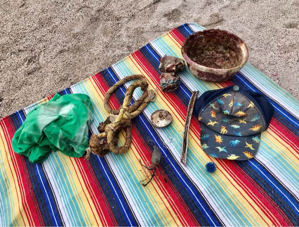
some rain mild surf
Maui diving scuba & snorkel center
johnny Matthews
1
2
6
6.00
50
30.00
12.00
estimated
100.00
On
pounds
I have debris data to report
33
Calm (glassy to rippled) for waves 0 – 0.1 meter high ft2
2
feet
coral reef
1
United States
State\Province
hawaii
City
lahaina
Map Help


Dive Location

If you know your survey site coordinates, enter them manually in decimal degrees using WGS84 Map Datum. Use the minus sign for latitudes south of the equator and longitudes west of the Prime Meridian to 180 degrees.

If you do not know your survey site coordinates, click the “Map Location” tab to use the map to zoom into your survey site and drop the pin on the map to fall within your survey dive site in the water (not on land or the beach). Ensure you zoom in as much as possible to ensure data accuracy.
Entangled Help


Use the vertical tabs below to record any entangled animals you found of each type.

Pele’s Well

0
0
0

19.703508780682, -156.04826081847

0
0
0
rock
0
0
0
0
0
None
0
0
0
0
0
0
0
0
0
0
0
0
0
0
0
0
0
0
0
0
Private
Simone Kittrell
0
0
0
0
0
0
0
0
0
0
0
0
0
0
0
0
0
0
0
3
0
0
0
0
0
0
0
0
0
0
1
0
0
0
2.00
60
15.00
3.00
0
estimated
0
1
34.21
0
0
0
0
0
0
On
kilograms
0
I have debris data to report
0
0
0
Slight for waves 0.5 -1.25 meter high
0
0
0
0
0
0
0
m2
1
0
meters
coral reef
0
0
1
0
0
0
0
0
0
2
0
0
0
1
0
2
0
0
0
0
0
0
0
0
0
0
0
0
United States
State\Province
Hawaii
City
Kailua Kona
Map Help


Dive Location

If you know your survey site coordinates, enter them manually in decimal degrees using WGS84 Map Datum. Use the minus sign for latitudes south of the equator and longitudes west of the Prime Meridian to 180 degrees.

If you do not know your survey site coordinates, click the “Map Location” tab to use the map to zoom into your survey site and drop the pin on the map to fall within your survey dive site in the water (not on land or the beach). Ensure you zoom in as much as possible to ensure data accuracy.

Entangled Help


Use the vertical tabs below to record any entangled animals you found of each type.

ADS644 - Point Panic

2
5
1
1
1
rock
42

21.290388878784, -157.86040092384

no
#protecthatyoulove
grinder wheels
Windy and Rainy
3 Ring Binder
grinder wheels
1
6
Nudi Wear
Ryan Scalf
3
1
2
3
13
1
1
2
1
83.00
50
25.00
4.00
measured
73
200.00
1
3
glass bottles
On
pounds
I have debris data to report
68
Smooth (wavelets) for waves 0.1 - 0.5 meter high
1
2
ft2
feet
rocky reef
3
3
2
5
1
2
7
11
1
United States
State\Province
Hawaii
City
Honolulu
Map Help


Dive Location

If you know your survey site coordinates, enter them manually in decimal degrees using WGS84 Map Datum. Use the minus sign for latitudes south of the equator and longitudes west of the Prime Meridian to 180 degrees.

If you do not know your survey site coordinates, click the “Map Location” tab to use the map to zoom into your survey site and drop the pin on the map to fall within your survey dive site in the water (not on land or the beach). Ensure you zoom in as much as possible to ensure data accuracy.

Entangled Help


Use the vertical tabs below to record any entangled animals you found of each type.

Playa Piskado

0
0
0
0

12.36941, -69.154162

2
0
0
coral
0
6
0
20
0
Lots of tune cans beach is local fishermen harbor
Good
PSD Curacao
Yahya Landman #379869
0
0
0
18
5
0
0
0
0
0
0
0
0
0
0
0
0
2
0
5
0
0
0
0
2
10
0
0
0
2
0
0
0
0
0
0
15.00
75
30.00
5.00
0
measured
0
0
0
0
256.93
0
0
0
0
0
Cans
Wood
Foodcontainer
0
On
kilograms
0
I have debris data to report
0
0
0
Smooth (wavelets) for waves 0.1 - 0.5 meter high
6
0
0
0
0
0
0
m2
0
0
meters
coral reef
0
0
0
2
0
0
0
0
0
0
0
0
0
0
0
0
10
0
0
0
0
0
0
0
0
0
0
0
0
Netherlands Antilles
City
Willemstad
Map Help


Dive Location

If you know your survey site coordinates, enter them manually in decimal degrees using WGS84 Map Datum. Use the minus sign for latitudes south of the equator and longitudes west of the Prime Meridian to 180 degrees.

If you do not know your survey site coordinates, click the “Map Location” tab to use the map to zoom into your survey site and drop the pin on the map to fall within your survey dive site in the water (not on land or the beach). Ensure you zoom in as much as possible to ensure data accuracy.

Entangled Help


Use the vertical tabs below to record any entangled animals you found of each type.

Eel Valley

0
0
0
0

12.06127, -68.847695

0
0
0
sand
0
0
0
0
0
N/A
N/A
Good
PSD Curacao
Yahya Landman
0
0
0
0
0
0
0
0
0
0
0
0
0
0
0
0
0
0
0
4
0
0
0
0
0
0
0
0
0
0
0
0
0
0
0
0
2.00
80
10.00
5.00
0
measured
0
0
0
0
1629.16
0
0
0
1
0
Bottles
Glass
Tyer part
0
On
kilograms
0
I have debris data to report
1
0
0
Smooth (wavelets) for waves 0.1 - 0.5 meter high
0
0
0
0
0
0
0
m2
0
0
meters
coral reef
0
0
0
0
0
0
0
0
0
0
0
0
0
0
0
0
0
0
0
0
0
0
2
0
0
0
0
0
0
Netherlands Antilles
City
Willemstad
Map Help


Dive Location

If you know your survey site coordinates, enter them manually in decimal degrees using WGS84 Map Datum. Use the minus sign for latitudes south of the equator and longitudes west of the Prime Meridian to 180 degrees.

If you do not know your survey site coordinates, click the “Map Location” tab to use the map to zoom into your survey site and drop the pin on the map to fall within your survey dive site in the water (not on land or the beach). Ensure you zoom in as much as possible to ensure data accuracy.

Entangled Help


Use the vertical tabs below to record any entangled animals you found of each type.

Beacon Point

0
0
0
0

12.070468, -68.873747

0
0
0
coral
0
0
0
0
0
Tangeld bt fishing line
Good
PSD Curacao
Yahya Landman
0
0
0
0
0
0
0
0
0
0
0
0
0
0
0
0
0
0
0
4
0
0
0
0
0
0
0
0
0
0
0
0
0
0
0
0
0.00
78
40.00
5.00
0
estimated
0
0
0
0
2133.40
0
0
0
0
0
0
On
kilograms
0
Our Survey Site was free of debris
0
0
0
Slight for waves 0.5 -1.25 meter high
0
0
0
Dead
Trumper Fish
1
Fishing Line
0
0
0
0
0
m2
0
0
meters
coral reef
0
0
0
0
0
0
0
0
0
0
0
0
0
0
0
0
0
0
0
0
0
0
0
0
0
0
0
0
0
0
Netherlands Antilles
City
Willemstad
Map Help


Dive Location

If you know your survey site coordinates, enter them manually in decimal degrees using WGS84 Map Datum. Use the minus sign for latitudes south of the equator and longitudes west of the Prime Meridian to 180 degrees.

If you do not know your survey site coordinates, click the “Map Location” tab to use the map to zoom into your survey site and drop the pin on the map to fall within your survey dive site in the water (not on land or the beach). Ensure you zoom in as much as possible to ensure data accuracy.

Entangled Help


Use the vertical tabs below to record any entangled animals you found of each type.

Parrasasa

0
0
0
0

12.113746, -68.958002

0
0
0
coral
0
1
0
0
0
Na
Good
PSD Curacao
Yahya Landman
0
0
0
12
0
0
0
0
0
0
0
0
0
0
0
0
0
0
0
8
0
0
0
0
0
5
0
0
0
0
0
0
0
0
0
0
6.00
-1
20.00
5.00
0
measured
0
0
0
0
-1.00
0
0
0
0
0
Cups
Food Containers
0
On
kilograms
0
I have debris data to report
0
0
0
Smooth (wavelets) for waves 0.1 - 0.5 meter high
2
0
0
0
0
0
0
m2
0
0
meters
other
0
0
0
0
0
0
0
0
0
0
0
0
0
0
0
0
0
0
0
0
0
0
0
0
0
0
0
0
0
Netherlands Antilles
City
Willemstad
Map Help


Dive Location

If you know your survey site coordinates, enter them manually in decimal degrees using WGS84 Map Datum. Use the minus sign for latitudes south of the equator and longitudes west of the Prime Meridian to 180 degrees.

If you do not know your survey site coordinates, click the “Map Location” tab to use the map to zoom into your survey site and drop the pin on the map to fall within your survey dive site in the water (not on land or the beach). Ensure you zoom in as much as possible to ensure data accuracy.

Entangled Help


Use the vertical tabs below to record any entangled animals you found of each type.

Panama City Beach jetties

1
0
1

30.120540208864, -85.734949610682

3
0
1
sand
0
4
1
10
4
Hurricanes
Lawn chair
0
0
0
0
0
0
0
0
0
0
0
0
0
0
0
0
0
0
0
0
Red Alert Diving
Amanda Wendt
0
0
0
0
4
2
0
0
1
0
2
0
0
0
0
0
0
4
0
18
2
0
2
0
1
0
0
0
0
1
0
0
0
0
50.00
45
75.00
20.00
2
estimated
0
4
75.00
1
0
0
0
0
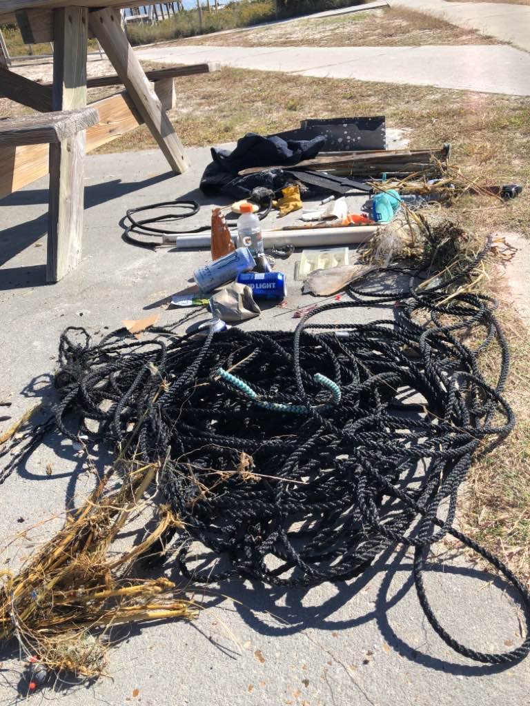
Fishing line
Nylon rope
Cigarette filters
0
On
pounds
0
I have debris data to report
1
2
0
Smooth (wavelets) for waves 0.1 - 0.5 meter high
1
0
0
0
0
0
0
ft2
4
0
feet
rocky reef
0
0
4
0
0
0
0
0
0
0
0
0
2
0
2
0
7
0
0
0
0
0
0
0
0
0
0
0
United States
State\Province
Fl
City
Panama City Beach
Map Help


Dive Location

If you know your survey site coordinates, enter them manually in decimal degrees using WGS84 Map Datum. Use the minus sign for latitudes south of the equator and longitudes west of the Prime Meridian to 180 degrees.

If you do not know your survey site coordinates, click the “Map Location” tab to use the map to zoom into your survey site and drop the pin on the map to fall within your survey dive site in the water (not on land or the beach). Ensure you zoom in as much as possible to ensure data accuracy.

Entangled Help


Use the vertical tabs below to record any entangled animals you found of each type.

ADS289 - Balky Point Zeneta

0
0
0
0

37.629910716018, -0.70113191911787

0
0
0
sand
0
0
0
0
0
Wind
Balkysub
Asier Cañizares Paton
0
0
0
0
0
0
0
0
0
0
0
0
0
0
0
0
0
0
0
4
0
0
0
0
0
0
0
0
0
1
0
0
0
0
0
0
0.60
48
9.00
3.00
0
estimated
0
0
0
0
625.00
0
0
0
0
0
Plasticos
Botellas
0
On
kilograms
0
I have debris data to report
1
0
0
Moderate to rough for waves greater than 1.25 meters
0
0
1
0
0
0
0
m2
0
0
meters
seagrass
0
0
0
0
0
0
0
0
0
0
0
0
0
0
0
0
0
0
0
0
0
0
0
0
0
0
0
0
0
Spain
State\Province
Murcia
City
Cabo de Palos
Map Help


Dive Location

If you know your survey site coordinates, enter them manually in decimal degrees using WGS84 Map Datum. Use the minus sign for latitudes south of the equator and longitudes west of the Prime Meridian to 180 degrees.

If you do not know your survey site coordinates, click the “Map Location” tab to use the map to zoom into your survey site and drop the pin on the map to fall within your survey dive site in the water (not on land or the beach). Ensure you zoom in as much as possible to ensure data accuracy.
Entangled Help


Use the vertical tabs below to record any entangled animals you found of each type.

Subscribe to