Menu

ADS663 - Alouette Lake

2
12
0
0

49.289491, -122.489035

1
0
0
silt
0
0
0
1
0
1
1
3
Dry bag
Paddle
Sunglasses
Ocean Pro Divers
Tori
0
0
0
14
0
0
0
0
0
0
0
0
0
0
0
0
0
0
0
15
0
0
2
0
0
0
3
0
0
0
0
0
7
0
0
0
99.00
45
45.00
5.00
0
measured
0
0
0
0
25281.00
0
0
0
1
0
0
On
pounds
0
I have debris data to report
53
0
0
Calm (glassy to rippled) for waves 0 – 0.1 meter high
0
0
2
0
3
0
0
ft2
0
0
feet
other
0
0
1
0
0
0
0
0
0
5
1
0
0
0
0
0
0
119
0
0
0
0
8
0
1
0
0
0
0
Canada
State\Province
BC
City
Maple Ridge
Map Help


Dive Location

If you know your survey site coordinates, enter them manually in decimal degrees using WGS84 Map Datum. Use the minus sign for latitudes south of the equator and longitudes west of the Prime Meridian to 180 degrees.

If you do not know your survey site coordinates, click the “Map Location” tab to use the map to zoom into your survey site and drop the pin on the map to fall within your survey dive site in the water (not on land or the beach). Ensure you zoom in as much as possible to ensure data accuracy.

Entangled Help


Use the vertical tabs below to record any entangled animals you found of each type.

Malibu Rd. 1st entry

0
0
0

34.026849992222, -118.70469053689

0
0
0
sand
0
0
0
0
0
Night dive
Night dive
A bit windy, starting to get chilly
0
0
0
0
0
0
0
0
0
0
0
0
0
0
0
0
0
0
0
0
N/A
Miles Roche
0
0
0
0
0
0
0
0
0
0
0
0
0
0
0
0
0
0
0
2
0
0
0
0
0
0
0
0
0
0
0
0
0
0
0.00
42
27.00
13.00
0
estimated
0
0
11197.40
0
0
0
0
0
0
On
kilograms
0
Our Survey Site was free of debris
0
0
0
Slight for waves 0.5 -1.25 meter high
0
0
0
0
0
0
0
m2
0
0
feet
rocky reef
0
0
0
0
0
0
0
0
0
0
0
0
0
0
0
0
0
0
0
0
0
0
0
0
0
0
0
0
United States
State\Province
CA
City
Malibu
Map Help


Dive Location

If you know your survey site coordinates, enter them manually in decimal degrees using WGS84 Map Datum. Use the minus sign for latitudes south of the equator and longitudes west of the Prime Meridian to 180 degrees.

If you do not know your survey site coordinates, click the “Map Location” tab to use the map to zoom into your survey site and drop the pin on the map to fall within your survey dive site in the water (not on land or the beach). Ensure you zoom in as much as possible to ensure data accuracy.

Entangled Help


Use the vertical tabs below to record any entangled animals you found of each type.

Smitty’s cove

0
0
0

60.777873001433, -148.665399

0
0
0
silt
0
2
0
0
0
No
All common items
Snowy windy
0
0
0
0
0
0
0
0
0
0
0
0
0
0
0
0
0
0
0
0
Scubapandaak
Claire Abrams
0
0
0
0
0
0
0
0
0
0
0
0
0
0
0
0
0
11
0
5
0
0
0
0
0
0
0
1
0
0
0
0
0
0
2.00
30
40.00
10.00
0
estimated
0
0
30.00
0
0
0
0
0
Plastic bags
Bottles
Caps
0
On
pounds
0
I have debris data to report
1
0
0
Calm (glassy to rippled) for waves 0 – 0.1 meter high
0
0
0
0
0
0
0
ft2
0
0
feet
seagrass
0
0
0
0
0
3
0
0
0
0
0
0
0
0
0
0
0
0
0
0
0
3
0
0
0
1
2
0
United States
State\Province
Ak
City
Whittier
Map Help


Dive Location

If you know your survey site coordinates, enter them manually in decimal degrees using WGS84 Map Datum. Use the minus sign for latitudes south of the equator and longitudes west of the Prime Meridian to 180 degrees.

If you do not know your survey site coordinates, click the “Map Location” tab to use the map to zoom into your survey site and drop the pin on the map to fall within your survey dive site in the water (not on land or the beach). Ensure you zoom in as much as possible to ensure data accuracy.
Entangled Help


Use the vertical tabs below to record any entangled animals you found of each type.

ADS305 - House Reef

15
2
seagrass

28.141698035433, -16.438181221596

Strong winds
Shape retainer for freediving fin
Good, different conditions: Sun, rain, wind, calm, a bit of everything
Tenerife Diving Academy
Kim Timmers
2
1
8
0.37
64
9.00
1.00
measured
100.00
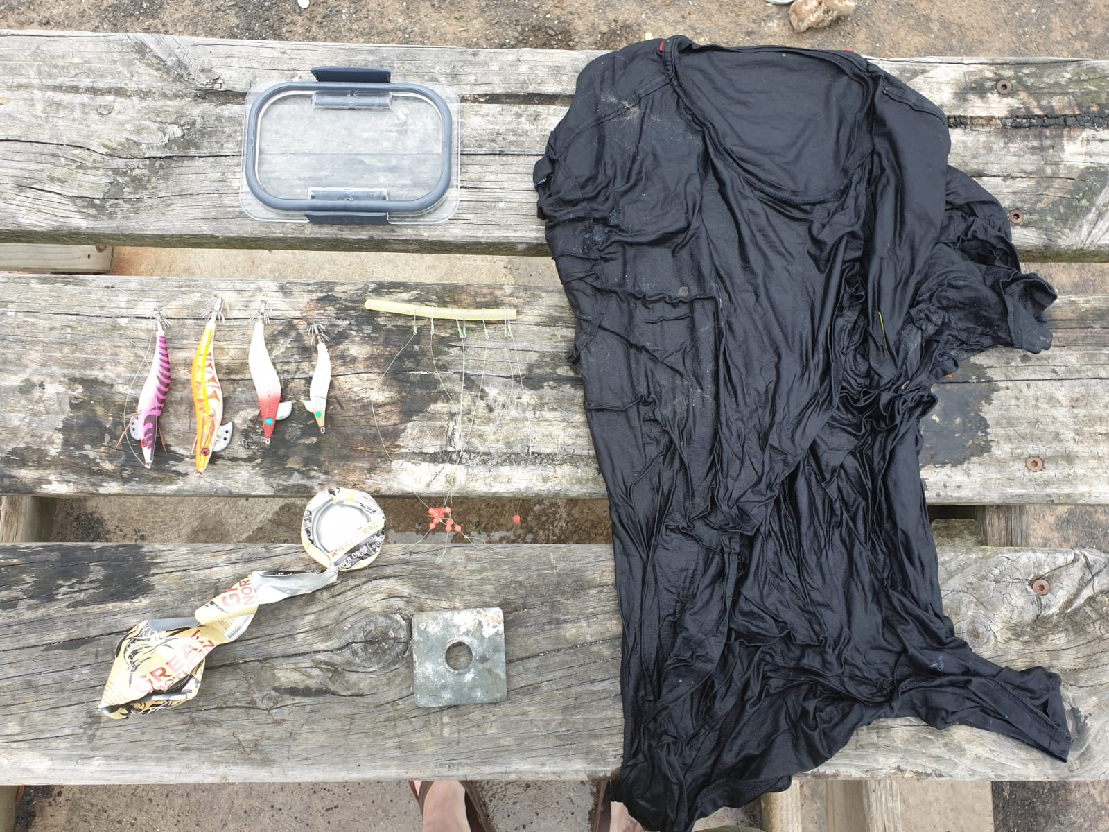
Fishing line with weights and lure
Plastic fragments
Glass fragments
On
kilograms
I have debris data to report
Slight for waves 0.5 -1.25 meter high
2
m2
meters
rocky reef
3
Spain
State\Province
Tenerife
City
Abades
Map Help


Dive Location

If you know your survey site coordinates, enter them manually in decimal degrees using WGS84 Map Datum. Use the minus sign for latitudes south of the equator and longitudes west of the Prime Meridian to 180 degrees.

If you do not know your survey site coordinates, click the “Map Location” tab to use the map to zoom into your survey site and drop the pin on the map to fall within your survey dive site in the water (not on land or the beach). Ensure you zoom in as much as possible to ensure data accuracy.

Entangled Help


Use the vertical tabs below to record any entangled animals you found of each type.

ADS13 Shore Road Pipeline

0
2
0

50.693999998625, -1.928

0
0
1
sand
0
0
0
0
0
Calm
0
0
0
0
0
0
0
0
0
0
0
0
0
0
0
0
0
0
0
0
Poole Diving
Kev Craddock
0
0
0
0
0
0
0
0
0
0
0
0
0
0
0
0
0
0
0
4
0
0
0
0
1
0
0
0
0
0
4
0
0
0
4.00
60
6.00
2.00
0
estimated
0
0
4194.09
0
0
0
0
0
0
On
kilograms
0
I have debris data to report
0
0
0
Smooth (wavelets) for waves 0.1 - 0.5 meter high
0
0
0
0
0
0
0
m2
0
0
meters
rocky reef
0
0
0
0
0
0
0
0
0
0
0
0
0
0
0
0
1
0
0
0
0
0
0
0
0
0
0
0
United Kingdom
State\Province
Dorset
City
Poole
Map Help


Dive Location

If you know your survey site coordinates, enter them manually in decimal degrees using WGS84 Map Datum. Use the minus sign for latitudes south of the equator and longitudes west of the Prime Meridian to 180 degrees.

If you do not know your survey site coordinates, click the “Map Location” tab to use the map to zoom into your survey site and drop the pin on the map to fall within your survey dive site in the water (not on land or the beach). Ensure you zoom in as much as possible to ensure data accuracy.

Entangled Help


Use the vertical tabs below to record any entangled animals you found of each type.

ADS621 - Matilda´s Reef

1

-38.17, 144.72

4
sand
Fishermen
T-shirt
1
T-shirt
Australian Diving Instruction
Jörg Pichler
2
1.50
59
3.90
2.00
estimated
7
500.00
1
beverage can
Fishing hooks
On
kilograms
I have debris data to report
Smooth (wavelets) for waves 0.1 - 0.5 meter high m2
meters
seagrass
1
1
Australia
State\Province
VIC
City
Geelong
Map Help


Dive Location

If you know your survey site coordinates, enter them manually in decimal degrees using WGS84 Map Datum. Use the minus sign for latitudes south of the equator and longitudes west of the Prime Meridian to 180 degrees.

If you do not know your survey site coordinates, click the “Map Location” tab to use the map to zoom into your survey site and drop the pin on the map to fall within your survey dive site in the water (not on land or the beach). Ensure you zoom in as much as possible to ensure data accuracy.

Entangled Help


Use the vertical tabs below to record any entangled animals you found of each type.

ADS396 - Manly Cove

40

-33.7992429, 151.2825684

sand
59
9
N/A
Toy scooter (non-electronic) and a number of vapes compared to previous Dive Against Debris events at Manly Cove.
Air temperature 24-40C, moderate SE wind early in the week - NE/NSW wind later in the week.
1
1
1
1
1
boat paddle
Pipe
Diving mask
Kid's Scooter (non-electric)
Supermarket trolley
Dive Centre Manly
Chloe Brant
18
6
2
5
28
3
4
2
3
1
53.00
45
6.00
3.00
measured
4
1888.00
3
1
Plastic fragments/bags
Bottles
Plastic food packaging
4
On
kilograms
I have debris data to report
14
Smooth (wavelets) for waves 0.1 - 0.5 meter high
Glass bottle
crab
Released Unharmed
1
2
m2
1
Plastic
Octopus
Released Unharmed
meters
seagrass
4
2
4
2
1
Australia
State\Province
NSW
City
Manly, Sydney
Map Help


Dive Location

If you know your survey site coordinates, enter them manually in decimal degrees using WGS84 Map Datum. Use the minus sign for latitudes south of the equator and longitudes west of the Prime Meridian to 180 degrees.

If you do not know your survey site coordinates, click the “Map Location” tab to use the map to zoom into your survey site and drop the pin on the map to fall within your survey dive site in the water (not on land or the beach). Ensure you zoom in as much as possible to ensure data accuracy.

Entangled Help


Use the vertical tabs below to record any entangled animals you found of each type.

Halona Blowhole

0
0
0
0

21.281493, -157.676589

6
0
0
sand
0
0
0
800
0
Current was very strong.
Heavy fishing pressure
Gaff hook, chaiz lounge
Fair, calm
1
1
1
Tarpaulin
Gaff hook
Chaiz lounge
ODA Hawaii
Glenn Roberts
0
0
0
0
0
0
0
0
0
0
0
0
0
0
0
0
0
0
0
15
0
0
0
0
0
0
2
0
0
0
0
0
0
0
0
0
100.00
45
50.00
30.00
0
estimated
0
0
0
100
200.00
0
0
0
0
0
A lot of very thick monofilament
0
On
pounds
0
I have debris data to report
0
0
0
Slight for waves 0.5 -1.25 meter high
0
0
0
0
0
0
0
m2
0
0
feet
coral reef
0
0
0
0
0
0
0
0
0
0
0
0
0
0
0
0
0
2
0
0
0
0
0
0
0
0
0
0
0
United States
State\Province
HI
City
Honolulu
Map Help


Dive Location

If you know your survey site coordinates, enter them manually in decimal degrees using WGS84 Map Datum. Use the minus sign for latitudes south of the equator and longitudes west of the Prime Meridian to 180 degrees.

If you do not know your survey site coordinates, click the “Map Location” tab to use the map to zoom into your survey site and drop the pin on the map to fall within your survey dive site in the water (not on land or the beach). Ensure you zoom in as much as possible to ensure data accuracy.

Entangled Help


Use the vertical tabs below to record any entangled animals you found of each type.

ADS485 - May Day

65
32
0
0

9.3344259723204, -82.241519634331

0
0
0
sand
0
10
0
1
1
No
Toy truck
Heavy Rain
Bocas Dive Center
Guillermo Veghazi
0
0
0
30
0
0
0
0
0
0
0
0
0
0
12
0
0
0
5
22
0
0
1
0
1
0
91
1
0
7
0
0
1
0
0
0
40.00
55
12.00
4.00
0
estimated
0
2
0
0
71382.70
0
0
0
4
0
Diapers
Glass beer bottles
Drink cans
1
On
kilograms
0
I have debris data to report
38
0
0
Calm (glassy to rippled) for waves 0 – 0.1 meter high
0
0
1
0
1
0
0
m2
1
0
meters
coral reef
0
0
0
0
0
0
0
0
0
0
0
0
0
0
0
0
0
146
0
1
0
0
8
0
0
0
0
0
0
Panama
State\Province
Bocas del Toro
City
Bocas Town
Map Help


Dive Location

If you know your survey site coordinates, enter them manually in decimal degrees using WGS84 Map Datum. Use the minus sign for latitudes south of the equator and longitudes west of the Prime Meridian to 180 degrees.

If you do not know your survey site coordinates, click the “Map Location” tab to use the map to zoom into your survey site and drop the pin on the map to fall within your survey dive site in the water (not on land or the beach). Ensure you zoom in as much as possible to ensure data accuracy.

Entangled Help


Use the vertical tabs below to record any entangled animals you found of each type.

Service Club Park

0
6
0

27.078644006039, -82.456648

1
0
0
sand
0
0
0
0
0
No
Sunglasses
Fairly calm
3
0
0
0
0
0
0
0
0
0
0
0
0
0
0
0
0
0
0
0
Sunglasses
Sarasota Ocean Preservers
Brooke Welch
0
0
0
0
0
0
0
0
1
0
1
0
1
0
0
0
0
0
0
1
0
0
0
0
0
0
0
0
0
2
3
0
0
0
6.00
79
20.00
14.00
0
estimated
0
0
2637.94
0
1
0
0
0
Crab traps
Rope
Plastic
0
On
pounds
0
I have debris data to report
0
0
0
Smooth (wavelets) for waves 0.1 - 0.5 meter high
0
0
0
0
0
0
0
ft2
0
0
feet
rocky reef
0
0
0
0
0
0
0
0
0
0
0
0
0
0
0
0
4
0
0
0
0
2
0
0
0
0
0
0
United States
State\Province
Florida
City
Venice
Map Help


Dive Location

If you know your survey site coordinates, enter them manually in decimal degrees using WGS84 Map Datum. Use the minus sign for latitudes south of the equator and longitudes west of the Prime Meridian to 180 degrees.

If you do not know your survey site coordinates, click the “Map Location” tab to use the map to zoom into your survey site and drop the pin on the map to fall within your survey dive site in the water (not on land or the beach). Ensure you zoom in as much as possible to ensure data accuracy.

Entangled Help


Use the vertical tabs below to record any entangled animals you found of each type.

Subscribe to