Menu

Vasiliko bay Alonnisos

25
10
sand
2
2

39.205296546589, 23.971476965539

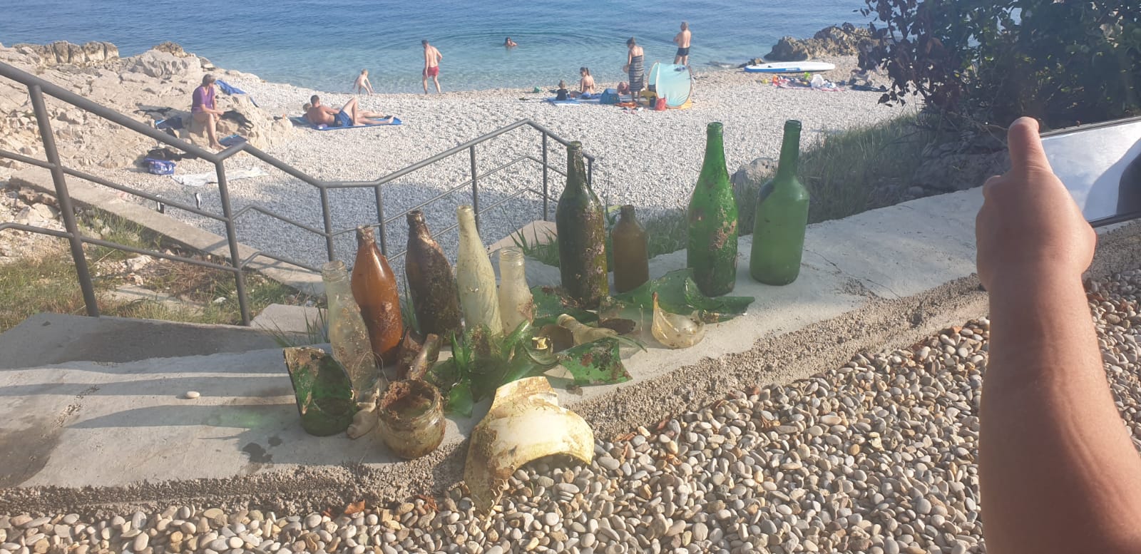
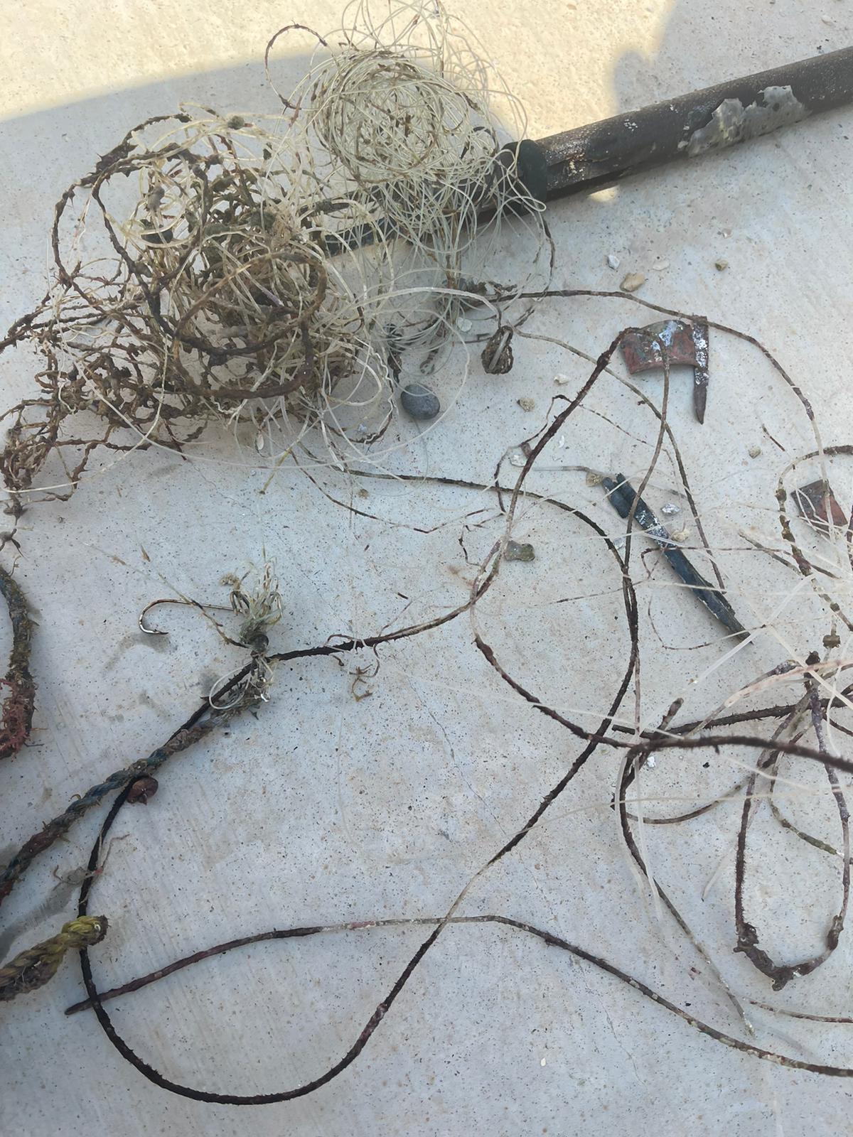
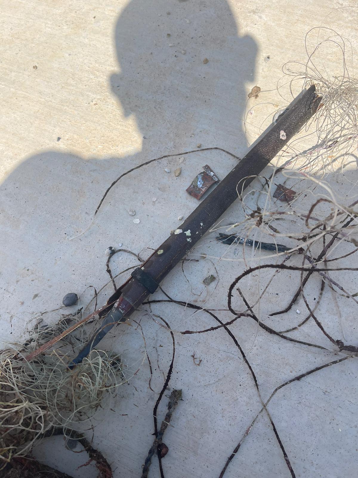
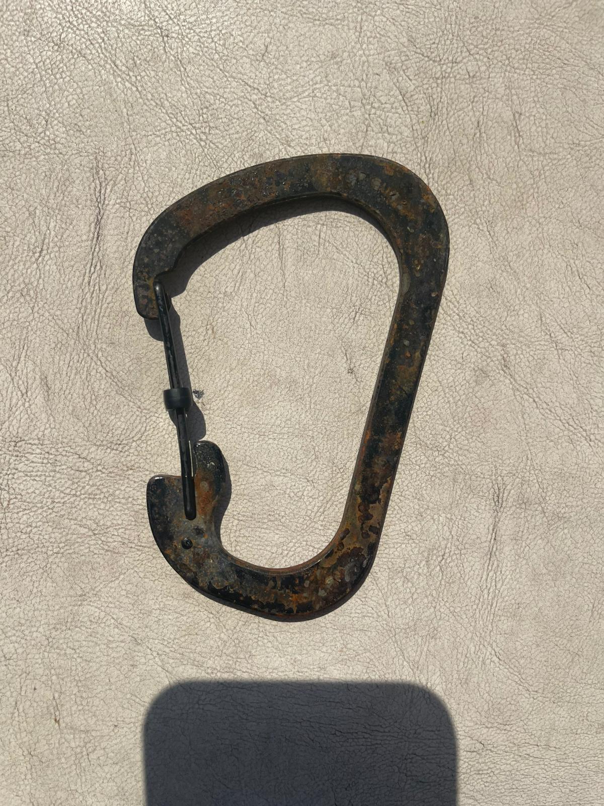
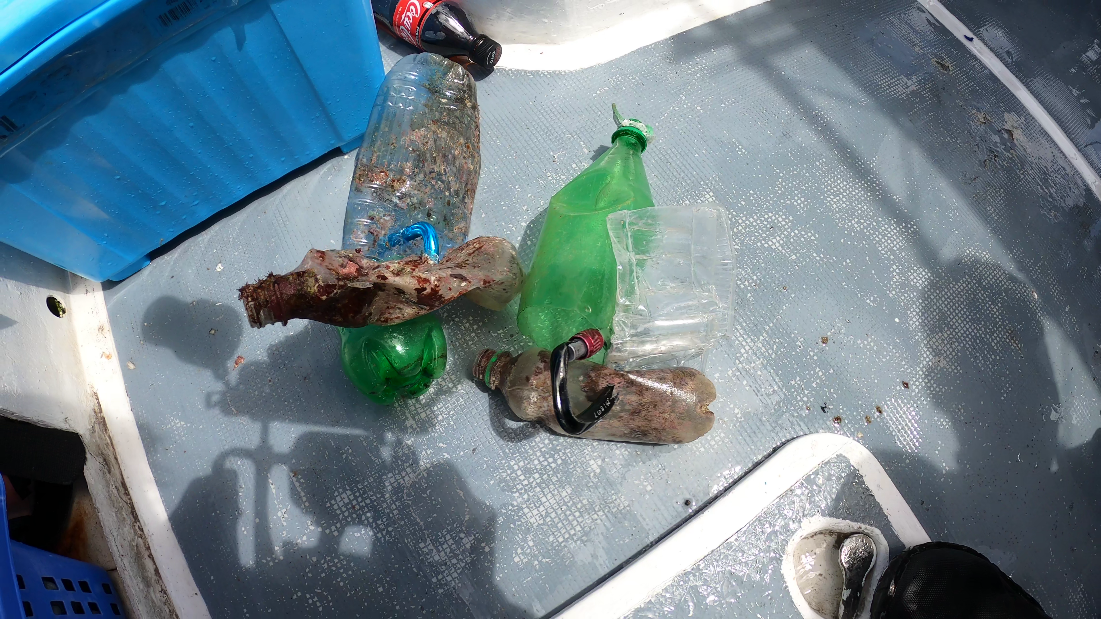
The Clean Up dive was organised by Thalassa Foundation, in collaboration with Mom (The Hellenic Society for the Study and Protection of the Monk seal) and Ikion Diving center. A special permission was given for the dive Against Debris on this site which was undertaken with great success.
The fact that Peristera is an unihabited island and the small bay that the dive against debris was conducted is a common anchorage spot for many leisure boats, and a favorite snorkeling site, contribute to the accumulation of debris and thrash that has been found and collected. In addition there are permanent restrictions on the area for any kind of diving activities as it it declared an archaelogical site, a fact which makes any Clean Up dive more complicate logistically in terms of licencing and conducting it.
Windy with heavy rainfall
Ikion Diving (Skopelos Dive Center's Branch)
Kostas Danis
2
3
17
2
50
1
4
3
23
1
2
70.00
55
14.00
2.00
6
estimated
2
250.00
On
kilograms
I have debris data to report
15
Calm (glassy to rippled) for waves 0 – 0.1 meter high
4
m2
6
2
meters
seagrass
35
6
2
3
4
3
19
22
8
15
5
Greece
State\Province
Thessaly
City
Alonnisos
Map Help


Dive Location

If you know your survey site coordinates, enter them manually in decimal degrees using WGS84 Map Datum. Use the minus sign for latitudes south of the equator and longitudes west of the Prime Meridian to 180 degrees.

If you do not know your survey site coordinates, click the “Map Location” tab to use the map to zoom into your survey site and drop the pin on the map to fall within your survey dive site in the water (not on land or the beach). Ensure you zoom in as much as possible to ensure data accuracy.

Entangled Help


Use the vertical tabs below to record any entangled animals you found of each type.

Main Stack Destin Bridge Rubble

30.34705, 86.2949

1
sand
2
Popular fishing site
Part of Dive Against Debris course
Large rope - way bigger than an anchor line
Also a large Southern Ray with a hook
Partly Cloudy
Emerald Coast Scuba
Scott Cole
3
0.98
36
68.00
64.00
measured
2
100.00
rope
fishing line
metal
On
pounds
I have debris data to report
Slight for waves 0.5 -1.25 meter high
Toad Fish
3
Rope
ft2
8
feet
rocky reef
United States
State\Province
Florida
City
Destin
Map Help


Dive Location

If you know your survey site coordinates, enter them manually in decimal degrees using WGS84 Map Datum. Use the minus sign for latitudes south of the equator and longitudes west of the Prime Meridian to 180 degrees.

If you do not know your survey site coordinates, click the “Map Location” tab to use the map to zoom into your survey site and drop the pin on the map to fall within your survey dive site in the water (not on land or the beach). Ensure you zoom in as much as possible to ensure data accuracy.

Entangled Help


Use the vertical tabs below to record any entangled animals you found of each type.

4 Anchors

30.3124, 86.5041

1
sand
5
Public Fishing site
Part of Dive Against Debris Specialty course
Fishing Rod
Partly cloudy no significant storms
Emerald Coast Scuba
Scott Cole
11
1.80
30
90.00
85.00
estimated
3
100.00
Fishing line
rope
metal
On
pounds
I have debris data to report
Slight for waves 0.5 -1.25 meter high
1
ft2
feet
rocky reef
United States
State\Province
Florida
City
Destin
Map Help


Dive Location

If you know your survey site coordinates, enter them manually in decimal degrees using WGS84 Map Datum. Use the minus sign for latitudes south of the equator and longitudes west of the Prime Meridian to 180 degrees.

If you do not know your survey site coordinates, click the “Map Location” tab to use the map to zoom into your survey site and drop the pin on the map to fall within your survey dive site in the water (not on land or the beach). Ensure you zoom in as much as possible to ensure data accuracy.

Entangled Help


Use the vertical tabs below to record any entangled animals you found of each type.

Branksome Chine

sand

50.705691768447, -1.9067947559713

N/A
We were very pleased that we didn't find any litter! :)
N/A
Little bit windy and overcast.
Dorset Diving Services
Ellie Richards
6
0.00
36
7.60
6.00
measured
4105.13
On
kilograms
Our Survey Site was free of debris
Smooth (wavelets) for waves 0.1 - 0.5 meter high m2
meters
rocky reef
United Kingdom
State\Province
Dorset
City
Poole
Map Help


Dive Location

If you know your survey site coordinates, enter them manually in decimal degrees using WGS84 Map Datum. Use the minus sign for latitudes south of the equator and longitudes west of the Prime Meridian to 180 degrees.

If you do not know your survey site coordinates, click the “Map Location” tab to use the map to zoom into your survey site and drop the pin on the map to fall within your survey dive site in the water (not on land or the beach). Ensure you zoom in as much as possible to ensure data accuracy.

Entangled Help


Use the vertical tabs below to record any entangled animals you found of each type.

Girandella beach

1
sand

45.07679846459, 14.170279201153

Sun
Diving Paradise
Dariusz Łomotowski
4
20.00
90
40.00
3.00
estimated
15000.00
On
kilograms
I have debris data to report
10
Calm (glassy to rippled) for waves 0 – 0.1 meter high m2
meters
rocky reef
20
2
Croatia
City
Rabac
Map Help


Dive Location

If you know your survey site coordinates, enter them manually in decimal degrees using WGS84 Map Datum. Use the minus sign for latitudes south of the equator and longitudes west of the Prime Meridian to 180 degrees.

If you do not know your survey site coordinates, click the “Map Location” tab to use the map to zoom into your survey site and drop the pin on the map to fall within your survey dive site in the water (not on land or the beach). Ensure you zoom in as much as possible to ensure data accuracy.

Entangled Help


Use the vertical tabs below to record any entangled animals you found of each type.

Red Rock / Japs

12
19
18
sand

10.121765700654, 99.815264439954

DAD for PADI AWARE WEEK with Neil Richards the PADI Regional Manager
With Neil Richards the PADI Regional Manager
crochet shopping basket
Windy / full sunshire
1
1
1
crochet plastic shopping basket
Bracelet
Fan belt
Eco Koh Tao - Crystal Dive
Jen Dowling
4
1
3
13
2
8.00
60
16.00
4.00
estimated
2
65.00
1
2
plastic fragments
food wrappers
On
kilograms
I have debris data to report
1
Slight for waves 0.5 -1.25 meter high
net & clothing
crab
Released Unharmed
5
1
m2
2
meters
coral reef
2
2
2
6
Thailand
State\Province
Surat Thani
City
Koh Tao
Map Help


Dive Location

If you know your survey site coordinates, enter them manually in decimal degrees using WGS84 Map Datum. Use the minus sign for latitudes south of the equator and longitudes west of the Prime Meridian to 180 degrees.

If you do not know your survey site coordinates, click the “Map Location” tab to use the map to zoom into your survey site and drop the pin on the map to fall within your survey dive site in the water (not on land or the beach). Ensure you zoom in as much as possible to ensure data accuracy.

Entangled Help


Use the vertical tabs below to record any entangled animals you found of each type.

Neptune Memorial Reef

25.7006, -80.09015

coral

25.7006, -80.09015

None
None
None
Cardboard
Good
@scubarocks_
Joel Gonzalez
2
10
4.00
40
45.00
40.00
estimated
1
100.00
Plastic
Hooks
Sinkers
On
pounds
I have debris data to report
Calm (glassy to rippled) for waves 0 – 0.1 meter high ft2
feet
coral reef
1
United States
State\Province
Florida
City
Miami
Map Help


Dive Location

If you know your survey site coordinates, enter them manually in decimal degrees using WGS84 Map Datum. Use the minus sign for latitudes south of the equator and longitudes west of the Prime Meridian to 180 degrees.

If you do not know your survey site coordinates, click the “Map Location” tab to use the map to zoom into your survey site and drop the pin on the map to fall within your survey dive site in the water (not on land or the beach). Ensure you zoom in as much as possible to ensure data accuracy.

Entangled Help


Use the vertical tabs below to record any entangled animals you found of each type.

Wood's Cove

2
2
1
sand
3
1
1

33.526345396608, -117.7708376359

Cloudy
Beach Cities Scuba
DJ Mansfield
1
8
1
1
1
4
9
1
7
8
3
1
92.00
75
52.00
3.00
estimated
3
300.00
1
On
pounds
I have debris data to report
1
Smooth (wavelets) for waves 0.1 - 0.5 meter high ft2
feet
rocky reef
United States
State\Province
CA
City
Laguna Beach
Map Help


Dive Location

If you know your survey site coordinates, enter them manually in decimal degrees using WGS84 Map Datum. Use the minus sign for latitudes south of the equator and longitudes west of the Prime Meridian to 180 degrees.

If you do not know your survey site coordinates, click the “Map Location” tab to use the map to zoom into your survey site and drop the pin on the map to fall within your survey dive site in the water (not on land or the beach). Ensure you zoom in as much as possible to ensure data accuracy.

Entangled Help


Use the vertical tabs below to record any entangled animals you found of each type.

Qit'at Al Bunayyah

28.616033596918, 48.428901974112

sand
Nautilus Diving Kuwait
Saleh Alsaleh
2
1
1.00
34
6.00
3.00
estimated
3
300.00
On
kilograms
I have debris data to report
Calm (glassy to rippled) for waves 0 – 0.1 meter high
1
m2
meters
coral reef
1
Kuwait
State\Province
Kuwait
City
Kuwait City
Map Help


Dive Location

If you know your survey site coordinates, enter them manually in decimal degrees using WGS84 Map Datum. Use the minus sign for latitudes south of the equator and longitudes west of the Prime Meridian to 180 degrees.

If you do not know your survey site coordinates, click the “Map Location” tab to use the map to zoom into your survey site and drop the pin on the map to fall within your survey dive site in the water (not on land or the beach). Ensure you zoom in as much as possible to ensure data accuracy.

Entangled Help


Use the vertical tabs below to record any entangled animals you found of each type.

Chilli Drop

-20.042175, 57.529106

coral
Clear weather 21 Celsius
Wind Direction ESE 110 degrees
Wind Speed 7km per hour
Dive Spirit
Charlene Stenton-Dozey
5
1
1.00
72
13.10
3.00
estimated
202.00
Plastic Bottles
Plastic Packaging
On
kilograms
I have debris data to report
Slight for waves 0.5 -1.25 meter high m2
meters
coral reef
Mauritius
State\Province
Pamplemousse
City
Trou Aux Biches
Map Help


Dive Location

If you know your survey site coordinates, enter them manually in decimal degrees using WGS84 Map Datum. Use the minus sign for latitudes south of the equator and longitudes west of the Prime Meridian to 180 degrees.

If you do not know your survey site coordinates, click the “Map Location” tab to use the map to zoom into your survey site and drop the pin on the map to fall within your survey dive site in the water (not on land or the beach). Ensure you zoom in as much as possible to ensure data accuracy.

Entangled Help


Use the vertical tabs below to record any entangled animals you found of each type.

Subscribe to