Menu

ADS31 - Spiegel Grove

25.066259, -80.311979

sand
Rainbow Reef Dive Center/ FKNMS
Kate Watnee
1
2
0.50
25
100.00
60.00
estimated
15034.00
On
pounds
I have debris data to report
Smooth (wavelets) for waves 0.1 - 0.5 meter high ft2
feet
coral reef
United States
State\Province
FL
City
Key Largo
Map Help


Dive Location

If you know your survey site coordinates, enter them manually in decimal degrees using WGS84 Map Datum. Use the minus sign for latitudes south of the equator and longitudes west of the Prime Meridian to 180 degrees.

If you do not know your survey site coordinates, click the “Map Location” tab to use the map to zoom into your survey site and drop the pin on the map to fall within your survey dive site in the water (not on land or the beach). Ensure you zoom in as much as possible to ensure data accuracy.

Entangled Help


Use the vertical tabs below to record any entangled animals you found of each type.

North North Dry Rocks

25.128587469977, -80.36203513468

coral
1
Metal grate
Rainbow Reef Dive Center/ FKNMS
Nate Sterns
2
15.00
45
30.00
15.00
estimated
2
22688.00
1
On
pounds
I have debris data to report
12
Smooth (wavelets) for waves 0.1 - 0.5 meter high ft2
feet
coral reef
United States
State\Province
FL
City
Key Largo
Map Help


Dive Location

If you know your survey site coordinates, enter them manually in decimal degrees using WGS84 Map Datum. Use the minus sign for latitudes south of the equator and longitudes west of the Prime Meridian to 180 degrees.

If you do not know your survey site coordinates, click the “Map Location” tab to use the map to zoom into your survey site and drop the pin on the map to fall within your survey dive site in the water (not on land or the beach). Ensure you zoom in as much as possible to ensure data accuracy.
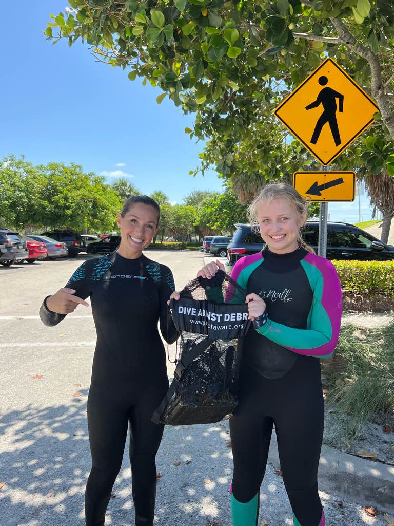
Entangled Help


Use the vertical tabs below to record any entangled animals you found of each type.

Deep French Reef

25.066316996096, -80.346344

coral

25.036837303182, -80.35062659935

1
Boat anchor and chain
Rainbow Reef Dive Center/FKNMS
Maddie Cholnoky
2
8
31.00
45
80.00
50.00
2
measured
9000.00
On
pounds
I have debris data to report
Smooth (wavelets) for waves 0.1 - 0.5 meter high ft2
feet
coral reef
United States
State\Province
FL
City
Key Largo
Map Help


Dive Location

If you know your survey site coordinates, enter them manually in decimal degrees using WGS84 Map Datum. Use the minus sign for latitudes south of the equator and longitudes west of the Prime Meridian to 180 degrees.

If you do not know your survey site coordinates, click the “Map Location” tab to use the map to zoom into your survey site and drop the pin on the map to fall within your survey dive site in the water (not on land or the beach). Ensure you zoom in as much as possible to ensure data accuracy.

Entangled Help


Use the vertical tabs below to record any entangled animals you found of each type.

South Sound Creek

10
3
silt
5
5

25.104627656906, -80.41407073888

The surveyed site is a prominent channel for boat traffic so much of the debris appeared to be litter and trash thrown out into the mangroves. However, some debris seemed to be from previous hurricanes or storms, for example a number of hurricane boat tie downs were found wrapped around mangrove roots.
Window pane
High winds (20-25 knots). Wave heights between 5-8ft. Conditions not suitable for ocean diving so this debris removal dive took place in the mangroves which provided protection.
1
3
2
4
1
Glass window pane
Boat Anchor
Fishing net w/ pole
Fishing Poles
Outrigger pole
Rainbow Reef Dive Center/FKNMS
Bianca Blanshine
1
11
1
150
1
385.00
60
10.00
1.00
50
measured
2292.00
1
1
Rope
Plastic bottles
Aluminum cans
On
pounds
I have debris data to report
200
Calm (glassy to rippled) for waves 0 – 0.1 meter high
Nets, rope
Lobster
Released Unharmed
5
m2
feet
mangroves
1
12
100
1
United States
State\Province
Florida
City
Key Largo
Map Help


Dive Location

If you know your survey site coordinates, enter them manually in decimal degrees using WGS84 Map Datum. Use the minus sign for latitudes south of the equator and longitudes west of the Prime Meridian to 180 degrees.

If you do not know your survey site coordinates, click the “Map Location” tab to use the map to zoom into your survey site and drop the pin on the map to fall within your survey dive site in the water (not on land or the beach). Ensure you zoom in as much as possible to ensure data accuracy.

Entangled Help


Use the vertical tabs below to record any entangled animals you found of each type.

Twins, Koh Tao

8
coral
8

10.116987614597, 99.808403276286

Sunny
1
DE Clip
The Coral tribe
Jennifer Dowling
1
1
5
1
0.50
60
14.00
2.00
11
measured
50.00
2
On
kilograms
I have debris data to report
Smooth (wavelets) for waves 0.1 - 0.5 meter high
2
3
m2
meters
coral reef
Thailand
State\Province
Suratthani
City
Koh Tao
Map Help


Dive Location

If you know your survey site coordinates, enter them manually in decimal degrees using WGS84 Map Datum. Use the minus sign for latitudes south of the equator and longitudes west of the Prime Meridian to 180 degrees.

If you do not know your survey site coordinates, click the “Map Location” tab to use the map to zoom into your survey site and drop the pin on the map to fall within your survey dive site in the water (not on land or the beach). Ensure you zoom in as much as possible to ensure data accuracy.

Entangled Help


Use the vertical tabs below to record any entangled animals you found of each type.

Tao Tong, Koh Tao

1
4
sand

10.068274236914, 99.816114279144

Snorkel
Sunny
1
Diver Pointer - Metal
The Coral Tribe
Jennifer Dowling
1
4
2
0.20
62
12.00
5.00
8
measured
1
40.00
Diver Pointer
On
kilograms
I have debris data to report
Smooth (wavelets) for waves 0.1 - 0.5 meter high
7
m2
meters
coral reef
2
1
1
Thailand
State\Province
Suratthani
City
Koh Tao
Map Help


Dive Location

If you know your survey site coordinates, enter them manually in decimal degrees using WGS84 Map Datum. Use the minus sign for latitudes south of the equator and longitudes west of the Prime Meridian to 180 degrees.

If you do not know your survey site coordinates, click the “Map Location” tab to use the map to zoom into your survey site and drop the pin on the map to fall within your survey dive site in the water (not on land or the beach). Ensure you zoom in as much as possible to ensure data accuracy.

Entangled Help


Use the vertical tabs below to record any entangled animals you found of each type.

Junkyard, Koh Tao

10
2
1
sand
5
4

10.086842719159, 99.82255164806

Light fitting
Plastic razor
1
1
1
1
Light Fixture
Disposable Plastic Razor
PPE Mask
Coat Hanger - Metal
The Coral Tribe
Jennifer Dowling
2
1
3
0
1
2.80
62
14.00
8.20
measured
70.00
Plastic fragments
Fishing Line
On
kilograms
I have debris data to report
Smooth (wavelets) for waves 0.1 - 0.5 meter high
2
1
m2
meters
other
1
1
2
Thailand
State\Province
Suratthani
City
Koh Tao
Map Help


Dive Location

If you know your survey site coordinates, enter them manually in decimal degrees using WGS84 Map Datum. Use the minus sign for latitudes south of the equator and longitudes west of the Prime Meridian to 180 degrees.

If you do not know your survey site coordinates, click the “Map Location” tab to use the map to zoom into your survey site and drop the pin on the map to fall within your survey dive site in the water (not on land or the beach). Ensure you zoom in as much as possible to ensure data accuracy.

Entangled Help


Use the vertical tabs below to record any entangled animals you found of each type.

Ecosystem Other
Artificial reef

Aow Mao

7

10.092495896884, 99.852432772864

sand

10.092519333139, 99.851312615325

sunny day,
Big Bubble Dive Resort
Khwanchai Nopnom
1
20
1
1
1
15.00
60
10.00
2.00
estimated
100.00
Plastic bag
bottle
fish net
On
kilograms
I have debris data to report
4
Calm (glassy to rippled) for waves 0 – 0.1 meter high m2
meters
coral reef
Thailand
State\Province
Surat Thani
City
Koh Tao
Map Help


Dive Location

If you know your survey site coordinates, enter them manually in decimal degrees using WGS84 Map Datum. Use the minus sign for latitudes south of the equator and longitudes west of the Prime Meridian to 180 degrees.

If you do not know your survey site coordinates, click the “Map Location” tab to use the map to zoom into your survey site and drop the pin on the map to fall within your survey dive site in the water (not on land or the beach). Ensure you zoom in as much as possible to ensure data accuracy.

Entangled Help


Use the vertical tabs below to record any entangled animals you found of each type.

Mango Bay, Koh Tao

1
11
3
sand
3

10.122834638024, 99.835461459199

Full sunshine
1
PPE Mask
The Coral Tribe
Jennifer Dowling
2
1
5
4.30
54
16.00
7.00
7
measured
2
60.00
1
1
On
kilograms
I have debris data to report
Calm (glassy to rippled) for waves 0 – 0.1 meter high
1
1
2
1
m2
4
meters
coral reef
1
1
1
1
1
1
Thailand
State\Province
Suratthani
City
Koh Tao
Map Help


Dive Location

If you know your survey site coordinates, enter them manually in decimal degrees using WGS84 Map Datum. Use the minus sign for latitudes south of the equator and longitudes west of the Prime Meridian to 180 degrees.

If you do not know your survey site coordinates, click the “Map Location” tab to use the map to zoom into your survey site and drop the pin on the map to fall within your survey dive site in the water (not on land or the beach). Ensure you zoom in as much as possible to ensure data accuracy.

Entangled Help


Use the vertical tabs below to record any entangled animals you found of each type.

Pottery, Koh Tao

1
2
sand
3

10.081295397041, 99.815723262711

Windy, Rainy
The Coral Tribe
Jennifer Dowling
3
4
1
0.15
62
10.00
3.00
estimated
1
30.00
On
kilograms
I have debris data to report
Slight for waves 0.5 -1.25 meter high
2
m2
1
meters
coral reef
1
Thailand
State\Province
Suratthani
City
Koh Tao
Map Help


Dive Location

If you know your survey site coordinates, enter them manually in decimal degrees using WGS84 Map Datum. Use the minus sign for latitudes south of the equator and longitudes west of the Prime Meridian to 180 degrees.

If you do not know your survey site coordinates, click the “Map Location” tab to use the map to zoom into your survey site and drop the pin on the map to fall within your survey dive site in the water (not on land or the beach). Ensure you zoom in as much as possible to ensure data accuracy.

Entangled Help


Use the vertical tabs below to record any entangled animals you found of each type.

Subscribe to