Menu

Un-named- South of Conch

2

24.938499, -80.470665

3
rock
10
Ongoing commercial and recreational fishing and boating.
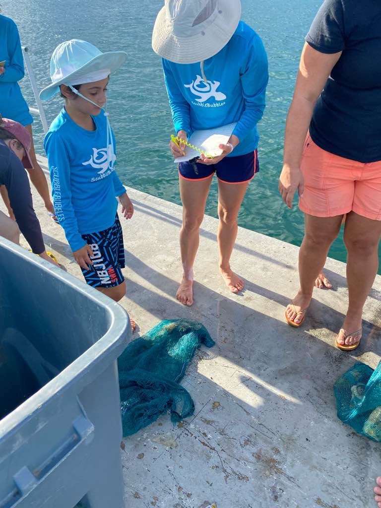
a net. similar to a live well, with a plastic netting, metal circular frame, with a plastic bottle attached.
mostly sunny, 85 degrees F, scattered showers, mild winds no more than 15mph, 0-2 ft waves
1
2
metal/plastic boat hook
plow anchors with chain and line
Key Dives/FKNMS
Alyssa
2
15
1
1
1
95.00
45
95.00
50.00
measured
6
300.00
fishing gear
anchor/boat line
On
pounds
I have debris data to report
Slight for waves 0.5 -1.25 meter high
1
ft2
5
feet
coral reef
1
United States
State\Province
FL
City
Islamorada
Map Help


Dive Location

If you know your survey site coordinates, enter them manually in decimal degrees using WGS84 Map Datum. Use the minus sign for latitudes south of the equator and longitudes west of the Prime Meridian to 180 degrees.

If you do not know your survey site coordinates, click the “Map Location” tab to use the map to zoom into your survey site and drop the pin on the map to fall within your survey dive site in the water (not on land or the beach). Ensure you zoom in as much as possible to ensure data accuracy.

Entangled Help


Use the vertical tabs below to record any entangled animals you found of each type.

ADS08 - Cabinsite Cove

2
4
2
0

35.238882960212, -114.57687199116

2
0
0
silt
0
2
1
1
0
Wind
Sin City Scuba
Curtis Snaper
0
0
0
2
0
0
0
0
0
0
0
0
0
0
0
0
0
4
0
4
0
0
0
0
0
0
3
0
0
1
0
0
0
0
0
0
3.50
35
38.00
10.00
0
estimated
0
0
0
0
17700.00
0
0
0
0
0
Fishing line
0
On
pounds
0
I have debris data to report
0
0
0
Calm (glassy to rippled) for waves 0 – 0.1 meter high
0
0
1
0
0
0
0
ft2
0
0
feet
other
2
0
0
0
0
0
0
0
0
0
0
0
0
0
0
0
0
6
0
0
0
0
0
0
0
0
0
0
0
United States
State\Province
Nevada
City
Las Vegas
Map Help


Dive Location

If you know your survey site coordinates, enter them manually in decimal degrees using WGS84 Map Datum. Use the minus sign for latitudes south of the equator and longitudes west of the Prime Meridian to 180 degrees.

If you do not know your survey site coordinates, click the “Map Location” tab to use the map to zoom into your survey site and drop the pin on the map to fall within your survey dive site in the water (not on land or the beach). Ensure you zoom in as much as possible to ensure data accuracy.

Entangled Help


Use the vertical tabs below to record any entangled animals you found of each type.

Ecosystem Other
freshwater lake

Churchill Barrier 3, S S Reginald R

1
4
0
0

58.87067, -2.915841

0
0
0
silt
0
3
0
12
0
Nasal spray plastic
Kraken Diving
Marjorie Watson
0
0
0
0
0
0
0
0
0
0
0
0
0
0
0
0
0
0
0
1
0
1
0
0
0
0
0
0
0
0
0
0
0
0
0
0
1.00
40
10.00
1.00
6
estimated
0
0
1
0
1264.00
0
0
0
0
0
0
On
kilograms
0
I have debris data to report
0
0
0
Calm (glassy to rippled) for waves 0 – 0.1 meter high
0
0
0
0
0
0
0
m2
0
0
meters
kelp
0
0
0
0
0
0
0
0
0
0
0
0
0
0
0
0
0
0
0
0
0
0
0
0
0
0
0
0
0
United Kingdom
State\Province
Orkney
City
Kirkwall
Map Help


Dive Location

If you know your survey site coordinates, enter them manually in decimal degrees using WGS84 Map Datum. Use the minus sign for latitudes south of the equator and longitudes west of the Prime Meridian to 180 degrees.

If you do not know your survey site coordinates, click the “Map Location” tab to use the map to zoom into your survey site and drop the pin on the map to fall within your survey dive site in the water (not on land or the beach). Ensure you zoom in as much as possible to ensure data accuracy.

Entangled Help


Use the vertical tabs below to record any entangled animals you found of each type.

Spanish Lagoon #513070

0
43
2
1
0
2
0
silt
0
63
0
3
2

12.473213319696, -69.976124816224

Ladder
ScubbleBubbles CLA & DPI
Nichole
4
3
3
12
0
0
0
0
0
0
0
0
0
1
0
0
0
1
0
20
0
0
0
0
0
0
73
1
0
13
0
0
0
0
0
0
55.00
90
4.00
1.00
2
estimated
0
0
7706.75
0
12
0
2
0
Bottles (plastic and glass)
Tires
0
On
kilograms
0
I have debris data to report
98
4
1
Smooth (wavelets) for waves 0.1 - 0.5 meter high
0
0
4
4
6
0
0
m2
7
0
meters
seagrass
16
0
2
0
0
0
4
0
0
0
0
0
0
0
0
0
25
55
0
0
0
0
0
0
0
0
1
2
0
Aruba
Map Help


Dive Location

If you know your survey site coordinates, enter them manually in decimal degrees using WGS84 Map Datum. Use the minus sign for latitudes south of the equator and longitudes west of the Prime Meridian to 180 degrees.

If you do not know your survey site coordinates, click the “Map Location” tab to use the map to zoom into your survey site and drop the pin on the map to fall within your survey dive site in the water (not on land or the beach). Ensure you zoom in as much as possible to ensure data accuracy.

Entangled Help


Use the vertical tabs below to record any entangled animals you found of each type.

Brohm Lake

2
7
2
0

49.822787886384, -123.13573392667

0
0
0
silt
0
1
3
0
0
No
Umbrella
Rain
1
1
3
1
2
1
1
1
1
Air mattress
Metal weed grinder
Sunglasses
35mm film
Jewelry
Metal carabiner
Vape
Umbrella
Boat paddle
Divers for Cleaner Lakes and Oceans
Henry Wang
0
0
0
2
0
0
0
0
2
0
0
0
0
0
0
0
0
1
0
1
0
0
0
0
0
0
0
0
0
1
0
0
13
0
0
0
49.50
43
37.00
10.00
0
measured
0
0
1067.65
0
0
0
0
0
Beer cans
Beer bottles
0
On
pounds
0
I have debris data to report
23
0
0
Calm (glassy to rippled) for waves 0 – 0.1 meter high
0
0
1
0
0
0
0
ft2
0
0
feet
other
3
0
0
0
0
0
0
0
0
3
0
0
0
0
0
0
0
36
0
0
0
0
1
0
0
0
0
0
0
Canada
State\Province
British Columbia
City
North Vancouver
Map Help


Dive Location

If you know your survey site coordinates, enter them manually in decimal degrees using WGS84 Map Datum. Use the minus sign for latitudes south of the equator and longitudes west of the Prime Meridian to 180 degrees.

If you do not know your survey site coordinates, click the “Map Location” tab to use the map to zoom into your survey site and drop the pin on the map to fall within your survey dive site in the water (not on land or the beach). Ensure you zoom in as much as possible to ensure data accuracy.

Entangled Help


Use the vertical tabs below to record any entangled animals you found of each type.

Ecosystem Other
Silt

8ª edição de Limpeza Subaquática da Marina de Oeiras

1
20
3
3

38.675935466903, -9.3184114097038

silt
2
1
10
11

38.6968607, -9.3146014

Pipe
Sunny
5
covid mask
Haliotis Oeiras
Lucas Martins
2
3
1
10
2
3
1
2
6
1
5
6
14
2
3
37
2
3
10
2
200.00
50
8.00
1.00
5
measured
5
1
2100.00
2
6
fishing gear
Plastic
On
kilograms
I have debris data to report
19
1
Calm (glassy to rippled) for waves 0 – 0.1 meter high
3
6
3
m2
2
2
fish pots
Holothuroidea
Released Unharmed
meters
rocky reef
4
2
3
5
2
13
2
2
2
1
Portugal
State\Province
Lisboa
City
Oeiras
Map Help


Dive Location

If you know your survey site coordinates, enter them manually in decimal degrees using WGS84 Map Datum. Use the minus sign for latitudes south of the equator and longitudes west of the Prime Meridian to 180 degrees.

If you do not know your survey site coordinates, click the “Map Location” tab to use the map to zoom into your survey site and drop the pin on the map to fall within your survey dive site in the water (not on land or the beach). Ensure you zoom in as much as possible to ensure data accuracy.

Entangled Help


Use the vertical tabs below to record any entangled animals you found of each type.

Ecosystem Other
Siltand Rock

Davey Crocker

24.9142, -80.51611

coral
Florida Keys Dive Center/FKNMS
Joe
5
35.00
45
35.00
15.00
estimated
1
1000.00
On
pounds
I have debris data to report
Calm (glassy to rippled) for waves 0 – 0.1 meter high ft2
1
feet
coral reef
United States
Map Help


Dive Location

If you know your survey site coordinates, enter them manually in decimal degrees using WGS84 Map Datum. Use the minus sign for latitudes south of the equator and longitudes west of the Prime Meridian to 180 degrees.

If you do not know your survey site coordinates, click the “Map Location” tab to use the map to zoom into your survey site and drop the pin on the map to fall within your survey dive site in the water (not on land or the beach). Ensure you zoom in as much as possible to ensure data accuracy.

Entangled Help


Use the vertical tabs below to record any entangled animals you found of each type.

Mitz #522489

0
0
0
0

11.843386, 93.036577

0
0
0
coral
0
0
0
0
0
No
Plastic
Sunny
Andaman Bubbles
Mithun Rao
0
0
0
0
0
0
0
0
0
0
0
0
0
0
0
0
0
0
0
4
0
0
0
0
0
0
0
0
0
0
0
0
0
0
0
0
0.00
40
15.00
12.00
0
estimated
0
0
0
0
25.00
0
0
0
0
0
0
On
pounds
0
Our Survey Site was free of debris
0
0
0
Calm (glassy to rippled) for waves 0 – 0.1 meter high
0
0
0
0
0
0
0
m2
0
0
meters
coral reef
0
0
0
0
0
0
0
0
0
0
0
0
0
0
0
0
0
0
0
0
0
0
0
0
0
0
0
0
0
India
State\Province
Andaman
City
Neil Island
Map Help


Dive Location

If you know your survey site coordinates, enter them manually in decimal degrees using WGS84 Map Datum. Use the minus sign for latitudes south of the equator and longitudes west of the Prime Meridian to 180 degrees.

If you do not know your survey site coordinates, click the “Map Location” tab to use the map to zoom into your survey site and drop the pin on the map to fall within your survey dive site in the water (not on land or the beach). Ensure you zoom in as much as possible to ensure data accuracy.

Entangled Help


Use the vertical tabs below to record any entangled animals you found of each type.

ADS126 - Chilpo Beach Northern Rocky Outcrop

5
194

36.136072, 129.398292

2
11
rock
2
12
Video of the full dive here: https://youtu.be/At2qD6OJu1s
rubber crab toy
Clear. No rain.
Dive Against Debris Korea (Daegu)
William Henderson
3
1
14
3
1
7
1
3
10.00
70
5.00
1.00
19
estimated
3
135.00
1
3
misc. plastic
cloth strips
On
kilograms
I have debris data to report
Slight for waves 0.5 -1.25 meter high
89
5
1
m2
25
meters
rocky reef
16
6
2
3
United States
State\Province
Gyeongsanbukdo
City
Pohang
Map Help


Dive Location

If you know your survey site coordinates, enter them manually in decimal degrees using WGS84 Map Datum. Use the minus sign for latitudes south of the equator and longitudes west of the Prime Meridian to 180 degrees.

If you do not know your survey site coordinates, click the “Map Location” tab to use the map to zoom into your survey site and drop the pin on the map to fall within your survey dive site in the water (not on land or the beach). Ensure you zoom in as much as possible to ensure data accuracy.

Entangled Help


Use the vertical tabs below to record any entangled animals you found of each type.

Sandy Bay

2
rock
1

-36.779661971986, 175.02890470671

Strong Northerlies
Waiheke Dive & Snorkel
Cameron
3
2
3
6.00
45
6.50
2.50
estimated
50.00
On
kilograms
I have debris data to report
4
Smooth (wavelets) for waves 0.1 - 0.5 meter high
6
m2
meters
rocky reef
2
New Zealand
State\Province
Auckland
City
Auckland
Map Help


Dive Location

If you know your survey site coordinates, enter them manually in decimal degrees using WGS84 Map Datum. Use the minus sign for latitudes south of the equator and longitudes west of the Prime Meridian to 180 degrees.

If you do not know your survey site coordinates, click the “Map Location” tab to use the map to zoom into your survey site and drop the pin on the map to fall within your survey dive site in the water (not on land or the beach). Ensure you zoom in as much as possible to ensure data accuracy.

Entangled Help


Use the vertical tabs below to record any entangled animals you found of each type.

Subscribe to