Menu

Davis Reef

24.987718373323, -80.49604552117

coral
Florida Keys Dive Center/FKNMS
Nate
8
0.00
45
30.00
20.00
estimated
1500.00
On
pounds
Our Survey Site was free of debris
Calm (glassy to rippled) for waves 0 – 0.1 meter high ft2
feet
coral reef
United States
Map Help


Dive Location

If you know your survey site coordinates, enter them manually in decimal degrees using WGS84 Map Datum. Use the minus sign for latitudes south of the equator and longitudes west of the Prime Meridian to 180 degrees.

If you do not know your survey site coordinates, click the “Map Location” tab to use the map to zoom into your survey site and drop the pin on the map to fall within your survey dive site in the water (not on land or the beach). Ensure you zoom in as much as possible to ensure data accuracy.

Entangled Help


Use the vertical tabs below to record any entangled animals you found of each type.

Davey Crocker

24.9142, -80.51611

coral
Florida Keys Dive Center/FKNMS
Nate
8
0.00
45
30.00
20.00
estimated
1500.00
On
pounds
Our Survey Site was free of debris
Calm (glassy to rippled) for waves 0 – 0.1 meter high ft2
feet
coral reef
United States
Map Help


Dive Location

If you know your survey site coordinates, enter them manually in decimal degrees using WGS84 Map Datum. Use the minus sign for latitudes south of the equator and longitudes west of the Prime Meridian to 180 degrees.

If you do not know your survey site coordinates, click the “Map Location” tab to use the map to zoom into your survey site and drop the pin on the map to fall within your survey dive site in the water (not on land or the beach). Ensure you zoom in as much as possible to ensure data accuracy.
Entangled Help


Use the vertical tabs below to record any entangled animals you found of each type.

The Eagle

24.86966, -80.57051

other
Florida Keys Dive Center/FKNMS
Nate
6
0.00
30
100.00
60.00
estimated
1000.00
On
pounds
Our Survey Site was free of debris
Calm (glassy to rippled) for waves 0 – 0.1 meter high ft2
feet
other
United States
Map Help


Dive Location

If you know your survey site coordinates, enter them manually in decimal degrees using WGS84 Map Datum. Use the minus sign for latitudes south of the equator and longitudes west of the Prime Meridian to 180 degrees.

If you do not know your survey site coordinates, click the “Map Location” tab to use the map to zoom into your survey site and drop the pin on the map to fall within your survey dive site in the water (not on land or the beach). Ensure you zoom in as much as possible to ensure data accuracy.
Entangled Help


Use the vertical tabs below to record any entangled animals you found of each type.

Ecosystem Other
Wreck/Artificial Reef
Dominant Substrate Other
Wreck/Artificial Reef

USCGC Duane

24.9898, -80.38146

other
1
250 ft of polypropylene line
100 ft of fishing line
3 fishing hooks
16 oz weight
4 oz weight
2
1
Fishing Weight
Polypropylene Line
Florida Keys Dive Center/FKNMS
Nate
6
9.00
30
100.00
80.00
estimated
3
1200.00
On
pounds
I have debris data to report
Calm (glassy to rippled) for waves 0 – 0.1 meter high ft2
feet
other
United States
Map Help


Dive Location

If you know your survey site coordinates, enter them manually in decimal degrees using WGS84 Map Datum. Use the minus sign for latitudes south of the equator and longitudes west of the Prime Meridian to 180 degrees.

If you do not know your survey site coordinates, click the “Map Location” tab to use the map to zoom into your survey site and drop the pin on the map to fall within your survey dive site in the water (not on land or the beach). Ensure you zoom in as much as possible to ensure data accuracy.
Entangled Help


Use the vertical tabs below to record any entangled animals you found of each type.

Ecosystem Other
Wreck/Artificial Reef
Dominant Substrate Other
Wreck/Artificial Reef

Marker 32

2

24.475, -81.744444

rock
1
Coral restoration and disease treatment
The plastic marker tags used for replanted corals or disease treated corals are breaking.
Plastic tags from disease treated corals or replanted corals.
Both calm and windy
The College of the Florida Keys
Lucja Rice
11
0.03
45
30.00
10.00
measured
2
20000.00
fishing line and hook
On
kilograms
I have debris data to report
Slight for waves 0.5 -1.25 meter high ft2
feet
coral reef
1
United States
State\Province
Florida
City
Key West
Map Help


Dive Location

If you know your survey site coordinates, enter them manually in decimal degrees using WGS84 Map Datum. Use the minus sign for latitudes south of the equator and longitudes west of the Prime Meridian to 180 degrees.

If you do not know your survey site coordinates, click the “Map Location” tab to use the map to zoom into your survey site and drop the pin on the map to fall within your survey dive site in the water (not on land or the beach). Ensure you zoom in as much as possible to ensure data accuracy.
Entangled Help


Use the vertical tabs below to record any entangled animals you found of each type.

Goda Kupatha

0
0
0
0

5.9904158203001, 80.267774057596

0
0
0
rock
0
1
0
0
0
No
Sunny for the most part
Sun Diving Center (S-25804)
Salin
0
0
0
0
0
0
0
0
0
0
0
0
0
0
0
0
0
0
0
4
0
0
0
0
0
0
0
0
0
0
0
0
0
0
0
0
0.01
50
15.00
5.00
0
estimated
0
0
121.18
0
0
0
0
0
0
On
kilograms
0
I have debris data to report
0
0
0
Smooth (wavelets) for waves 0.1 - 0.5 meter high
0
0
0
0
1
0
0
m2
0
0
meters
rocky reef
0
0
0
0
0
0
0
0
0
0
0
0
0
0
0
0
0
0
0
0
0
0
0
0
0
0
0
0
0
Sri Lanka
State\Province
Southern Province
City
Unawatuna
Map Help


Dive Location

If you know your survey site coordinates, enter them manually in decimal degrees using WGS84 Map Datum. Use the minus sign for latitudes south of the equator and longitudes west of the Prime Meridian to 180 degrees.

If you do not know your survey site coordinates, click the “Map Location” tab to use the map to zoom into your survey site and drop the pin on the map to fall within your survey dive site in the water (not on land or the beach). Ensure you zoom in as much as possible to ensure data accuracy.

Entangled Help


Use the vertical tabs below to record any entangled animals you found of each type.

Diyamba Kupatha

0
0
0
0

5.9848557161729, 80.266353442958

0
0
0
rock
0
2
0
0
0
Fun Dive during the Rescue Dive Course.
No
Forgot to photograph the trash
N/A
Sunny and clear weather for the most part
Sun Diving Center
Salin
0
0
0
0
0
0
0
0
0
0
0
0
0
0
0
0
0
0
0
5
0
0
0
0
0
0
0
0
0
0
0
0
0
0
0
0
0.05
37
28.10
15.00
0
estimated
0
0
213.67
0
0
0
0
0
0
On
kilograms
0
I have debris data to report
0
0
0
Smooth (wavelets) for waves 0.1 - 0.5 meter high
0
0
0
0
0
0
0
m2
0
0
meters
rocky reef
0
0
0
0
0
0
0
0
0
0
0
0
0
0
0
0
0
0
0
0
0
0
0
0
0
0
0
0
0
Sri Lanka
State\Province
Southern Province
City
Unawatuna
Map Help


Dive Location

If you know your survey site coordinates, enter them manually in decimal degrees using WGS84 Map Datum. Use the minus sign for latitudes south of the equator and longitudes west of the Prime Meridian to 180 degrees.

If you do not know your survey site coordinates, click the “Map Location” tab to use the map to zoom into your survey site and drop the pin on the map to fall within your survey dive site in the water (not on land or the beach). Ensure you zoom in as much as possible to ensure data accuracy.

Entangled Help


Use the vertical tabs below to record any entangled animals you found of each type.

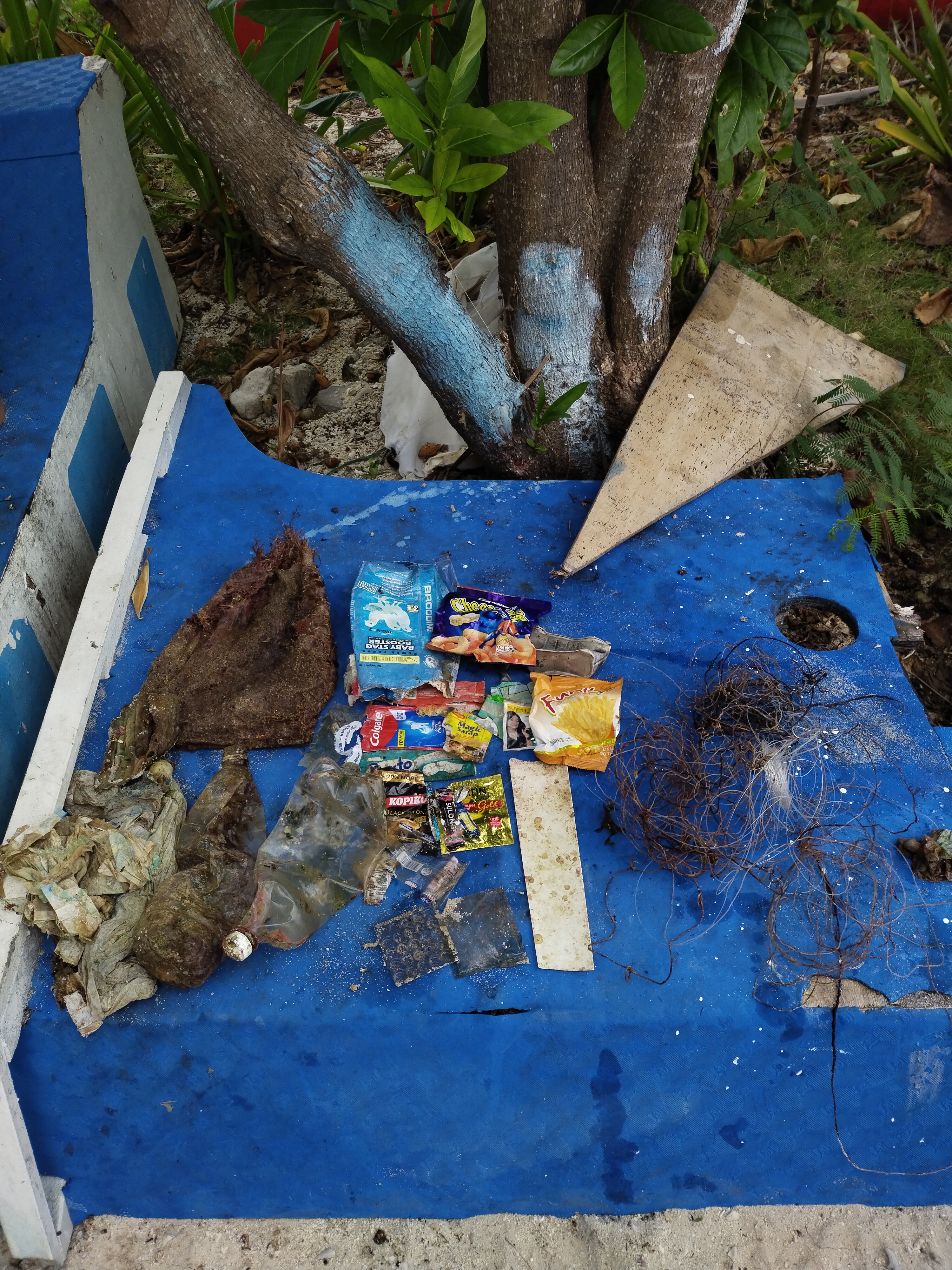
Lapus lapus

2
coral
3
25

11.346549444756, 124.10628788173

Thresher shark divers
Toni
1
4
3
15
1
1
1.00
45
16.00
7.00
measured
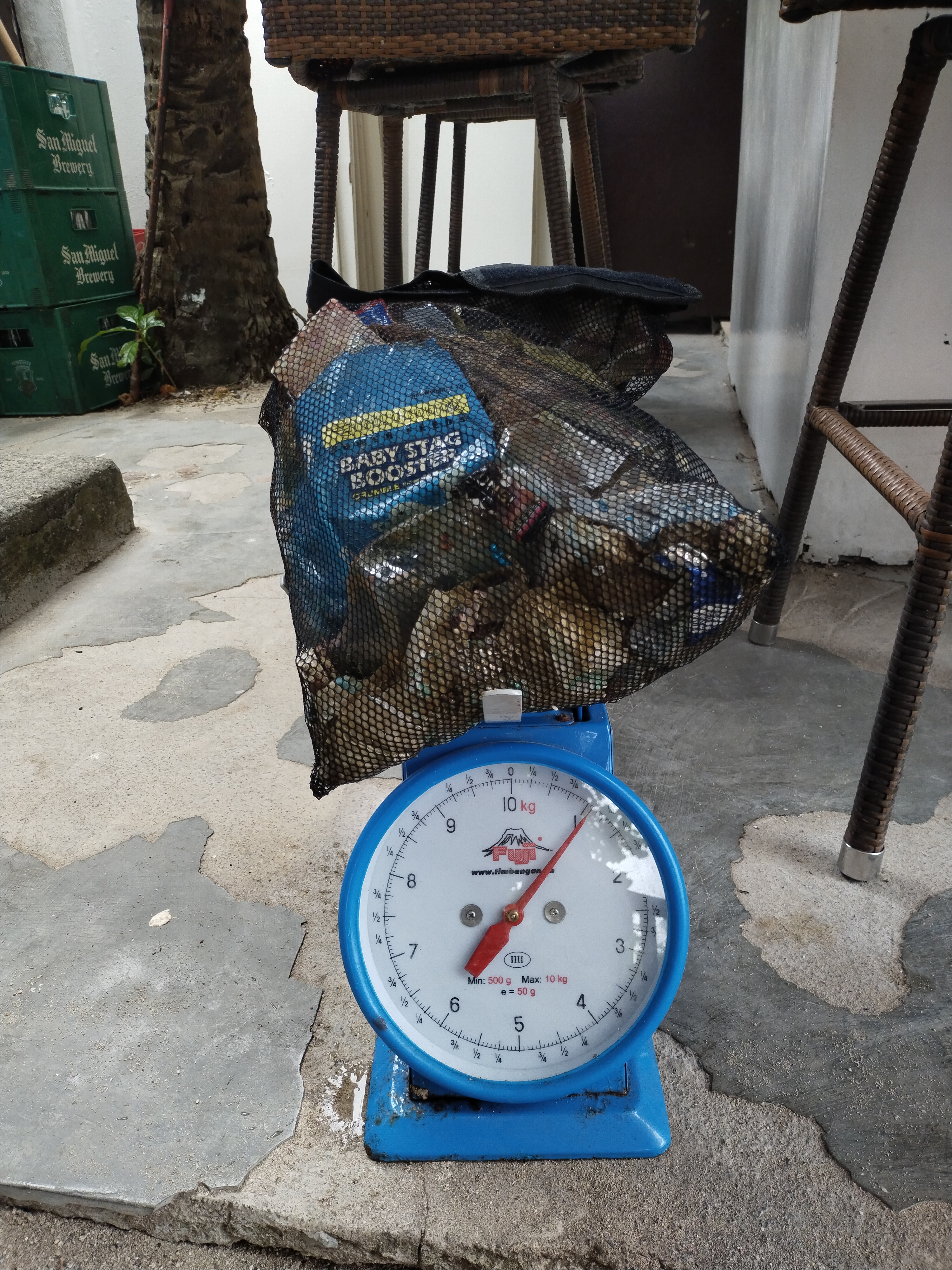
80.00
Plastic
Fishing line
On
kilograms
I have debris data to report
Calm (glassy to rippled) for waves 0 – 0.1 meter high
1
m2
meters
coral reef
Philippines
City
Malapascua
Map Help


Dive Location

If you know your survey site coordinates, enter them manually in decimal degrees using WGS84 Map Datum. Use the minus sign for latitudes south of the equator and longitudes west of the Prime Meridian to 180 degrees.

If you do not know your survey site coordinates, click the “Map Location” tab to use the map to zoom into your survey site and drop the pin on the map to fall within your survey dive site in the water (not on land or the beach). Ensure you zoom in as much as possible to ensure data accuracy.

Entangled Help


Use the vertical tabs below to record any entangled animals you found of each type.

La Grieta

rock

15.716572866373, -96.161239271163

Medium to high surge in the golf of tehuantepec.
Huatulco Dive Center
David-Alexandre Gassin
4
3.00
45
20.00
6.00
2
estimated
839.00
On
kilograms
I have debris data to report
Smooth (wavelets) for waves 0.1 - 0.5 meter high m2
meters
rocky reef
Mexico
State\Province
Oaxaca
City
Bahias de huatulco
Map Help


Dive Location

If you know your survey site coordinates, enter them manually in decimal degrees using WGS84 Map Datum. Use the minus sign for latitudes south of the equator and longitudes west of the Prime Meridian to 180 degrees.

If you do not know your survey site coordinates, click the “Map Location” tab to use the map to zoom into your survey site and drop the pin on the map to fall within your survey dive site in the water (not on land or the beach). Ensure you zoom in as much as possible to ensure data accuracy.

Entangled Help


Use the vertical tabs below to record any entangled animals you found of each type.

El Tigre

1
3
rock
2
1

15.716210878967, -96.177061105159

Medium to high surge in the golf of Tehuantepec.
Huatulco Dive Center
David-Alexandre Gassin
1
4
1.00
53
11.00
5.00
estimated
4475.00
On
kilograms
I have debris data to report
Calm (glassy to rippled) for waves 0 – 0.1 meter high
1
m2
meters
rocky reef
Mexico
State\Province
Oaxaca
City
Bahias de huatulco
Map Help


Dive Location

If you know your survey site coordinates, enter them manually in decimal degrees using WGS84 Map Datum. Use the minus sign for latitudes south of the equator and longitudes west of the Prime Meridian to 180 degrees.

If you do not know your survey site coordinates, click the “Map Location” tab to use the map to zoom into your survey site and drop the pin on the map to fall within your survey dive site in the water (not on land or the beach). Ensure you zoom in as much as possible to ensure data accuracy.

Entangled Help


Use the vertical tabs below to record any entangled animals you found of each type.

Subscribe to