Marker 32
2
24.475, -81.744444
1
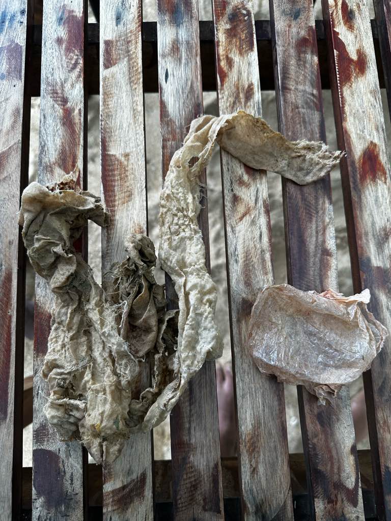
Coral restoration and disease treatment
The plastic marker tags used for replanted corals or disease treated corals are breaking.
Plastic tags from disease treated corals or replanted corals.
Both calm and windy
The College of the Florida Keys
Lucja Rice
11
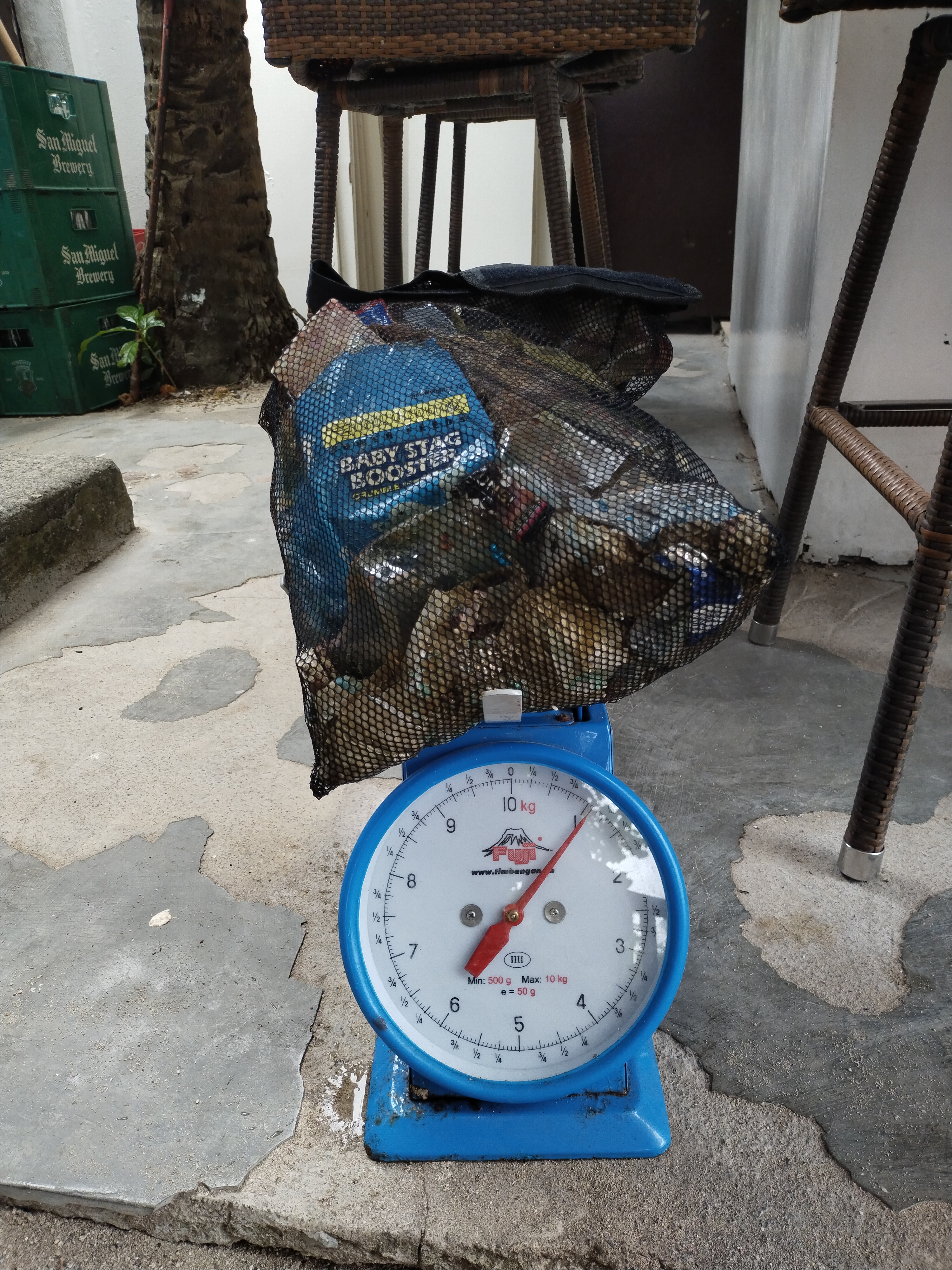
0.03
45
30.00
10.00
measured
2
20000.00
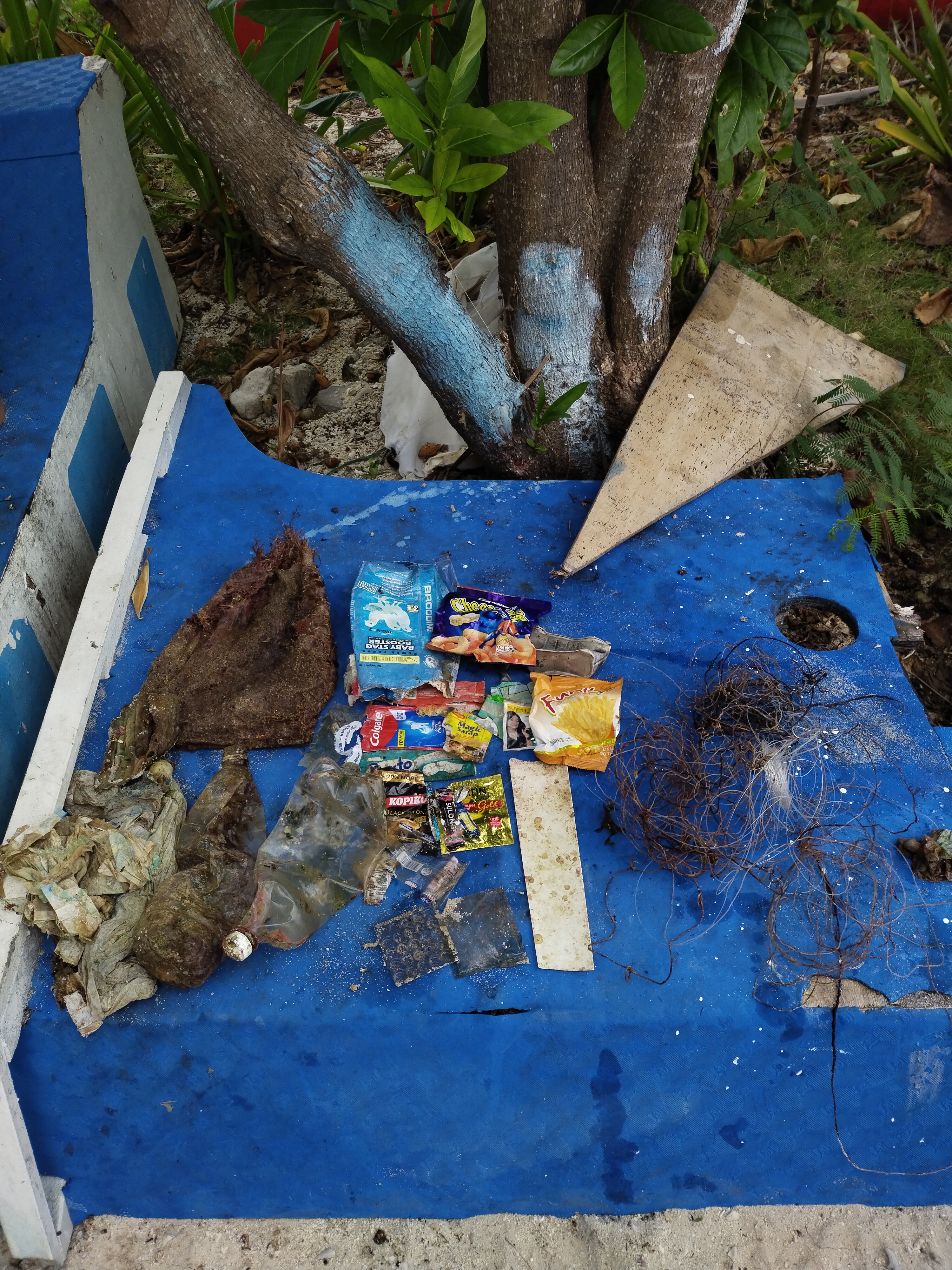
fishing line and hook
On
kilograms
I have debris data to report
Slight for waves 0.5 -1.25 meter high
ft2
feet
coral reef
1
State\Province
Florida
City
Key West
Map Help
Dive Location
If you know your survey site coordinates, enter them manually in decimal degrees using WGS84 Map Datum. Use the minus sign for latitudes south of the equator and longitudes west of the Prime Meridian to 180 degrees.
If you do not know your survey site coordinates, click the “Map Location” tab to use the map to zoom into your survey site and drop the pin on the map to fall within your survey dive site in the water (not on land or the beach). Ensure you zoom in as much as possible to ensure data accuracy.
Entangled Help