Haad Salad
0
0
0
0
9.788489, 99.971732
0
0
0
coral
0
0
0
0
0
Boat fishing too close to the reef
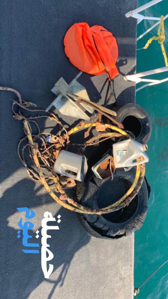
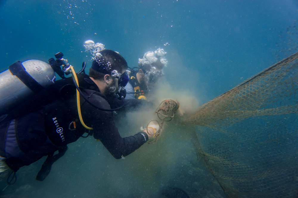
Felt really good to clear this net, it was relatively new debris so luckily no fish had been caught in it yet
Big spiky orange crab, don't know species
The massive Gill net
Clear with some heavy rain
1
Fishing net (150m gill net)
CoreSea
Victoria Fahey
0
0
0
0
0
0
0
0
0
0
0
0
0
0
0
0
0
0
0
13
0
0
0
0
0
0
0
0
0
0
0
0
0
0
0
0
40.00
40
8.00
4.00
0
estimated
0
0
0
0
2608.08
0
0
0
0
0
The fishing line wrapped around Acropora corals
0
On
kilograms
0
I have debris data to report
0
0
0
Smooth (wavelets) for waves 0.1 - 0.5 meter high
0
0
0
Fishing Net
Large Spiky Reef Crab
Released Unharmed
1
0
0
0
0
m2
0
0
meters
coral reef
0
0
0
0
0
0
0
0
0
0
0
0
0
0
0
0
0
0
0
0
0
0
0
0
0
0
0
0
0
State\Province
Surat Thani
City
Koh Phangan
Map Help
Dive Location
If you know your survey site coordinates, enter them manually in decimal degrees using WGS84 Map Datum. Use the minus sign for latitudes south of the equator and longitudes west of the Prime Meridian to 180 degrees.
If you do not know your survey site coordinates, click the “Map Location” tab to use the map to zoom into your survey site and drop the pin on the map to fall within your survey dive site in the water (not on land or the beach). Ensure you zoom in as much as possible to ensure data accuracy.
Entangled Help