Menu

Al Bahiya Beach #395167

7
42
0
7

24.5394, 54.625

12
6
6
sand
3
33
0
14
8
Yes
Cool
UAE Sea Dragon
Cpt Ahmed Al Maazmi
0
6
10
33
0
0
0
0
1
10
0
0
3
0
10
5
4
16
0
395167
0
0
9
0
23
5
32
4
0
10
8
0
0
0
1
5
80.00
40
8.00
3.00
7
estimated
0
22
135705.00
0
35
8
0
0
Plastic
Tyers
Fishong nets
0
On
kilograms
6
I have debris data to report
8
0
0
Calm (glassy to rippled) for waves 0 – 0.1 meter high
0
0
0
0
0
0
0
m2
0
3
meters
seagrass
5
0
0
0
2
0
0
0
3
0
0
0
0
0
3
0
2
13
0
0
0
0
13
0
14
0
13
0
0
United Arab Emirates
State\Province
Ad
City
Abu Dhabi
Map Help


Dive Location

If you know your survey site coordinates, enter them manually in decimal degrees using WGS84 Map Datum. Use the minus sign for latitudes south of the equator and longitudes west of the Prime Meridian to 180 degrees.

If you do not know your survey site coordinates, click the “Map Location” tab to use the map to zoom into your survey site and drop the pin on the map to fall within your survey dive site in the water (not on land or the beach). Ensure you zoom in as much as possible to ensure data accuracy.

Entangled Help


Use the vertical tabs below to record any entangled animals you found of each type.

Bannerfish Bay - left

0
26
0
0

28.498606272352, 34.518127428261

0
0
0
seagrass
0
0
0
0
0
Tourism - beach use
As the Egypt holidays have ended there is less trash that can be found in the area during the summer.
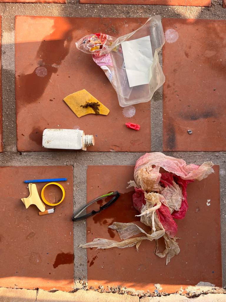
Cigarette butts and tissue
Light wind
H2O Divers Dahab
Dom Gibbings
0
0
0
1
0
73
0
0
0
0
0
0
0
2
0
0
0
0
0
3
0
0
0
11
1
0
0
0
0
0
0
0
0
0
0
0
0.50
45
14.00
2.00
0
measured
0
0
4559.41
0
0
0
1
0
Cigarette butts
Tissues
1
On
kilograms
0
I have debris data to report
0
0
0
Smooth (wavelets) for waves 0.1 - 0.5 meter high
0
0
0
0
3
0
0
m2
0
0
meters
seagrass
1
0
0
0
0
2
0
10
0
0
0
0
0
3
0
0
0
0
0
0
0
0
13
0
0
0
0
0
0
Egypt
State\Province
S Sinai
City
Dahab
Map Help


Dive Location

If you know your survey site coordinates, enter them manually in decimal degrees using WGS84 Map Datum. Use the minus sign for latitudes south of the equator and longitudes west of the Prime Meridian to 180 degrees.

If you do not know your survey site coordinates, click the “Map Location” tab to use the map to zoom into your survey site and drop the pin on the map to fall within your survey dive site in the water (not on land or the beach). Ensure you zoom in as much as possible to ensure data accuracy.
Entangled Help


Use the vertical tabs below to record any entangled animals you found of each type.

ADS575 - Red Slave

21

12.02636, -68.251795

coral
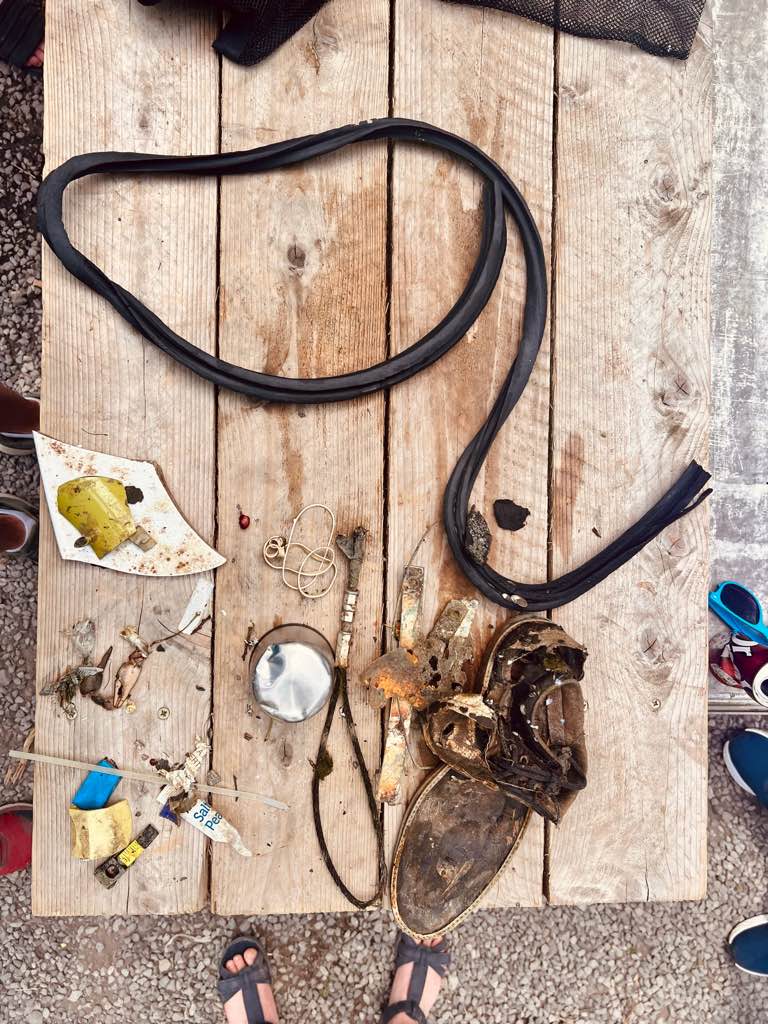
Thanks to: Stefan & Patrick, Merel & Rutger and Annemieke & Maxime for the help!
pill strip (noted under fragmats)
AB-Dive
Dewi
1
7
29
6
3.10
46
23.00
10.00
measured
299.00
plastic
On
kilograms
I have debris data to report
Slight for waves 0.5 -1.25 meter high
plastic
crab
Released Unharmed
3
m2
1
2
meters
coral reef
1
2
Netherlands Antilles
State\Province
Bonaire
City
Kralendijk
Map Help


Dive Location

If you know your survey site coordinates, enter them manually in decimal degrees using WGS84 Map Datum. Use the minus sign for latitudes south of the equator and longitudes west of the Prime Meridian to 180 degrees.

If you do not know your survey site coordinates, click the “Map Location” tab to use the map to zoom into your survey site and drop the pin on the map to fall within your survey dive site in the water (not on land or the beach). Ensure you zoom in as much as possible to ensure data accuracy.
Entangled Help


Use the vertical tabs below to record any entangled animals you found of each type.

Heron island South West #444200

0
0
0
0

-23.442051, 151.905324

0
0
0
coral
0
0
0
0
0
Drift dive
Clear
Heron Island Resort
Elliot
0
0
0
0
0
0
0
0
0
0
0
0
0
0
0
0
0
0
0
5
0
0
0
0
0
0
0
0
0
0
0
0
0
0
0
0
0.00
42
13.00
3.00
0
estimated
0
0
0
0
9648.20
0
0
0
0
0
0
On
pounds
0
Our Survey Site was free of debris
0
0
0
Calm (glassy to rippled) for waves 0 – 0.1 meter high
0
0
0
0
0
0
0
m2
0
0
meters
coral reef
0
0
0
0
0
0
0
0
0
0
0
0
0
0
0
0
0
0
0
0
0
0
0
0
0
0
0
0
0
Australia
State\Province
Queensland
City
Heron Island
Map Help


Dive Location

If you know your survey site coordinates, enter them manually in decimal degrees using WGS84 Map Datum. Use the minus sign for latitudes south of the equator and longitudes west of the Prime Meridian to 180 degrees.

If you do not know your survey site coordinates, click the “Map Location” tab to use the map to zoom into your survey site and drop the pin on the map to fall within your survey dive site in the water (not on land or the beach). Ensure you zoom in as much as possible to ensure data accuracy.
Entangled Help


Use the vertical tabs below to record any entangled animals you found of each type.

Heron Island Harbour

0
2
0
0

-23.442127, 151.910556

0
0
0
sand
0
0
0
0
0
No
Sock
Rain
1
Sunglasses
Heron Island Resort
Elliot Peters
0
0
0
0
0
0
0
0
0
0
0
0
0
0
0
0
0
0
0
1
0
0
0
0
0
0
0
0
0
0
0
0
0
0
0
0
0.10
22
5.00
1.00
0
estimated
0
0
0
0
380.77
0
0
0
0
0
Random clothing
0
On
kilograms
0
I have debris data to report
0
0
0
Calm (glassy to rippled) for waves 0 – 0.1 meter high
0
0
0
0
0
0
0
m2
0
0
meters
other
0
0
0
0
0
0
0
0
0
1
0
0
0
0
0
0
0
0
0
0
0
0
0
0
0
0
0
0
0
Australia
State\Province
Queensland
Map Help


Dive Location

If you know your survey site coordinates, enter them manually in decimal degrees using WGS84 Map Datum. Use the minus sign for latitudes south of the equator and longitudes west of the Prime Meridian to 180 degrees.

If you do not know your survey site coordinates, click the “Map Location” tab to use the map to zoom into your survey site and drop the pin on the map to fall within your survey dive site in the water (not on land or the beach). Ensure you zoom in as much as possible to ensure data accuracy.
Entangled Help


Use the vertical tabs below to record any entangled animals you found of each type.

Ecosystem Other
sand harbour

The cathedral

0
0
0
0
0
0
1
coral
0
2
0
1
0

27.890054780629, 34.3269750677

Tourism
Plastic tube
Good
Alfa Buceo
Valentín
1
0
0
1
0
0
0
0
0
0
0
0
0
0
0
0
0
2
0
8
0
0
0
0
0
1
0
0
1
0
0
0
0
0
0
0
6.00
45
9.00
2.00
2
estimated
0
0
4907.79
0
0
0
0
0
0
On
kilograms
0
I have debris data to report
2
0
0
Calm (glassy to rippled) for waves 0 – 0.1 meter high
0
0
0
0
0
0
0
m2
0
0
meters
coral reef
0
0
0
0
0
0
0
0
0
0
0
0
0
0
0
0
0
0
0
0
2
0
4
0
0
0
0
0
0
Egypt
City
Sharm el sheik
Map Help


Dive Location

If you know your survey site coordinates, enter them manually in decimal degrees using WGS84 Map Datum. Use the minus sign for latitudes south of the equator and longitudes west of the Prime Meridian to 180 degrees.

If you do not know your survey site coordinates, click the “Map Location” tab to use the map to zoom into your survey site and drop the pin on the map to fall within your survey dive site in the water (not on land or the beach). Ensure you zoom in as much as possible to ensure data accuracy.
Entangled Help


Use the vertical tabs below to record any entangled animals you found of each type.

El puerto

0
0
0
0

36.728320290828, -3.7267804019729

0
0
0
sand
0
2
0
0
0
No
Rope
Windy
Buceo Marina
Valentín
0
0
0
0
0
0
0
0
0
0
0
0
0
0
0
0
0
0
0
2
0
0
0
0
0
0
0
0
0
0
0
0
0
0
0
0
1.00
35
6.00
1.00
0
estimated
0
0
1365.57
0
0
0
0
0
0
On
pounds
0
I have debris data to report
0
0
0
Calm (glassy to rippled) for waves 0 – 0.1 meter high
0
0
0
0
0
0
0
m2
2
0
meters
other
0
0
0
0
0
0
0
0
0
0
0
0
0
0
0
0
0
0
0
0
0
0
0
0
0
0
0
0
0
Spain
State\Province
Granada
City
La Herradura
Map Help


Dive Location

If you know your survey site coordinates, enter them manually in decimal degrees using WGS84 Map Datum. Use the minus sign for latitudes south of the equator and longitudes west of the Prime Meridian to 180 degrees.

If you do not know your survey site coordinates, click the “Map Location” tab to use the map to zoom into your survey site and drop the pin on the map to fall within your survey dive site in the water (not on land or the beach). Ensure you zoom in as much as possible to ensure data accuracy.
Entangled Help


Use the vertical tabs below to record any entangled animals you found of each type.

Ecosystem Other
Sand

Praia Vermelha

30
1
sand
3
50

-22.955191505967, -43.164159211264

Local com muita vida Marinha.
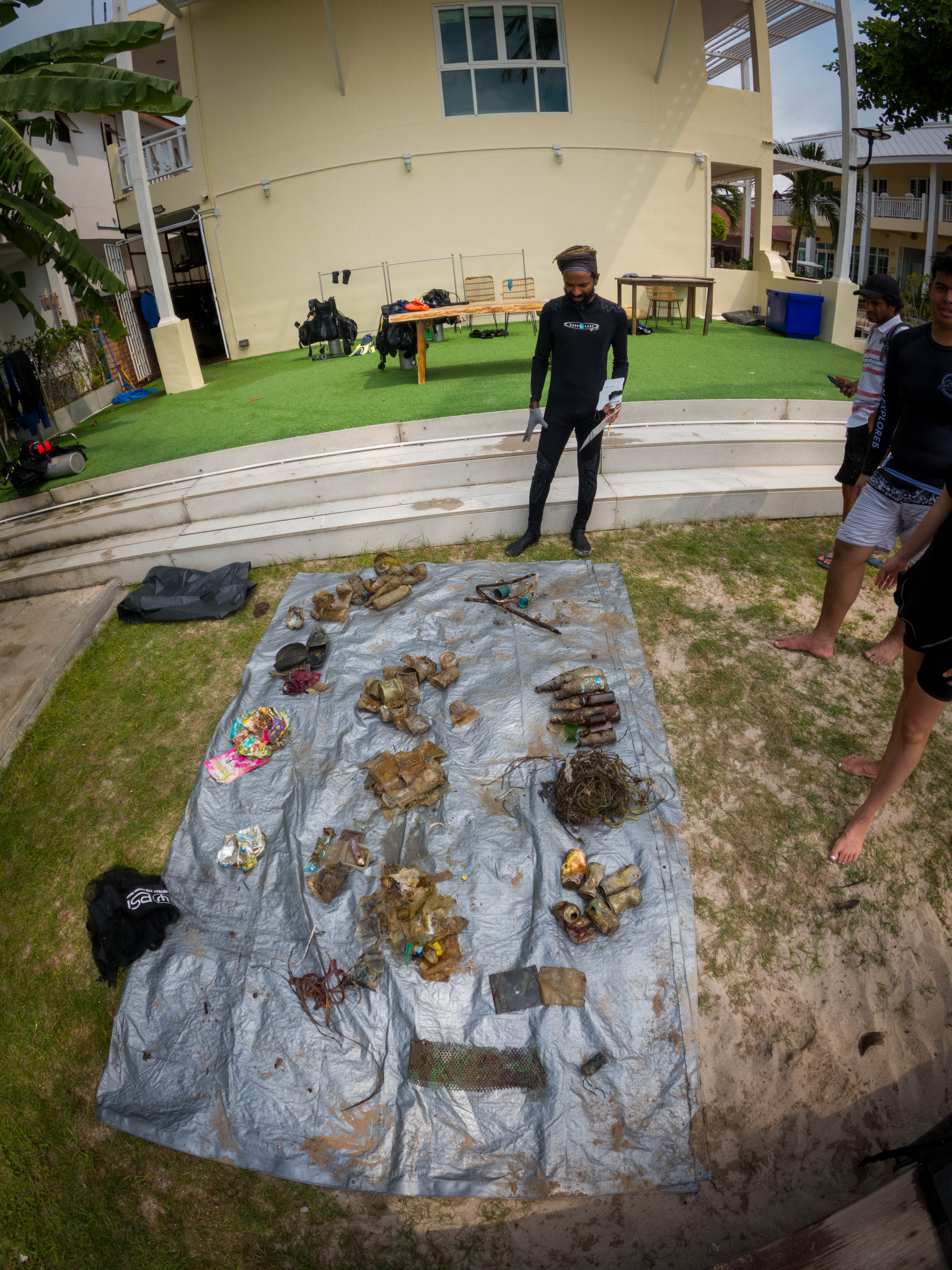
Limpeza planejada e organizada com sucesso.
calcinha
36
1
vela de carro (spark plugs)
vela (candle)
Profissão Mergulho
Diogo Silva
1
14
3
8
1
1
15.00
80
8.00
2.00
10
measured
47
400.00
1
On
kilograms
I have debris data to report
1
Smooth (wavelets) for waves 0.1 - 0.5 meter high
1
m2
meters
rocky reef
3
1
1
1
1
Brazil
State\Province
Rj
City
Rio de Janeiro
Map Help


Dive Location

If you know your survey site coordinates, enter them manually in decimal degrees using WGS84 Map Datum. Use the minus sign for latitudes south of the equator and longitudes west of the Prime Meridian to 180 degrees.

If you do not know your survey site coordinates, click the “Map Location” tab to use the map to zoom into your survey site and drop the pin on the map to fall within your survey dive site in the water (not on land or the beach). Ensure you zoom in as much as possible to ensure data accuracy.
Entangled Help


Use the vertical tabs below to record any entangled animals you found of each type.

BICD Dock area

7
10
2
sand
4

16.096440852519, -86.897017569886

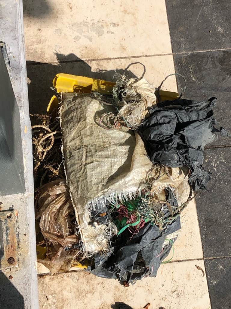
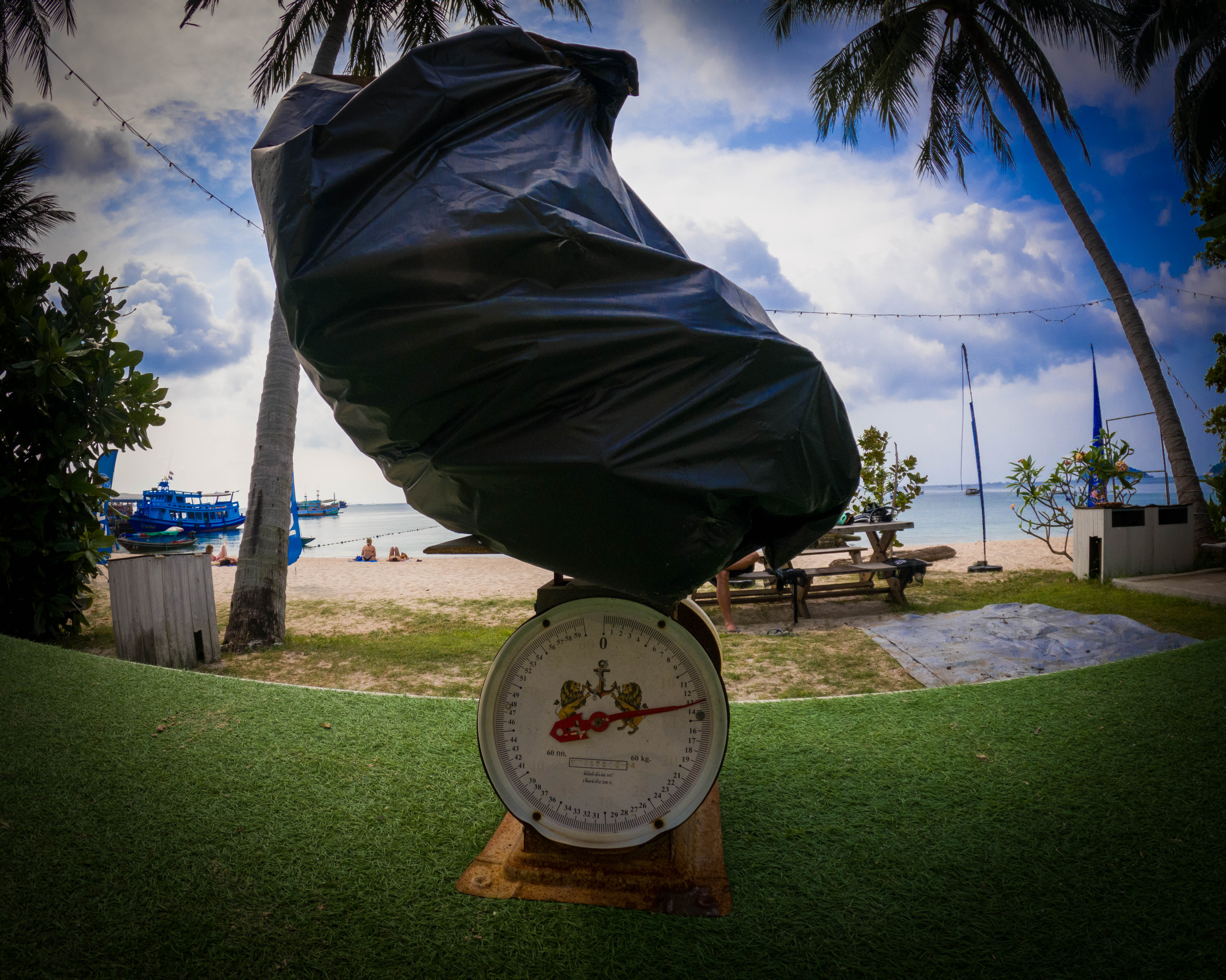
Unfortunately our boat broke down on the way to our usual dive against debris site, and we improvised by cleaning off the dock of our Dive Center.
socks
It has been raining constantly with a bit of windy
3
parts of fiber glass
Bay Islands College of Diving
Renata Bonfa
2
1
6
3
1
1
22.00
29
5.00
2.00
measured
2
50.00
1
plastic fragments
On
pounds
I have debris data to report
3
Smooth (wavelets) for waves 0.1 - 0.5 meter high
fishing lines and pieces of nets
crabs and shrimps
Released Unharmed
4
3
m2
2
meters
seagrass
2
2
1
4
1
Honduras
State\Province
Bay Islands
City
Utila
Map Help


Dive Location

If you know your survey site coordinates, enter them manually in decimal degrees using WGS84 Map Datum. Use the minus sign for latitudes south of the equator and longitudes west of the Prime Meridian to 180 degrees.

If you do not know your survey site coordinates, click the “Map Location” tab to use the map to zoom into your survey site and drop the pin on the map to fall within your survey dive site in the water (not on land or the beach). Ensure you zoom in as much as possible to ensure data accuracy.
Entangled Help


Use the vertical tabs below to record any entangled animals you found of each type.

Poblacion Dauin

0
18
0
0

9.186867, 123.266085

0
0
0
sand
0
0
0
0
0
Weekend
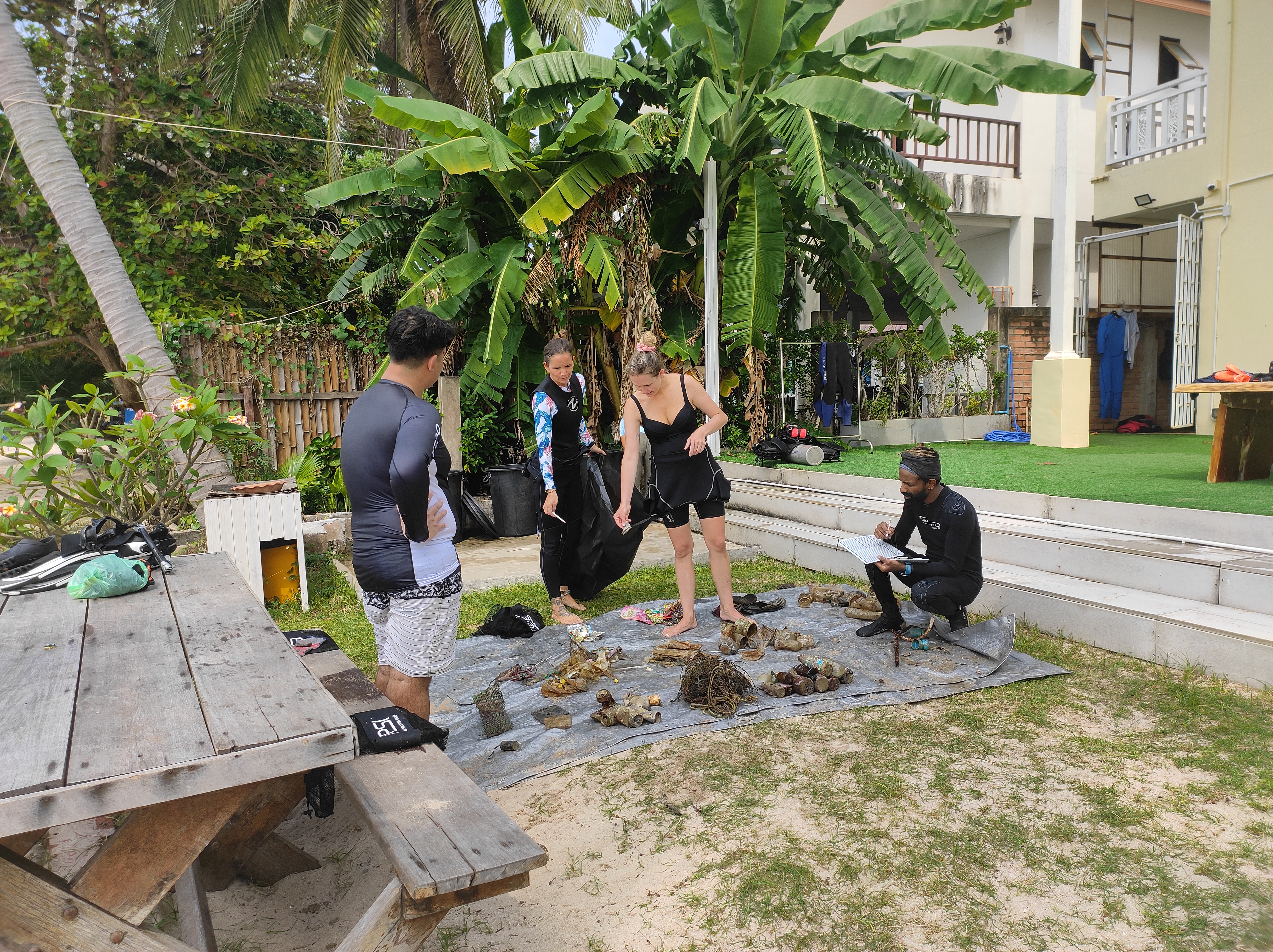
Necklace beads
Rough
1
1
Necklace beads
Facemask
Liquid Dive
Rainier
0
0
0
1
1
0
0
0
0
0
0
0
0
0
0
0
0
1
0
3
0
0
0
0
1
0
0
0
0
0
0
0
0
0
0
0
1.50
40
18.00
2.00
1
estimated
0
0
0
0
1299.40
0
0
0
0
0
0
On
kilograms
0
I have debris data to report
1
0
0
Calm (glassy to rippled) for waves 0 – 0.1 meter high
0
0
0
0
4
1
0
m2
0
3
meters
coral reef
2
0
0
0
0
5
0
0
0
0
1
0
0
0
0
0
4
0
0
0
0
0
5
0
0
0
0
0
0
Philippines
State\Province
Negros Oriental
City
Dauin
Map Help


Dive Location

If you know your survey site coordinates, enter them manually in decimal degrees using WGS84 Map Datum. Use the minus sign for latitudes south of the equator and longitudes west of the Prime Meridian to 180 degrees.

If you do not know your survey site coordinates, click the “Map Location” tab to use the map to zoom into your survey site and drop the pin on the map to fall within your survey dive site in the water (not on land or the beach). Ensure you zoom in as much as possible to ensure data accuracy.
Entangled Help


Use the vertical tabs below to record any entangled animals you found of each type.

Subscribe to