Menu

ADS268 - Dibba Rock

0
0
0

25.602598, 56.351134

0
0
0
coral
0
1
0
0
0
0
0
0
0
0
0
0
0
0
0
0
0
0
0
0
0
0
0
0
0
N/A
Hassan NK Khayal
0
0
0
0
0
0
0
0
0
0
0
0
0
0
0
0
0
0
0
3
0
0
0
0
0
0
0
0
0
0
0
0
0
0
0.10
60
14.00
5.00
0
estimated
0
0
50.00
0
0
0
0
0
0
On
kilograms
0
I have debris data to report
0
0
0
Calm (glassy to rippled) for waves 0 – 0.1 meter high
0
0
0
0
0
0
0
m2
0
0
meters
coral reef
0
0
0
0
0
0
0
0
0
0
0
0
0
0
0
0
0
0
0
0
0
0
0
0
0
0
0
0
United Arab Emirates
Map Help


Dive Location

If you know your survey site coordinates, enter them manually in decimal degrees using WGS84 Map Datum. Use the minus sign for latitudes south of the equator and longitudes west of the Prime Meridian to 180 degrees.

If you do not know your survey site coordinates, click the “Map Location” tab to use the map to zoom into your survey site and drop the pin on the map to fall within your survey dive site in the water (not on land or the beach). Ensure you zoom in as much as possible to ensure data accuracy.

Entangled Help


Use the vertical tabs below to record any entangled animals you found of each type.

ADS127 - Muka Kampung Bunaken Island

19
47
1

1.593708, 124.777075

seagrass
6
4
1
Fibreglass section of boat (around 3m long, 1m wide)
Rainy, thunderstorms
1
1
Fibreglass section of boat
Boat engine
Two Fish
Hannah Gooch
9
3
1
4
8
16
3
8
1
56.00
60
20.00
1.00
measured
70.00
3
6
Section of boat - shouldn't have been left there by owners
Boat engine - shouldn't have been left there
Fishing line - can cause entrapment
On
kilograms
I have debris data to report
13
2
Calm (glassy to rippled) for waves 0 – 0.1 meter high
9
2
2
m2
meters
seagrass
13
6
2
3
2
5
4
21
2
1
3
Indonesia
Map Help


Dive Location

If you know your survey site coordinates, enter them manually in decimal degrees using WGS84 Map Datum. Use the minus sign for latitudes south of the equator and longitudes west of the Prime Meridian to 180 degrees.

If you do not know your survey site coordinates, click the “Map Location” tab to use the map to zoom into your survey site and drop the pin on the map to fall within your survey dive site in the water (not on land or the beach). Ensure you zoom in as much as possible to ensure data accuracy.
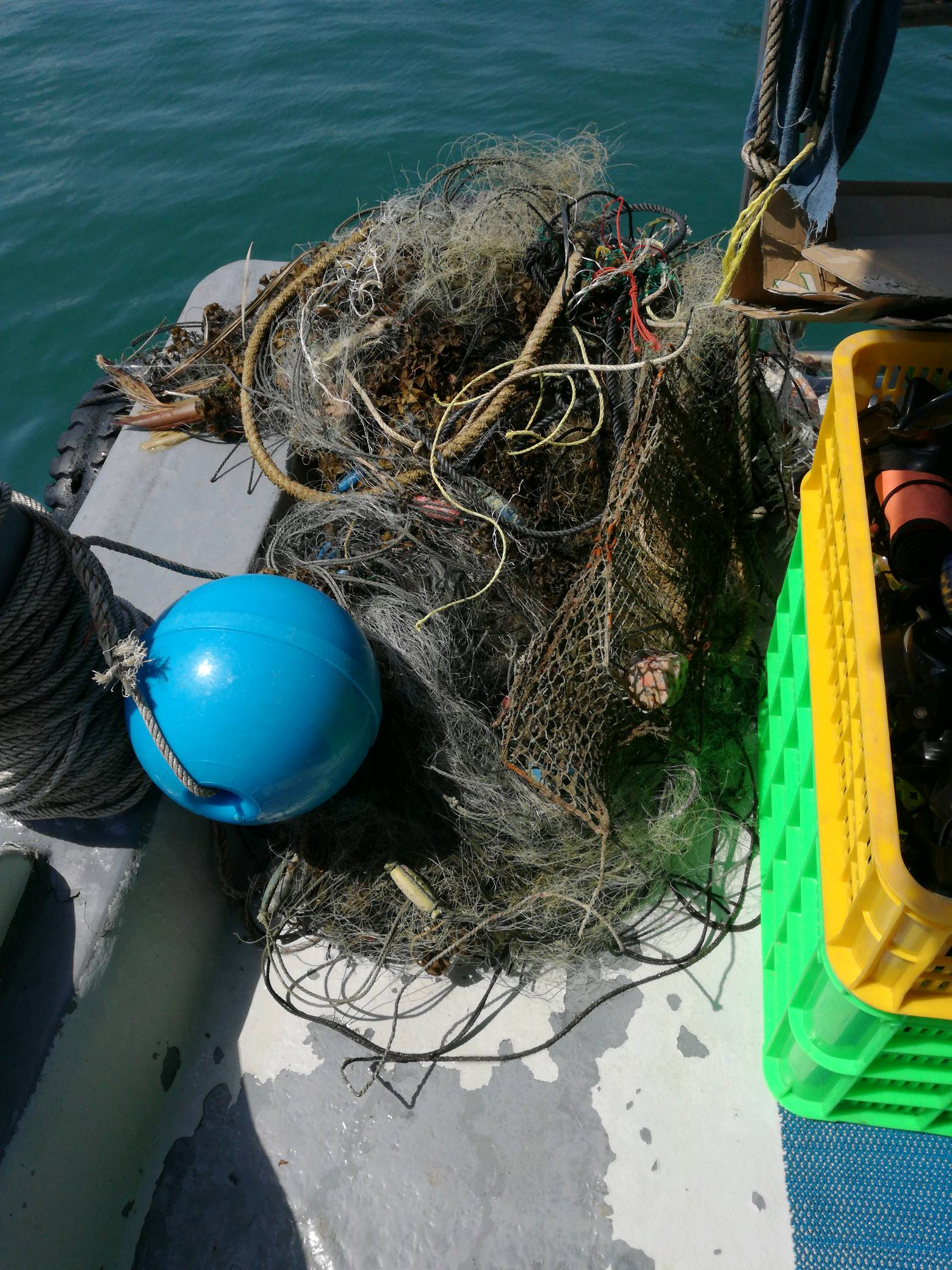
Entangled Help


Use the vertical tabs below to record any entangled animals you found of each type.

ADS324 - Stella Maris Mambo Beach

1
9

12.085003, -68.898663

sand
1
No
Plastic coffee table/x-mas lights
Good
1
1
1
Fake hair, wig
Plastic coffeetable
X-mas lights
Ocean Encounters
Pieter de Groot
164
2
1
10
6
1
6
21
2
36.00
60
3.00
1.00
measured
400.00
13
Plastic cups
Straws
Giant umbrella
8
On
kilograms
I have debris data to report
22
Calm (glassy to rippled) for waves 0 – 0.1 meter high
1
3
m2
1
meters
other
1
3
1
27
1
Netherlands Antilles
City
Willemstad
Map Help


Dive Location

If you know your survey site coordinates, enter them manually in decimal degrees using WGS84 Map Datum. Use the minus sign for latitudes south of the equator and longitudes west of the Prime Meridian to 180 degrees.

If you do not know your survey site coordinates, click the “Map Location” tab to use the map to zoom into your survey site and drop the pin on the map to fall within your survey dive site in the water (not on land or the beach). Ensure you zoom in as much as possible to ensure data accuracy.

Entangled Help


Use the vertical tabs below to record any entangled animals you found of each type.

Ecosystem Other
confined water/connected to ocean

ADS72 - Bajo Tranquilo

12.535518939943, -81.734891608357

sand
El consolidado a Octubre 15 de 2017 es el siguiente:
Total participantes: 650
Total de llantas (sin vida adherida) extraídas: 674
Total animales marinos rescatados con vida: alrededor de 7.000
Total de residuos (en peso aprox.): 15.480 Kg.
Entre los residuos más comunes extraídos, además de las llantas, se tienen: botellas plásticas y de vidrio, latas de cerveza; zapatos y prendas de vestir; tapetes, cortinas y espumas; tubos de PVC de diferente tamaño y diámetro, retazos de tela, cuerdas de amarre y zuncho, así como elementos de aseo tales como escobas, esponjillas y cepillos de dientes.
Lo que una persona en promedio, bota en menos de cinco minutos, los buzos se tardan más o menos 55 minutos en extraerlo del mar; este tiempo es sólo de inmersión pues no se cuenta con el de desplazamiento de los voluntarios al punto de encuentro, reuniones previas de los coordinadores, separación y transporte de residuos, diligenciamiento de planillas, etc.
El área de incidencia total del proyecto es de 180.000 mt2.
Este domingo 15 de octubre se realizó la última acción tendiente a la restauración ecosistémica del sector de ‘Bajo Tranquilo’, actividad ahora respaldada por la Gobernación en 2017.

Con esta, se completaron 32 jornadas similares realizadas por la ONG 'Help 2 Oceans' que en sus inicios comenzó como una iniciativa autofinanciada.

Para ello se realizó una labor especial de extracción en la que participaron 34 voluntarios (incluyendo 13 personas en tierra y en lancha de la Armada Nacional) y 432 kg de residuos sólidos fueron sacados del mar: entre estos, 16 llantas.

A la fecha, de manera preliminar, se tiene un consolidado solo en 'Bajo Tranquilo' (km 10.5 lado oeste de San Andrés) de 308 llantas extraídas y 8.585 kilos de otros desechos.

Con el pasar del tiempo y comparativamente con el inicio de las actividades en el sector en el año 2015, la mejoría en el aspecto es más que notoria; lo que hace de este tradicional sitio –en inmediaciones del barco hundido Blue Diamond– un lugar muy llamativo para el buceo y snorkeling.

Próximamente se estarán presentando los resultados de manera oficial a toda la comunidad y al gobierno local, donde se sumaron esfuerzos no solo institucionales sino también de la empresa privada y por su puesto de la ciudadanía local, nacional y extranjera.
Buenas
HELP 2 OCEANS FOUNDATION
Jorge Dos Oceanos
34
232.00
62
42.00
40.00
estimated
60000.00
16
On
kilograms
I have debris data to report
Calm (glassy to rippled) for waves 0 – 0.1 meter high
Rope
Released Unharmed
Red Eyes
Crabs
Released Unharmed
10
10
Rope
m2
19
feet
coral reef
Colombia
City
San Andres, Isla
Map Help


Dive Location

If you know your survey site coordinates, enter them manually in decimal degrees using WGS84 Map Datum. Use the minus sign for latitudes south of the equator and longitudes west of the Prime Meridian to 180 degrees.

If you do not know your survey site coordinates, click the “Map Location” tab to use the map to zoom into your survey site and drop the pin on the map to fall within your survey dive site in the water (not on land or the beach). Ensure you zoom in as much as possible to ensure data accuracy.

Entangled Help


Use the vertical tabs below to record any entangled animals you found of each type.

The Next Wave Submission 1508600074

User Name
Maurice Grefe
User Email
User Country
AX
Top Issue
cleanocean
Ocean Lover Type
beach visitor

ADS305 - House Reef

6

28.14203, -16.438416

sand
Very little debris in the water today, probably due to the very calm conditions. There is debris on the beach, of which we collected some as well. When the wind picks up again, I expect more debris in the water again.
no unusual items, only plastic and 1 fishing line with hook
Extremely calm, no waves, perfect typical October weather
Tenerife Diving Academy
Kim Timmers
3
7
0.60
36
9.00
1.00
measured
1
2000.00
Plastic
Plastic bottle lids
Fishing line
On
kilograms
I have debris data to report
Calm (glassy to rippled) for waves 0 – 0.1 meter high m2
meters
rocky reef
1
Spain
State\Province
Arico, Tenerife
City
Abades
Map Help


Dive Location

If you know your survey site coordinates, enter them manually in decimal degrees using WGS84 Map Datum. Use the minus sign for latitudes south of the equator and longitudes west of the Prime Meridian to 180 degrees.

If you do not know your survey site coordinates, click the “Map Location” tab to use the map to zoom into your survey site and drop the pin on the map to fall within your survey dive site in the water (not on land or the beach). Ensure you zoom in as much as possible to ensure data accuracy.

Entangled Help


Use the vertical tabs below to record any entangled animals you found of each type.

ADS305 - House Reef

5
12

28.14203, -16.438416

sand
2
Large metal wiring, cannot identify what it was originally
Large ball/chunk of metal wiring, fishing line trapped on it too
Fair, some waves and surge
Tenerife Diving Academy
Kim Timmers
2
1
9
1
5
2
4
1
2.30
29
7.00
2.00
measured
4
1000.00
Metal, large quantity
Fishing line, even though it is a marine protected area
Plastic, always a big problem, especially on and around the beach
On
kilograms
I have debris data to report
Slight for waves 0.5 -1.25 meter high m2
meters
rocky reef
5
1
5
Spain
State\Province
Arico, Tenerife
City
Abades
Map Help


Dive Location

If you know your survey site coordinates, enter them manually in decimal degrees using WGS84 Map Datum. Use the minus sign for latitudes south of the equator and longitudes west of the Prime Meridian to 180 degrees.

If you do not know your survey site coordinates, click the “Map Location” tab to use the map to zoom into your survey site and drop the pin on the map to fall within your survey dive site in the water (not on land or the beach). Ensure you zoom in as much as possible to ensure data accuracy.

Entangled Help


Use the vertical tabs below to record any entangled animals you found of each type.

ADS305 - House Reef

3
8

28.14203, -16.438416

sand
1
1
2
3 small grey shrimp were found in the debris whilst measuring and collecting data, they were immediately taken back to the water and released.
Sock
Very calm, clear ocean, good visibility
Tenerife Diving Academy
Kim Timmers
1
4
8
3
5
1
1.60
32
8.00
2.00
1
measured
2
2000.00
Plastic, lots of of, especially fragments that were probably there for a long time
Fishing lines, even though it is a marine protected area
Bottle lids, there were many more on the beach
On
kilograms
I have debris data to report
1
Smooth (wavelets) for waves 0.1 - 0.5 meter high
Net
3
Released Unharmed
Grey Shrimp
5
m2
2
meters
rocky reef
2
1
1
Spain
State\Province
Arico, Tenerife
City
Abades
Map Help


Dive Location

If you know your survey site coordinates, enter them manually in decimal degrees using WGS84 Map Datum. Use the minus sign for latitudes south of the equator and longitudes west of the Prime Meridian to 180 degrees.

If you do not know your survey site coordinates, click the “Map Location” tab to use the map to zoom into your survey site and drop the pin on the map to fall within your survey dive site in the water (not on land or the beach). Ensure you zoom in as much as possible to ensure data accuracy.

Entangled Help


Use the vertical tabs below to record any entangled animals you found of each type.

Utila Bay Islands

1
sand
3

16.095669738857, -86.903454086932

Tropical Storm Nate has just been through the area, which washed up alot of debris from Neighbouring islands.
I did notice alot more Debris @ the surface on south side of the island vs the North side of the island.
Sunny & Very Humid
Utila Dive Lodge & Just Go Scuba
Steve Camacho
1
23
14
2
4
10
200
10
75.00
45
0.00
0.00
2
estimated
2000.00
1
Houseold Trash thrown out on streets, lack of awareness
On
kilograms
I have debris data to report
20
Calm (glassy to rippled) for waves 0 – 0.1 meter high
15
6
ft2
1
feet
seagrass
50
21
13
10
22
35
12
Honduras
City
Utila
Map Help


Dive Location

If you know your survey site coordinates, enter them manually in decimal degrees using WGS84 Map Datum. Use the minus sign for latitudes south of the equator and longitudes west of the Prime Meridian to 180 degrees.

If you do not know your survey site coordinates, click the “Map Location” tab to use the map to zoom into your survey site and drop the pin on the map to fall within your survey dive site in the water (not on land or the beach). Ensure you zoom in as much as possible to ensure data accuracy.

Entangled Help


Use the vertical tabs below to record any entangled animals you found of each type.

Oakville Dive For Debris & Shore clean up

8
silt
10
8
4

43.439508961043, -79.666280171368

Tourists that walk tjhe shore, are careless , being a boat Harbour lost of boaters are careless with their waste.
Alot of people fish fro the shores, which is wahy we found lots of fishing lures embedded in the rocks.
I found an Ipad 2 in the water
Sunny water was very Calm
Oakville Divers Scuba Shop
Steve Camacho
14
3
1
30
10
1
100.00
120
20.00
10.00
estimated
4000.00
On
kilograms
I have debris data to report
22
6
Calm (glassy to rippled) for waves 0 – 0.1 meter high
6
ft2
3
feet
seagrass
2
3
2
1
5
3
13
Canada
State\Province
Ontario
City
Oakville
Map Help


Dive Location

If you know your survey site coordinates, enter them manually in decimal degrees using WGS84 Map Datum. Use the minus sign for latitudes south of the equator and longitudes west of the Prime Meridian to 180 degrees.

If you do not know your survey site coordinates, click the “Map Location” tab to use the map to zoom into your survey site and drop the pin on the map to fall within your survey dive site in the water (not on land or the beach). Ensure you zoom in as much as possible to ensure data accuracy.

Entangled Help


Use the vertical tabs below to record any entangled animals you found of each type.

Subscribe to