ADS73 - House Reef
5
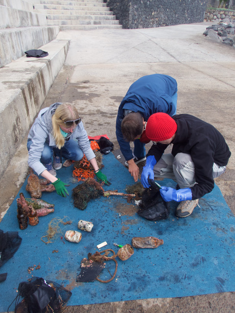
coral
3
2.5180481080208, 103.97505197632
Construction on Jetty, many steel nails lost and free of algae, indicating recent loss.
Wrench/Spanner
Heavy rain this morning, clear all week otherwise.
Orca Scuba
Stephen Lee
1
11
6
7.00
60
6.00
4.00
3
estimated
1
130.00
2
Fishing line, grows over coral is is difficult to remove.
Fishing hooks are dangerous to handle for cleaners
strapping bands from cargo boats
On
kilograms
I have debris data to report
Smooth (wavelets) for waves 0.1 - 0.5 meter high
1
m2

meters
coral reef
31
11
1
3
State\Province
Johor
City
Mersing
Map Help
Dive Location
If you know your survey site coordinates, enter them manually in decimal degrees using WGS84 Map Datum. Use the minus sign for latitudes south of the equator and longitudes west of the Prime Meridian to 180 degrees.
If you do not know your survey site coordinates, click the “Map Location” tab to use the map to zoom into your survey site and drop the pin on the map to fall within your survey dive site in the water (not on land or the beach). Ensure you zoom in as much as possible to ensure data accuracy.
Entangled Help