Whangamata Beach
sand
 New Zealand
-37.216404351777, 175.88333168061
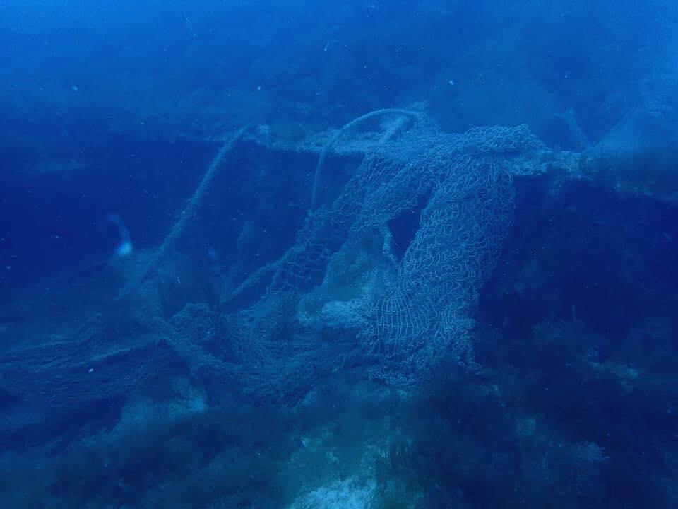
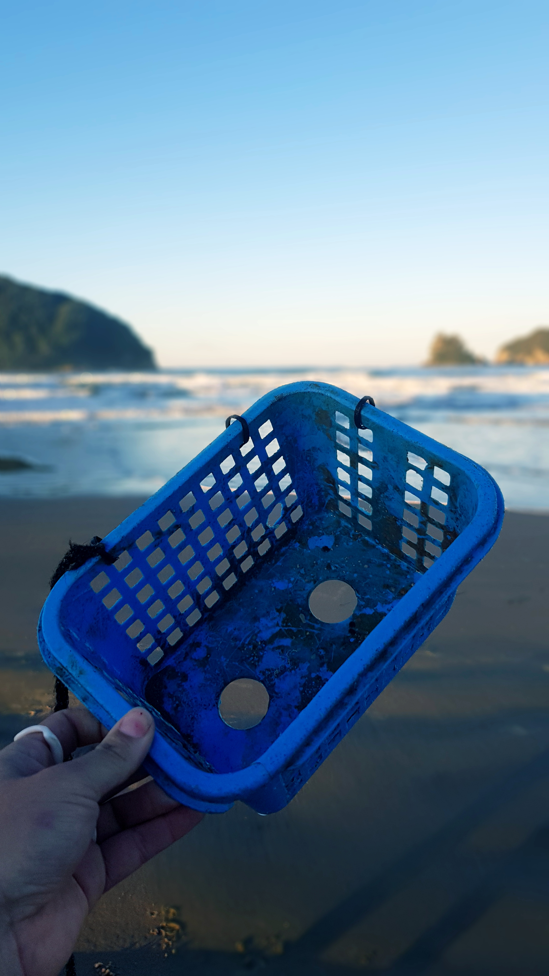
Dive site clean up along Whangamata Beach after high storm warnings. Only found one piece of debris (a plastic basket) washing in with waves.
Wednesday 20th: Wind- SE 35knts
Swell- E 2.0m
Thursday 21st: Wind- SE 35knts
Swell- E 3.0m
Friday 22nd: Wind- S 10knts
Swell- E 0.5m
Swell- E 2.0m
Thursday 21st: Wind- SE 35knts
Swell- E 3.0m
Friday 22nd: Wind- S 10knts
Swell- E 0.5m
Dive Zone Whitianga
Elise Norman
2
0.00
60
10.00
2.00
estimated
200.00
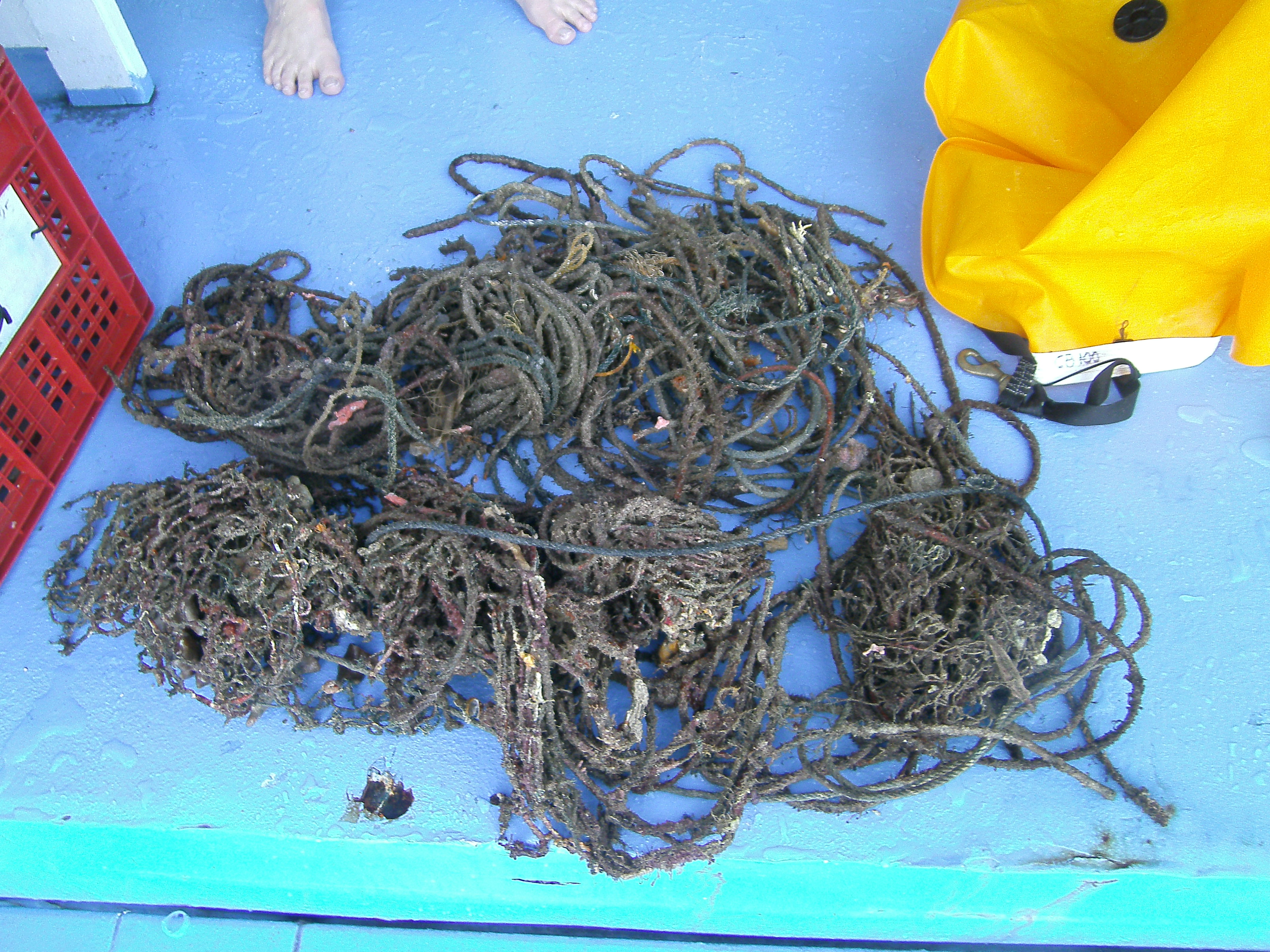
On
kilograms
Our Survey Site was free of debris
Moderate to rough for waves greater than 1.25 meters
m2
meters
other
State\Province
Coromandel
City
Whitianga
Map Help
Dive Location
If you know your survey site coordinates, enter them manually in decimal degrees using WGS84 Map Datum. Use the minus sign for latitudes south of the equator and longitudes west of the Prime Meridian to 180 degrees.
If you do not know your survey site coordinates, click the “Map Location” tab to use the map to zoom into your survey site and drop the pin on the map to fall within your survey dive site in the water (not on land or the beach). Ensure you zoom in as much as possible to ensure data accuracy.
Entangled Help
Use the vertical tabs below to record any entangled animals you found of each type.
Ecosystem Other
Sand - Beach