Menu

Mango Bay Wall

46
8
14

10.122599708134, 99.832808304738

coral
12
6
8
4

10.122599708134, 99.832808304738

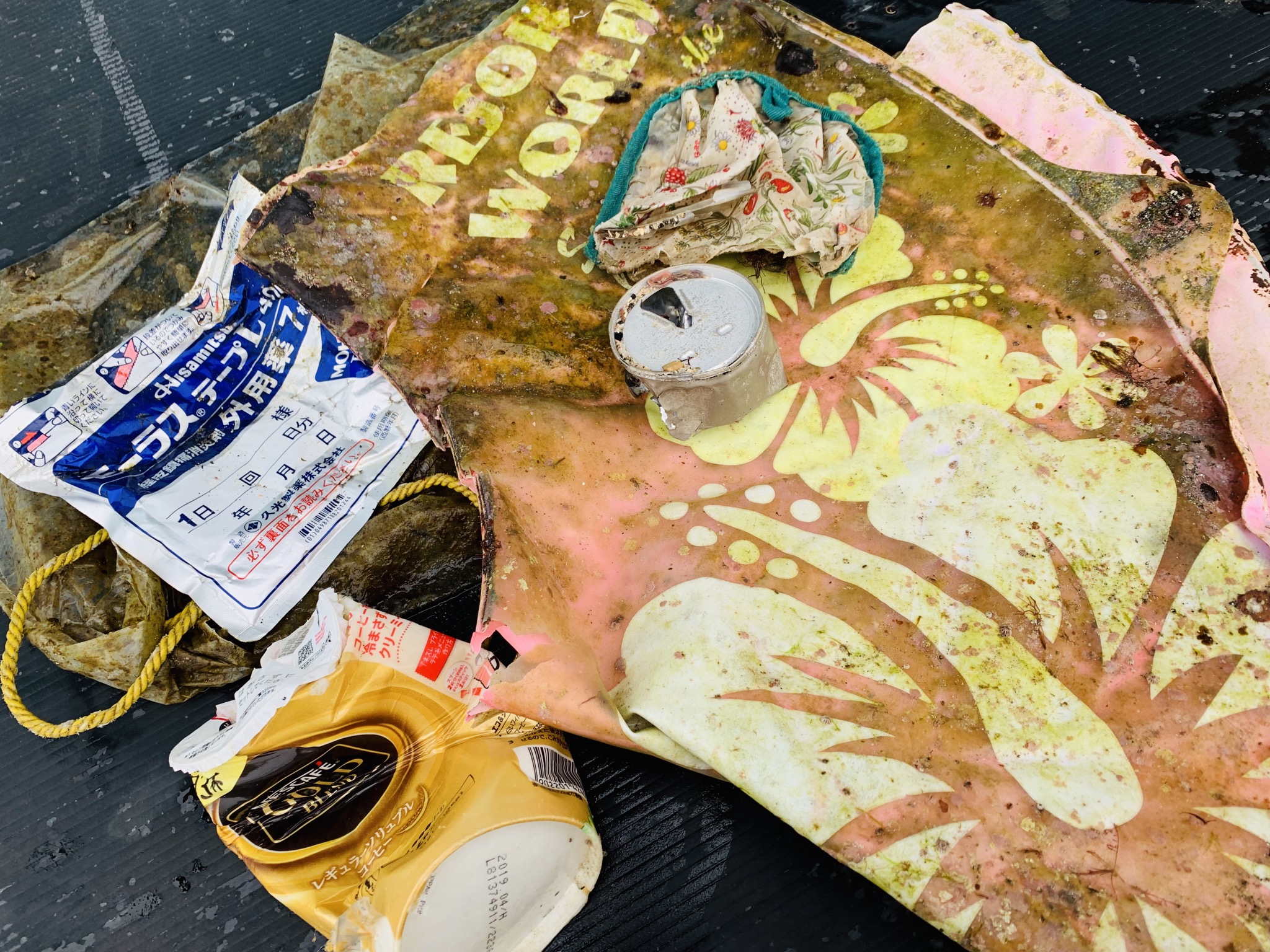
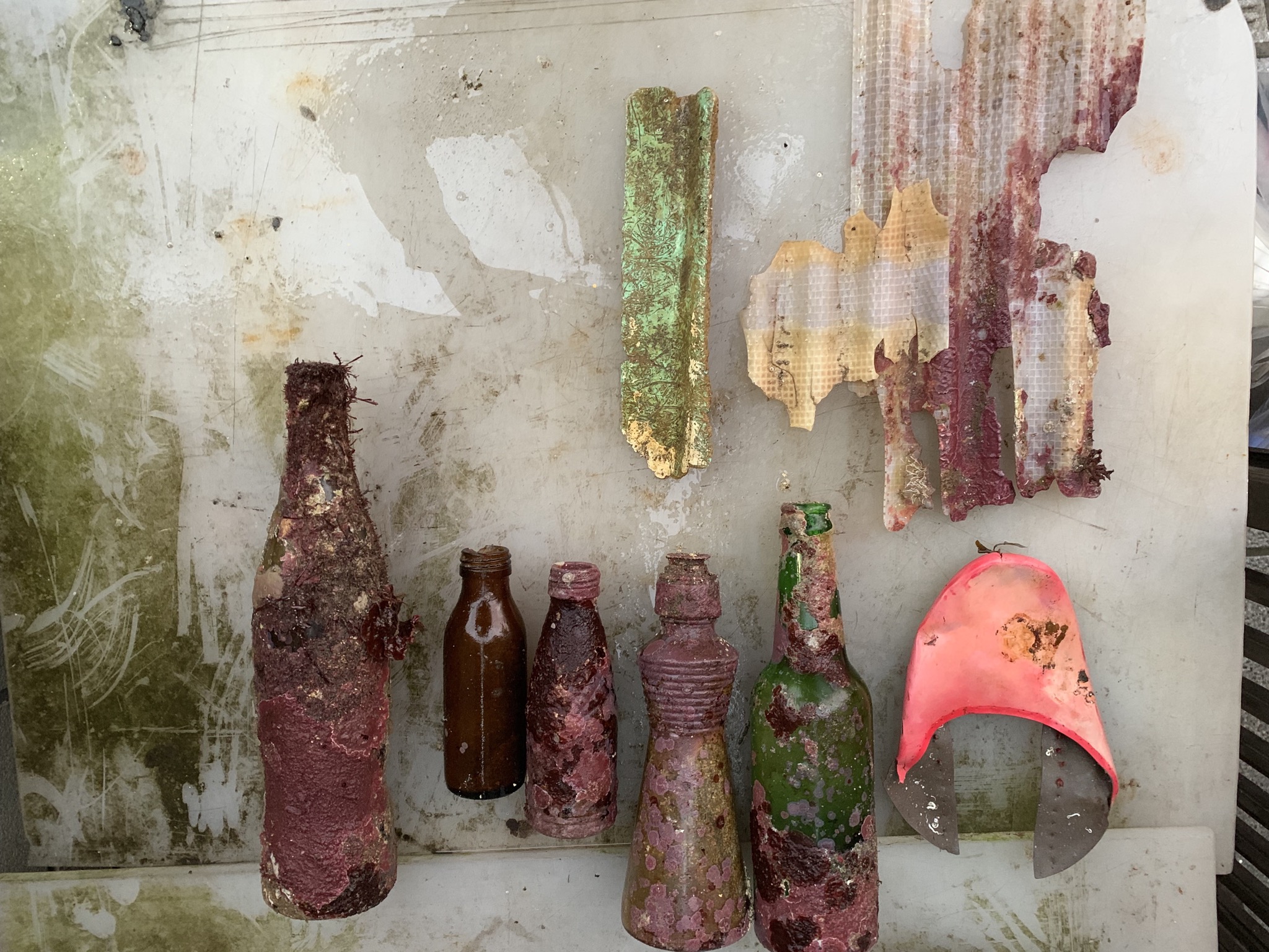
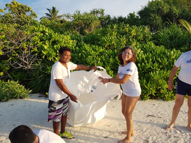
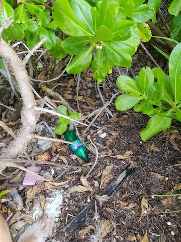
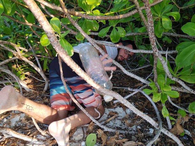
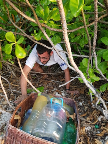
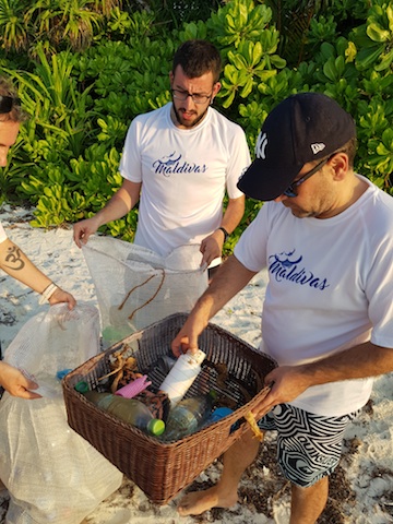
Current breaks on the North side of Koh Tao often leave Northerly and Westerly dive site bays with regular build ups of trash, both on the surface and underwater.
3/4 of a longtail engine!
Calm, Warm, Clear
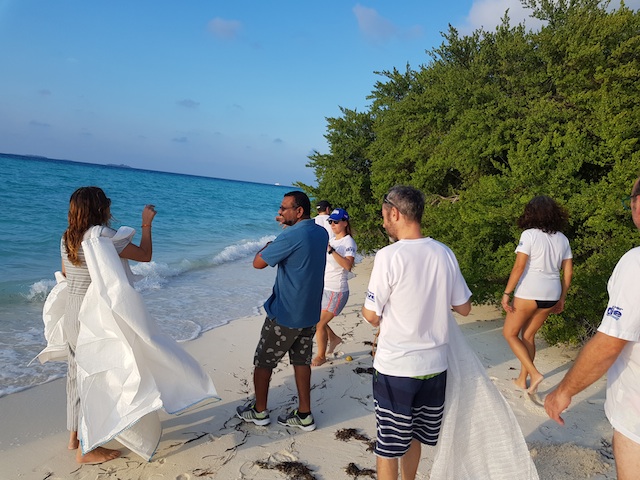
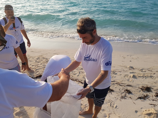
Sairee Cottage Diving
Felix
2
1
35
27
3
2
47
1
25
12
1
3
8
1
5
500.00
40
14.00
6.00
estimated
100.00
2
15
plastics mainly cigarettes, difficult to get them all
metal, sharp objects and heavy objects
glass, didn't want to disturb marine life
On
kilograms
I have debris data to report
15
Calm (glassy to rippled) for waves 0 – 0.1 meter high
9
16
6
m2
meters
coral reef
17
1
28
1
6
3
2
3
5
23
Thailand
State\Province
Surat Thani
City
Koh Tao
Map Help


Dive Location

If you know your survey site coordinates, enter them manually in decimal degrees using WGS84 Map Datum. Use the minus sign for latitudes south of the equator and longitudes west of the Prime Meridian to 180 degrees.

If you do not know your survey site coordinates, click the “Map Location” tab to use the map to zoom into your survey site and drop the pin on the map to fall within your survey dive site in the water (not on land or the beach). Ensure you zoom in as much as possible to ensure data accuracy.

Entangled Help


Use the vertical tabs below to record any entangled animals you found of each type.

ADS200 - House Reef Spa

10
12

4.097169, 73.402089

coral
5
Best Dives vittaveli
Laushan
8
1
3
3
1
4.00
45
18.00
5.00
2
estimated
1854.60
On
kilograms
I have debris data to report
Calm (glassy to rippled) for waves 0 – 0.1 meter high
2
0
5
m2
meters
coral reef
1
4
Maldives
State\Province
bolifushi
City
male'
Map Help


Dive Location

If you know your survey site coordinates, enter them manually in decimal degrees using WGS84 Map Datum. Use the minus sign for latitudes south of the equator and longitudes west of the Prime Meridian to 180 degrees.

If you do not know your survey site coordinates, click the “Map Location” tab to use the map to zoom into your survey site and drop the pin on the map to fall within your survey dive site in the water (not on land or the beach). Ensure you zoom in as much as possible to ensure data accuracy.

Entangled Help


Use the vertical tabs below to record any entangled animals you found of each type.

ADS352 - Meno Slope

10
5
0
0

-8.35026, 116.0511

0
0
0
coral
0
0
0
0
0
Windy
1
1
Shampoo wrapper
Laundry liquid wrapper
Gili Shark Conservation
Bratton
0
0
0
0
0
0
0
0
0
0
0
0
0
0
0
0
0
0
0
6
0
0
0
0
0
0
2
0
0
0
0
0
0
0
0
0
0.30
47
24.00
11.00
0
estimated
0
0
0
0
6840.00
0
0
0
0
0
Food wrapper
0
On
kilograms
0
I have debris data to report
0
0
0
Slight for waves 0.5 -1.25 meter high
0
0
0
0
0
0
0
m2
0
0
meters
coral reef
0
0
0
0
0
0
0
0
0
0
0
0
0
1
0
0
0
0
0
0
0
0
0
0
0
0
0
0
0
Indonesia
State\Province
West Nusa Tenggara
City
Gili Air
Map Help


Dive Location

If you know your survey site coordinates, enter them manually in decimal degrees using WGS84 Map Datum. Use the minus sign for latitudes south of the equator and longitudes west of the Prime Meridian to 180 degrees.

If you do not know your survey site coordinates, click the “Map Location” tab to use the map to zoom into your survey site and drop the pin on the map to fall within your survey dive site in the water (not on land or the beach). Ensure you zoom in as much as possible to ensure data accuracy.

Entangled Help


Use the vertical tabs below to record any entangled animals you found of each type.

ADS234 - Seaventures House Reef

2
5

4.253718, 118.633482

rock
Calm
Seaventures Dive Rig
Dan Buxton
1
1
1
3
5
1
2.00
45
16.00
13.00
estimated
2148.00
1
1
On
kilograms
Our Survey Site was free of debris
Calm (glassy to rippled) for waves 0 – 0.1 meter high m2
meters
rocky reef
1
Malaysia
City
Mabul
Map Help


Dive Location

If you know your survey site coordinates, enter them manually in decimal degrees using WGS84 Map Datum. Use the minus sign for latitudes south of the equator and longitudes west of the Prime Meridian to 180 degrees.

If you do not know your survey site coordinates, click the “Map Location” tab to use the map to zoom into your survey site and drop the pin on the map to fall within your survey dive site in the water (not on land or the beach). Ensure you zoom in as much as possible to ensure data accuracy.

Entangled Help


Use the vertical tabs below to record any entangled animals you found of each type.

ADS455 - House Reef Toberua

0
0
0
0

-17.975254, 178.703459

0
0
0
sand
0
0
0
0
0
No
Plastic bottle
Toberua Divers
Everette Ingram
0
0
0
0
0
0
0
0
0
0
0
0
0
0
0
0
0
0
0
3
0
0
0
0
0
0
1
0
0
0
0
0
0
0
0
0
4.00
70
16.00
3.00
0
estimated
0
0
0
0
533.00
0
0
0
0
0
Beer bottles
Building rubbish
Plastic
0
On
kilograms
0
I have debris data to report
7
0
0
Calm (glassy to rippled) for waves 0 – 0.1 meter high
0
0
0
0
0
0
0
m2
0
0
meters
coral reef
0
0
0
0
0
0
0
0
0
0
0
0
0
0
0
0
1
1
0
0
0
0
0
0
0
0
0
0
0
Fiji
City
Toberua Island
Map Help


Dive Location

If you know your survey site coordinates, enter them manually in decimal degrees using WGS84 Map Datum. Use the minus sign for latitudes south of the equator and longitudes west of the Prime Meridian to 180 degrees.

If you do not know your survey site coordinates, click the “Map Location” tab to use the map to zoom into your survey site and drop the pin on the map to fall within your survey dive site in the water (not on land or the beach). Ensure you zoom in as much as possible to ensure data accuracy.

Entangled Help


Use the vertical tabs below to record any entangled animals you found of each type.

ADS92 - Grand Anse Beach

47
51
1

12.027003431986, -61.764083849623

0
0
0
sand
1
6
0
3
5
No
Asked that we limit glass bottle collection for weight as many were snorkeling
Calm
0
0
0
0
0
0
0
0
0
0
0
0
0
0
0
0
0
0
0
0
Eco Dive
Christine
0
0
0
23
2
0
0
0
2
0
9
0
1
0
1
0
0
5
0
12
0
0
1
0
2
1
2
0
1
0
0
0
0
0
138.89
65
4.00
1.00
3
measured
0
2
3657.27
0
0
0
0
0
Plastics
Food wrappers
0
On
pounds
0
I have debris data to report
7
0
0
Smooth (wavelets) for waves 0.1 - 0.5 meter high
0
0
2
0
4
0
0
m2
2
7
meters
seagrass
0
0
0
0
0
18
0
2
0
4
0
0
0
0
0
5
2
1
0
1
0
4
0
0
0
1
2
0
Grenada
State\Province
St. George’s
City
Grand Anse
Map Help


Dive Location

If you know your survey site coordinates, enter them manually in decimal degrees using WGS84 Map Datum. Use the minus sign for latitudes south of the equator and longitudes west of the Prime Meridian to 180 degrees.

If you do not know your survey site coordinates, click the “Map Location” tab to use the map to zoom into your survey site and drop the pin on the map to fall within your survey dive site in the water (not on land or the beach). Ensure you zoom in as much as possible to ensure data accuracy.

Entangled Help


Use the vertical tabs below to record any entangled animals you found of each type.

Ngor Bay dive against debris

1
sand

14.750356065787, -17.51224837697

Less debris this time in the bay
Part of plastic chair
A lot of wind and waves
Nautilus Diving Dakar
Hilda Hausard
2
2
3
1
8
15
25
36
3
4
150.00
55
4.00
1.50
estimated
100.00
Aluminium cans
Platic bottles
On
kilograms
I have debris data to report
3
Moderate to rough for waves greater than 1.25 meters
6
4
m2
meters
other
6
27
4
Senegal
City
Dakar
Map Help


Dive Location

If you know your survey site coordinates, enter them manually in decimal degrees using WGS84 Map Datum. Use the minus sign for latitudes south of the equator and longitudes west of the Prime Meridian to 180 degrees.

If you do not know your survey site coordinates, click the “Map Location” tab to use the map to zoom into your survey site and drop the pin on the map to fall within your survey dive site in the water (not on land or the beach). Ensure you zoom in as much as possible to ensure data accuracy.

Entangled Help


Use the vertical tabs below to record any entangled animals you found of each type.

Ecosystem Other
sand

HASAMA JAPAN

1

34.9729, 139.7884

sand
OCEAN DREAM
JUNKO NAKAO
2
2
1.00
20
7.00
2.00
estimated
60.00
On
kilograms
I have debris data to report
Calm (glassy to rippled) for waves 0 – 0.1 meter high
1
m2
meters
rocky reef
1
Japan
City
CHIBA
Map Help


Dive Location

If you know your survey site coordinates, enter them manually in decimal degrees using WGS84 Map Datum. Use the minus sign for latitudes south of the equator and longitudes west of the Prime Meridian to 180 degrees.

If you do not know your survey site coordinates, click the “Map Location” tab to use the map to zoom into your survey site and drop the pin on the map to fall within your survey dive site in the water (not on land or the beach). Ensure you zoom in as much as possible to ensure data accuracy.

Entangled Help


Use the vertical tabs below to record any entangled animals you found of each type.

KATSUURA JAPAN

1

35.1355, 140.2791

sand

35.152834867177, 140.32373299291

OCEAN DREAM
JUNKO NAKAO
4
3.00
20
8.00
2.00
estimated
1
60.00
On
kilograms
I have debris data to report
5
Smooth (wavelets) for waves 0.1 - 0.5 meter high
1
m2
meters
rocky reef
Japan
City
CHIBA
Map Help


Dive Location

If you know your survey site coordinates, enter them manually in decimal degrees using WGS84 Map Datum. Use the minus sign for latitudes south of the equator and longitudes west of the Prime Meridian to 180 degrees.

If you do not know your survey site coordinates, click the “Map Location” tab to use the map to zoom into your survey site and drop the pin on the map to fall within your survey dive site in the water (not on land or the beach). Ensure you zoom in as much as possible to ensure data accuracy.

Entangled Help


Use the vertical tabs below to record any entangled animals you found of each type.

Cleaning beach in Maldives dessert island no PLASTIC is FANTASTIC

45
sand
23

-0.69711743417221, 73.14386994474

Cleaning beach in a dessert island in Maldives ( island call Digurah ) in colaboration with Parley Maldives with Chiqui BUstos
SuperDive Tossa de Mar with Parley Maldives
Chiqui Bustos
2
22
19
65
23
3
34
60.00
45
0.00
0.00
estimated
120.00
On
kilograms
I have debris data to report
Calm (glassy to rippled) for waves 0 – 0.1 meter high m2
meters
other
Spain
Map Help


Dive Location

If you know your survey site coordinates, enter them manually in decimal degrees using WGS84 Map Datum. Use the minus sign for latitudes south of the equator and longitudes west of the Prime Meridian to 180 degrees.

If you do not know your survey site coordinates, click the “Map Location” tab to use the map to zoom into your survey site and drop the pin on the map to fall within your survey dive site in the water (not on land or the beach). Ensure you zoom in as much as possible to ensure data accuracy.

Entangled Help


Use the vertical tabs below to record any entangled animals you found of each type.

Ecosystem Other
beach
Subscribe to