Menu

Pinnacles

0
0
0
0

-26.8425701, 32.8859574

0
0
0
coral
0
0
0
0
0
Lake opened up in to the ocean north of the dive site
Plastic bottles on the surface
Windy
Blowing Bubbles Diving
Josh
0
0
0
0
0
0
0
0
0
0
0
0
0
0
0
0
0
0
0
4
0
0
0
0
0
0
0
0
0
0
0
0
0
0
0
0
0.00
60
30.00
10.00
0
estimated
0
0
0
0
-1.00
0
0
0
0
0
Fishing line
Plastic
Fishing net
0
On
pounds
0
Our Survey Site was free of debris
0
0
0
Moderate to rough for waves greater than 1.25 meters
0
0
0
0
0
0
0
m2
0
0
meters
coral reef
0
0
0
0
0
0
0
0
0
0
0
0
0
0
0
0
0
0
0
0
0
0
0
0
0
0
0
0
0
Mozambique
State\Province
Matutuine
City
Maputo
Map Help


Dive Location

If you know your survey site coordinates, enter them manually in decimal degrees using WGS84 Map Datum. Use the minus sign for latitudes south of the equator and longitudes west of the Prime Meridian to 180 degrees.

If you do not know your survey site coordinates, click the “Map Location” tab to use the map to zoom into your survey site and drop the pin on the map to fall within your survey dive site in the water (not on land or the beach). Ensure you zoom in as much as possible to ensure data accuracy.

Entangled Help


Use the vertical tabs below to record any entangled animals you found of each type.

ADS 126 - Chilpo Beach Northern Rocky Outcrop

13
262
1

36.136089, 129.398324

2
7
sand
11
2
6
Full video of the dive here: https://youtu.be/4UauKjdXkdI
No specific event, but since the last survey several typhoons have been around the country, and the summer vacation season is over, which is when I typically find large amounts like this.
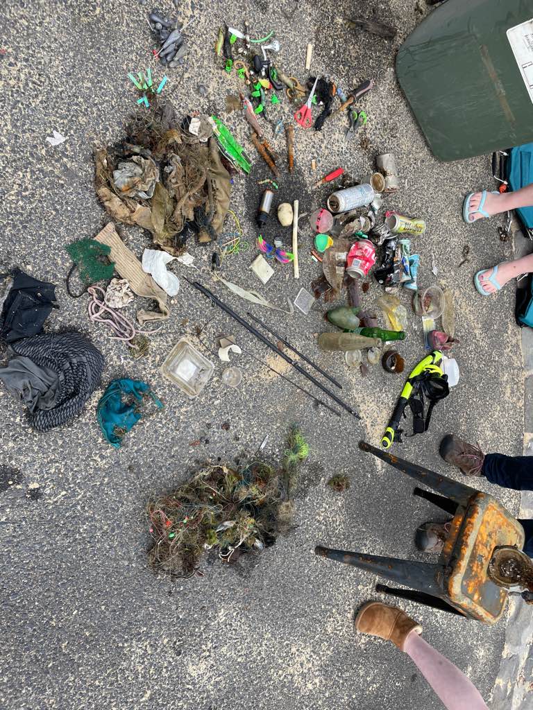
scuba mask (cleaned it and will use/give to someone else)
Clear
Dive Against Debris Korea (Daegu)
William Henderson
1
3
1
1
3
0
3
2
0
2
5
15.00
64
4.00
1.00
10
estimated
1
1
1
110.00
7
6
plastic gloves
cloth gloves
On
kilograms
I have debris data to report
1
Smooth (wavelets) for waves 0.1 - 0.5 meter high
3
2
21
14
3
m2
3
meters
rocky reef
9
1
1
4
4
18
South Korea
State\Province
Gyeongbukdo
City
Pohang
Map Help


Dive Location

If you know your survey site coordinates, enter them manually in decimal degrees using WGS84 Map Datum. Use the minus sign for latitudes south of the equator and longitudes west of the Prime Meridian to 180 degrees.

If you do not know your survey site coordinates, click the “Map Location” tab to use the map to zoom into your survey site and drop the pin on the map to fall within your survey dive site in the water (not on land or the beach). Ensure you zoom in as much as possible to ensure data accuracy.
Entangled Help


Use the vertical tabs below to record any entangled animals you found of each type.

Aquarium

0
0
0
0

-4.603497, 55.44208

0
0
0
sand
0
0
0
0
0
Mixed Heavy Rain most days
GVI Seychelles
Sam Cookson
0
0
0
0
0
0
0
0
0
0
0
0
0
0
0
0
0
0
0
5
0
0
0
0
0
0
0
0
0
0
0
0
0
0
0
0
0.00
44
13.20
10.60
0
estimated
0
0
0
0
20.00
0
0
0
0
0
0
On
pounds
0
Our Survey Site was free of debris
0
0
0
Smooth (wavelets) for waves 0.1 - 0.5 meter high
0
0
0
0
0
0
0
m2
0
0
meters
coral reef
0
0
0
0
0
0
0
0
0
0
0
0
0
0
0
0
0
0
0
0
0
0
0
0
0
0
0
0
0
Seychelles
State\Province
Mahe
City
Mahe
Map Help


Dive Location

If you know your survey site coordinates, enter them manually in decimal degrees using WGS84 Map Datum. Use the minus sign for latitudes south of the equator and longitudes west of the Prime Meridian to 180 degrees.

If you do not know your survey site coordinates, click the “Map Location” tab to use the map to zoom into your survey site and drop the pin on the map to fall within your survey dive site in the water (not on land or the beach). Ensure you zoom in as much as possible to ensure data accuracy.

Entangled Help


Use the vertical tabs below to record any entangled animals you found of each type.

Light House, Koh Tao

6
1
coral
10

10.120838381933, 99.843441789921

Beard trimmer, mobile phone
Occasional heavy rain, with a westerly wind.
14
Paint fragments
Black Turtle Dive
Darern Sutton
1
4
1
25
1
1
4.20
45
17.00
11.00
7
measured
8382.00
2
On
kilograms
I have debris data to report
5
Calm (glassy to rippled) for waves 0 – 0.1 meter high m2
7
meters
coral reef
2
2
2
4
Thailand
Map Help


Dive Location

If you know your survey site coordinates, enter them manually in decimal degrees using WGS84 Map Datum. Use the minus sign for latitudes south of the equator and longitudes west of the Prime Meridian to 180 degrees.

If you do not know your survey site coordinates, click the “Map Location” tab to use the map to zoom into your survey site and drop the pin on the map to fall within your survey dive site in the water (not on land or the beach). Ensure you zoom in as much as possible to ensure data accuracy.

Entangled Help


Use the vertical tabs below to record any entangled animals you found of each type.

North Beach

0
0
0
0

21.456986155937, -157.74035507375

0
0
0
rock
0
0
0
5
0
No
No
No
Surfboard
Sun and rain
James Delecki
0
0
0
0
0
0
0
0
4
0
0
0
0
0
0
0
0
0
0
1
0
0
0
0
0
0
0
0
1
0
0
0
33
0
0
0
12.00
65
35.00
15.00
1
measured
0
5
9473.77
0
0
0
0
0
Fishing line
Golf balls
0
On
pounds
0
I have debris data to report
0
0
0
Smooth (wavelets) for waves 0.1 - 0.5 meter high
0
0
0
0
0
0
0
m2
0
0
feet
rocky reef
0
0
0
0
0
0
0
0
0
0
0
0
0
0
0
0
0
1
0
0
0
0
0
0
0
0
0
0
0
United States
State\Province
Hawaii
City
Kailua
Map Help


Dive Location

If you know your survey site coordinates, enter them manually in decimal degrees using WGS84 Map Datum. Use the minus sign for latitudes south of the equator and longitudes west of the Prime Meridian to 180 degrees.

If you do not know your survey site coordinates, click the “Map Location” tab to use the map to zoom into your survey site and drop the pin on the map to fall within your survey dive site in the water (not on land or the beach). Ensure you zoom in as much as possible to ensure data accuracy.

Entangled Help


Use the vertical tabs below to record any entangled animals you found of each type.

Aow Mao Bay

0
1
0
2

10.084743, 99.8248849

0
0
0
coral
1
2
0
1
0
Maybe current or boats in the area
Painted wood
Windy
DJL Diving #36338
Marina Arias
0
0
0
0
0
0
0
0
0
0
0
0
0
0
0
0
0
1
0
4
0
0
0
0
0
0
0
0
0
0
0
0
0
0
0
0
1.00
51
14.00
9.00
2
estimated
0
0
0
0
7149.34
0
0
0
0
0
Plastics
Wood
0
On
kilograms
0
I have debris data to report
0
0
0
Smooth (wavelets) for waves 0.1 - 0.5 meter high
1
0
0
0
0
0
0
m2
0
0
meters
coral reef
0
0
0
0
0
0
0
0
0
0
0
0
0
0
0
0
0
0
0
0
0
0
0
0
0
0
0
0
0
Thailand
State\Province
Surat Thani
City
Koh Tao
Map Help


Dive Location

If you know your survey site coordinates, enter them manually in decimal degrees using WGS84 Map Datum. Use the minus sign for latitudes south of the equator and longitudes west of the Prime Meridian to 180 degrees.

If you do not know your survey site coordinates, click the “Map Location” tab to use the map to zoom into your survey site and drop the pin on the map to fall within your survey dive site in the water (not on land or the beach). Ensure you zoom in as much as possible to ensure data accuracy.

Entangled Help


Use the vertical tabs below to record any entangled animals you found of each type.

Jemeluk beach

2
3
2
0

-8.3382742, 115.6601428

2
3
0
coral
1
2
0
20
2
Dive against debris at eco dive
Clothes
Sunny
ÉCO DIVE
Marjolaine voignier
0
1
0
0
1
0
0
0
0
0
2
0
1
0
0
0
0
1
0
5
0
0
0
0
5
0
0
0
0
0
0
0
0
0
0
0
5.00
65
18.00
3.00
2
estimated
0
0
12704.10
0
0
0
2
0
Fishing lines
Clothes
0
On
kilograms
0
I have debris data to report
0
0
0
Calm (glassy to rippled) for waves 0 – 0.1 meter high
0
0
0
0
20
0
0
m2
3
0
meters
coral reef
0
0
0
0
0
0
0
0
0
0
0
0
1
0
0
0
0
0
0
0
0
0
2
0
0
0
0
0
0
Indonesia
State\Province
Bali
City
Amed
Map Help


Dive Location

If you know your survey site coordinates, enter them manually in decimal degrees using WGS84 Map Datum. Use the minus sign for latitudes south of the equator and longitudes west of the Prime Meridian to 180 degrees.

If you do not know your survey site coordinates, click the “Map Location” tab to use the map to zoom into your survey site and drop the pin on the map to fall within your survey dive site in the water (not on land or the beach). Ensure you zoom in as much as possible to ensure data accuracy.

Entangled Help


Use the vertical tabs below to record any entangled animals you found of each type.

川奈ビーチ

0
0
0
0

34.954223624445, 139.13522133314

0
0
0
rock
0
0
0
0
2
はい。
船の一部の様なプレート
晴れ
川奈ダイビングサービス
岡井 詩子
0
0
0
0
0
0
0
0
0
0
0
0
0
0
0
0
0
0
0
2
0
0
0
0
0
0
0
0
0
0
0
0
0
0
0
0
2.50
80
15.00
2.00
0
measured
0
0
11204.10
0
0
0
0
0
エントリー口のすぐ横
0
On
kilograms
0
I have debris data to report
0
0
0
Slight for waves 0.5 -1.25 meter high
1
0
0
0
0
0
0
m2
0
0
meters
coral reef
0
0
0
1
0
0
0
0
0
0
0
0
0
0
0
0
1
0
0
0
0
0
0
0
0
0
0
0
0
Japan
State\Province
静岡
City
伊東市川奈
Map Help


Dive Location

If you know your survey site coordinates, enter them manually in decimal degrees using WGS84 Map Datum. Use the minus sign for latitudes south of the equator and longitudes west of the Prime Meridian to 180 degrees.

If you do not know your survey site coordinates, click the “Map Location” tab to use the map to zoom into your survey site and drop the pin on the map to fall within your survey dive site in the water (not on land or the beach). Ensure you zoom in as much as possible to ensure data accuracy.

Entangled Help


Use the vertical tabs below to record any entangled animals you found of each type.

龍洞四號

4

25.112851176002, 121.91946548466

rock
3

25.112851176002, 121.91946548466

施工用塑膠護欄碎片
陰雨
Oceanfun Diving shop
李佶軒
2
10
6
1
8
8.00
50
15.00
5.00
1
estimated
1250.00
On
kilograms
I have debris data to report
5
Slight for waves 0.5 -1.25 meter high m2
meters
rocky reef
3
10
Taiwan
City
Taichung
Map Help


Dive Location

If you know your survey site coordinates, enter them manually in decimal degrees using WGS84 Map Datum. Use the minus sign for latitudes south of the equator and longitudes west of the Prime Meridian to 180 degrees.

If you do not know your survey site coordinates, click the “Map Location” tab to use the map to zoom into your survey site and drop the pin on the map to fall within your survey dive site in the water (not on land or the beach). Ensure you zoom in as much as possible to ensure data accuracy.

Entangled Help


Use the vertical tabs below to record any entangled animals you found of each type.

Scuba Republic House Reef

4

-0.4424672342396, 130.75381825366

coral
Toilet hose
Sunny and a bit windy
Indo Ocean Project
Matilda
4
3
1
2
0.34
60
18.00
5.00
measured
1000.00
1
On
kilograms
I have debris data to report
Calm (glassy to rippled) for waves 0 – 0.1 meter high m2
meters
coral reef
1
Indonesia
State\Province
West Papua
City
Raja Ampat
Map Help


Dive Location

If you know your survey site coordinates, enter them manually in decimal degrees using WGS84 Map Datum. Use the minus sign for latitudes south of the equator and longitudes west of the Prime Meridian to 180 degrees.

If you do not know your survey site coordinates, click the “Map Location” tab to use the map to zoom into your survey site and drop the pin on the map to fall within your survey dive site in the water (not on land or the beach). Ensure you zoom in as much as possible to ensure data accuracy.

Entangled Help


Use the vertical tabs below to record any entangled animals you found of each type.

Subscribe to