Menu

DAY.11 Jeju Island

4
2
rock
3

33.259050113319, 126.63978175078

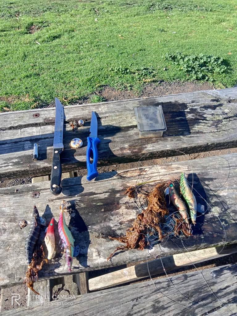
I could find the tire in the ocean.
I think it has been dropped from a boat.
I will keep cleaning up my office.
Cans
Sunny and Windy
Time Space Dive
Hyungseok Kim
5
4
1
40.00
60
7.00
3.00
estimated
5595.82
1
Tire
Cans
Plastic Botles
On
kilograms
I have debris data to report
Slight for waves 0.5 -1.25 meter high m2
meters
rocky reef
4
9
South Korea
State\Province
Jeju-do
City
Seogwipo
Map Help


Dive Location

If you know your survey site coordinates, enter them manually in decimal degrees using WGS84 Map Datum. Use the minus sign for latitudes south of the equator and longitudes west of the Prime Meridian to 180 degrees.

If you do not know your survey site coordinates, click the “Map Location” tab to use the map to zoom into your survey site and drop the pin on the map to fall within your survey dive site in the water (not on land or the beach). Ensure you zoom in as much as possible to ensure data accuracy.

Entangled Help


Use the vertical tabs below to record any entangled animals you found of each type.

ADS644 - Point Panic

3
3

21.290445419006, -157.86052218934

5
rock
1
116

21.290175091743, -157.86074119965

Wind, Rain
1
1
rubber floor mat
hose
Boat part
1
Nudi Wear
Ryan Scalf
1
1
1
1
9
1
3
3
1
1
132.00
50
24.00
6.00
4
measured
56
300.00
1
Fishing line
On
pounds
I have debris data to report
26
Smooth (wavelets) for waves 0.1 - 0.5 meter high ft2
feet
rocky reef
2
2
2
2
11
8
United States
State\Province
Hawaii
City
Honolulu
Map Help


Dive Location

If you know your survey site coordinates, enter them manually in decimal degrees using WGS84 Map Datum. Use the minus sign for latitudes south of the equator and longitudes west of the Prime Meridian to 180 degrees.

If you do not know your survey site coordinates, click the “Map Location” tab to use the map to zoom into your survey site and drop the pin on the map to fall within your survey dive site in the water (not on land or the beach). Ensure you zoom in as much as possible to ensure data accuracy.

Entangled Help


Use the vertical tabs below to record any entangled animals you found of each type.

ADS54-Mosquito Pier

18.148801134028, -65.5145115423

8
sand
18
Mostly sunny,scattered showers. Low winds
Isla nena scuba
Laura
1
1
2
6
15.00
60
40.00
1.00
measured
211
45273.80
3
Line
Lead
Hooks
On
pounds
I have debris data to report
1
Smooth (wavelets) for waves 0.1 - 0.5 meter high
1
ft2
feet
other
1
3
1
1
1
Puerto Rico
State\Province
Puerto Rico
City
Vieques
Map Help


Dive Location

If you know your survey site coordinates, enter them manually in decimal degrees using WGS84 Map Datum. Use the minus sign for latitudes south of the equator and longitudes west of the Prime Meridian to 180 degrees.

If you do not know your survey site coordinates, click the “Map Location” tab to use the map to zoom into your survey site and drop the pin on the map to fall within your survey dive site in the water (not on land or the beach). Ensure you zoom in as much as possible to ensure data accuracy.

Entangled Help


Use the vertical tabs below to record any entangled animals you found of each type.

Ecosystem Other
Man made pier

ADS551 - St Leonards Pier

0
0
0

-38.1705063617, 144.71944724921

5
0
0
sand
0
1
0
0
0
0
0
0
0
0
0
0
0
0
0
0
0
0
0
0
0
0
0
0
0
Australian Diving Instruction
Aza Idoumbin
0
0
0
0
0
0
0
0
0
0
0
0
0
0
0
0
0
1
0
4
0
0
0
0
0
0
1
0
0
0
0
0
0
0
0.60
60
4.00
1.70
0
measured
0
0
1521.25
0
0
0
0
0
0
On
kilograms
0
I have debris data to report
0
0
0
Calm (glassy to rippled) for waves 0 – 0.1 meter high
0
0
0
0
0
0
0
m2
0
0
meters
seagrass
2
0
0
0
0
1
0
0
0
1
0
0
1
0
0
0
0
0
0
0
0
1
0
1
0
0
0
0
Australia
State\Province
VIC
City
St Leonard
Map Help


Dive Location

If you know your survey site coordinates, enter them manually in decimal degrees using WGS84 Map Datum. Use the minus sign for latitudes south of the equator and longitudes west of the Prime Meridian to 180 degrees.

If you do not know your survey site coordinates, click the “Map Location” tab to use the map to zoom into your survey site and drop the pin on the map to fall within your survey dive site in the water (not on land or the beach). Ensure you zoom in as much as possible to ensure data accuracy.

Entangled Help


Use the vertical tabs below to record any entangled animals you found of each type.

St Abbs

0
0
0

55.900436816396, -2.103134186993

0
0
0
silt
0
0
0
0
0
0
0
0
0
0
0
0
0
0
0
0
0
0
0
0
0
0
0
0
0
The Fifth Point
James learwood
0
0
0
0
0
0
0
0
0
0
0
0
0
0
0
0
0
0
0
10
0
0
0
0
0
0
0
0
0
0
0
0
0
0
0.00
25
19.00
7.00
0
estimated
0
0
33121.00
0
0
0
0
0
0
On
kilograms
0
Our Survey Site was free of debris
0
0
0
Slight for waves 0.5 -1.25 meter high
0
0
0
0
0
0
0
m2
0
0
meters
rocky reef
0
0
0
0
0
0
0
0
0
0
0
0
0
0
0
0
0
0
0
0
0
0
0
0
0
0
0
0
United Kingdom
Map Help


Dive Location

If you know your survey site coordinates, enter them manually in decimal degrees using WGS84 Map Datum. Use the minus sign for latitudes south of the equator and longitudes west of the Prime Meridian to 180 degrees.

If you do not know your survey site coordinates, click the “Map Location” tab to use the map to zoom into your survey site and drop the pin on the map to fall within your survey dive site in the water (not on land or the beach). Ensure you zoom in as much as possible to ensure data accuracy.

Entangled Help


Use the vertical tabs below to record any entangled animals you found of each type.

ADS500 - Tikila Beach

0
6
0

20.4832265, -86.9718085

0
0
0
sand
0
0
0
0
0
0
0
0
0
0
0
0
0
0
0
0
0
0
0
0
0
0
0
0
0
Blue Magic Scuba
Mònica Macias Jane
0
5
0
0
0
0
0
0
0
0
0
0
1
0
0
0
0
0
3
5
0
0
0
0
0
0
0
2
0
0
0
0
0
0
11.00
63
13.00
2.00
0
estimated
0
0
2000.00
0
0
2
0
0
0
On
kilograms
0
I have debris data to report
9
0
1
Calm (glassy to rippled) for waves 0 – 0.1 meter high
0
0
0
0
0
0
0
m2
6
0
meters
coral reef
0
0
0
0
0
0
0
0
0
0
0
0
0
0
0
0
0
0
0
0
0
0
0
0
0
0
0
0
Mexico
State\Province
Quintana Roo
City
Cozumel
Map Help


Dive Location

If you know your survey site coordinates, enter them manually in decimal degrees using WGS84 Map Datum. Use the minus sign for latitudes south of the equator and longitudes west of the Prime Meridian to 180 degrees.

If you do not know your survey site coordinates, click the “Map Location” tab to use the map to zoom into your survey site and drop the pin on the map to fall within your survey dive site in the water (not on land or the beach). Ensure you zoom in as much as possible to ensure data accuracy.

Entangled Help


Use the vertical tabs below to record any entangled animals you found of each type.

Deep Rock

0
0
0

11.346654370891, 124.11999818885

0
0
0
rock
0
0
0
4
0
Good
0
0
0
0
0
0
0
0
0
0
0
0
0
0
0
0
0
0
0
0
Thresher Shark Divers
Toni
0
0
0
0
0
0
0
0
0
0
0
0
0
0
1
0
1
0
0
3
0
0
0
0
18
0
0
0
0
0
0
0
0
0
2.00
50
20.00
12.00
1
measured
0
0
1088.25
0
0
0
0
0
0
On
kilograms
0
I have debris data to report
1
0
0
Calm (glassy to rippled) for waves 0 – 0.1 meter high
0
0
0
0
0
0
0
m2
0
0
meters
rocky reef
0
0
0
0
0
0
0
0
0
0
0
0
0
0
0
0
0
0
0
0
0
0
0
0
0
1
0
0
Philippines
State\Province
Cebu
City
Malapascua
Map Help


Dive Location

If you know your survey site coordinates, enter them manually in decimal degrees using WGS84 Map Datum. Use the minus sign for latitudes south of the equator and longitudes west of the Prime Meridian to 180 degrees.

If you do not know your survey site coordinates, click the “Map Location” tab to use the map to zoom into your survey site and drop the pin on the map to fall within your survey dive site in the water (not on land or the beach). Ensure you zoom in as much as possible to ensure data accuracy.

Entangled Help


Use the vertical tabs below to record any entangled animals you found of each type.

ADS594 - Nestends Gully

0
0
0

55.875448, -2.0815

0
0
3
silt
0
0
0
0
0
0
0
0
0
0
0
0
0
0
0
0
0
0
0
0
0
0
0
0
The Fifth Point
Sam Norton
0
0
0
0
0
0
0
0
0
0
0
0
0
0
0
0
0
0
1
12
0
0
0
0
0
0
0
0
0
0
1
0
0
0
1.00
25
12.00
7.00
0
estimated
0
0
1344.74
0
0
0
0
0
Golf balls
0
On
kilograms
0
I have debris data to report
0
0
0
Slight for waves 0.5 -1.25 meter high
0
0
0
0
0
0
0
m2
0
0
meters
rocky reef
0
0
0
0
0
0
0
0
0
0
0
0
0
0
0
0
0
0
0
0
0
0
0
0
0
0
0
0
United Kingdom
State\Province
Berwickshire
City
Eyemouth
Map Help


Dive Location

If you know your survey site coordinates, enter them manually in decimal degrees using WGS84 Map Datum. Use the minus sign for latitudes south of the equator and longitudes west of the Prime Meridian to 180 degrees.

If you do not know your survey site coordinates, click the “Map Location” tab to use the map to zoom into your survey site and drop the pin on the map to fall within your survey dive site in the water (not on land or the beach). Ensure you zoom in as much as possible to ensure data accuracy.

Entangled Help


Use the vertical tabs below to record any entangled animals you found of each type.

ADS148 - Twin Peaks

1

10.117279, 99.812562

sand
3
Cloudy
Eco Koh Tao
Jennifer Dowling
1
2
2
5
0.25
71
12.00
5.00
4
estimated
1
20.00
Plastic Bottles
String / rope
On
kilograms
I have debris data to report
Smooth (wavelets) for waves 0.1 - 0.5 meter high
1
m2
meters
coral reef
1
Thailand
State\Province
Surat Thani
City
Koh Tao
Map Help


Dive Location

If you know your survey site coordinates, enter them manually in decimal degrees using WGS84 Map Datum. Use the minus sign for latitudes south of the equator and longitudes west of the Prime Meridian to 180 degrees.

If you do not know your survey site coordinates, click the “Map Location” tab to use the map to zoom into your survey site and drop the pin on the map to fall within your survey dive site in the water (not on land or the beach). Ensure you zoom in as much as possible to ensure data accuracy.

Entangled Help


Use the vertical tabs below to record any entangled animals you found of each type.

Jissa point

0
0
1

23.557685209799, 58.653066545814

1
0
0
coral
0
1
0
0
0
Usually clean
Yes
No
NA
Ok
0
0
0
0
0
0
0
0
0
0
0
0
0
0
0
0
0
0
0
0
Euro divers
Bechir
0
0
0
1
0
0
0
0
0
0
0
0
0
0
0
0
0
0
0
5
0
0
0
0
0
0
0
0
0
0
0
0
0
0
5.00
40
11.00
9.00
1
estimated
0
0
3274.04
0
0
0
0
0
Fish net
Ropes
Plastic bottles
1
On
kilograms
0
I have debris data to report
0
0
0
Smooth (wavelets) for waves 0.1 - 0.5 meter high
0
0
0
0
0
0
0
m2
0
0
meters
coral reef
0
0
0
0
0
0
0
0
0
0
0
0
0
0
0
0
0
0
0
0
0
0
0
0
0
0
0
0
Oman
State\Province
Muscat
City
Muscat
Map Help


Dive Location

If you know your survey site coordinates, enter them manually in decimal degrees using WGS84 Map Datum. Use the minus sign for latitudes south of the equator and longitudes west of the Prime Meridian to 180 degrees.

If you do not know your survey site coordinates, click the “Map Location” tab to use the map to zoom into your survey site and drop the pin on the map to fall within your survey dive site in the water (not on land or the beach). Ensure you zoom in as much as possible to ensure data accuracy.

Entangled Help


Use the vertical tabs below to record any entangled animals you found of each type.

Subscribe to